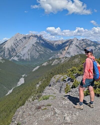
British Columbia is a dream destination for multi-day hiking.
Not sure where to go? Whether you’re experienced hiker or a first timer, I’ve got you covered with this guide to British Columbia’s best backpacking trails.

Written with more than 10 years of experience exploring BC’s backcountry in mind, this comprehensive post brings together my favourite multi-day hikes with the province’s most popular trails.
It’s a great place to start when searching for the next big trip or as a overview for anyone new to BC. I know I felt a little overwhelmed when I first moved here back in 2011!
Here’s what to expect:
- Vancouver Island
- Vancouver and Lower Coast
- Thompson Okanagan
- East and West Kootenays
- Canadian Rockies
- Northern British Columbia
Looking for a more specific backpacking guide? I also have curated lists of BC’s best shoulder season multi-day hikes, first time backpacking trips and reservation-free backpacking trails. I have shared my favourite BC day hikes as well.
If you have questions or just want to chat BC backpacking trips, head to my BC and Alberta Travel Tips Facebook group!
There are affiliate links in this post. If you make a qualifying purchase through one of these links, we may receive a small commission at no extra cost to you.

Best British Columbia Backpacking Trails
Time to get into this list of amazing BC backpacking trails!
The majority of these routes are situated in provincial parks or national parks, which means that they are not ‘secret places.’ They are well-established, frequently used hiking trails that have been designed for recreational use.
We have personally hiked all of the featured routes, so you can trust that these recommendations are genuine!

Please note that this is not an exhaustive list of backpacking destinations in BC. There are many more options available, especially in BC’s interior and northern regions—these are simply the most popular and developed.
I have purposely chosen to include locations with facilities only, giving priority to trails with provincial and national park protection.
Always Leave No Trace when exploring the backcountry – pack out everything you bring with you. Sign up to our newsletter for a free backpacking checklist.
Be bear aware at all times and carry bear spray in a place with quick access. Bring the 10 Essentials on every hike.
This post provides a starting point for research about these backpacking trips.
Before embarking on a hike, be sure that you have the fitness, equipment, appropriate clothing and ability to complete the trip. Prepare for the worst possible weather conditions.
And, of course – always tell someone where you are going and when you plan to return.

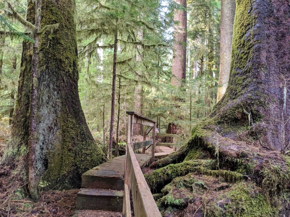
Vancouver Island
Vancouver Island has a wealth of backpacking trails, with a varied mix of coastal, forest and subalpine experiences on offer. We have hiked all of the most popular, longer trails on the Island.
West Coast Trail, Pacific Rim National Park
Length: 75km
Difficulty: Challenging
Best time to go: Open May to September only, July and August are driest
Camping: 12 campgrounds
Fees: Around $330 for permit, park pass, reservation and ferry plus optional shuttle bus fee
Reservation: Required
Dogs: Not permitted
More info: West Coast Trail guide
The West Coast Trail (WCT) is British Columbia’s most famous backpacking adventure. Stretching 75km along Vancouver Island’s coast, this legendary hike follows First Nations routes along the rugged and remote Pacific shoreline.
Expect stunning sandy beaches, pristine waterfalls, towering old-growth forests, and breathtaking sunsets! It’s a great trail for hiker camaraderie as well.
Although it’s a popular route, the West Coast Trail remains a challenging hike with muddy forest sections, massive fallen trees, root obstacles, slippery rocks, cable car crossings and more than 100 ladders. Feel completely prepared with the help of our West Coast Trail series.

Juan de Fuca Trail, Juan de Fuca Provincial Park
Length: 47km thru-hike
Average trip: 3 to 5 days
Difficulty: Challenging
Best time to go: May to September
Camping: 12 campgrounds, mostly on the beach
Fees: $10/per person/per night camping fee – BC Parks backcountry permit
Reservation: No reservation system, first come first serve
Dogs: Allowed on leash, note challenging terrain with some ladders
More info: Juan de Fuca Trail guide
The Juan de Fuca Trail (JDF) provides an another opportunity to become immersed in the raw beauty and power of Vancouver Island’s stunning Pacific coastline.
Listen to the crashing surf, camp on the beach, explore intricate tide pools, marvel at ancient trees, enjoy breathtaking ocean views, spot whales and more.
The western trailhead of this BC backpacking trip is in Port Renfrew, very close to the much more famous West Coast Trail (above).
The Juan de Fuca Trail is shorter and more accessible but features similar challenges to the WCT (lots of mud, slippery surfaces, tree obstacles, beach terrain) with significantly more elevation and longer forest sections. 87% of the total trail distance is in the trees.

Cape Scott Trail, Cape Scott Provincial Park
Length: 47km return
Average trip: 3 to 4 days
Difficulty: Easy in dry summer months, moderate otherwise
Best time to go: May to September
Camping: 6 campgrounds
Fees: $10/per person/per night camping fee – BC Parks backcountry permit
Reservation: No reservation system, first come first serve
Dogs: Not allowed due to local wildlife conflicts
More info: Cape Scott Trail guide
This BC backpacking adventure travels to the northwestern tip of Vancouver Island along an often muddy but historically interesting forest trail. After 15km, the Cape Scott Trail reaches a series of gorgeous sandy beaches, also where most of the campgrounds are located. The finale is a red and white lighthouse.
Old growth trees can be spotted along the inland sections of the trail, as well as remnants of human settlement being reclaimed by nature. These include moss-covered military road planks, a farm-turned meadow, and rusted pots and pans nestled among the ferns.
If you’re after a shorter and much easier coastal backpacking experience in the area, check out San Josef Bay, just a 45 minute walk from the parking lot. The Cape Scott Trail connects to the North Coast Trail (below).

North Coast Trail, Cape Scott Provincial Park
Length: 59.5km thru-hike, optional extensions
Average trip: 4 to 5 days for main trail
Difficulty: Challenging to very challenging
Best time to go: Mid June to September
Camping: 7 campgrounds, mostly on the beach
Fees: $10/per person/per night camping fee plus shuttle costs
Reservation: Not for camping but recommended for shuttle
Dogs: Not allowed due to local wildlife conflicts
More info: North Coast Trail guide
The North Coast Trail (NCT) leads hikers through some of the wettest and most challenging terrain in British Columbia. Expect rope climbs, deep bog, slippery boardwalks, cable car crossings and huge fallen trees.
There are plenty of rewards, however, with long stretches of beautiful sandy beaches, frequent wildlife sightings (especially whales and black bears, spectacular old growth forests and plenty of solitude.
Needless to say, this BC backpacking trip is best for experienced hikers. It is possible to hike the easier western side from the Cape Scott Trail (more details above) and get a taste of the wild coast.

Nootka Trail, Nootka Island
Length: 35km thru-hike
Average trip: 4 to 6 days
Difficulty: Moderate
Best time to go: May to September
Camping: 6 popular camping areas plus official campground at trailhead
Fees: $50 per person user fee charged by Mowachaht/Muchalaht First Nations
Reservation: No reservation system, first come first serve
Dogs: Not recommended due to wildlife conflicts and transportation issues
More info: Nootka Trail guide
Want to hike a coastal trail that delivers on the coastal aspect? Check out the Nootka Trail – just over 80% of the trail is directly on the beach! It’s definitely one of our favourite coastal hikes.
Located on Nootka Island just off Vancouver Island’s west coast, this BC backpacking route has a real ‘edge of the earth’ feeling. The Nootka Trail isn’t protected by any park system and there are no formal campgrounds along the route.
The most challenging parts of the trail are found in the short forest sections, with huge fallen trees to climb over and plenty of mud.
The beaches offer a variety of hiking experiences, featuring many rocky headlands (some rope climbs required), long stretches of pebbles and some gorgeous sandy stretches too.

Della Falls Trail, Strathcona Provincial Park
Length: 32km return, day hiking opportunities
Average trip: 2 to 3 days, 3 to 5 days if paddling
Difficulty: Moderate
Best time to go: June to September (mid July onwards for Love Lake)
Camping: 4 campgrounds
Fees: None
Reservation: No reservation system, first come first serve
Dogs: Allowed on leash but not recommended by BC Parks
More info: Della Falls Trail guide
Did you know that one of Canada’s tallest waterfalls is tucked away in the lush green valleys of central Vancouver Island? With a stunning vertical drop of 444 meters, Della Falls is truly a sight to behold.
The Della Falls Trail begins on the western shore of Great Central Lake and leads to the base of the breathtaking waterfall. The trailhead can only be reached by water, so you’ll need to take a water taxi or embark on a combined paddle and hike journey, just as we did (would recommend!)
Many visitors choose to add-on the 10km return day hike to turquoise coloured Love Lake. The steep uphill trail offers better views of Della Falls.

Bedwell Lakes Trail, Strathcona Provincial Park
Length: 12km return, day hike opportunities
Average trip: 2 to 3 days
Difficulty: Moderate
Best time to go: July to mid September
Camping: 2 campgrounds
Fees: $10/per person/per night camping fee – BC Parks backcountry permit
Reservation: No reservation system, first come first serve
Dogs: Allowed on leash but not recommended by BC Parks (also note challenging terrain)
More info: BC Parks website
The Bedwell Lakes Trail is just one example of the host of subalpine backpacking trails available in Strathcona Provincial Park (see below for more ideas).
The diverse route will keep you engaged with its mix of ladders, switchbacks, steps, large tree roots, boardwalks, bridges, and rocky terrain. Two scenic backcountry campgrounds await, one at Baby Bedwell and the other a little further along the trail at Bedwell Lake.
Consider a longer trip and take the chance to day hike to nearby Cream Lake, a beautiful blue-green lake sitting below Mount Septimus (10km return). It is possible to spot Della Falls from the ridge above Cream Lake.

Other popular Vancouver Island backpacking trails
- Elk River Trail to Landslide Lake, optional day hike to Foster Lake – 24km return, intermediate, 2-3 days (Strathcona Provincial Park)
- Augerpoint Traverse – 30km thru hike, challenging, 3-4 days (Strathcona Provincial Park)
- Flower Ridge Trail – 33km return, challenging, 2-3 days (Strathcona Provincial Park)
- Marble Meadows Trail – 21km return, challenging, 2-3 days (Strathcona Provincial Park)
- Lake Helen Mackenzie Loop – 8km, easy, 2 days (Strathcona Provincial Park)
- Circlet Lake Trail, optional day hike to Mount Albert Edward – 32km return, moderate, 2-3 days (Strathcona Provincial Park)
- Kwai Lake Loop, many day hike options – 15.5km, moderate, 2-3 days (Strathcona Provincial Park)
- 5040 Peak – 8.5km return, challenging, 2 days (near Port Alberni)
- Carmanah Valley – Multiple options, easy, 2 days (Carmanah Walbran Provincial Park)
- San Josef Bay – 5km return, easy, 2 days (Cape Scott Provincial Park)
- Raft Cove – 4km return, moderate, 2 days (Raft Cove Provincial Park)
- Keeha Beach, 10km return, challenging, 2-3 days (Pacific Rim National Park)
- Hesquiat Peninsula Trail, 4-6 days, moderate to challenging, 4-5 days (Southeast of Nootka Island)
- Tatchu Trail, 32km thru hike, challenging, route finding required, 5-6 days (Northwest of Nootka Island)
- Wildside Trail, 22km return, easy to moderate, 2-3 days (Flores Island, near Tofino)
Vancouver and Coast
Most of the backpacking trails in this region of British Columbia see a lot of use due to their proximity to Vancouver. Be sure to read up carefully on reservation requirements (if applicable) and try to plan a weekday trip if you can.
Elfin Lakes, Garibaldi Provincial Park
Length: 22km return, day hiking and extension opportunities
Average trip: 2 to 3 days
Difficulty: Moderate
Best time to go: July to October
Camping: Campground plus shelter
Fees: $10/per person/per night camping fee, $15pp/pn for shelter, reservation fee
Reservation: Required
Dogs: Not allowed
More info: BC Parks website
Garibaldi Provincial Park is a sprawling wilderness area that stretches along the Sea to Sky Highway from Squamish to Whistler and beyond. The expansive trail network spans more than 90km with multiple backcountry campgrounds.
Elfin Lakes gets my vote as a top backpacking destination, but honestly, you really can’t go wrong. Other options are listed below. Elfin Lakes features two very pretty lakes in a spectacular subalpine setting, surrounded by snow capped mountains.
There are excellent day hiking opportunities from the scenic campground, such as the steep ascent up to the rocky Gargoyles. There is another campground at Rampart Ponds, 9km from Elfin Lakes.

Watersprite Lake
Length: 17km return
Average trip: 2 days
Difficulty: Moderate to challenging
Best time to go: July to early October
Camping: Lakeside campground
Fees: $20 per campsite (up to 4 people)
Reservation: Required
Dogs: Allowed on leash but discouraged due to terrain
More info: BCMC website
Want to camp by a picture perfect turquoise coloured alpine lake? Consider a backpacking trip to Watersprite Lake, a beautiful spot that has to be seen to believed. The tiny islands on the lake and the dramatic surrounding peaks are just gorgeous.
The hike to the lake is quite an adventure, featuring a lengthy exposed boulder field (which can be very hot in summer!) and significant elevation gain.
Throughout the trail, you’ll enjoy unobstructed views of the surrounding mountains and valleys, offering plenty of beautiful scenery to take in along the way.
HBC Heritage Trail
Length: 74km
Average trip: 5 to 8 days
Difficulty: Challenging
Best time to go: Late July to mid September
Camping: 10 campgrounds
Fees: None
Reservation: No reservation system, first come first serve
Dogs: Allowed
More info: HBC Heritage Trail guide
The restored Hudson’s Bay Company Heritage Trail (1849) cuts through the Cascade Mountains, connecting Hope with the small community of Tulameen.
This historical trail, mostly built and maintained by volunteers, enables hikers to step into the footsteps of First Nation and European fur traders.
The challenging route transitions from coastal to interior ecosystems, showcasing old-growth temperate rainforest as well as rugged mountain slopes, sub-alpine meadows and more. We enjoyed the variety of scenery, well crafted campgrounds, historical significance and solitude (only five other hikers total!)
Although the HBC Trail was significantly affected by floods and landslides in November 2021, all major obstacles had been cleared by August 2024.

Sunshine Coast Trail
Length: 180km thru hike or 30-70km section hikes
Average trip: 10 to 12 days or 2 to 5 day sections
Difficulty: Moderate to challenging
Best time to go: June to September
Camping: Multiple hut and campground options
Fees: None
Reservation: No reservation system, first come first serve
Dogs: Allowed
More info: Sunshine Coast Trail guide
The 180km long Sunshine Coast Trail (SCT) is one of BC’s premier long distance backpacking routes. There are multiple trailheads and convenient road access to many sections, so it can be hiked in one go or in sections.
Showcasing a mix of old and new-growth forests, coastal stretches, mountainous panoramas and scenic lakeside paths, the Sunshine Coast Trail offers incredible variety. This is especially special when you realise that none of it is protected by a park system!
12 well constructed huts are situated along the path, all free to use and maintained by dedicated volunteers. There are campgrounds too, some free and some paid.

Other Vancouver and Coast backpacking trails
- Panorama Ridge, optional day hike to Golden Ears summit – 21km return, challenging, 2 days (Golden Ears Provincial Park)
- Viewpoint Beach/Alder Flats – 9km/11.4km return, moderate, 2 days (Golden Ears Provincial Park)
- Halfmoon Beach – 19.6km return, easy, 2 days (Golden Ears Provincial Park)
- Garibaldi Lake/Taylor Meadows, optional day hike to Panorama Ridge – 18km/14km return, moderate, 2-3 days (Garibaldi Provincial Park)
- Cheakamus Lake/Singing Creek – 8km/15km return, easy, 2-3 days (Garibaldi Provincial Park)
- Helm Creek, optional day hike to Panorama Ridge – 15.7km easy to moderate, 2-3 days (Garibaldi Provincial Park)
- Russet Lake via High Note – 26km return with gondola ride, moderate, 2-3 days (Garibaldi Provincial Park)
- Wedgemount Lake – 12km return, challenging, 2 days (Garibaldi Provincial Park)
- Joffre Lakes – 11km return, moderate, 2 days (Joffre Lakes Provincial Park)
- Tenquille Lake (Branch 12 route) with day hiking opportunities -12km return, moderate, 2 days (Tenquille Lake Recreation Site)
- Semaphore Lakes, day hiking opportunities with route finding – 6km return, moderate, 2-3 days (near Pemberton)
- Lindeman/Greendrop/Flora Lakes – 3 to 18 km return, 2-3 days (Chilliwack Lake Provincial Park)
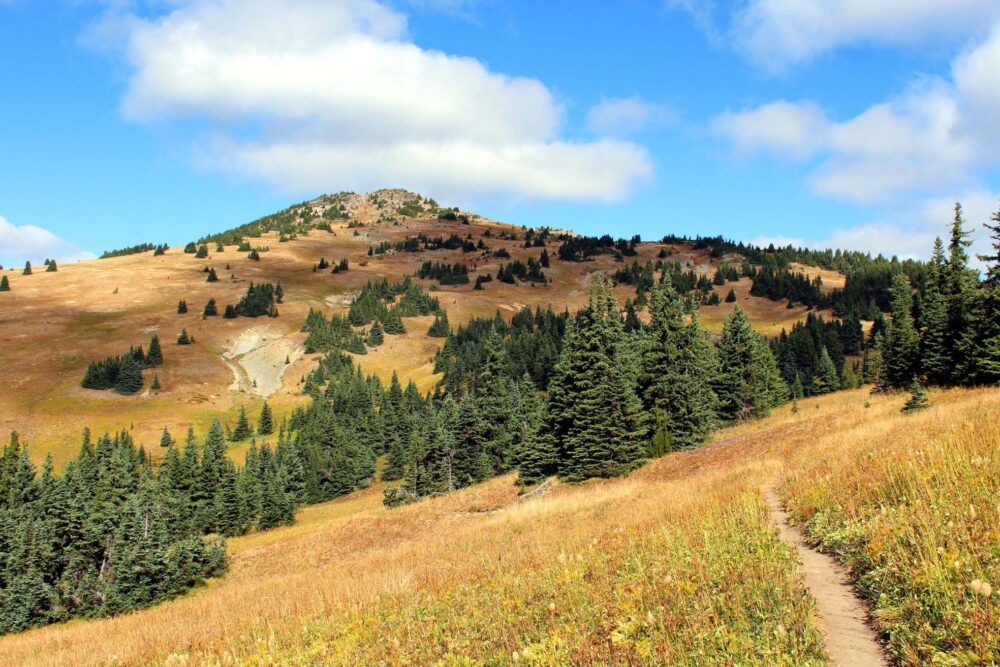
Thompson Okanagan
While it may be my home region, I have to admit that the Thompson Okanagan region doesn’t have a ton of established backpacking trails. I’ve included Manning Provincial Park in this section as it is right on the border.
The Heather Trail, Manning Provincial Park
Length: 44km return or 39km thru-hike
Average trip: 3 days
Difficulty: Moderate
Best time to go: July to Late September
Camping: 3 campgrounds
Fees: $5/per person/per night camping fees – BC Parks backcountry permit
Reservation: Required for two campgrounds during peak season
Dogs: Allowed on leash
More info: Heather Trail guide
Delivering stunning views with relatively low effort, the Heather Trail makes for an exceptionally rewarding BC backpacking trip. The trailhead is located at 1980m, so the most of the ‘hard part’ is done before starting!
With expansive mountain views, colorful wildflower meadows, excellent camping facilities, and little elevation gain, it’s the perfect trail for a first-time backpacking adventure. The Heather Trail can be explored as an out-and-back trail or a shorter and easier thru-hike.
Frosty Mountain Trail, Manning Provincial Park
Length: 21km return or 27km loop
Average trip: 2 days
Difficulty: Moderate with challenging ascent to summit
Best time to go: Late July to early October
Camping: Campground located at 7km mark
Fees: $5/per person/per night camping fees – BC Parks backcountry permit
Reservation: Required from late July to mid October
Dogs: Allowed on leash
More info: Frosty Mountain guide
Frosty Mountain is another fabulous backpacking destination in Manning Provincial Park. Best known for its display of golden larches in early autumn, this trail can also be hiked as an overnight out-and-back trip or slightly longer loop.
Most of the trail is moderate rating, with the exception of the final summit climb. The panoramas from 2408m high Frosty Mountain are truly spectacular, with endless mountain ranges stretching as far as the eye can see (beyond the Canadian border!)
The loop route combines the Frosty Mountain Trail with the Windy Joe Trail. The connector is on the ridgeline on the way to Frosty Mountain’s summit.

Core area, Cathedral Provincial Park
Length: N/A – base camping with day hiking opportunities
Average trip: 3 to 4 days
Difficulty: Easy to moderate
Best time to go: Late July to late September
Camping: 2 core area campgrounds (before fire, see note below)
Fees: $10/per person/per night camping fees – BC Parks backcountry permit
Reservation: No reservation system, first come first serve
Dogs: Not allowed due to wildlife conflicts
More info: Rim Trail guide
I’m stretching the boundaries with this recommendation as it’s a base camping trip rather than a true backpacking experience, but I still felt Cathedral Provincial Park deserved a place on this list.
This lesser known wilderness area is just over half way between E.C. Manning Park and Penticton. The park’s core area is located above 2000m, so the most popular trails showcase spectacular high alpine scenery.
Most hikers access the core area via the 4X4 shuttle service operated by the Cathedral Lakes Lodge. To make this a real backpacking trip, hike the 14km one-way Lakeview Trail. It has 1450m elevation gain, which quickly explains why the shuttle is so popular!
Please note that Cathedral Provincial Park was significantly impacted by wildfires in August 2023 and most of the park remains closed at the time of writing (December 2024). Check the BC Parks website for updates.

Divide Lake Trail / Mountain Goat Trail, Okanagan Mountain Provincial Park
Length: 19km / 10km
Average trip: 2 days
Difficulty: Moderate
Best time to go: April, May, June, September, October
Camping: Divide Lake
Fees: None
Reservation: No reservation system, first come first serve
Dogs: Allowed on leash, not recommended during summer
More info: Okanagan Mountain Provincial Park guide
Okanagan Mountain Provincial Park is one of the Okanagan Valley’s most prominent features and has a couple of different backpacking options.
Divide Lake is a popular overnight destination and is accessible from both ‘sides’ of the park – the Divide Lake Trail from Kelowna and the Mountain Goat Trail from Naramata. The park’s highest peak, Okanagan Mountain (1576m) is a short hike away.
Hikers can also access some of the park’s marine campgrounds via the Wild Horse Canyon Trail (27km, 2-3 days). Keep in mind that Okanagan Mountain Park is best visited in the spring and fall – the summer months are incredibly hot and there is very little shade.
Spectrum Lake Trail, Monashee Provincial Park
Length: 12km return
Average trip: 2 to 3 days
Difficulty: Easy/challenging
Best time to go: Early June to early October (Spectrum)
Camping: Spectrum Lake
Fees: $5/per person/per night camping fees – BC Parks backcountry permit
Reservation: No reservation system, first come first serve
Dogs: Not allowed
More info: Spectrum Lake guide
Spectrum Lake is an ideal first time backpacking destination. It’s particularly good for families, with the access trail being short and mostly flat. The campground has lots of nice features like wooden shelters above the picnic tables and a floating dock on the lake.
Typically snow-free in June, Spectrum Lake is a popular spring backpacking trip. It’s a dreamy place to be during the hot days of summer as well, when the lake provides cool relief.
The campground also serves as a convenient rest stop or lunch spot for hikers venturing further into the subalpine terrain of Monashee Provincial Park (see below).

Little Peters and Big Peters Lake, Monashee Provincial Park
Length: 27.2km return, day hiking opportunities to Margie Lake and Mount Fosthall
Average trip: 3 to 4 days
Difficulty: Mostly moderate with one challenging section
Best time to go: mid July to early October
Camping: 2 campgrounds
Fees: $5/per person/per night camping fees – BC Parks backcountry permit
Reservation: No reservation system, first come first serve
Dogs: Not allowed
More info: Little/Big Peters Lake guide
The subalpine of Monashee Provincial Park is much less visited than the lower valley area. There’s one big reason for this – elevation gain!
While Little Peters Lake may be located only 6.5km from Spectrum Lake, it is at the top of a headwall. The trail to reach the lake gains 800m in just 3km. Needless to say, this makes for a pretty challenging backpacking experience.
Those who do make the effort are rewarded with access to two pretty subalpine lakes, each with a backcountry campground.
The lakes mirror the surrounding peaks, vibrant wildflowers flourish in the meadows, and marmots chirp from the near rock piles. It’s not as dramatically beautiful as subalpine areas further east (or west), but Monashee Provincial Park is a great option for locals.

Trophy Meadows Trail, Wells Gray Provincial Park
Length: 10km return
Average trip: 2 to 3 days
Difficulty: Easy to moderate
Best time to go: July to September
Camping: Sheila Lake campground
Fees: None
Reservation: No reservation system, first come first serve
Dogs: Allowed on leash but not recommended by BC Parks
More info: Trophy Meadows Trail
The Trophy Meadows Trail in Wells Gray Provincial Park is one of my top picks for a first time backpacking trip. The reason is simple – minimal effort for pretty big rewards!
Since the trailhead is located at 1700m, there’s only a small amount of elevation to be gained to reach beautiful sub-alpine meadows. More than 20 species of delicate wildflowers reach peak bloom here at the start of August.
The scenery gets even better from there, with far-reaching views of surrounding mountain peaks. Many small alpine lakes are scattered across the sub-alpine landscape. One of these, Sheila Lake, has a well equipped (free!) backcountry campground and day hiking opportunities.

Other Thompson Okanagan backpacking trails
- Strike Lake – 16km loop, easy, 2-3 days (Manning Provincial Park)
- Skyline II Trail to Mowich Camp, day hiking opportunities – 25km return, moderate, 2-3 days (Manning Provincial Park)
- Poland Lake – 16km, moderate, 2 days (Manning Provincial Park)
- Skagit River Trail, extension opportunities – 28km, moderate, 2 days (Manning Provincial Park / Skagit Valley Provincial Park)
- Lower Stein Valley – Up to 30km, easy to moderate, 2-4 days (Stein Valley N’lakapamux Heritage Provincial Park)
- Stein Valley Traverse – 70km, challenging, 5-6 days (Stein Valley N’lakapamux Heritage Provincial Park)
- Falls Lake – 2km return, easy, 2 days (Coquihalla Summit Recreation Area)
- High Rim Trail from Vernon to Kelowna – 53km thru hike, moderate, 3-4 days (maintained by a volunteer group)
- Pinnacle Lake – 9km return, moderate to challenging, 2 days (Monashee Mountains, more info)
- Twin Lakes – 8km return, moderate, 2 days (Monashee Mountains, more info)
- Wavy Ridge Trail – 15km return, moderate, 2 days (Wells Gray Provincial Park)
- Fight Lake with day hike to Battle Mountain – 30km, moderate, 2-3 days (Wells Gray Provincial Park)

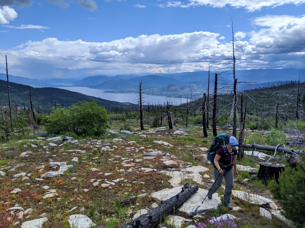
East and West Kootenays backpacking trails
The Kootenays are full of amazing backpacking trails! The most popular ones are busy on the weekends, but beyond that, you’ll probably see very few other hikers.
Gwillim Lakes Trail, Valhalla Provincial Park
Length: 12km return
Best time to go: 2 to 3 days
Camping: Three campgrounds
Fees: None
Reservation: No reservation system, first come first serve
Dogs: Not permitted
More info: Valhalla Provincial Park guide
An off the beaten path gem, Valhalla Provincial Park has a whole host of backpacking and multi-day paddling opportunities. It’s truly one of my happy places in BC!
The Gwillim Lakes Trail is, in my opinion, the top backpacking experience in the park. Both the hiking trail and destination are so impossibly pretty, with many small lakes and ponds, delicate meadows and soaring peaks to admire. It’s a very special place.
Another great option for backpacking, albeit a pretty short and sweet trip, is Gimli Ridge. The main attraction is a dramatic 2803m high ‘horn’ of rock rising above the ridge itself (and mountain goats!)
Kokanee Lake Trail, Kokanee Glacier Provincial Park
Length: 15km return, many day hiking options
Average trip: 2 to 4 days
Difficulty: Moderate
Best time to go: Late July to late September
Camping: Kaslo Lake Campground
Fees: $10/per person/per night camping fees – BC Parks backcountry permit
Reservation: No reservation system, first come first serve
Dogs: Not permitted
More info: Kokanee Glacier Provincial Park guide
Kokanee Glacier Provincial Park is a paradise for backpackers looking for an overnight or multi-day base camping experience. If you can, definitely try and spend 3 to 4 days in the area.
The relatively short Kokanee Lake Trail provides access into the subalpine and to the well equipped Kaslo Lake Campground. From here, hikers can explore the park’s excellent network of trails, explore a historic cabin and even summit a few mountains.
A highlight is the Sapphire Lakes Trail, which showcases a series of seriously pretty subalpine lakes and waterfalls. We took the opportunity to climb to the top of nearby Mount Giegerich. Other backpacking opportunities exist in the park, with three huts and another campground at Tanal Lake.

Jumbo Pass Trail, Purcell Mountains
Length: 10km return
Average length of trip: 2 days
Difficulty: Moderate
Best time to go: Late July to early October
Camping: Informal camping at pass, hut rental
Fees: None for camping
Reservation: Required for hut, no reservation system for camping
Dogs: Permitted
More info: Jumbo Pass guide
The distance from the parking lot to Jumbo Pass is just 5km, but the payoff is extraordinary – a stunning subalpine landscape dotted with larch trees and framed by towering peaks and majestic glaciers.
For this reason, Jumbo Pass is one of my top day hikes in BC. It’s also a popular overnight trip, with informal camping available on the pass plateau. There is a hut as well, though reservations are required.
Behind the hut is a steep path up to a ridge. Better views await from the top, especially in late September when the larch trees in the pass turn golden. Truly spectacular! Another amazing day or overnight hike in this area is Monica Meadows.

Conrad Kain Hut Trail, Bugaboo Provincial Park
Length: 10km return to hut, extra 500m to Boulder, 2km to Applebee Dome
Best time to go: Late July to late September
Camping: Two campgrounds
Fees: $10/per person/per night for camping, $25/pp/pn for hut
Reservation: Recommended for hut, no reservation system for camping
Dogs: Not recommended due to challenging terrain
More info: Conrad Kain Hut Trail guide
The granite spires of the Bugaboos are legendary for rock climbers. But this beautiful mountain range has a lot to offer hikers too.
The trail up to the Conrad Kain Hut should not be taken lightly, however, especially with a heavy backpack. It’s short but very steep, more like a staircase than a hiking trail! Most of the 700m elevation gain is achieved in less than 3km. There is a ladder and two sections with chains.
After reaching the hut, choose between forested Boulder Camp or the rock slabs of Applebee Dome. The latter has better views and is favoured by climbers but is very exposed, with no shade or wind protection.

Eva Lake Trail, Mount Revelstoke National Park
Length: 14km return
Average trip: 2 days
Difficulty: Moderate
Best time to go: Late July to late September, early to mid August for the wildflowers
Camping: Eva Lake Campground
Fees: $15/per night/per person, plus park pass and reservation fee
Reservation: Required in peak season
Dogs: Not allowed
More info: Eva Lake Trail guide
Eva Lake is my favourite backpacking trail in Mount Revelstoke National Park. The hike winds through subalpine meadows bursting with colorful wildflowers, crosses boulder fields echoing with the calls of pikas, and offers stunning views of snow capped peaks.
There are four tent sites by the lakeshore of blue-green Eva Lake. During the peak camping season (1 August to September 30), reservations are available to secure a spot.
Eva Lake backpackers also have the opportunity to explore Jade Pass. This 3km round-trip trail offers sweeping views of tree-lined valleys and towering peaks. Well worth the side trip!

Other East and West Kootenays backpacking trails
- Jade Lakes – 19km return, moderate to challenging, 2 days (Mount Revelstoke National Park)
- Slocan-Evans Creek Trail – 17km return, moderate, 2 days (Valhalla Provincial Park)
- Emerald, Cahill and Beatrice Lakes – 18km return, moderate, 2 days (Valhalla Provincial Park)
- Gimli Ridge – 7km return, moderate, 2 days (Valhalla Provincial Park)
- Hermit – 6.4km return, challenging, 2 days (Glacier National Park)
- Sir Donald – 12.2km return, challenging, 2 days (Glacier National Park)
- Monica Meadows – 10km return, moderate, 2 days (Purcell Mountains)
- Lake of the Hanging Glacier – 16km return, moderate, 2-3 days (Purcell Mountains)
- Welsh Lakes – 8km return, moderate, 2 days (Purcell Mountains)
- Earl Gray Pass – 61km thru hike, very challenging, 4-6 days (Purcell Wilderness Conservancy Park)

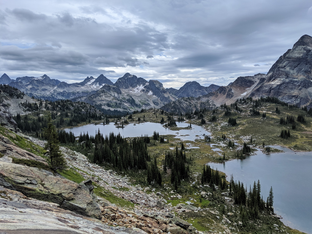
Canadian Rockies
It’s not surprise that many of BC’s most impressive backpacking trails are found on the western side of the Canadian Rockies. Here are my favourites.
The Rockwall (including Floe Lake), Kootenay National Park
Length: 54km
Average trip: 4 to 5 days
Difficulty: Moderate
Best time to go: Late July to late September
Camping: 5 campgrounds
Fees: $15/per person/per night plus park pass and reservation fee
Reservation: Required
Dogs: Allowed on leash
More info: Rockwall Trail guide
The Rockwall Trail in Kootenay National Park is undoubtedly one of the premier backpacking trips in the Canadian Rockies (Alberta side included). We hiked it a couple of years ago and it remains my favourite.
The trail ascends three alpine passes, offering breathtaking views of towering mountain peaks, wildflower filled meadows, waterfalls, and crystal-clear turquoise lakes. It is all backdropped by the huge limestone cliff that is the trail is named for. Honestly, it is just incredible!
Floe Lake is a premier backpacking destination in its own right, especially in early fall. It is possible to day hike to Numa Pass (and further, if desired) from the campground. In late September, the larch in the surrounding meadows turn golden.

Mount Assiniboine, Mount Assiniboine Provincial Park
Length: 52km minimum (dependent on route)
Average trip: 4 to 6 days
Difficulty: Moderate
Best time to go: Mid July to Late September
Camping: Multiple options plus huts and lodge
Fees: $10-$15/per person/per night for camping, plus park pass and reservation fees
Reservation: Required for most campgrounds
Dogs: Allowed on leash
More info: Mount Assiniboine guide
The pyramidal shaped peak of Mount Assiniboine is iconic; the Canadian Rockies’ own version of the Matterhorn. But Mount Assiniboine is just one of the highlights in this provincial park of the same name.
The subalpine landscape (a UNESCO World Heritage site!) surrounding the peak is just as impressive, featuring turquoise lakes, expansive alpine meadows and other snow capped peaks.
With a choice of trailheads and half a dozen nearby campgrounds, there are quite a few ways to structure a Mount Assiniboine Provincial Park. The best way, in my opinion, is to hike from Sunshine Meadows to Mount Shark over 6 days, with 3 nights of camping in the Mount Assiniboine core area.

Great Divide Trail
Length: 1,123km
Average trip: 6 to 8 week thru-hike, shorter sections possible
Difficulty: Moderate to very challenging
Best time to go: Late June to Late September (section dependent)
Camping: Multiple!
Fees: Some free campgrounds, some paid $10-15/per person/per night plus reservation fee and parks pass
Reservation: Required in some places
Dogs: Allowed in most areas while on leash
More info: Great Divide Trail guide
The above two trails are part of the Great Divide Trail (GDT), Canada’s ultimate long distance hiking adventure. Stretching 1,123km along the Continental Divide (also the BC/Alberta border), this adventurous route truly showcases the wild and rugged nature of the Rockies.
Each section features spectacular alpine scenery, including hanging glaciers, wildflower meadows, soaring mountain peaks, turquoise lakes and more.
The Great Divide Trail can be explored on short day hikes, longer backpacking trips or as a 6 to 8 week thru-hike. We have explored a significant part of Section C, from Helmet Falls to the Kananaskis Valley (about 125km) and from the North Interlakes Trailhead to LeRoy Creek (around 20km).

Lake O’Hara, Yoho National Park
Length: N/A – base camping with day hiking opportunities
Difficulty: Easy to challenging, depending on day hike choice
Best time to go: Late July to late September
Camping: Shuttle bus accessed campground
Fees: $15/per person/per night plus reservation, park pass and bus fees
Reservation: Required for campground, launch date in January each year
Dogs: Not permitted on bus
More info: Lake O’Hara guide
While Lake O’Hara may not technically be a backpacking destination, I couldn’t not include it on this list since the area has some of the most beautiful backcountry scenery anywhere in BC.
Reserve a spot at the Lake O’Hara campground for three nights (the maximum allowed) and day hike the surrounding alpine trails, including the incredible Alpine Circuit. If you don’t mind cold temps, consider a late September trip to see a magnificent golden larch display.

Yoho Valley (including Iceline Loop), Yoho National Park
Length: Various options, from 7.8km to 30km+
Difficulty: Easy to moderate options
Best time to go: Late July to late September
Camping: Laughing Falls, Twin Falls, Yoho Lake, Little Yoho, Stanley Mitchell Hut
Fees: $15/per person/per night plus reservation and park pass fees
Reservation: Required for campground, launch date in January each year
Dogs: Allowed on leash
More info: Iceline Trail guide
Yoho National Park’s Yoho Valley has a great choice of interconnecting subalpine backpacking trails.
There’s some awesome options for first-timers (such as Yoho Lake, 9km return) and longer loop routes, like the Iceline Trail. The latter is usually a very rewarding 2 day 20km loop route but can be extended to 3 days and also include the fabulous Whaleback Trail.
No matter which you choose, Yoho Valley will deliver beautiful views of Takakkaw Falls (Canada’s second tallest waterfall) in addition to glaciers, mountains and alpine lakes. There are more waterfalls to see as well, like Twin Falls.

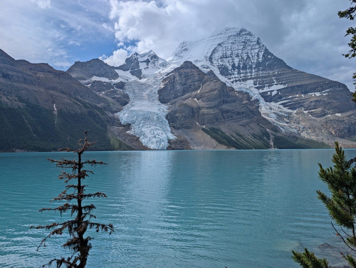
Berg Lake Trail, Mount Robson Provincial Park
Length: 44km return
Average trip: 3 to 5 days
Difficulty: Moderate
Best time to go: Mid June to late September
Camping: 7 campgrounds
Fees: $10/per person/per night camping fees (BC Parks backcountry permit) plus reservation fee
Reservation: Required, 2026 season launch date was 2nd December 2025 at 7am PT
Dogs: Allowed on leash
More info: Berg Lake Trail hiking guide
No list of BC backpacking trails would be complete without mention of the Berg Lake Trail. This 22km long trail features dramatic waterfalls, beautiful Kinney Lake, old-growth cedar forests, and a series of towering mountain peaks, including Mount Robson, the tallest in the Canadian Rockies.
The trail’s grand finale is Berg Lake itself, named for the ice chunks that sometimes break off the glacier above and float on its surface. The lake shimmers brilliant blue under the sun.
A massive flooding event following extreme heat caused the Berg Lake Trail to close in June 2021. It fully reopened in late June 2025. We were so stoked to finally hike this iconic trail in July 2025!
From Berg Like, there are plenty of day hike opportunities, including the challenging but exceptionally rewarding Snowbird Pass. For this reason, I’d recommend a 3 to 5 day trip.
Other BC Rockies backpacking trails
- Goodsir Pass, day hiking and extension opportunities – 50km return, challenging, 4-5 days (Yoho National Park)
- Diana Lake – 12km return, moderate, 2 days (Diana Lake Recreation Site)
- Fish Lake, day hiking opportunities – 12km return, moderate, 2-4 days (Top of the World Provincial Park)
- Limestone Lakes – 35km return, challenging, 3 to 4 days (Height of the Rockies Provincial Park)
- Beatty Lake, loop extension possible – 30km return, moderate, 2-3 days (via Alberta’s Kananaskis Valley)

Northern British Columbia
The following trails are only a taste of the backpacking adventures to be had in Northern British Columbia. Expect more route finding but far less people than elsewhere in BC.
- Monkman Lake Trail – 50km return, moderate, 3-4 days (Monkman Provincial Park)
- Windfall Lake Trail – 10km return, moderate, 2-3 days (near Tumbler Ridge)
- Rainbow Range Trail – 14km return, moderate, 2 days (Tweedsmuir Provincial Park South)
- Hunlen Falls Trail – 33km return, challenging, 2-3 days (Tweedsmuir Provincial Park South)
- Ptarmigan Lake/Echo Lake/Rosemary Pass Loop – 14km, moderate, route finding required, 2-3 days (Tweedsmuir Provincial Park South)
- Ptarmigan Lake/Molly Lake/Rosemary Pass Loop– 14km, moderate, route finding required, 2-3 days (Tweedsmuir Provincial Park South)
- Wapiti Onion Trail – 36km return, challenging, 2-3 days (Wapiti Lake Provincial Park)
- Wokkpash Valley-MacDonald Creek Loop – 70km, challenging, route finding required, 5-7 days (Stone Mountain Provincial Park)
- East Beach Trail – 89km, challenging, 4-8 days (Naikoon Provincial Park)
What to bring on a BC backpacking trip
Whether I’m backpacking for one night or four, my packing list looks very similar with the exception of the amount of food! I bring almost the same gear and clothing on every multi-day hike in BC.
Hiking essentials
In addition to our sleeping equipment, cooking gear and tent, we always bring the following essentials on every backpacking trip:
- Appropriate First Aid Kit
- Multiple navigation tools (map, offline app)
- Headlamp
- Sun hat, sunscreen
- Warm hat, gloves, Buff
- Water filter / purification equipment
- Emergency fire starters
- Knife
- Small repair kit (including some tenacious tape)
- A whistle (attached to my backpack)
- Portable battery charger
For more gear recommendations, head to our multi-day hiking packing guide or Resources page.

Check out these recently published articles next


One half of the Canadian/British couple behind Off Track Travel, Gemma is happiest when hiking on the trail or planning the next big travel adventure. JR and Gemma are currently based in the beautiful Okanagan Valley, British Columbia, Canada. Consider buying us a coffee if you have find any of our guides helpful!