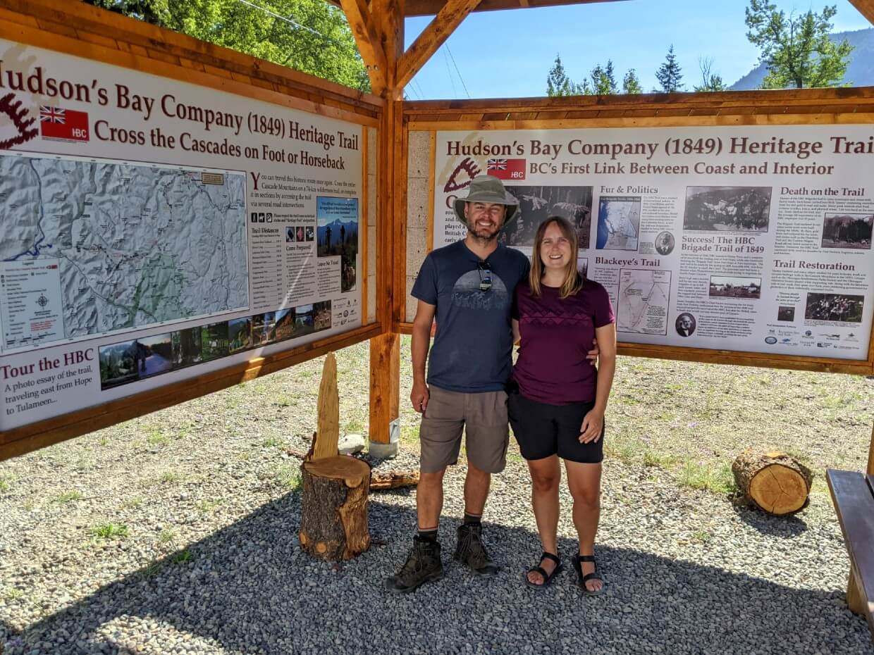
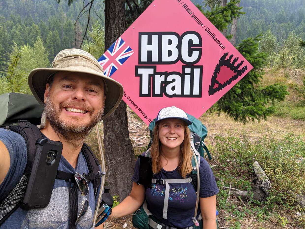
Crossing the Cascade Mountains by foot has been made possible with the restored Hudson’s Bay Company Heritage Trail (1849) from Hope to Tulameen, British Columbia.
The reinstatement of this historical trail enables hikers to step into the footsteps of First Nation and European traders.
Originally a First Nations hunting and trading route, the HBC Trail was integral to the success of BC’s fur trade.

Brigades, up to 200 horses and 30 men strong, would transport furs and supplies between the Interior region to the Pacific Coast.
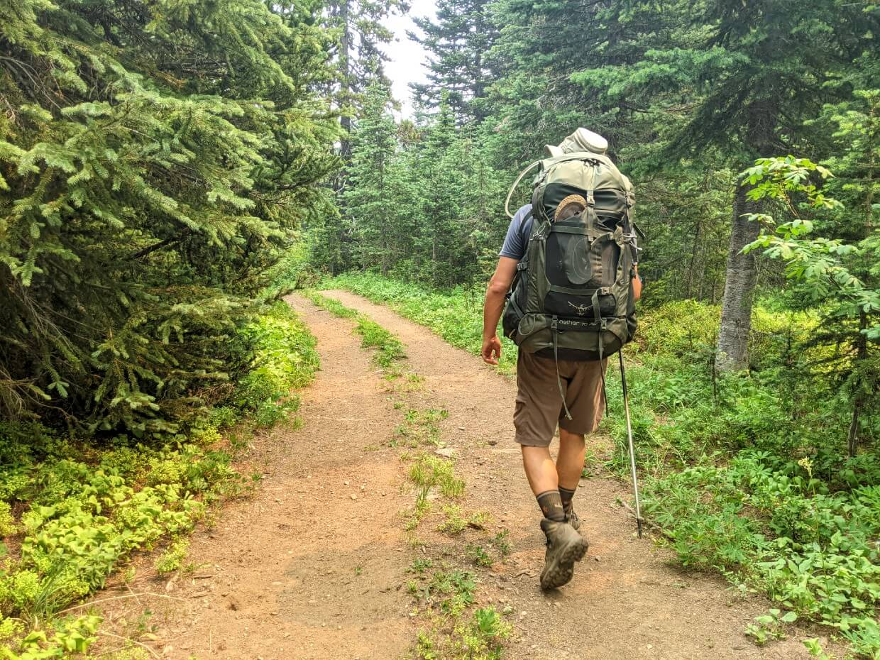
The 74km long trail traverses old-growth forest, mountain slopes, subalpine meadows and more, with ten campgrounds located along the route. Each day is a little bit different as you travel between coastal and interior ecosystems.
We hiked the HBC Heritage Trail with trailhead shuttle assistance provided by Kelly Pearce from the Hope Mountain Centre and Destination BC.
The HBC Trail was significantly impacted by the November 2021 floods but as of August 2024, all major obstacles have been cleared. Please check the Hope Mountain Centre website and Facebook page for updates regarding trail condition and potential closures for maintenance.

Introducing the HBC Heritage Trail
The HBC Heritage Trail is ideal for hikers who:
- Enjoy exploring off the beaten path
- Have an interest in the historical aspect of the trail
- Like the idea of hiking through a mix of ecosystems
- Have backpacked before
- Are looking for a challenge
- Want a quieter hiking experience
- Have an adventurous side
If this describes your hiking style, I’d consider a backpacking trip on the HBC Trail.
This post will share all the details you need to know about the HBC Trail, including where to start, what to expect, where to camp, what to bring and more.
At 8500+ words, it’s a little longer than my usual hiking guides, but because the HBC Heritage Trail is relatively new (at least in it’s current form) I wanted to be sure to cover absolutely everything!
The breakdown looks like this:
Hudson Bay Company (HBC) 1849 Heritage Trail
Location: Hope to Tulameen, British Columbia
Distance: 74km (officially)
Elevation change: 2875m gain, 3090m loss
Hike type: One-way
Time: 5-8 days
Difficulty: Challenging
Dogs: Permitted
Backpacking necessities
Before attempting the HBC Heritage Trail:
- Remember to bring the 10 Essentials
- Know how to stay safe and also avoid negative bear encounters
- Understand how to Leave No Trace to help keep the HBC Trail beautiful
- Be prepared to pack out everything you bring with you
- Check out our recommended gear for backpacking
- Need a backpacking checklist? Sign up to our newsletter for a free one
About the Hudson Bay Company 1849 Heritage Trail
The HBC Heritage Trail is a 74km multi-use trail featuring 10 campgrounds, ideal for 5-8 day backpacking trips. It is free to hike and has no reservation system.
The trail is located within the traditional territory of three First Nations, the Stó:lo, Nlaka’pamux (Thompson), and Similkameen.
Sections of the route have been utilised for foraging, hunting and trading for thousands of years.
The development of the HBC Trail
In 1846, the Hudson Bay Company (HBC) tasked Chief Trader A.C. Anderson with finding a trade route between Fort Kamloops and Fort Langley.
It had just been agreed that the 49th parallel would form the border with the USA and a solution was needed quickly. Initial attempts end in failure.
Progress was made when respected Upper Similkameen Chief Blackeye shared his own hunting trail route.
Starting from his village in Otter Lake (near present day Tulameen), it travelled across the Tulameen Plateau, through the Defiles ravine, along Podunk Creek and then up to the meadows below the Cascade Divide.
The Hudson’s Bay Trail was built in the summer of 1848, by HBC surveyor Henry Peers and a company of 10 men. A new trading post was established the same year, at the western trailhead – Fort Hope.

The Hudson Bay Company horse brigades
Starting in 1849 and continuing for the next decade, horse brigades would use the HBC Trail to travel between Fort Hope and Otter Lake.
Brigades would usually include First Nation guides and packhorse handlers.
Each horse would carry two 90lb pieces containing tradeable goods. Westbound horses were loaded with animal pelts, commonly beaver and river otter.
Eastbound horses, on the other hand, were loaded with mail, food and manufactured or processed items, such as muskets, gun powder, tobacco, buttons and HBC blankets.
The horse brigades would camp in four different locations along the HBC Trail – Manson’s Camp, Campement du Chevreuil, Horseguard Camp and Lodestone Lake. They would also camp at Otter Lake before continuing over the Nicola Plateau to Fort Kamloops, 150km away.
The steep terrain of the HBC Trail proved difficult for both horses and human brigadiers, especially when muddy or snowy. In 1857, dozens of horses were lost in a blizzard.
The HBC Trail reborn
Official use of the HBC Trail lasted 12 years. It was replaced by the Dewdney Trail, a safer route between Fort Hope and Princeton.
In the 1960’s, the HBC Trail was relocated and mapped by engineer/historical/explorer extraordinaire Harley Hatfield and a group of friends.
Reopening the trail for public use, Harley and his friends also successfully lobbied for its protection as a legally designated Heritage Trail.
Fast forward a few decades and the HBC Trail again fell into disrepair. Interest was revived by Princeton resident Kelley Cook in 2008.
Teaming up with Kelly Pearce from the Hope Mountain Centre, a plan was soon underway to redevelop the trail.
Thanks to the help of hundreds of volunteers and partner groups, the Hudson Bay Heritage Trail (1849) officially re-opened on the May long weekend in 2016.
The Hope Mountain Centre
The Hope Mountain Centre (HMC) is, in their own words, “a registered charity working to strengthen people’s connection with nature.”
Dedicated to education and ecological awareness, the HMC offers a packed calendar of professionally led outdoor programs.
The HMC also has a leadership role in the funding, development and maintenance of Hope’s impressive network of multi-use trails.
The HBC Trail wouldn’t be what it is today without the help of the Hope Mountain Centre or Kelly Pearce, the HMC’s program director.
Thank you to the Hope Mountain Centre and its team of hard working volunteers.

The HBC Heritage Trail: Our experience
We hiked the HBC Heritage Trail in late July 2021. It was a fairly last minute addition to our summer hiking schedule, sandwiched in-between the West Coast Trail and the Berg Lake Trail (later cancelled due to trail closure).
Though the HBC Trail had been on my radar for a few years, the distance between the trailheads had proved to be an obstacle.
As our start day approached, a new obstacle appeared – wildfires. 2021 was a devasting year for wildfires in British Columbia. Air quality and safety were two big concerns for us.
With sunny skies on our first day, an InReach communicator close at hand and a family member regularly checking the wildfire situation, our hike was a go. Here’s the story of our HBC Heritage Trail hike.

Please note
This is a trail with big elevation losses and gains over relatively short distances. For each hiking day, I have noted the relevant elevation gains and losses, specifically listing them in the order in which they happen.
Day one, for example, started with a continual elevation gain of 650m and ended with the noted 530m loss. The only day this didn’t happen is the final one, during which the elevation losses occurred throughout the day.
I’ve also included the length of time it took us to hike the relevant section. This includes breaks, which typically would include a 45 minute stop for lunch and a 20 minute rest stop every 3km or so.
Day 1 – Peers Creek Trailhead to Colville Camp
Distance: 7km (should be 11km)
Elevation: 650m, 530m loss (usually 1120m gain, 530m loss)
Time: 5.5 hours with breaks
Our trip plan for the HBC Trail was a six day, five night backpacking adventure.
Some organisation is needed to backpack the trail from one end to the other. We parked our vehicle at Tulameen Trailhead and then travelled back to Peers Creek (thank you Kelly!), to finally start the trail around 2pm.
At the current time, the HBC Heritage Trail begins with a 4km section along the deactivated Peers Creek Forest Service Road. Full disclosure – we didn’t hike it.
From 2022 onwards, there will be a brand new single track trail all the way to Manson’s Camp. From the small part we saw (and the photo updates I’ve seen on the HMC’s Facebook page), it looks fantastic.
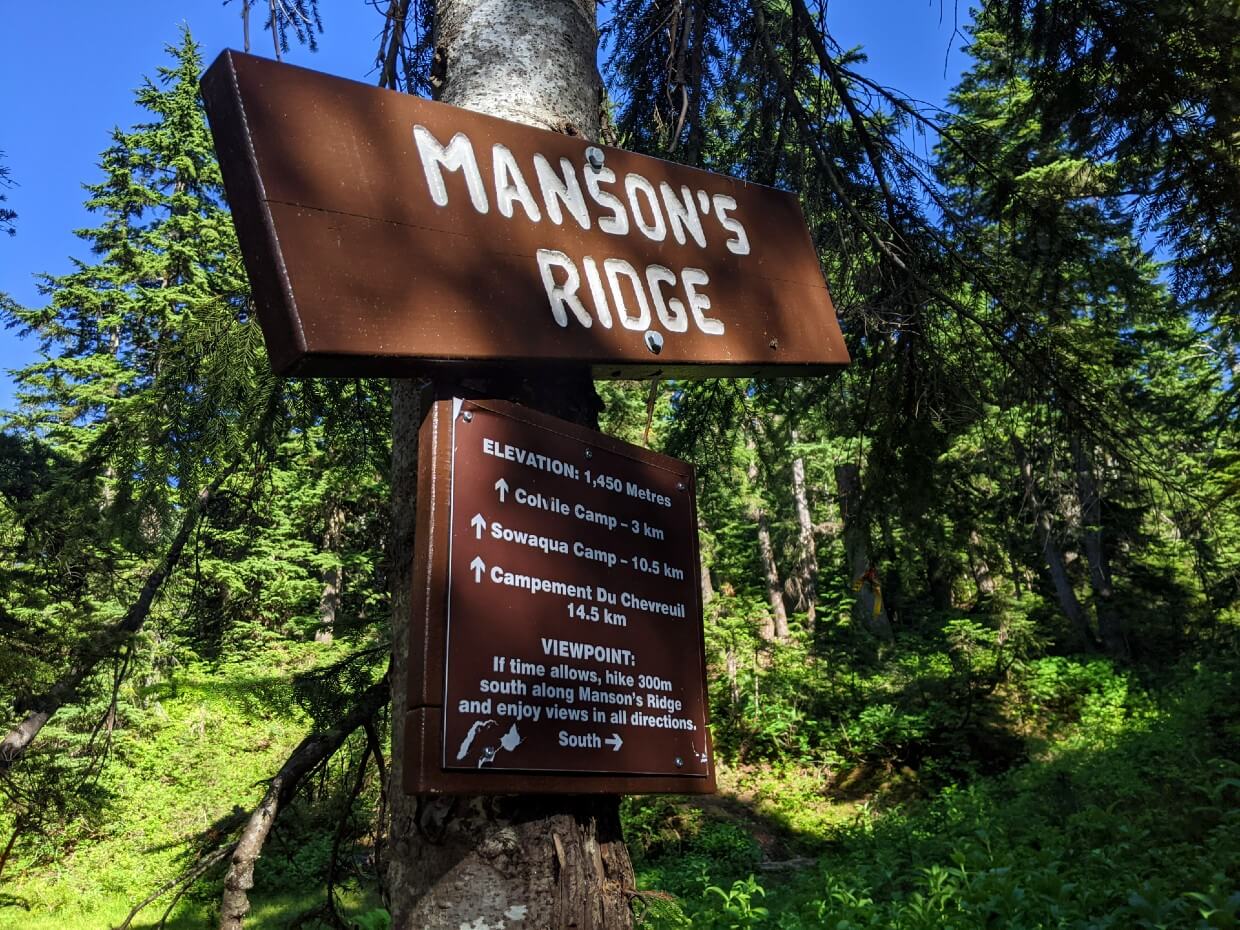
Manson’s Ridge
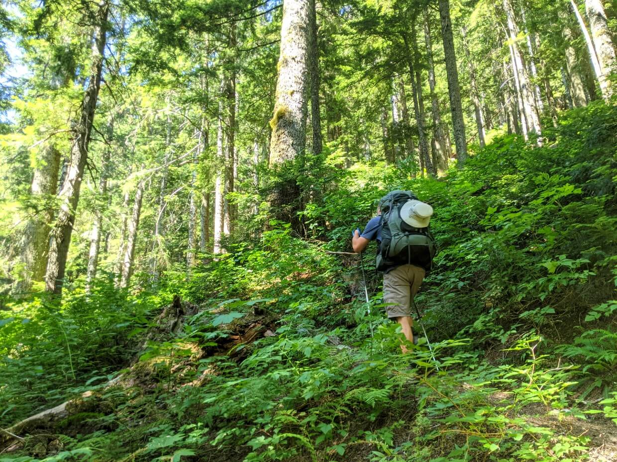
The FSR is followed by a bushy 2km through the forest. We paused for a snack before attempting the climb up Manson’s Ridge.
This 470m ascent is no joke – it starts steep and doesn’t let up. It is, however, almost completely shaded. Some of the trees have blazes, axe markings left by the HBC horse brigades to mark the way.
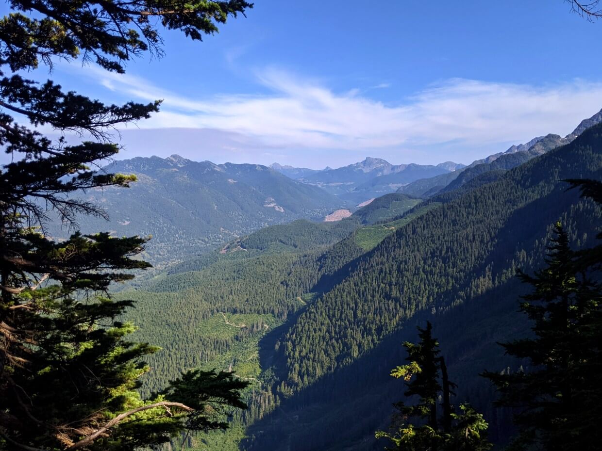
A sweaty two hours later and we were at the ridge lookout. If you have the energy, I’d highly recommend the extra 300m to the signed area with several different scenic viewpoints.
The real mental challenge of Manson’s Ridge is having to immediately hike back down again. This steep, technical section of the trail travels through the rather aptly named Fool’s Pass!
The reward is some wonderful old growth trees and the peaceful Colville Camp.
Day 2 – Colville Camp to Campement du Chevreuil (Deer Camp)
Distance: 11.5km
Elevation: 100m loss, 725m gain
Time: 8 hours with breaks
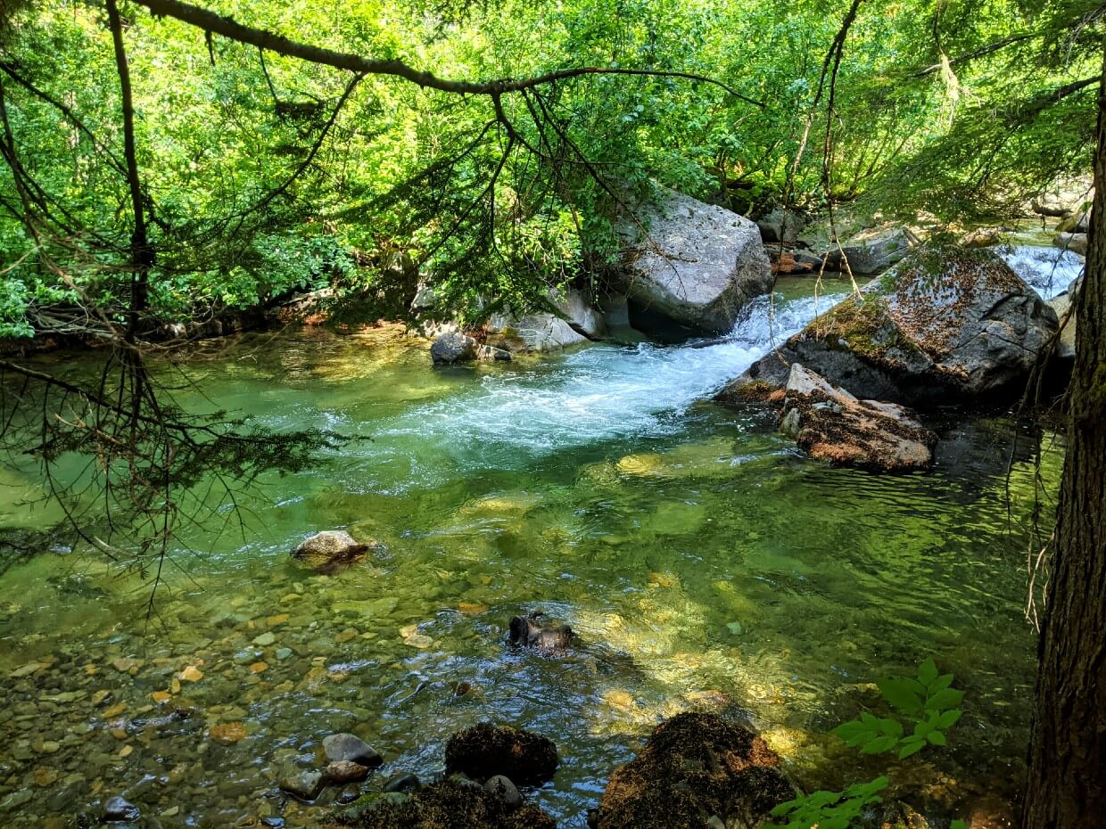
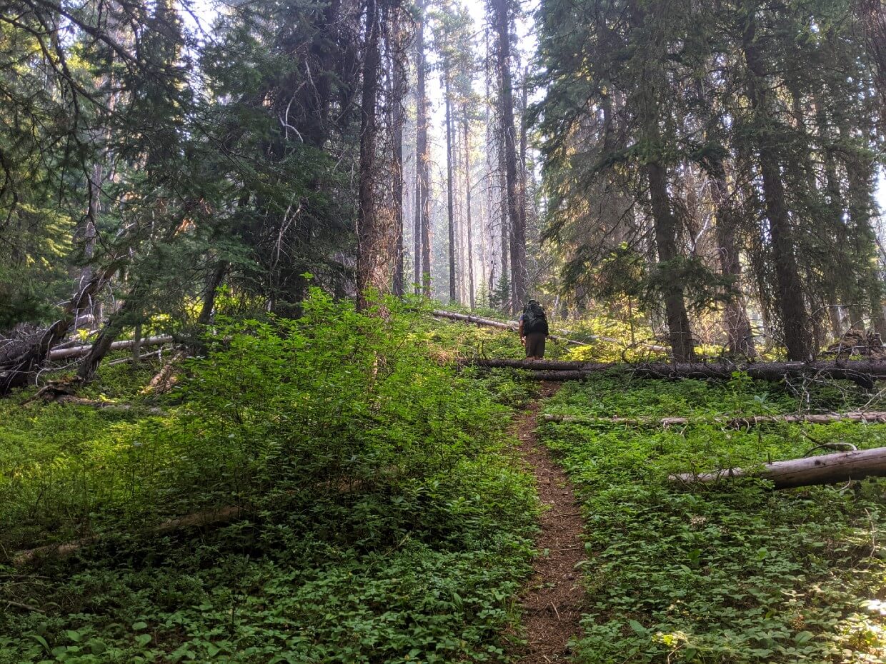
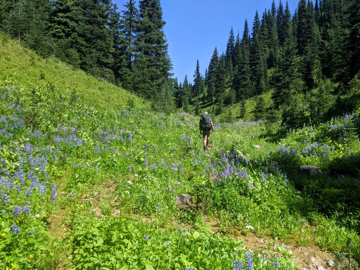
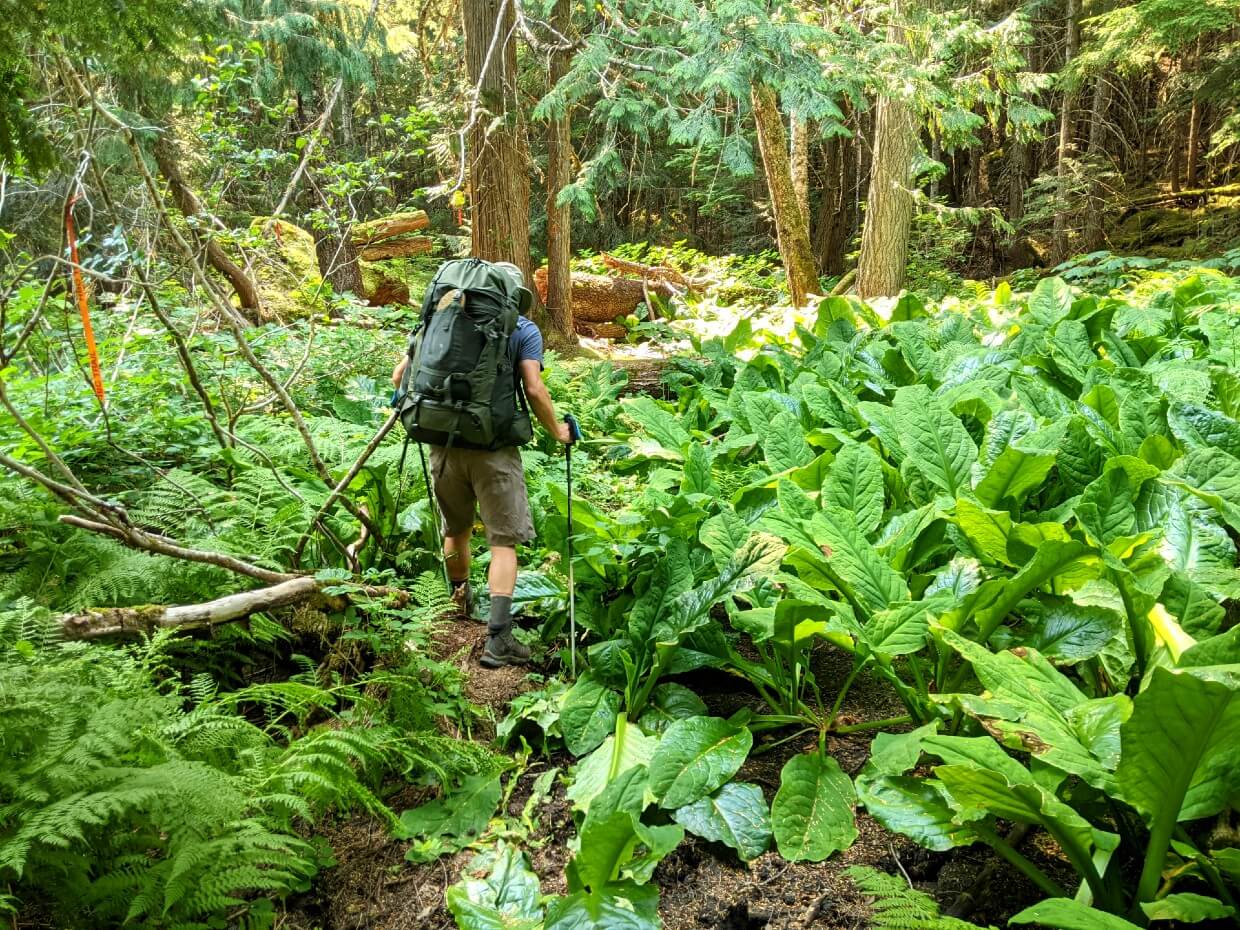
The first part of our second day took in the lush Upper Sowaqua Valley. This easy, mostly flat section was a welcome relief after the elevation gains and losses of the previous day.
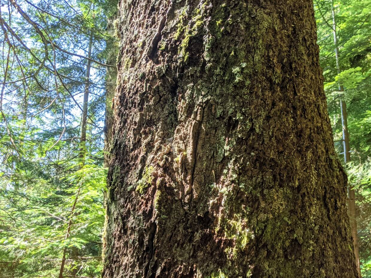
We admired the old growth stands of red cedar, hemlock and amabilis fir while trying to avoid the worst of the skunk cabbage bogs.
The morning was made even better by the presence of a number of excellent natural swimming holes.
After lunch at Sowaqua Creek Camp, it was time for another big climb. The biggest of all on the HBC Trail in fact.
The total elevation gain from Sowaqua Creek Camp to Deer Camp is 735m over 3.7km, but most of that happens over just 2.4km. It’s tough, for sure, but at least the views of Mt Outram start to appear quickly!
Wanting to get this ascent done as soon as possible, I made the rookie mistake of ignoring pain in my heels. The resulting injuries caused problems for the rest of the hike.

Campement du Chevreuil (Deer Camp)
I was so happy when we reached the lookout. The views were spectacular and Deer Camp was just around the corner.
The original name of this camp reflects the influence of the French voyageurs who worked for the Hudson Bay Company.
One of the HBC’s Chief Traders, Paul Fraser, died in his tent in this camp in 1855. A disliked, and apparently violent, man, some say Fraser was murdered.
Grisly history aside, Deer Camp was my favourite of all on the HBC Trail. As well as being in a beautiful location, it also signaled the start of the trail’s mountainous section.
Day 3 – Campement du Chevreuil (Deer Camp) to Horseguard Camp via Jacobson Lake Camp
Distance: 17km
Elevation: 225m gain, 605m loss
Time: 9 hours with breaks
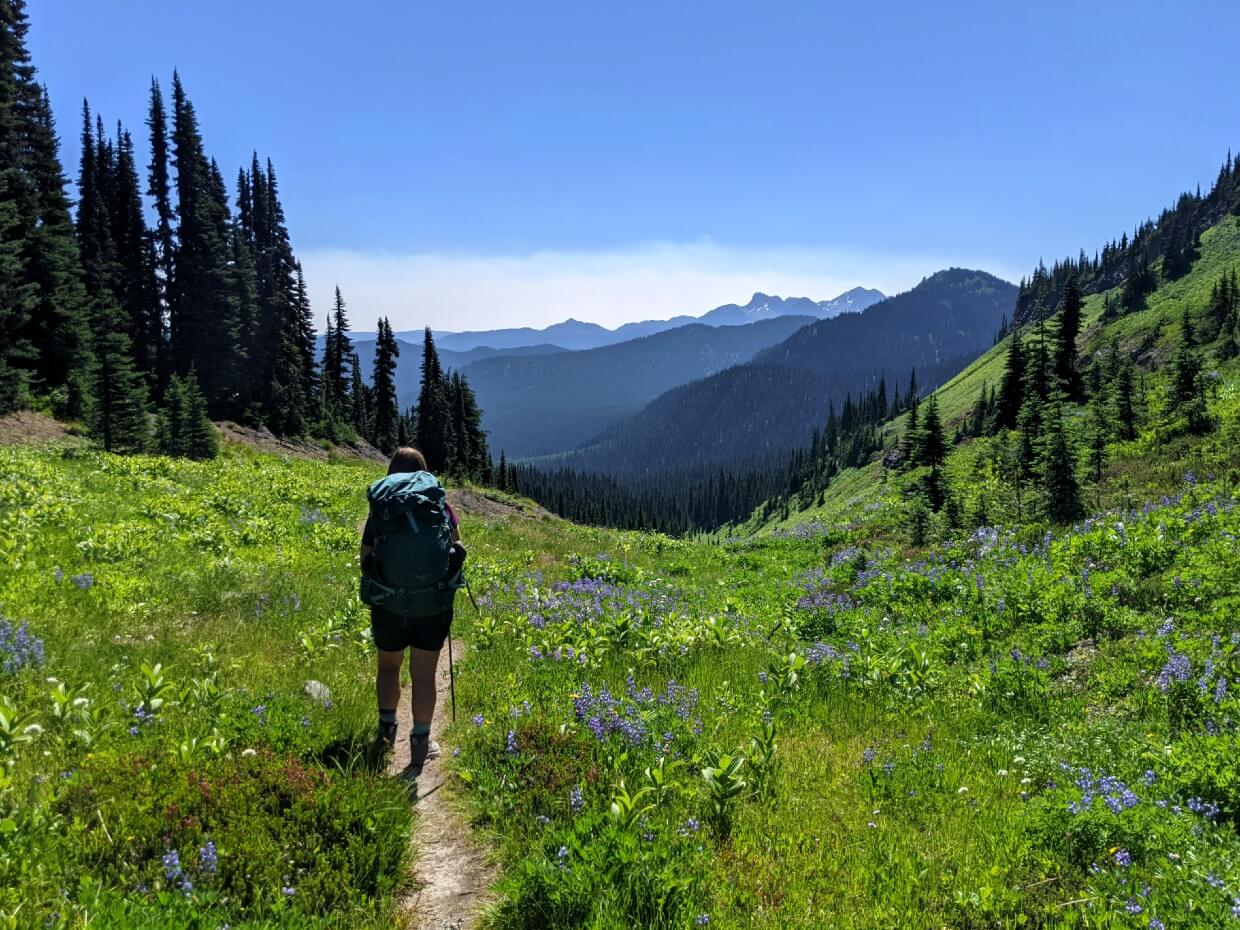
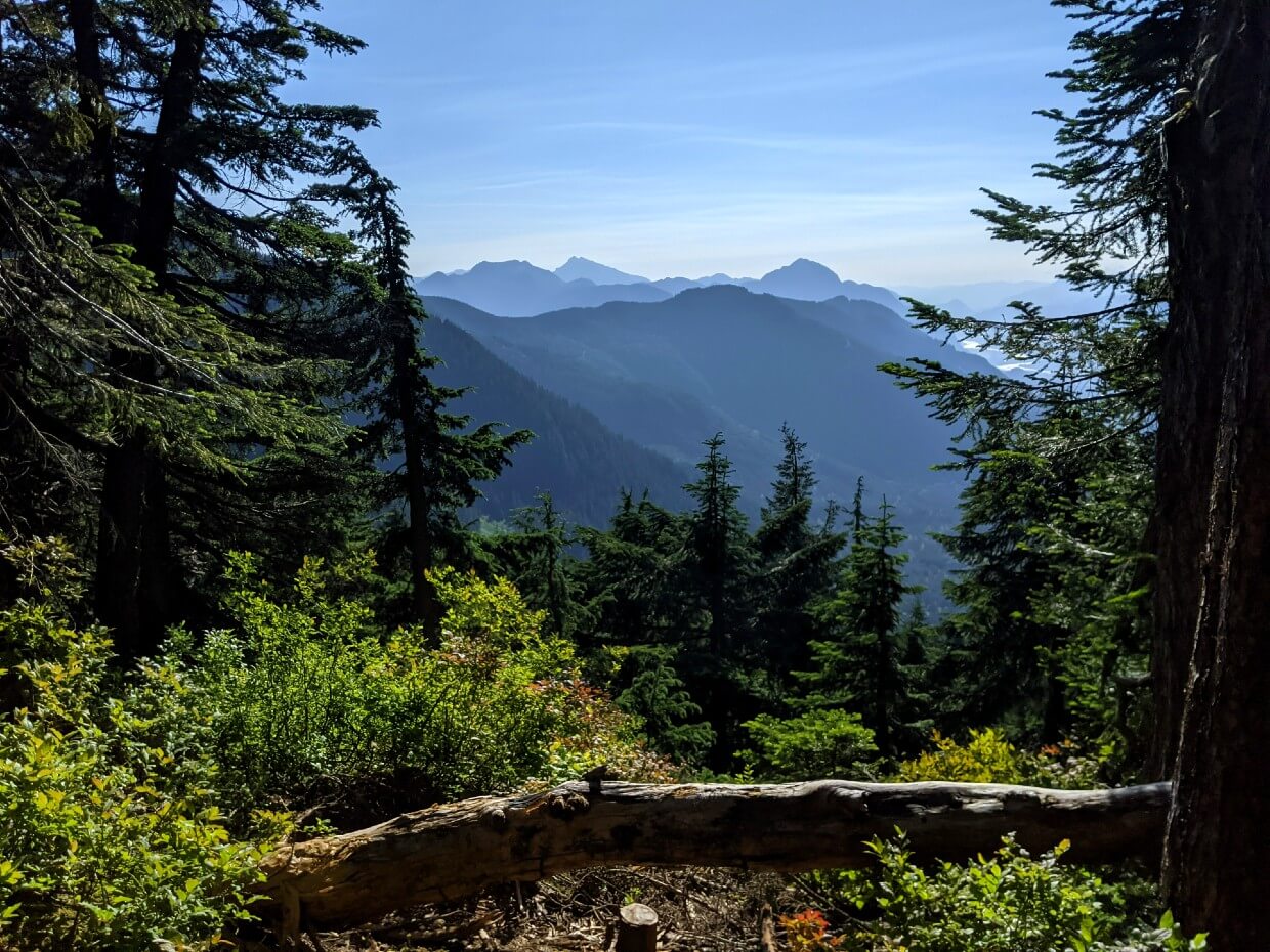
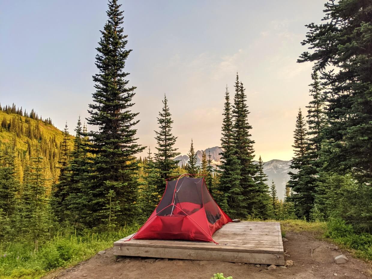
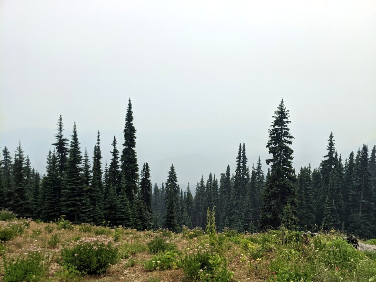
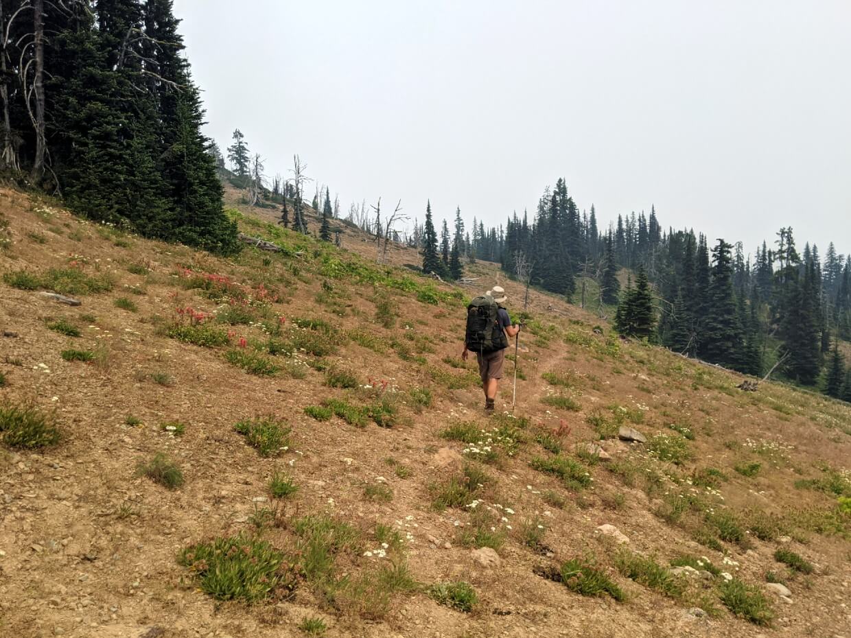
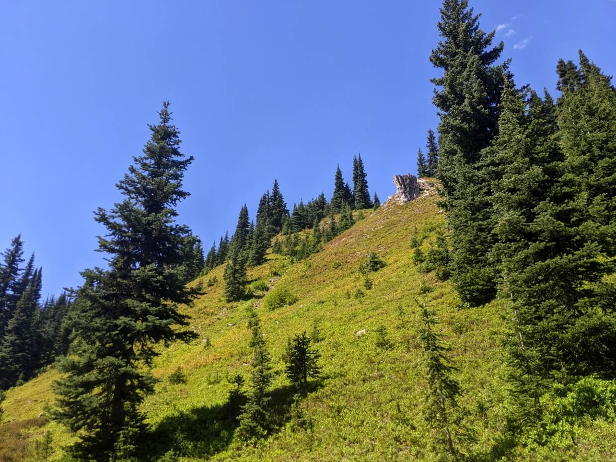
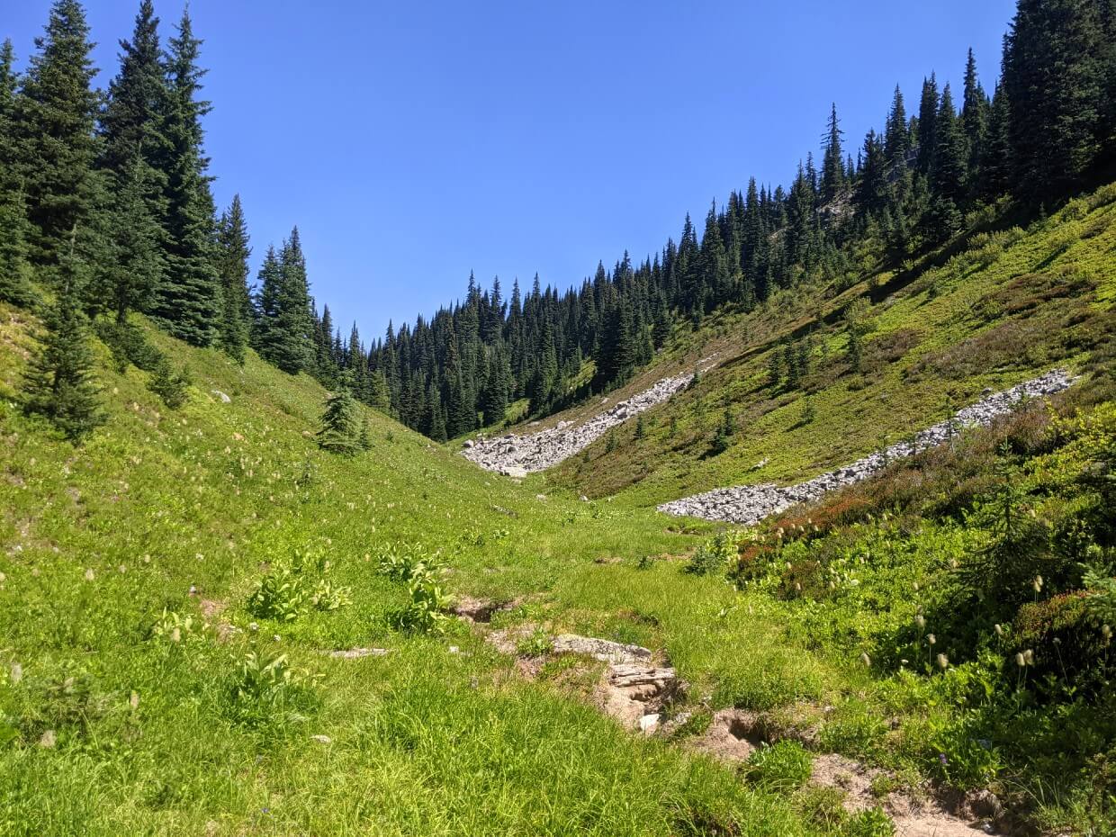
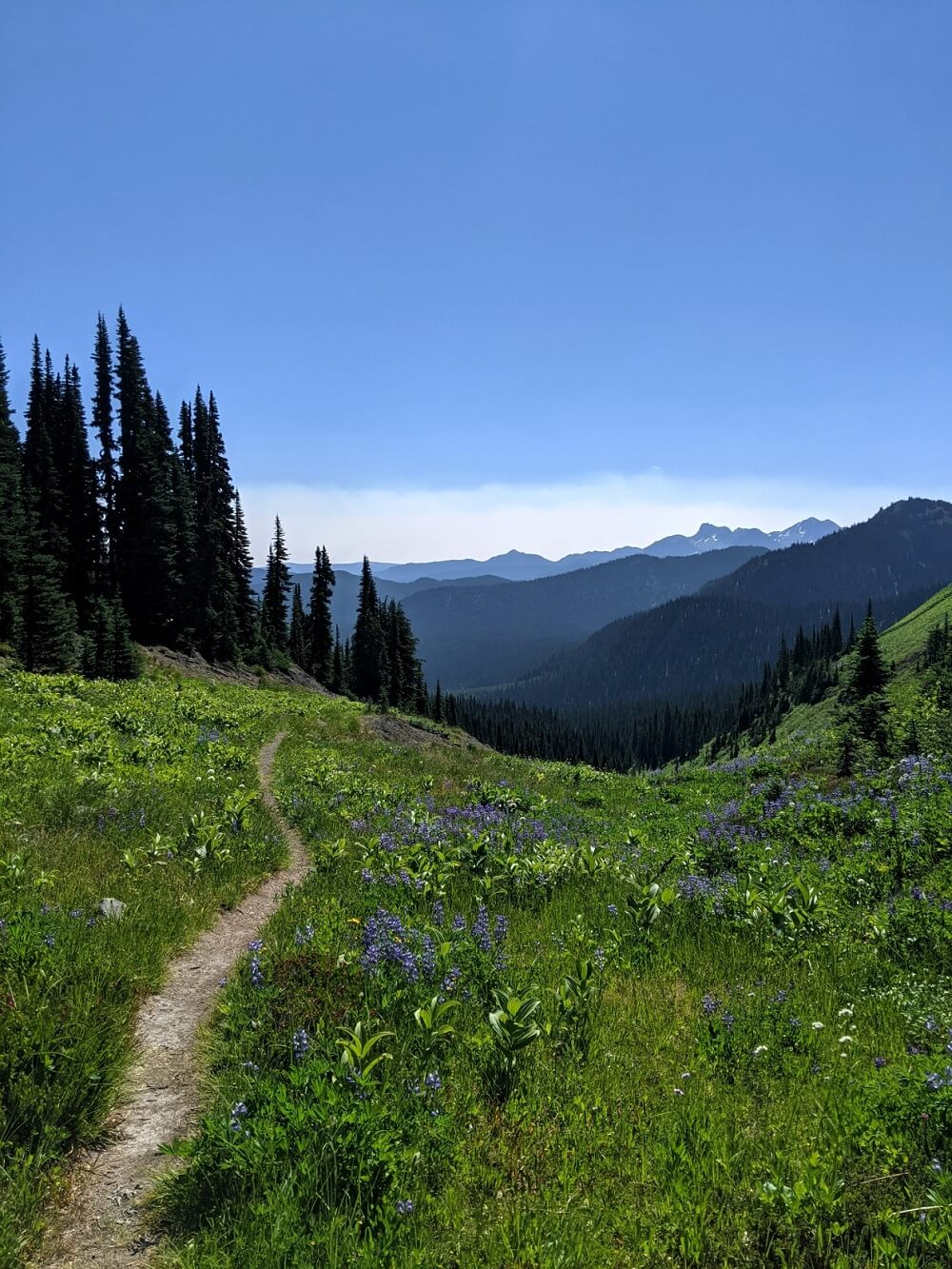
Sleeping with the tent fly off, we were warmed by early morning sun. Panoramic views of mountain peaks and endless layered valleys awaited us as we headed uphill from the campground.
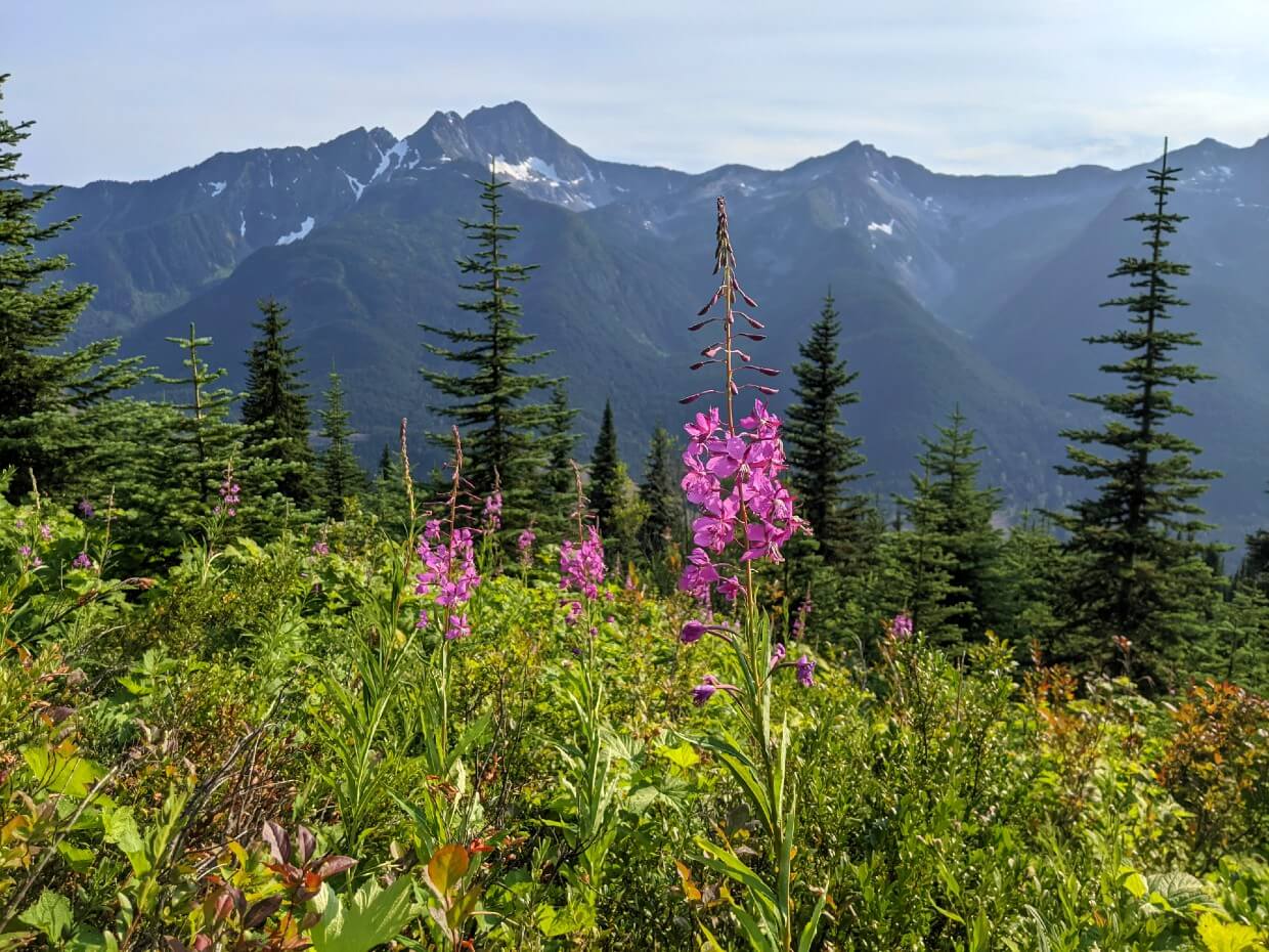
The HBC Heritage Trail crosses the Cascade Divide (1855m) on the slopes of Mt Davis. This marks the transition between the wet, coastal ecosystem of the Fraser watershed and the drier, interior environment of the Columbia.

Palmer’s Pond
Always feeling most at home in the mountains, I loved every second of this section of the HBC Heritage Trail. The highlight was Palmer’s Pond, sparkling turquoise in the sun. JR didn’t wait long to go for a swim!
It was here that we met a group of three hikers, only the second group of people we had seen so far.

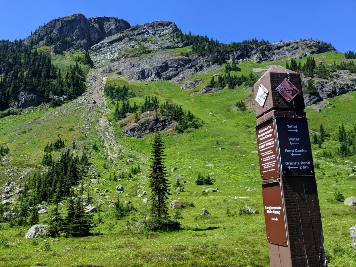
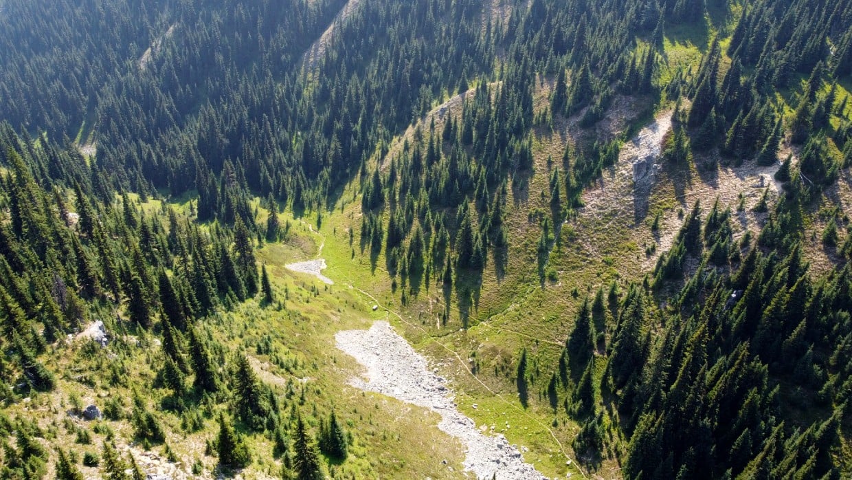
Continuing along the trail, we were enveloped by gorgeous wildflowers and more far reaching views. We stopped again at the scenic Conglomerate Flats Camp, named after the pudding stones found in this area.
It was downhill almost all the way to Jacobson Lake, a 1km detour from the main trail. We were surprised to find the vehicle accessible campground completely empty. The picnic tables were perfect for a nap.
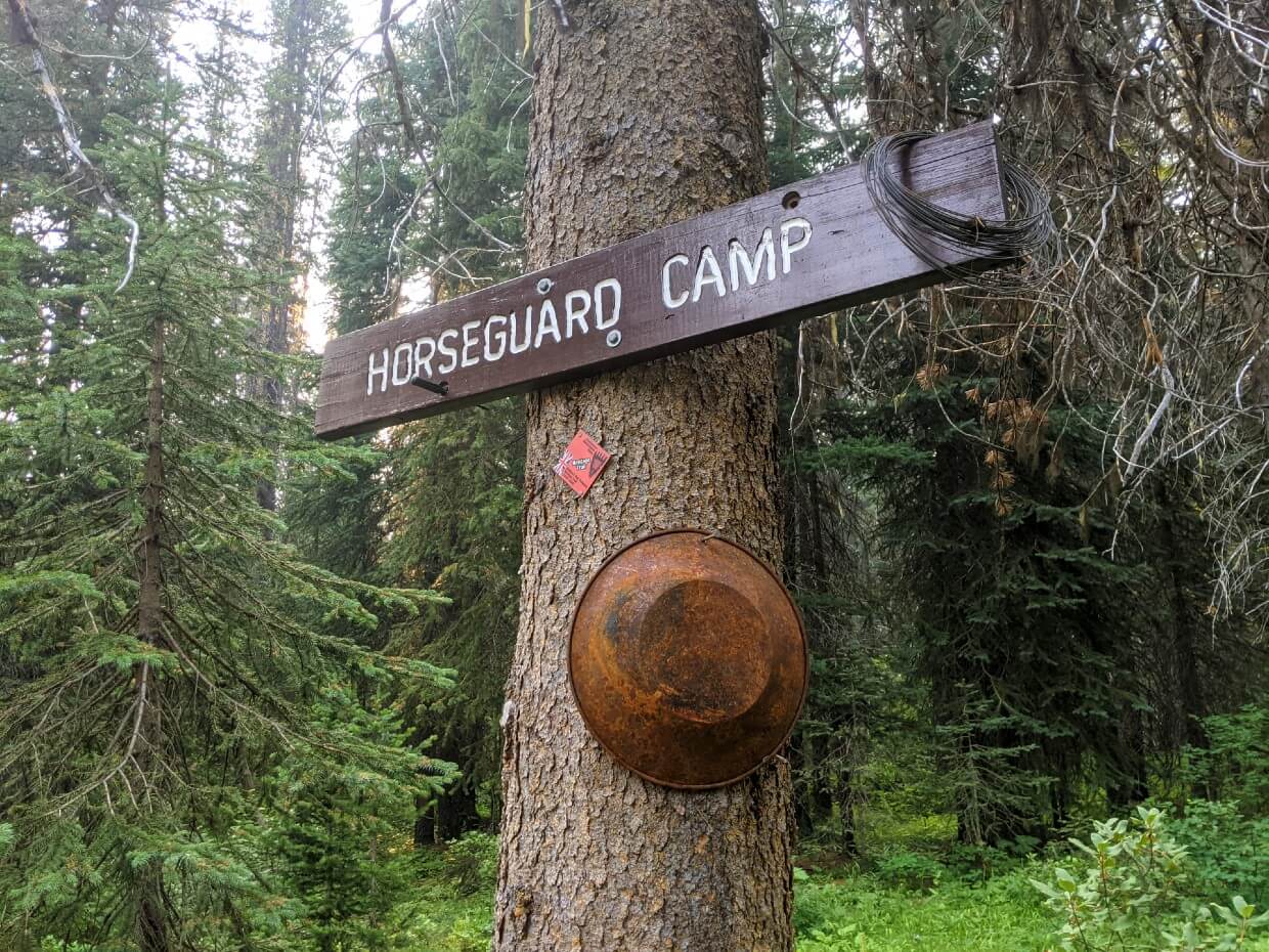
Jacobson Lake to Horseguard Historical Camp
We had anticipated that the afternoon would be a fairly straightforward 11.5km downhill jaunt through the forest to Horseguard Camp.
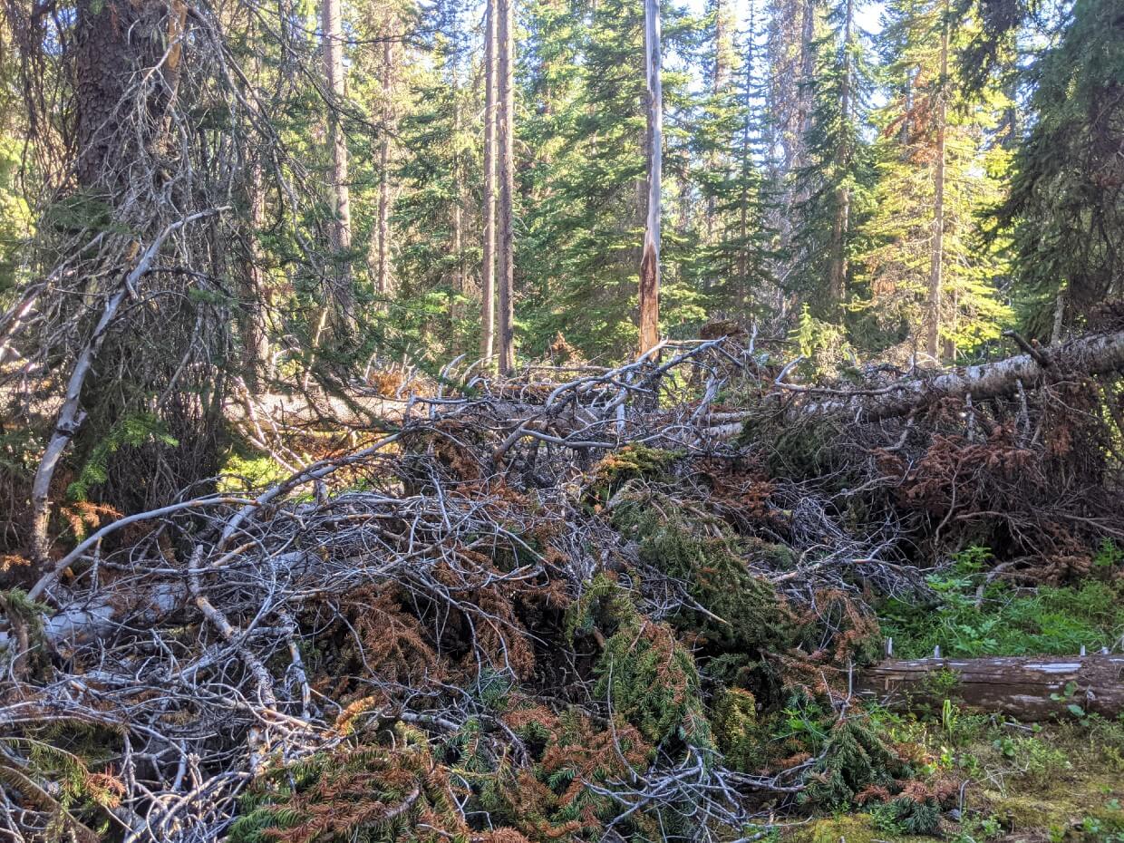
And it would have been, if not for winter storms that brought down dozens of trees on top of the path.
We got pretty scraped up climbing over the tree trunks and also ferociously bitten by the mosquitoes hiding within the foliage.
This section of trail was cleared by volunteers a few weeks after our hike so our experience would have been completely different later in the season.
I was so glad to finally arrive at Horseguard Historical Camp and even happier to dunk my sweaty, dirty self into the Tulameen River!

Day 4 – Horseguard Camp to Blackeye’s Plateau Camp
Distance: 6.25km
Elevation: 605m gain
Time: 4 hours with breaks
We woke with a smell of wildfire smoke in the air – it had finally caught up with us.
The first challenge of the day was to cross the Tulameen River. It’s pretty convenient to stay at the Horseguard Historical Camp as you don’t have to take your hiking boots off!
A steady climb was waiting on the other side of the river. After the steeper ascents on day one and two, this one felt like a piece of cake (even with a couple more downed trees!) Thankfully, the wildfire smoke started to lift as we hiked.
The Defiles
At the top, the path started to parallel a trickling stream, leading us into a narrow, natural ravine.
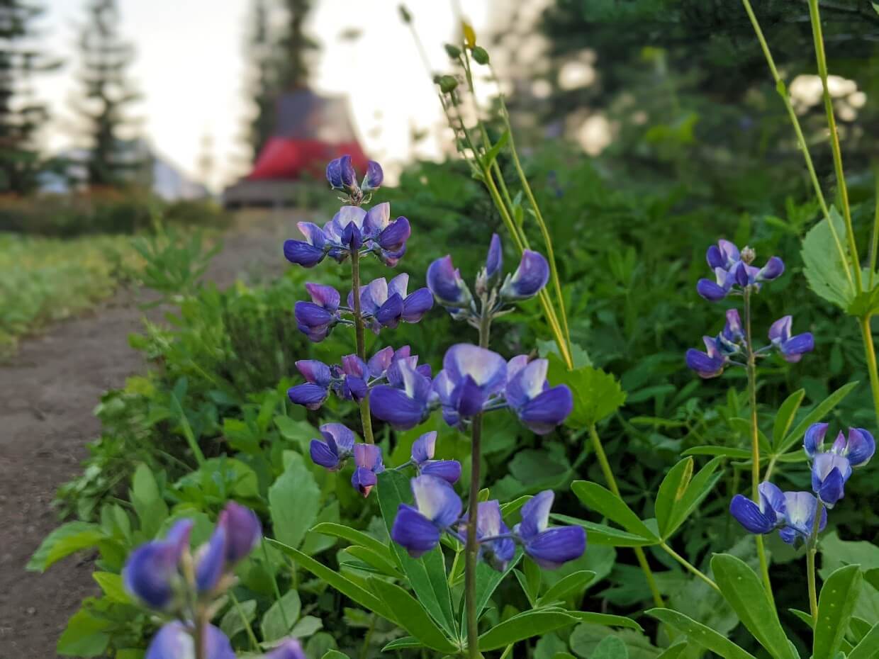
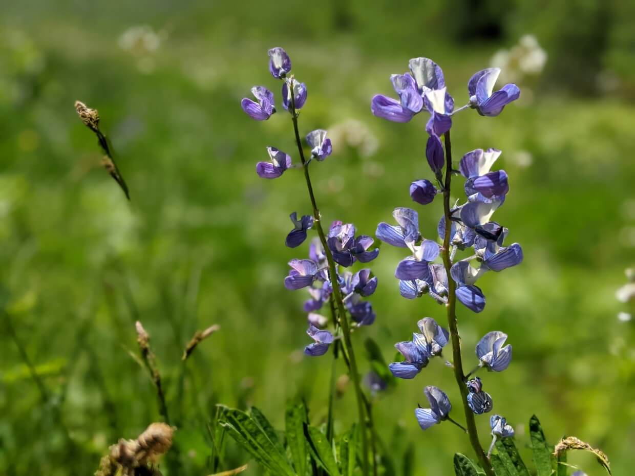
A chorus of squeaks and whistles came from pikas and marmots hidden within the rocky slopes. Wildflowers bloomed in the meadows, almost reaching shoulder height at times.
This gorgeous area is called the Defiles and was used as a hunting ground by the Similkameen people.
Meeting the locals
The Defiles provides the perfect natural path to follow but visibility is limited. As we approached one corner, a black bear suddenly ran across our path and up the other side of the ravine. A baby bear quickly followed.
Concerned that a baby bear had been left behind, we waited a long time before cautiously passing at a distance. We were in no hurry – our camp for the night was up and around the next corner.
Our early start enabled us to fully appreciate Blackeye’s Camp. I was grateful for such a short day on trail, as the last few days had been long and tiring.
Just before darkness fell, I spotted a large, brown shape running through the forest. With my animal encounter quota filled for the day, I quickly zipped up the tent vestibule….(I think it was an elk)

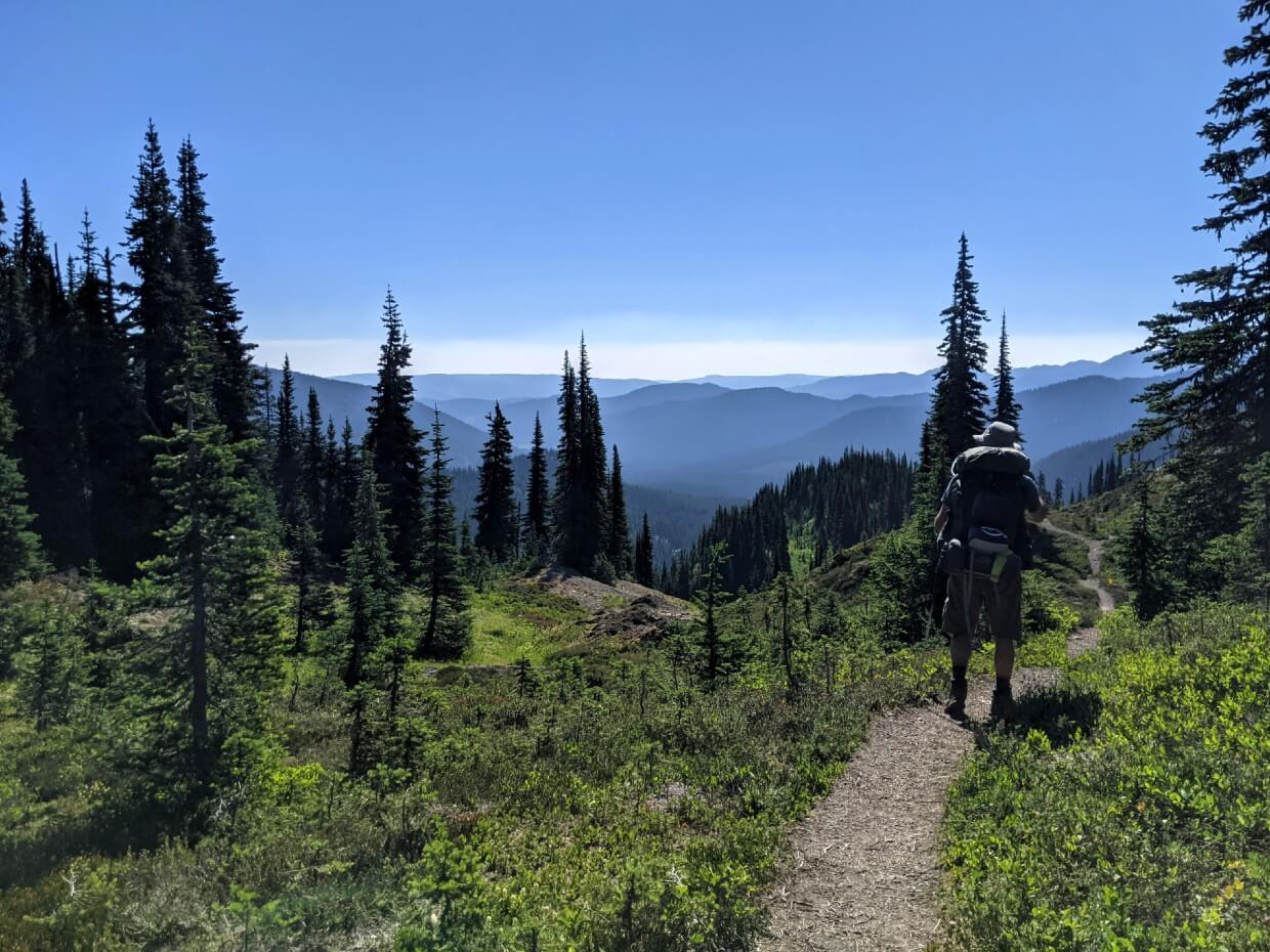
Day 5 – Blackeye’s Plateau Camp to Tulameen River Trailhead
Distance: 28.25km
Elevation: 1200m loss, 200m gain
Time: 12 hours with breaks
After a difficult night of sleep due to heat and wildfire smoke, we got up early and made the decision to finish the trail.
Although the remaining distance was intimidating at first, we divided it into three manageable portions (Blackeye’s Camp to Lodestone, Lodestone to Olivine, Olivine to Tulameen) and enjoyed hour long breaks between them.
It definitely also helped that this section of the HBC Trail was one of the easiest, at least in this direction.
Blackeye’s to Olivine
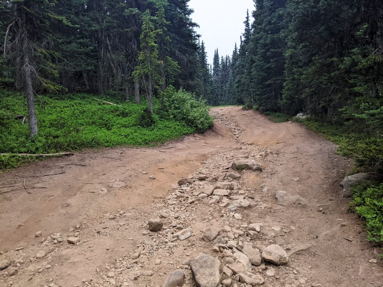
A few kilometers out of Blackeye’s Camp, the HBC Trail converged with the Whipsaw, a 4X4 track. While this wide, sometimes muddy, path wasn’t particularly scenic, it did enable us to make excellent time.
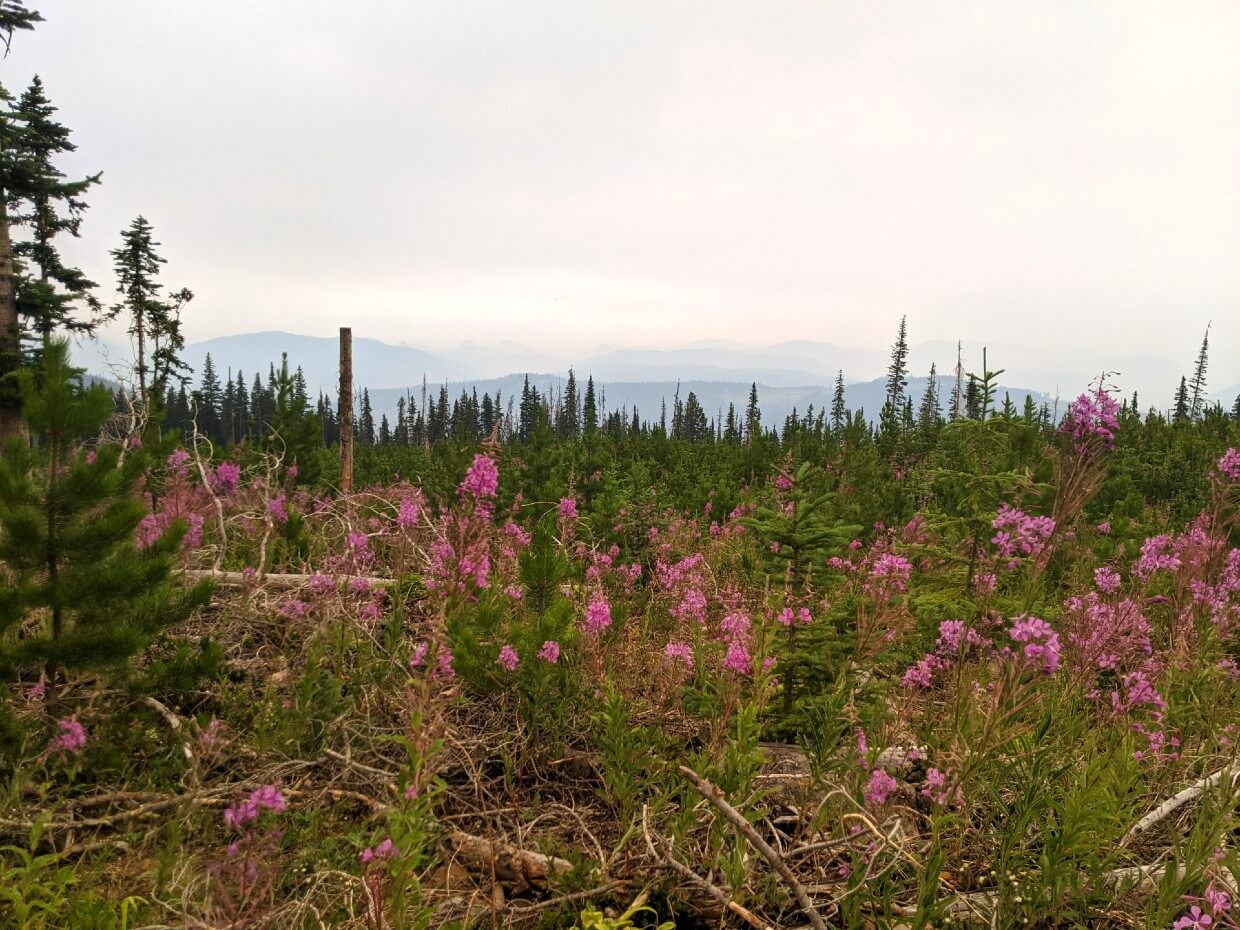
At Lodestone Lake, we lunched next to a small group of truck campers. From here, the trail weaved between (and sometimes on) logging roads.
Without smoke, I believe some of the cut blocks would have offered good views! We enjoyed the wildflowers instead.
Olivine to Tulameen
Although we couldn’t see much, it looked like hiking up to Olivine Mountain would have been fun. After a hot dinner in the campground, it was time for our final descent.
We switchbacked down through more cut blocks, losing our way a couple of times. At kilometer 70 it was very apparent that there was a bear in the area, enjoying the plentiful berry bushes lining the trail.
The bear’s scat led us almost all the way to the Tulameen River. To be able to spot our parked van across the water was a wonderful sight after such a long day.
The cool river was the perfect antidote for sore feet – the perfect ending to our challenging but rewarding HBC Heritage Trail experience.
Thoughts on the HBC Trail
JR and I enjoyed hiking the HBC Heritage Trail.
- As well as the challenge, I loved the mix of coastal forest, mountains and dry interior landscape
- The backcountry campgrounds on the trail are fantastic and we had them all to ourselves, meeting only seven people along the entire 74km route.
- I personally revel in the solitude of nature and prefer trails with less people on them
- The HBC Trail may not be in complete wilderness but it felt remote enough to me, especially as we were so alone
- The historical aspect adds something extra to the hiking experience. I appreciated the incorporation of interpretive signage along the route
- I remain incredibly impressed that the HBC Trail is completely free to enjoy. Thank you so much to the volunteer team that allows this to be possible
I do want to end this section with the following in mind – I don’t think every backpacking trail is right for every hiker.
I know hikers who would be happy to walk through the forest for days on end, purely for the pleasure of hiking.
On the other hand, I also have hiker friends who carefully weigh up the reward to effort ratio on every trail.
I sit somewhere in the middle and the HBC Trail delivered for me.
HBC Heritage Trail Hiking Guide
In this section, I’ll share all the information you need to hike the HBC Heritage Trail.
It includes trailhead and parking information, as well as detailed campground descriptions, navigational tips and suggested backpacking itineraries.
The best source of HBC Heritage Trail information is the Hope Mountain Centre website. There is a dedicated HBC Heritage Trail section, which includes excellent downloadable planning materials. These include:
- PDF map of the entire trail
- Elevation profile graphic
- GPX file of kilometre waypoints
- Detailed Peers Creek trailhead map
- Detailed Tulameen trailhead map
A HBC Heritage Trail topo map and trail book are available via the Hope Mountain Centre’s online store.
If you enjoy the historical aspect of the trail, I’d highly recommend purchasing a copy of the HBC Trail Book. This slim 77 page book shares the stories of trail users through the centuries as well as ecological information. It’s the ideal backpacking companion.
For general trail updates, be sure to follow the HMC’s Facebook page.
This section of the post contains some affiliate links. If you make a purchase via one of these links, I may receive a small percentage of the sale at no extra cost to you.
Location
The 74km HBC Heritage Trail traverses the Cascade Mountains between Hope and Tulameen, British Columbia.
Hope is located at the edge of BC’s Lower Mainland region, just under two hours drive from Vancouver (154km).
The town sits at the junction of some of BC’s busiest highways, including the Coquihalla (Highway 5) and the Trans Canada (Highway 1).
Tulameen is a small community near Princeton, which is a small town on Highway 3. Put simply, Princeton is two thirds of the way between Vancouver (285km) and the Okanagan Valley (112km).

Trailheads
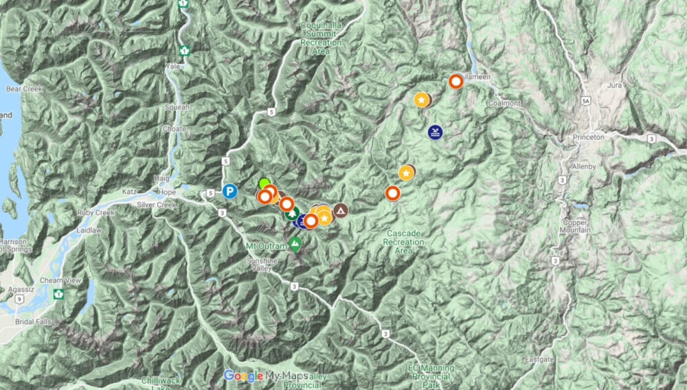
By road, the HBC Heritage Trail’s trailheads are located around 165km apart. If you’re a visual person, check out our HBC Trail Google Map.
This distance can prove to be the trickiest aspect to organising a backpacking trip on this trail. There is no official shuttle system currently in place and public transportation options in this area are reasonably limited.
The easiest solution is to DIY a two vehicle shuttle system. Driving time between the two trailheads is around two hours, so plan accordingly.
If you manage to enlist a friend to help with a shuttle, be sure to make an informed choice where to leave your vehicle.
Choosing to hike west to east, we left our vehicle at the Tulameen Trailhead.
This allowed us to finish the trail and then drive to our next destination immediately. We also felt more comfortable leaving our vehicle in Tulameen (more about this in the Hiking Direction section).

Peers Creek Trailhead (West)
The HBC Trail’s western trailhead is a 15-20 minute drive from Hope, British Columbia.
The parking lot is located at the end of the unpaved Peers Creek Forest Service Road, 1.5km from Exit #184 of the Coquihalla Highway (Highway 5). The Hope Mountain Centre offers excellent directions.
- The current trail started on the other side of the locked yellow gate, across the creek. It follows the deactivated section of the Peers Creek Forest Service Road for the first 4km
- The new trail (projected opening date summer 2022) will start to the right of the gate and run south of the creek
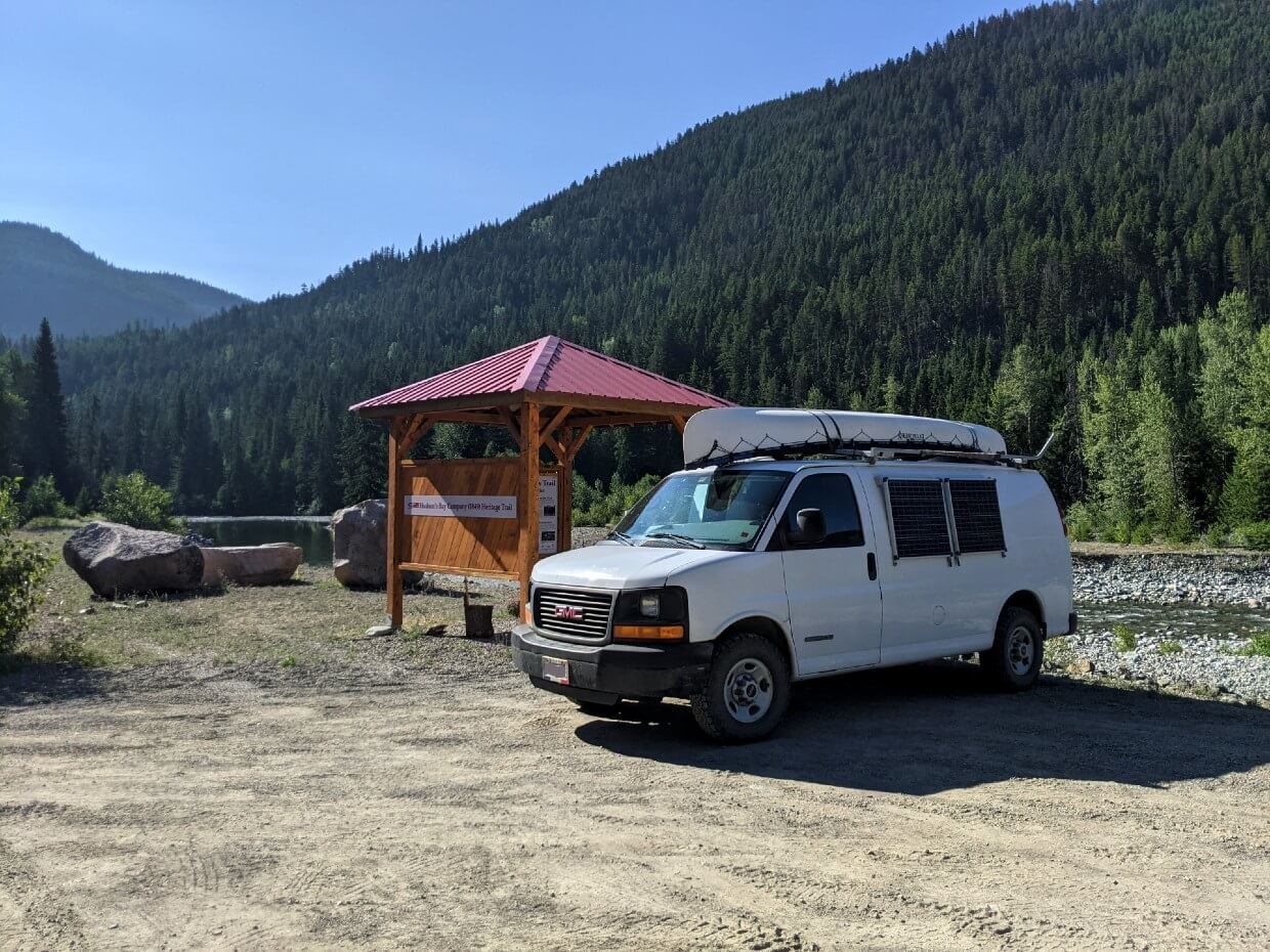
Tulameen Trailhead (East)
The HBC Trail’s eastern trailhead is located on the paved Tulameen River Road, approximately 3km west of the community of Tulameen. Detailed directions from the HMC can be found here.
Tulameen is a 30 minute drive from Princeton, British Columbia.
- Look for the red-roofed kiosk next to the river
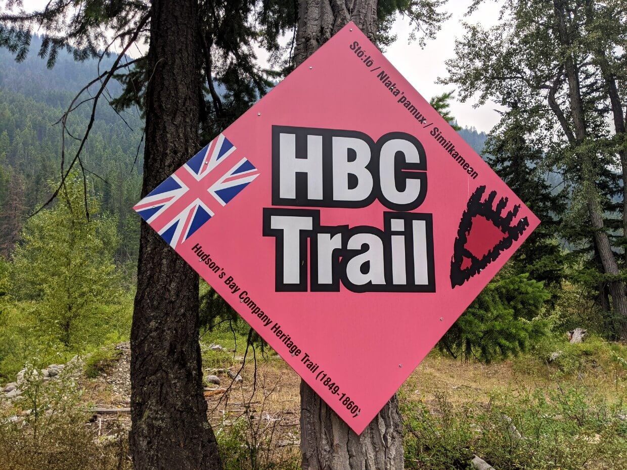
- The HBC Trail officially starts on the other side of the Tulameen River. It can be hard to spot initially but there is a big red diamond shaped sign with ‘HBC Trail’ on it
Parking
The HBC Trail has dedicated vehicle parking lots at the west and east trailheads. There are some additional parking options along the route too, where the path crosses unpaved industrial (logging) roads.
Peers Creek Trailhead (West)
- There is a large gravel parking lot, with space for at least a dozen vehicles.
- To the side of the lot, there is an interpretive kiosk with a bench
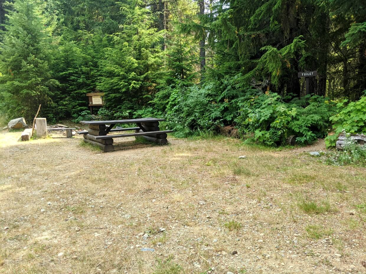
- Beyond this, there is a fire pit and seating. An outhouse sits a little further, accessible via a set of stairs
- Camping is allowed at the Peers Creek Trailhead
- This trailhead has phone signal
Tulameen Trailhead (East)
- Located just off road, the dedicated parking lot has space for around eight vehicles
- There is an interpretive kiosk with a bench
- There is no phone signal at this trailhead – head to Tulameen if you need signal
Alternative parking locations
Sowaqua Creek – There is a vehicle accessible campground and parking area where the HBC Trail crosses the Sowaqua Creek FSR. It is located at kilometer 20, measured from Exit #192 on Highway 5. Detailed directions from the HMC here.
Jacobson Lake – There is a vehicle accessible Recreation Site campground located at kilometer 50 on the Tulameen Forest Service Road, accessible from Exit #228 (Britton Creek) on Highway 5. Detailed directions from the HMC. The Tulameen is reportedly the best maintained FSR in the area and the best vehicle access to the HBC Trail, besides the trailheads.
Lodestone Lake – This lake hosts a vehicle accessible Recreation Site campground with ample room for parking, accessible via the Lodestone Forest Service Road. Detailed directions can be found on the Sites and Trails BC website. Please note that this is a popular campground for off road recreationalists.

Campgrounds
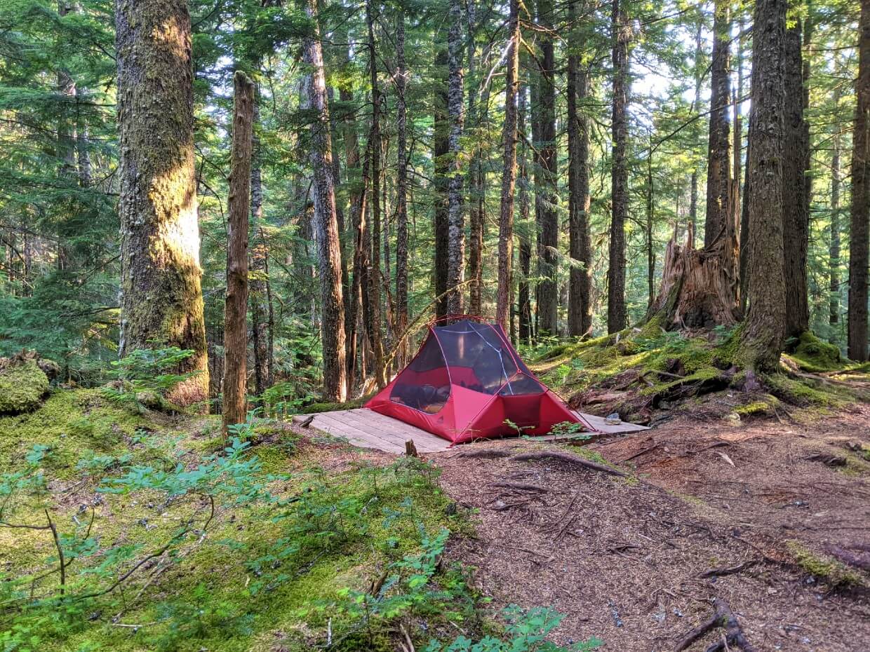
There are ten established campsites located at regular intervals along the HBC Heritage Trail, seven of which not accessible by road.
Not only are these campgrounds completely free for backpackers to use, but they have also been built to an exceptionally high standard.
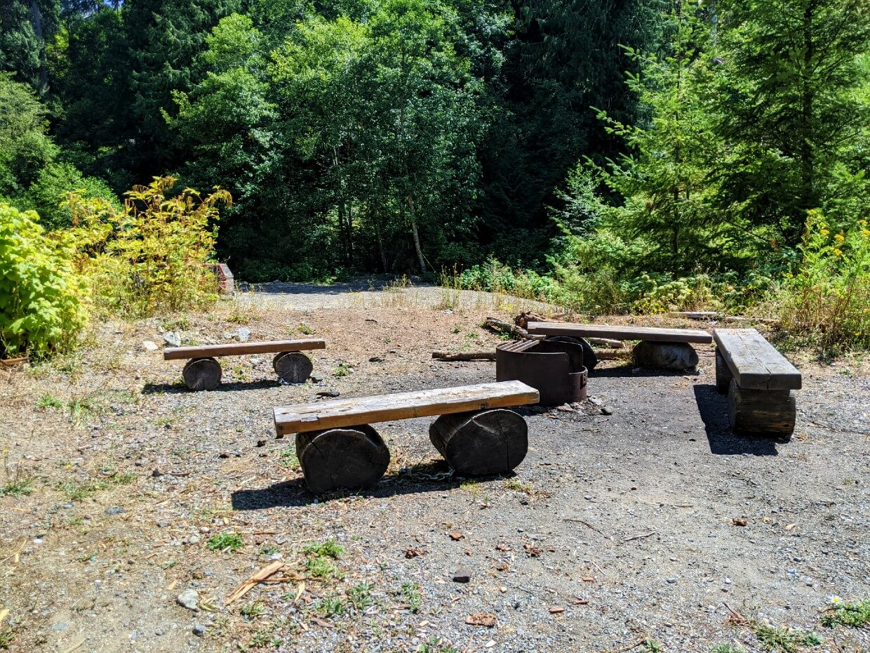
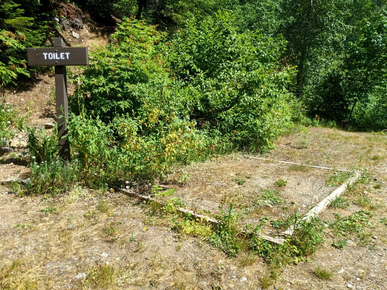
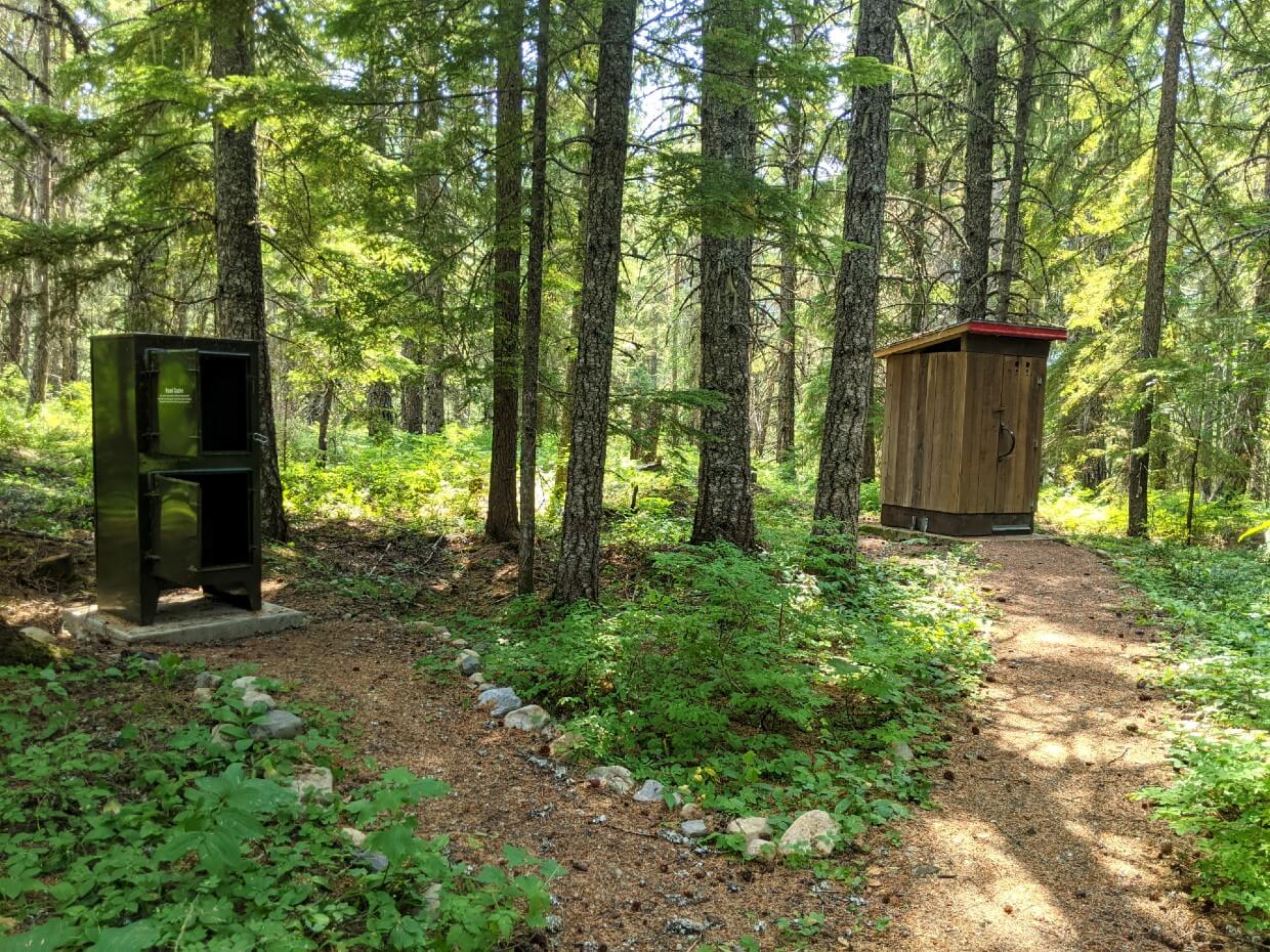
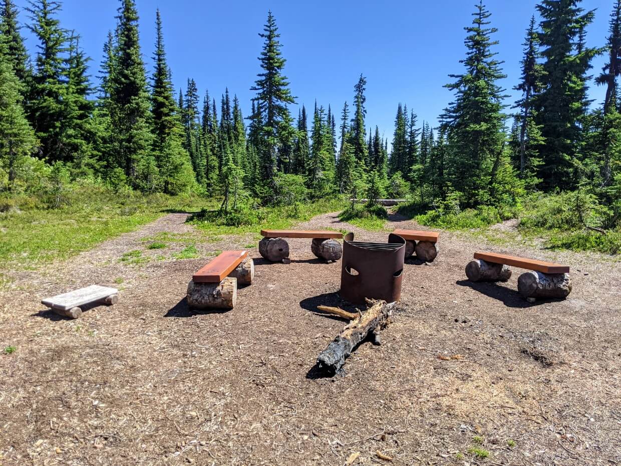
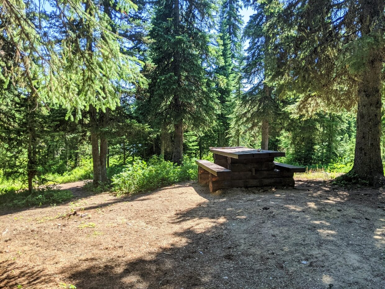
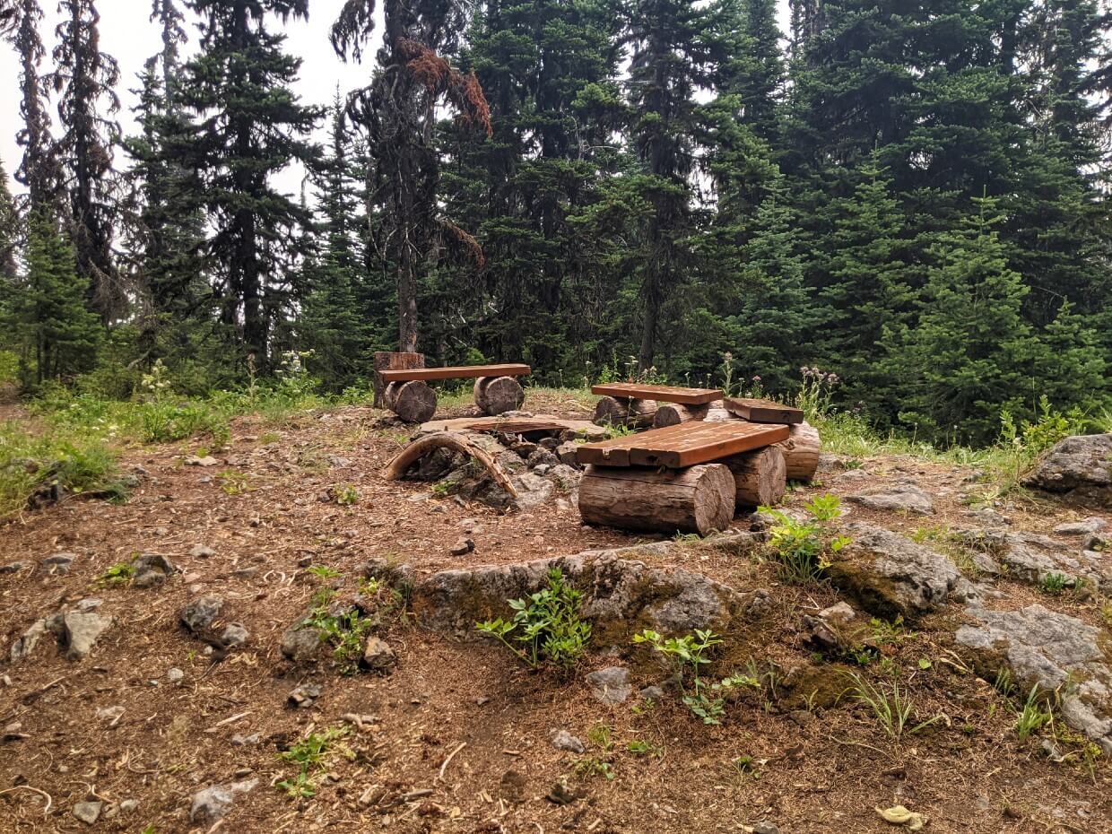
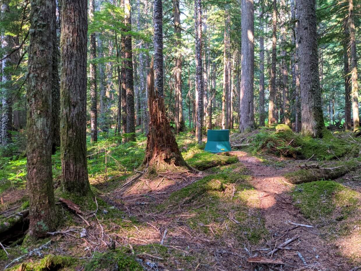
All ten of the HBC Trail campgrounds feature a food cache with two compartments. Seating, fire pits and outhouses are also standard features.

We were extremely impressed and wish all backcountry campgrounds were as good as these!
Four of the campgrounds are historical locations where the Hudson Bay Company horse brigades would have stopped for the night.
The campgrounds all work on a first come, first service system.
Manson’s Historical Camp – 950m
Seemingly cut right into the hillside, Manson’s Camp is a compact campground surrounded by forest, wildflowers and mountain views. It’s a good place to stop if you start the trail late.
On our visit in July 2021, one of the tent pads was a bit overgrown. The foliage in this area grows exceptionally fast so keep it in mind that some bushwhacking may be needed.
Location: 6km from Peers Creek
Facilities: Throne toilet, food cache, three dirt tent pads, table with seating, rock fire pit, interpretive signage
Water: Small creek near camp which usually dries up in July. Secondary source 500m from camp
Our score: 7/10

Colville Camp – 920m
Peaceful forested campground with dappled light and access to plentiful, reliable water sources. We were very happy to stop here.
There is space for additional tents if tent pads are already occupied. The throne toilet and food cache are located a short walk away from the main camping area.
Location: 11km from Peers Creek
Facilities: Throne toilet, food cache, three wooden tent pads, picnic table, fire pit and seating
Water: Two year round creeks, both very close to camp
Our score: 9/10

Sowaqua Camp – 905m
Roadside, vehicle accessible campground bordered by forest on one side. While there are no tent pads, the camping area is blocked off with large boulders. The outhouse and food cache are located just inside the forest.
Location: 18.75km from Peers Creek
Facilities: Outhouse, food cache, picnic table, interpretive kiosk, fire pit and seating
Water: Small steam near camp
Our score: 7/10
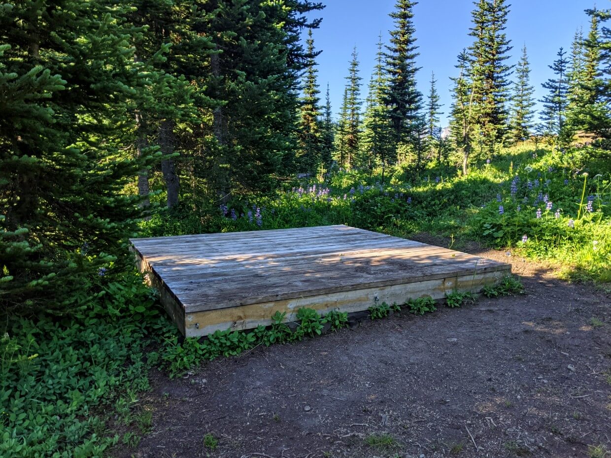
Campement du Chevreuil (Deer Camp) Historical Camp – 1630m
This beautiful subalpine campground was my favourite on the HBC Heritage Trail – I loved the subtle mountain views, layout and easy access to water. It’s the perfect reward after the epic climb up from Sowaqua Camp!
There are some trees in this campground but it is, on the whole, quite exposed. So keep that in mind if the weather is against you.
Location: 22.5km from Peers Creek
Facilities: Throne toilet, food cache, three wooden tent pads, fire pit with seating, interpretive signage
Water: Small steam very close to camp. Follow downhill in summer|
Our score: 10/10
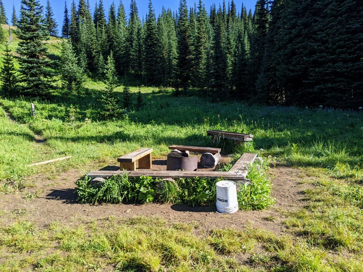
Conglomerate Flats Camp – 1660m
Conglomerate Flats Camp is a very pretty open subalpine campground situated at the base of Mt. Davis (1855m).
Although we didn’t stay there, this was one of my favourite campgrounds. The setting is absolutely gorgeous (but exposed) and there are day hiking opportunities to Grant’s Pond.
Location: 25.5km from Peers Creek
Facilities: Throne toilet, food cache, three wooden tent pads, fire pit with seating
Water: Year round streams close to camp
Our score: 10/10

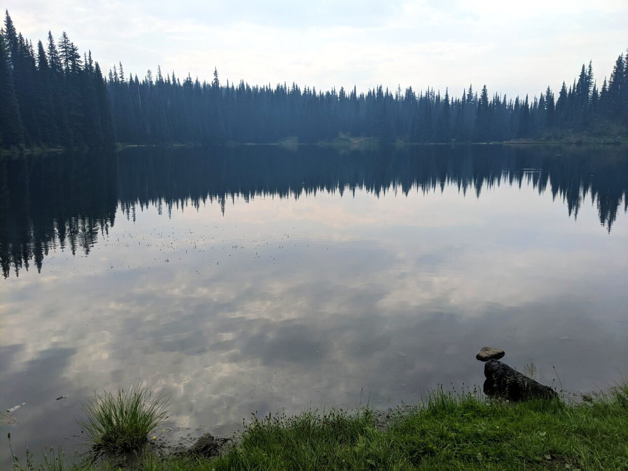
Jacobson Lake Camp – 1470m
This vehicle accessible Recreation Site campground has six campsites and horse corral facilities. Most of the sites are shaded by trees. There is a short trail to the lake itself. The shoreline is a bit boggy, the reason we did not collect water from here. I wouldn’t swim in it either.
I believe that the small size and layout of the campground would prevent larger RVs and trailers staying here. We expected to see campers in late July but saw no-one.
Please note that Jacobson Lake Camp is 1km off the main HBC Trail. There is signage indicating the detour.
Location: 28km from Peers Creek
Facilities: Outhouse, food cache, picnic tables, fire pits
Water: From lake
Our score: 6/10

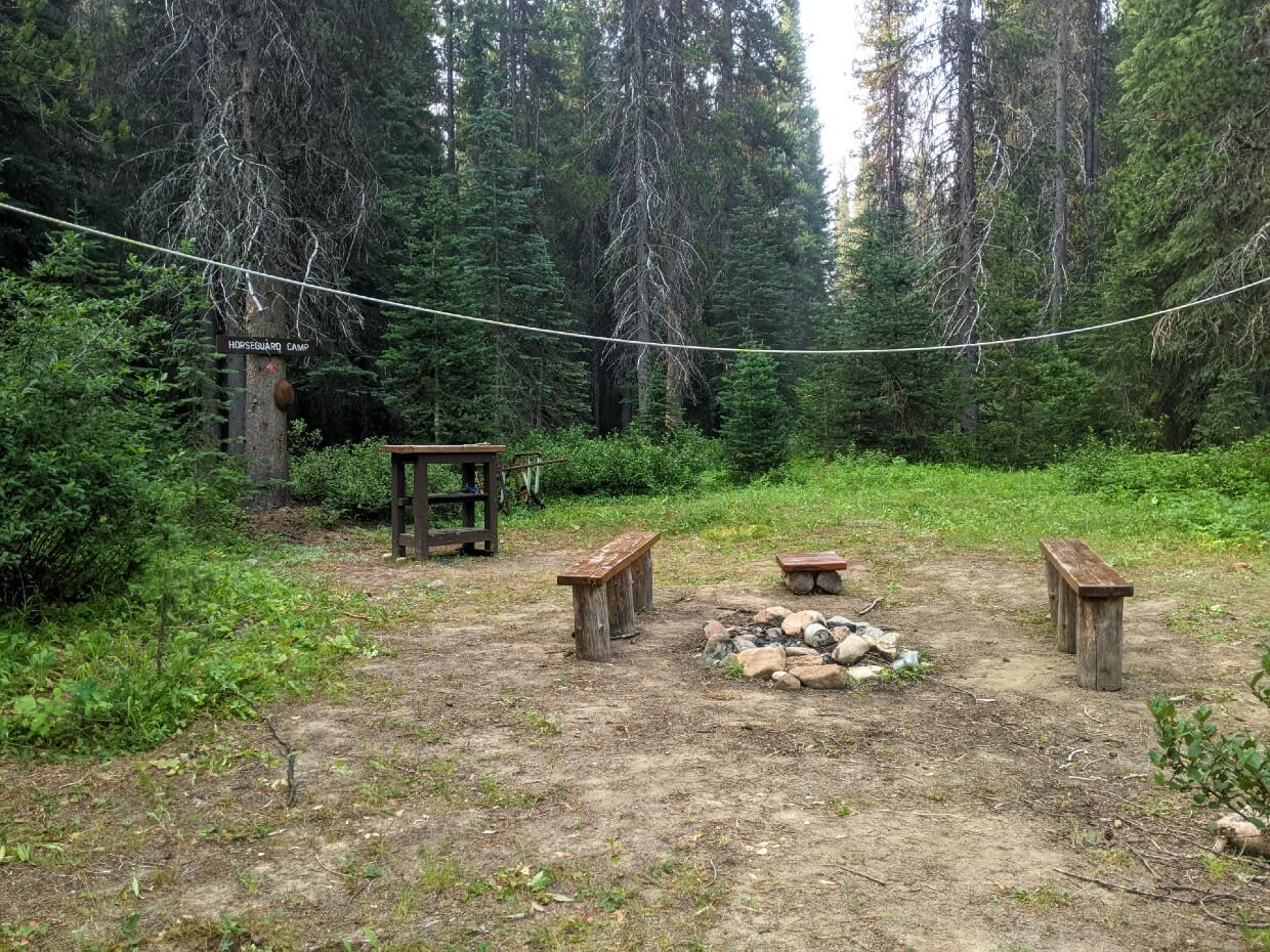
Horseguard Historical Camp – 1255m
The Tulameen River sits on one side of the Horseguard Historical Camp, with forest on every other side. There are no tent pads here but there is plenty of cleared space suitable for half a dozen tents.
My favourite aspect to this campground was the close proximity of the Tulameen River. It was great for washing and collecting water.
We did notice some clear cuts through the trees so be aware that logging does occur in this area.
Location: 39.5km from Peers Creek
Facilities: Throne toilet, food cache, table, fire pit with seating, interpretive signage
Water: Fast flowing river directly next to camp
Our score: 8/10

Blackeye’s Camp – 1860m
This subalpine campground is named after the respected Upper Similkameen First Nation Chief who shared his hunting trail route with HBC Chief Trader A.C. Anderson.
Located just above the wonderful Defiles section of the trail, the campground is large and airy.
Despite having limited views, Blackeye’s Camp was also one of my favourites. I really liked the open feel and well spaced tenting areas.
Location: 45.75km from Peers Creek
Facilities: Throne toilet, food cache, three wooden tent pads, fire pit with seating
Water: Stream located 100m to west of camp, shallow ponds 1km east
Our score: 9/10


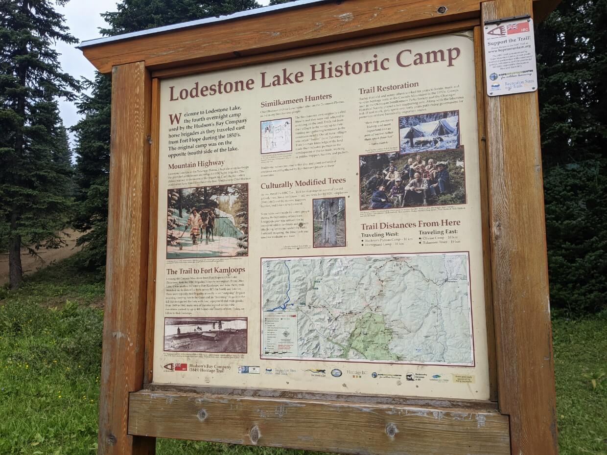
Lodestone Lake Historical Camp – 1820m
Lodestone Lake is a well used vehicle accessible Recreation Site campground, popular with fishermen and off road drivers.
The camping area is located right next to the lake. Though expansive at first glance, we found only two picnic tables.
According to the HMC, there is a plan in the works to add some tent-only campsites for HBC Trail users.
Location: 55.5km from Peers Creek
Facilities: Outhouse, food cache, picnic tables, fire pits, interpretive signage
Water: From lake
Our score: 5/10
Olivine Camp – 1710m elevation
Situated just below the mountain peak of the same name, this compact campground is set into a sheltered patch of trees. There are no formal tent pads, but there are a couple of obvious tent spots close to the fire pit area.
Reading the trail logbooks, this campground seems to divide opinion. Some people called it the worst of the trail but I think that is a little harsh!
The water source is downhill walk away but there also are hiking opportunities up to the peak of Olivine Mountain (1801m).
Fun fact – Olivine is a green coloured magnesium iron silicate mineral.
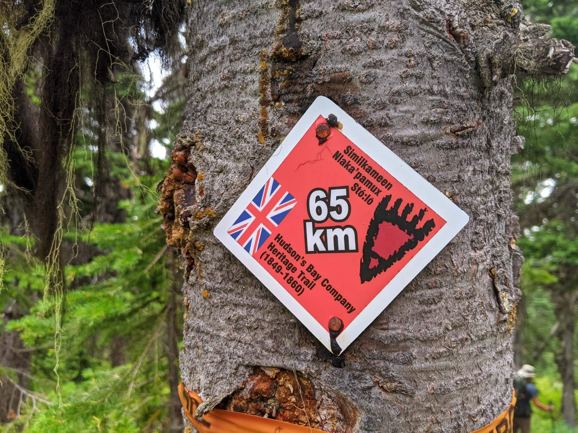
Location: 65km from Peers Creek
Facilities: Throne toilet, food cache, fire pit with seating, additional benches
Water: 800m return trip to small spring
Our score: 7/10
When to hike
While the HBC Trail is technically open all year round, the best time to hike it is July to September.
Before this time, snow may be present on the high elevation sections. The river crossings may also prove to be difficult with spring snowmelt. Snow usually starts to fall at higher elevations in October.
We found late July to be a great time to hike the HBC Trail. The river crossings were easy, the water sources still abundant and the trail not too muddy.
The only seasonal problems we encountered were hot weather (30c, even in the alpine!) and wildfire smoke.
Navigation
The HBC Heritage Trail is well marked and, for the most part, straightforward to navigate. It is important, however, to remain aware of your surroundings as the path crosses logging roads, 4X4 tracks and rivers.
- The path is well established along the majority of the route. The surrounding foliage can sometimes visibility hide it but it is there.
- Forested sections feature regular kilometer markers, bearing a grizzly bear paw pictograph and HBC flag (see below)
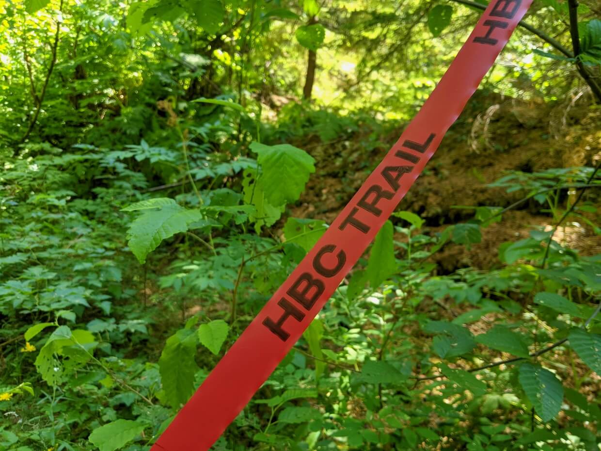
- Red flagging is also provided at regular 100-200m intervals. Note that older flagging is vulnerable to the sun and can turn orange or yellow!
- For navigation, I would highly recommend the official HBC Topo Map produced by the Hope Mountain Centre.
- We used the Maps.me app as our secondary navigation source, which showed the trail to almost 100% accuracy as well as our position on it
- The only imperfection was the location of the campgrounds, which always seemed to be at least 200m further along the trail than indicated
Losing the trail
We lost the trail a total of six times. For a 74km long trail that is built and maintained by volunteers, I think that is pretty good!
Each time we lost the trail, it only happened momentarily and almost always where the path crossed a logging road.
Most of these instances occurred in the last 18km of the trail, a section that does not currently have the same historic designation as the rest (and hence does not have a 200-metre-wide buffer zone for protection).
Difficulty
Overall, I would rate the HBC Heritage Trail to be difficult/challenging, due to the elevation profile, total distance and style of trail.
There is no scrambling or ridge walking required, but the trail has some very steep sections, two river crossings and has a risk of obstacles (overgrown path, downed trees) early in the season.
If you are an experienced hiker, you may find the HBC Trail to be moderate in difficulty. For a point of reference, the HBC Trail was one of our hardest backpacking trips to date.
I would not consider all sections of the HBC Trail to be challenging, especially if there are no natural obstacles (i.e. fallen trees).
- Jacobson to Horseguard Historical Camp is mostly flat, as is Blackeye’s Camp to Lodestone Lake and Colville Camp to Sowaqua Creek
- Hiking downhill from the Cascade Divide to Jacobson Lake and Olivine Camp to the Tulameen Trailhead is straightforward
Elevation gain and loss
There are significant elevation gain and losses on the HBC Trail, especially along the most western 30km section. Personally, I think this is the hardest challenge of the hike.
The most difficult ascent, in my opinion, is from Sowaqua Camp to Deer Camp (eastbound hikers only).
The elevation difference is 735m over 3.7km, but most of this gain actually happens within a short 2.4km section.
The climb from Manson’s Camp up to Manson’s Ridge and then back down into the Upper Sowaqua Valley is also very demanding, especially as you’re likely to still be fresh on the trail!
470m of elevation is gained over 1.7km and then lost in the next 2km.

Steep terrain
The HBC Trail’s major elevation gains and losses are a consequence of steep terrain.
There are a lot of very, steep switchbacks on the ascent from Sowaqua Camp to Deer Camp. Luckily, there is a bench at the top, so be sure to celebrate as soon as you see it!
The descent from Manson’s Ridge to the Upper Sowaqua Valley can be very hard on the knees. The trail surface is varied, being rocky, rooty and sometimes loose. Concentration is definitely needed.
There are similar risk factors for west-bound hikers descending from Deer Camp.
Rain or snowy weather would make these steep descents even trickier.
River crossings
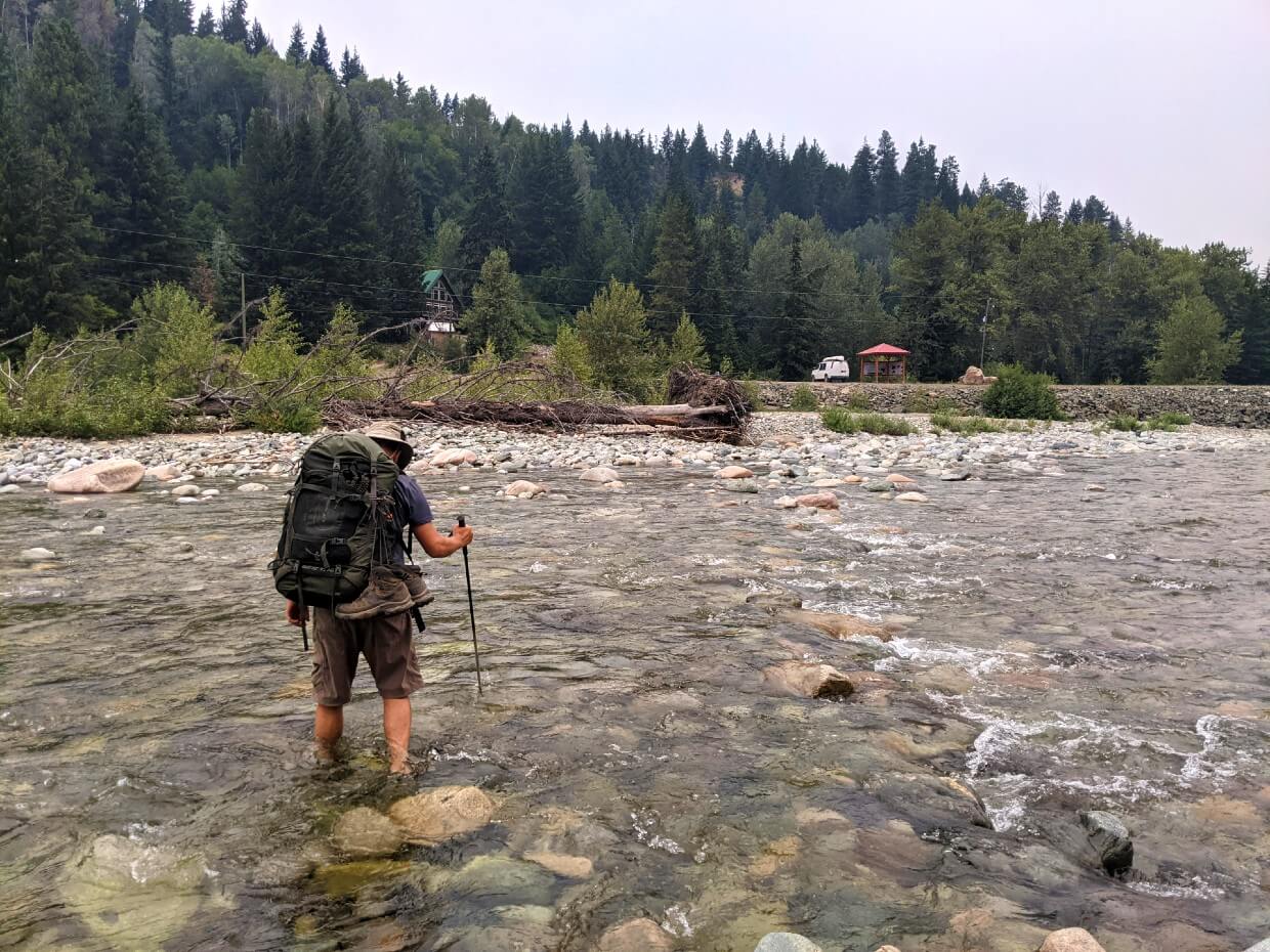
There are two major river crossings that much be forded to continue on the trail –
- The Tulameen River at 39.5km, on the northern side of Horseguard Historical Camp (short crossing)
- The Tulameen River at 70km, at the Tulameen Trailhead (longer crossing)
Official advice from the Hope Mountain Centre suggests that the latter crossing should be avoided until after the spring snow melt. Mid July onwards is usually a good bet, but it does depend on the year.
In late July, the Tulameen had a steady but not fast flow. Water levels were halfway to my knee at the deepest point on both crossings. The water temperature was cold, but not ‘I can’t feel my feet’ kind of freezing.
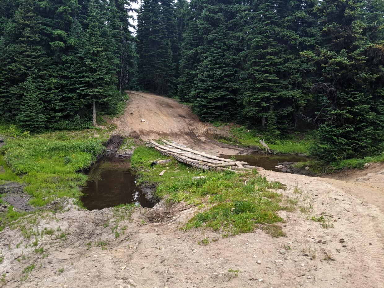
Depending on winter storms, level of snowmelt and recent maintenance, it is possible that you may need to ford additional river or streams. On our hike, we were able to rock hop over all streams that did not have bridges.

Trail obstacles
The 74km long HBC Trail is almost entirely maintained by volunteers.
As hard as they work, this still means that you may encounter downed trees, damaged bridges and high brush along the trail. This is more likely in the earlier part of the hiking season.
Maintenance usually starts in April but due to the length of the trail, it can take some time to cover the entire route.
We encountered obstacles (mostly downed trees) but were able to work our way around.
Drop-offs and loose rock
While there is no narrow ridge walking on this trail, there are a couple of sections with steep drop-offs, uneven surfaces and loose rock/gravel. This is true for the descent from Manson’s Ridge to Colville Camp and the ascent from Sawaqua Camp to Deer Camp.
There are some viewpoints with steep drop-offs too, but these can be reasonably easily avoided if you have an extreme fear of heights.

Mud
While much of the path seems to be well drained, there are a few spots that can be particularly muddy.
The section between Colville Camp and Sowaqua Creek traverses through an old growth forest and is mostly flat. It’s also riddled with skunk cabbage bogs.
For the most part, the worst of these bogs can be avoided with the help of boardwalk and rocks. Using waterproof hiking boots, you’ll probably come out with muddy, but not wet, shoes. This was our experience in late July.
Another section that is liable for mud is between kilometers 48 and 55. This is the Whipsaw 4X4 road, used by motorised recreationalists.
The road is very wide so you can go around the larger pools of mud, but we still ended up with mud caked on our boots.
Hiking direction
The HBC Heritage Trail can be hiked from west to east or east to west.
Alternatively, it’s possible to hike individual sections of the trail, from whichever direction you prefer.
From the trail logbooks, it appeared that most backpackers hike from west to east (like we did), from Peers Creek to Tulameen.
For us, hiking in this direction was mostly about convenience. Finishing in Tulameen, our drive back to Penticton was less than two hours (compared to almost three hours from Peers Creek).
We also felt more comfortable leaving our vehicle at the Tulameen Trailhead, as opposed to Peers Creek.
This is not to say that there are specific issues with parking at the Peers Creek Trailhead, but the proximity to larger population areas and the busy Coquihalla Highway heightens the inherent risk of vehicle damage or theft.
Here are some other factors to consider when choosing which direction to hike the HBC Heritage Trail:
- There is a bigger range of services (accommodation, food, supplies) close to the Peers Creek Trailhead
- Camping is allowed in the Peers Creek Trailhead parking lot
- Elevation gain is steeper from west to east, with more gradual descents (and vice versa)
- The climate is wet in the west, drier in the east
- The western half of the trail sticks closer to the historical route
- The most difficult terrain (major elevation gains/loss) is encountered on the western half of the trail
Suggested backpacking itineraries
We hiked the HBC Heritage Trail in five days, four nights. But that involved a challenging 12 hour, 30km hiking day.
Personally, I think a six day itinerary is the way to go for most hikers.
Upon reading the trail logs located along the HBC, I noticed that some people were aiming for a trip of four days, three nights maximum.
Having now hiked the entirety of the trail, I take my hat off to anyone who has managed to complete it in this timeframe or shorter!
The elevation profile of the HBC Trail is challenging, so be sure not to underestimate it. Since there is no reservation system, however, there is the ability to chop and change your backpacking itinerary on the go.
So if you reach a campground early in the day and want to continue hiking, you can do it (and vice versa).
6 day, 5 night itinerary
This was our original trip plan, before wildfire smoke rolled in during the afternoon of our 4th day on the trail.
If we had been able to continue with it, I believe I would have been happy with this itinerary. It has a good balance of challenging and shorter, easier days and includes almost all of my favourite campgrounds.
- Day 1 – Peers Creek Trailhead to Colville Camp (11km, 1120m gain, 520m loss)
- Day 2 – Colville Camp to Deer Camp (11.5km, 100m loss, 725m gain)
- Day 3 – Deer Camp to Horseguard Camp (17km, 225m gain, 605m loss)
- Day 4 – Horseguard Camp to Blackeye’s Plateau Camp (6.25km, 605m gain)
- Day 5 – Blackeye’s Plateau Camp to Olivine Camp (19.25km, 340m loss, 200m gain)
- Day 6 – Olivine Camp to Tulameen River Trailhead (9km, 900m loss)

7 day, 6 night itinerary
If you love hiking in alpine areas and have extra time to play with, I’d highly recommend this 7 day itinerary.
While I was happy with our campground choices overall, I wished we had been able to stay overnight at the Conglomerate Flats Camp.
Situated in such a beautiful area, camping here also offers the opportunity to day hike to Grant’s Pond (4km return).
- Day 1 – Peers Creek Trailhead to Colville Camp (11km, 1120m gain, 520m loss)
- Day 2 – Colville Camp to Deer Camp (11.5km, 100m loss, 725m gain)
- Day 3 – Deer Camp to Conglomerate Flats Camp (3km, 225m gain, 200m loss)
- Day 4 – Conglomerate Flats Camp to Horseguard Camp (14km, 405m loss)
- Day 5 – Horseguard Camp to Blackeye’s Plateau Camp (6.25km, 605m gain)
- Day 6 – Blackeye’s Plateau Camp to Olivine Camp (19.25km, 340m loss, 200m gain)
- Day 7 – Olivine Camp to Tulameen River Trailhead (9km, 900m loss)
8 day, 7 night itinerary by the Hope Mountain Centre
This extended itinerary, suggested by the Hope Mountain Centre, takes a slow yet steady approach. It allows for plenty of free time to explore and also rest.
I would recommend this itinerary to novice backpackers, mixed ability hiking groups and anyone wanting to become truly immersed in the trail.
- Day 1 – Peers Creek Trailhead to Manson’s Camp (6km, 620m elevation gain)
- Day 2 – Manson’s Camp to Colville Camp (5km, 500m gain, 520m loss)
- Day 3 – Colville Camp to Deer Camp (11.5km, 100m loss, 725m gain)
- Day 4 – Deer Camp to Horseguard Camp (17km, 225m gain, 605m loss)
- Day 5 – Horseguard Camp to Blackeye’s Plateau Camp (6.25km, 605m gain)
- Day 6 – Blackeye’s Plateau Camp to Lodestone Lake (9.75km, 40m loss)
- Day 7 – Lodestone Lake to Olivine Camp (9.5km, 300m loss, 300m gain)
- Day 8 – Olivine Camp to Tulameen River Trailhead (9km, 900m loss)
Wildlife
The Cascade Mountains are home to a myriad of animals, including large mammals.
We saw marmots, pikas, black bears, squirrels, bald eagles, bats, deer and elk while hiking the HBC Heritage Trail.
Other animals in the area include grizzly bear, cougar, otter, owl, weasel, wolverine, bobcat, coyote and moose.
Our bear black encounter happened in the Defiles area (close to Blackeye’s Plateau Camp). It would have been difficult for the mother bear to hear or smell us in this narrow valley.
Shorter backpacking trip ideas
The HBC Heritage Trail is an ideal multi-day backpacking trip, but it can also be utilised for shorter adventures. Here are some ideas, in order of preference:
Jacobson Lake to Conglomerate Flats Camp and back – 1 or 2 nights, 5km return with 190m elevation gain, 190m loss. Day hiking opportunities to Palmer’s Pond, Grant’s Pond, Mt. Davis.
Jacobson Lake to Deer Camp and back – 1 night at Conglomerate Flats, 1 night at Deer Camp, 11km return with 615m elevation gain, 615km loss. Day hiking opportunities to Palmer’s Pond, Grant’s Pond, Mt. Davis (1855m).
Lodestone Lake to Blackeye’s Camp and back – 1 or 2 nights, 19.5km return with minimal elevation gain and loss. Day hiking opportunities to the Defiles.
Peers Creek Trailhead to Manson’s Camp and back – 1 or 2 nights, 12km return with 500m elevation gain, 500m loss. Day hiking opportunities to Manson’s Ridge. This would be a good training hike for longer alpine trips.
Tulameen Trailhead to Olivine Camp and back – 1 or 2 nights, 18km return with 900m elevation gain, 900m loss. Day hiking opportunities to Olivine Mountain (1801m). This would also be a good training hike.
Day hiking options
Not interested in backpacking? The HBC Trail can be a day hiking destination too.
To make a longer trip of it, consider car camping at Jacobson Lake or Lodestone Lake and day hiking the HBC Heritage Trail. Jacobson Lake has the best access.
Sowaqua Creek is also a good option for car camping but be sure to leave space in this small campground for potential backpackers.
Safety information
- The HBC Trail has some unavoidable river crossings, the water level of which can fluctuate. When crossing rivers, it’s recommended to loosen backpack straps, unclip your hip belt and face upstream. My friend Leigh shares some great safety tips for crossing rivers.
- Bears, and other predators, live and roam in this area. Be sure to make noise while hiking, have your bear spray handy and know how to react if you do see a bear. Always store attractants (food and anything smelly) in the campground food caches overnight
- This trail has limited phone signal. The only places we found signal on the Koodo/Telus network were at the Peers Creek trailhead, on Manson’s Ridge and above Deep Camp (near Mt. Davis)
- Before heading out to hike the HBC Trail, be sure to let someone know where you are going and when you plan to be back (check out our outdoor safety guide for more tips)
- Always purify water before drinking. On this trip, we used a MSR Trailshot filter. It proved helpful as some of the water sources were quite shallow
- Be prepared to be alone along the trail. We saw a total of four hikers and three car campers in five days

Water
All campgrounds have close access to a water source but in dry months more effort is required to reach or find it.
I have briefly noted each water source in the campground section of this guide, but HMC’s Topo Map has detailed descriptions.
JR and I usually carry at least 1 liter of water each while backpacking.
With this in mind, we had no issues finding additional water from streams to filter along the trail when needed (late July). We then waited until camp to collect larger amounts of water for cooking purposes.
Later on in the summer, some of the smaller streams along the trail may run dry.
We noticed that these sections have limited options for water:
- Manson’s Camp to Colville Camp (no water sources at all)
- Blackeye’s Plateau Camp to Lodestone Lake Camp
- Lodestone Lake Camp to spring near Olivine Camp
- Olivine Camp to kilometre 70
A side note – we avoided filtering water from Jacobson Lake as it was quite boggy on the shore. Luckily, there were plentiful streams between Jacobson Lake and kilometer 35.

Essential items to bring
In addition to all of your standard backpacking gear and 10 Essentials, I think it is worthwhile to bring these items:
HBC Heritage Trail topo map
Although the HBC Trail is well marked, the Hope Mountain Centre’s HBC Trail Topo Map is indispensable for general planning and navigation.
Bear spray
Both grizzly and black bears inhabit this area of BC, as well as other predators. Carry bear spray in an accessible place and know how to use it.
We had one cannister each and also carried an airhorn, which we used when encountering a black bear with cubs.
Satellite communication device
We brought a Garmin InReach device with us on this hike and I was glad for it, especially as wildfires were a concern. This area has patchy phone signal, limited access and few other people.
Hiking poles
These are most helpful to use on the steeper sections and river crossings. JR and I usually share a pair of Black Diamond Carbon Z poles, which are incredibly light and fold down into three sections for easy storage when not in use
Tried and tested hiking shoes
This is a long hike, so be sure to wear appropriate footwear. For me, that’s my Salomon Quest 4 hiking boots. I had to get a new pair just before this hike and it presented an additional challenge (don’t do this if you can avoid it)!
Toilet paper and hand sanitizer
Most of the outhouses on the HBC Trail are throne toilets. Toilet paper is not provided so be sure to bring your own! Keep it in a waterproof bag so it stays dry.
Sandals or water shoes
Unless you want to get wet shoes, having a pair of secure sandals or water shoes is essential for the HBC Trail’s two major river crossings.
I used a pair of Teva Hurricane Drift sandals for this purpose and they worked perfectly. Made completely from plastic, these sandals are super light (only 170g each), dry incredibly quickly and also have a rugged sole.
Extra rope for non-freestanding tents
If your backpacking tent is not freestanding, you may want to bring an extra rope or length of cord. Some of the HBC Trail’s backcountry campgrounds feature wooden tent pads. We used cord to help keep our MSR Freelite 2 semi-freestanding tent taut on the tent pads.
Insect repellent
Some sections of the trail were quite buggy in late July.
Flies were persistent along Peers Creek and also in Manson’s Camp.
Mosquitoes were tenacious (but not hell-ish) between Jacobson Lake and Horseguard Historical Camp and also around kilometres 55-60. Horseguard Camp itself was also pretty buggy during our hike.
For the most part, the mosquitoes were manageable with repellent.

Where to stay
With it being necessary to organise a shuttle system in advance, you may want to spend a night near to your chosen trailhead before starting the HBC Heritage Trail. These suggestions also work for that all important post-hike shower too!
Tulameen trailhead
Accommodation options are limited in Tulameen, so I’d suggest looking at Princeton.
This small town (pop. 3k) has a number of low cost motels as well as a couple of chain hotels. Located on Highway 3, there’s also a good collection of restaurants, stores and gas stations.
Ace Motel is rated as the one of the best rated in town, with friendly staff, comfortable rooms and a convenient location.
Castle Resort features a 7 bedroom lodge as well as 11 log chalets on 110 acres of land, just a five minute drive from Princeton.
Peers Creek trailhead (Hope)
Sitting at the meeting point of some of BC’s busiest highways, Hope has many convenient places to spend a night or two. Motels, hotels and inns are easy to find, alongside B&Bs and vacation rentals.
The Alpine Motel is a reliable choice with good value for money. It’s centrally located too, with eating (and coffee) options within walking distance.
A little further out of town is the High Hopes Bed and Breakfast. This highly rated spot offers beautiful balcony views of the surrounding mountains and an attentive, accommodating host.
Staying in Hope after your HBC hike? Head to Mountainview Brewing Co, Hope’s very own craft brewery, for well deserved post-hike beers!
Housed in an old (and surprisingly airy) machine shop, Mountainview Brewing has up to ten beers on draught at any one time, plus cans and growler fills to go. They serve food as well.

Camping
If you’re looking for somewhere to camp on the way to or from either of the trailheads, I would suggest E.C. Manning Provincial Park. This is where we stayed prior to our own HBC hike.
The main campground, Lightning Lake, has free showers. Campsite reservations are highly recommended, however.
Coldspring, Mule Deer and Hampton campgrounds are smaller but do have some first come, first serve sites.
It is also possible to camp at the Peers Creek Trailhead, on the western side of the HBC Trail. There is an outhouse, fire pit and benches here. Camping is not allowed at the Tulameen Trailhead.

Check out these other BC backpacking guides next:
13 of the Best Shoulder Season Backpacking Trips in BC
West Coast Trail: Complete Hiking Guide
Mount Assiniboine Provincial Park: 2022 Hiking Guide
25 of the Best Overnight Backpacking Trips in BC
The Nootka Trail: A Wild Adventure on the Pacific Ocean
Lake O’Hara Hiking and Camping 2022 Guide, Yoho National Park
Hiking the Iceline Trail, Yoho National Park: Complete Guide
West Coast Trail Alternatives: Best Coastal BC Backpacking Trips
Ultimate Hiking Guide to the Cape Scott Trail, Vancouver Island

One half of the Canadian/British couple behind Off Track Travel, Gemma is happiest when hiking on the trail or planning the next big travel adventure. JR and Gemma are currently based in the beautiful Okanagan Valley, British Columbia, Canada. Consider buying us a coffee if you have find any of our guides helpful!
Hello, Bonjour, I post your blog link on our Facebook Group https://www.facebook.com/groups/1550712771903105/ I hope it s ok for you. Regards René
Thanks for sharing Rene! I appreciate it.
Thanks for making and posting this awesome guide! Really Helpful. 🙂
Hi Kurt, thanks so much for letting me know that you found this guide helpful! Happy trails!