Stretching 1,123km along the formidable Rockies, the Great Divide Trail is Canada’s ultimate long distance hiking adventure.
This rugged route crosses the Continental Divide between British Columbia and Alberta no less than 30 times, passing hanging glaciers, vibrant wildflower meadows, snow capped peaks, turquoise lakes and more.

The Great Divide Trail (GDT) can be explored on short day hikes, longer backpacking trips or as a 6 to 8 week thru-hike.
Keep reading to discover a brief history of the trail, a rundown of the route and essential planning information as well as a summary of our own experience hiking a section of the GDT, Canada’s #wildestthruhike!
Full disclosure – I have not thru-hiked the GDT nor am I planning to the moment. I have hiked around 160km on the GDT at the time of the last post update.
This guide is intended to act as a ‘quick and dirty’ overview of the GDT for curious hikers. Consider it a starting point for further research.
Here’s the breakdown:
We stayed at Sunshine Mountain Lodge courtesy of Banff Sunshine and Ski Big 3. There are some affiliate links in this post. If you make a purchase via one of these links, we may receive a small percentage of the sale at no extra cost to you.
Backcountry necessities
- Always bring the 10 Essentials
- Know how to stay safe in the backcountry
- Remember to Leave No Trace to help keep the wilderness wild
- Understand how to avoid negative bear encounters
- Check out our packing guide with gear recommendations
- Sign up to our newsletter for a free backpacking checklist
Introducing the Great Divide Trail
The Great Divide Trail is a challenging wilderness path traversing the Canadian Rockies, from Waterton Lakes National Park in the south to Kakwa Provincial Park (north of Mount Robson).
A combination of established hiking trails and rugged routes, the GDT winds through five national parks (Waterton, Banff, Kootenay, Yoho and Jasper), eight provincial parks, three wildland provincial parks, two wilderness areas, two special management areas, and five forest districts.
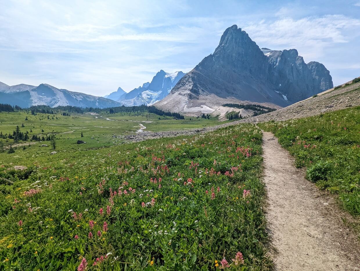
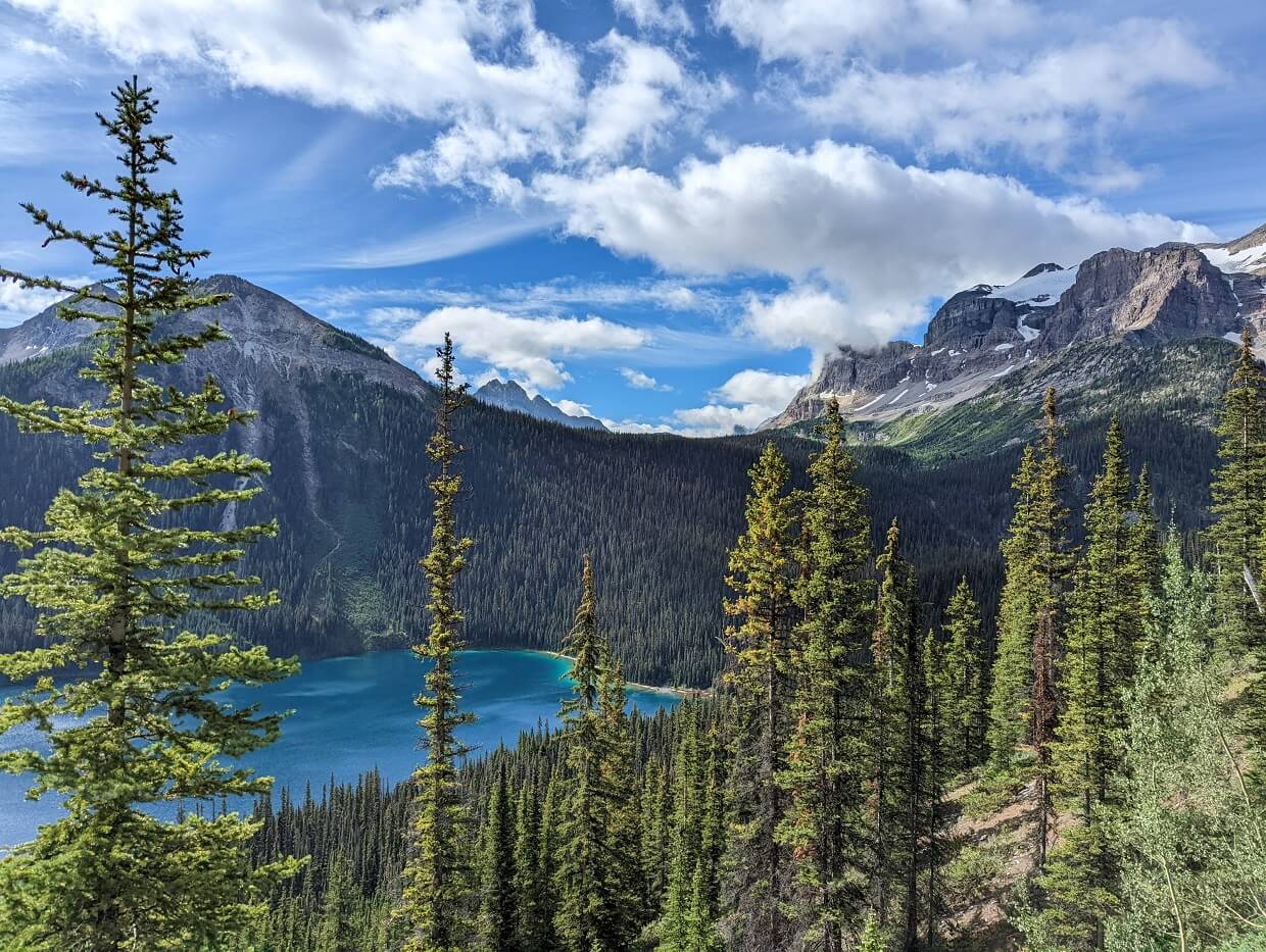
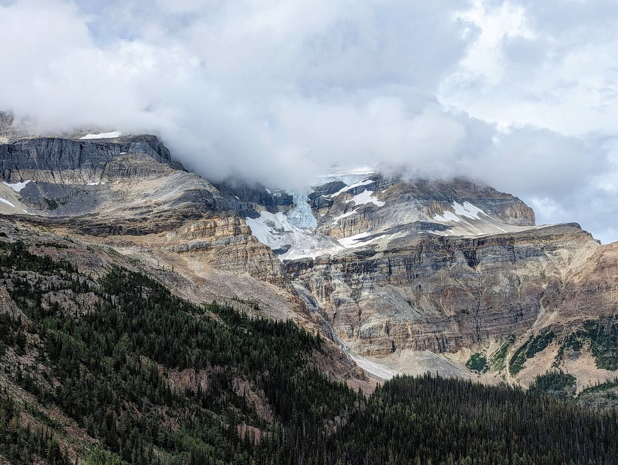
Most of the GDT is located in the alpine, in the midst of soaring peaks and glaciers. Some of Canada’s most iconic mountain landscapes are showcased on the GDT, including Mount Assiniboine, the Rockwall and Mount Robson.
There are plenty of lesser known highlights as well and these can often be enjoyed without a single other hiker in sight. Some sections of the GDT are extremely remote, true wilderness areas with very little development or visitation.
The chance of seeing wildlife is high too, with local residents including grizzly and black bears, elk, coyote, deer and big horn sheep.
Needless to say, the GDT offer a truly magnificent hiking experience in one of the most beautiful regions in the world.
Here are some quick facts:
- 1,123 kilometres – 35% in BC, 65% in Alberta
- Highest point: 2,590 m (8,497 ft)
- Lowest point: 1,055 m (3,461 ft)
- Construction began in 1976
- Around 150-200 people attempt to thru-hike the GDT each year
The Great Divide Trail Association maintains, protects, and promotes the GDT. Donations are appreciated.

A brief history of the GDT
The Great Divide Trail traverses dozens of mountain passes, many of which have been used for trading and travel for thousands of years.
Early origins
The route spans the traditional lands of the Anishinabe, Aseniwuche Winewak, Dene-zaa, Nêhiyawak, Secwépemc, Tsuut’ina, Stoney-Nakoda Nation Bearspaw, Chiniki and Wesley bands, Ktunaxa, Secwépemc, Cree, Lheidli T’enneh, Métis and the Blackfoot Confederacy Nations. Some areas are part of Treaty 6, 7 and 8.
The idea for the GDT as we know it today was born in 1966, when the Girl Guides of Canada proposed the idea of a trail along the mountainous border of BC and Alberta.
The first ever trail guide was created by Jim Thorsell in 1970, based on a provisional route. While the national park service initially approved the idea of the GDT, the project later stalled.
The first formal survey took place by six students from the Opportunities for Youth (OFY) program in the early 1970s. They concentrated on the unprotected area between Banff and Waterton national parks.
With the feasibility of the project established, the Great Divide Trail Association (GDTA) was formed in 1975. The first official stretch of the GDT was built not long after, with financial assistance from the Alberta government.
The GDT as we know it today
Development stalled in the 1990s but was revived again in the early 2000s. A new group, the Friends of the Great Divide Trail (later merging into the Association), took up the task of maintenance and advocacy.
Since 2013, the Great Divide Trail Association has been working to improve the condition, routing and prominence of the GDT with regular trail building, maintenance trips and promotion.
For a more detailed account of the history of the GDT, head to the Great Divide Trail Association’s website.
The Great Divide Trail route
The Great Divide Trail traverses 1,123km from the International Boundary in Watertotn National Park to Kakwa Provincial Park.
The route is divided into seven sections:
- Section A: Waterton to Coleman, 144km
- Section B: Coleman to Peter Lougheed Provincial Park, 179km
- Section C: Peter Lougheed Provincial Park to Field, 201km
- Section D: Field to Saskatchewan Crossing, 105km
- Section E: Saskatchewan Crossing to Jasper, 188km
- Section F: Jasper to Mount Robson, 122km
- Section G: Mount Robson to Kakwa Provincial Park, 160km
The trailheads for each section are road accessible, although some of these roads are unpaved.
Not a designated hiking trail itself, the GDT is actually a combination of other trails. Some of Canada’s most popular trails form part of the GDT’s route, such as the Rockwall Trail in Kootenay National Park and the Skyline in Jasper National Park.
As well as the main GDT route, there are various ‘alternates’ that hikers can choose from.
Thru-hiking the GDT
A standard thru-hike of the Great Divide Trail, from Waterton National Park to Kakwa Provincial Park, takes around six weeks at 25km/day pace. Some people hike a little slower and finish in eight weeks.
Experienced thru-hikers typically spend four to five weeks hiking the GDT.
A significant number of people attracted to the GDT are Triple Crowners, hikers who have completed the Pacific Crest Trail, Appalachian Trail and the Continental Divide Trail.

The fastest known time for hiking the GDT is 20 days, held by Canmore resident Andrew Cotterell. The fastest yo-yo was completed by Elaine Bissonho (Brazil Nut) in 52 days.
The original northern trailhead for the GDT was Mount Robson Provincial Park.
Some northbound thru-hikers still finish here (or Jasper) to avoid the logistical issue of returning from Kawa. It does mean skipping some of the most remote and rugged parts of the GDT, however.
A few dozen truly adventurous folks have successfully attempted to continue hiking past Kakwa, continuing along the Continental Divide to Monkman Provincial Park near Tumbler Ridge. This so called ‘Section H’ involves 150km of challenging hiking, with plenty of bushwhacking.

Section hiking the GDT
If a thru-hike of the GDT isn’t on the cards for you, consider hiking a segment of the route. Choose one of the defined sections as described above, or pick your own trailhead and length of hike.
We’ve hiked a significant percentage of Section C over two backpacking trips in 2022 and 2023 (more information later in this post).
Our first GDT adventure started at the Paint Pots trailhead in Kootenay National Park. We linked up with the GDT proper close to Helmet Falls and then followed the trail to the turnoff near Mount Shark in Spray Valley Provincial Park.
We returned to the GDT the next year, hiking a short section in the Kananaskis Valley between North Interlakes and LeRoy Creek, via North Kananaskis Pass (part of the Turbine Canyon Loop).
Section C is one of the busiest areas of the GDT and also one of the most popular to section hike, due to the road access. Sections A, D and E are also common choices for section hiking as they also have good trailhead accessibility.
Great Divide Trail planning guide
Inspired to hike part of the Great Divide Trail? Start your planning here!
Maps
- The GDTA website has a Google Map featuring the GPS data for the Great Divide Trail. It is useful for quick reference and/or general orientation
- Ryan Silk has produced a series of topographic maps, kindly available to GDT hikers for free. The entire file is 282mb, with 87 pages at 1:50,000 scale. Note that the maps are from 2017 and do not reflect some recent routing changes
- Gem Trek sells a series of topographic maps of the Rockies, with most of the GDT marked. National Geographic has illustrated maps as well
- A GPS enabled map is available through the FarOut app. The app itself is free but section maps have a small fee (some of which goes to the GDTA)
- We have personally used Maps.me and Organic Maps while hiking part of Section C – maps can be downloaded and then used offline. We found the GDT routing and campsite locations to be accurate on the trail section we hiked (with the exception of the LeRoy Creek area)

When to go
Being located in the alpine of the Canadian Rockies, the window to safely thru-hike the Great Divide Trail is pretty small, from late June to mid September. Most thru-hikers spend five to eight weeks on the GDT.
Snow levels always fluctuate from year to year. In 2022, the winter snow pack was on the larger side and spring temperatures lower than normal. Late June NOBOs found themselves hiking on significant snow in Section A and B.
Starting a northbound hike in Waterton in mid July usually offers the chance to hike an almost completely snow free trail. It does, however, mean that there will be less water sources around.
Leaving later than this can be a gamble. September can be a bit hit or miss, with winter weather sometimes coming in hard and fast. Some years, it can be warm-ish (at least during the day) until October.
Of course, freezing temperatures and snow are possible at any time of year in the alpine.
We hiked 140km on the GDT from 18th to 28th August 2022, experiencing temperatures between -3c at night to +28c during the day.
The most ideal time to section hike the GDT is late July to late August. This period offers the best chance of warm weather and a clear trail. Wildfire smoke is a risk anytime during the summer, but is more common in mid to late August.
Direction
Most hikers navigate the Great Divide Trail in a northbound direction. The southern mountains are safer to travel earlier in the season.
The weather is also usually warmer. As hikers travel north, temperatures increase. And any remaining snow melts.
Another reason for hiking northbound is the multiple river crossings. The glacier-fed rivers and streams in the northern sections are dangerous to cross when water levels are high. The highest water levels are usually seen in June and July, sometimes August as well.
Access
- The GDT’s southern trailhead is located on the International Boundary in Waterton National Park. Waterton is a three hour drive from Calgary. A shuttle bus runs from Calgary airport to Waterton. Alternatively, there is the option to take a bus to Pincher Creek and then taxi to Waterton
- The GDT’s original northern trailhead was in Mount Robson Provincial Park, west of Jasper. The newer, extended trailhead is Kakwa, a remote location 75km from Highway 16. A 4WD high clearance vehicle is required to drive the muddy access road. A shuttle service is available
- Section hikers have a number of different trailheads to choose from. Popular options include Jasper, Saskatchewan Crossing, Field, Floe Lake, Sunshine Village, Mount Shark, Upper Kananaskis Lake, Coleman, Waterton
- There are also opportunities to join the GDT from a multitude of interconnected trails such as the Brazeau Loop (Jasper NP), Helmet Creek Trail (Kootenay NP), Redearth Creek Trail/Shadow Lake Trail (Banff NP)
Navigation
The Great Divide Trail is an amalgamation of trails spread over a large geographical area. As such, signage and trail condition varies hugely across the route.
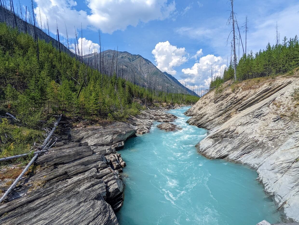
In some places, the trail is more like a wilderness route and navigational skills are required. There are multiple river crossings without bridges on the GDT, particularly in Section D.
Maintenance is inconsistent too – the popular areas are cleared quicker, while the more rugged areas not at all.
There are some official Great Divide Trail signs found along the trail in section A, B, C and G, but besides that, hikers must use maps and follow signage for other named trails.
We didn’t see a single reference to the Great Divide Trail on either of our two Section C backpacking trips.
As mentioned in relevant section above, there is a downloadable GPS-enabled map of the Great Divide Trail on the FarOut app. This app can be used offline. A portion of every sale of the guide goes to the GDTA. Of course, hikers should always bring a map and compass as well.
Resources
- The Great Divide Trail Associate website is a goldmine of information, with detailed itineraries, campground guide, permit breakdown and more
- The Great Divide Trail Hikers Facebook group is managed by the GDTA and is a friendly 5k+ strong community of experienced and aspiring hikers. The search function will help answer most of your burning questions
- Dustin Lynx’s Hiking Canada’s Great Divide Trail is the must have guidebook. The 4th edition is the most recent, published in May 2022
- Many hikers have published blogs and vlogs recording their journey along the GDT as well as post-hike thoughts and planning advice. Some examples include – Fun Size (Eloise Robbins), Backpacks & Bike Racks, Eating Snow and Justin Outdoors.

Permits and fees
The Great Divide Trail is not formally designated as a trail by the Canadian, BC or Alberta governments so there is no singular permit system (like the PCT or AT).
The land that the GDT sits on is controlled by a variety of different land managers. It can be a bit complicated to get your head around all the different permit systems while planning a GDT hike:
- National parks (Waterton, Banff, Kootenay, Yoho and Jasper): All visitors need a valid park pass. For 7+ days, a Discovery Pass provides best value – $83.50. On top of that, a backcountry permit is required for camping – $15.00/night. Campsite reservations are required in certain areas – $11.50 online fee
- Provincial parks – Permit registration required for backcountry camping – up to $10/night. Three parks (Assiniboine, Mount Robson and Peter Lougheed) require campsite reservations – $6-12 fee
- Public land in Alberta – Public Lands Camping Pass required to random camp on public land in limited areas of section A, E and G – $30 for annual pass
Outside of these areas, no permit or camping fee is required.
Acquiring some of the above permits can be tricky, especially those in Section C as well as parts of Section D and F (before the Berg Lake Trail closed in 2021, tentative reopening date is 2025).

Camping
The GDT passes through, or close to, a number of different campgrounds. These range from rustic backcountry sites to developed vehicle accessible campgrounds.
Random camping is an option in some areas (when Leave No Trace principles are used), but hikers need to be careful to understand exactly which areas allow this type of camping and which kind of permit is required. More information on the GDTA website.
GDT hikers must stay in designated campgrounds in most national and provincial parks. A permit is required. The best way to secure one is with a reservation.
- Reservations for Banff, Kootenay, Yoho, Waterton Jasper national parks usually open in January and February each year
- Specific launch dates for each national park are listed on this page and are usually updated towards the end of the calendar year
- Reservations for backcountry camping in Banff, Kootenay & Yoho open up on the same day, with Jasper and Waterton on separate days
- Reservations for Mount Assiniboine and Mount Robson (when open) operate with a rolling three month window. For example, if you want to arrive on 24th July, the site will become available to book on 24th April
- Availability for backcountry reservations in Peter Lougheed Provincial Park opens 90 days ahead

Reservation tips
- Go to the relevant website prior to the reservation launch and create an account ahead of the reservation launch
- Practice practice practice! Availability for some popular campgrounds (Floe Lake, Magog Lake, Skyline Trail) disappears within minutes. You’ll need to be fast and know exactly what you’re doing to secure a reservation
- To reserve campsites in the national parks, you must know the trailhead where you’ll be starting. Note that the online system does not allow for long hiking days (25km+). A phone call to the relevant park office would be required in this instance
- Enlist a friend or family member if you can, to help improve your chances of securing spots
- Navigate to the website at least 10 minutes prior to the reservation launch so you can be ready to go as soon as it opens
- Parks Canada uses a waiting room system – at the exact time of reservation launch, all website visitors are allocated a random number and placed in a queue accordingly. Use multiple devices to improve your chances of a lower number
- A credit card is only required after a reservation has been placed in your basket. At this point, you’ll be given 15 minutes to check out
- Didn’t get lucky? Wait at least 15 minutes to see if any users fail to complete their booking
- Consider using a service like Campnab if you don’t manage to secure the reservations you need. Campnab automatically scans cancellations and sends a notification when a site is available

Resupply
Most GDT thru-hikers will carry food supplies for 4-9 days and pick up resupply boxes along the way.
Unlike the Pacific Crest Trail and the Appalachian Trail, the GDT is not regularly crossed by main roads. Resupply locations are therefore limited and hikers need to plan ahead.
The following locations offer hiker facilities as well as resupply box holding services (unless otherwise noted).
- Waterton Townsite, kilometre 6.7 – accommodation, restaurants, outdoor gear shop, campground
- Castle Mountain Ski Resort, kilometre 63 – hostel, pub, guest services office
- Coleman, kilometre 144 – post office, accommodation, restaurants, convenience store
- Blairmore, kilometre 144 + 5 – post office, accommodation, restaurants, outdoor gear shop, supermarket
- Boulton Creek Trading Post, kilometre 337.2 + 2 – small convenience store (does not accept resupply packages)
- Mount Engadine Lodge, kilometre 389.9 – accommodation, afternoon tea service
- Sunshine Village, kilometre 433.8 + 1.3 – accommodation, restaurants, guest services office, gondola + shuttle to Banff
- Field, kilometre 540.3 – accommodation, general store, restaurant and café
- Saskatchewan Crossing, kilometre 646 – accommodation, restaurant, general store
- Jasper, kilometre 835 – post office, accommodation, restaurants, supermarket, outdoor gear shop
- Mount Robson, kilometre 937 + 28 – café, convenience store, campground
Some nearby businesses and ‘Trail Angels’ also offer box holding, please refer to the full list on the GDT Association website.
Safety
The GDT is one of the most challenging backpacking trails in Canada. Hikers must be self-sufficient. Here are some of the hazards:
- Remote location – No phone signal, limited access, some sections have very little foot traffic
- Wildlife – The GDT is located in prime grizzly and black bear habitat. Other local residents include wolverine, elk, deer, coyote, wolf, moose. Hikers need to know how to avoid negative encounters and store food properly
- Navigation – Some sections feature a well-defined, regularly maintained trail. In remote areas, the trail is sometimes non-existent
- Weather – Most of the GDT is located in the alpine, where snow is possible even in the height of summer. Heatwaves are not uncommon
- Stream and river crossings – The trail crosses many glacier-fed rivers and streams; some crossings do not have bridges
- Trail condition – Depending on the winter snowpack and weather, the path may have snow. Some sections may be muddy, overgrown and/or covered in blowdown
- Mountainous terrain – The GDT climbs one summit and many mountain passes, with some steep ascents. It can be very strenuous. Some sections are easier than others, however
- Mosquitoes and deer flies – The bugs can be ferocious in July and August. Wasps can also be prevalent in some areas
- Short season – As a general rule, the GDT is most safely hiked from late June to mid September. Most thru-hikers spend 6-8 weeks on the 1,123km long trail
Essential items
With the GDT travelling through many alpine areas with high bear populations, hikers need to think carefully about food storage.
Provincial and national park campgrounds usually provide facilities, either a cable system or metal cache.
Tall trees are hard to find in the alpine (for hanging food), so Ursacks (bear resistant bags) are popular. An alternative is to use a hard sided bear canister, but these are awkward to carry.
I would also consider bear spray to be essential for hiking the GDT. Negative bear encounters are rare but bear spray is an ideal ‘just in case’ measure. Carry it in an accessible place (a holster works well) and learn how to use it quickly.
Hiking poles can reduce pressure on the knees when descending. Incredibly light and foldable, Black Diamond’s Carbon Z poles are our tried and tested favourite pair.
With the remoteness of the trail in mind, a satellite communicator device is well worth its weight. Popular devices include the Spot or InReach (both brands are recommended by Search and Rescue organisations).

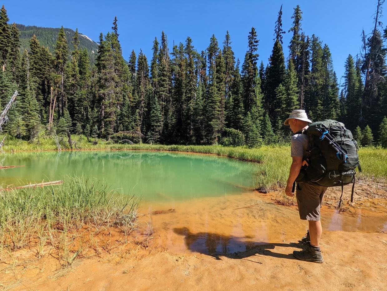
Hiking the Great Divide Trail: Our experience
Over two backpacking trips and two years, we’ve hiked a significant portion of Section C of the Great Divide Trail.
Helmet Falls to Mount Shark
In August 2022, we hiked 140km from Paint Pots in Kootenay National Park, British Columbia, to Mount Shark in Spray Valley Provincial Park, Alberta. Around 85% of our route was on the Great Divide Trail.
This section would typically be hiked by GDT thru-hikers in about five days. We spent double the time, enjoying a very leisurely pace. In hindsight, I’m glad we planned it this way as JR actually had a broken toe at the time.
Our itinerary was:
- Day 1: Paint Pots to Helmet Falls, 15km
- Day 2: Helmet Falls to Tumbling Creek, 12km
- Day 3: Tumbling Creek to Numa Creek, 8km
- Day 4: Numa Creek to Floe Lake, 10km
- Day 5: Floe Lake to Trailhead, 10km
- Day 6: Trailhead to Ball Pass, 11km
- Day 7: Ball Pass to Egypt Lake, 8km
- Day 8: Egypt Lake to Sunshine Village, 13km
- Day 9: Sunshine Village to Og Lake, 21km
- Day 10: Og Lake to Magog Lake, 5km
- Day 11: Magog Lake to Mount Shark, 26km
Read on for the highlights (and some lowlights) of our incredible experience on the GDT, along with some helpful tips for those planning a similar trip.
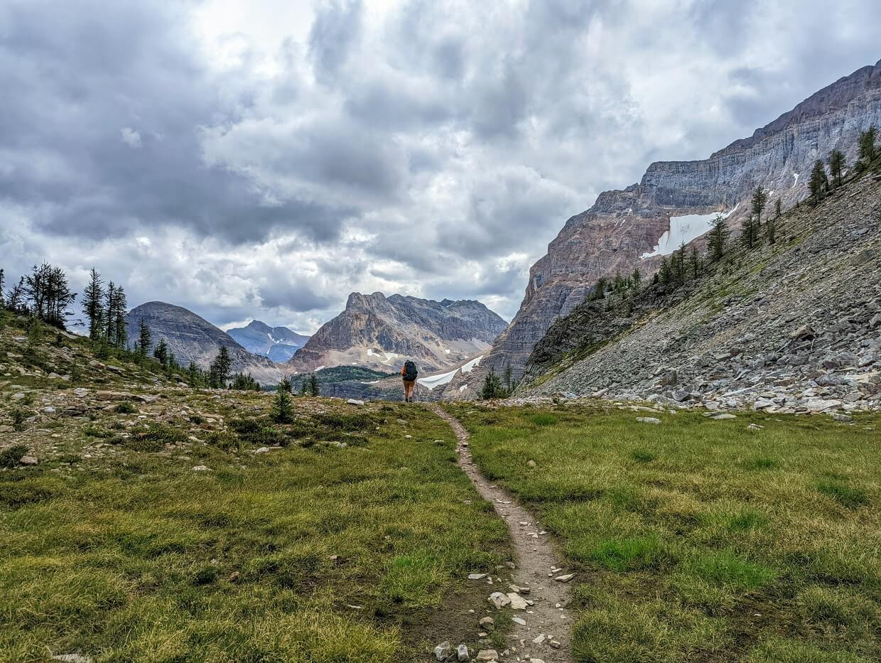
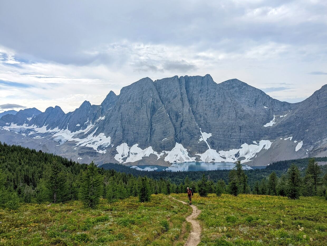
Day 1 to 5: Paint Pots to Floe Lake (the Rockwall)
Our GDT experience started with a hitchhike from the Floe Lake parking lot. Luckily, it didn’t take long, thanks to a lovely couple from Barcelona.
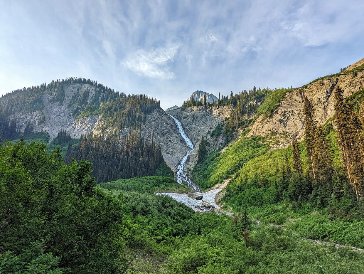
After passing the brightly coloured mineral pools of the Paint Pots, we headed into the shady forest and towards Helmet Falls.
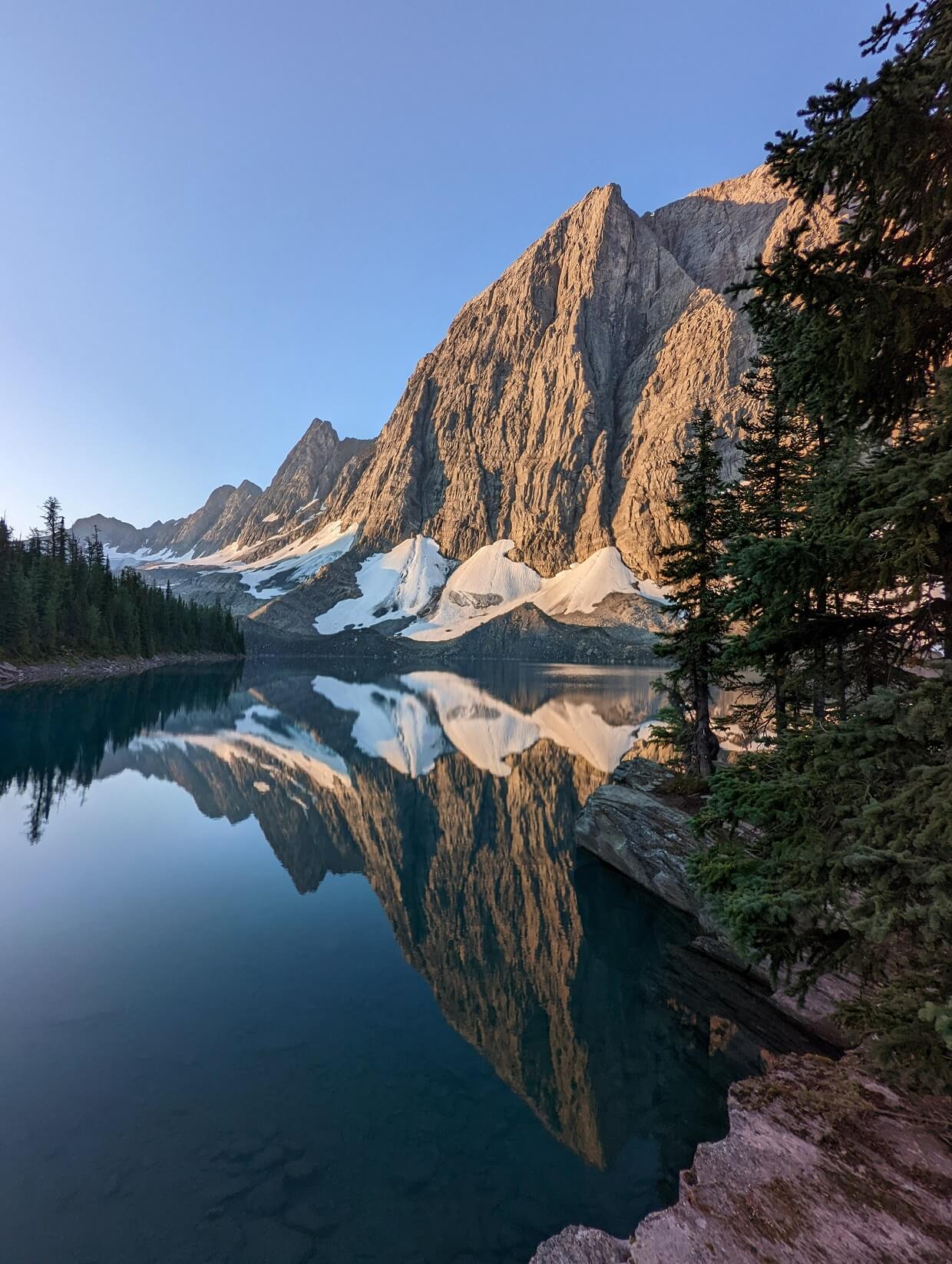
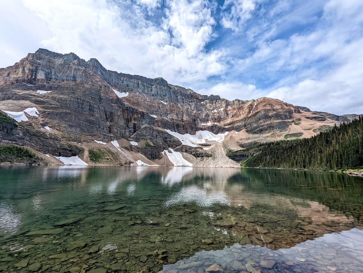
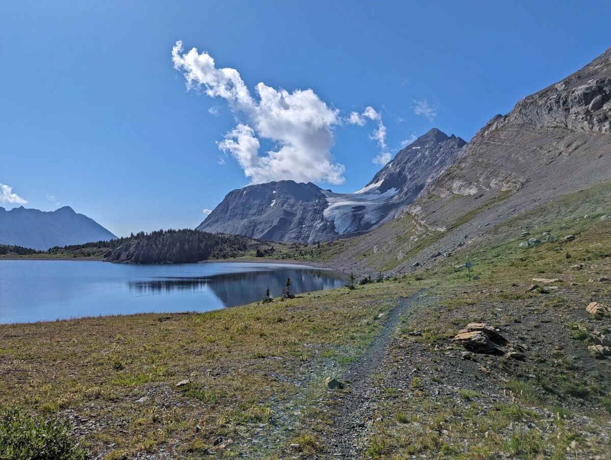
The Great Divide Trail joined our route just before Helmet Falls, also the location of our campsite for the night. For the next three days, we paralleled the Rockwall, a huge limestone cliff featuring soaring peaks and hanging glaciers. We also ascended three passes.
The Rockwall Trail is one of BC’s premier backpacking trips and I can definitely see why. It was truly spectacular from start to finish.
Arriving back at our vehicle in the Floe Lake parking lot, it was a novelty to think that we were going to carry on hiking the very next day!
We were, however, quite happy to head to Johnston Canyon front country campground for the night.
Utilising the facilities to their fullest, we washed clothes, enjoyed multiple hot showers and walked to the nearby restaurant for dinner. We were also able to resupply our First Aid kit and food bag.

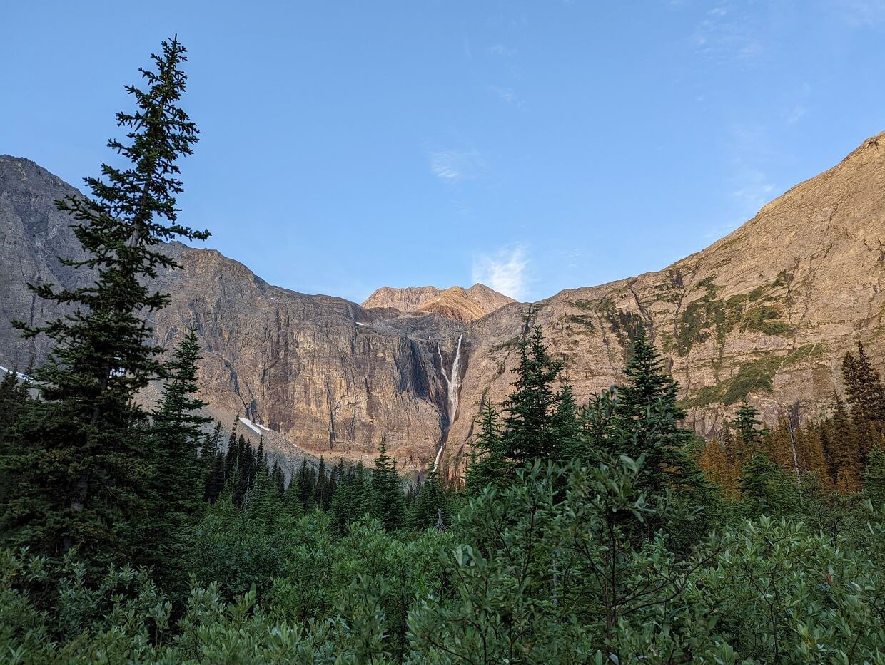
Day 6 to 8: Floe Lake to Sunshine Village
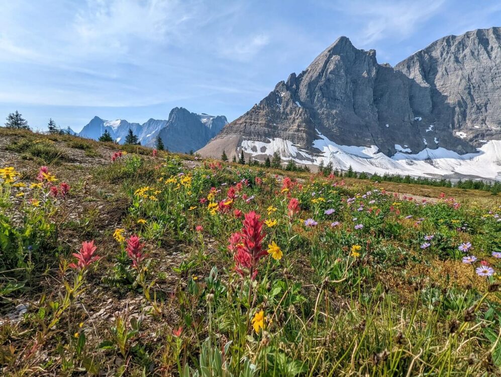
Back at Floe Lake parking lot in the morning, we crossed Highway 93 and headed up to Ball Pass.
The 850m elevation gain was a lot more manageable than I had expected and we were soon rewarded with sweeping views of Ball Glacier, Shadow Lake and surrounding mountains. We lingered on the pass for some time before heading down to our nearby campsite.

On the way up, we had bumped into the only Great Divide Trail thru-hikers we would meet on our journey. Being that it was pretty late in the season, I was surprised and also pleased to see these northbound hikers.
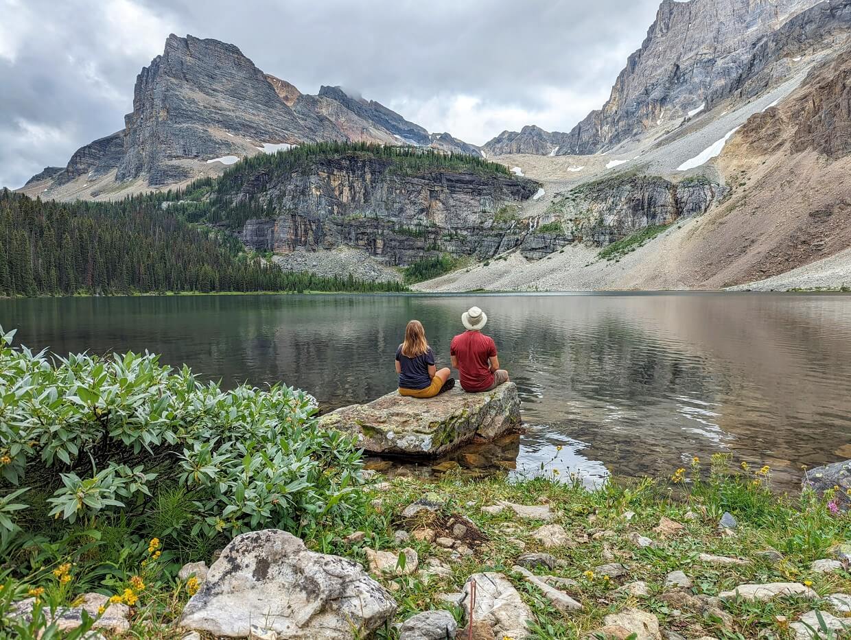
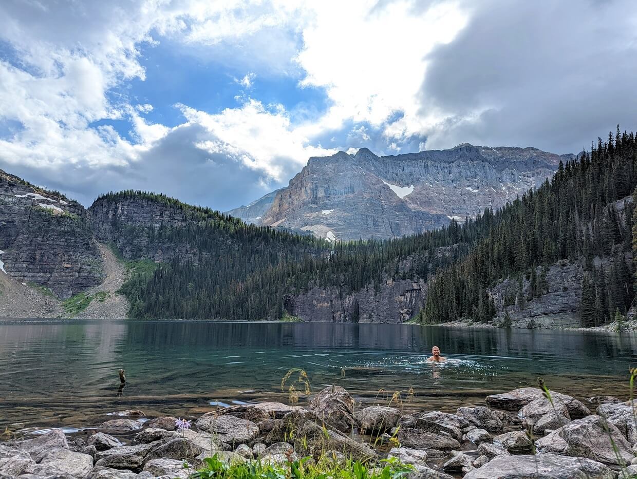
Egypt Lake was our destination the next day, a relatively short hike over Whistling Pass. We stopped for a swim at Scarab Lake (1km off trail), with another in Egypt Lake in the evening.
Our final day in this section was even shorter, but still one of the most beautiful. We climbed up to Healy Pass and onto Sunshine Village, where a hotel room and several hot (non-dehydrated!) meals awaited us.
As you can imagine, I was looking forward to this stop and it surpassed all expectations. We soaked our tired bodies in the huge outdoor hot tub (one of the largest in Canada!) and enjoyed the mountain views.

Day 9 to 11: Sunshine Village to Mount Shark (via Mount Assiniboine)
Waking up after a very restful night at Sunshine Mountain Lodge, we picked up breakfast at the Java Express Coffee Bar and headed towards Mount Assiniboine.
This was familiar territory for us, having hiked to Assiniboine from Sunshine Village (and back) in July 2019. We had hoped for better weather, seeing as we had experienced torrential rain and snow last time.

Sadly, it was not to be. We felt a little jinxed as we hiked across Sunshine Meadows in the pouring rain and then got hit by a thunderstorm right as we tried to put our tent up at Og Lake.
Half of our gear got absolutely soaked. On the up side, we did see the summit of Mount Assiniboine for the very first time at sunset!
Another thunderstorm rolled in the next day, just as we started to pack up. We hiked to Lake Magog in the torrential rain (another repeat of 2019!), which continued until the early hours.

Luckily, sunrise was clear. But we couldn’t stay very long – we had 26km to hike by 5pm. A good friend had kindly agreed to pick us up at Mount Shark trailhead and deliver us back to our vehicle at Floe Lake parking lot.
It was a long, but still scenic day (Wonder Pass and Marvel Lake were definite highlights). We said finally said goodbye to the GDT 6km from Mount Shark, vowing to return someday. This relatively small taster hike just wasn’t enough!

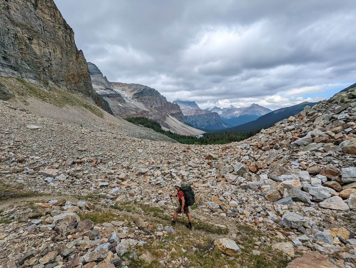
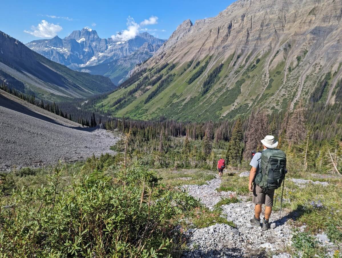
North Interlakes Trailhead to LeRoy Creek
In late July/August 2023, we returned to the Great Divide Trail while backpacking the Kananaskis Valley’s Turbine Canyon Loop. It wasn’t planned; I had no idea that we’d follow the GDT when first looking at the route!
The first part of this section of the GDT is well-worn, being popular with backpackers as well as day hikers.
The trail to Forks Campground is both pretty and approachable, though the number of hikers soon drops off as the path heads north.
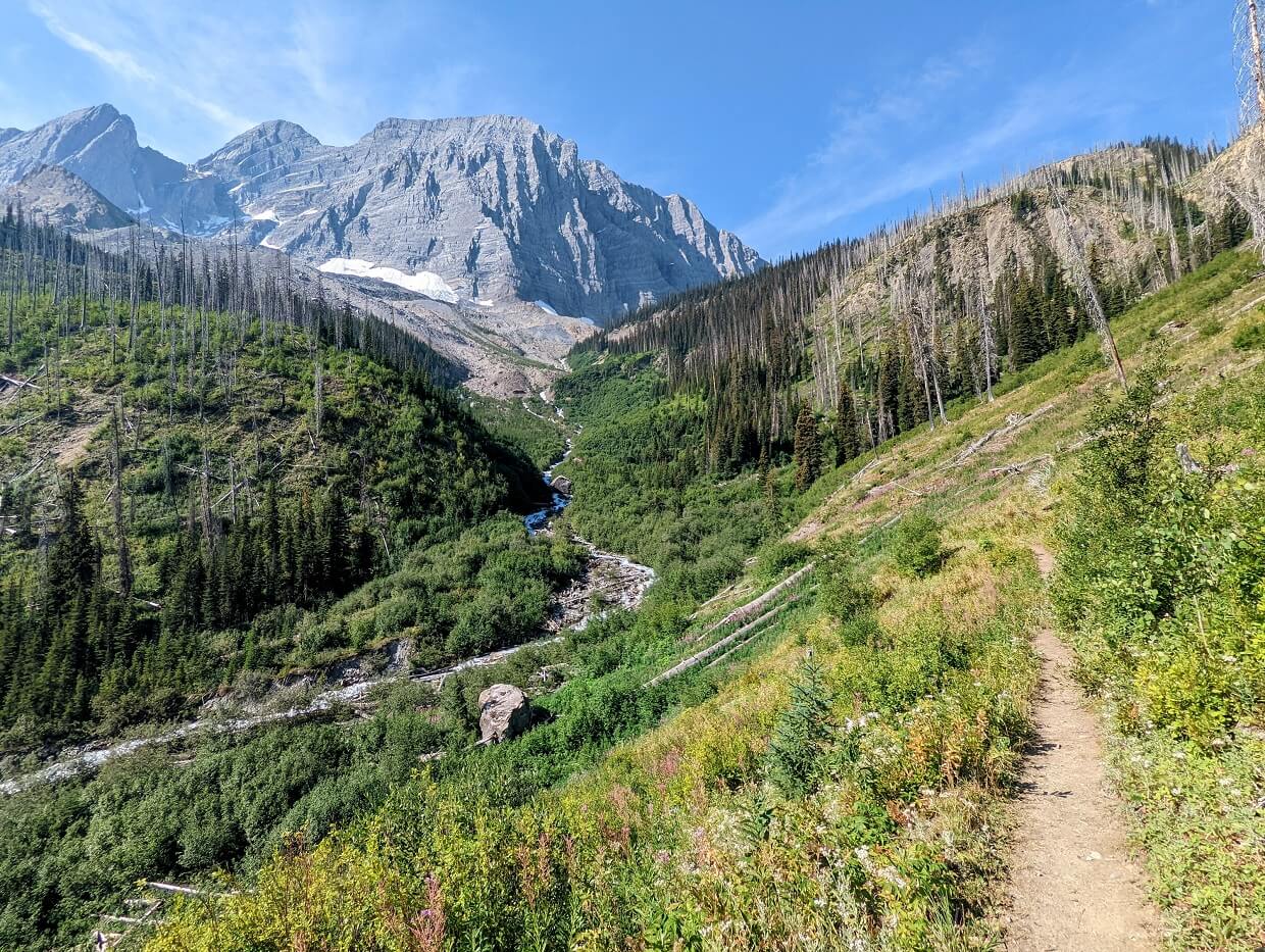
Turbine Canyon is a beautiful (and quiet) renovated campground, with a flat approach through gorgeous meadows. The hike to the North Kananaskis Pass is spectacular, with the Beatty Glacier and Maude Lake as a backdrop.
Over the pass, the the breathtaking Royal Group of mountains appear. These imposing peaks all rise above 3200m, with Mount King George being the highest at 3411m. The descent down to LeRoy Creek is steep and loose.
GDT hikers have the choice to hike to LeRoy Creek via South Kananaskis Pass instead (a small part of the Northover Ridge alternate), a route that we explored on our way back to the trailhead.
Beatty Lake is a definite highlight, with the free first come, first come campsite situated right on the shoreline. The kilometre long scree slope on the other side is a less positive feature of this alternate route!
Thoughts, tips and planning advice
- We made reservations for Helmet Falls, Tumbling Falls, Numa Creek and Floe Lake in January, during Kootenay National Park’s reservation launch
- With the help of some CampNab cancellation scans (they offered us a free membership to try it out), we secured Ball Pass Junction and Egypt Lake in June
- We then booked Mount Assiniboine two months before our trip, as per BC Parks’ rolling reservation window at the time (four months in 2024)
- Staying at Sunshine Mountain Lodge was the perfect way to break up the trip. An early arrival allowed us plenty of time to enjoy the facilities (that hot tub!), savour three delicious meals (at three different restaurants) and take in the views
- If we had not been able to stay at Sunshine Mountain Lodge, we would have tried to get a cancellation for Howard Douglas or pushed on to Porcupine (free, first come first serve)
- Hitchhiking? Make a sign. We were picked up relatively quickly with a sign stating our destination (only `10km up the road). We saw other hitchhikers without signs waiting longer
- We were very lucky to have a friend (the wonderful Leigh from Hike Bike Travel) willing to shuttle us back to our starting point. Our backup plan was a mix of hitchhiking and bus rides
- Hiking in mid August, we only met two people thru-hiking the GDT. Not too surprising, seeing as most northbound hikers would have been through this area quite a bit earlier

Great Divide Trail FAQs
The GDT is located on the Continental Divide between Alberta and British Columbia, Canada.
1,123km from Waterton Lakes National Park to Kakwa Provincial Park
In some areas, yes. In most national parks and provincial parks, no. Hikers must use designated campgrounds in these protected areas.
There is no singular ‘GDT permit’ but a permit is required to camp in most national and provincial parks along the route.
Late June to mid September. Most northbound thru-hikers will start in Waterton between late June and mid July.
Yes. The GDT passes through many national and provincial parks, most of which require a permit (and often, a reservation) for camping.
The Great Divide Trail is designed for non-motorized use (foot, horse). Bikes cannot be used on many of the national park and provincial park trails.
Around 150-200 attempt to thru-hike the GDT annually. Many more hike smaller sections. Hundreds more hike the GDT (sometimes unknowingly) by traversing popular routes like the Rockwall, Skyline, Brazeau Loop etc.
For most of the GDT, yes, when on a leash. But you must be aware of the risks involved when bringing a dog into the backcountry. Bears see dogs as a predator or prey – both scenarios can be dangerous for you and your dog.
There are some sections of GDT where dogs are not allowed – one area in Jasper National Park and in campgrounds on the Berg Lake Trail (re-opening in 2025).
At the start of the year. Parks Canada launches backcountry reservations in January each year. It is, in theory, possible to plan a GDT hike later in the year, but you’ll need to be lucky with cancellations or plan for some long hiking days.
Though I haven’t thru-hiked the GDT myself, my understanding is that it is not as social as the PCT and AT. At the current time, far fewer people thru-hike, or even section hike, the GDT compared to the AT or PCT. The campsite reservation system does make things a little more difficult too, offering less itinerary flexibility. I have read many reports from people who have said they were often alone for days at a time on some remote sections of the GDT. Since the GDT is a combination of trails, some areas are very busy with day hikers and backpackers.
Other hiking posts you may find helpful:
Where to Find Golden Larches in British Columbia, Canada
Nootka Trail: Complete 2022 Hiking Guide
Backpacking Gear List: Packing Guide for Multi-Day Hikes
Hiking the Jumbo Pass Trail near Kaslo, British Columbia
The HBC Heritage Trail (1849): Complete Hiking Guide
13 of the Best Shoulder Season Backpacking Trips in BC

One half of the Canadian/British couple behind Off Track Travel, Gemma is happiest when hiking on the trail or planning the next big travel adventure. JR and Gemma are currently based in the beautiful Okanagan Valley, British Columbia, Canada. Consider buying us a coffee if you have find any of our guides helpful!
Thanks for the writeup. During your section hike, were there areas where the trail was hard to find? I am trying to carve out a section hike of the GDT where the trail is well defined, as I don’t have off trail experience.
Thanks
Hi Erik!
Glad you found this helpful. Section C is one of the most well used and popular areas of the GDT. The section from Spray Lakes to Helmet Falls takes in some of the most popular backpacking trails in the Canadian Rockies (such as Mount Assiniboine and the Rockwall). For that reason, this part is well signed, clearly established and not hard to follow.
Since writing this post, I’ve also hiked the North Kananaskis Pass area of Section C. It’s less well used but we still found the route to be pretty well established and straightforward enough to follow. We did have a GPS track and we checked it occasionally to make sure of our positioning. But honestly, that was just a double check!