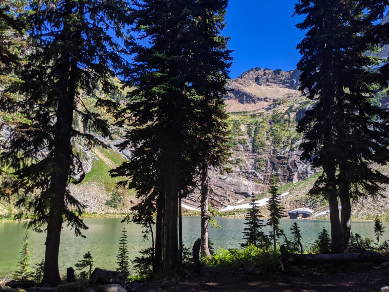
An amphitheatre of steep rock walls and talus slope protects spectacular glacier-fed Pinnacle Lake.
Waterfalls cascade down the cliff face while patches of snow continue to melt nearby, even in late summer.
The shore of the lake provides a pristine spot to camp overnight or simply enjoy the magnificent scenery.

The hike to reach Pinnacle Lake is almost as exciting as the destination, featuring old growth trees, calming valley views, eddying creek pools and an impressive waterfall.
The 4.5km one-way distance may be short but is made surprisingly challenging with numerous creek crossings and plenty of mud.
Pinnacle Lake is a beautiful alpine destination in the Monashee Mountains of British Columbia, Canada. This post includes:
Please remember to Leave No Trace to help keep the wilderness wild. Pinnacle Lake does not currently have park protection.
Pinnacle Lake
Location: Cherryville, BC
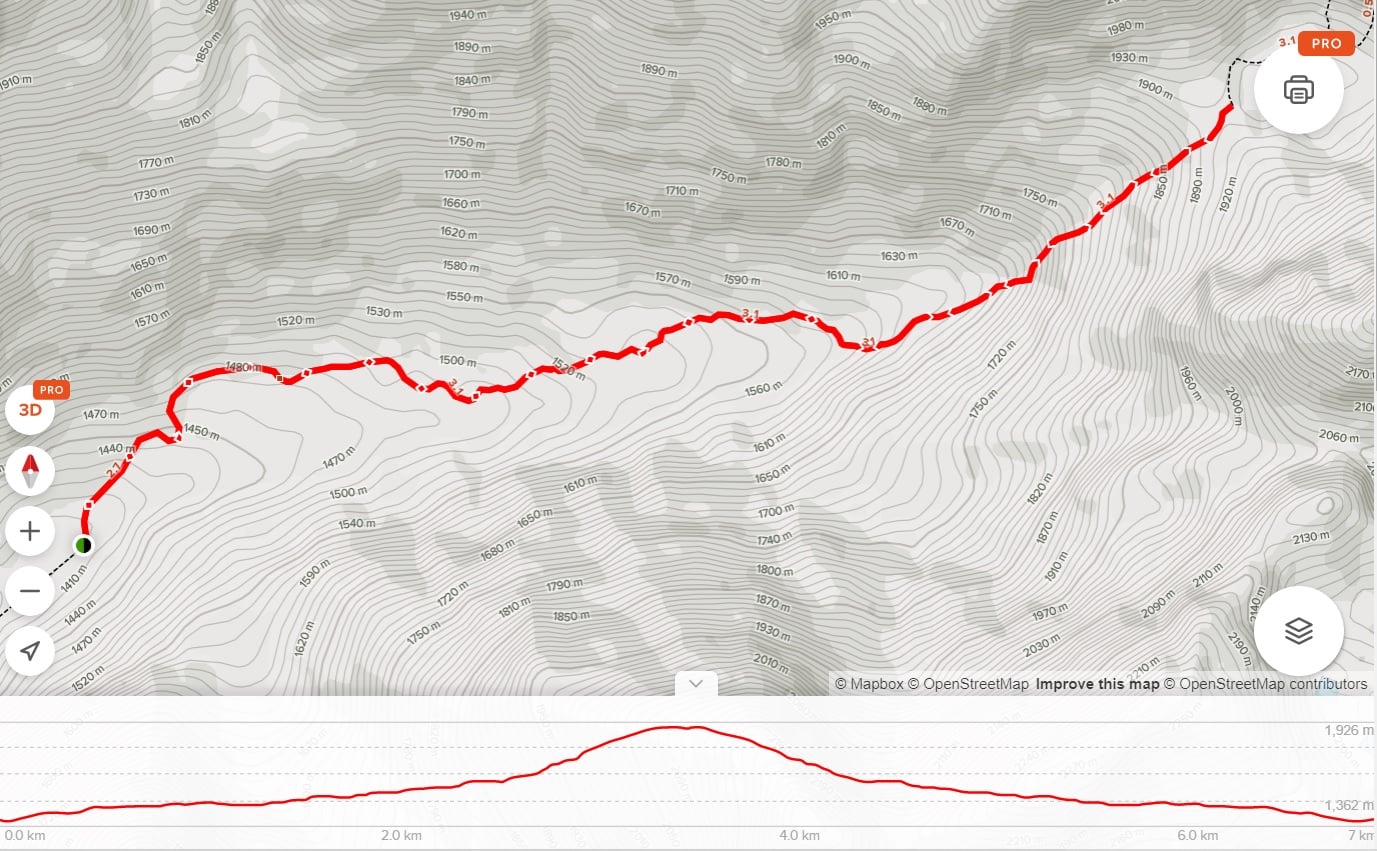
Distance: 9km return
Elevation gain: 450m
Hike type: Out and back
Time: 2 hours each way
Difficulty: Moderate to challenging
Camping: Yes but no facilities
Fees: None
When to go: Late July to mid-September
Backcountry necessities
- Always bring the 10 Essentials
- Know how to stay safe in the backcountry
- Follow Leave No Trace principles to reduce your impact
- Understand how to avoid negative bear encounters
- Recommended gear is listed on our Shop page
- Need a packing list? Sign up to our newsletter for a free one!
Introducing Pinnacle Lake
A recent trip to Monica Meadows and Jumbo Pass (both near Kaslo), sparked my inspiration for finding other hiking trails outside of provincial and national parks.
With our recent adventures in Vernon in mind, I turned my attention to the closest mountain range – the Monashees.
Using our Kootenay Rockies Backroad Mapbook, I found a collection of short (15km or less) hiking trails in the Pinnacles, just east of Vernon. Bingo! On this trip, we also hiked to Twin Lakes.
Published September 2020. This post includes affiliate links. If you make a purchase via one of these links. I may receive a percentage of the sale at no extra to cost you.
The magic of the Monashees
A small cluster of rocky summits, the Pinnacle mountains are part of the Monashees range.
There are over 300 named mountains in the Monashee Mountains, varying from glaciated peaks in the north (near Valemount) to lower tree-covered hills further south (Washington, USA).
While the highest summit is Mount Monashee (3274m), the most well-known peak is Mount Begie, which sits prominently above Revelstoke.
Before this trip, we had only ever appreciated the higher peaks of the Monashees from afar.
Read more posts about the Monashees:
- Spectrum Lake, Monashee Provincial Park
- Little Peters Lake and Big Peters Lake, Monashee Provincial Park
- Twin Lakes

Pinnacle Lake Trail: Hike Experience
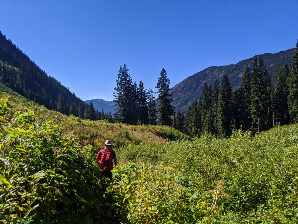
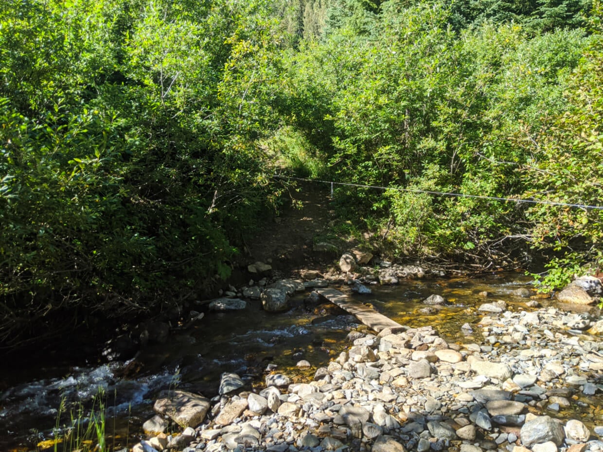
The 9km return hike to Pinnacle Lake starts with an introduction to the creek that the trail will follow for almost the entire journey.
A rope strung across the crossing signifies the challenge of high water during the earlier weeks of summer.
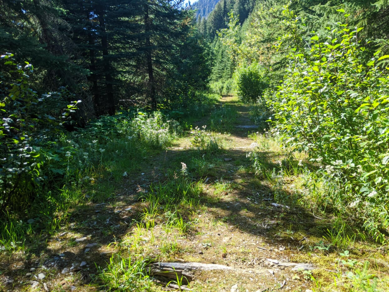
The following trail section is unusually wide and flat. Old timbers peek out of the dirt underfoot. The name of the nearby river, Railroad Creek, hints at a previously industrious past.
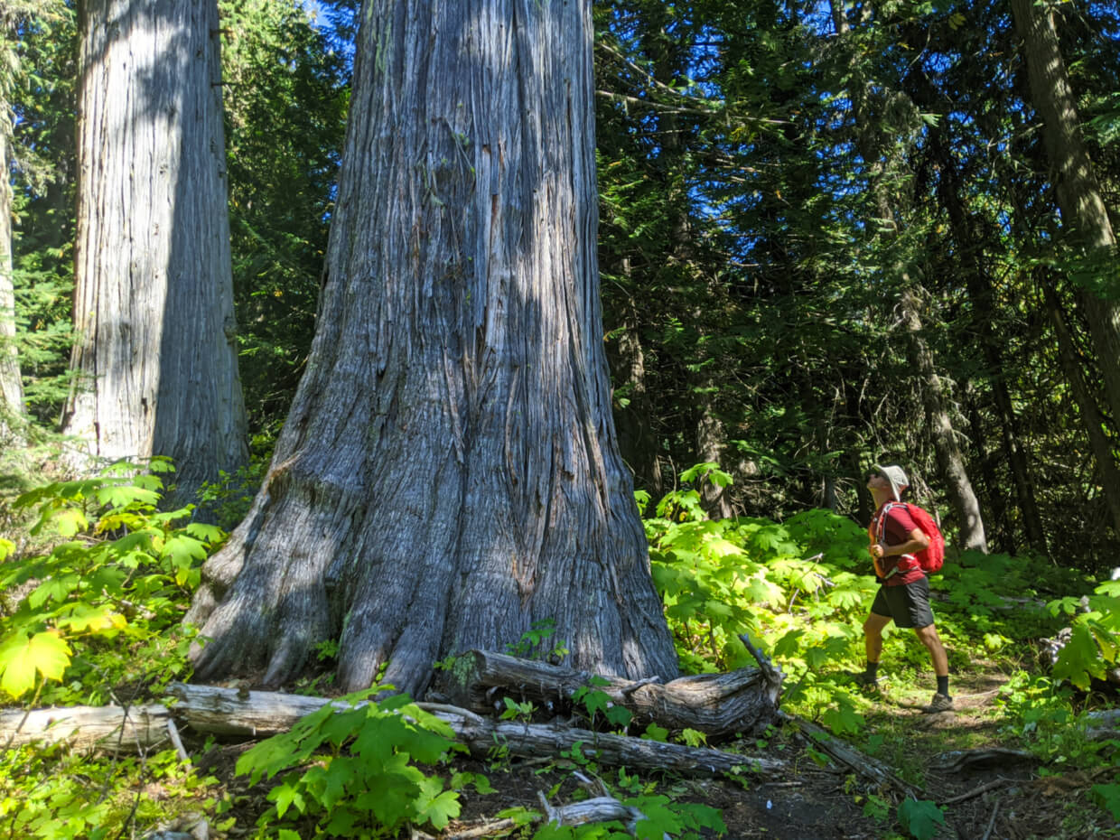
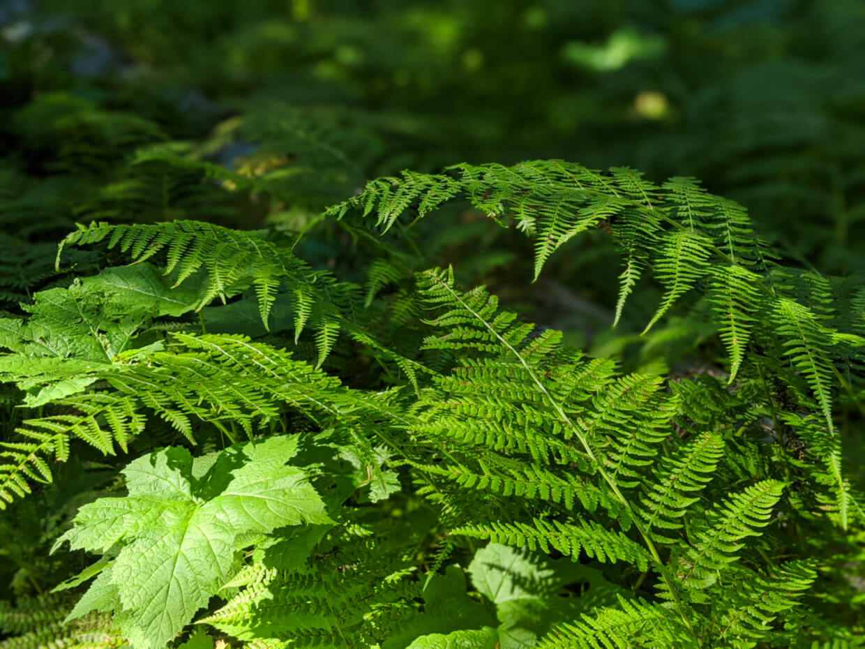
Over a cattle grid, through two small meadows and we arrive, to my surprise, in an old-growth forest, with a soft carpet of ferns. The size of the cedars here is simply extraordinary, and not something I ever expected on this alpine adventure.
A hidden waterfall
Cedar trees prefer a damp environment, so the mud wasn’t too far away. Giant swathes of it too, covering up to 50m of the trail at a time. Being late summer, the mud wasn’t as bad as it likely would be earlier in the season.
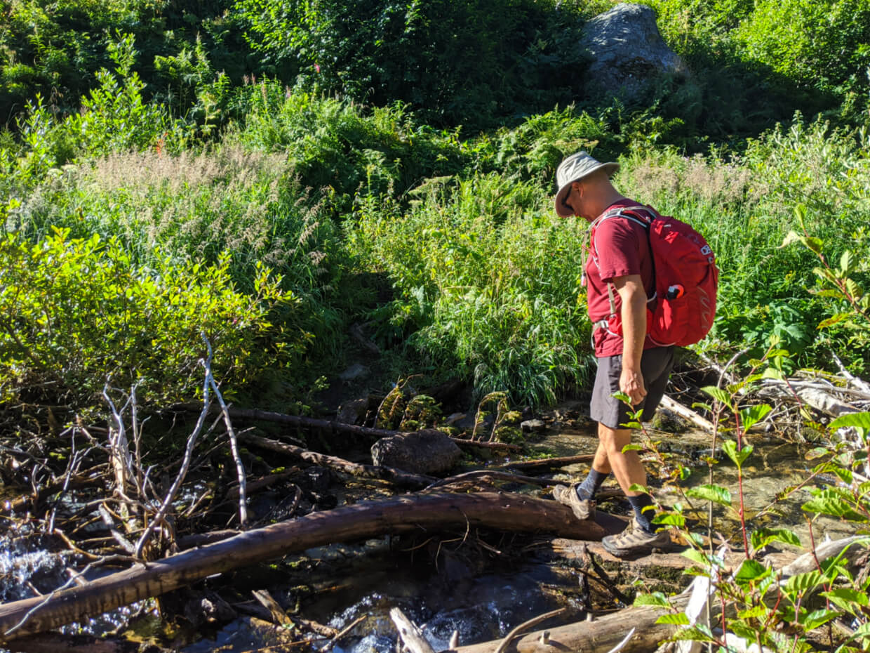
Beyond the mud, it was time for the biggest creek crossing yet. The other side greeted us with a narrow, damp path through shoulder-height foliage. Stinging nettles brushed past our ankles as the trail started a slow ascent.
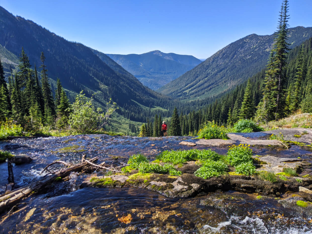
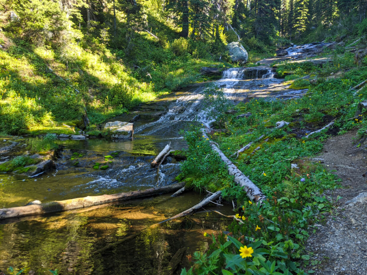
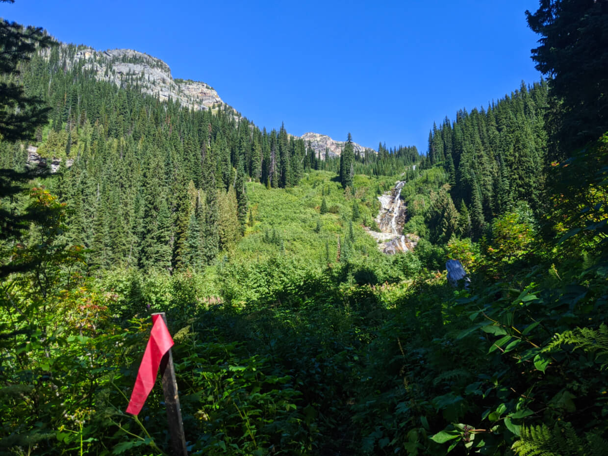
Avalanche chutes and rugged peaks started to appear high above us and then suddenly, a waterfall! Spilling out from a plateau above us, it was clear that route to Pinnacle Lake would take us pretty close to the tumbling falls. But I didn’t guess just how close.

The climb
As we approached the very base of the waterfall, the trail abruptly sent us the other direction to start a series of steep switchbacks.
Most of the trail’s elevation is gained here. Fallen trees, rocks and giant roots proved to be both obstacles and assets as we climbed alongside the waterfall.
While we could hear the water, we could only catch glimpses. Near the very top, we were finally able to peer over the plunging water and take in the views of the valley.
From here, we had the choice of following the creek (possible at low water levels) or more steep switchbacks for the final approach to the lake.
Arriving at Pinnacle Lake
Full of eddying pools, moss and wildflowers, the creek is definitely the prettiest route of the two. Leading us right to the shore of the lake, the views opened up to reveal a spectacular cirque, ringed with rock, snow and trees.
Following a path to the left, I found a giant rock to sunbathe on while JR took a dip in the (freezing) lake. After lunch, it was time to return the way we came and leave the solitude of Pinnacle Lake behind.
In the five hours we spent in the area, we saw no-one else at the lake, nor anyone on the trail.
To experience such beauty is always incredible, but to be alone in pristine wilderness is simply wondrous. For such a relatively short hike, this one left a big impression on me.

Pinnacle Lake Trail Planning Guide
Inspired to check out Pinnacle Lake yourself? Read on to discover everything you need to know about this beautiful hiking trail near Cherryville, BC.

When to hike the Pinnacle Lake Trail
The best time to hike this trail is late August and early September. The trail follows a creek for the most part and consequently has some very muddy sections. Later in the summer, mud dries up a little and is more manageable.
There are a number of creek crossings that may make this hike more difficult when water levels are high (spring/early summer). The creek crossing at the very start can have knee deep water July and into August.
During our visit (second week of September), water levels at this first creek were very low and made it very easy to cross. We still experienced mud on the trail, but only for reasonably short sections. The area at the base of the waterfall had lots of high foliage due to growth during the summer.
Another factor to consider is the elevation. The starting elevation for the Pinnacle Lake trail is around 1370m. Snow is possible at any time of year and can linger on the trail into July.

How to access the Pinnacle Lake trailhead
The Pinnacle Lake trailhead is located on the South Fork Forest Service Road (also known as Monashee Creek Road), southeast of Cherryville, BC. Cherryville is an easy 45 minute drive from the city of Vernon.
- The turnoff for the South Fork FSR is approximately 5km south of the Gold Panner Campground on Highway 6. When approaching from Cherryville direction, the FSR entrance is on the left
- I say ‘approximately’ above because we had a little trouble getting access to South Fork FSR. 1.7km south of the Gold Panner is a turnoff to the road marked on various maps as South Fork FSR and Monashee Creek Road. This road, however, is completely blocked
- We went back on Highway 6, drove a little further south and the next left turn was the correct one, with a large sign after the turn. I’m assuming that the old entrance was decommissioned after the new one was built
- The distance from Highway 6 to the Pinnacle Lake trailhead is 21km. It took us 40 minutes to drive each way
- For navigation on this road, I’d highly recommend the Kootenay Rockies Backroad Mapbook
- The parking lot is located at GPS coordinates 50°11’10.9″N 118°17’49.8″W
Driving the South Fork FSR
South Fork FSR is an industrial road, meaning that it is privately maintained. The surface is not paved.
For the first 13km or so kilometres, it is fairly flat. During our visit, it was reasonably well maintained and easy to drive, with not much debris on the road.
After the signed junction (wooden signs pointed left for Monashee Lake, right for Pinnacle Lake and Vista Pass), the road becomes more rough and narrow. It starts to gain elevation here too. The final 2km were even narrower with a steeper ascent. Our van was scratched a little by plants on the side of the road.
While I wouldn’t have said that a high clearance vehicle was absolutely essential when we drove this road, I would say it is preferable. I’m sure people try but I personally wouldn’t take a low riding vehicle.
This is still an industrial road and you should plan to drive slow and be prepared to receive some minor damage (body scratches for example).
Industrial vehicles always have priority on industrial roads. Be prepared to pull over quickly to give way at all times. This road may occasionally be closed to non-industrial traffic.
Navigating the trail
The majority of the Pinnacle Lake Trail is marked with colourful flagging tape. I didn’t notice many flags during the first 1km or so, but that is likely due to the trail being fairly wide and flat.
We were surprised to find the trail so relatively established, though it was, obviously, fairly late in the hiking season. It could be that it is harder to find earlier in the summer. This trail is, however, not that well used.
Maps.me is our go-to app for on-trail navigation, but only a portion of the Pinnacle Lake trail marked (as ‘Railroad Creek.’) You can find it listed on AllTrails but offline navigation is limited to paid members only. Alternatively, this trail is also marked on Trailforks.
Trail hazards
I really enjoyed hiking this varied trail but if you plan to go, you should be aware of:
- Creek crossings (as mentioned above). There are a number of them, though most have some means to help cross them e.g. logs, rocks etc.
- Mud. A substantial portion of this trail follows a creek and so there are some very muddy parts
- Stinging nettles. The area around the base of the waterfall (about 3km along the trail) is prevalent with stinging nettles. They can grow pretty tall and brushing against them is enough to hurt. This initial sting can develop into a rash
- Bears. This area is grizzly bear territory so be careful to stay alert at all times. The dense foliage, steep switchbacks and creek noise may make particularly difficult to spot or hear a bear (and vice versa)
- General difficulty. Despite the relatively short length (only 4.5km each way), this is still a relatively challenging hike. This would be especially true when carrying an overnight backpack. Some sections are very easy but they creek crossings and mud slowed us down. The ascent near the waterfall is very steep at times, with plenty of tree roots and rocks
Camping at Pinnacle Lake
There is an informal Recreation Site for camping at Pinnacle Lake. I say informal because there are no facilities at all, only cleared tent areas and rock fire pits. This area is completely user maintained, meaning that the responsibility of keeping the campsite clean is on campers.
It is therefore crucial to follow Leave No Trace principles to protect the pristine beauty of Pinnacle Lake and its surroundings.
To do this, you should be prepared to pack out everything you brought in, use an established campsite, minimise campfire impacts and be careful to dispose of human waste properly.
Following these simple steps ensures that Pinnacle Lake remains clean, beautiful and accessible for everyone.
Camping overnight at Pinnacle Lake allows for further exploration around the lakeshore. I’ve read quite a few trip reports which feature hikers climbing the talus to the ridge above.
Essential items to bring
- The 10 Essentials: Situations that would usually be slight inconveniences elsewhere (changes in weather, injuries, other unexpected events) can easily turn into life-threatening emergencies in the backcountry. Never forget to bring the 10 Essentials when exploring BC’s backcountry
- Bear spray – Considering the location and level of isolation, bear spray is an absolute must when hiking the Pinnacle Lake Trail. Be sure to store it somewhere handy using a holster. JR and I usually carry one bear spray each on trails like this
- Hiking poles – I found it very helpful to have hiking poles on this trail. I usually only ever use one but I found myself using two on a number of a sections – specifically the muddy parts, creek crossings and steep climb near the waterfall. Incredibly light and foldable, Black Diamond’s Carbon Z poles are my tried and tested favourite pair
- Leave No Trace supplies (trash bags, trowel) – As mentioned above, there are no facilities anywhere on the Pinnacle Lake Trail. This includes at the camping area and parking lot
Before heading out to the Pinnacle Lake trailhead, be sure to let someone know where you are going and when you plan to be back. There is zero phone signal after leaving Highway 6


Other local things to do
Hiking to Twin Lakes in the Monashee Mountains
34 Awesome Things to Do in Vernon
A Complete Adventure Guide to Valhalla Provincial Park
8 Fast and Fun Hikes in Vernon
Predator Ridge Hiking: Best Trails + Essential Info
How to Go Camping in BC Without a Reservation
Okanagan Valley Road Trip: What to Do and Where to Stop


One half of the Canadian/British couple behind Off Track Travel, Gemma is happiest when hiking on the trail or planning the next big travel adventure. JR and Gemma are currently based in the beautiful Okanagan Valley, British Columbia, Canada. Consider buying us a coffee if you have find any of our guides helpful!
Hiked on Sept 10th. This was a Friday and there were logging trucks to avoid so suggest a Sat or Sun trip would be less stressful. Even this late in a very dry season, there were muddy sections so suggest gaiters would help. Trekking poles essential. Definitely a gorgeous area worth the climb.
Glad you had a great time!
Hello you two. Thank you Gemma and Jean for your thorough reviews of hikes. We (four seniors) did this hike into Pinnacle Lake on August 15, 2023. Your pictures and narrative are an excellent chronicle of the trail. This is truly one of those hikes where the path is part of the adventure; changing many times: meadows, huge trees, mud, creeks to cross, stinging needle bushes, roots, and a clamber up the last bit. The walk along the creek just below the lake is spellbinding as it does an infinity pool drop over the falls. We’ve hiked a lot of trails in BC and have never seen a more magical creek. The lake surrounded by a snow topped cirque is nature’s cathedral. This would be a fun hike for the young and fit; for me the climb near the waterfall was a challenge, but the view at the lake was a wonderful reward.
Hi Bernita,
I’m so glad you enjoyed the hike to Pinnacle Lake! It really is one of BC’s best. I appreciate having a review from a group of seniors like yourselves.