The Iceline Trail, Yoho National Park’s signature hike, showcases breathtaking alpine panoramas, spectacular waterfalls and lush subalpine meadows.
It’s a true feast for the eyes, especially if you love glaciers and snow-capped mountains.

Usually hiked as a 20km loop, the Iceline Trail provides a whole day of hiking discovery (with no double backing!)
For all these reasons and more, we rate the Iceline Trail as one of British Columbia’s best day hikes. It can also be hiked as part of a longer backpacking trip as well.

This post will share everything you need to know about hiking the Iceline Trail, including where to start, what to expect, what to bring and more.
The breakdown looks like this:

Iceline Loop Trail (via Little Yoho)
Location: Yoho National Park, British Columbia
Distance: 20.8km
Elevation change: 710m
Hike type: Loop
Time: 7-9 hours
Difficulty: Moderate
Dogs: Permitted on leash
Fees: $11/adult daily Parks Pass

Hiking necessities
Before heading onto the Iceline Trail:
- Remember to bring the 10 Essentials
- Know how to stay safe and avoid negative bear encounters
- Understand how to Leave No Trace to help keep nature beautiful
- Be prepared to pack out everything you bring with you
- Check out our recommended gear
- Need a backpacking checklist? Sign up to our newsletter for a free one
This post contains some affiliate links. If you make a purchase via one of these links, I may receive a small percentage of the sale at no extra cost to you.

About the Iceline Trail
The Iceline is an alpine hiking trail in Yoho National Park. The official path is quite short (7.8km) but is only accessible via other hiking trails.
For this reason, most visitors hike the Iceline as part of a larger loop.
The Iceline Loop Trail as described in this post is a combination of five trails:
- Takakkaw Falls to Yoho Lake Trail (first 1km of the clockwise loop)
- Yoho Lake Trail (next 2.6km)
- Iceline Trail (following 7.8km)
- Little Yoho Valley Trail (next 4.9km)
- Yoho Valley Trail (final 4.5km back to Takakkaw Falls)
Parks Canada refers to this route as ‘Iceline via Little Yoho.’ The total distance is 20.8km with 710m elevation gain.
There is an alternative route called ‘Iceline via Celeste Lake.’ This is a shorter hike (17.5km compared to 20.8km) which bypasses the Little Yoho Valley.
My AllTrails map shows this hike to be just over 20km with 1000m elevation gain.

The Iceline Trail: Hike experience
This section describes the Iceline Loop Trail (via Little Yoho) in a clockwise direction, starting and finishing at the Takakkaw Falls parking lot
First, head towards Takakkaw Falls – look for the ‘Iceline Trail via the Whiskyjack hostel.’

At the bridge, stay right and follow the gently sloping path. Within 10 minutes, you’ll reach Yoho Valley Road.
Cross the road and continue towards the hostel. Look out for the upcoming Yoho Lake Trail trail signage on the right, signifying the turn onto the trail.

The work starts here, with the path ascending almost immediately (almost 200m gain in 1km). The good news is that the views immediately improve too! Steep switchbacks (watch for slippery spots) take over before the trail levels out.
Stay right at the Yoho Lake/Highline junction. You’re now officially on the Iceline Trail!

The path begins to climb above the trees (yes, with some more switchbacks) and becomes rockier. It’s more exposed too, so if you don’t already have a hat/sunscreen/sunglasses on, you’ll want them now!
At this point, you should be able to spot the Daly Glacier above Takakkaw Falls as well as many snow-capped mountains across Highway 1 (to the south).

Into the moraine field
You’re now in the Emerald Glacier moraine field, a huge rocky expanse left after the ice has receded. The glacier itself can still be seen to the left, with the trail impressively close.

The path levels out for a short time, though some small creek and snow patch crossings may be required (depending on the snow/ice melt and time of year).
The vistas seem to get better with every step. A rocky spur trail on the right offers a magnificent viewpoint of it all.

A slow ascent starts again, this time heading for the highest point on the trail. There are plenty of distractions though. The path skirts the shore of a beautiful alpine tarn, tinted turquoise by glacial flour.

The high point
The Iceline ‘summit’ is another rocky offshoot of the main trail. Offering 360-degree views (and conveniently more than a third of the way through the hike) this is a very popular spot for lunch.

From here, it’s almost all downhill for hikers heading in a clockwise direction. The trail stays in the moraine field for another 2km or so, passing a number of other tarns and creeks.

And then the trees start to appear. The views remain wide and open for the most part, as the trail descends towards the Little Yoho River. A bridge crosses it close to the Stanley Mitchell Hut (and turnoff for the Little Yoho Campground).

The trail runs roughly parallel to the river for some time, with mountain peaks still accompanying the descent. After the Whaleback junction, the grade becomes steeper, with long switchbacks through the forest.

The home stretch
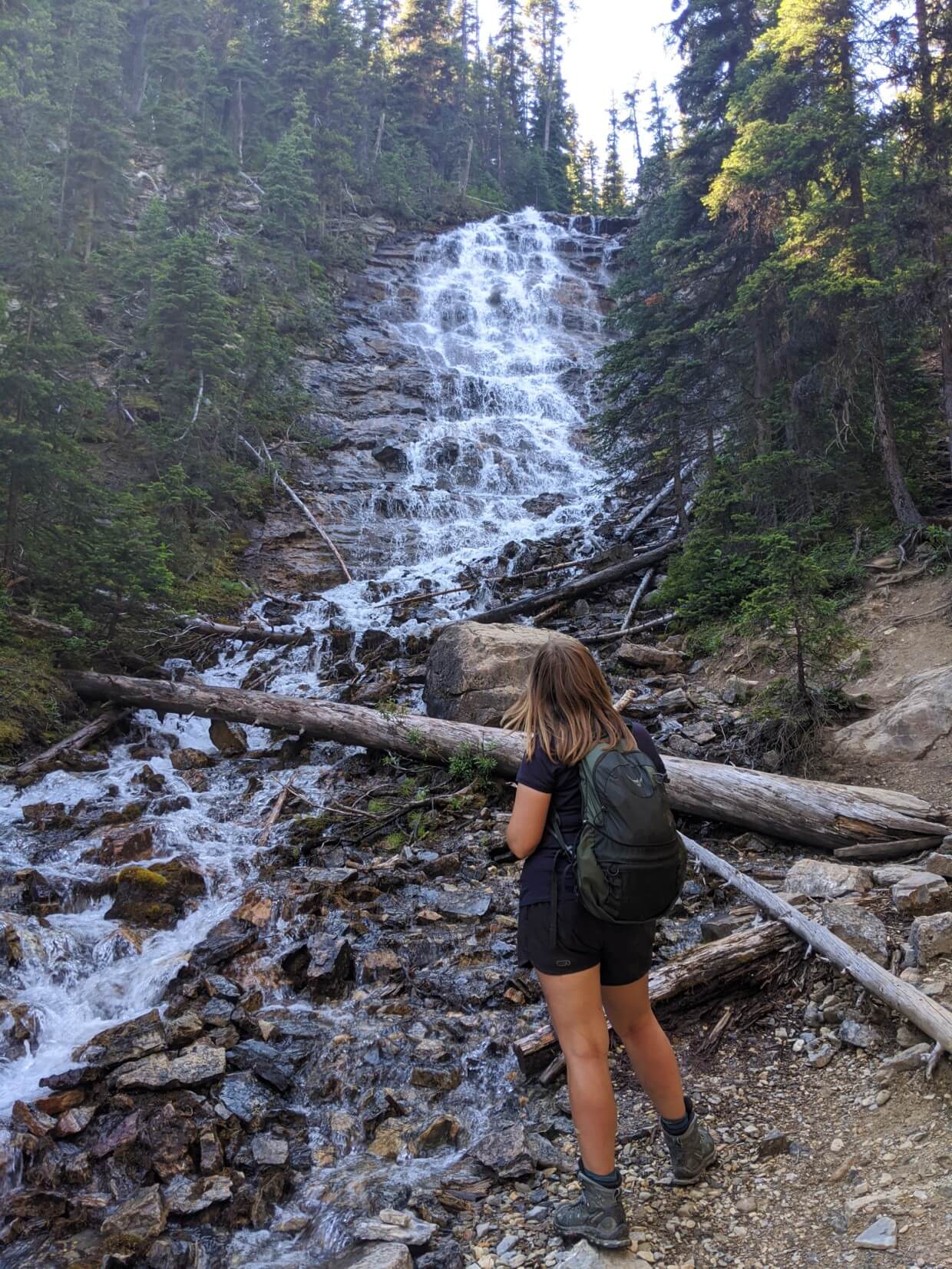
The reward is Laughing Falls, a cooling cascade. Now you’re on the home stretch!
This section is the easiest of the trail. The descent is gradual and features several short (optional) detours to see other waterfalls. Point Lace Falls is a highlight (400m return).

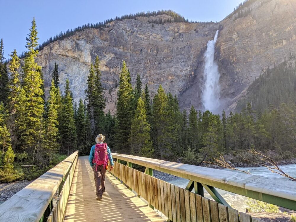
As the Yoho River widens, the path finally flattens. The final 2km is almost completely level, providing a straightforward finish. After such a long day, Takakkaw Falls is a very welcome sight!

Iceline Trail hiking guide
In this section, you’ll find all the essential info about the Iceline Trail, to help you plan your hiking adventure.
A valid Parks Canada day pass is essential for this hike. The cost is $11 per adult, per day.
If you’re staying in the Rockies for a while, consider purchasing a Discovery Pass that allows unlimited entry for a year. The price is $75.52/adult or $151.25 for up to 7 adults.
Location
The Iceline Trail is located in Yoho National Park, British Columbia.
The trailhead is located at the end of the paved Yoho Valley Road, accessible directly from Highway 1.
There are no reservations required to day hike the Iceline Trail, though hikers do need a valid National Parks day pass.
Driving distances/time:
Field: 18km, 25 minutes
Golden: 74km, 1 hour
Banff: 92km, 1 hour 10 minutes
Calgary: 216km, 3 hours 30 minutes
Please note that the Yoho Valley Road is open from mid June to mid-October only. Large RVs and trailers are not allowed on Yoho Valley Road due to a very tight switchback section

Parking
The main parking lot for the Iceline Trail is located at the Takkakaw Falls Day Use Area in Yoho National Park. Parking is free of charge.
This large parking area is found right at the end of the Yoho Valley Road. There are a number of outhouses located close to the parking lot as well as bench seating.
Some Iceline hikers choose to park close to the HI Whiskey Jack hostel on the Yoho Valley Road. There are no facilities here, however, besides trail signage.
Personally, I enjoyed starting and finishing at Takkakaw Falls since it offered the chance to see it up close twice!

Camping options
The Iceline Trail can be hiked as a day hike as well as part of a longer backpacking trip.
There are four designated backcountry campsites within close proximity of the Iceline Trail:
- Yoho Lake
- Laughing Falls
- Twin Falls
- Little Yoho
Reservations usually open in January each year and are highly recommended for July and August (especially on weekends).
In 2025, the reservation launch date for backcountry campgrounds in Yoho National Park is 27th January at 8am MT.
The Parks Canada Visitor Centre in Field does also issue same-day camping permits but there is no guarantee of availability.
Backcountry fees (for camping) in Yoho National Park are $13.50 per adult, per night. Online reservations cost $11.50..
The Stanley Mitchell Hut, owned by the Alpine Club of Canada, is located very close to the Little Yoho Campground. It is a shared rental with a communal sleeping space.

The options for backpacking are numerous, but here are a couple of the most popular trips:
1 night, 21.7km
- Day 1: Start at Takakkaw Falls, hike to Little Yoho Campground (9.6km)
- Day 2: Hike Iceline Trail back to Takkakaw Falls (12.1km)
2 nights, 30.6km
- Day 1: Start at Takakkaw Falls, hike to Twin Falls Campground (6.6km)
- Day 2: Hike from Twin Falls Campground to Little Yoho Campground via Whaleback Trail (11km)
- Day 3: Hike Iceline Trail back to Takkakaw Falls (12.1km)

Best time to go
The Iceline Trail is accessible from the Yoho Valley Road, which is open seasonally from late June to mid October only. The exact opening and closing dates vary from year to year, being completely weather-dependent.
The best time to hike the Iceline Trail is late July to early September, when the path is usually snow-free.
Depending on the year, it may be possible to hike without snow earlier or later in the season.
Parks Canada regularly updates trail conditions here.

Navigation
The Iceline Trail is a well defined path, with Parks Canada trail signage at junctions.
Download Yoho National Park hiking map.
As previously mentioned, the Iceline loop described in this post is actually a combination of five different trails:
- Takakkaw Falls to Yoho Lake Trail (first 1km of clockwise loop)
- Yoho Lake Trail (next 2.6km)
- Iceline Trail (following 7.8km)
- Little Yoho Valley Trail (next 4.9km)
- Yoho Valley Trail (final 4.5km back to Takakkaw Falls)
The trail signage can therefore be a little confusing if you are not already aware of this.
I’d highly recommend using the app Maps.me for hike planning purposes as well as on-trail navigation. Once the relevant maps have been downloaded, offline use is possible.
On Maps.me, the Iceline Trail is marked as such from the Takakkaw Falls parking lot all the way to the Stanley Mitchell Hut, where it becomes the Little Yoho Valley Trail.
Difficulty
The standard Iceline Loop (via Little Yoho) is 20.8km with 710m elevation gain.
Trail difficulty is subjective. As someone who hikes regularly, I would rate the Iceline Trail to be moderate in difficulty (no technical sections, manageable elevation gain). The length does push it towards the harder side of moderate for me personally.
If you do not hike often (particularly in mountainous areas), you will likely find this hike to be more strenuous. For reference, Parks Canada rates the trail to be difficult, with a black diamond symbol.
Important to know:
- The main trailhead (Takkakaw Falls parking lot) sits at around 1500m. The highest part of the trail is around 2150m. Hiking at high altitude is more tiring due to less oxygen being present
- The terrain is not technical, with no scrambling required
- For most people, the most challenging sections will be those with elevation gain/loss – more details below

Which direction to hike the Iceline Trail?
It is possible to hike the Iceline Trail in a clockwise or counter clockwise direction. Both are popular choices.
We decided to hike the Iceline Trail in a clockwise direction. We started at the Takakkaw Falls parking lot, headed towards the HI Whiskey Jack, up the Yoho Lake Trail and then along the Iceline towards the Stanley Mitchell Hut, finishing the hike with a descent down through the Little Yoho Valley.
Most people we met that day hiked in the same direction.
One of the main deciding factors relates to elevation gain.
- Hiking clockwise involves climbing steep switchbacks on the Yoho Lake Trail, followed by a more gradual ascent and then a long, slow descent through the Little Yoho Valley
- Hiking counter clockwise involves a longer, more gradual (and shaded) climb up through the Little Yoho Valley and then a steeper descent on the Yoho Lake Trail
Personally, I like steeper climbs to get major elevation gain over and done with. I also find steeper descents to be harder on my knees, even with the use of poles.
On the other hand, I know hikers who prefer gradual climbs and find long descents to be more physically tiring/painful.
I was happy with our choice to hike clockwise, especially since it was a relatively hot day. The forest in the Little Yoho Valley provided shade and it was cooling to hike next to the Yoho River and associated waterfalls.

Wildlife
As many as 58 species of mammals live in Yoho National Park, including black and grizzly bears, moose, mountain goats, wolverines, coyotes, elk, deer, porcupines, marmots and cougars.
While hiking the Iceline Trail, you may encounter some of these mammals (or not!)
To avoid negative wildlife interactions:
- Stay alert and be aware of your surroundings
- Make noise to warn wildlife of your approach
- Carry bear spray, know how to use it and keep it accessible
- Pack out everything you bring with you (including biodegrable items like banana peels and apple cores)
- Store food and smelly items when not in use. When camping, use the provided bear cache or bear hang
- If you do see animals – keep your distance, don’t feed and always leave them with an escape route
Check out our complete guide to bear safety for more info
Trail hazards and important safety info
While the Iceline Trail may be a well travelled route, it is located in challenging mountainous terrain:
- Weather conditions can vary and change quickly. Snow is possible at any time of year
- The middle section of the hike is very exposed, with no trees for shade or cover
- The trail is generally well-maintained but hikers should be prepared for occasional blowdown, snow patches, loose rocks, mud etc.
- Trail surfaces include rock and dirt. Some surfaces are uneven and can be slippery, especially in wet weather
- The switchbacks on the Yoho Lake Trail (close to the Whiskey Jack hostel) are steep and slippery in places
- Besides these hazards, it’s also important to be aware of wildlife (see previous section) and the relatively remote location. We did not have phone signal at any point while hiking the trail

Essentials items to bring
Besides the 10 Essentials, here are a few more must have items for this hike:
- National Parks pass. Since the Iceline Trail is located in Yoho National Park, you’ll need a National Parks day pass to hike it. If you’re spending more than a week in Canada’s national parks, it is worthwhile to get a Discovery Pass instead
- Hiking poles. These are most helpful to use on the steeper sections of the Iceline Trail. JR and I usually share a pair of Black Diamond Carbon Z poles, which are incredibly light and fold down into three sections for easy storage when not in use
- Bear spray. Yoho National Park is home to both grizzly and black bears. Carry bear spray in an accessible place and know how to use it
- Tried and tested hiking shoes. This is a long hike, so be sure to wear appropriate footwear. For me, that’s my Salomon Quest 4 hiking boots
- Sunscreen, sunglasses and sun hat. As mentioned above, the middle section of the Iceline Trail is very exposed. We use and recommend Canadian made Just Sun, an all natural mineral sunscreen
Other things to do in Yoho National Park
The Iceline Trail isn’t the only epic adventure in Yoho National Park. If you love to hike, this place is a paradise!
Takakkaw Falls is Canada’s second highest waterfall (381m!) and is visible from the Iceline Trail. Be sure to take the time to walk right to the base and feel the powerful spray of the water!
We also enjoyed hiking the Yoho Valley Trail, Twin Falls Trail and Whaleback Trail as a 20.4km loop. This route offers incredible panoramas of glaciers and mountains as well as the chance to visit multiple waterfalls. Twin Falls itself is a glorious sight.

Emerald Lake is as beautiful and distinctively blue-green hued as its name implies.
Surrounded by rugged mountains and a glacier by the same name, Emerald Lake is a must visit while in Yoho National Park. There is a hiking trail all the way around the lake. There are canoe rentals available too.
If you love waterfalls, be sure to make a stop at Wapta Falls. This wide 30m high waterfall is the largest on the Kicking Horse River and is accessible via a short and mostly flat hiking trail (4.6km).

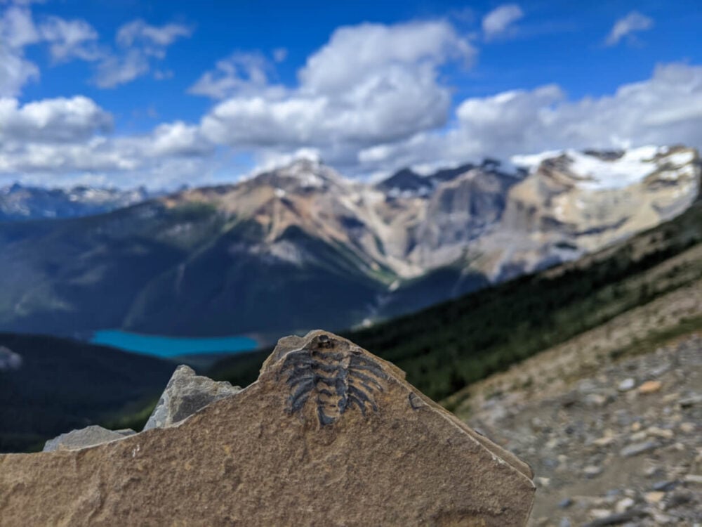
Yoho National Park is protected not only for natural beauty but also to safeguard the Burgess Shale rock formation, which contains some of the rarest and most exceptionally well-preserved fossils in the world.
The Burgess Shale can only be visited with a guided tour (read about our Burgess Shale hike experience!)
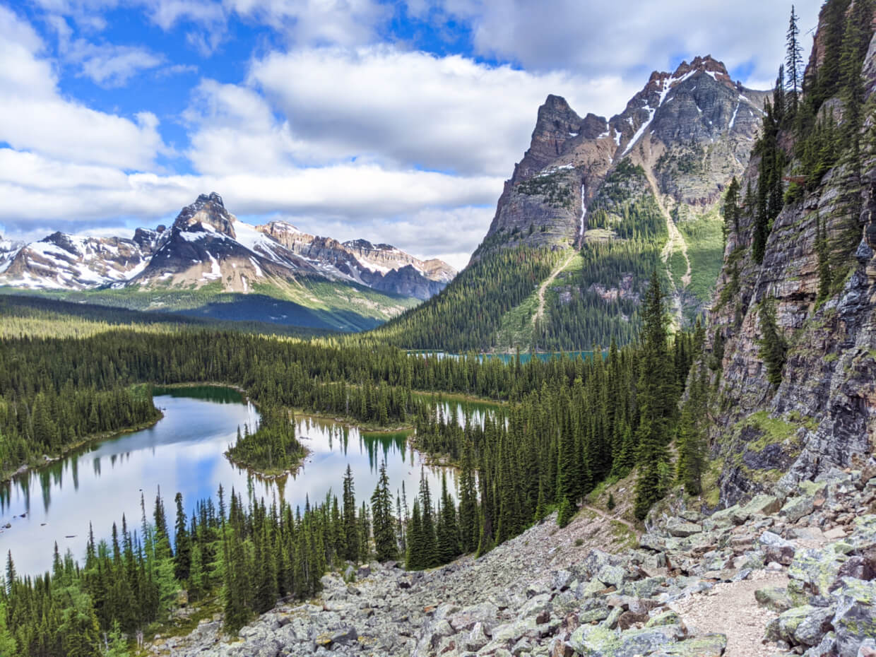
If you’re reading this post well in advance of your summer adventures, I’d highly recommend trying to secure a spot at Lake O’Hara.
This alpine area is a paradise for backcountry hikers, with more than a dozen exceptionally well-maintained trails traversing one of the most gorgeous landscapes in Canada.

Where to stay in Yoho National Park
There is an awesome tent campground at Takakkaw Falls. Previously first come, first serve, this campground is now reservable.
The first tent spots are only 300m from the parking lot and there are wheelbarrows to help carry your gear in. Some of the campsites have truly spectacular views of the falls.
If camping isn’t your thing, there are several independently run guesthouses and B&Bs in nearby Field.
The Canadian Rockies Inn is a highly rated adults-only guesthouse, located very close to Truffle Pigs Bistro (a must for dinner!)
Alternatively, check out Emerald Lake Lodge, located on dreamy Emerald Lake. There are 24 cabins sit on a 13 acre peninsula, some offering spectacular lake views.

Looking for more adventures in the Canadian Rockies?
The Great Divide Trail: Canada’s Most Epic Thru Hike
Climbing Mt Norquay’s Via Ferrata, Banff, Alberta
The Rockwall Trail: Complete Hiking Guide
Hiking the Kananaskis Valley from Mount Engadine Lodge, Alberta
Glacier Crest Trail, BC: Complete Hiking Guide
Mount Assiniboine Provincial Park: Complete Hiking Guide
Burgess Shale Fossil Hunting in Walcott Quarry, Yoho National Park
Unique Places to Stay: Charming Inns of Alberta

One half of the Canadian/British couple behind Off Track Travel, Gemma is happiest when hiking on the trail or planning the next big travel adventure. JR and Gemma are currently based in the beautiful Okanagan Valley, British Columbia, Canada. Consider buying us a coffee if you have find any of our guides helpful!

Dear Team,
I am contacting you as I am staying in Banff for three full days (13th-15th June). I would love to complete the Iceline Trail and wanted to ask if you have availability for any one of the three dates?
Please let me know if you would like any further information.
Kind regards,
Jack
Hi Jack,
Thanks for the interest but we do not guide hikes at this time. I don’t know of a company that offers regular scheduled Iceline hikes but I’d recommend contacting White Mountain Adventures to see if you can set something up. We went on a guided snowshoe in Banff NP with them in 2021 and it was incredible!