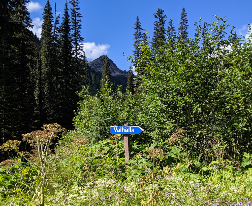
Valhalla Provincial Park, British Columbia – majestic, mysterious and magical all at once, the name of this park alone inspires wonder.
Named after the Norse equivalent of Heaven, Valhalla is exactly that if you like wild, beautiful natural areas.
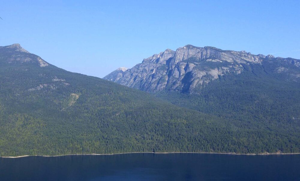
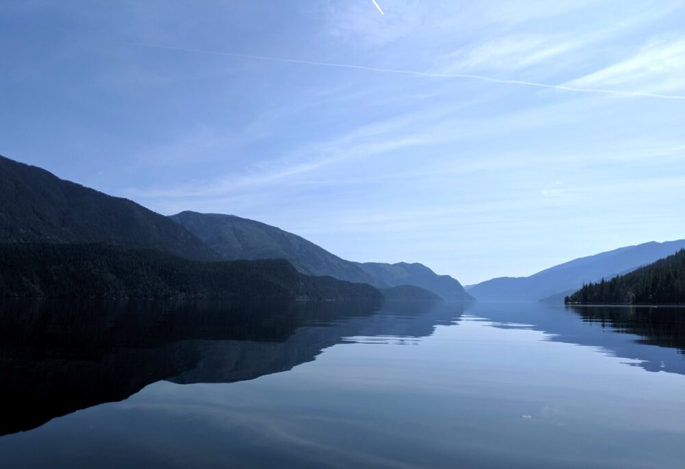
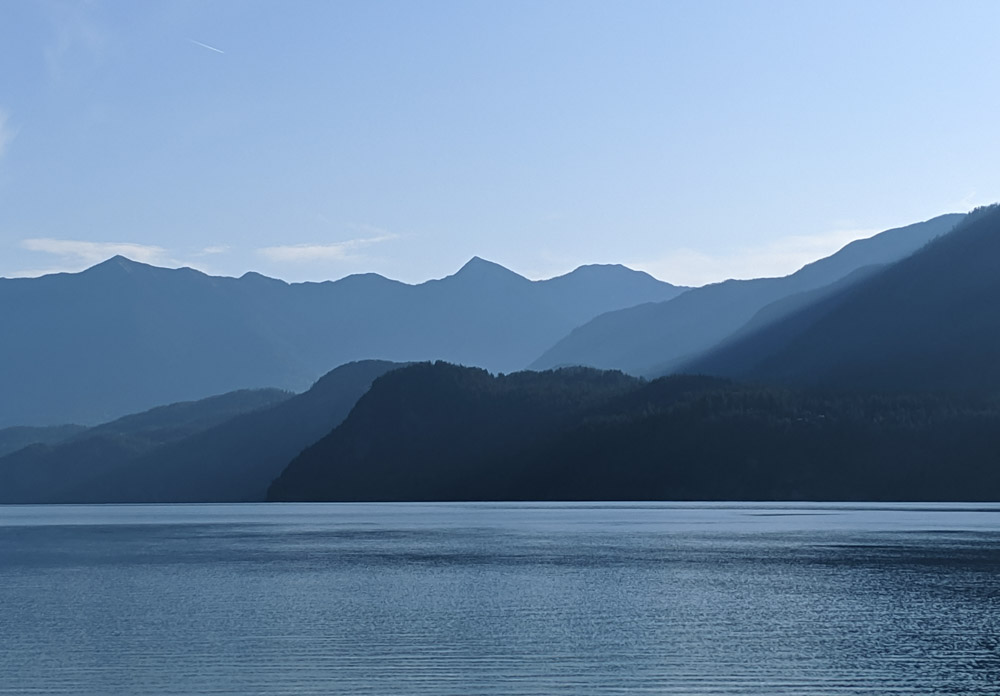
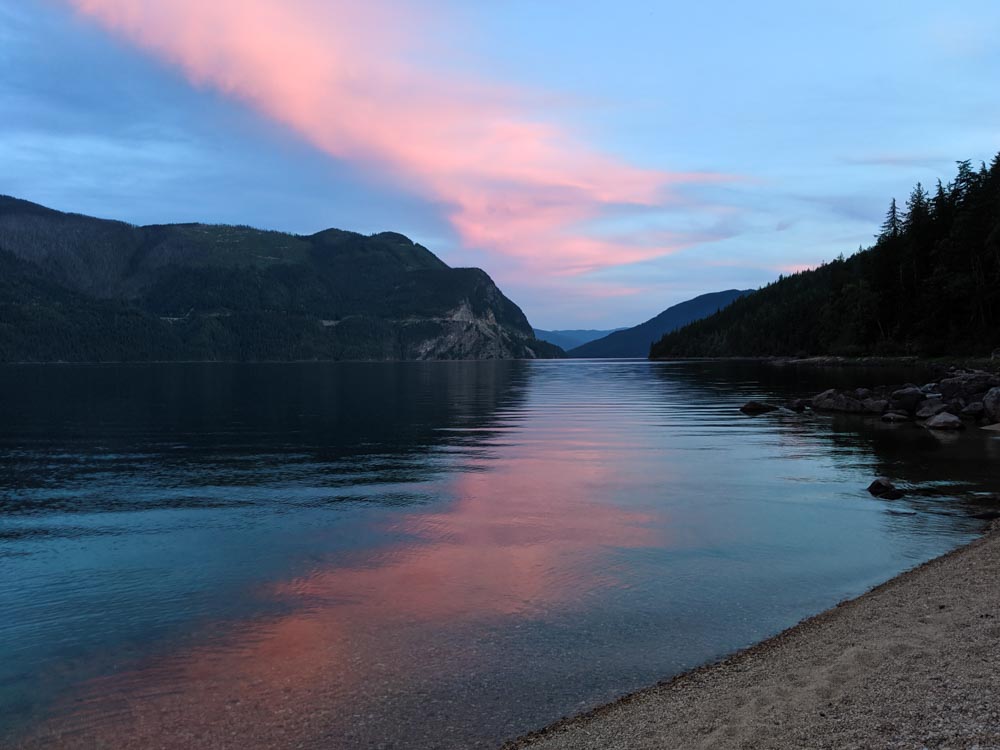
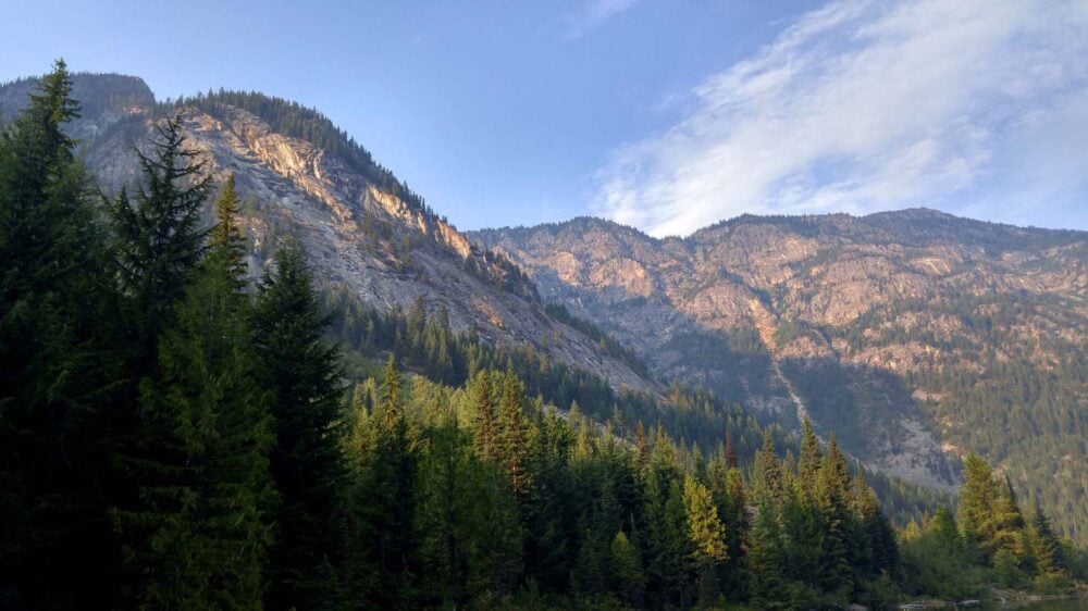
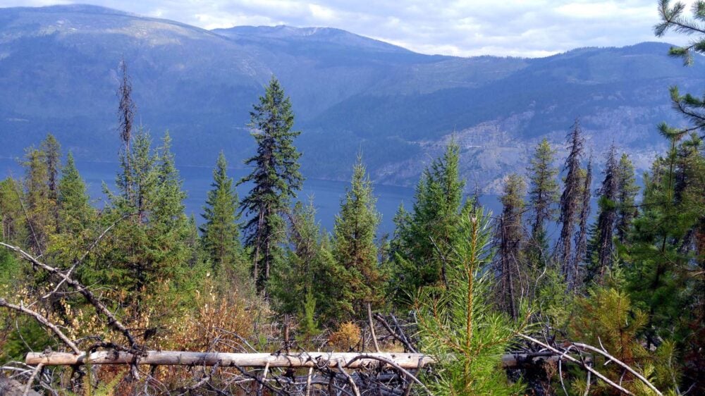
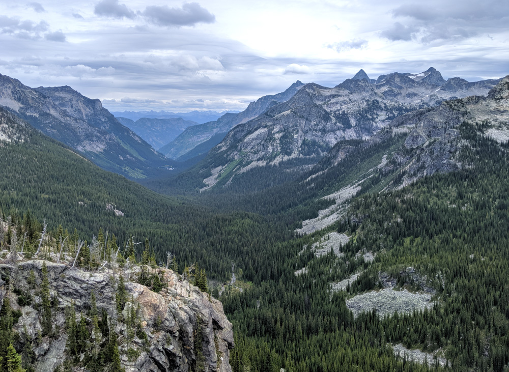
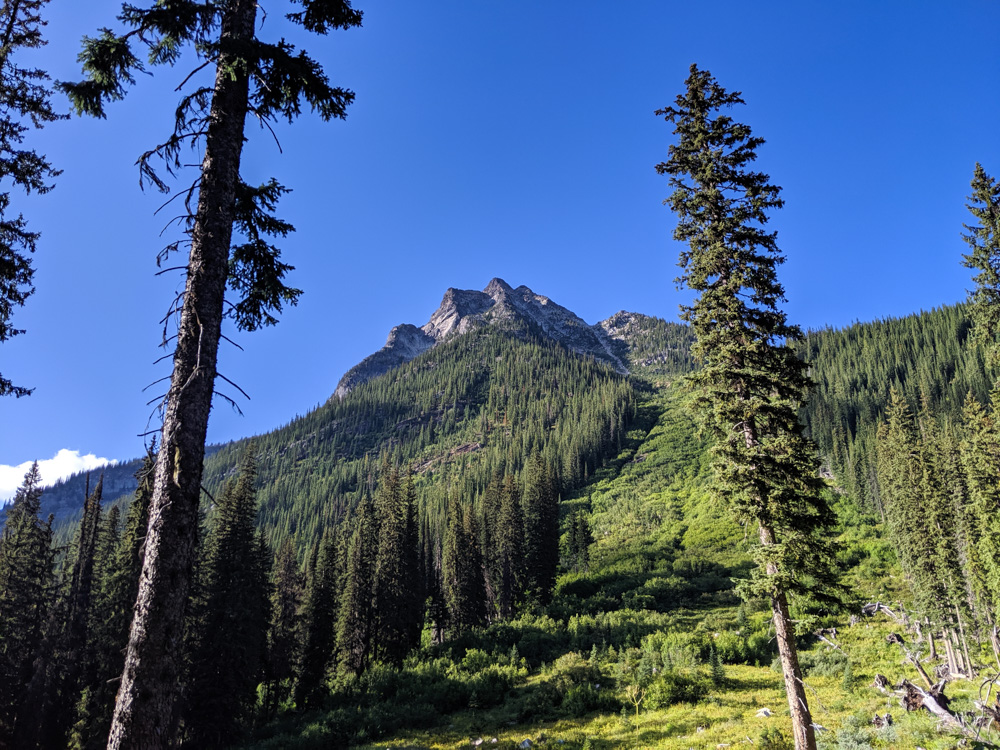
Towering mountain peaks and deep valleys dominate the centre of this magnificent park. To the east, the cool and seemingly bottomless Slocan Lake creates a natural 39km long border.
Besides the outstanding beauty in every panorama, Valhalla Provincial Park is particularly special in that it is possible to explore from lake level (536m) all the way to epic mountain summits (2800m).
This post is a complete hiking, paddling and backpacking guide to Valhalla Provincial Park. All three of the most visited areas of the park are covered in detail, based on two extended trips of our own.
Here’s what to expect:
- Introducing Valhalla Provincial Park
- Planning a trip
- Slocan Lake
- Gimli Ridge
- Gwillim Lakes
- Essential items to bring
Important update – Please note that Valhalla Provincial Park was impacted by wildfires in 2024. Some of the campgrounds and trails on Slocan Lake are remain closed. Check the BC Parks’ website for details.
Valhalla Provincial Park is situated on the traditional territory of the Sinixt, Ktunaxa, Secwepmec and Syilx Nations as well as the Confederated Tribes of the Colville Reservation.
Backcountry necessities
- Always bring the 10 Essentials
- Know how to stay safe in the backcountry
- Remember to Leave No Trace to help keep the wilderness wild
- Understand how to avoid negative bear encounters
- Trying out backpacking for the first time? Read Backpacking 101
- Check out our packing guide with gear recommendations
- Sign up to our newsletter for a free backpacking checklist
Introducing Valhalla Provincial Park
Valhalla Provincial Park is the kind of place you have to make an effort to reach.
Located in British Columbia’s Slocan Valley, the park is around half way between Nelson and Nakusp. Allow about eight hours drive from both Vancouver and Calgary.
Highway 6 looks out towards the park as it winds in and out of the trees high above Slocan Lake.
Even with the relatively close highway positioning, there is, however, no paved road access to the park itself. Visitors must either paddle, hike or drive along rough gravel roads to reach backcountry areas.
Those who make the trip are rewarded with well maintained campgrounds and trails in a variety of beautiful locations. Independent, intrepid outdoor adventurers who like hiking through alpine meadows and/or leisurely lake canoe trips will find a lot to love here.
One of the best and most amazing aspects of Valhalla Provincial Park is that access is completely free. There are no backcountry or day passes required to explore this incredible place. Overnight camping is also free.
Choose your Valhalla adventure: paddling or hiking
Valhalla Provincial Park is an extensive protected area of 50,060 hectares. There are a number of different recreational areas in the backcountry of Valhalla but the three most visited are:
- Slocan Lake (paddling, hiking, fishing, camping)
- Gimli Ridge (hiking, camping, climbing)
- Gwillim Lakes (hiking, camping)
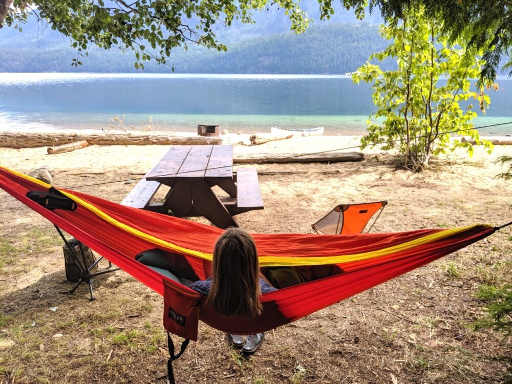
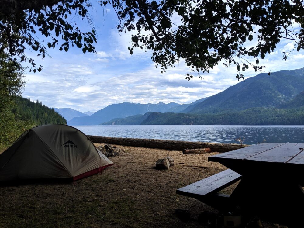
Slocan Lake is definitely the most ‘frontcountry’ area of the three. Camping on the lake isn’t quite a wilderness experience but still feels remarkably idyllic.
All three areas are accessed via dedicated trailheads, located a substantial distance apart.
Gimli Peak and Gwillim Lakes are actually situated relatively close geographically but due to the rugged terrain, are very difficult to travel directly between.
This post includes some affiliate links. If you make a purchase through one of these links, I may receive a small commission at no extra cost to you.
Planning a trip to Valhalla Provincial Park
Before diving into the detail of hikes and campgrounds in Valhalla Provincial Park, let’s go through some basics.
- All campgrounds in Valhalla are allocated on a first come, first serve basis only (and FREE!) There is no reservation system. The park is busiest during weekends and holidays in July and August
- Dogs must be on leash and are only allowed in limited areas of the park – Slocan Lake marine campgrounds, the Slocan to Evans Creek Beach Trail and the Beatrice Lake Trail.
- Campfires are allowed in designated fire rings on Slocan, Cahill and Emerald Lakes (and when there is no fire ban)
- Valhalla is home to a variety of wildlife including grizzly bears, black bears, mountain goats and cougars. Be sure to use store all food, trash and scented products in the provided bear caches when not in use
- Stay alert, make noise, carry bear spray and know what to do when encountering bears, cougars and other animals
- July and August are the best months to visit Valhalla Provincial Park. Note that there can still be snow on Gimli Ridge and other high elevation areas of the park into July
- Two of three most popular areas of Valhalla are only accessible via logging roads. Drive defensively and be prepared to give way to industrial vehicles. Use a Backroad Mapbook for navigation
Porcupines apparently enjoy eating brake lines of vehicles in the Gwillim Lakes and Gimli Ridge parking lots. Many hikers choose to wrap the lower half of their vehicle in chicken wire. Whatever you do, don’t leave the chicken wire to rust in the parking lot as it’s a nightmare for the rangers to clean up!
Slocan Lake
Please note that the shoreline of Slocan Lake was significantly impacted by wildfires in summer 2024.
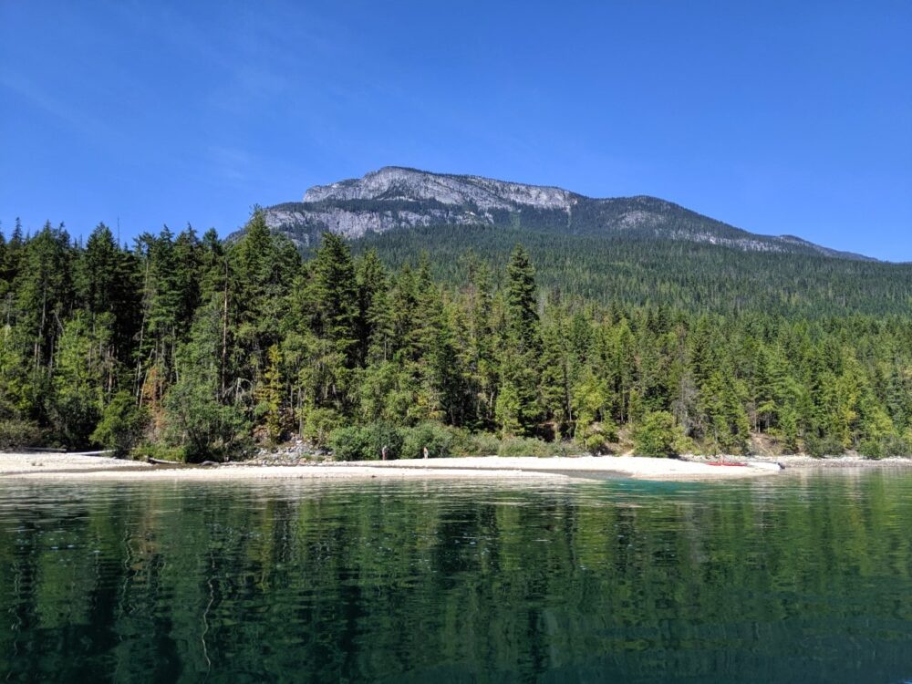
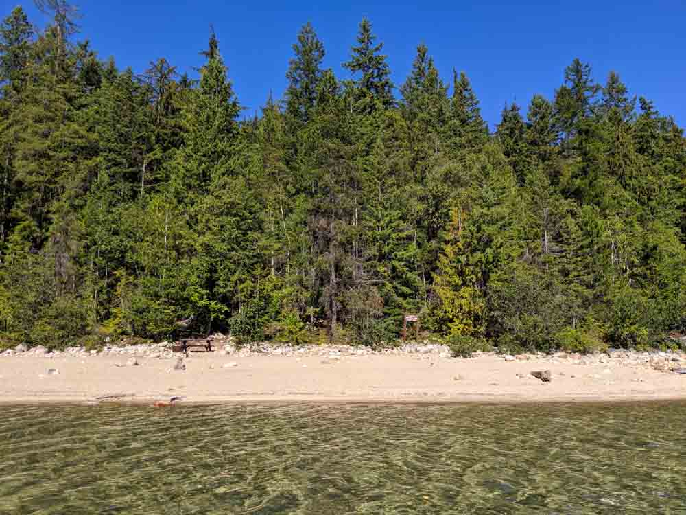
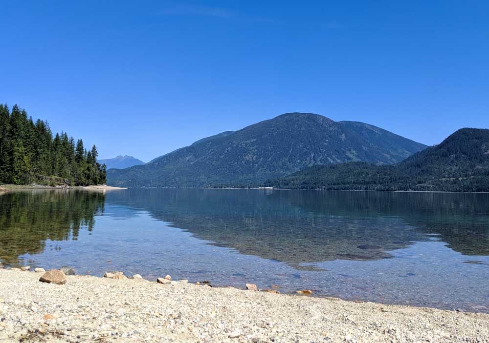
This 39km long lake provides a natural border to Valhalla Provincial Park. It is the most accessible area in Valhalla and provides backcountry hiking, paddling and camping opportunities.
The western shoreline of the lake features eight marine beach campgrounds (one with a cabin) as well as five trailheads for hiking.
Most of the hiking trails lead into the subalpine, with the Beatrice Lake Trail offering additional backcountry camping opportunities.
There are three communities located on the edge of the lake – New Denver, Slocan and Rosebery (in order of size).
With boat launches in both New Denver and Slocan, the lake is visited by motorboat users in summer as well as canoeists and kayakers.
How to get to Slocan Lake
Slocan Lake is situated just west of Highway 6 and can be seen from numerous viewpoints on the road.
Right at the bottom of the lake is the small community of Slocan. Paddlers can access Slocan Lake from a few different spots including:
- Slocan
- Bannock Point Recreational Site
- Silverton
- New Denver
- Rosebery
- Wragge Beach Recreational Site
- Bonanza Creek Road (north end)
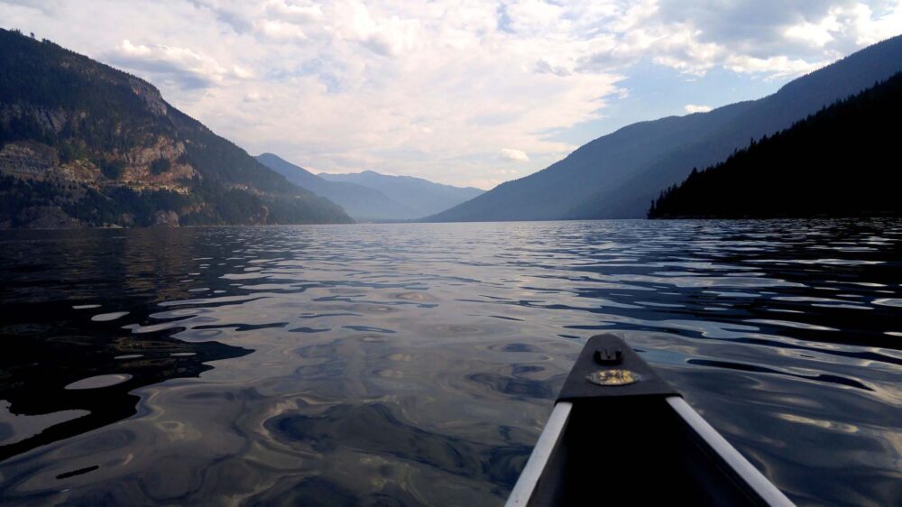
We’ve found Slocan to be most convenient for our purposes and have launched there twice for extended paddling trips in Valhalla.
There is a large open parking area and boat launch near the beach. Parking is free and we haven’t experienced any security issues.
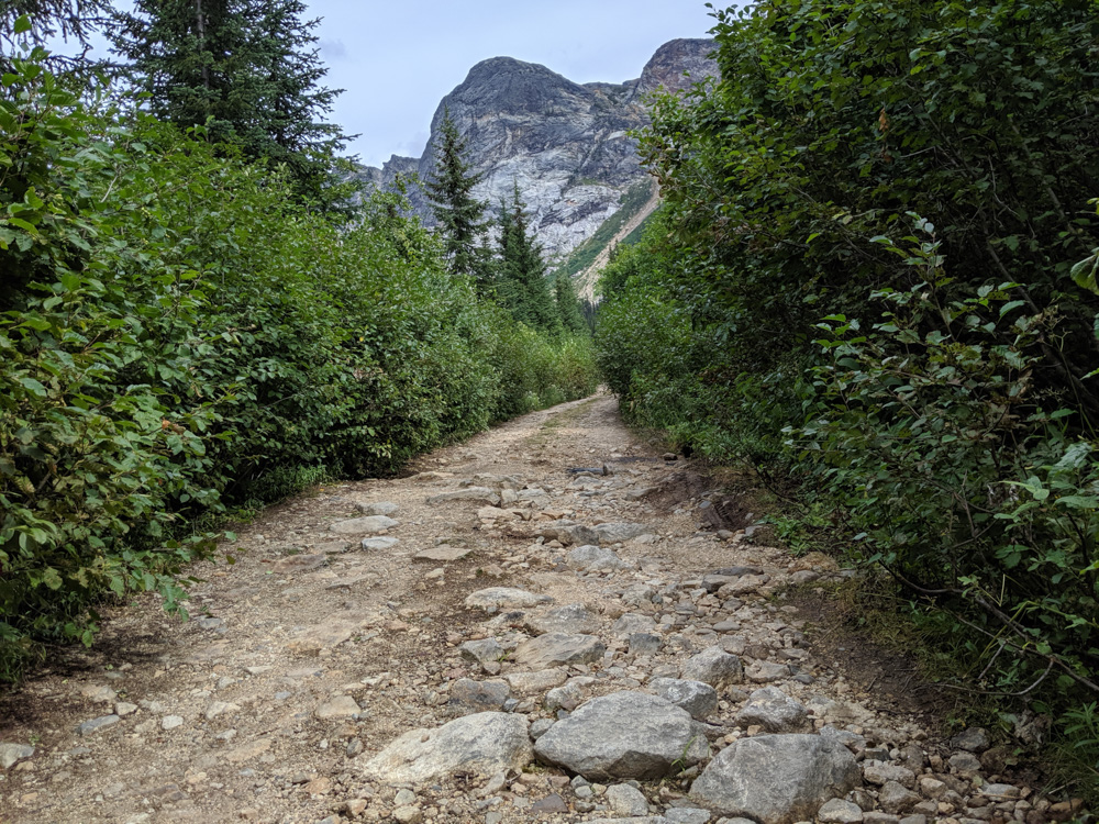
Slocan is also the only entry point for hikers looking to explore the Slocan Lake side of Valhalla Provincial Park. A 7.5km hiking trail leads to Evans Beach from Slocan, via a number of swimming spots.
From here, hikers can then hike the Beatrice Lake Trail (see below for more info). The Slocan-Evans trailhead is located just across the bridge on Slocan North Road, but hikers should park on the east side of the river at the corner of Park Ave and Main St.
Slocan Lake campgrounds
27km of the shoreline of Slocan Lake is part of Valhalla Provincial Park. There are eight marine campgrounds located along the water, each with an outhouse, metal food cache, picnic tables and fire pits.
There are no formal tent pads, but most campgrounds have cleared sheltered spaces and as well as beach camping.
South Evans Beach – 7km from Slocan
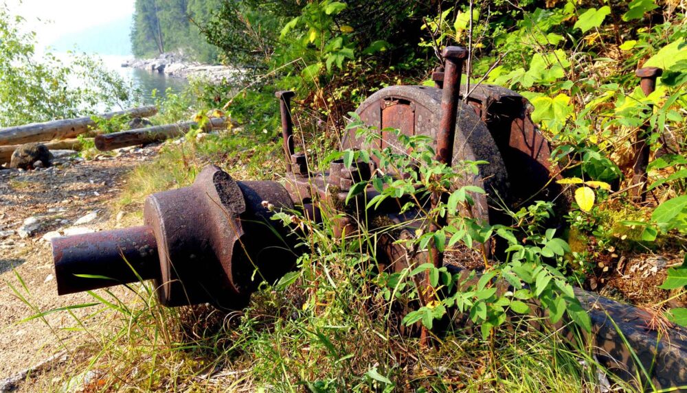
The largest of the Slocan Lake marine campgrounds, South Evans Beach has numerous tenting areas on and behind a pretty beach.
The campground is scattered with historical artifacts and also features a shelter and a rushing creek.
Ben Browns – 11km from Slocan
Ben Browns features a fairly long golden sand beach backing onto a shady forest. We are often drawn back to Ben Browns for the stunning location and convenient paddling distance from Slocan.
Indian Creek Beach – 12km from Slocan
Another stretch of golden sand, though this one features less suitable camping space on the beach itself.
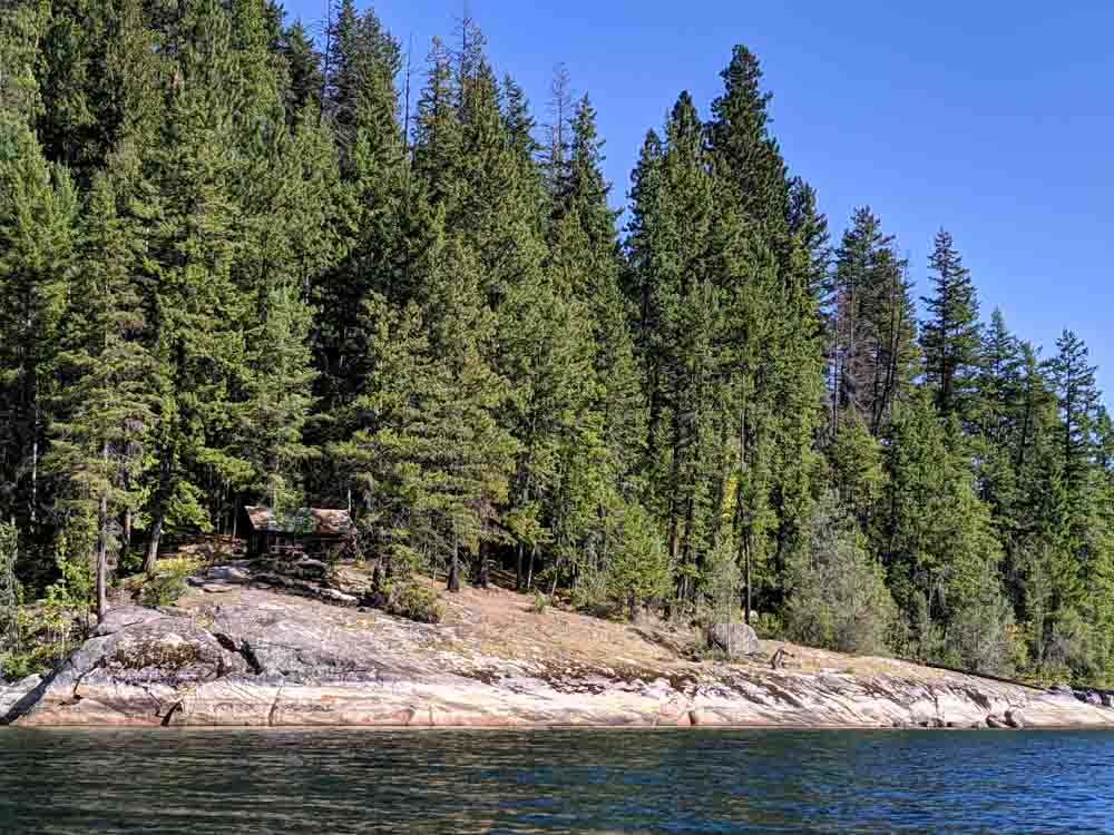
Cove Creek Beach – 14km from Slocan
Perched on a rock headland, the small Cove Creek cabin provides emergency shelter and an interesting day paddling destination.
A pebble beach below provides a comfortable landing area, suitable for camping if needed.
Cory’s Ranch – 17km from Slocan
Golden sand wraps around a curving bay of the lake to offer an expansive campground with northern and eastern facing shores.
Campers can choose to pitch a tent right on the beach or in an open but shady inland area.
Nemo Creek Beach – 19.5km from Slocan
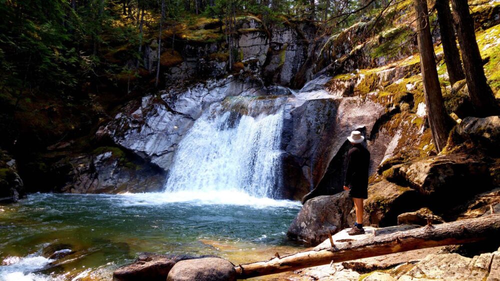
One of the most popular destinations on Slocan Lake, Nemo Creek features a spacious fine sand beach plus beautiful hiking trails leading to waterfalls and a canyon.
Sandpoint Beach – 24.5km from Slocan
Another lovely sandy beach backed by forest. Sandpoint is the closest campground to Silverton.
Wee Sandy Creek Beach – 28.5km from Slocan
The last provincial park campground on the lake, Wee Sandy Creek has a coarse pebble beach. A trail starts here to Wee Sandy Lake, via goat bluffs and trappers cabins.
Beatrice Lake Trail campgrounds
The following campgrounds are located on the Beatrice Lake Trail, accessible on foot from the Evans Creek campground on Slocan Lake.
Emerald Lake – 5km from Evans Creek campground
Emerald Lake is a reasonably large, open lake. Living up to its name, the water at the shoreline changes from blue, turquoise and sometimes green.
There are four tent pads set into the trees accompanied by a grey water pit. Emerald Lake, or ‘Little Cahill’ is situated on the Beatrice Lake Trail.
Cahill Lake – 8.5km from Evans Creek campground
Cahill Lake is larger than Emerald and has a more impressive backdrop, but the water is less easy to access. Set deeper into the trees, the campground is also gloomier. There are six tent pads accompanied by a grey water pit.
I believe there was once a campground (with as many as twelve tent pads) at Beatrice Lake but the BC Parks maps and trail information no longer mention it. I presume it is no longer maintained and they wish to discourage hikers from using it.
Slocan Lake hiking trails
All trails listed below are out and back trails, meaning you need to walk back the same way you came after reaching the final destination. Distances mentioned below are one way.
Slocan-Evans Trail
Following the Slocan Lake shoreline, this 7.5km trail offers beautiful views but not without effort.
The meandering path traverses forest, boulderfields and rocky meadows. It leads to the Evans Creek campground, where you can stand above the raging water as it races through the canyon.

Beatrice Lake Trail
Continuing on from the Slocan-Evans Trail, this 11km route takes in three surprisingly large lakes – Emerald (5km, 500m elevation gain), Cahill (7km, additional 200m elevation) and Beatrice (additional 170m elevation).
Emerald is a good day hike destination, providing a beautiful picnic stop on the shore of the lake.
There are historical artifacts to be seen along the trail as well as views back to Slocan Lake. Although pretty in sections, we didn’t find this trail to have a great effort/reward ratio. We still enjoyed it, however.
Cove Creek Trail
A 3.5km trail leads from the cabin through ponderosa pines to a patch of coastal salal.
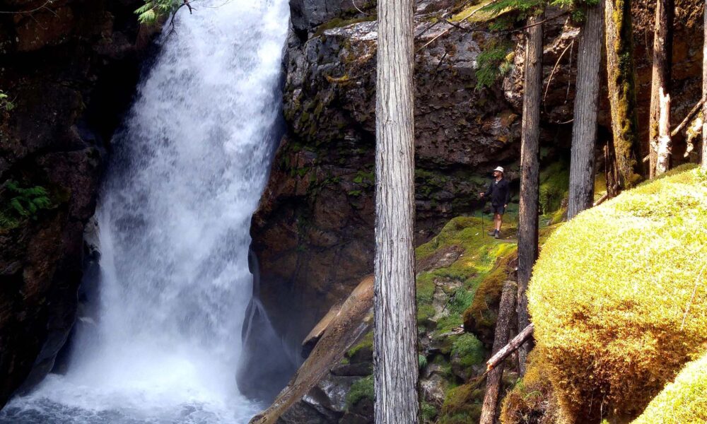
Nemo Creek Trail
The trail first passes a small, yet still impressive, waterfall before reaching a canyon with larger plunging waterfall (accessible on a 30 minute loop). It continues 3.5km to rock formations and finally, a cabin.
Sharp Creek Trail (New Denver Glacier)
A strenuous 8km route takes hikers to an upper basin beneath New Denver Glacier and an alpine meadow beyond. There are huge cedar trees and old cabins to check out along the trail. The trail gains about 2200m as it travels towards the glacier. Many people finish their hike at a waterfall at the 3.7km mark.
Wee Sandy Trail
The 14.4km trail to Wee Sandy Lake offers solitude as well as a challenge.
The path is apparently hard to follow after 4km but takes in mountain goat bluffs, old trappers’ cabins and waterfalls before reaching the namesake lake. There is a shelter available for overnight use en route.
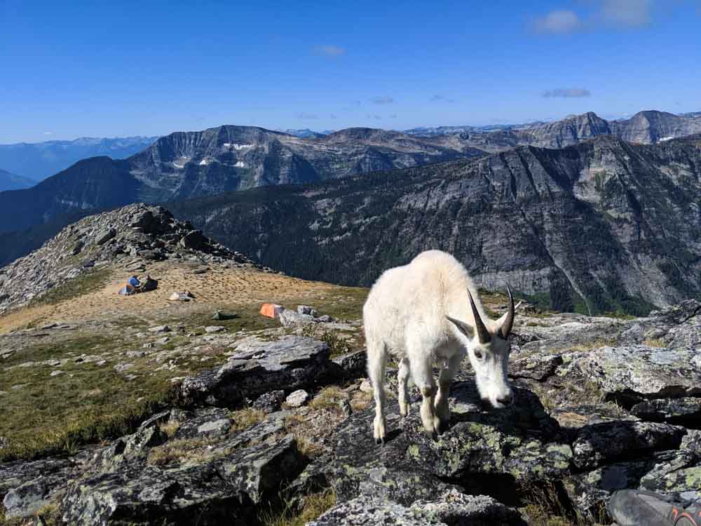
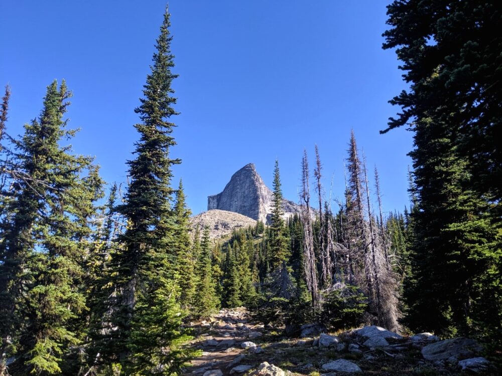
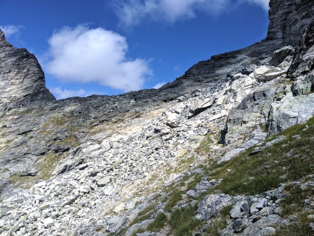
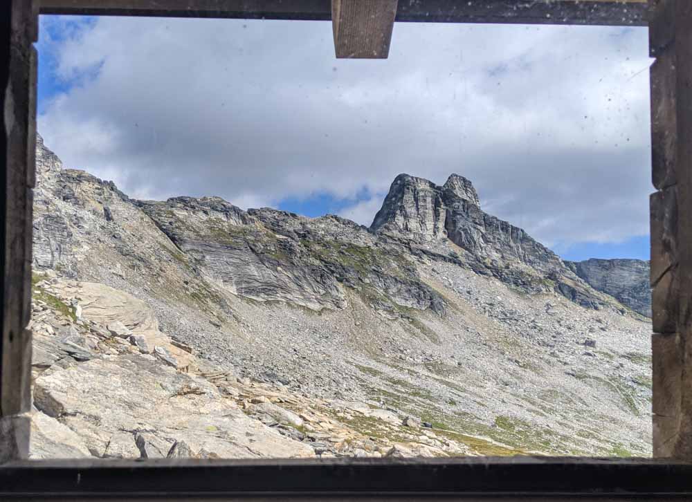
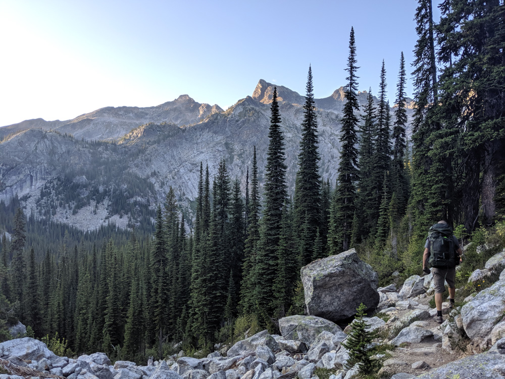
Gimli Ridge
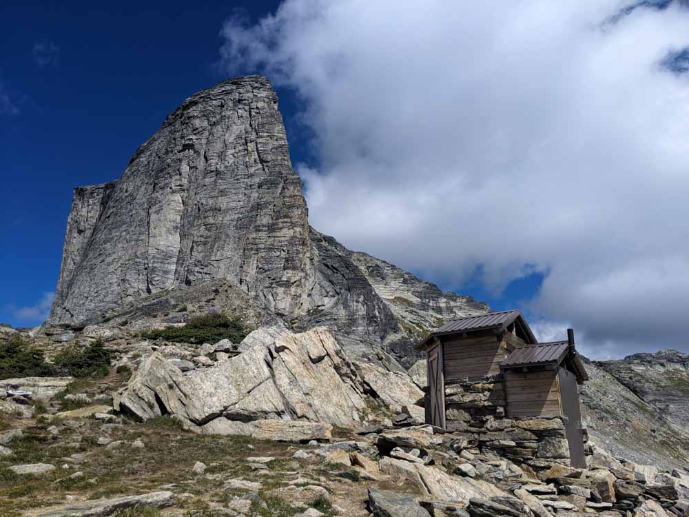
Gimli Ridge is a small alpine recreational area with hiking, climbing and alpine camping opportunities.
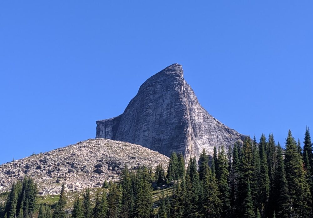
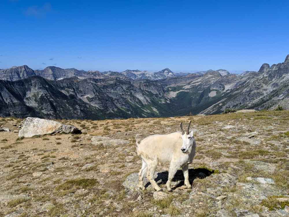
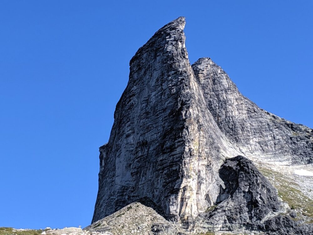
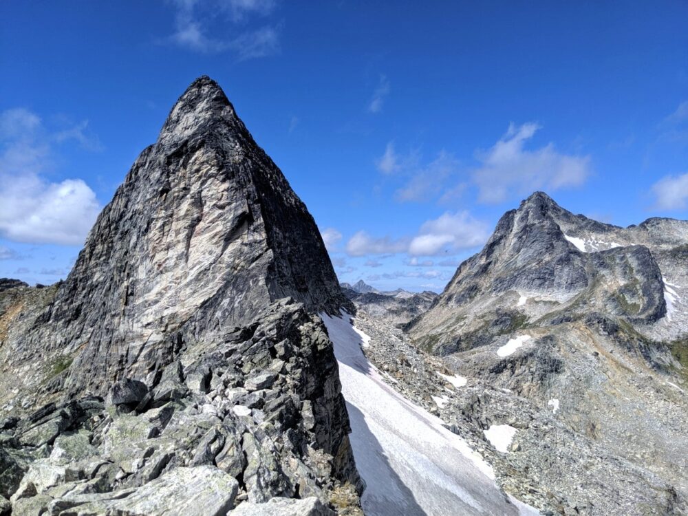
The main attraction is Gimli Peak itself, a dramatic 2803m high ‘horn’ of rock rising from a ridge. It’s a sight that has to be seen to be believed – I know I’ve never seen anything else like it anywhere in British Columbia!
The camping area on South Gimli Ridge is home to a number of mountain goats, which are (sadly) quite habituated to humans.
Keep your distance, be careful not to leave any food scraps and, of course, do not feed them. If you need to pee (or brush your teeth), use the outhouse or urinal at the base of Gimli Peak.
The goats LOVE the salt from urine but it is unhealthy behaviour for them that risks continued access to Gimli Ridge.
How to get to the Gimli Ridge trailhead
There are a couple of different approaches to Gimli Ridge, which meet at the final junction and 13km distance to the trailhead.
The first route is from the community of Slocan via Little Slocan North Road. The second is a southern approach from Highway 6 via Upper Passmore Road and then Little Slocan Main FSR. All roads are gravel.
There are blue directional signs at the major junctions, but they can be easy to miss. The final turn on either route is onto Bannock Burn FSR, which you follow all the way to the Gimli Ridge parking lot.
There’s no question about it, the access to Gimli Ridge (and Gwillim Lakes, below) is rough.
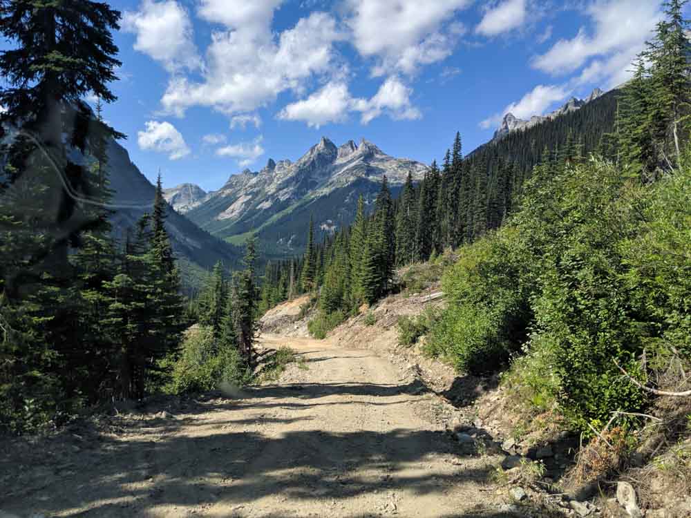
Even before turning onto Bannock Burn FSR, the road is dusty and jarring, with plenty of loose rock. Beyond that, it just gets worse, with the last 3/4km being the most challenging.
I wouldn’t describe it as a 4WD road (though it depends on your skill level) but high clearance is essential if you like your vehicle.
Bannock Burn is narrow, features a number of switchbacks and almost a hundred waterbars. It’s definitely a bumpy ride. The water bars are the biggest issue for low clearance vehicles – some are deep and there are so many!
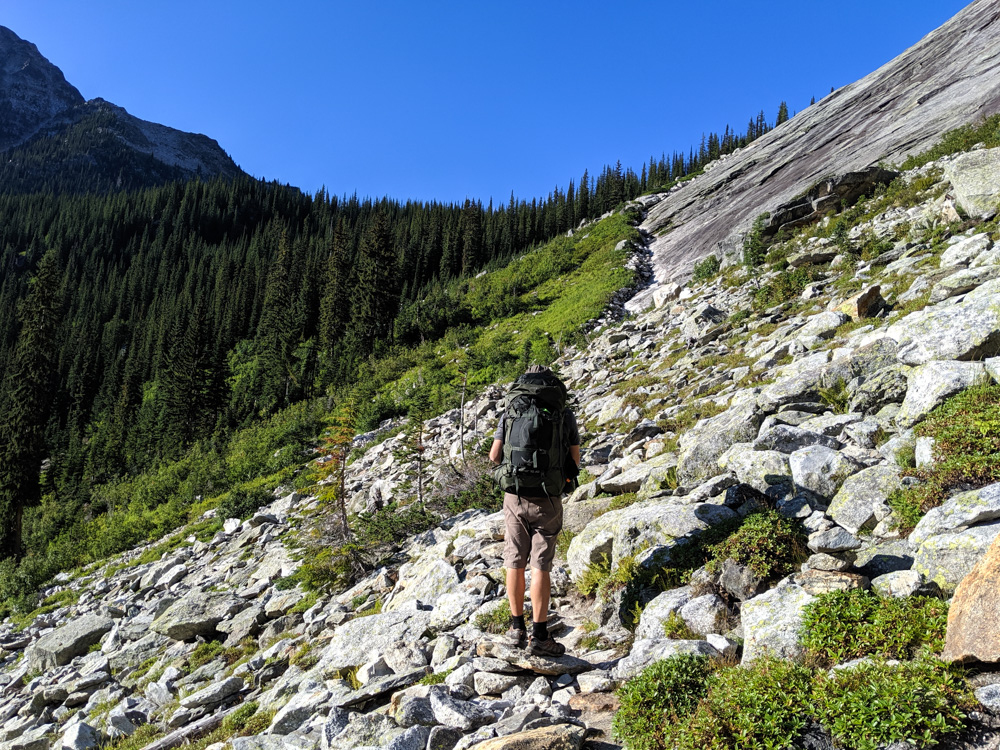
Hiking to Gimli Ridge
- The one way hike to Gimli Ridge is 3.4km, gaining about 550m elevation.
- I’d class it as moderate difficulty, mainly due to the elevation gained in the relatively short period of time. The trail is well established and was in good condition during our visit
- It took us 1 hour 40 to reach Gimli Ridge and 1 hour 20 to hike back down
- The optional side trip to the Mulvey Basin viewpoint is around 3km return with an extra 300m elevation gain. This is definitely more of a route than a trail and involving some scrambling over large boulders
- Our excursion to the Mulvey Basin viewpoint was just over two hours including an extended lunch break and a few wrong turns
Trail description
The impressive horn of Gimli Peak can already been seen from the small parking lot. The trail enters the forest, crosses a creek and then starts to steadily climb. A couple of switchbacks assist to gain quick elevation as well as a workout.
Soon enough, the trees start to peel away and you’ve reached the sub-alpine. The deep valleys below start to appear and Gimli is visible right ahead.
Rounding the ridge, the trail winds its way through and over the rock to deliver you on a saddle below Gimli. Time to take a break, take in the spectacular views and watch the mountain goats!
If you’re feeling adventurous, head towards the base of Gimli and look for a rough trail around to the left.
There’s a rough route leading along the steep slope towards a ridge. Try to stay high here (we went too low and had to scramble back up) but be mindful of the rockfall risk.
Eventually, the trail dissipates to a boulderfield. To reach the ridge proper, a bit of scrambling over the huge boulders is necessary.
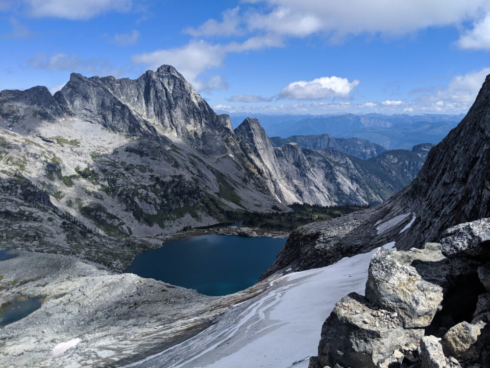
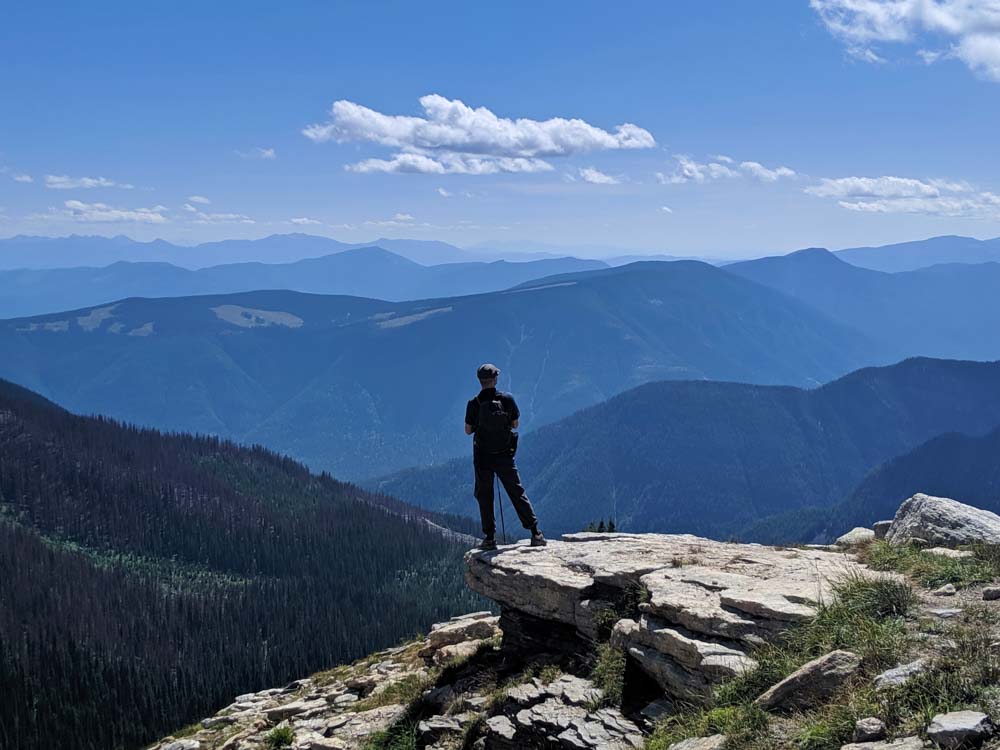
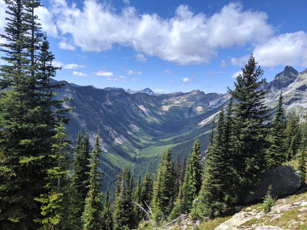
From the ridge (be careful of the edge, the drop is steep to say the least), there are stunning views over the Mulvey Lakes and the mountains beyond. Dramatic Nisleheim Peak (2580m) is situated to the left.
Camping on Gimli Ridge
Gimli Ridge features a primitive backcountry campground, popular with rock climbers attempting to summit Gimli Peak. The panoramas are pretty extraordinary.

- There are no facilities beyond a food cache and an outhouse (with a view)
- There are a number of different flat areas, providing some privacy and space from other campers (and goats…)
- Being on a ridge, the campground is exceptionally exposed to weather. Rocks have been used to create wind barriers around tent areas.
- I haven’t camped here myself but reports say that horseflies can be an issue.
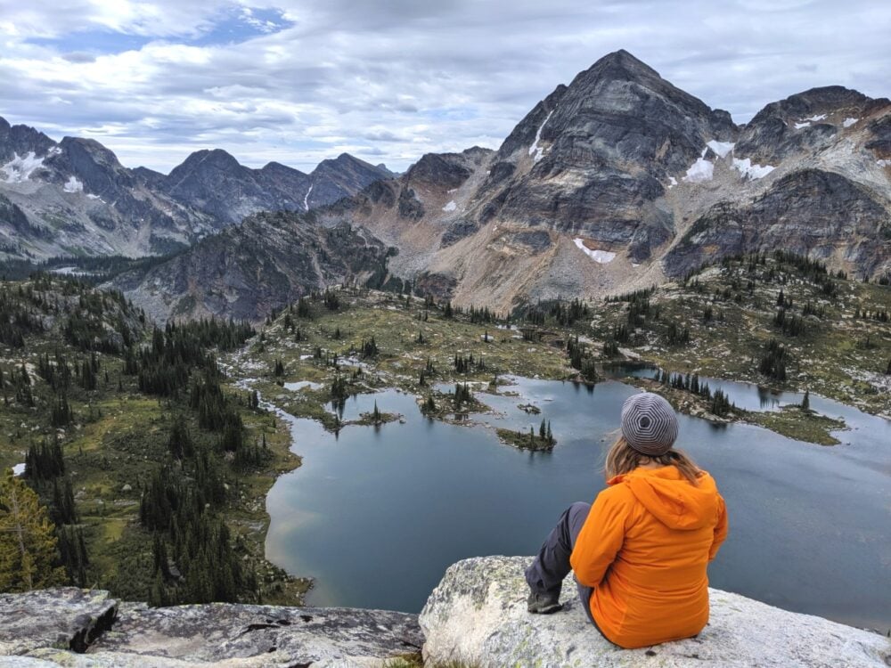
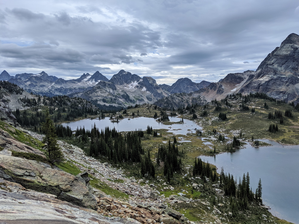
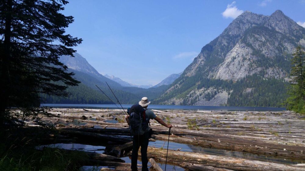
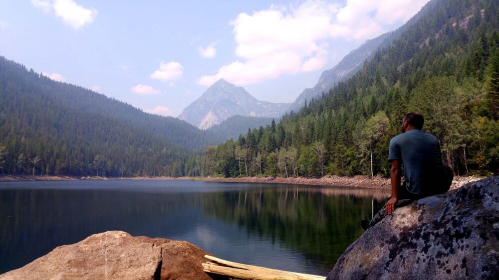
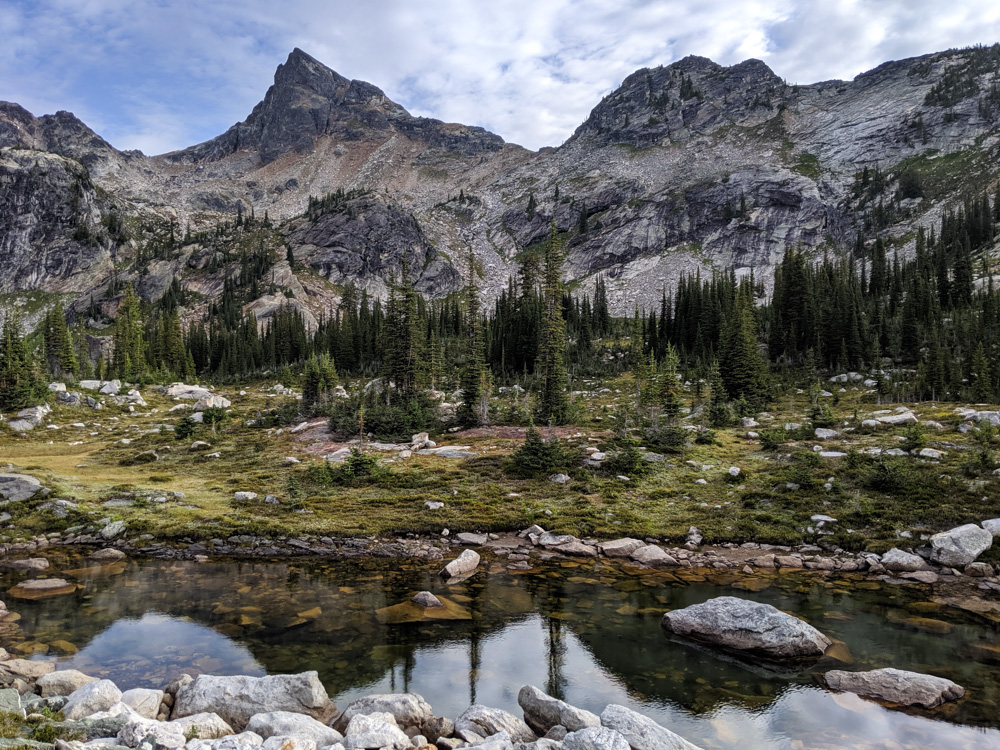
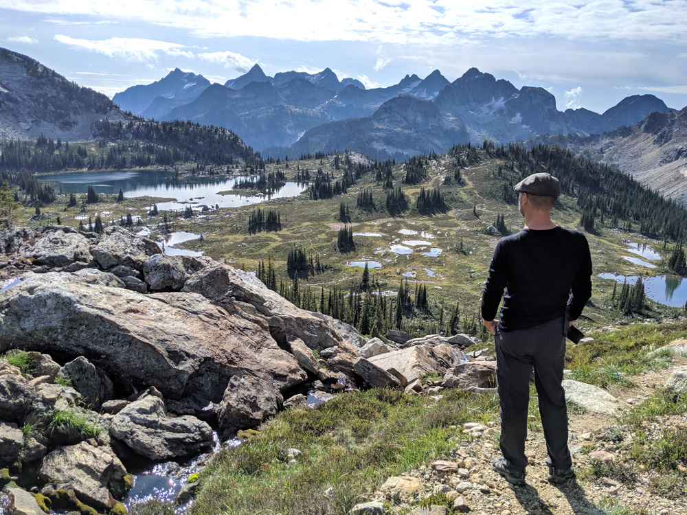
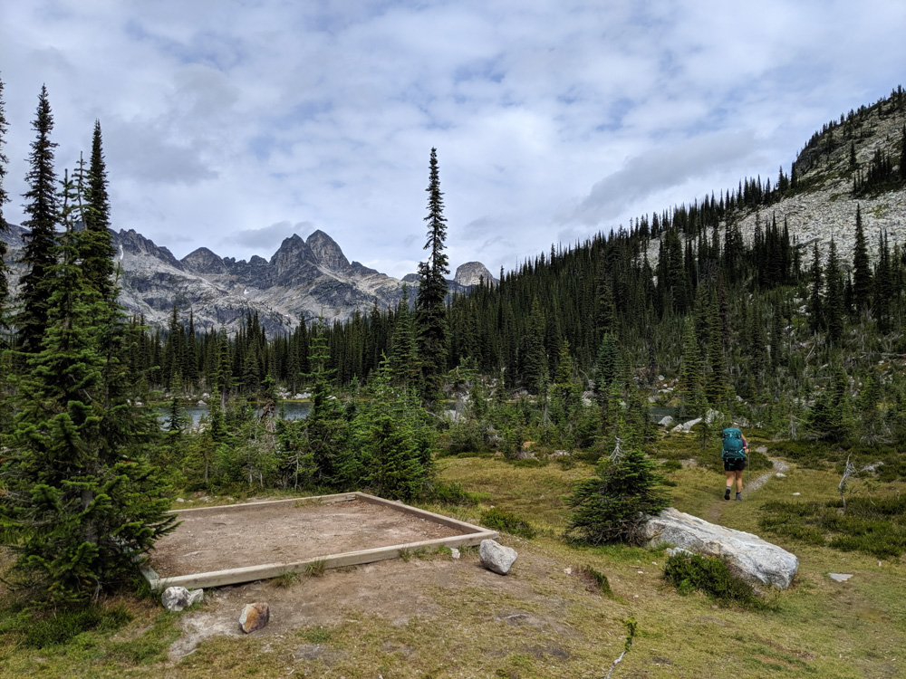
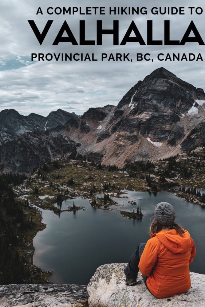
Gwillim Lakes
The Gwillim Lakes area of the park features a 6km long trail through Drinnon Pass.
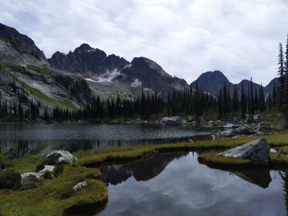
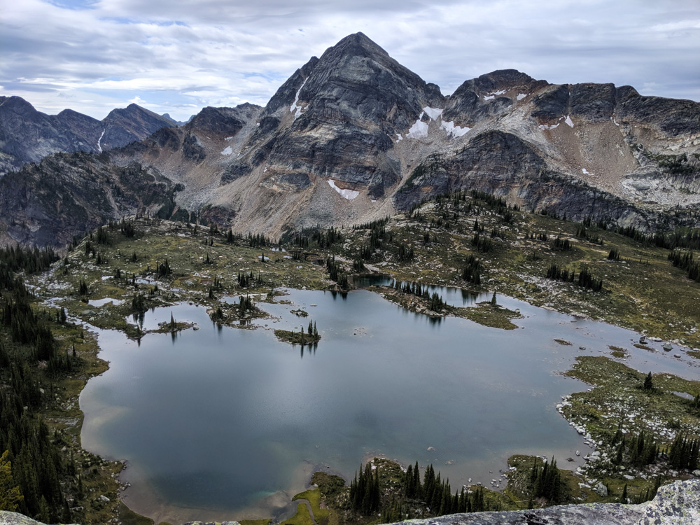
The hike is picturesque in itself but the real star is Gwillim Lakes, a gorgeously intricate landscape of alpine meadows and lakes, surrounded by grandiose mountain peaks.
Three different backcountry campgrounds offer a chance to stay overnight in this stunning area. Gwillim Lakes also makes an excellent destination for a day hike.
How to get to the Gwillim Lakes trailhead
Much like Gimli Ridge, there are two approaches to Gwillim Lakes.
The first route is from the community of Slocan via Little Slocan North Road, Little Slocan River FSR and Little Slocan Main FSR.
The second route is a southern approach from Highway 6 via Upper Passmore Road and then Little Slocan Main FSR. All roads are gravel.
There are blue directional signs (‘Drinnon Pass’ or ‘Valhalla’) at the major junctions, but they can be easy to miss.
The final turn on either route is onto Hoder Creek FSR. The Gwillim Lakes trailhead is found at the end of Hoder Creek FSR, at 21km.
The logging roads in this area are on the rough side, but the final stretch to Gwillim is a lot better than the one to Gimli Ridge (above). That is, with the exception of the last 2.4km of Hoder Creek FSR.
At this point, the road narrows and climbs upwards along what must be a dry creek bed complete with craters, large rocks and a very uneven surface.
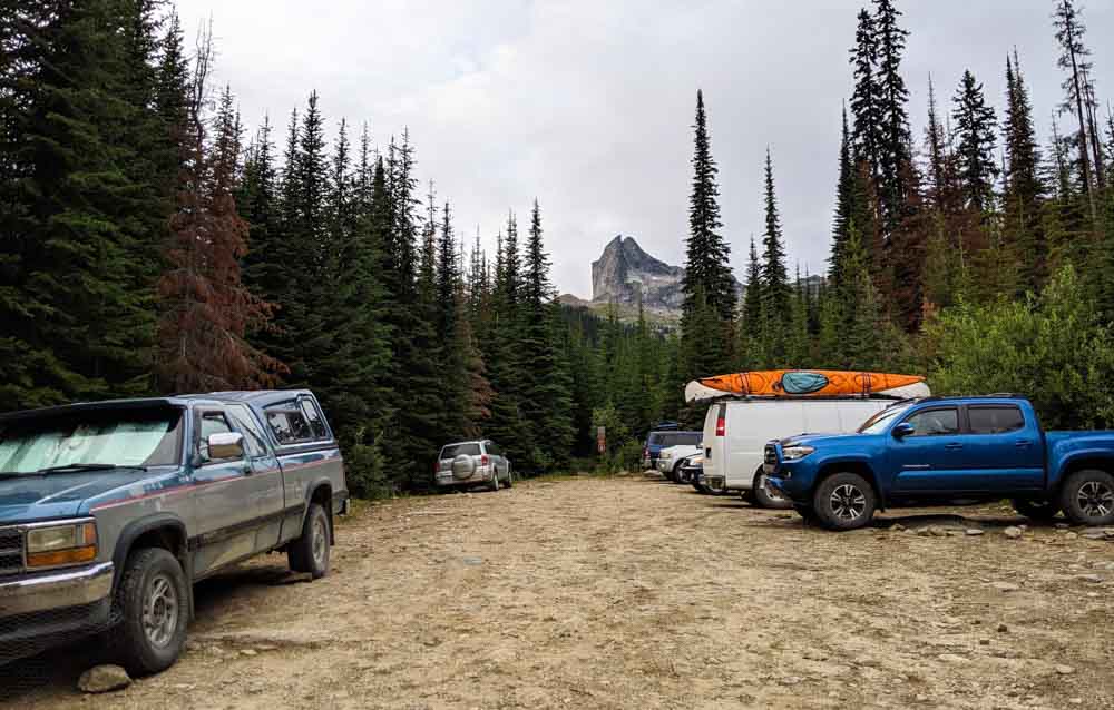
We started driving it in our (high clearance) cargo van but bailed out at the 1km mark. It was just too damaging on our vehicle.
It was tough to turn around but we managed it and parked in the open area just before the road narrows. At the time, there was space for about four or five vehicles here.
It was reported in 2019 that the Gwillim Lakes trailhead would be moved back sometime in 2020, with the final 2.4km blocked off and a designated parking area created at the bottom of the hill.
This would increase the hiking distance from trailhead to Gwillim Lakes but would avoid driving the roughest section of road. I believe this change was postponed.
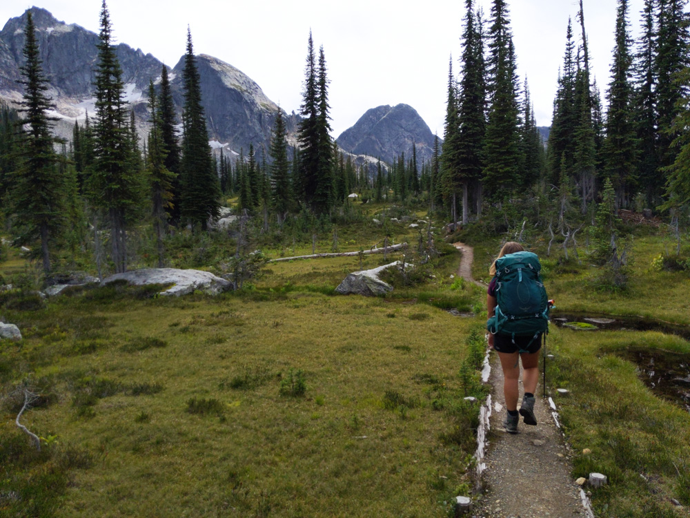
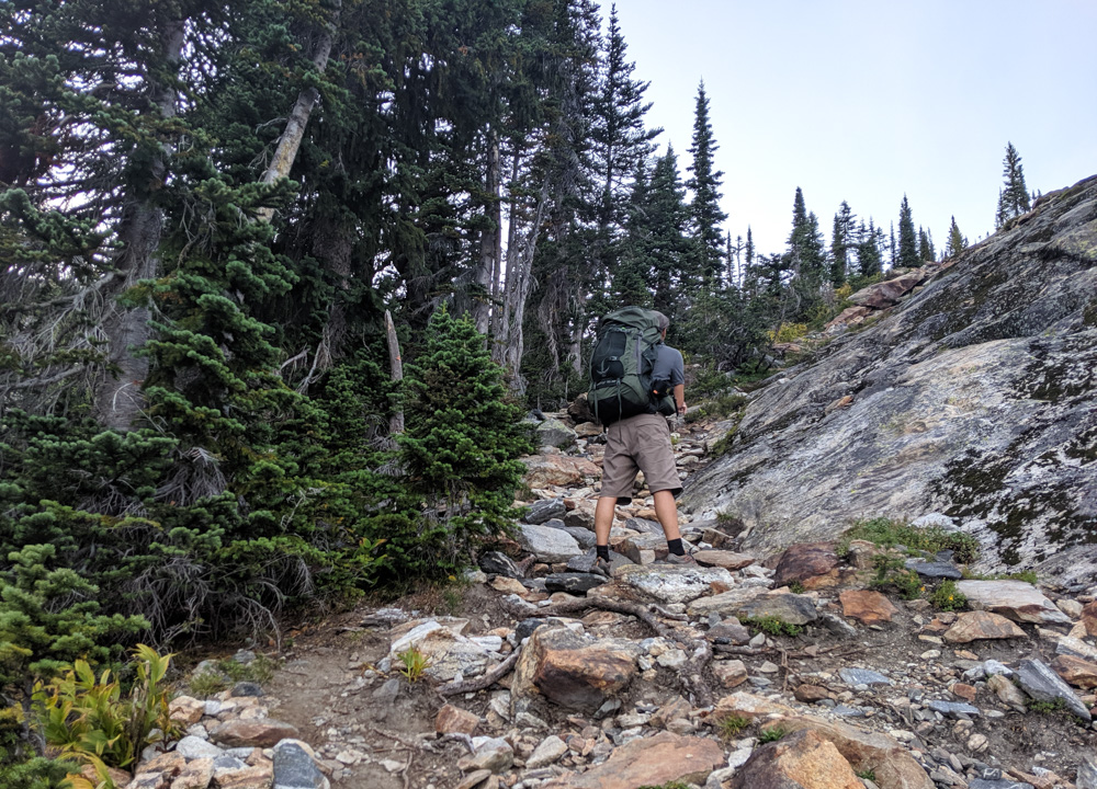
Gwillim Lakes Trail
- The one way hike to Gwillim Lakes is 6km from the current trailhead, with 660m elevation gain
- The biggest climb is between the trailhead and Drinnon Lake, though there is also a steep final ascent just before the Gwillim Lakes campground
- I’d class the Gwillim Lakes Trail as a moderate difficulty trail
- Besides the two uphill sections and rock slide traverse (which doesn’t last long and is marked for navigation), most experienced hikers shouldn’t feel too challenged. The relatively short 6km distance definitely helps.
- We reached Gwillim Lakes in 3 hours, hiking at a steady pace since sunset was approaching. Our return trip was 4 hours, with leisurely stops along the route.
Trail description
Starting off in the forest, the Gwillim Lakes Trail climbs quickly to reveal views of surrounding mountains.
The Valhalla Provincial Park boundary is reached while traversing a rock slide. Look carefully for the flagging to follow the right route across the rocks.
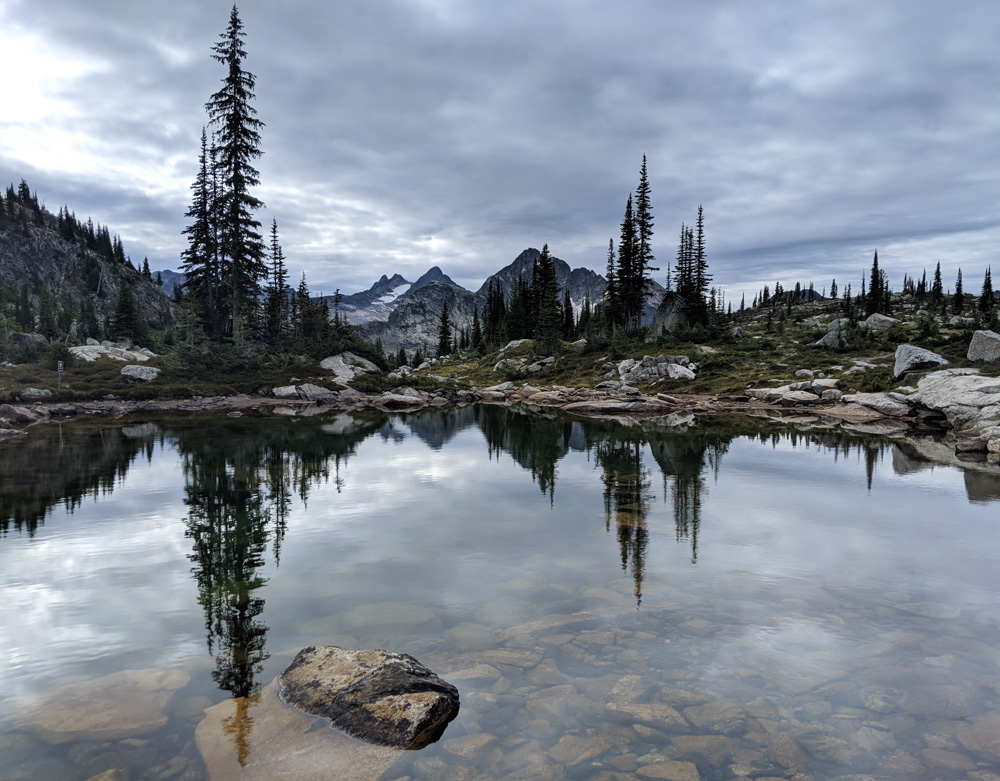
Switchbacks, steep at times, follow the rock slide. At the top of the ridge is Drinnon Lake, a pretty body of water accompanied by a handful of tent pads.
The tips of dramatic mountain peaks just inch over the treeline, providing a tease of the scenery to come.
The trail continues by skirting around the lake and ascending up to Drinnon Pass. The trees start to open up to reveal alpine meadows and tiny ponds. Time it right, and the wildflowers would be gorgeous.
A junction marks the exit for Drinnon Pass (Wicca Lake) campground before continuing to amble through more meadows before descending towards another lake. Across a couple of bridges and the trail finally starts the final climb to Gwillim Lakes.
It’s a bit of a grind but there are some pretty sweet views of the surrounding valleys providing a distraction.
Near the top, the trail crosses a rock face. Ascend this and you’re greeted by the enchanting landscape of Gwillim Lakes.
As mentioned above, it appears that the trailhead will be moved at some point in the near future.
In this case, the hike into Gwillim Lakes will be 8.4km rather than 6km, with a return distance of 16.8km instead of 12km. This is a reasonable increase, but we found the road quick and easy to hike. It took us an extra 40 minutes each way.
Other hiking trails in Gwillim Lakes
There are numerous other hiking opportunities from the Gwillim Lakes campground, both for serious alpinists as well as less experienced visitors.
For the adventurous hikers, the base of Lucifer Peak (northeast of the campground) is a popular destination.
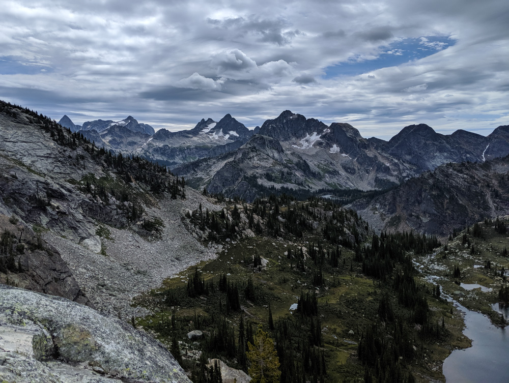
We didn’t quite go that far but scrambled up the same boulder strewn route to a ridge overlooking the lakes.
Alternatively, you can follow the Gwillim Lakes Trail beyond the campground up a set of rough switchbacks to reach a different ridge.

Gwillim Lakes Campgrounds
The Gwillim Lakes Trail features three campgrounds, each with an unique setting and distinctive vibe. As mentioned, all offer free camping.
Drinnon Lake Campground
Facilities: 3 tent pads, horizontal food cache, throne outhouse, lake
Location: 2km from trailhead
This fairly informal, spread out Gwilim Lakes Trail campground has a wonderful view of Drinnon Lake. The shoreline of the small lake is lined with driftwood. The tent pads here will receive less direct sun than those at other campgrounds.
BC Parks states that this campground has four tent pads, but we managed to find only three.
There are two relatively close to the trail (one is higher than the other) and the third is further down the overgrown shoreline.
One of the closest to the trail is huge, with enough space to fit two small backpacking tents, so perhaps it counts as four.
Drinnon Pass (Wicca Lake) Campground
Facilities: 6 tent pads, cooking area, vertical food cache, grey water pit, outhouse, lake
Location: 3.7km from trailhead
Somewhat confusingly, this Gwillim Lakes Trail campground has two names.
The website and trailhead signage refers to Wicca Lake but in person, the campground is called Drinnon Pass. So if you plan to stay here, look for the Drinnon Pass signs on the trail!
I was pleasantly surprised by this campground. Located 200m from the Gwillim Lakes Trail itself, it features six tent pads scattered around in a lakeside meadow with a stunning mountainous backdrop. The tent pads are spaced fairly well apart.
A designated cooking area (with food cache and grey water pit) is located just up the hill, closer to the main trail. The views from the cooking area aren’t quite as great but it’s still relatively open.
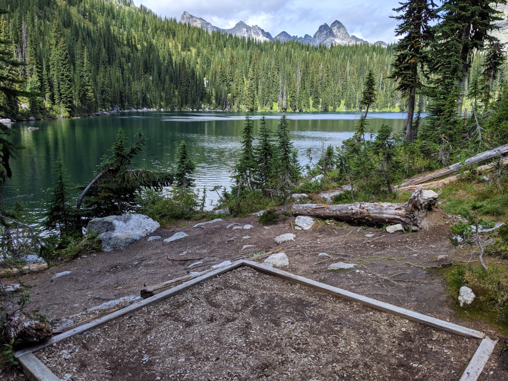
Gwillim Lakes Campground
Facilities: 12 tent pads, cooking area, vertical food caches, grey water pit, two outhouses, lake
Location: 6km from trailhead
Gwillim Lakes must be one of the prettiest backcountry campgrounds I’ve ever visited. The campsites are nicely spaced along the shore of one of the largest lakes, some only a rock throw from the water.
The BC Parks website mentions thirteen tent pads but we found only twelve.
Most of these are sunken dirt tent pads but a handful are raised tent platforms (important to note if you do not have a free standing tent).
Please do not camp off the pads – this will irreparably damage the meadows.
There are two outhouses, one with an interesting conveyor belt system.
The Gwillim Lakes campground has a communal cooking area close to lakeshore, with food caches, seating and sheltered cooking stands. There are a lot of cheeky ground squirrels in this area, so keep an eye on your food at all times.

Essential items for a Valhalla adventure
- Camp stove – Always bring a stove for cooking in the backcountry. We personally use a Jetboil MiniMo for boiling water for dehydrated meals. Campfires are NOT allowed anywhere in the Gwillim Lakes area at any time
- Backroad Mapbook – I highly recommend using a Kootenay Rockies Backroad Mapbook to navigate to Gimli Ridge and Gwillim Lakes. It’s also useful for reaching other great hikes and camping spots in the area
- Portable air compressor – We once blew a tire on a gravel logging road and with our spare tire being flat, we wouldn’t have got very far without our air compressor! We now always carry one. It’s come in handy to help other people too
- Bear spray – Valhalla Provincial Park is home to both grizzly and black bears. Stay bear aware at all times, carry bear spray in a holster and be familiar in using it
- Hiking poles – A must on any challenging trail, hiking poles have many benefits (balance, impact reduction, endurance, speed). We usually share a pair of collapsible, superlight Black Diamond Carbon Z hiking poles

Looking for more amazing hiking adventures in British Columbia? Check these posts out:
The Cape Scott Trail, Vancouver Island
The Heather Trail, Manning Park
Lake O’Hara, Yoho National Park
The 180km Sunshine Coast Trail
Mount Assiniboine Provincial Park
Iceline Trail, Yoho National Park
Eva Lake, Mount Revelstoke National Park
West Coast Trail, Pacific Rim National Park
Della Falls (Canada’s highest waterfall), Strathcona Park
PIN or save this post for future reference with one of the below images!

One half of the Canadian/British couple behind Off Track Travel, Gemma is happiest when hiking on the trail or planning the next big travel adventure. JR and Gemma are currently based in the beautiful Okanagan Valley, British Columbia, Canada. Consider buying us a coffee if you have find any of our guides helpful!
What a great place for an adventure! I always enjoy travelling with you, Gemma – keep those stories coming 🙂
Thanks Murray! Have you explored the Slocan Valley yourself much?
What a beautiful place to explore! I miss kayak camping even though we went a month ago:) Sounds like you will be back for a hike and more adventures!
Kayak/canoe camping is so fun! I like being able to take a few more luxuries than we usually would when backpacking. 🙂
Awesome pictures! We are planning a trip this summer to Banff/Jasper. Hoping to learn how to canoe/kayak by then to get on some lake!
Thanks Jose! Hope you consider making a detour into the Kootenays on your Banff/Jasper trip!
We’re going to do the hike to Gwillim Lakes in the park in July this year though the canoeing looks equally amazing.
That hike is on my wish list this year too! Along with Gimli. Maybe we’ll see you up there Leigh 🙂
So majestic!
Awesome trip report!!
This is really helpful.
Thank you very much:)
I’m glad you found it helpful Tempei! 🙂
What specific dates (July, August etc?) did you go for this trip? We’re doing this mid July and are somewhat nervous about snow/bugs/water.
Hi Chris,
Our visits to the alpine of Valhalla have always been in August. The photos in this post of Gwillim Lakes and Gimli are both from late August specifically. I had friends climb Gimli last year in early/mid July and they found snow on the ridge.
Hey – this is an awesome summary with many useful details (that are so often missing in travel blogs). I want to go. After reading this, I am keen to go! I have one major question though…… what would you think my chances are in getting a campsite later this August, in the Gwillim Lakes area? I would hate to travel all the way there and then find that the place is full. And have to hike back out. No-one (of course) actually knows the answer to this question, but I would be interested to know what you think. Just on a Weekday in late August. Or is it basically never really full?
Thanks again for writing a really good review (and not just ‘polluting the internet’ with a half-baked one!!)
C.
Hi Christof,
I’m so glad you found this post helpful. As for availability, it’s so hard to say. We last visited in late August (weekday) and Gwillim Lakes was very quiet – just one tent at Drinnon Lake, none at Drinnon Pass and only two other tents at the final campground. So based off our experience, I would have said you were fine. Having said that, there are a lot more BC residents out looking for backpacking trips this year so I would anticipate it to be busier. You’re doing the right thing going on a weekday though – I know it does get a lot busier on weekends, with the main campground overflowing.
@Gemma, Hi – me again – I didn’t get to go in 2021 🙁 and I believe the forest fire situation was really bad the following year, so I will finally make another attempt in 2025! My question is: is the Hoder creek road (except for the last bit of course) passable with a normal car – like a Honda Civic? I am assuming it is.
Christof.
Hi Christof,
I didn’t travel it last year so unsure of current conditions. My general rule with unpaved roads though is to take use a vehicle with high clearance.
Gwillim Lakes trailhead has been cleared of alder. Totally drivable in AWD and 4×4 vehicles. I was up there September 3-4, 2022. If moving the trailhead was a plan, it hasn’t been executed yet.
Thanks for the update Dana! Hope you had a good trip.
What a fantastic blog to find so much detail! Heading up to Gwillim Lakes this summer. Hoping to avoid bugs as much as possible. Any recommendations on a good timeframe for that area?
Hi Julia,
We had no issues with bugs when visiting Gwillim Lakes at the end of August.