The Sunshine Coast Trail is an incredible 180km hut-to-hut hiking route in south-west British Columbia, Canada.
The path weaves along and away from the coast, also featuring lakes, waterfalls, old growth tree groves, creeks, working forests, mountain peaks and panoramic viewpoints.

Read on to discover our own experience hiking the Sunshine Coast Trail (SCT), and then read the following comprehensive planning guide so you, too, can organise your own adventure on this magnificent trail!

Here’s what to expect in this post:
- Introducing the Sunshine Coast Trail
- Our Experience on the Sunshine Coast Trail
- Sunshine Coast Trail Hiking Guide

Last updated December 2023. We hiked the SCT in 2019, 2022 and 2023. Our first two trips were in partnerships with Sunshine Coast Tourism, the Sunshine Coast Shuttle and BC Ferries.

Backcountry necessities
- Always bring the 10 Essentials
- Know how to stay safe in the backcountry
- Remember to Leave No Trace to help keep the wilderness wild
- Understand how to avoid negative bear encounters
- Trying out backpacking for the first time? Read Backpacking 101
- Check out our packing guide with gear recommendations
- Sign up to our newsletter for a free backpacking checklist

Introducing the Sunshine Coast Trail
The Sunshine Coast Trail is a 180km hiking route from Sarah Point to Saltery Bay, travelling through both public and private lands. The total elevation gain is around 6000m for the entire route.
Canada’s longest ‘hut-to-hut’ trail, there are 16 shelters located along the SCT, plus additional camping opportunities.
There is no registration or hiking fee required to use the Sunshine Coast Trail, nor a charge for using the huts or wilderness campsites.

A brief history
The land on which the trail sits is the traditional territory of the Tla’amin Nation, one of the tribes of the northern Coast Salish.
The Final Agreement treaty, in effect from 2016, included 8,323 hectares of settlement land, some of which the Sunshine Coast Trail travels through.

The area is also the traditional territory of the Klahoose and Homalco First Nations.
The origins of the Sunshine Coast Trail go back to 1992 when a group of local enthusiasts formed the Power River Parks and Wilderness Society (known as PRPAWS or just PAWS), a non-profit volunteer organisation.

The initial aim, was to build a long distance hiking trail that would link the remaining old growth in the area.
Completed in 2000, the Sunshine Coast Trail is continually being improved today, with the newest hut at Sarah Point being completed in late 2021.
In 2022, PRPAWS became qPAWS. qathet is the name gifted to the local regional district with the meaning ‘working together.’ It is pronounced ‘KA-thet.’

Respect the trail
The Sunshine Coast Trail is unusual in that it is not located in a provincial park, national park or other protected area.
Traversing through a mixture of private and public lands, the future of the Sunshine Coast Trail relies on the courteous behaviour of trail users.
With the help of the BOMB Squad (the Bloody Old Men’s Brigade), the volunteer run qPAWS continues to maintain and enhance the SCT and huts.
Assistance, equipment, expertise and funds have been donated by many other local businesses and community members as well as provincial organisations.

When hiking the SCT, always follow Leave No Trace principles. Be kind to other hikers and share the huts and other provided facilities.
Take a few moments also to appreciate the incredible effort to make the SCT what it is today. After your hike, consider making a donation to qPAWS to help continue their excellent work.

Hiking the epic Sunshine Coast Trail: Our experience
The Sunshine Coast is one of our absolute favourite regions of British Columbia. The varied landscape here has so much to offer, especially in terms of outdoor adventure.
We also find the Sunshine Coast to be relatively quiet and undiscovered, despite being so close to both Vancouver and Vancouver Island.

This section of the guide will feature a day to day overview of our experience on the SCT. It is possible to skip directly to the hiking guide.
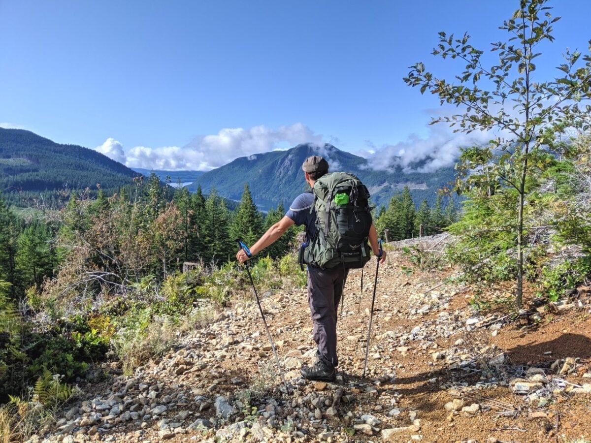
In September 2019, we hiked what is often called the most difficult section of the trail – Inland Lake to Lang Bay, taking in Tin Hat Mountain, Elk Lake and Walt Hill (kilometre 64 to 134).

Following the pandemic and the reopening of the SCT huts, we returned to the Sunshine Coast in May 2022 to hike the most northern stretch of the trail – Sarah Point to Inland Lake (kilometre 0 to 64).
- Sarah Point to Inland Lake (in reverse)

We finally made it back to the Sunshine Coast in August 2023 to hike the final section of the SCT, from Lang Bay to Saltery Bay (kilometre 134 to 178).

Sarah Point to Inland Lake – kilometre 0 to 64
We hiked this section of the Sunshine Coast Trail in May 2022. For a couple of different reasons, we decided to hike the trail in a northerly direction. So we started at Inland Lake and finished at Sarah Point.
After more than two years, we were so excited to return to the Sunshine Coast Trail. Though the trail was open during the pandemic, we decided to wait to until the huts were officially reopened in April 2022.

Day 1 – Inland Lake to Little Sliammon Lake (21.5km, 9 hours)
Our day began with a ride from Lund with Sunshine Coast Shuttle, to the exact point on Inland Lake where we started our last SCT hike. The sun was shining – our day was already off to a great start!
Within just a few kilometres, I was reminded why I loved the SCT so much. The lush environment just oozes with life everywhere you look – ribbiting frogs in the peaceful lakes, delicate mushrooms on fallen wood, striped snakes in the bushes and old growth branches covered in moss.

Arriving onto Powell Lake, it was interesting to see this huge waterbody from a different perspective. We finished the Powell Forest Canoe Route here some years ago.
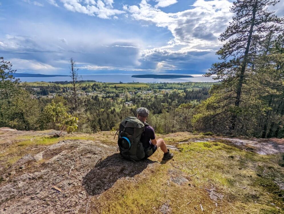
Tony’s Point, named in memory of a PRPAWS trailbuilder, was the perfect place to take it all in.
Ignoring the intoxicating smell of fish and chips at the Shingle Mill Pub, we ascended the side of Scout Mountain to find outstanding views of the Powell River, Ahgykson Island, the Salish Sea and even Vancouver Island. We had timed it just right to watch a Snowbirds demonstration, with the pilots looping into the sky.

Not wanting to miss anything, we followed the side trail up to the summit area for even better panoramas. While it was worth the extra effort, it did sap our energy for the rest of the afternoon.
For the first multi-day hike of the year, I knew this particular day was a bit ambitious. My GPS recorded our total distance as being closer to 25km.
Needless to say, we were pretty worn out by the time we arrived at Little Sliammon Lake. Luckily, the Shangri-La campsite exceeded our expectations with a beautiful dock, shelter and cosy tent spots.

Day 2 – Little Sliammon Lake to Rieveley’s Pond (10km, 5 hours)
We were both looking forward to this short day after such a long first one. Our movements were definitely on the slower side.
Leaving our lovely little campsite behind, we weaved our way between lakes and ponds and up onto scenic bluffs. The sun was hiding but the calmness of the weather provided exceptional lake reflections.

The second part of the day was all about waterfalls. And we didn’t even set out to chase them! We seemed to find impressive cascades around every corner of the trail.
Spoiled for choice for lunch spots, we took a few more breaks than usual. I was tempted to take a long sojourn at Appleton Creek as well, under a towering canopy of old growth Douglas Fir trees.

Rieveley’s Pond hut was just around the corner, however. This tranquil place is best known for its soothing chorus of frogs.
As well as the amphibians, we were joined by a family from Penticton (also our home town). It was our first time sharing a hut on the SCT. With a dog in their party, the friendly group opted to sleep downstairs.

Day 3 – Rieveley’s Pond to Manzanita Bluff (17km, 6 hours)
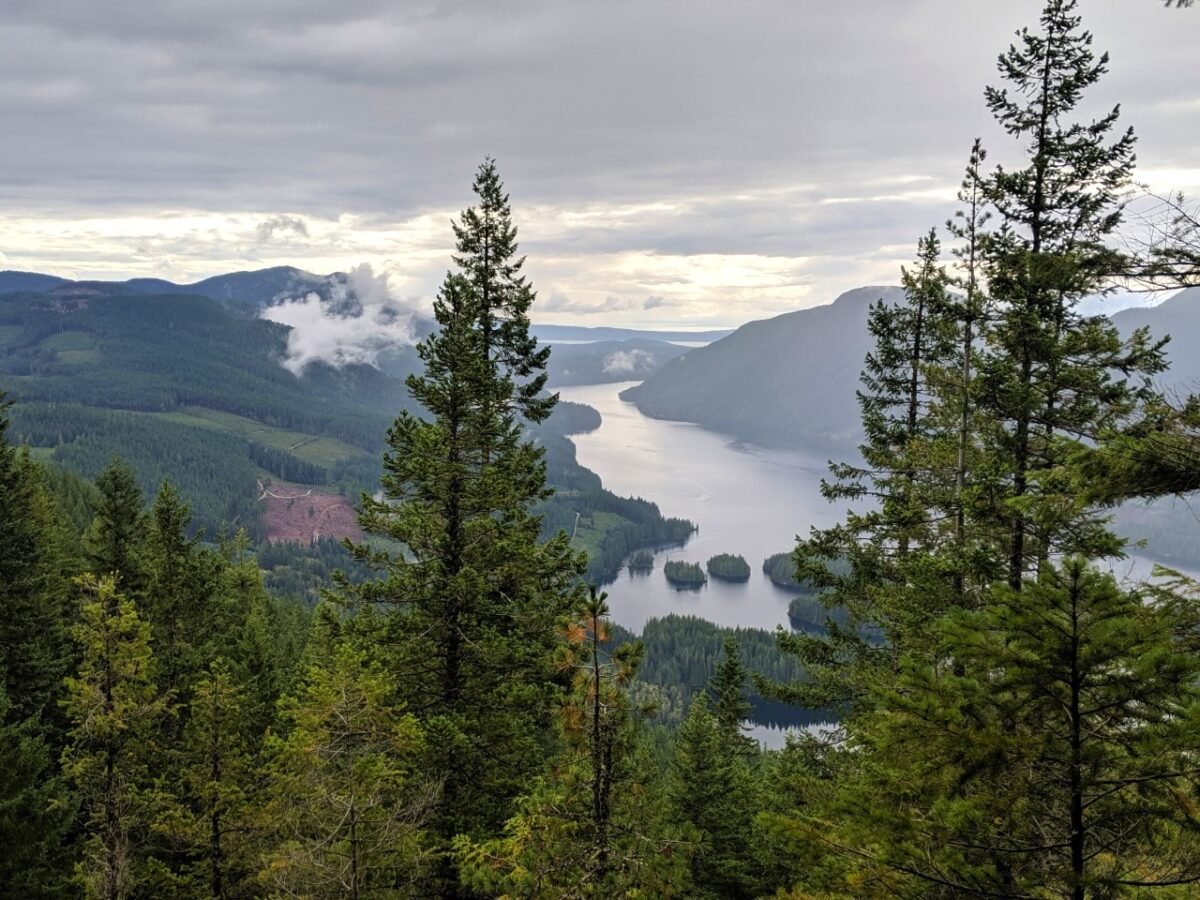
With rain forecast for the afternoon, we left Rieveley’s Pond early. Despite still being a bit tired, we took the side trail to the Gibraltar viewpoint.
And wow, what a detour! The sweeping vistas of the Sunshine Coast, Salish Sea and Vancouver Island are truly spectacular. We felt very glad to have waited to enjoy our breakfast with a view.

The rewards continued with even more gorgeous old growth trees, rushing creeks and waterfalls.
We were also surprised by a stretch of alder forest featuring thin, ghostly white trees swaying in the wind.

The moss and mushrooms became more plentiful again as we headed towards Plummer Creek campground, our planned lunch spot.
Progress was impeded by rain and wind in the afternoon, as well as the need to collect water before heading up the Manzanita Bluffs.

The final climb up to the Manzanita hut was easier than I expected, though the view was just as wonderful as we’d heard from other trail users.
The hut was almost full that night, with five other hikers. The weather cleared up just enough to reveal a sunset, before doubling down into a storm. The arbutus trees groaned in the wind all night, accompanied by torrential rain.

Day 4 – Manzanita Bluffs to Sarah Point (17km, 6 hours)
Knowing that the wind was predicted to ease up late morning, we delayed our departure from the Manzanita hut. Eventually, however, it was necessary to venture outdoors and into the rain.
And let me tell you, there’s no rain quite like West Coast rain! It was absolutely pouring from the sky that day, hammering so hard on our jackets that it was hard to hear each other.

I could barely take my camera out for photos without fear of flooding it.
It seemed appropriate that the forest here was as lush as we’d seen it anywhere on the trail, with huge ferns and a carpet of moss. Through the rain and mist, we spotted a number of old growth trees.

Stopping wasn’t really an option as we became cold very quickly. Our first goal was to get to the new Bliss Portage hut at the (roughly) half way point to warm up and eat lunch.
The shelter was very welcome but we still didn’t stay long. After climbing up and down the next hill, we realised we had make the right decision. The creeks were starting to flood.

We jumped our way across several crossings and hopped over a couple of brand new streams. The trail to Feather Grove campground was completely under water, though we did wade through to check out the views from the rocky beach (stunning!)
A raging river led us up our final climb towards Sarah Point. It was a relief to reach dry trail at the top! Traversing around the point itself, we soon dropped down to sea level and found ourselves hiking through a waterfall.
The Sarah Point hut was waiting on the other side, just beyond the end of the 4X4 road. We had finished this section of the SCT and arrived at kilometre 0!

Day 5 – Sarah Point to Lund (by boat)
The Sarah Point hut was completed in autumn 2021, so we were excited to check out the brand new build. So excited, in fact, that we intentionally planned our trip so we could easily spend one night here!
And it was absolutely worth it.

This new hut is absolutely stunning, offering panoramic views of the Salish Sea with Cortes Island, Twin Islands and Hernando Island as a backdrop. With the rain clearing up a little by evening, we enjoyed an orange toned sunset.
The sun shone the next morning, with blue skies in every direction. We travelled back to Lund in style, with a Zodiac boat ride from Terracentric Adventures.

Not only was the ocean the calmest it could be, our guide took the time to show us a 400 year old pictograph on a rockface on the way. Despite exploring the area many times in kayaks, we had never seen it before.
We were reunited with our van in Lund less than 45 minutes later. Another successful hike on the SCT!

Inland Lake to Lang Bay – kilometre 64 to 134
We hiked this section of the Sunshine Coast Trail in September 2019. We travelled in a southerly direction, as SCT hikers do.
Our original plan was for a five day, four night trip, averaging no more than 15km a day. Our plans changed a little, as you’ll discover.

Day 1 – Inland Lake to Confederation Lake (10km, 4 hours)
Dropped off shortly before kilometre 65, the flat path around Inland Lake offered a chance to slowly ease into our 62km hike.
After checking out the Anthony Island cabin (older style, small and dark), we started the climb up to Confederation Lake. I soon felt glad of that easy section around the lake, as the path ascended up through the dense rainforest.

With days of rain already, the streams and waterfalls were bursting with water and the soaked ground was almost bouncy in places. Thick moss shined with raindrops and mushrooms seemed to sprout from everywhere (I’ve never seen so many varieties).
The climb was tiring in places but the glint of Confederation Lake didn’t take too long to appear. The route around the lakeshore was surprisingly long and full of slippery obstacles.
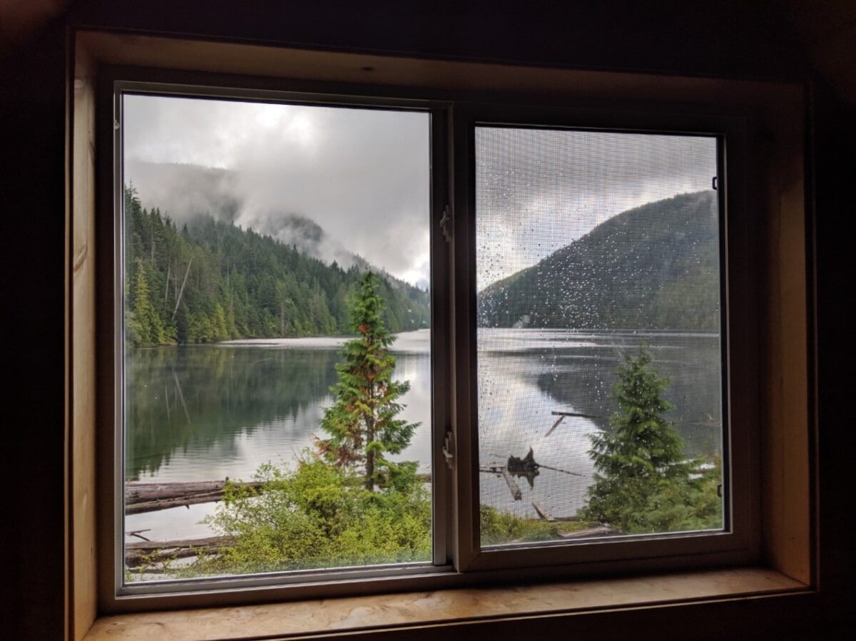
But finally, our first Sunshine Coast Trail hut appeared! And what a well built and maintained hut it was, with an incredibly pretty outlook of the still lake.
Although still relatively early, we were happy to put down our packs and settle in for the afternoon. There wasn’t a soul to be seen so we had the hut to ourselves through the stormy night.
Day 2 – Confederation Lake to Tin Hat Mountain (14km, 7.5 hours)
Hiking between Confederation Lake and Tin Hat Mountain isn’t a great distance but the elevation is intimidating. Confederation Lake sits at 600m, Tin Hat hut at 1150m but the trail descends down almost to sea level (150m) in the middle.

Yep, that’s an initial loss of 450m and a gain of 1000m elevation without even taking into account the meandering nature of the trail in general!
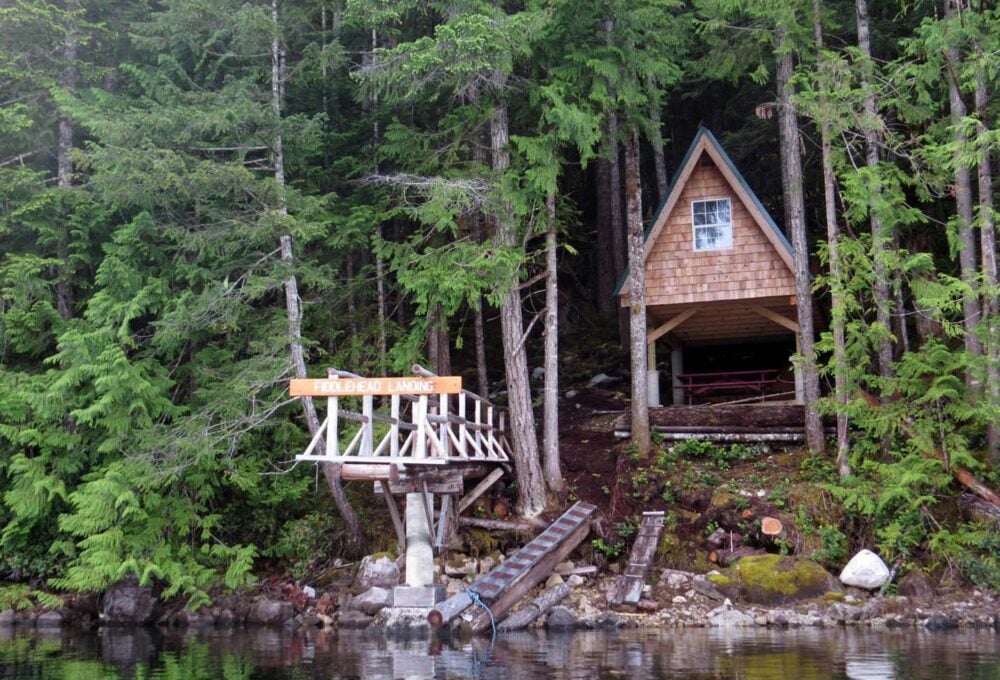
The day passed better than I imagined, however. The rain was on and off, offering teasing, misty views at ‘Vomit Vista’ and heavy showers during lunch at Fiddlehead Farm (thankfully, there’s a shelter). We had to climb over some trees brought down by the storm, very close to a logging operation.
Post-lunch, the foliage became mossier, the bridges slipperier and the mushrooms even more numerous.
And then, the climbing began. Slowly at first, but then…steep switchbacks. It felt never ending at times, not helped by the red kilometre markers disappearing for a time.
A stream heralded the start of the end, said to be around 3km from the hut itself. We gathered water, not knowing yet that there would be a filled-to-bursting rainwater barrel at the top.
A wide but rough 4X4 road appeared, leading almost to the top of Tin Hat Mountain. The flat sections were covered in deep puddles of water.
The path narrowed again to huge boulders, which required a very small amount of scrambling. I waited for JR near the top, snapping a couple of photos of the view and yelled down that he should hurry.

Day 3 – 24 hours on Tin Hat Mountain
Within 30 seconds of our arrival to the Tin Hat Mountain hut, we were swallowed by a giant cloud. The 360 degree views we were promised were gone, just like that.
It soon becomes clear that the cloud wasn’t going away anytime soon. We were firmly socked in.

That evening, we took stock of our food supplies and hatched a plan. We came to see the views and we’d just have to ration our food and wait it out. It was frustrating, but such is the unpredictable way of nature.
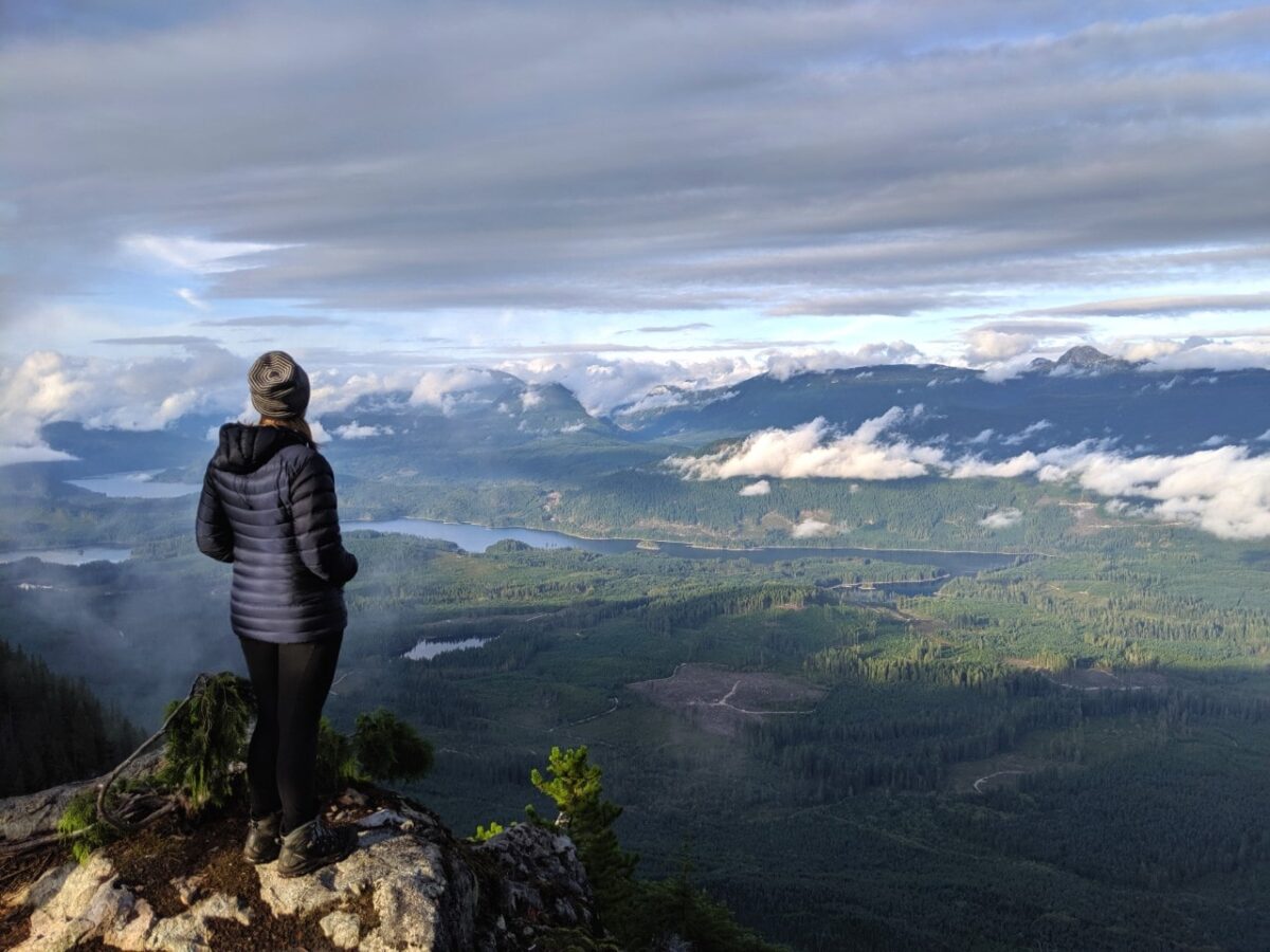
It took almost 24 hours (and plenty of Yahtzee) for the cloud to dissipate a little. We were able to see a foggy, yet atmospheric sunset from the Tin Hat summit, with glimpses of the promised lakes below. Most of the mountains are still shrouded in cloud, however.
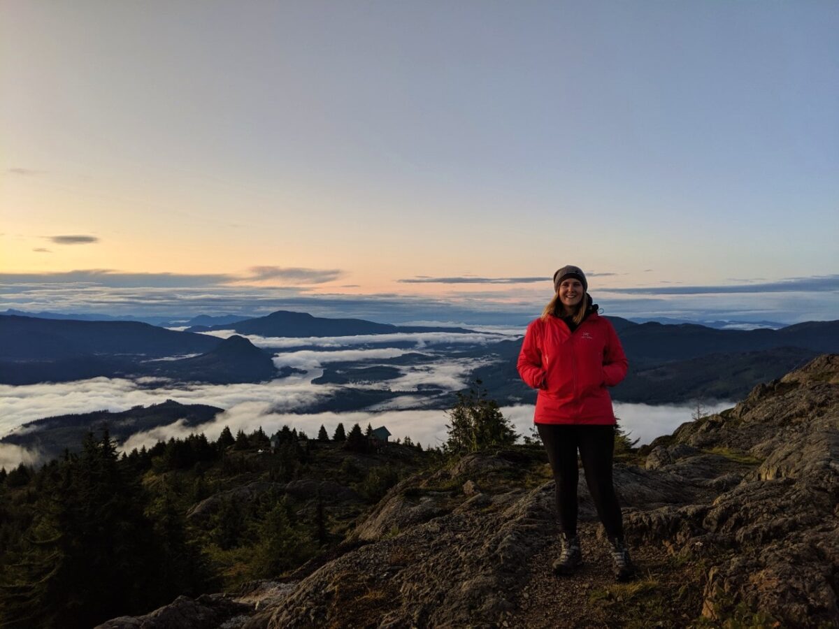
The next morning, we wake at 6am with plenty of hope. We quickly scrambled up to the summit behind the hut and kept our fingers crossed.
Surrounded by mountain peaks, with low clouds blanketing the ground, it felt like we were on top of the world. The sunrise is as epic as we hoped and worth every single second of waiting.
Day 4 – Tin Hat Mountain to Elk Lake (13km, 6.5 hours via shortcut)
The day continued as awesome as it started, with wall-to-wall blue skies. We were sad to leave the beauty of Tin Hat but our food supplies were now on the low side. Another day at Tin Hat was simply not an option.
My research before this trip indicated that the section from Tin Hat to Marsh Lake via Lewis Lake isn’t particularly interesting. It is also often impacted by active logging activity, so the route changes often.
With the temptation of a short day in mind, we decide to take a short-cut through an older path of the SCT (Option A, if you’re using the guidebook).

The rocky trail led through saddening clear cuts. On the upside, the views were open, the skies sunny and we were able to dry out our souls a little.
We met a day hiker on the old logging railway section and chatted for a while. He would be the only person we see for the entire six day period!

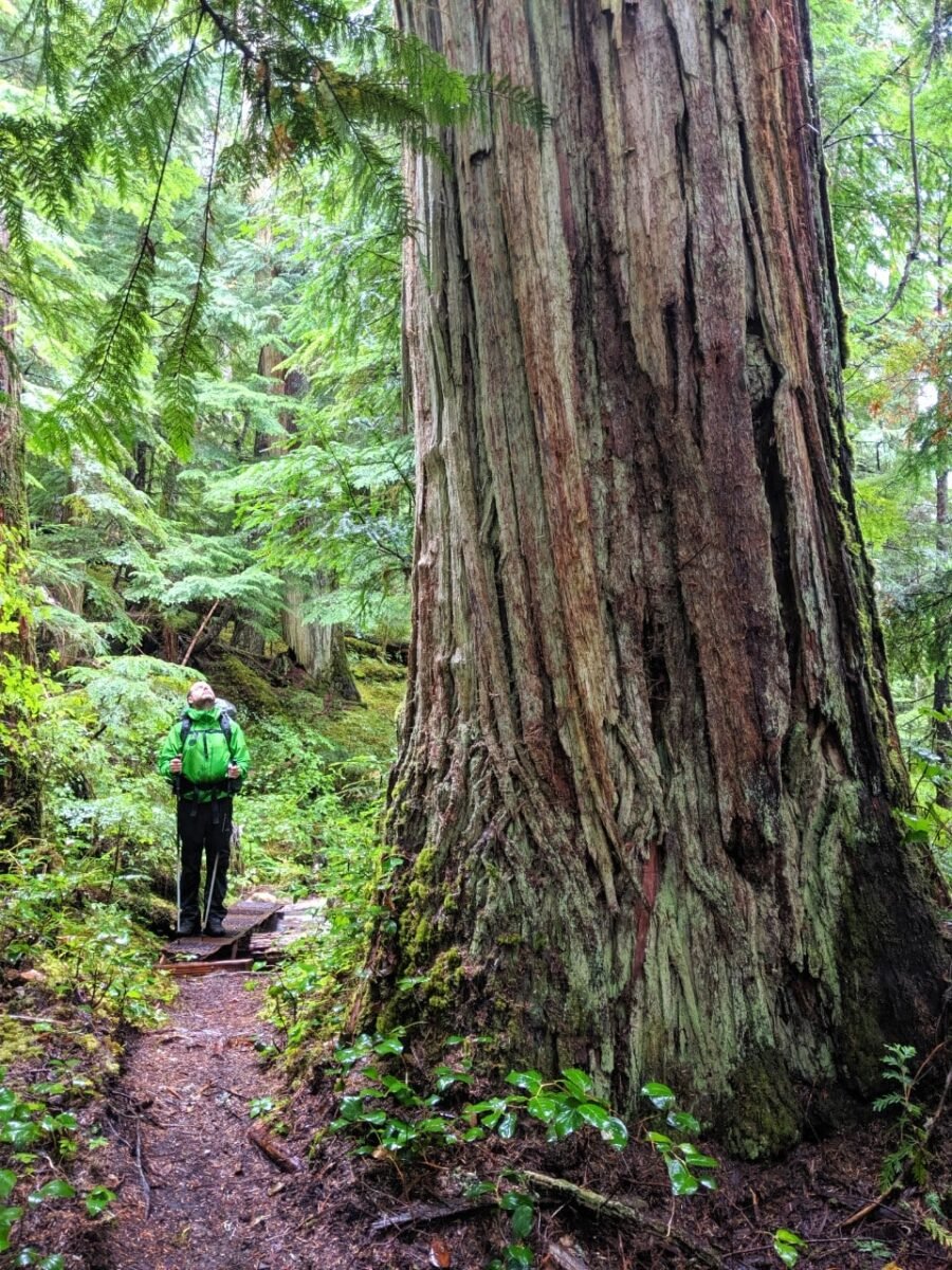
This is also the day we became acquainted some incredible old growth trees. Perched just below a logging road, these huge Douglas Firs seemed to reach all the way to the sky.
The real challenge came in the last 1.5km with the hill to end all hills. I was glad to see the Elk Lake Hut, peeking out of the brush. JR immediately went for a swim in the pristine lake while I sunbathed on the dock. A perfect sunny day on the SCT.

Day 5 – Elk Lake to Walt Hill (14km, 5.5 hours)
With the rain returning with a vengeance, we spent much of the next day back in the clouds. The path was narrow in places and the overgrown foliage dripped even more raindrops onto us.
We stopped at misty Coyote Lake for a snack, where the motionless surface blended perfectly with the milky sky.

Viewpoints passed with little to see, until we reach the ‘Walt Hilton’ emergency shelter at kilometre 120.5. Here, the elevation could finally be appreciated.
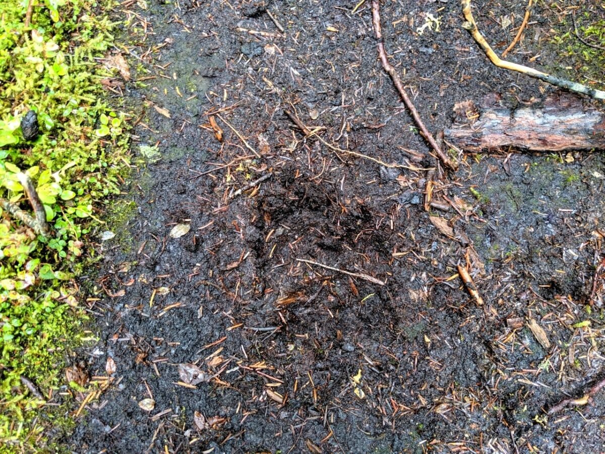
Ripe blueberries started to line the twisty trail. Prior to this point on the SCT, the blueberry season had been and gone. We picked a handful or two and started calling out for bears in earnest.
Our instincts were proven right as we discover very fresh bear tracks around one of the blind corners.
The upturned dirt surrounding the tracks implies that the bear was probably startled and ran off in a hurry. Like us, the bear had probably not seen or heard any other life on the trail for days.
After a short detour to get water at Walt Creek (in hindsight, we should have dropped our packs first and then backtracked), we arrived at wonderful Walt Hill hut.
The outlook here isn’t quite as panoramic as Tin Hat but the lake studded backdrop is still stunning. Had the weather been better, we may have camped on the tiny wooden platform right in front of it all.
Day 6 – Walt Hill to Lang Bay (11km, 4 hours)
Our final day was mostly downhill, an almost literal comedown. Though steep in places, we moved fast through Suicide Pass and Smokey’s Blue Ridge.
We stopped at one of the picnic areas for a while to try and slow things down a little and take in the last of our Sunshine Coast Trail experience.

Most impressive along this section were the huge fallen trees (see example above) and logging artefacts. We also passed some lovely camping areas, perfect for thru-hikers looking to escape the huts during the busier months.
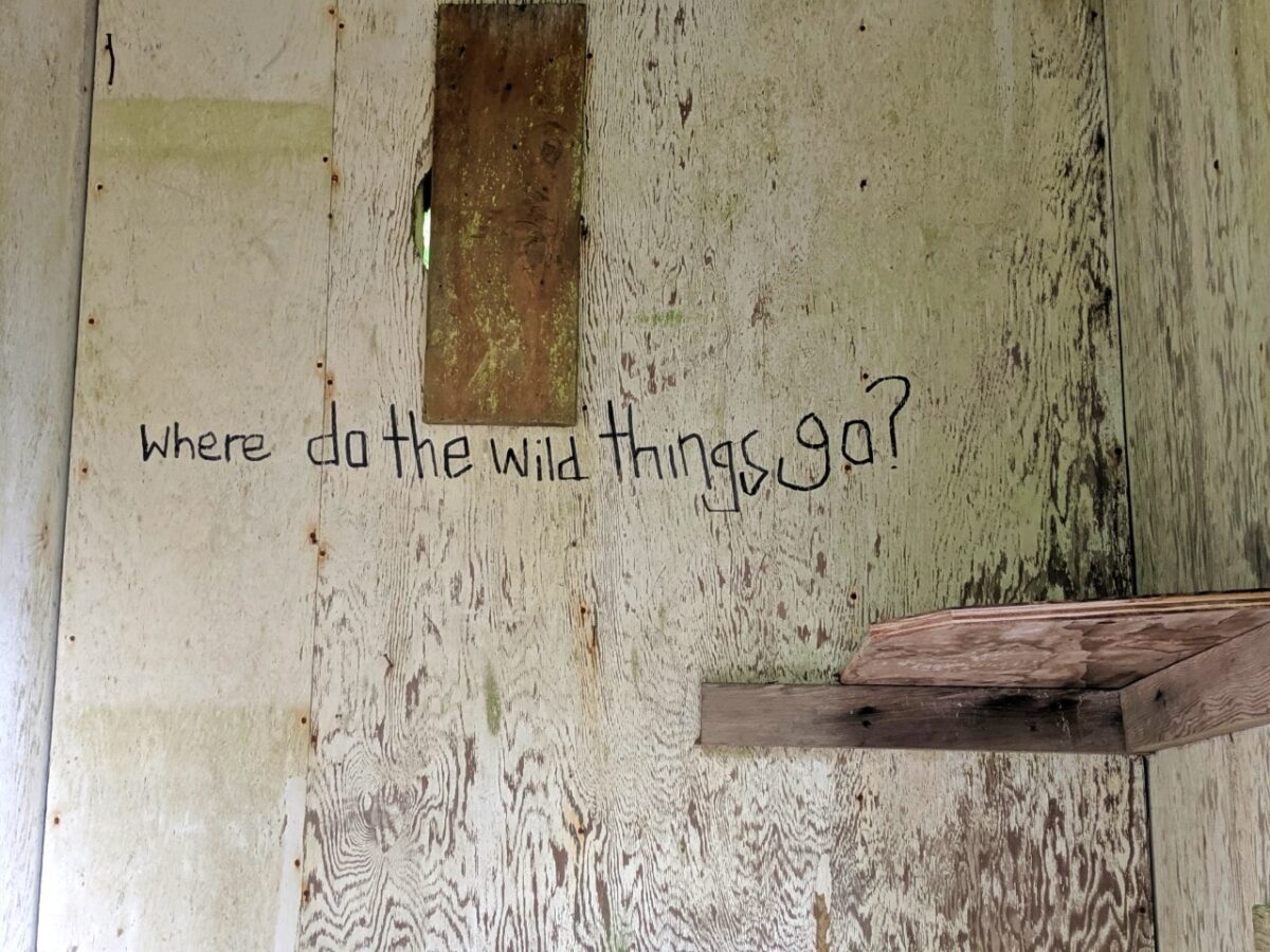
The strangest sight had to be a tea party along the trail. I won’t give any more explanation (mostly because I have none) so you can hike the trail and discover that for yourself.
Just after kilometre 134, the path intersected Dixon Road and we followed this back to our vehicle. A slightly anti-climatic end it may have been but the sun was shining (hooray!) and a portion of fish and chips were calling our name. Thanks for the memories, SCT – we’ll be back to finish soon.

Lang Bay to Saltery Bay kilometre 134 to 178
After having to cancel two planned backcountry trips due to wildfires in August 2023, we decided that finishing the Sunshine Coast Trail would be a worthy replacement.
With the Sunshine Coast being one of our most favoured shoulder season destinations, it felt strange to be hiking in the middle of the summer!

Day 1 – Lang Bay to Golden Stanley hut (11km, 4 hours)
Our original (albeit very last minute) plan for this trip was to take the 12.55 ferry from Earls Cove, park at the ferry terminal in Saltery Bay and then catch the 14.10 bus to Lang Bay and start hiking.
As it was, the ferry was late and we were the very last vehicle to get on.
Consequently, we had to go to plan B, which involved parking at the Lang Bay Community Hall and then catching the same bus at Saltery Bay on our last day back to our vehicle.

With this late start in mind, our first day back on the SCT was never going to be very long in terms of distance. Golden Stanley seemed like a reasonable goal.
Our first challenge was crossing the river below the Lois Lake dam. In mid August, this wasn’t an issue, with water levels being so incredibly low.

The rest of the day was spent meandering along the shoreline of Lois Lake, a classic up-down section of the SCT. Along the way, we found some interesting old artefacts, a beautiful lakeside campsite and a ferocious wasp nest.
While it wasn’t a super hard day, I was pretty happy to arrive to the (empty!!) Golden Stanley hut. We enjoyed the sunset while eating dinner and then quickly went to bed.

Day 2 – Golden Stanley hut to Rainy Day Lake (24km, 9 hours)
To be able to make the last bus back to Lang Bay, we had worked out that we needed to hike to either Rainy Day Lake or Fairview Bay on our second day.
The 24km distance to Rainy Day Lake was intimidating enough, but it also came with 1000m elevation gain and almost the same in loss as we were heading over the SCT’s highest point – Mount Troubridge (1302m).

And no kidding, this was a difficult day. And interestingly, it wasn’t the ascent that was the challenging part.
We made it to the beautiful Douglas-fir Mount Troubridge hut in good time. Most of the climb was in the trees, but we found a great viewpoint 2.1km after leaving the Golden Stanley Hut (turn right on the logging road).

Gorgeous ocean views awaited us at the actual summit of the mountain, just 1.3km from the hut. And then it was time to go down, and down…and down!My quads, knees and feet were burning as we arrived at Rainy Day Lake.
JR had his own battles going on, with two recent wasp stings. He promptly jumped into the lake while I chatted with the other hiker at the hut, only the second backpacking ‘party’ we’d seen on this trip.

Day 3 – Rainy Day Lake to Saltery Bay (9km, 4 hours)
The time had finally come to finish the Sunshine Coast Trail. We wanted to take the longer route, via Fairview Bay, to check out the cabin and hike along the ocean.
We were, however, on a time crunch. If we didn’t make the 14.10 bus, we’d have to hitchhike back to our car. While 9km may not sound like much, my quads really did hurt that day!

Rainy Day Lake lived up to its name, with a rain shower falling just as we left. The first part of the journey to Fairview Bay was surprisingly steep. It mellowed out after we crossed a logging road.
Fairview Bay was simply spectacular, featuring several rocky beaches and views across the water to the nearby islands. I wish we’d been able to stay here!
The beauty of the place waylaid us way longer than planned and we therefore found ourselves having to rush the last section of trail to Saltery Bay.

The trail stays relatively close to the ocean the entire way, with half a dozen short but steep hills providing a final challenge.
I really loved this part of the SCT and I look forward to coming back one day to overnight hike the loop route to Fairview.
Our three trip, five year SCT journey finally came to an end at the Saltery Bay trailhead. What an adventure! (And if you wondered, yes, we made the bus!)

The Sunshine Coast Trail: Hiking Guide
Inspired to go hiking on the Sunshine Coast Trail? Awesome! This section will tell you everything you need to know about planning your adventure.
I’ve written the following advice with multi-day and thru-hikers in mind, but day hikers will find a lot of relevant information here too.
This section does include some affiliate links. If you make a purchase through one of these links, I may receive a small commission at no extra cost to you.
Location
Not familiar with the concept of the Sunshine Coast at all? No problem. It’s a beautiful section of the British Columbia coastline in western Canada.
The Sunshine Coast begins just north west of Vancouver and sits directly across from Vancouver Island.

The Sunshine Coast is divided into two sections, connected by ferry only:
- The lower portion comprises Earls Cove to Langdale and is geographically close to Vancouver
- The upper (or ‘North Coast’) portion comprises Saltery Bay in the southern and Sarah Point in the north
Even on the Sunshine Coast itself, there can be little confusion about where the Sunshine Coast Trail actually is.
The Sunshine Coast Trail traverses the ‘upper’ (or ‘North Coast’) portion of the Sunshine Coast only, from Sarah Point in the north to Saltery Bay in the south.

How to get to the Sunshine Coast
Due to the rugged nature of the British Columbia coastline (fjords, inlets and mountains et al), the Sunshine Coast is accessible only via air and boat.
There are no bridges connecting the Sunshine Coast to the rest of the British Columbia.

Ferry routes
Travelling by road, the North Sunshine Coast (where the SCT is located) is accessible via two vehicle ferries from Vancouver. The first, from Horseshoe Bay to Langdale, takes 40 minutes.
The second ferry, from Earls Cove to Saltery Bay, is a slightly longer journey at 50 minutes. The 80km distance is twisty in parts and takes about 80 minutes to drive comfortably.
Both ferry routes are operated by BC Ferries and accept vehicles of all sizes as well as bikes and pedestrians. Magnificent views abound, even on slightly misty days. Don’t forget to watch for whales!

Another way to access the Sunshine Coast is from Comox (Vancouver Island) to Powell River. The ferry journey time is 90 minutes but is very convenient as it arrives at the Sunshine Coast Trail’s main supply town.
Ferry times vary depending on the season and don’t necessarily line up. Weekend and holiday sailings can be very busy.
Reservations are possible on the Horseshoe Bay to Langdale route so I’d recommend doing that if you have a strict schedule. A BC Ferries Experience card offers discounts on all three of these routes.

Air travel
It is possible to fly to Powell River from Vancouver on Pacific Coastal Airlines.
Another option is flying to Sechelt or Comox (on Vancouver Island), but a ferry journey would still be required to get closer to the Sunshine Coast Trail itself.

Getting around the Sunshine Coast
Once on the Sunshine Coast, one main road (Highway 101) links all major communities. For the most part, it is a two lane highway. It winds through both rural and town areas and has some winding sections near Earls Cove.
The Sunshine Coast Connector operates a seasonal service run between Langdale and the Earls Cove ferry terminal, with some stops along the route. Although you can turn up and pay cash to the driver, it is a good idea to secure a seat with an online reservation.
BCTransit operates a limited year round service along the South Coast (Langdale to Half Moon Bay) and also on the North Coast (Lund to Powell River, Lang Bay and also to Saltery Bay twice a day). The latter is most helpful for SCT hikers travelling between trailheads.

What to expect
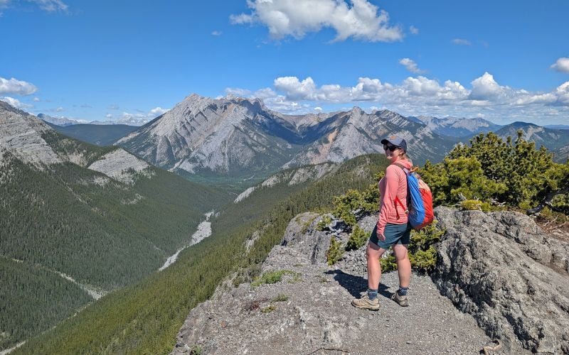
The Sunshine Coast Trail travels through a variety of landscapes, from beautiful rocky coastline and pretty lakes to lush temperate rainforest and mountain summits.
There is natural beauty to be seen almost everywhere along the 180km length of the trail, with truly spectacular panoramas to be found.

Hikers do have to be aware, however, of two things:
- The Sunshine Coast Trail is not located in total wilderness. Dirt roads (mostly for logging or recreational use) criss cross across the local landscape and the path does weave in and out of populated areas
- Some sections of the trail do route through or close to working forests. In this context, that means active or dedicated logging areas

For me, these two factors did not dampen my enthusiasm or enjoyment for this trail. I still had the opportunity to see so many magnificent places and truly immerse myself in nature.
I feel it is important to mention this to properly set expectations of perspective Sunshine Coast Trail hikers.

The scenery is not pristine in all places, but this, in my mind, proves that recreation is perfectly possible even in areas that have long been associated with industry.
In terms of difficulty, the Sunshine Coast Trail is not technically hard. The path is established, very well marked and easy to follow. There’s no scree or exposed trail walking on the main route.
The challenging aspects for most hikers will be the meandering terrain (lots of ups and downs), long distances (which can be mitigated) and slippery surfaces (rock bluffs, wooden boardwalks, mud, tree roots) during or after rain.

Itinerary suggestions
With such huge choice in overnight accommodation (huts, campsites, paid lodging), there are many ways to structure a multi-day trip or thru-hike on the Sunshine Coast Trail.
For this reason, it would be almost impossible for me to list all of the possible combinations.
Base your own itinerary on available budget and time, while considering your group’s fitness and experience. If you have some flexibility, you could just make it up as you go.
Hikers planning to traverse the entire length of the SCT typically spend 9-12 days doing so. 10 days seems to be the most popular length of trip.

Here is an example of what a typical SCT thru-hike may look like a reasonably fit hiker (comfortable with walking around 8 hours a day with a full pack) who wants to stay in the huts as much as possible. Distances are approximate.
- Sarah Point to Manzanita Hut (17km)
- Manzanita Hut to Rieveley Pond (17km)
- Rieveley Pond to Haywire Bay camping (24km) or Townsite, Powell River for resupply (18km)
- Townsite, Powell River or Haywire Bay to Confederation Lake (23/17km)
- Confederation Lake to Tin Hat Mountain (14km)
- Tin Hat Mountain to Elk Lake (20km or 13km if you take shorter route like we did)
- Elk Lake to Walt Hill (14km)
- Walt Hill to Golden Stanley (22km)
- Golden Stanley to Rainy Day Lake (24km)
- Rainy Day Lake to Saltery Bay (11km)
This is a very hut focused itinerary.
Some SCT thru-hikers primarily use campsites, while others use a mix of huts and campsites, and a few exit the trail at convenient points (Townsite, Lang Bay) to seek accommodation.

Section hiking
Some popular itineraries for section hiking are:
- Sarah Point to Powell River, overnighting at Manzanita and Rieveley Pond huts (3 days, 50km)
- Inland Lake to Lang Bay, overnighting at Confederation Lake, Tin Hat, Elk Lake, Walt Hill (5 days, 62/70km)
- Fiddlehead Landing to Lang Bay, overnighting at Tin Hat, Elk Lake, Walt Hill (4 days, 56km)
- Lang Bay to Saltery Bay, overnighting at Golden Stanley, Mount Troubridge, Rainy Day Lake or Fairview (3 or 4 days, 43km)
The Inland Lake to Walt Hill and Golden Stanley to Rainy Day Lake sections feature the most elevation change and are considered to be the most difficult physically.

There are also many day hike options on the SCT, especially if you have two vehicles available (or use a shuttle or the local bus service).
Tin Hat Mountain, Walt Hill, Mount Troubridge and Manzanita Bluff all feature amazing panoramas, while Confederation Lake, Rainy Day Lake and Fairview Bay also make for great destinations.
Suggestions above are based on my own experience and research plus recommendations in hut log books.

Sunshine Coast Trail huts
The Sunshine Coast Trail hosts 16 different huts and shelters, located fairly evenly along the trail. All are free to use and operate on a first come, first serve system.

Here’s a quick breakdown of each SCT hut:
- Sarah Point – Fully enclosed hut, kilometre 0
- Bliss Landing – Fully enclosed hut, kilometre 8.5
- Manzanita Bluffs – Partially open with closed sleeping loft, kilometre 17
- Rieveley Pond – Partially open with closed sleeping loft, kilometre 33
- Inland Lake West (off main route) – Small closed hut, kilometre 65
- Anthony Island (Inland Lake) – Small closed hut, kilometre 67
- Confederation Lake – Fully enclosed, winterized hut, kilometre 74
- Fiddlehead Landing – Partially open with closed sleeping loft, kilometre 81
- Tin Hat Mountain – Fully enclosed and winterized, kilometre 90
- Elk Lake – Partially open with closed sleeping loft, kilometre 110
- Walt Hill – Fully enclosed and winterized, kilometre 123
- Golden Stanley – Partially open with closed sleeping loft, kilometre 145
- Mount Troubridge – Fully enclosed and winterized, kilometre 158
- Mount Troubridge Emergency – Small and insulated enclosed, kilometre 159
- Rainy Day Lake – Partially open with closed sleeping lost, kilometre 169
- Fairview Bay – Fully enclosed, kilometre 173
Having now visited all of the huts and stayed at most, I can tell you that our favourites are Sarah Point, Manzanita Bluffs, Confederation Lake, Tin Hat Mountain and Fairview Bay.
For more details, head to our dedicated Sunshine Coast Trail hut guide.

Hut facilities
All huts have outhouses or composting toilets nearby. There is space around each hut for tents, useful if the hut is full or for hikers who prefer more privacy. Some huts have wooden tent pads as well (Tin Hat, Walt Hill, Sarah Point, Bliss Landing).

Where noted as ‘partially open,’ the hut features a covered seating area and closed sleeping loft.
Most huts accommodate around 8 people in the main enclosed sleeping area. Depending on the comfort of hut users, more people could potentially fit.

In recent years, metal food caches have been added to many of the huts for food storage.
As of September 2023, huts at Sarah Point, Bliss Portage, Manzanita Bluffs, Fiddlehead Landing, Tin Hat Mountain, Elk Lake, Walt Hill, Golden Stanley, Mount Troubridge, Rainy Day Lake and Fairview all have caches.
Confederation and Tin Hat huts have basements (the latter with a rock floor) that can provide extra sleeping room when necessary. We have found rainwater barrels outside most huts, primarily for emergency use.

Winterized huts have a pellet stove, which look like a traditional wood stove but work more like a furnace.
Pellet stoves can be bit tricky to start, operate using pellets only (bring your own to guarantee stock) and require constant attention. It’s not the kind of fire you can light and walk away.
Inland Lake West, Anthony Island and Fiddlehead Landing huts are all located slightly off the main trail route.
The Sunshine Coast Trail huts are AMAZING. To help ensure their free use, please pack out what you pack in and leave the huts better than you found them.

Camping on the Sunshine Coast Trail
As well as the huts, there are designated camping areas along the trail. At a minimum, these have a relatively small but cleared area suitable for a few backpacking tents.
Most of these rustic campsites have outhouses, picnic table and a water source nearby.
Some of these free campsites are vehicle accessible Recreational Sites. One example is Homestead Creek.

There are also some paid campgrounds accessible along the SCT. One of these is Haywire Bay Regional Park.
As well as tent campsites and showers (extra $2, bring coins), this campground has a reservable cabin available for $50/night. Many thru-hikers choose to stay here to take advantage of the showers and convenient location.
Another paid campground is located in Inland Lake Provincial Park. It has 22 vehicle accessible campsites.
Our favourite free campsites were:
- Plummer Creek, kilometre 26 (picnic tables, fire ring, outhouse, creek access)
- Appleton Creek, kilometre 35.5 (benches, outhouse, creek access)
- Sliammon Lake, kilometre 40 (picnic tables, outhouse, lake access)
- Little Sliammon Lake (Shangri-La), kilometre 42.5 (picnic table, outhouse, shelter, lake access, dock)
- Tony’s Point, kilometre 55.5 (picnic table, lake access*)
- Anthony Island, kilometre 67 (outhouse, lake access)
- Coyote Lake, kilometre 116 (picnic table, lake access*)
- Lois Lake Recreation Site**, kilometre 139.5 (picnic table, outhouse, lake access)
There are a few more free campsites marked on the official Sunshine Coast Trail maps, but we either wouldn’t recommend them or couldn’t find them (Elephant Lakes)!
*Please note – be prepared to follow Leave No Trace principles or camp at a location with an outhouse instead
**There are a couple of hike-in spots at the far eastern end of this vehicle accessible campground

General hut and camping etiquette
- According to the Sunshine Coast Trail website, thru-hikers should be given priority for hut use. It also suggests that large groups (8 or more) should consider using campsites rather than huts
- Campfires are allowed as long as there is no provincial ban. Use designated fire rings, keep fires small and only burn dead wood
- Be prepared to hang your food. This isn’t just for bears, but smaller critters too. The huts attract a lot of mice and other small creatures to the surrounding area. Metal food caches are now located at most hut locations

- Treat water from lakes, streams and rivers (and rainwater barrels!) before drinking. We use the the BeFree filter – super fast and no chlorine taste. We also carry Aquatabs for purifying large amounts of water and as a lightweight backup
- Use existing campsites – don’t create new ones. This avoids further damage to the land and also respects local land owners
- Where there is no outhouse or composting toilet, use the cat hole method. Leave No Trace has a great guide
- PACK OUT EVERYTHING YOU PACK IN! I just can’t say this enough. If you hiked in with it, you need to hike out with it as well. This includes fuel canisters, leftover food and trash

Trail condition
The Sunshine Coast Trail is kept in very good condition. The volunteer maintenance teams clearly put a lot of work into removing obstacles, building new bridges and rerouting the trail when necessary.
With some parts of the trail being next to clear cuts, the surrounding trees are vulnerable to high winds.
Though the trail maintenance is excellent overall (better than most other backpacking trail we’ve hiked in BC), be prepared for downed trees on the trail after storms.

Hiking season
The main backpacking season for the entire Sunshine Coast Trail is May to September.
The lower elevation sections, specifically Sarah Point to Inland Lake and Saltery Bay to Rainy Day Lake, can be comfortably hiked almost all year round.
The busiest time on the trail seems to be mid May to August. With the weather warming up faster on the coast, the SCT is a popular spring destination when other multi-day hiking routes are still snowed in.
A very popular spring backpacking trip on the SCT is Sarah Point to the Shinglemill Pub (Townsite). Most hikers will traverse this route in 2 nights, with stops at Manzanita Bluffs hut and Rieveley Pond.
Mosquitoes are more of an issue in spring and early summer, so keep that in mind if you’re sensitive to biting bugs. The coast is susceptible to heavy and prolonged downpours, especially in spring and autumn.

We hiked from Inland Lake to Lang Bay in mid September 2019 and saw only one hiker (out on a short walk) over six days on trail. The weather forecast was, admittedly, pretty rainy.
In May 2022, we hiked north and encountered a total of 49 backpackers and four day hikers in four days. We shared two huts and one campsite with other hikers.
In August 2023, we hiked south from Lang Bay to Saltery Bay and saw only two other backpacking groups and one day hiker.
Snowshoeing the SCT is popular in the colder months, with Confederation Lake, Tin Hat Mountain, Walt Hill and Mount Troubridge being popular overnight destinations.
Transportation
With the Sunshine Coast Trail being an end-to-end hike (as opposed to a loop), there has to be some thought concerning navigation.
A common solution is to have two vehicles, one parked at each of the chosen trailheads.
For thru-hikers or groups with only one vehicle, there are other solutions:
- The easiest way is to use the Sunshine Coast Shuttle. The owner, Jesse, is a SCT expert and also offers resupply services. Due to the prevalence of logging roads throughout the region, there are many different drop off points available. The service charge varies with the distance travelled and amount of passengers
- Sarah Point, the SCT’s northern terminus, can be reached by water as well as dirt 4X4 road. Both Lund Water Taxi and Terracentric Adventures run services on request. Terracentric Adventures uses Zodiac boats and is able to land very close to the Sarah Point hut (and kilometre 0), while Lund Water Taxi drops hikers on a rock face
- There is a limited BC Transit service from Saltery Bay to Lund, via Powell River (extension of Route 12). The Saltery Bay extension runs only twice a day, four days a week in summer
- Staying at the Old Courthouse Inn prior to one of our hikes, we were offered a ride to our desired SCT trailhead by the owner. I’m sure there are other accommodation providers in the area doing the same
- If budget is a concern, I’d recommend joining the Sunshine Coast Trail Facebook group to try and link up with other hikers to split shuttle or water taxi costs

Navigation
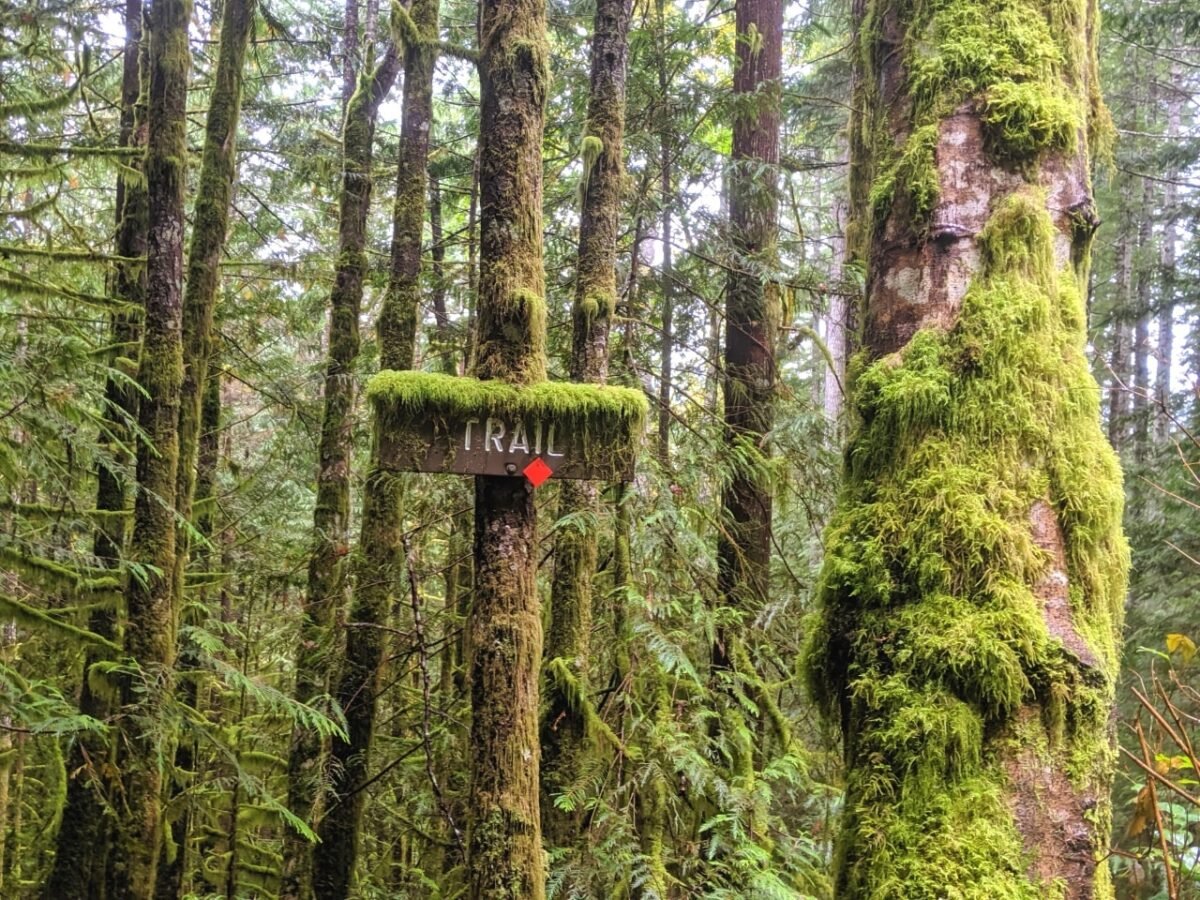
The Sunshine Coast Trail may well be the best signed path we have ever hiked.*
The trail itself is marked with bright orange diamond blazes, appearing every five metres or so. Sometimes, even more frequently. These trail markers can be spotted on trees, fences, fallen logs, bridges and more.
According to the SCT trail website, there are double the amount of markers going from north to south than the other direction. In addition to the orange blazes, there are numerous wooden directional signs, kilometre markers and SCT maps at trailheads.

A map of the Sunshine Coast Trail can be picked up at the Powell River Visitor Information Centre. Section maps are available on the Sunshine Coast Trail website.
A step-by-step description of the entire trail can be found in Eagle Walz’s Sunshine Coast Trail guidebook, as well as trailhead directions and elevation breakdown. We purchased our copy at Tailwind Books in Sechelt.
The SCT is marked on both the Organic Maps (we used this one) and Hiking Project apps. There are also section maps available for the Avenza Maps app.
*Please note that sometimes the SCT does get rerouted due to logging activity. Check the Sunshine Coast Trail Facebook page for updates

Parking
The choice of where to park our vehicle was probably one of the biggest decisions we had to make when planning our SCT hikes. Your own choice for parking will depend on your hiking plans and level of desired security.
With the SCT being intersected by logging roads in numerous places, there are many access points besides Sarah Point and Saltery Bay.
Hikers also have the option to park their vehicle in surrounding communities, either in paid parking lots or outside businesses (with prior permission).
There are paid parking lots in Lund, Mowat Bay, Powell River Government Marina, the Shinglemill Pub, the Lang Bay Store and at Saltery Bay.
Unsecured parking lots can be found on the Sunshine Coast Trail maps on the official website (marked in blue).

Our experience
For our first SCT hike (Inland Lake to Lang Bay), we chose to park our vehicle at the Lang Bay Community Hall.
The building manager lives next door (the house to the immediate north of the lot). There is a donations box on the side of the hall.
Jesse from the Sunshine Coast Shuttle picked us up and took us to our starting point on Inland Lake.
From our finishing point at kilometre 134, we needed to walk 2km along the (wide) Dixon Road to Highway 101 and then a very short 100m stretch north to get back to the hall.

For our second SCT hike (Inland Lake to Sarah Point), we parked at Lund Parking. We paid $40 for 4 days, or 96 hours, of parking. The main parking lot in Lund also charges $40 (May 2022) for this length of time.
From Lund, we took a ride with Sunshine Coast Shuttle to Inland Lake. To get back to Lund from Sarah Point, we had prearranged a Zodiac ride with Terracentric Adventures.
We parked again at the Lang Bay Community Hall at the start of our third and final SCT hike. From here, we walkED 2km back to the Dixon Road trailhead. After finishing at Saltery Bay, we caught the 14.10 BC Transit bus back to Lang Bay ($2.25/person). There is a bus stop outside the community hall.

Safety considerations
- The Sunshine Coast is an extremely safe place to visit, with minimal crime. Hikers should, however, be aware that parking a vehicle overnight in an unattended location is inherently risky. Take all valuables with you where possible and keep all remaining items out of sight
- Phone signal is limited on the SCT. During our hikes, we’ve only received phone signal at higher elevation spots like Tin Hat, Manzanita Bluff, Walt Hill and Mount Troubridge. We also received signal at Rainy Day Lake
- At approx 135.7km, the trail crosses the Eagle (Lois) River. There is no bridge here and the flow of the river can vary. Besides the potential for deep water, the other hazard here is the dam above the river. There are warning sirens, but they would be difficult to hear from the river itself. A safer option is to backtrack to Stillwater Main (135.1km), follow the road west and then south to cross on a concrete (road) bridge and then continue back onto the trail via Lois Main
- Some SCT trailheads are only accessible via active logging roads. When driving on these, be prepared to meet industrial vehicles at all times. Slow down and pull over completely where possible. Check the Western Forest Products Facebook page for closures, restrictions and one-way system information. The Vancouver Coast Backroad Mapbook can be a great help for navigation
- Bears, cougars, elk and other wild animals live on and around the Sunshine Coast Trail. Sightings of larger animals are rare but hikers must take precautions. Make noise on the trail to avoid startling any animals nearby, keep alert, carry bear spray, hang your food at night and be sure to pack out everything brought in
Supply points
Powell River is the main supply town for the Sunshine Coast Trail. There is a locally owned gear store called Powell River Outdoors.
Also in town is a Walmart, Dollarama, Canadian Tire, choice of fast food chains (A&W, McDonald’s) and numerous banks. There is a good variety of restaurants and independent businesses along Marine Ave, near the ferry terminal.
The grocery stores in Powell River are well stocked but are on the pricier side, with Save-on-Foods, Safeway and Quality Foods as options.
We’ve always found gas prices to be higher in Powell River too, sometimes up to 10c/l higher than Comox or Sechelt.

Other supply points on the SCT are Lund (bakery, pub, restaurant), Townsite (brewery, restaurants, convenience store) and Lang Bay (convenience store, pizza).
The Shingle Mill pub is located just off the trail at kilometre 50. As well as food, you can inquire about bag storage. Many thru-hikers use the Shingle Mill as a pick-up point after hiking the first part of the trail from Sarah Point.
The Lang Bay Store apparently offers free supply storage and pick-up (of course, I’d recommend thanking them with a purchase).
It is also possible to organise a supply drop with Sunshine Coast Shuttles.
Packing list essentials
- The Ten Essentials, of course, is a good starting point for the Sunshine Coast Trail and any other hike
- If this is your first multi-day hike, I cannot emphasize enough to practice first and find comfortable footwear that works for you. I use fairly high waterproof hybrid boots but there are merits to using lighter, less waterproof hikers
- Bring a tent or lightweight tarp to sleep under in case the huts are full. This was the case during our May hike
- I always carry lightweight hiking poles during multi-day hikes and these especially came in handy during our ascent of Tin Hat and descent from Walt Hill and Mount Troubridge. It is steep in places and the poles help to take pressure off your knees. We share a pair of Black Diamond Carbon Z poles (pricey, but totally worth it)

- Waterproof backpack covers are helpful on the SCT not only for the frequent rain but also for protection in forests. We got dripped on a lot! Our Osprey ultralight raincovers haven’t let us down so far
- The Sunshine Coast Trail isn’t just for hikers; it’s a wildlife route too. Elk, coyotes, cougars, bears and other animals live in the area. Black bears are more commonly seen than grizzly bears. Always make noise, be alert and carry bear spray in an easily accessible holster (and know how to use it!)
- Most of the huts now have metal caches but you should still be prepared to hang your food if full. The simplest bear hang system uses a waterproof roll-top dry bag and 15m of paracord-style rope
- Toilet paper! Don’t expect any of the outhouses along the route to have toilet paper. Bring your own, with some alcohol based hand sanitizer
For more outdoor gear recommendations, check out our multi-day hike packing guide

SCT Passport and Certificate of Completion
The SCT Passport is a fun way to record your journey on the SCT (thru-hiking or otherwise). It costs $5 and can be picked up at the Visitor Centre in Powell River.
To receive stamps, hikers must take a photo of themselves in front of each of the huts (Golden Stanley and Mount Troubridge Emergency Shelter excepted). On return to Powell River, hikers then go to each corresponding business and receive a unique stamp.
Once all stamps are collected, the Visitor Centre will issue you a SCT Certificate of Completion!
Alternatively, you can also present the photos at the Visitor Centre and get a generic stamp for each hut.

Where to stay
The Northern Sunshine Coast has a large choice and variety of places for hikers to stay before, after or even during their journey on the SCT.
Choose between resorts, motels, cottages, campgrounds, guesthouses and even oceanside Airbnbs.
Powell River is an ideal place to stay due the availability of accommodation, local facilities and central location.
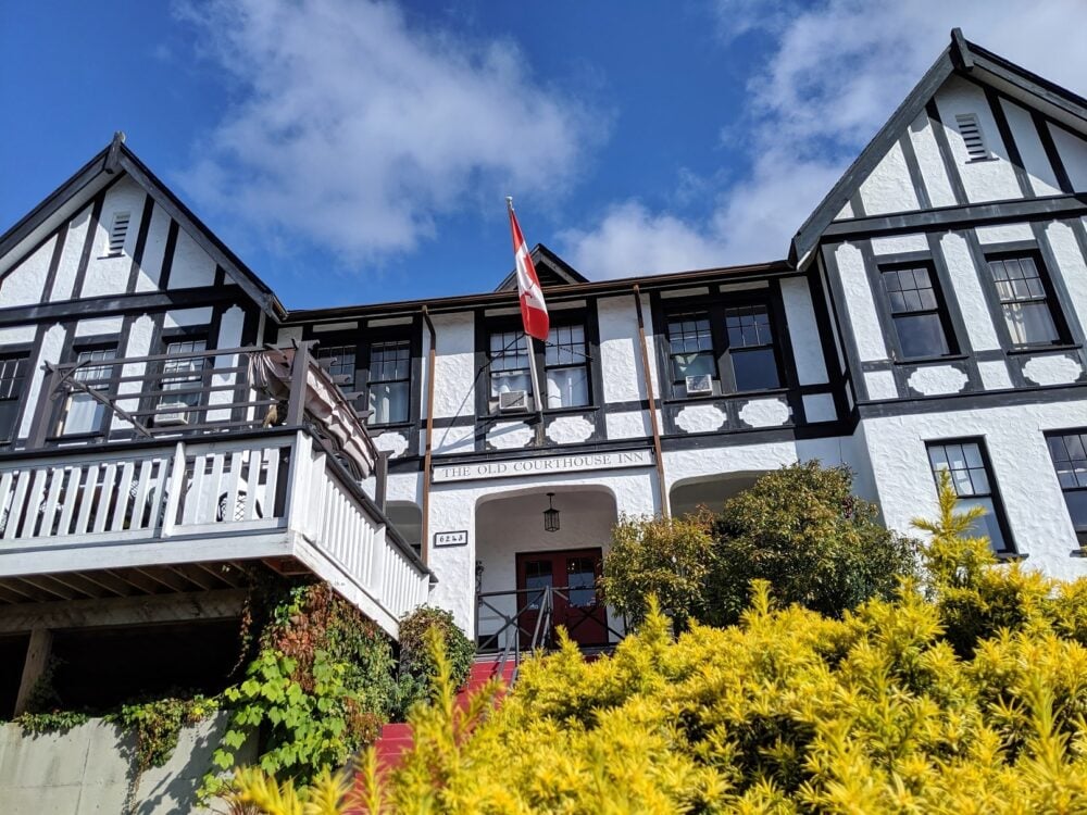
We loved the Old Courthouse Inn, located in the Townsite district. Yep, it really is an old courthouse, but is completely renovated and each room has a unique theme.
A freshly made hot (or cold, it’s your choice) breakfast is included for all guests. Townsite Brewing is also conveniently located just across the street.
For free camping, check out Lois Lake Recreation Site. This rustic campground has 12 vehicle accessible spots and 4 walk-in sites. The path of the SCT actually travels right through here.

Other things to do on the Sunshine Coast
The Sunshine Coast Trail isn’t the only world class attraction on the Sunshine Coast! There are so many amazing things to do in this area, especially if you love the outdoors as much as we do.
Princess Louisa Inlet
Accessible only via boat or helicopter, Princess Louisa Inlet is one of the most beautiful places I have been anywhere in the world.
This magnificent fjord features huge granite walls and ends with a thundering waterfall. It’s even more impressive in the rain. Sunshine Coast Tours run five hour boat tours from Egmont.

Skookumchuck Narrows
Another one of a kind attraction on the Sunshine Coast is the tidal rapids at Skookumchuck Narrows. The powerful tide changes cause huge waves and whirlpools to form in the Narrows. It is exhilarating to watch, especially if any kayakers are trying to surf the waves!
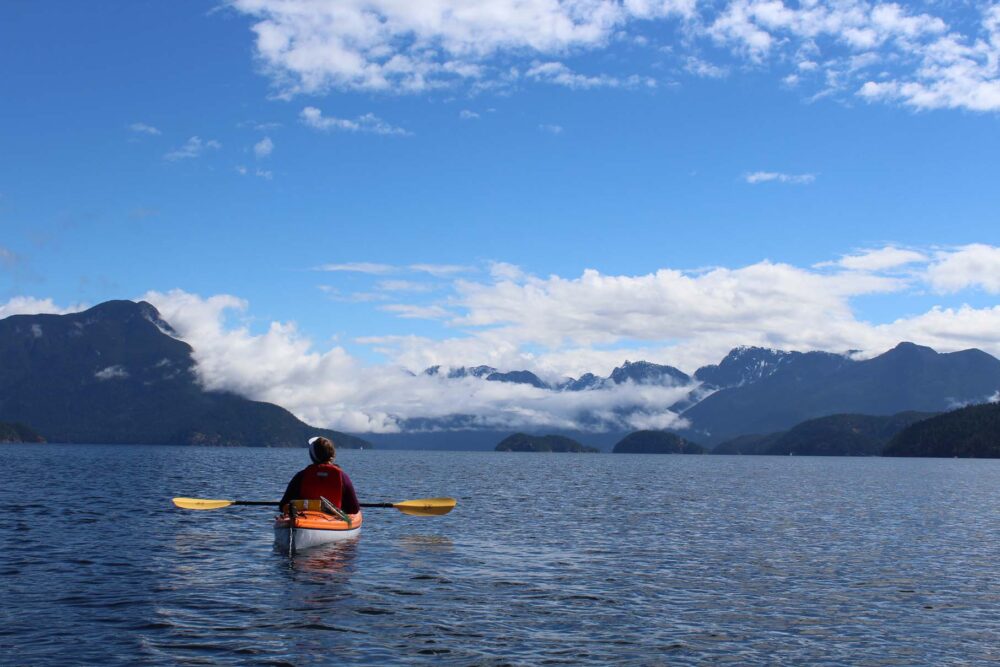
Multi-day paddling opportunities
If paddling is your forte, Desolation Sound Marine Provincial Park offers fabulous ocean kayaking while the Powell Forest Canoe Route (visible from the SCT itself) is a satisfying lake hopping adventure.
Other outdoor activities
Back on land, you can find over 700km of bike trails. There are climbing opportunities too, as well as awesome rock climbing gyms in Townsite and Sechelt (plus a bouldering gym too!
Local breweries
The craft drinks scene is thriving on the Sunshine Coast, with four breweries, three distilleries and three cideries.
Raise a glass to Persephone Brewing Company’s sustainability ethos on their beautiful 11 acre beer farm, watch the ocean from Tapworks‘ stunning patio and try the Belgian brewed beers at Townsite. The latter has a wonderfully casual picnic area as well.

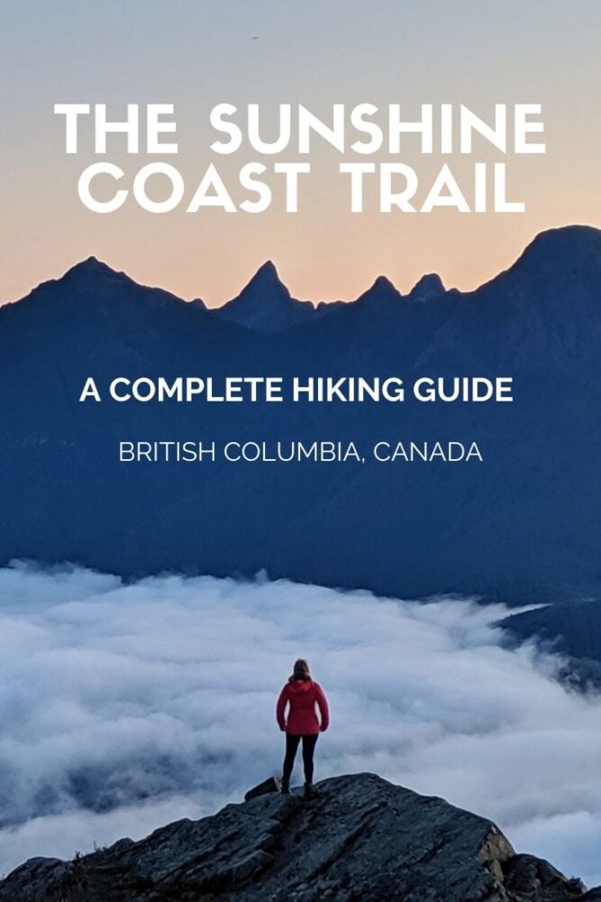
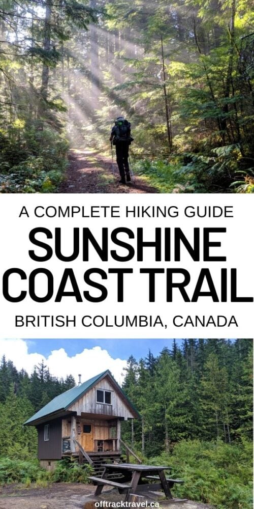
If you liked this post, PIN or save it for future reference with the below images!

Check out these other hiking posts next

One half of the Canadian/British couple behind Off Track Travel, Gemma is happiest when hiking on the trail or planning the next big travel adventure. JR and Gemma are currently based in the beautiful Okanagan Valley, British Columbia, Canada. Consider buying us a coffee if you have find any of our guides helpful!
Thank you for this genuinely impressive article! We have been noodling the idea of hiking the Sunshine Coast Trail for two years, and have been hindered by the dearth of online information on the trail. I love the tremendous amount of info that you’ve packed into this article. I feel so much better informed!
I clicked on a bunch of your affiliate links as thanks!
Amazing article – really excited to hike the SCT this summer, thanks to your help!
Awesome!! I’m so glad you found the post helpful! Enjoy your hike.
Thank you for the great write up!! I have been trying to figure out some different 5-6 day options and this looks like a definite possibility! Appreciate all the detail in your post!! I might also suss out the idea of Sarah Point to Inland Lake. Happy Adventuring!
Awesome Jill! So glad you found this helpful! Sarah Point to Inland Lake sounds like a great itinerary. Hope you have an amazing time!
Hi I have a question for you. What time of year did you hike it? What were the daytime and night time temperatures like on the trail? Thanks for your help. I’m planning to hike it this year. 🙂
Hi Lori,
We hiked the Sunshine Coast Trail during the second week of September. It was about 10-14 degrees (Celsius) during the day and around 4-8 at night.
Great article. Love the pictures and descriptions! I did the first 50km from Sarah Point to the Shingle Mill (and a very well deserved plate of nachos and a cider) last year with a friend. We are planning to return for another leg in the first week of September. Thanks for the great info and trail details! Happy Hiking.
Hi Teresa,
That would have been a very well deserved plate of nachos! We had fish and chips after finishing our hike at Lang Bay. Post-trail food is the best! Thanks for letting me know that you found this post helpful! Hope you have a great hike in September.
@Gemma, A question: how were the water sources in September? Did you have any problems keeping up with the demands for water? Thanks in advance 🙂
Hi Teresa,
We had no issues at all finding water while hiking the SCT in September. It was a particularly wet September however!
@Gemma, Thank you for the reply. Much appreciated.
A thorough and informative guide with great photos. Thanks
Thanks John!! It means a lot. Happy trails!
Hi Off Track Travel!
Your hiking guide for the SCT is awesome! The best I’ve seen online. We are attempting a thru- hike this May. You mentioned the bugs are worse in spring and early summer.
How were the bugs on your section that you did in May 2022?
Thank you! Your posts and pictures are so inspiring!
Jenn
Hi Jenn,
Thanks so much for the compliment and taking the time to let me know!
It was pretty buggy at Little Sliammon Lake and also Rieveley’s Pond. It’s difficult to define as everyone has their limits, but they didn’t bother me enough to want to wear a headnet while making dinner but I did get a few bites while putting the tent up. I don’t remember any other particularly problematic areas, but we did have quite a bit of wind/rain at Manzanita Bluff and Sarah Point.
What a great article! Is there anyway I could get in touch with you or leave you my contact info somehow because I am new to the trail and I would like to ask some questions about entry points and ferries.
Hi Deborah,
You can email me if you like – gemma[at]offtracktravel.ca
Thanks for the very useful article.
is there a source of GPX files that match your hut to hut itinerary?
Hi Mark,
I don’t personally have one, sorry!