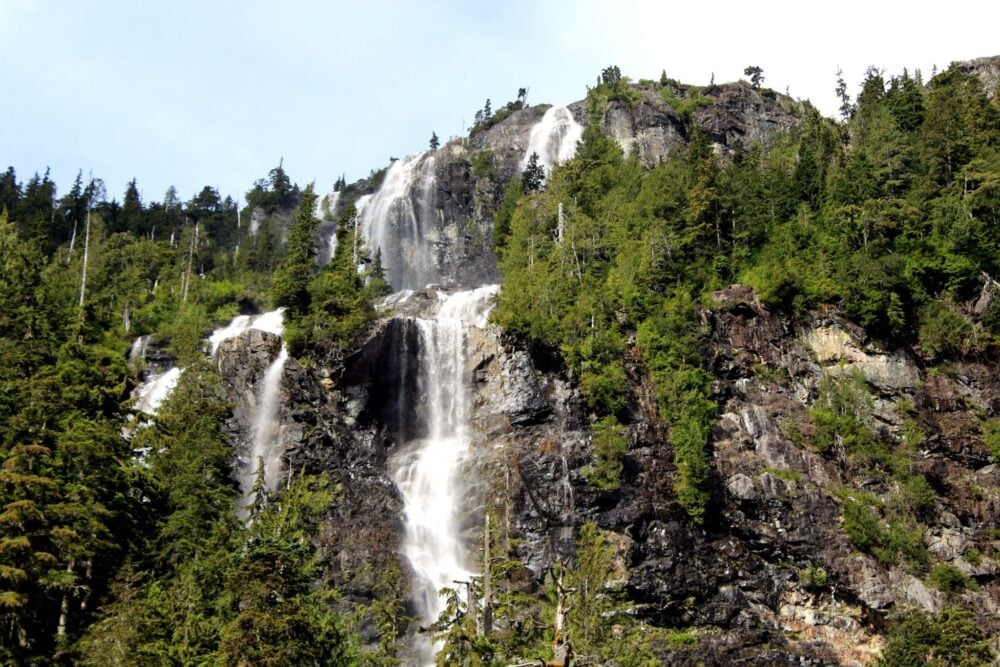
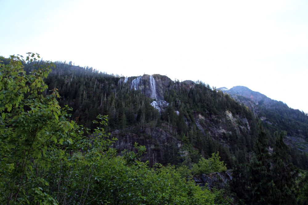
Hidden in the deep green valleys of Vancouver Island is one of Canada’s highest waterfalls – Della Falls. With a vertical drop of 444m, it is an extraordinary sight to behold.
To be able to reach the base, waterfall chasers must first cross 45km long Great Central Lake and then hike the 16km Della Falls Trail.
For this adventure, the journey AND the destination are equally spectacular.
Indeed, our four-day paddling and hiking adventure to see Della Falls is one of the coolest outdoor adventures we’ve ever done in Canada! And we’ve done a lot of backpacking and paddling trips since then.
Read on for the full story of our experience, followed by a complete Della Falls hiking trail guide.
Here’s what to expect:
This post includes affiliate links. If you click one of these links and make a qualifying purchase, we may receive a small percentage of the sale.
Backcountry necessities
- Always bring the 10 Essentials
- Know how to stay safe in the backcountry
- Remember to Leave No Trace to help keep the wilderness wild
- Understand how to avoid negative bear encounters
- Trying out backpacking for the first time? Read Backpacking 101
- Check out our packing guide with gear recommendations
- Sign up to our newsletter for a free backpacking checklist
Della Falls: Canada’s highest waterfall
Della Falls is located in the heart of Strathcona Provincial Park on Vancouver Island, British Columbia, Canada. This is the traditional territory of the Hupacasath and Tseshaht First Nations.
At 440m, Della Falls is said to be one of Canada’s highest waterfalls. Despite that, it’s not particularly well known. That is likely because it’s not very easy to reach.
The hiking trail to the base of the falls is 32km return with 550m elevation gain. For the majority of people, the hike involves an overnight trip at a minimum (2-3 nights is more common).
The trailhead is located on the western side of Great Central Lake, one of Vancouver Island’s largest lakes. It is accessible by water only, via helicopter, float plane, water taxi or canoe/kayak.
Della Falls had, however, been on our personal ‘must-do’ list for a long time. We had first spotted it in our Vancouver Island Backroad Mapbook, shortly after moving to Canada in 2011!
Besides the height of the falls, it was the isolation and complex journey that appealed to us. We liked the idea of hiking and paddling on the same backcountry trip. The beauty of Strathcona Provincial Park was another draw.
Della Falls Trail: quick facts
- 16km one-way with 550m elevation gain
- 2 to 3 day backpacking trip
- Trail difficulty is on the low side of moderate
- Usually snow-free from mid-May to mid-September
- Love Lake side trip is usually snow-free from mid-June
- No reservations, no camping/backcountry fees
- Water taxi to trailhead costs $185-210/per adult ($105/children)
- Leashed dogs are allowed but BC Parks does not recommend bringing pets into the backcountry

Della Falls – our experience
As mentioned, Della Falls was a long-awaited trip for us. Joined by a couple of friends from the Comox Valley, we finally made the journey in mid-June one year.
I’ll share our experience below. It is followed by a trail guide.
Paddling to the Della Falls trailhead
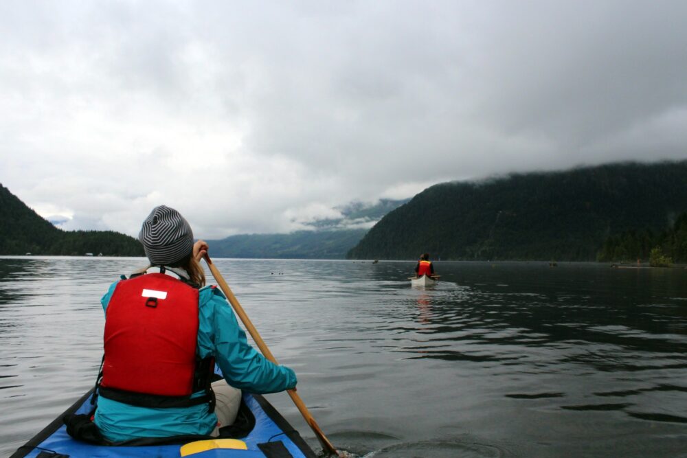
Having more time than money (plus a huge sense of adventure), we chose to paddle our canoes the required 25km to the trailhead.
As lake paddles go, it was actually one of the most successful we have ever done. It was surprising, especially since Great Central Lake is renowned for high winds and big waves.
At 7am this day though, the lake’s surface was as still as glass. Alone on the water, we enjoyed the silence and stillness, as well as the early morning mist hanging around the hills and the steady approach through the valley.
We hadn’t even reached the Della Falls Trail yet and this was shaping up to be a beautiful adventure.
Turning the final corner and spotting the trailhead sign in the distance was exciting. With the sides of the lake rising hundreds of metres into the sky, the scenery reminded me of Jurassic Park.
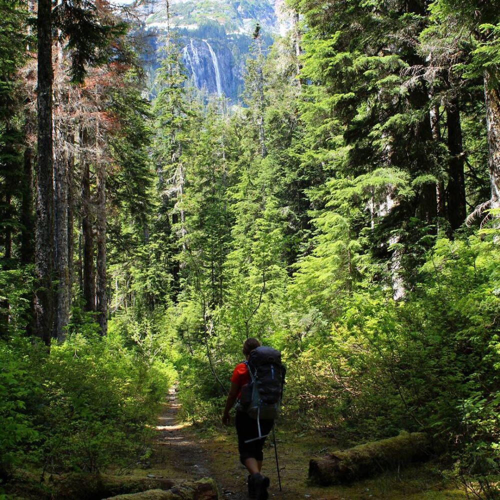
Starting the Della Falls Trail
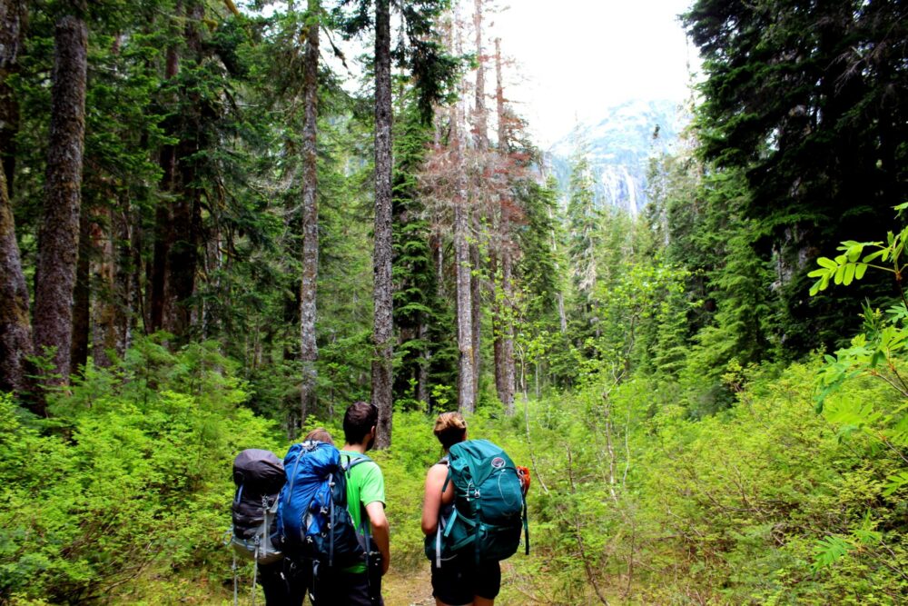
Arriving at the wharf and trailhead around lunchtime, it didn’t make sense to set up camp. After a quick lunch in the lakeside campground, we started the 16km long Della Falls Trail.
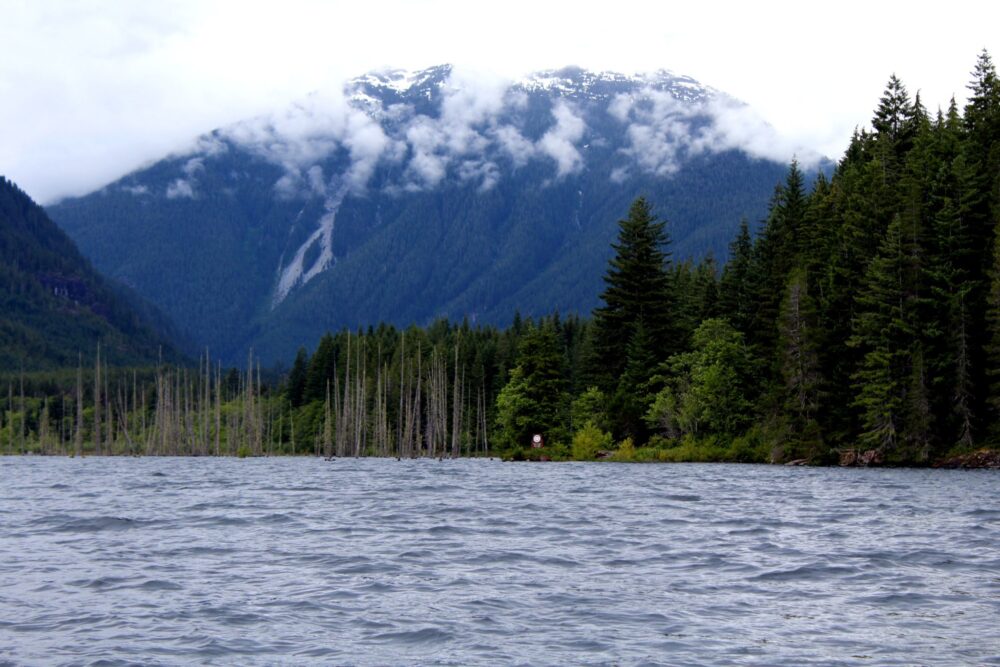
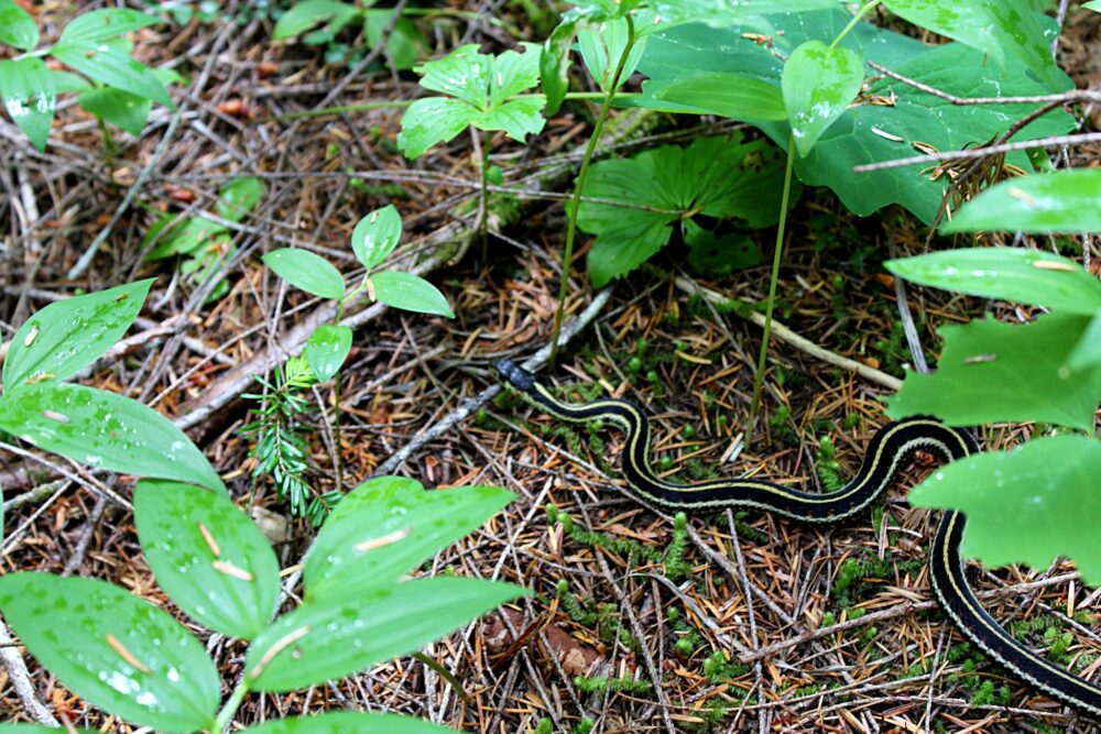
Starting the hike, the trail travels through thick temperate rainforest. Though the sky may be hard to see through the trees, there’s still plenty to look at. Indeed, we almost walked on a snake less than 500m from the trailhead.
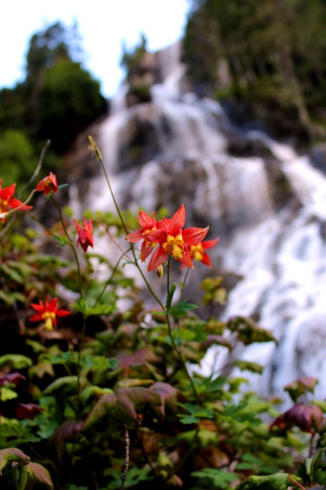
There was so much colour everywhere from the lush greens of the trees to the rich brown mushrooms, vibrant wildflowers and aquamarine river.
Although the trail is not particularly challenging, getting up at 5am took its toll on all of us and we eventually stopped for the night at the cable car crossing, about 10km along the Della Falls Trail.
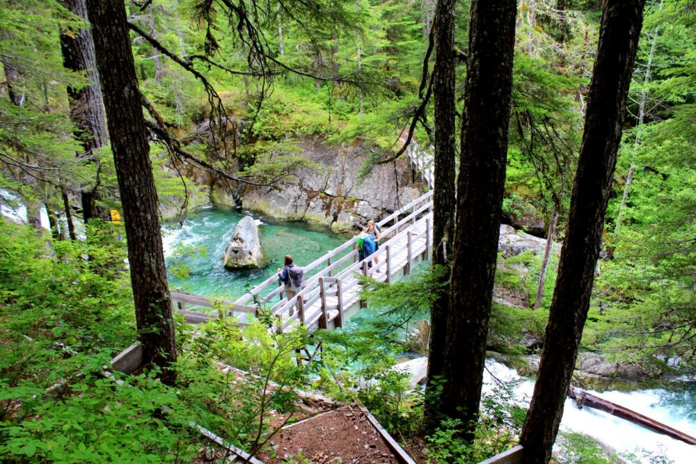
The Della Falls trail cable car
I have to say, the cable car crossing was one of the highlights of the hike. I’d never seen anything like this before on a hike. The first time we used the cable car, I was a little apprehensive!
The steel cable car itself is quite solid, but there’s something about having to physically pull yourself across a narrow gorge with white water rushing through below.
The distant view of Della Falls right in the middle of the crossing was, by far, the best part of the crossing. It was the first time we’d caught a glimpse of the waterfall itself and even though we were still 6km away, it was incredibly impressive.

Arriving at the magnificent Della Falls
The rest of the trail, minus a short section over and around some large boulders, was fairly straightforward.
The sun was out, the ever-closer views of Della Falls were enticing and the too-blue river looked more surreal than ever.
It was very tempting to go for a swim, but luckily, JR tested it for all of us and confirmed that the glacial water was cold enough to numb limbs within seconds.
Seeing Della Falls up close was an amazing experience. The noise was deafening, the turquoise water fast and wild, the mist thick and cool.
Such power, seemingly just falling from the sky. The bridge viewpoint provided a larger perspective to this magnificent sight.
Camping at the base of Della Falls
Before heading to the base of Della Falls, we had set up our tents in the main campground.
Historical artefacts (including one of the largest saws I’ve ever seen!) are scattered around the fairly large camping area, providing a fleeting glimpse of the past.
Being the singular group of hikers on the trail, we had only Della Falls for company that night.
I wished we’d camped a little closer to be able to hear the white noise of the cascading water from our tents, but the solitude of the main campground was relaxing enough.
The next morning, we returned to the bottom of the falls for breakfast with a view. It was sad to leave Della Falls behind. It’s the kind of place I could sit and meditate all day.
The return journey
The hike back down the Della Falls Trail was fast and a little more eventful with the sighting of a black bear about 30m from the trail.
This was the first one JR and I had ever seen outside of a vehicle! It was my birthday that day too, so I like to think it was a bonus gift from nature.
Already this adventure had proved to be an excellent present, with dry weather, calm lake conditions, an exceptionally quiet trail and, of course, the spectacular falls.
The return paddle across the lake the next day at 7am was no different, with serene stillness almost all the way back to our vehicles. We, again, arrived at our destination around noon.
Della Falls Trail Hiking Guide
The Della Falls trailhead is found on the eastern side of Great Central Lake, Vancouver Island’s second-largest lake. It is the southeastern access point to Strathcona Park, BC’s oldest provincial park.
The nearest supply town to the trailhead is Port Alberni, which is about 30 minutes drive south of the edge of Great Central Lake.
Port Alberni has most of the standard chain stores (Walmart, Dollarama, Canadian Tire, No Frills) but no dedicated hiking store. There is, however, an Atmosphere store and VPO in Nanaimo.
Looking for somewhere to stay in Port Alberni before or after the Della Falls hike? The Best Western Plus is a reliable choice, with the Beaver Hut Bed and Breakfast offering a more personable experience.

How to get to the Della Falls trailhead
The Della Falls trailhead is located at the western edge of Great Central Lake, a 35km long lake on Vancouver Island. The trailhead is only accessible by water.
Della Falls water taxi
Most hikers heading to the Della Falls Trail take a water taxi from Great Central Lake RV Resort & Marina, 33km east from the trailhead. Ark Resort is a half-hour drive from Port Alberni on a paved road.
The cost of the Della Falls water taxi is determined by the size of your group, starting with $210 return per adult for a party of two. With a larger group, the price reduces to $185 per adult.
The journey to the Della Falls trailhead takes around 55 minutes. There is a maximum of five people per trip. If you have a larger group, you’ll need to be shuttled out on multiple trips.
The service runs from Thursday to Tuesday from mid-May to mid-September.
Della Falls water taxi reservations are required, with bookings usually opening in late winter. In 2026, reservations opened 2nd February.
By canoe or kayak
It is also possible to paddle to the Della Falls trailhead by canoe or kayak (like we did).
Great Central Lake is 35km long, with the Della Falls trailhead located very close to the western end. The lake is renowned for its strong afternoon winds.
The two main departure points for paddlers are:
- Great Central Lake Marina – approximately 33km from the trailhead
- Scout Beach Recreational Site – approximately 23km from the trailhead
Needless to say, launching at Scout Beach reduces the paddling time significantly.
For this reason, we parked and launched our canoe at Scout Beach. It took us around five hours to paddle from Scout Beach to the trailhead.
We stayed at the 12 site Scout Beach campground the night before launching (free).
Upon leaving, there were only a few other vehicles in the campground. We parked our vehicles at the edge of the campground, away from the individual campsites. We had no issues parking our vehicle there.
The condition of the access road to Scout Beach was decent when we drove it – mostly flat and gravel with occasional rocks.
I’ll share my Great Central Lake paddling tips later in this guide.

Della Falls Trail description
The Della Falls Trail is 16km long with 550m elevation gain (32km return). It takes around 5 to 7 hours to hike the one-way distance.
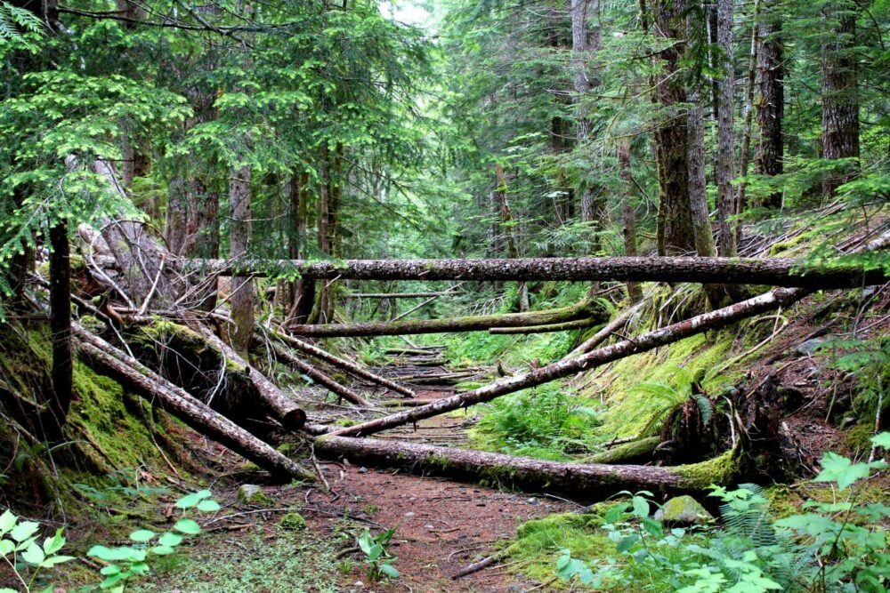
The trail is usually snow-free from mid-May to mid-September. When hiking in the early season (May, June), expect to see the occasional fallen tree or broken bridge slat.
The first four kilometres of the Della Falls Trail follows an old railway grade and is consequently fairly wide and flat.
The trail then narrows, crosses a few rivers (bridges all intact during our visit) and takes on a very small amount of elevation before the first campground.
A fairly steady incline leads to a cable car crossing over a deep canyon. After the cable car, the Della Falls Trail descends to the river and over some large boulders (look for flagging).
The trail then climbs steadily to the main Della Falls campground. The base of Della Falls is just 700m further up the trail.
Della Falls Trail difficulty
I would rate the Della Falls Trail to be on the low side of moderate, due to the distance and relatively low overall elevation gain (550m).
The elevation gain is fairly gradual, with a few prolonged steeper (but nothing intense) sections. There are long, fairly flat sections.
The path is established and well-marked with orange flagging.
There are several river crossings on the Della Falls Trail, all of which either have a bridge, cable car or rocks to cross.
Most of the trail is in the forest, which provides shade on sunny days.
The boulder section after the cable car is probably the trickiest part of the trail. It is not very long, however. Pay careful attention to the flagging to avoid getting lost.
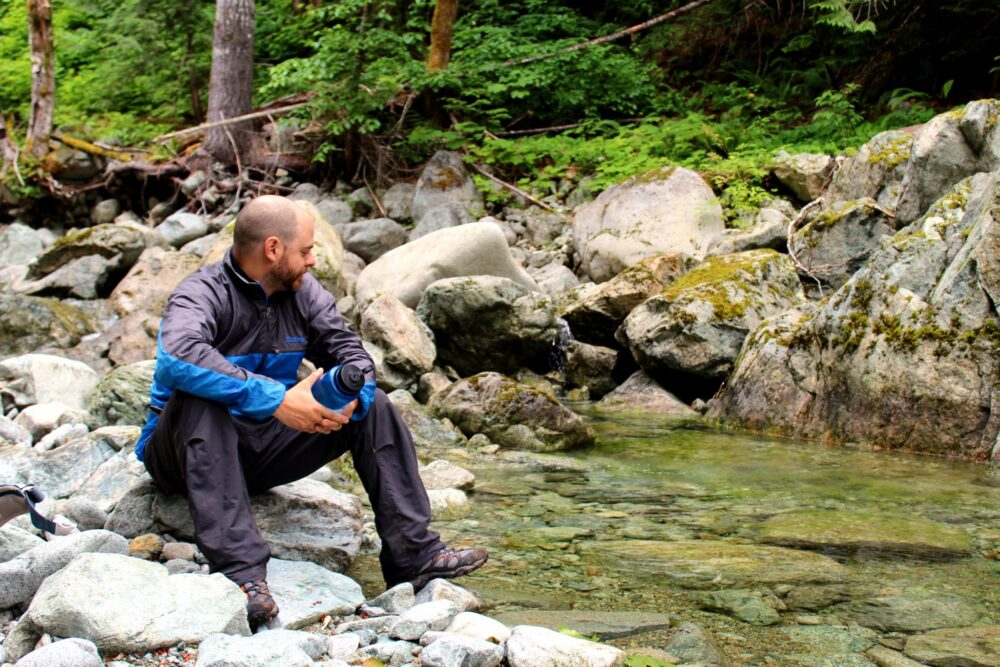
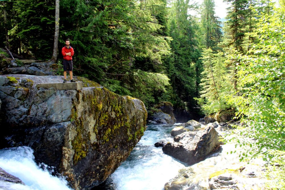
The Della Falls Trail stays in fairly close contact with turquoise Drinkwater Creek almost the whole way to Della Falls itself. While beautiful, this creek has VERY cold water so caution should be taken when close to it.

Della Falls Trail campgrounds
The Della Falls Trail has four established campgrounds, none of which require reservations or a backcountry permit. All operate on a first-come, first service.
Please note that campfires are not allowed in Strathcona Provincial Park’s backcountry areas, including the Della Falls Trail.
- The Della Falls trailhead campground has at least 8 accessible sites (plus a number of overgrown sites) complete with tent pads and small benches. There is a BC Parks fire pit here, plus a bear cache, two outhouses and a canoe rack
- The first on-trail campground is found around 7.5km into the trail, close to the river. There is a bear cache, a ‘throne’ outhouse plus an informal fire pit. There are some flat areas suitable for tents
- At 15km, there is the main Della Falls campground. There is old logging equipment (saw blades) nailed on the trees. This is a large, flat treed area with space for 4/5 tents. 20 metres further on, there is another small camp area next to the river with distant views of Della Falls. Both sites share a bear cache and a ‘throne’ outhouse.
- The final campground is called Della Falls View and is located 700m further up the trail. Located a very short walk from the bottom of the falls, there is a bear cache and ‘throne’ outhouse plus space for 2/3 tents. Had we known about this campground, we probably would have stayed there instead of the ‘main’ one
There are also two informal campgrounds, with the first located just before the cable car (around 10km in). There are no facilities, just a couple of flat areas suitable for tents right on the trail.
The second is on a river beach, 13km in. There is a sign on the rock stating no campfires. No outhouse or bear cache. Following Leave No Trace principles is absolutely essential.

Day hiking opportunities
From the Della Falls base area, it is possible to day hike to Love Lake. It is a 7km round trip with 760m elevation gain.
The hike to Love Lake takes around 4 to 5 hours return, but it offers spectacular elevated perspectives of Della Falls and a chance to swim in the crystal clear sub-alpine Love Lake.
The trail to Love Lake is usually snow-free from mid-June onwards. This is very dependent on recent weather conditions, however.
Despite early spring temperatures being exceptionally warm, it snowed at around 900m elevation the week before we headed out on this trip.
We did not do this side trip as most of the trail was still under 4-5 feet of snow (which we were not prepared for).

Paddling advice
Paddling Great Central Lake should be approached with some caution.
Surrounded by mountains, the long and thin lake (like so many others on Vancouver Island) acts as a wind tunnel. As such, big waves can whip up fast. Indeed, Great Central Lake has a reputation for them.
We started paddling before 7am both to and from the Della Falls Trailhead in the hopes of being off the water before the winds picked up in the afternoon.
As it was, we had the wind behind us on the way there and against us for only a short time on the way back. The outgoing journey took just over 5 hours, the return 4 and a half hours.
Surprisingly (against all advice I read before the trip), there are a couple of places to pull off and camp on the northern side of the lake if needed.

Della Falls Trail fees and permits
There are no fees to hike the Della Falls Trail, nor is any kind of permit required.
The water taxi ride to the trailhead is the only aspect of the trip that requires payment. The fee in 2024 is $205/$180 per person (price varies according to the size of your group).
Paddling to the Della Falls trailhead is free.
The Great Central Lake RV Resort & Marina may charge a launch and/or parking fee if you choose to start your trip there.
Camping at Scout Beach Recreation Site is free, with the launch access free as well.
Water access
Water is easily found throughout the hike as the Della Falls trail stays close to pretty Drinkwater Creek for almost the full length.
The Della Falls campgrounds all have easy access to (very cold) water.

Safety information
- The Della Falls Trail is located in a remote area of Vancouver Island. Hikers should be self-reliant
- There is very limited phone signal north of Port Alberni, with no signal at all on Great Central Lake or the Della Falls Trail
- For the above reason, make sure to tell someone where you are going and when you plan to be back
- Black bears and other predators live in Strathcona Provincial Park. Hikers should how to avoid negative wildlife encounters
- Carrying the 10 Essentials is the best way to avoid small inconveniences from turning into emergencies
- There may be a significant amount of snow on the trail to Love Lake prior to mid-June (and depending on the year, sometimes later)
- There are several river crossings along the route. The smaller creeks will require rock-hopping
- When hiking in the early season (June or earlier), there may be fallen trees along the route. Depending on the preceding winter, there may be damage to trail facilities (such as bridges)
Wildlife
Black bears are relatively common in this area. We saw fresh scat and claw marks on trees and also on the bear caches. And most obviously, we spotted a bear on the last day.
If you stay at one of the camping areas without a bear cache, make sure to hang your food high in the trees away from camp.
The cable car came in handy for us the first night as we were able to secure all of our food in the car and then pull it out to the middle of the river. We removed it all early the next morning before any hikers came through.
Elk, wolves, cougars and deer also live in Strathcona Provincial Park, as well as ptarmigan and grouse.
Final tips to make the most of your Della Falls adventure
- The best time of year to hike the Della Falls Trail is late June and early July when the run-off is still plentiful and the Love Lake Trail is (usually) snow-free
- Della Fall’s flow dries up a little in August and is a little less impressive at this time
- While the Della Falls Trail is not hugely popular (less than 650 people hike it every summer), weekends and holidays are definitely the busiest days
- The cable car crossing had a major rework before the 2020 season, with new pulley wheels and pull rope
- The Della Falls Trail is included in the Hiking Trails 3: Northern Vancouver Island book
- Campfires are not allowed on the Della Falls Trail – be sure to bring a stove to cook on – we use a Jetboil MiniMo
- A must on any long trail, hiking poles have many benefits (balance, impact reduction, endurance, speed). We usually share a pair of collapsible, superlight Black Diamond Carbon Z hiking poles
- I highly recommend using a Vancouver Island Backroad Mapbook to navigate the logging roads around Strathcona Park. It’s also useful for reaching other great hikes and camping spots in the area

You may find these other hiking posts helpful:
Where to Find Big Trees on Vancouver Island
25+ Amazing Vancouver Island Waterfalls You Must Visit
Cape Scott Trail, Vancouver Island: Complete Hiking Guide
25+ of the Best Campgrounds on Vancouver Island, BC
15 of the Best Day Hikes in British Columbia
Where to Find Golden Larches in British Columbia

One half of the Canadian/British couple behind Off Track Travel, Gemma is happiest when hiking on the trail or planning the next big travel adventure. JR and Gemma are currently based in the beautiful Okanagan Valley, British Columbia, Canada. Consider buying us a coffee if you have find any of our guides helpful!
What a wonderful way to spend your birthday
Wow what an amazing hiking adventure! It reminds me so much of my time living in Montana! We used to go hiking all the time in Glacier National Park! #WeekendWanderlust
It’s beautiful! I especially love the cable car crossing, as treacherous as it may seem.
What a great hike!! I love the cable car and that you have to paddle to get to the trail head. Bonus to get to camp too! I’d love to do this hike one day- added it to my Pinterest file on Canada!
beautiful nature! #weekend wanderlust
It looks so peaceful there!
This is quite an adventure! I can see the paddling and the hiking but crossing using a cable car? That has to be unique. What a nice trip!
Looks amazing! Another trip to add to my bucket list!
It’s definitely a worthy one!
When you say “$160 return per person” does this mean the same as round trip?
Hi Marie,
Yes, return = round trip. 🙂
We just came back from an amazing 4 day trip to the falls and Love Lake.
Your guide was super helpful and it primary information source.
One bit of feedback: the elevation gain is about 600m, not 350. That’s an important difference. Coupled with the very rough trail for last 4km, most parties were taking 6.5 to 9 hours.
Hi Chris,
So glad you had such a good trip! Not sure why I repeatedly put 350m in this post – my notes are all closer to 600m! My apologies. That is a significant difference for sure.