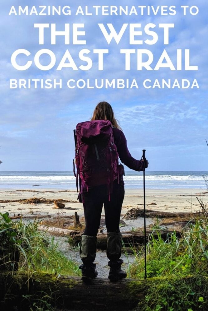
Traversing wild stretches of coastline and rugged old-growth forest in Pacific Rim National Park, the West Coast Trail is often billed as the best coastal backpacking trip in Canada.
It is no surprise that reservations disappear within minutes of the launch each year. The problem is, there just simply isn’t enough spots for everyone.

The first limitation is that the West Coast Trail is open just five months of the year. Second, only a maximum of 70 hikers may start each day.
The great news is that there are many alternative hikes to the West Coast Trail.
Read on to discover the best coastal BC backpacking trips and all the details you need to start planning a trip.

Here’s what to expect in this post:
- Cape Scott Trail
- North Coast Trail
- Juan de Fuca Trail
- Sunshine Coast Trail
- Nootka Trail
- Hesquiat Peninsula Trail
- Wildside Trail
- Tatchu Trail
- Essential coastal hiking items
There are affiliate links in this post. If you make a qualifying purchase through one of these links, I may receive a small commission at no extra cost to you.
Backcountry necessities
- Always bring the 10 Essentials
- Know how to stay safe in the backcountry
- Remember to Leave No Trace to help keep the wilderness wild
- Understand how to avoid negative bear encounters
- Trying out backpacking for the first time? Read Backpacking 101
- Check out our packing guide with gear recommendations
- Sign up to our newsletter for a free backpacking checklist
Coastal Backpacking Trails in British Columbia
The coastline of BC stretches for an incredible 25,725 kilometres.
The West Coast Trail is only a very small portion of that; there are many more British Columbia coastal backpacking trails that deserve attention!
The best part is that most of them have zero or minimal fees compared to the West Coast Trail’s $300 per person fee. These trails also attract far fewer people.
Here are eight coastal BC backpacking trips that offer a great alternative to the West Coast Trail, with more solitude, fewer fees and no reservations required.
I have hiked most of these trails and the remaining couple are on my ‘hike soon’ list. Any questions? Head to my BC & Alberta Travel Tips Facebook group.
Cape Scott Trail
Length: 47km return, 103m total elevation gain
Where: North Coast of Vancouver Island
Best time to hike: May to September
Camping: 6 designated camping areas on or close to the trail
Fees/reservations: $10/per person/per night (1st May to 30th Sept), first come first serve
Transportation: Not required
Dogs: Not permitted
Suggested length of trip: 2 to 4 days
More info: Ultimate Cape Scott Hiking Guide
The Cape Scott hike begins and ends at the San Josef parking lot. It takes around two hours to drive there from Port Hardy, with most of the 70km distance consisting of gravel logging roads.
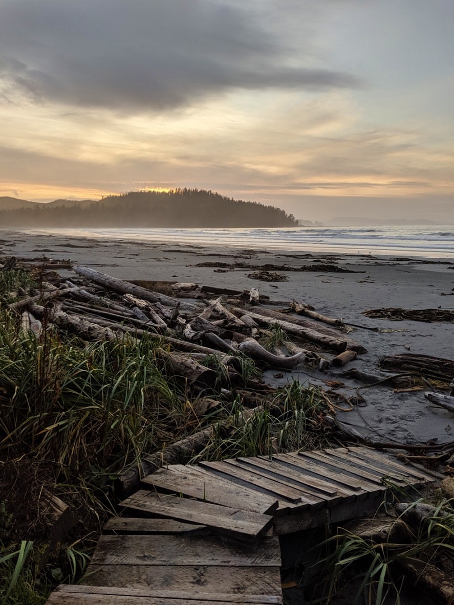
The Cape Scott Trail has to be one of the most unique coastal BC backpacking trips around.
Alongside the sweeping sandy beaches and epic Pacific sunsets you’d hope for on a coastal hike, there are also intriguing signs of civilisation that are being surrendered to nature.
Moss-covered planks of a military road, a meadow surrounded by the rainforest, rusting pots and pans nestling in the ferns. A lighthouse perches at the very end of the rugged coastline, heralding the end of Vancouver Island.
The Cape Scott Trail is as challenging as it is interesting. Despite the majority of the trail is mostly flat, it is not quite a walk in the park. Hikers must be prepared to traverse giant fallen trees, slippery boardwalks and swathes of mud.

North Coast Trail
Length: 43.1km one-way hike (many possible extensions)
Where: North Coast of Vancouver Island
Best time to hike: May to September (but open all year round)
Camping: 7 designated campsites on the trail, plus Cape Scott Trail campsites
Fees/reservations: $10/per person/per night (1st May to 30th Sept), first come first serve
Transportation: Water taxi, shuttle service
Dogs: Not permitted
Suggested length of trip: 5 to 7 days
More info: North Coast Trail guide
The North Coast Trail is the West Coast Trail’s wilder, less developed cousin.
This route along Vancouver Island’s northern coastline is a journey through some of the wettest and most rugged terrain in British Columbia. This difficult hike is for physically fit, experienced backpackers only.
Those who do venture on the North Coast Trail will be rewarded with unbeatable solitude, a high chance of wildlife encounters (whales in particular), impressive old-growth forest and several spectacular stretches of sandy beach.
The North Coast Trail connects to the Cape Scott Trail, and, as such, hikers also traverse 15km of the other route to get back to the parking lot.
A 60-minute water taxi from Port Hardy is required to reach the eastern trailhead. The southern trailhead (shared with the Cape Scott trail, above) is accessed via a network of logging roads. A shuttle bus is available.

Juan de Fuca Trail
Length: 47km thru hike with around 1500m elevation gain
Where: West Coast of Vancouver Island
Best time to hike: May to September (but open all year round)
Camping: 6 established campsites
Fees/reservations: $10/per person/per night, first come first serve
Transportation: Shuttle service between trailheads
Dogs: Not recommended
Suggested length of trip: 3 to 4 days
For more info: Juan de Fuca Trail Guide
The Juan de Fuca Trail (JDF) traverses a scenic stretch of coastline just south of Port Renfrew on Vancouver Island.
As well as crossing some spectacular beaches and rocky coves, the trail spends significant time in the temperate forest.
Most of the camping areas are either located on the beach or have beach access, offering excellent opportunities for watching sunsets and spotting wildlife.
Many people choose the Juan de Fuca Trail as an alternative to the West Coast Trail. With no reservation system, it is certainly less restrictive. There is a shuttle bus running between trailheads.
Debate remains on the overall difficulty, however, with some arguing that certain sections are a lot harder with gruelling switchbacks replacing the WCT’s famous ladders.
Personally, I still found the harder sections of the WCT (southern end) more difficult than anything on the JDF.
The full Juan de Fuca Trail will reopen on 1st July 2026 after a prolonged closure due to storm damage. See advisories for more details.

Sunshine Coast Trail
Length: 180km thru-hike or shorter section hike
Where: Sunshine Coast from Sarah Point to Saltery Bay
Best time to hike: May to October
Camping: 14 huts plus several established camping areas
Fees/reservations: No fees, first come first serve
Transportation: Shuttle service, water taxi, public bus, taxi
Dogs: Permitted
Suggested length of trip: 9 to 12 days for full length
For more info: Ultimate Sunshine Coast Trail Guide
Despite the name, the Sunshine Coast Trail (SCT) spends the least amount of time by the ocean of all these coastal backpacking trips.
While it may not provide a true coastal experience in the same way that the others do (the path is almost always in the forest), I still thought it was a worthy inclusion on this list.
Both of the SCT’s northern and southern trailheads are located by the ocean, with the first section of each staying reasonably close to the water. The majority of the rest of the trail is inland, though there are some epic viewpoints offering ocean vistas.
The total distance of the Sunshine Coast Trail is 180km, but the accessibility of the route makes it possible to hike shorter sections. The Saltery Bay to Fairview Bay section is the most ocean focused (2-3 day loop).
There are 13 free-to-use huts located along the trail, as well as free and paid campgrounds. The huts vary a little in age and facilities but all have a sleeping loft and outhouse.
Nootka Trail
The 35km Nootka Trail offers a wild coastal backpacking experience along on the western coast of Nootka Island, which sits just off the northwestern coast of Vancouver Island.
Length: 35km one-way, 520m elevation gain
Where: Nootka Island, off the West Coast of Vancouver Island
Best time to hike: May to September
Camping: 6 unofficial campsites (throne toilets only)
Fees/reservations: $50 per person user fee charged by Mowachaht/Muchalaht First Nations
Transportation: Water taxi, seaplane, boat (Uchuck)
Dogs: Not recommended
Suggested length of trip: 4 to 6 days
For more info: Complete Nootka Trail Guide
Though a relatively short distance, the Nootka Trail packs a lot of variety into those kilometres.
The untamed path winds its way through beautiful old-growth forest, up and over rocky headlands and along stunning stretches of sand.
There are some challenging sections too, with huge fallen trees to climb over and steep slopes to ascend (aided by rope) as well as mud, slippery rocks and multiple creek crossings. Just over 80% of the trail is directly on the beach.
With the trailheads only accessible via seaplane and boat, solitude is almost guaranteed. Indeed, we saw more black bears than people during our mid-September hike of the Nootka Trail!

Hesquiat Peninsula Trail
Perched on the west coast of Vancouver Island, the Hesquiat Peninsula Trail is completed by only dozens of hikers every year.
The northern trailhead, Escalante, is a short water taxi journey southwest of Yuquot, on Nootka Island.
Like the Nootka Trail, most of this backpacking route is located directly on the shoreline. The path is varied, with the beaches featuring sandstone rock shelves, tide pools, cliffs, boulders and pebbles as well as sand.
Near the end, there is the opportunity to visit the pioneer homestead of Cougar Annie’s Garden.
The name of the peninsula comes from the Nuu-chah-nulth word ‘heish-heish-a’ (to tear with the teeth) referring to the stripping technique used to gather herring spawn from eelgrass.
It is a bit of an adventure in itself to reach one of the trailheads of this hike. This coastal BC backpacking trip is covered in detail in Tim Leadem’s Hiking the West Coast of Vancouver Island book.
Wildside Trail
Length: 11km one-way, minimal elevation gain
Where: West Coast of Vancouver Island
Best time to hike: May to September
Camping: 3 designated campsites
Fees/reservations: $15 per person, per day permit fee
Transportation: Water taxi, seaplane
Dogs: Not recommended
Suggested length of trip: 2 to 3 days
For more info: Wildside Trail website
The Wildside Trail is a true coastal hike, with the path staying very close to the ocean for almost the entire length.
The route follows traditional paths used by the First Nation community on Flores Island for thousands of years.
Being relatively short and easy in hiking difficulty, the Wildside Trail is ideal for first-timers looking for a coastal BC backpacking trip. It is usually hiked as a 22km return route from the Ahousaht trailhead.
Despite the relatively remote-sounding location, Flores Island is surprisingly accessible. There is a scheduled water taxi service from Tofino ($50). Seaplane charters are also available.
Permits are available online or in person at the MHSS office in Tofino or Ahous Fuel Stop.

Tatchu Trail
Length: 32km one-way, minimal elevation gain
Where: West Coast of Vancouver Island
Best time to hike: May to September
Camping: Informal campsites (no facilities)
Fees/reservations: No fees, first come first serve
Transportation: Water taxi, seaplane, boat (Uchuck)
Dogs: Not recommended
Suggested length of trip: 5 to 6 days
For more info: 2020 ClubTread Trip Report by ‘Bluefoot’
The remote Tatchu Trail is one of the least hiked coastal BC backpacking trips on this list. It’s an ideal West Coast Trail alternative for experienced, self-sufficient hikers.
It is no easy feat to traverse this wild, unmarked route, which features multiple creek crossings, cliff scrambles, slippery surge channels and plenty of bushwhacking.
For some, the challenge is the appeal. For others, it is the chance to hike where very few go and experience true wilderness.
Most hikers traverse the trail from south (Port Eliza) to north (Rugged Point).
Before 2020, it was an option to take the MV Uchuck boat to Port Eliza. It doesn’t appear that this service has resumed.

What to Bring on Every Coastal BC Backpacking Trip
When organising your gear, ensure you have the following items:
- The 10 Essentials – Check and double-check that you have the 10 Essentials before setting out on any coastal backpacking trip in British Columbia.
- Sturdy hiking boots. All of the trails mentioned require a good pair of shoes. Unless you’re an experienced ultralight trail runner or thru-hiker, you’ll need sturdy hiking boots. I love the Oboz range of hikers, for day hikers as well as backcountry treks
- Bear spray. BC’s coastline is a major bear habitat. Carry a full bear spray canister and know how to use it. Always carry bear spray on your person (with a holster), not in a backpack
- Bear hang equipment. The majority of coastal BC backpacking trails mentioned in this post do not have bear caches at designated campsites. You must be prepared to hang your food. Bring at least 15 metres of strong rope or cord
- Satellite communicator. Most of these hikes do not have any phone signal on the trail. I would recommend bringing a satellite communicator such as an InReach
- Gaiters. Coastal British Columbia is wet, no question about it. Gaiters offer protection for the lower legs against water, mud and rock abrasion. I would consider them essential on any coastal hike in BC
- Tide tables. Use of a tide table is essential for many of these coastal hikes. Otherwise, you may become trapped by incoming tides and unable to continue (or backtrack)
- Hiking poles. Even just one will help when traversing hills, coastal cliffs and slippery rocks. We love Black Diamond’s incredibly light and compact Distance Z series. Your knees will thank you, I promise

More BC Backpacking Trips
Lake O’Hara, Yoho National Park
Eva Lake Trail, Mount Revelstoke National Park
HBC Heritage Trail, from Hope to Tulameen
Pinnacle Lake, Monashee Mountains
Monica Meadows Trail near Kaslo
Mount Assiniboine Provincial Park
Della Falls Trail (Canada’s highest waterfall)
How to Reserve Backcountry Camping in BC: Essential Details and Dates
25 of the Best Overnight Backpacking Trips in British Columbia
Check out these other hiking posts next

One half of the Canadian/British couple behind Off Track Travel, Gemma is happiest when hiking on the trail or planning the next big travel adventure. JR and Gemma are currently based in the beautiful Okanagan Valley, British Columbia, Canada. Consider buying us a coffee if you have find any of our guides helpful!