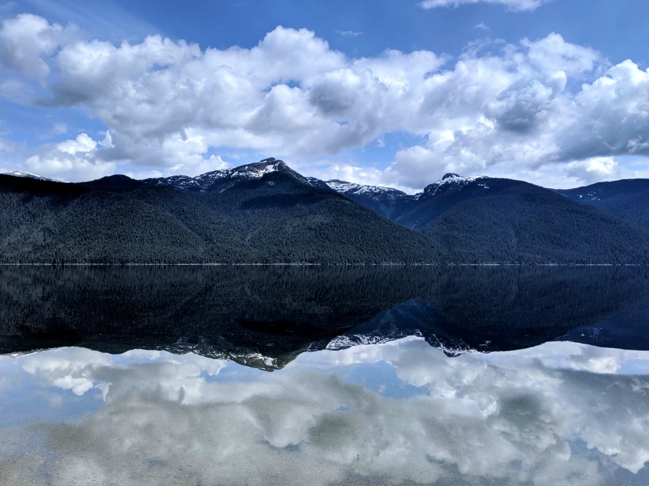
As North America’s largest paddle-only lake, Murtle Lake offers canoeists and kayakers an unparalleled wilderness experience in British Columbia, Canada.
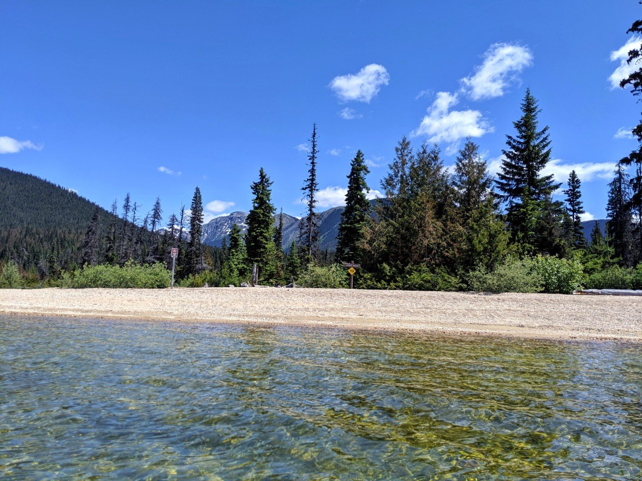
Wide sandy beaches, tiny intricate islands, waterfalls and rustic campsites are scattered along 100 kilometres of shoreline, all back-dropped by magnificent mountain peaks.
A lava-dammed lake in Wells Gray Provincial Park, Murtle Lake is located between Kamloops (BC) and Jasper (AB).
The combination of Murtle Lake’s remote positioning, motor boat ban and immense size combine to create a peaceful yet adventurous paddling destination.
Better still, only one portage (2.5km) is required to reach the lake!

We spent six days on and around Murtle Lake in late June 2019, blending canoe camping with backpacking to fully absorb the scenery as much as we could.
Read on for more about our trip and then discover how to plan your own Murtle Lake adventure in the subsequent guide. Here’s what to expect:
Last updated July 2024. Murtle Lake is located on the traditional territory of the Ktunaxa Nation and Secwepemc Nation.

Backcountry necessities
- Always bring the 10 Essentials
- Know how to stay safe in the backcountry
- Remember to Leave No Trace to help keep the wilderness wild
- Understand how to avoid negative bear encounters
- Trying out backpacking for the first time? Read Backpacking 101
- Check out our packing guide with gear recommendations
- Sign up to our newsletter for a free paddling checklist

An Introduction to Murtle Lake
Murtle Lake is a vast lake located at 1067m elevation in Wells Gray Provincial Park in east-central British Columbia, Canada. As mentioned, it is North America’s largest paddle-only lake.
Shaped like a backwards capital ‘L,’ Murtle Lake consists of two main bodies of water.
The ‘West Arm’ (or Main Arm) stretches about 15km while the ‘North Arm’ heads 20km exactly in the direction you would expect. The lake’s width varies but is only 3km at its maximum.
With more campsites, shorter distances and supposedly better fishing, the West Arm is more well-used.

The North Arm, on the other hand, has more dramatic scenery. For us, the choice was simple. To the North Arm of Murtle Lake, we go.
Please note – there are very limited day-use opportunities at Murtle Lake. This beautiful place is all about multi-day paddling trips.
I mention this specifically because we met people who had driven all the way on the gravel road to be surprised (and a bit disappointed) that there wasn’t much to see and do.
Canoe rentals have to be pre-arranged with a two day minimum. The rest of Wells Gray has plenty to offer day visitors!
Before planning a trip to Murtle Lake, check for advisories on the BC Parks’ Wells Gray page. At the time of this update (26th July 2024), Murtle Lake is closed to visitors due to wildfire risk.

Our Murtle Lake Paddling Experience
In this section, I’ll share our six-day Murtle Lake paddling experience. The trip planning guide will follow.
Exploring the North Arm
To reach the shore of Murtle Lake, it is first necessary to transport all your gear (canoe included) from the parking lot along a 2.5km trail.
Besides the ever-changing weather, this is probably the biggest challenge of any Murtle Lake trip.
Even with a canoe cart brought from home, it was still an awkward, sweaty, buggy mess of a journey. The Murtle Lake portage doesn’t have much elevation change overall (less than 50m) but it’s certainly doesn’t feel flat when you’re lugging a canoe along it!
Once at the lake, however, things get a lot more interesting.
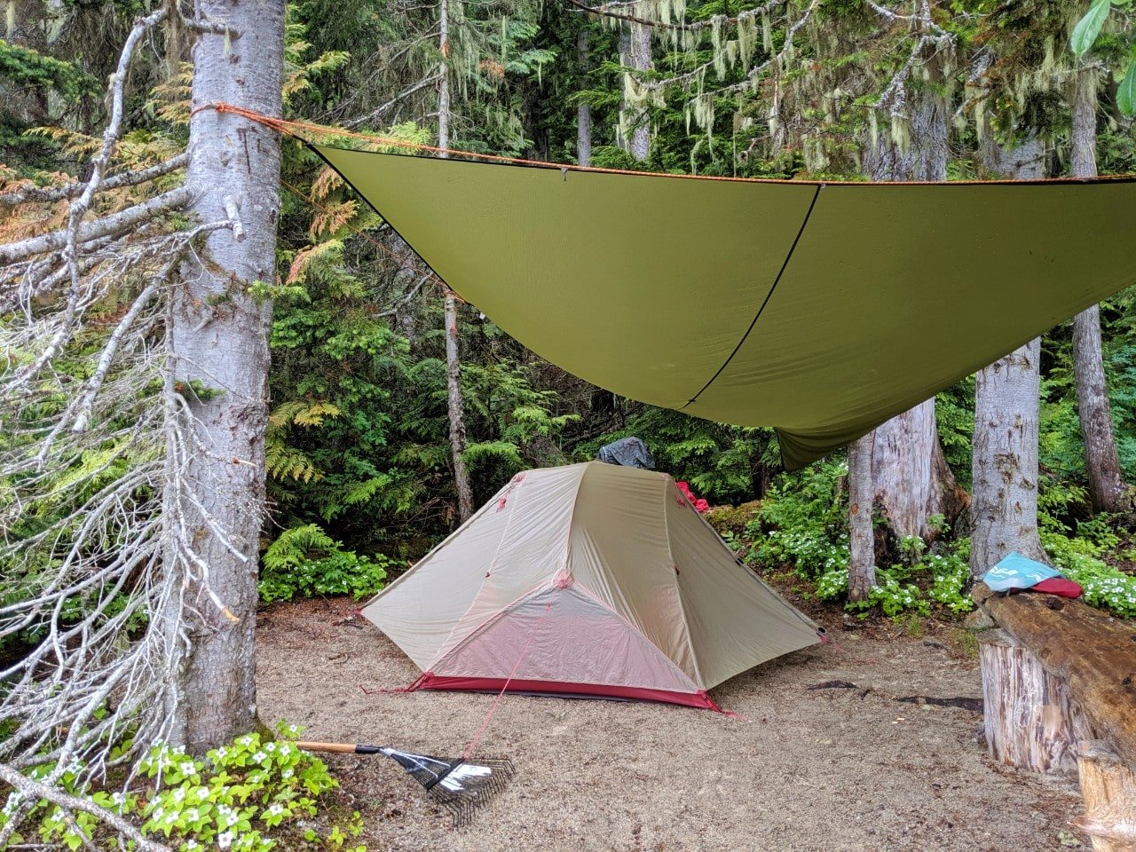
Our home for the night (and actually, the next four nights) was Wavy View campsite, a cosy spot with a lovely beach, forested camping area and easterly aspect.
We had originally planned to move around after a couple of days, but the rain settled in and us with it.
Rain or not, we still managed to explore the North Arm to the very end, stopping at campsites along the way.
The views got better and better the further we went, much like the weather. Evenings were for fishing, reading and playing cards by the fire.

North America’s largest paddle only lake
Boat motors are not allowed on Murtle Lake. Only visitors using canoes, kayaks and paddleboards are able to explore this spectacular lake.
This guarantees that a paddling trip on Murtle Lake will be a peaceful one, with the only sounds being the steady lap of water on the shore and an occasional loon call.

At least, that is, during the day. On three consecutive nights, we were woken by the loud baritone hooting of a Barred owl.
So loud was this owl that it felt like it was perched right on the top of our tent. It called out into the silence to receive no reply.
Although I may have initially been grumpy to have had my sleep interrupted, that haunting cry in the night was one of the top highlights of our six day Murtle Lake adventure.
Alone on Murtle Lake
For almost four days on Murtle Lake, we didn’t see a single other soul.
On the fourth night, we spotted the tell-tale sign of campfire smoke snaking into the sky on the opposite shore. The occupants were too far away, however, to see or even to hear.
Our fifth day on the lake was Canada Day, the perfect time for us to get a different perspective on the lake. The weather also decided it was finally time to improve and celebrated the holiday with wall to wall sunshine.
As we waved goodbye to our dear Wavy View campsite, we started spotting other paddlers. A group of three canoes glided past us near Sunshine Cove and another two by the Wavy Alpine trailhead, our next destination.

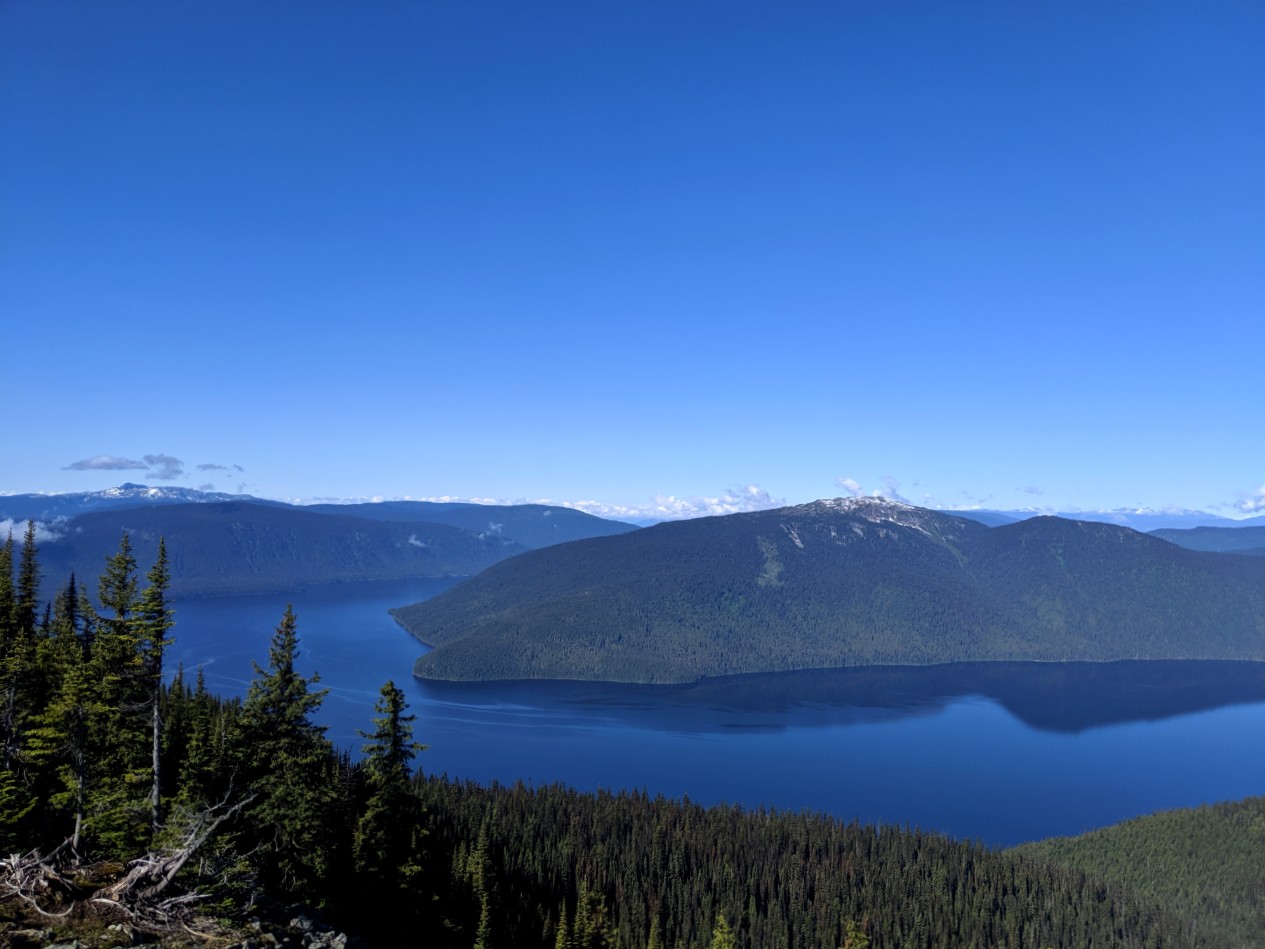
Exploring Wavy Ridge
Though Murtle Lake is already high in elevation, it is possible to climb even further still into the surrounding mountains and reach the alpine.
The lure of the alpine is pretty irresistible for me, so it was a given that we’d tack on a mini backpacking trip to our Murtle Lake paddling adventure.
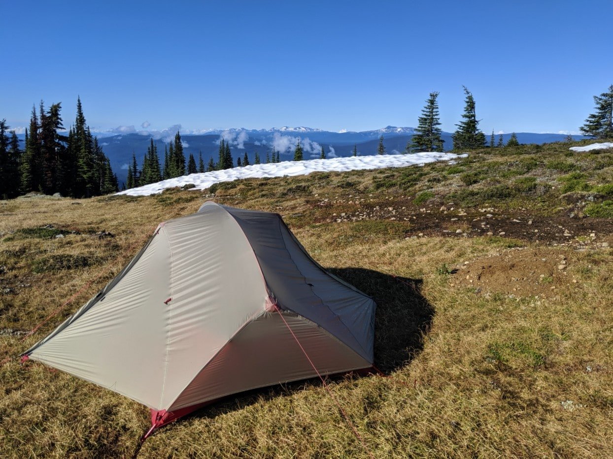
We chose to hike the Wavy Alpine trail, a 7km one way trek up to the ridge that had been directly across from our campsite.
The Wavy Alpine trail starts with a mellow ramble through the forest (watch for big cedar!) before ascending steeply. As our first backpacking trip of the year, the 975m gain was pretty punishing.

There are no views on offer until the very last kilometre or so either, so distractions are pretty thin on the ground.
Almost needless to say, it was worth the effort. The forest disappeared quickly to reveal the ridge stretching into the distance, surrounded by endless mountains and valleys on two sides with the deep blue Murtle Lake on the other.

Goodbye to Murtle Lake
There was still a fair bit of snow around so we didn’t go too far along the ridge before setting up the tent.
Rain and wind rolled in quickly after our arrival and unfortunately stuck around all night, but we were able to appreciate the views once more in the morning before heading back down to Murtle Lake.
The journey down was, of course, a lot faster, though we got absolutely soaked by all the wet brush on the trail. Luckily, we were able to dry out while paddling back to Murtle Lagoon.
The little landing beach in the Lagoon was crowded with two family groups heading out onto the water.
Some of them seemed a little anxious about the building wind, but such is the nature of Murtle. Wait half an hour and it may be calm again.
While it may be unpredictable, the tranquillity and serene beauty of Murtle Lake is unrivalled. It’s the perfect retreat for paddlers looking to enjoy the simple pleasures of nature (once you get past that first portage…)
Murtle Lake: Trip Planning Guide
If you’re thinking about planning a trip to Murtle Lake yourself, you’ll find everything you need to know below.
Here are some of the most important points to get your trip planning started:
- Murtle Lake is famed for being North America’s largest canoe and kayak-only lake
- There are 19 camping areas, with 69 campsites
- While free to visit, backcountry camping fees are $5/per person per night on Murtle Lake
- In addition to the paddling opportunities, there are numerous hiking trailheads along Murtle Lake’s shores
- Canoe rentals must be arranged in advance
- Dogs are not allowed in the backcountry of Murtle Lake
This post includes affiliate links. If you make a purchase via one of these links, we may receive a small percentage at no extra cost to you.

How to get to Murtle Lake
Murtle Lake is located in Wells Gray Provincial Park, a huge wilderness area in east-central British Columbia, Canada.
The closest community is Blue River on Highway 5. From here, a 27km mostly gravel road leads to the Murtle Lake parking lot. The route is winding, sometimes narrow and rough.
The parking lot has space for RVs as well as regular sized vehicles. There is an outhouse and some information boards.
To reach Murtle Lake itself, a 2.5km portage is necessary. Large gear carts are available for rental canoe customers. Pink canoe carts are free for anyone to use (though I only realised this after our trip!)*
*August 2022 update – a reader recently advised me that the free pink canoe carts no longer seem to be available.
The well-maintained portage route meanders through the forest and over a creek or two before arriving at Murtle Lagoon. Mosquitoes are pretty prevalent here.
At Murtle Lagoon, there is an outhouse, self-registration vault, information boards and locked rental canoes (see below for more info). The trail continues along Murtle Lagoon to Campsite 1 on Murtle Lake.

When to visit
Located at an elevation of 1067m and fed by a glacial river, Murtle Lake has a cool climate.
Murtle Lake is technically open all year but is difficult to access from October to April due to local weather and road conditions.
The main paddling season for Murtle Lake is June to September, with July and August being the warmest and busiest months.
The average high for both of these months is 22c. Be prepared for all kinds of weather (heavy rain, snow, hail), even in summer.
Here are some other good things to know when planning your Murtle Lake trip:
- Water levels are usually highest in May and June, and lowest in September. Since the lake is fed by a glacial river, water temperatures are cold, even in summer
- Being a large lake, Murtle is susceptible to strong wind gusts. Wind can also build up surprisingly quickly, causing choppy conditions on the lake. This happens most often in the afternoon but can occur at any time of day
- Mosquitoes are present throughout the paddling season but are generally worse during the spring and early summer
- If avoiding the busiest times is a priority for you, I’d aim to visit away from holiday weekends (Canada Day, BC Day, Labour Day). I’d also suggest exploring the North Arm rather than the West Arm

Canoe rentals
If you don’t have your own canoe or kayak, there are a couple of local options:
- Murtle Canoes offers canoe rentals right from Murtle Lagoon. There is a two day minimum rental period and there is a strict 11.00am pick-up and drop-off time. Murtle Canoes customers have free use of canoe carts (found in the parking lot) to transport gear along the portage
- Blue River Campground rents canoe and camping equipment rentals, to be transported to Murtle Lake independently. Canoe carts can also be rented for use on the portage (recommended, though there are some free ones in the parking lot)

Wilderness camping
19 wilderness camping areas are situated on the shores of Murtle Lake, with space for approximately 69 tents in total.
Each camping area has at least one outhouse and fire pit plus a metal bear cache for food storage. There are no formal tent pads.

Murtle Lake’s camping areas are numbered from 1 to 20 on maps. A large numbered yellow sign is located on each beach. The bright yellow signage makes the campsites easy to spot from a distance.
Camping fees on Murtle Lake are $5 per night, per person aged 6 and over.
From 2026, non-BC residents will be charged an additional $20 per stay, per camping group, at provincial campgrounds.
There is a self-registration vault at Murtle Lagoon – bring cash and remember to keep the receipt safe!
If you can, I would recommend purchasing a permit online instead. This records your visit in the BC Parks system and means that if there was an evacuation due to wildfire, they would know to look for you.

Choosing a campsite
The Murtle Lake brochure map offers a breakdown of campsites with suggested number of tent spots.
The map refers to some sites as being ‘group sites’ but there is no restriction on where you can camp, no matter the size of the group. The group sites are simply the larger ones.
Campsites 1-12, all located on the busier West Arm, are stated to experience ‘high use.’
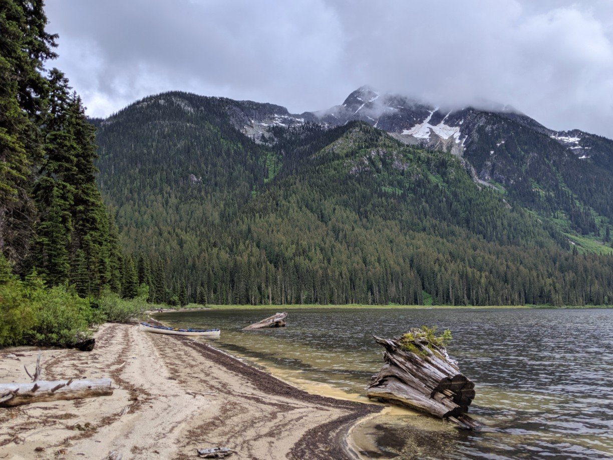
I would also add Straight Creek (site 20) to that list. Being relatively close to the entrance of the lake and featuring a large sandy beach, it proved consistently popular during our visit.
The amount of camping space at each site does vary depending on the time of year. When the lake level is high, beach space disappears.
Here’s what we thought of the campsites we personally visited:
Sunshine Cove – #13
Small site with space for ideally one tent, two at a push. Despite the name, I don’t think it would receive much sun.
Wavy View – #14
We stayed here and were very happy with our choice. It has wonderful views of Wavy Ridge and an expansive beach. There’s space for two tents in the forest just behind the beach. If needed, you could also camp on the beach.

Little Anderson – #15
This campsite is a little different in that it is next to a lagoon type area. This means that the site has a corner aspect, with views to the north and also to the east. There’s space for about two tents here.

Murtle Beach – #16
Located right at the end of the North Arm, this campsite has the potential to get really windy. It undoubtedly also receives a lot of debris from the rest of the lake.
This campsite does have a beautiful beach though as well as stunning mountain views all around. The actual camping area is a bit overgrown in sections, but there are some cleared areas behind the beach for about three tents. The beach offers more space.
Eagle Point – #17
The positioning of this site is pretty nice, on a corner with views all around. The camping area itself is elevated above the beach.
There’s space for two or three tents. At the time of our visit, the lake level was relatively high so there wasn’t much beach left.

Moonlite Bay – #18
This is a small camping area which can be hard to spot. I liked it but even so, it wasn’t one of my favourites. It does face west so the evening sun would be lovely here.

Strait Creek – 19 (referred to as 20 on the map)
Hugely popular, this campsite has a really long beach next to a marshy area. Due to the latter, I imagine it could be buggy on windless days.
At the northern end, you can access the Wavy Alpine trailhead. Officially, BC Parks states there to be space for 6 tents here but the size of the beach implies that quite a few more could fit if needed.
Hike-in camping
As mentioned below, Murtle Lake also offers hiking opportunities to nearby lakes, a waterfall and into the alpine.
Camping on Wavy Ridge is allowed, though there are no developed facilities or campsites. Follow Leave No Trace principles at all times.
Hiking opportunities
Accessible by water only, there are a number of hiking trails around Murtle Lake.
All of the following are return distances (there and back). Hiking trails are shown on this Murtle Lake map.
- Henrietta Lake – Easy 2km hike to fishing lake
- Anderson Lake – Easy 8km hike featuring abandoned cabin and beautiful views
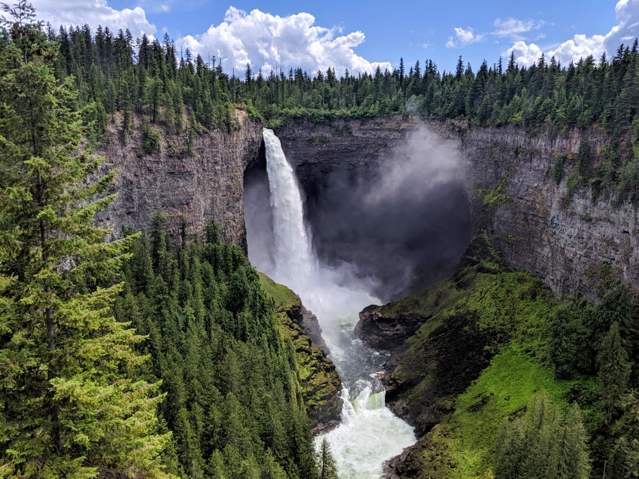
- McDougall Falls – Easy 10km hike to 14m high waterfall
- Central Mountain – Moderate/difficult 15km hike (1037m elevation gain) to alpine
- Wavy Ridge – Moderate/difficult 14km hike (975m elevation gain) to alpine
- Strait Lake – Moderate 12.8km hike to a lake below Wavy Ridge
- File Creek/McDougall Lake – Adventurous, unmaintained route starting with a 1.5km portage
Murtle Lake’s hiking trails are on the wilder side – they do not necessarily receive much maintenance. For that reason, you may experience deadfall on the trail as well as other obstacles.
As mentioned earlier in this post, we loved our overnight excursion to Wavy Ridge. Taking a side trip to the alpine isn’t something we’ve ever done on a paddling trip before.
The only unfortunate thing was being a bit early in the season so there was still quite a lot of snow on the ridge in early July. I’m sure the wildflowers would be fabulous on Wavy Ridge in late July and into August.

Essential items to bring
In addition to your choice of canoe or kayak, safety equipment and standard camping gear, be sure to bring these items on your Murtle Lake adventure!
Mosquito repellent – I’ve mentioned this a couple of times, but Murtle Lake is pretty buggy in certain areas. Be sure to bring your repellent of choice, whether it is a Deep Woods spray, a deet-free alternative or a Thermacell appliance
Camp chairs – Murtle Lake’s campsites do not have picnic tables. If you’d like to sit down comfortably in the evenings, consider bringing a couple of camp chairs. We use and love Chair One by Helinox – each one weighs only 900g (2lbs)

Bear spray – Black and grizzly bears live in Wells Gray Provincial Park. When on land, always remain alert and make noise. Be sure to store food, aromatic items and trash in the bear caches. Bear spray is a good ‘just in case’ item to have. Use a holster to keep it handy
Lightweight tarp – Whether you need to use it for rain or shade, a lightweight tarp is a definite must have for a canoe trip on Murtle Lake. It rained almost every day on our trip and the tarp enabled us to create a cosy and dry base camp. We have used our Rab Siltarp 2 for years now
Fishing licence – If you plan to go fishing on Murtle Lake, purchase your licence online at home (or in person from a Licence Vendor) and then bring a printed copy along with you. Be sure to check the relevant fishing regulations first too – Murtle Lake is in Region 3
Check out our Resources page for more outdoor gear recommendations for trips like this.
If you need any last minute items, try to stop in Clearwater (or Valemount if arriving from the other direction). Blue River is the nearest community to Murtle Lake but stores selling supplies (equipment, groceries) are pretty limited.

Other things to do in Wells Gray Provincial Park
Murtle Lake is just one part of the huge wilderness area that is Wells Gray Provincial Park.
The main developed section of the park is the Wells Gray Corridor, located north of Clearwater (106km south west of Blue River).
The 68km Corridor driving route takes in a dozen spectacular waterfalls and offers access to alpine hiking (including the beautiful Trophy Meadows), historical sites, vehicle-accessible campgrounds and more.
At the end of the road, Clearwater Lake offers multi-day paddling opportunities. Azure Lake can also be accessed via a short portage from Clearwater.
Other posts about multi-day canoe trips you may be interested in:
Bowron Lakes Canoe Circuit, British Columbia
Kejimkujik National Park, Nova Scotia
Slocan Lake, Valhalla Provincial Park, British Columbia
Sayward Forest Canoe Circuit, British Columbia
Algonquin Provincial Park, Ontario
Della Falls, Strathcona Provincial Park, British Columbia
Powell Forest Canoe Route, British Columbia


One half of the Canadian/British couple behind Off Track Travel, Gemma is happiest when hiking on the trail or planning the next big travel adventure. JR and Gemma are currently based in the beautiful Okanagan Valley, British Columbia, Canada. Consider buying us a coffee if you have find any of our guides helpful!
Awesome write up! I can’t find anywhere that states pets are not allowed at Murtle. Can you help us out there?
Thanks!
Hi Gord,
Dogs are not allowed at Murtle Lake, sorry. You can see this specifically mentioned in the special notes under the ‘Know before you go’ section on BC Parks’ Murtle Lake page here. There are a lot of bears in the area so I presume it is to do with that.
Thank you for your info regarding Murtle Lake, I took my 10 year old daughter there last weekend for her first overnight backpacking trip. We hiked from the parking lot to the lagoon (2.5km) and then carried on to Murtle Lake Campsite 1 another 800m past the lagoon. I missed that the pay station was actually at the lagoon so had to go back there on our way out. The campsite was great, we chose a spot on the beach and had a lovely view of the lake. Swimming conditions were perfect so my daughter had an evening dip once we got there. There is a group campsite across the canal, on the map it looked like there was a trail to get there but we couldn’t find where that started.
When we arrived the parking lot was packed, at least 30 cars, so I was concerned that we wouldn’t have anywhere to camp. But we took out chances and at Campsite 1 there were 3 other parties that shared the beach with us, and over at the group campsite there were probably 4 other tents, the rest of the people must have already been on the lake and camping out there.
I would definitely recommend this for younger children. The hike was quite easy, particularly the first 2.5km as it is meant for portaging canoes. The last 800m had some hills but nothing technical or terribly difficult. And the reward of the beach at the end was well worth it. Of note there was an out house, but was low on TP so be sure to bring your own (and it was an all uphill hike to get to it), and there is a bear cache at the head of the trail to the toilet.
I always have trouble finding info online so I appreciate what you posted and just wanted to add these tidbits for anyone else looking for an easy overnight hike.
Thanks for sharing your experience Ricki – I appreciate it and I’m sure other readers will too! 🙂 Sounds like a fun idea for an overnight backpacking trip, especially for groups with children.
Awesome !!!!
Thank you for the info and links! SO appreciated. We have been twice to Wells Gray and want to visit Murtle Lake with my cousin this summer but have found it tricky to find info about this park (online, at least).
Hi Sondi,
Thanks for letting me know you found this guide helpful! If you have any questions I’d be interested to hear them as I always strive to improve our posts and help more people! 🙂
Love these posts and I’m planning a trip this month. I’ve heard conflicting things about the road from Blue River to the lake. Do you need to have a 4 wheel drive or will a good manual transmission make it?
Hi Heidi,
We used our high clearance van to drive this road – not a 4X4. It’s not the worst gravel road I’ve ever been on, but I’d suggest not bringing a low clearance vehicle for sure. Check your tire pressure before leaving and make sure your spare is a full sized one (and not flat!)
Hi there
My son and I canoed the west arm of Murtle Lake in August 2022 and we loved every minute of it. From Tropicana camp site, we paddled across and hiked to Anderson Lake. I just wanted to update that the abandoned cabin has collapsed recently and the trail to Anderson Lake is very overgrown and difficult to follow in many places. But the lake itself is beautiful!
Hi Wayne,
So great to hear you had a fantastic trip to Murtle Lake! And thanks for the update re: Anderson Lake trail. Good to know.