For many travellers, the drive from Victoria to Nanaimo is seen as a simple 90-minute trip between Vancouver Island’s two largest cities. But there’s far more to this route than just getting from A to B. Speeding along Highway 1 means skipping past countless worthwhile stops.
Some highlights include one of British Columbia’s best provincial parks, the world’s largest outdoor collection of totem poles and a 44m high railway trestle. And that’s before even mentioning the incredible ocean views from the Malahat Summit!
What might normally take 90 minutes can easily stretch into a full day of exploring. In fact, it would be more than possible to turn every stop on this list into a leisurely long weekend itinerary.
We’ve driven between Victoria and Nanaimo so many times in the last decade. The first time we drove this route, it was on our very first trip to Vancouver Island. We ended up continuing to the Comox Valley and living there for the next two years! So it will always hold a special place in my heart.
This guide shares our top picks for places to stop along this 110km long drive, all tried and tested by us. I’ll also explain how you can combine this route with other memorable Vancouver Island road trips.
Here’s an overview:
- Goldstream Provincial Park
- The Malahat – free viewpoints
- Malahat SkyWalk
- Kinsol Trestle
- Merridale Cidery and Distillery
- Cowichan Bay
- Duncan Totem Tour
- Chemainus
- Ladysmith
- Crow & Gate Pub
- Petroglyph Provincial Park
- The Abyss
- Vancouver to Nanaimo: Essential details
There are affiliate links in this post. If you make a purchase via one of these links, we may receive a small percentage of the sale.
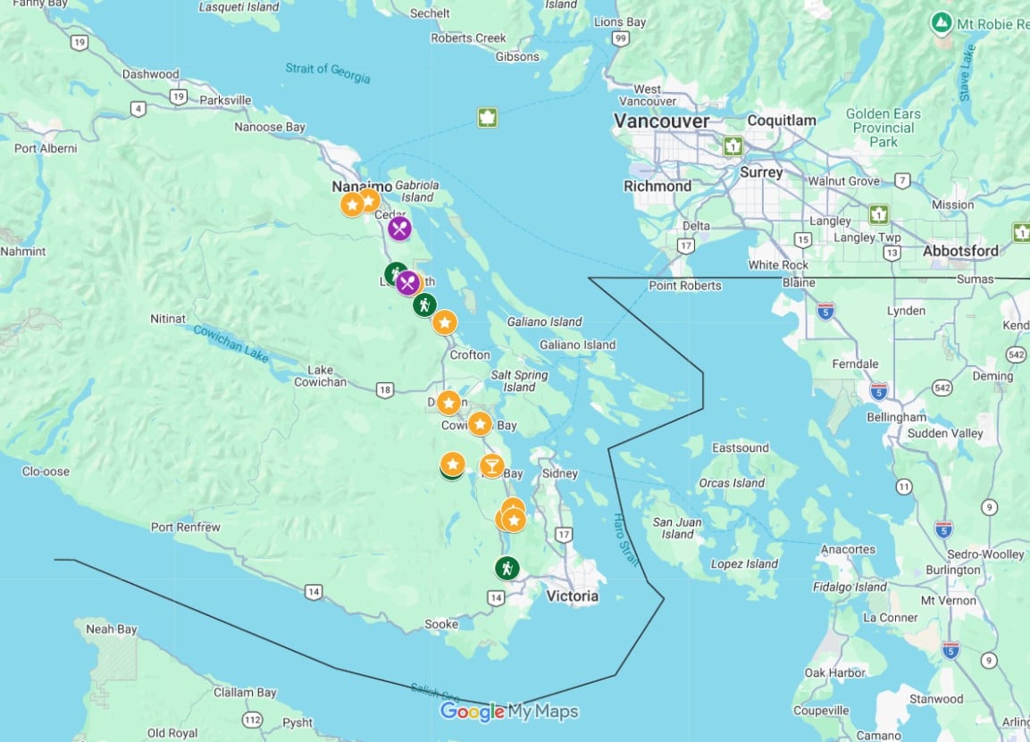
Victoria to Nanaimo road trip map
This map will help you locate all of the featured places in this guide.
If you’re planning to drive between Victoria and Nanaimo within a half day, I’d suggest choosing just a couple of these places to check out. For a full day drive, consider 3-4 stops.
Goldstream Provincial Park
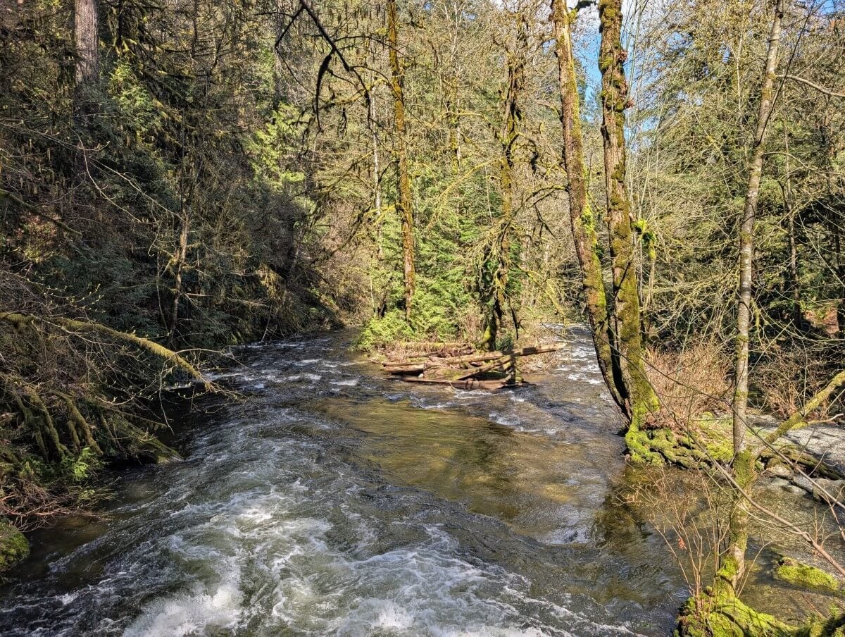
Despite being so close to Victoria, Goldstream Provincial Park still feels like a different world. It features towering old-growth trees, hiking trails to summits and waterfalls, and seasonal salmon runs from mid-October through December.
One of my favourite hikes is Mount Finlayson. It’s a good, short workout, climbing 410m in just 2km. The summit views towards the Langford area are well worth the effort. If that sounds like too much, I’d suggest a leisurely walk to the Visitor Centre (1.2km return).
The trail passes a number of large trees and has some pretty river and inlet views as well. There is a short side trail to 47m high Niagara Falls.
The only downside about Goldstream is that the access to the main day use area is a bit tricky when travelling south. I’ll explain more about this later in the guide.
The Malahat – free viewpoints
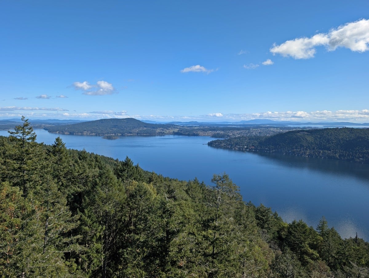
Highway 1 climbs and descends the 356m high summit of Malahat Mountain. Named after the local First Nation community, the Malahat is considered one of the most sacred places on southern Vancouver Island.
For drivers, the Malahat section of highway is a winding and steep 25km long journey over rugged mountainsides, through the forest and along steep cliffs.
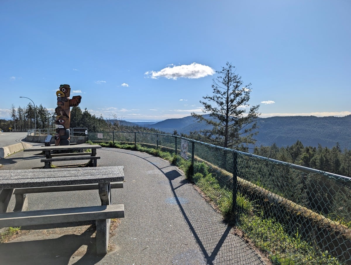
Accessible northbound only, there are two free viewpoints. The first viewpoint, Malahat Summit, has some lovely forested views of the Saanich Inlet. There’s a totem pole with interpretive signage as well as picnic tables.
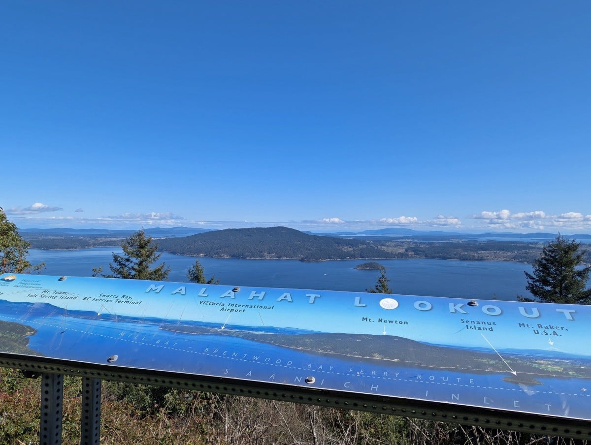
The second viewpoint is called the Split Rock Lookout and has more impressive views of the Inlet as well as the Saanich Peninsula, Salt Spring Island and the surrounding Salish Sea. On a clear day, you may even be able to spot the snowy top of Mount Baker (in the USA).
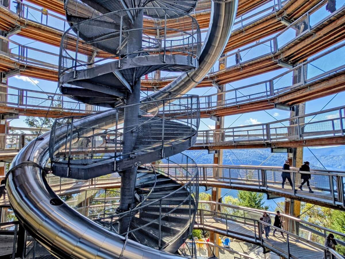
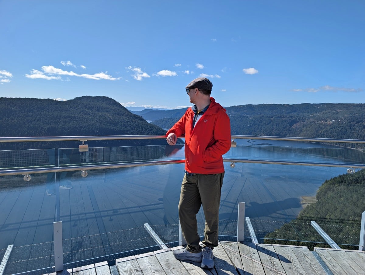
Malahat Skywalk
To see the best Malahat views, consider a trip to the Malahat SkyWalk. This sustainably built attraction boasts an elevated treetop boardwalk and 32m tall spiral observation tower with 360 degree lookout. For kids over 5 (and those young at heart), there’s a slide down from the top as well!
The SkyWalk is one of the few paid attractions in this guide, but in my opinion it’s well worth it, especially for families and wheelchair users. Accessibility was clearly a key consideration in its design.
The views really are fantastic from the top of the Spiral Tower. With good weather, you can see far across the ocean into the USA. There are interpretative panels to explain which islands are which.
Keep in mind that when travelling southbound, you’ll need to follow some U-turn routes to access the Malahat SkyWalk (extra 20km or so total). There are no left turns on and off this fast moving and narrow stretch of the highway.
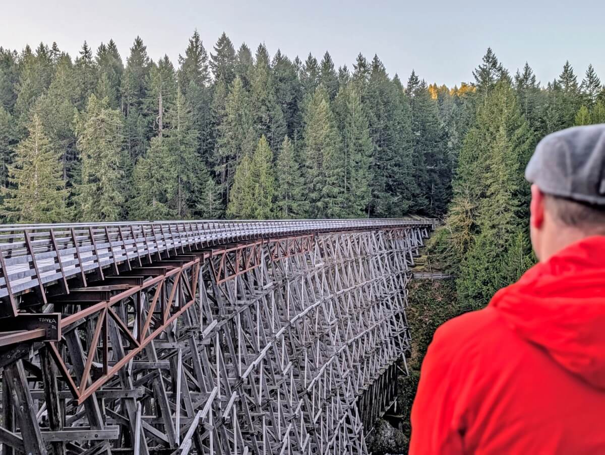
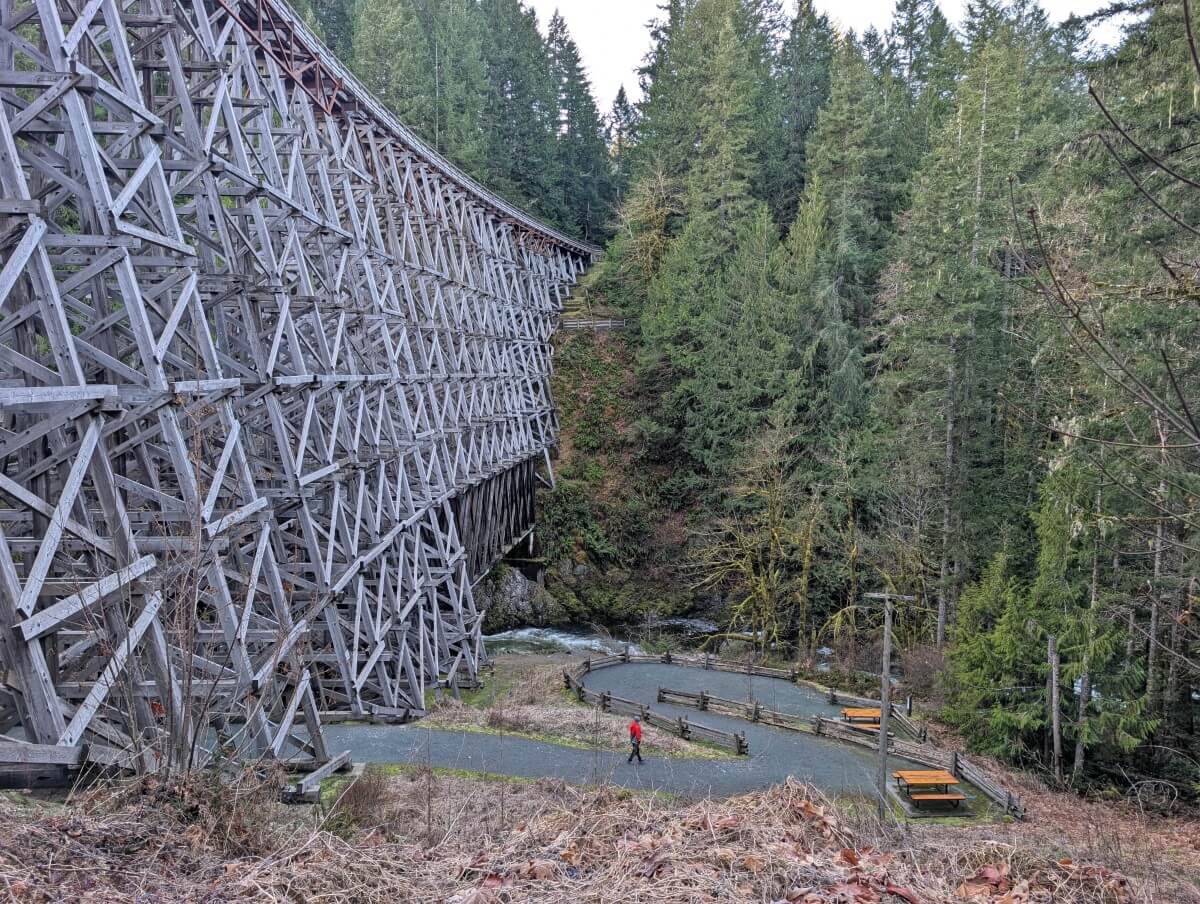
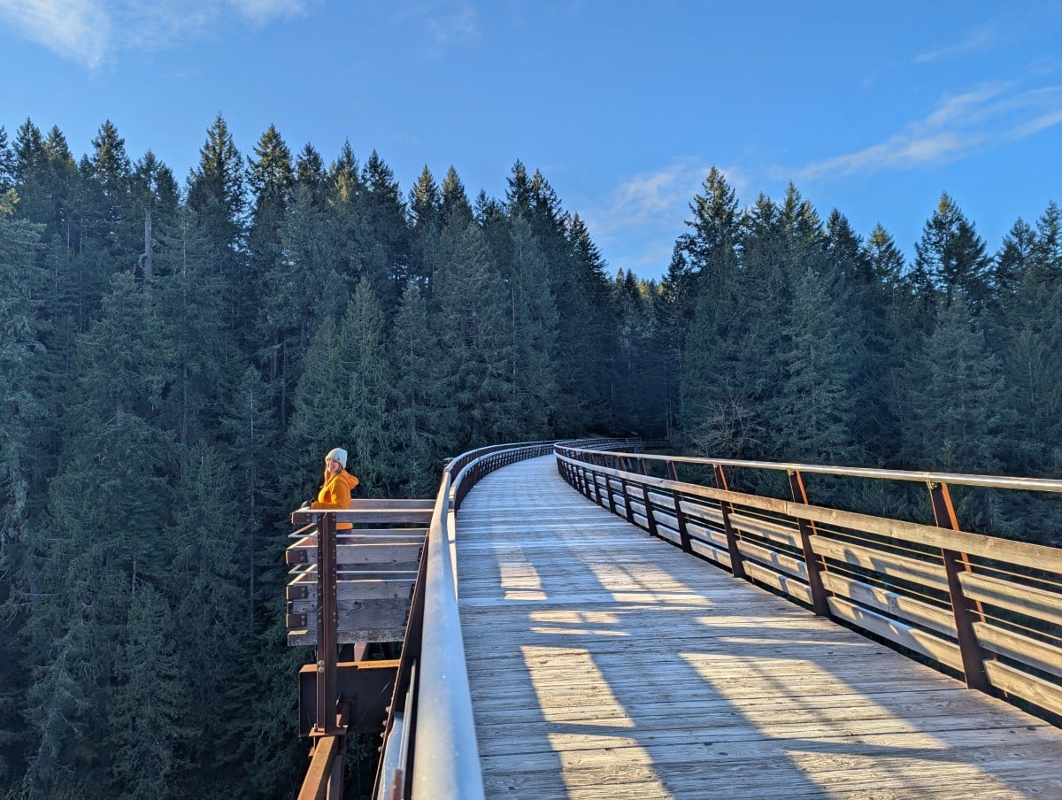
Kinsol Trestle, Shawnigan Lake
One of the tallest free-standing timber rail trestles in the world, the Kinsol Trestle rises 44m high and stretches 187m across the Koksilah River.
Constructed by the Canadian Northern Pacific Railway in the early 1900s, the trestle carried both passenger and freight trains until 1979. It was later restored and reopened in 2011 as part of the Cowichan Valley Trail (also the Trans Canada Trail).
While the views from the top are stunning, the perspective from below is even more striking – the intricate, layered timber design is an engineering feat in itself.
From the south parking lot, it’s a 1.2km (20 minute) walk to the trestle. The trail is flat and accessible to hikers, cyclists, and equestrians. There is a wheelchair accessible viewing platform at the top as well.
Merridale Cidery and Distillery
The Cowichan Valley area receives Canada’s warmest year round temperatures, which makes it the ideal place for growing crops, raising animals and fishing. With such bountiful produce, the valley is something of a foodie heaven.
One of my favourite local producers is Merridale Cidery and Distillery. This family owned farm has been operating for over 30 years and is both dog and child friendly. Set onto 20 acres, it’s a great place to hang out for a while. There’s a restaurant, tasting room, store, patio and orchard to explore. Guided tours are available as well.
If cider isn’t your thing, consider checking out one of the local wineries instead. There are a total of thirteen, with the first one opening in 1992.
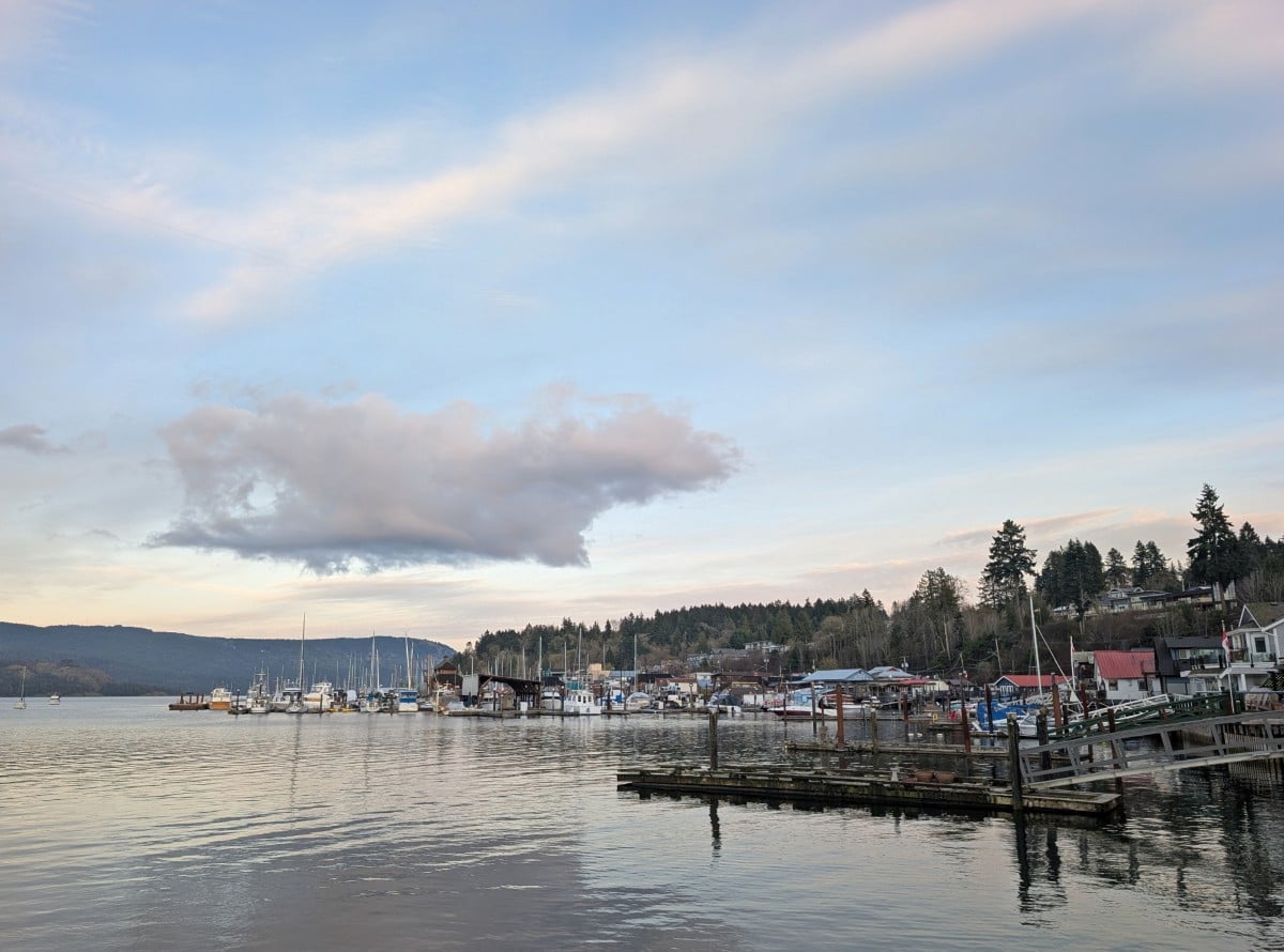
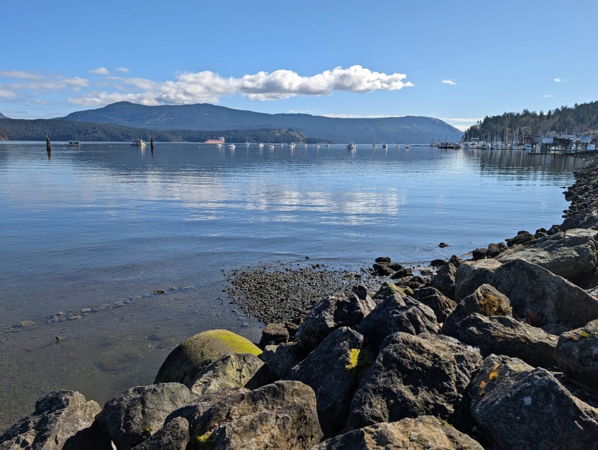
Cowichan Bay
Cowichan Bay (or ‘Cow Bay’) is one of the most charming places to stop in this area. The waterfront strip has a mix of colourful shops and restaurants, artist studios, boardwalks, floating houses and buildings on stilts. Whale-watching and kayaking tours are offered during the warmer months.
Originally founded as a wooden boat building workshop in the 1980s, the Cowichan Bay Maritime Centre is worth a visit. It hosts a 100m long heritage pier, dugout canoes, sunny patio and boatbuilding exhibits. The entry fee ($5 on our last visit) is modest.
After visiting the main area, continue along Cowichan Bay Road to Hecate Park. The bird watching platform here overlooks the Cowichan Estuary, an internationally designated Important Bird Area (IBA). The Cowichan Estuary Nature Centre is free to enter and has some interesting interactive exhibits.
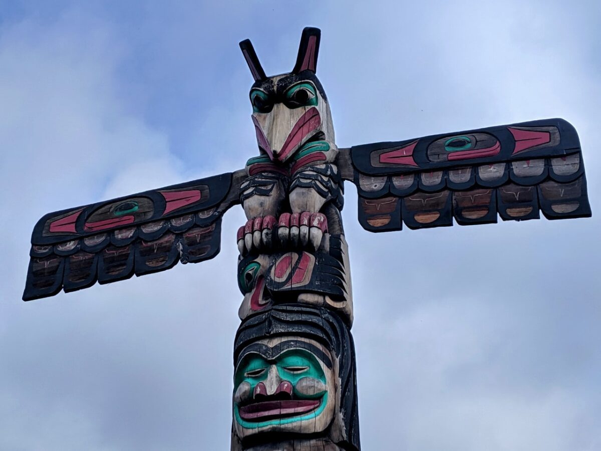
Duncan totem tour
The small city of Duncan is host of the world’s largest outdoor collection of publicly displayed totem poles. There are 40+ different totems here, each with a rich history. Most are in the downtown area.
Start your totem tour outside the Cowichan Valley Museum, which is located in the old station building. Yellow footprints mark the self-guided tour route, though you can also check out the totem map online.
If you’re in town on a Saturday morning, the Duncan Farmers’ Market is a must do. It takes place 9am to 2pm and is one of the oldest and largest in BC (100+ stalls!)
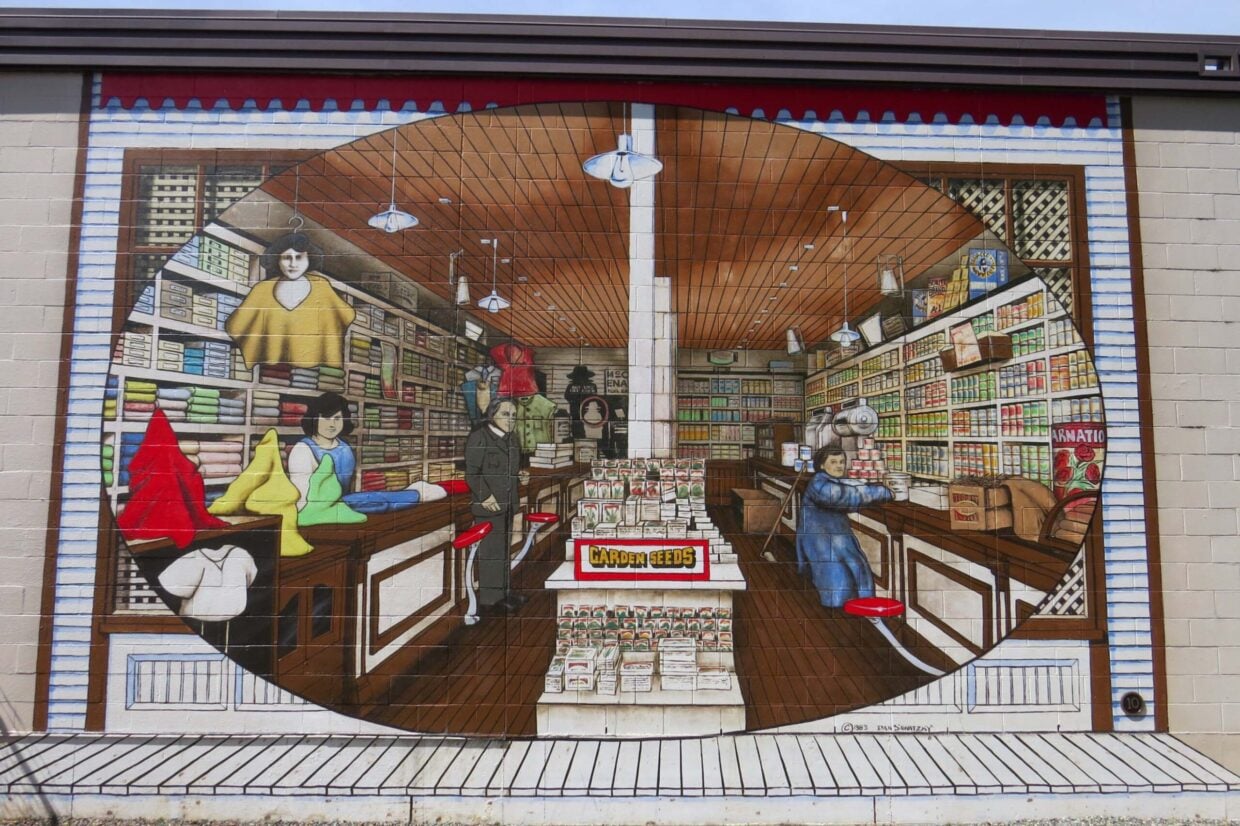
Chemainus
The artsy little community of Chemainus is well worth a short walk around. The downtown area has some lovely independent shops, a great theatre and 60+ outdoor murals.
The murals depict the history of Chemainus and its residents, beginning with the earliest inhabitants (the Stz’uminus First Nation) and through to its development as a forestry town. The Festival of Murals Society has a great murals map to help with your self-guided tour.
Kinsmen Beach Park is a beautiful spot, just north of town. Ferries leave to Thetis Island from the nearby terminal regularly.
One of the best local waterfall hikes is in Chemainus – Stocking Creek Falls. A 2.4km long loop trail leads through the wonderfully mossy forest to the waterfall.
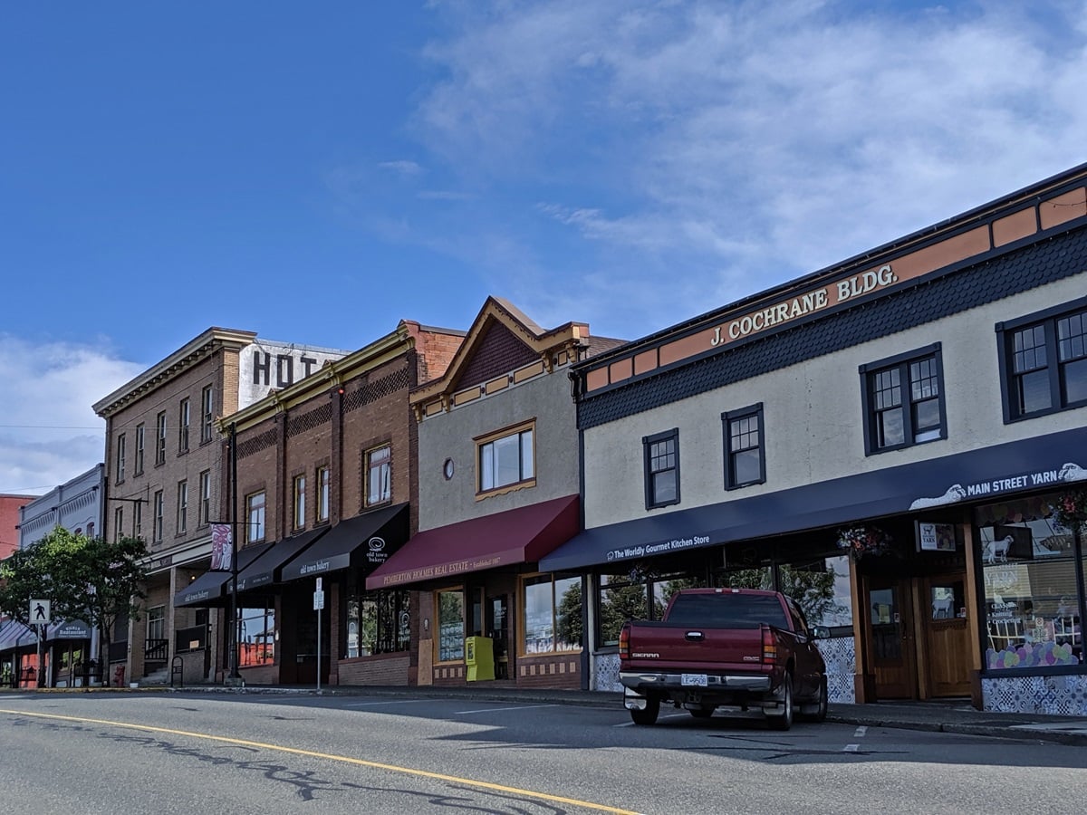
Ladysmith
Ladysmith is a charming small town just adjacent to Highway 1. It has a wonderful downtown street (First Avenue), filled with turn of the century buildings. One houses the Old Town Bakery, which sells the best cinnamon buns anywhere on the Island (lots of different flavours!)
We’re big fans of Ladysmith – so much so that we actually tried to buy a house there. Great hiking awaits just behind the town, including a 6.3km return trip to Christie Falls. By the coast, Transfer Beach is a lovely place to take in the views.
If you’ve ever seen the Resident Alien TV show, Ladysmith was the stand-in for Patience, Colorado. One time we stopped for cinnamon buns, only to be disappointed to learn the film crew had already taken the last of them! Ladysmith was also featured in the Sonic the Hedgehog movies.
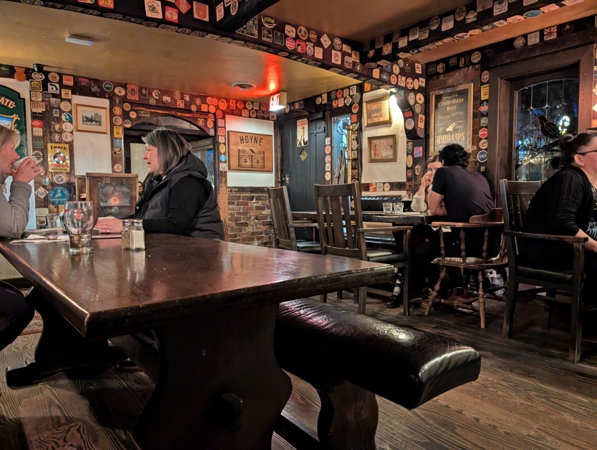
Crow & Gate Pub
One of my favourite places to eat between Victoria and Nanaimo is the Crow & Gate Pub. I’m originally from England and the Crow & Gate is the closest thing to a British country pub anywhere in BC!
The Tudor-style pub is set in a rural area south of Nanaimo, surrounded by beautiful gardens. It is especially charming in summer, when you can relax with a beer on the sunny patio. Dogs are welcome.
The interior is all low beams and brick, with dark furnishings, just like the pubs where I grew up! The menu has a good mix of Canadian favourites mixed with some British classics (nothing is deep fried).
The Crow & Gate is very popular with both locals and visitors so keep this in mind if you’re in a hurry. The food doesn’t come out super fast. It’s also 19+ only.

Petroglyph Provincial Park
This small park on the south side of Nanaimo features a collection of First Nation rock carvings. Etched into a sandstone outcrop, these ancient petroglyphs sit on a hillside overlooking the city.
An interpretive area offers background on their history and possible meanings. There are also concrete replicas available for paper rubbings. Just be sure to bring your own materials!
Note that Petroglyph Provincial Park is accessible via a small parking area directly off Highway 1 and is only accessible when travelling northbound.

The Abyss
The most unique place to visit on the outskirts of Nanaimo is the Abyss. The exact origin of this 50cm wide fissure on a ridge is unknown, though some believe it may have formed from the collapse of an old mine tunnel, possibly triggered by an earthquake.
The Abyss is located along the Extension Ridge Trail (part of the Trans Canada Trail), about a 10-minute drive southwest of downtown Nanaimo. The 1km uphill trail is well marked and winds through a beautiful stand of arbutus trees, along with a section of less appealing cut block.
If you’re visiting with a dog, keep them on a short leash. There have been instances of dogs falling into the crack and needing rescue.
Once you’re in Nanaimo, I’d recommend Neck Point Park for amazing ocean views and Saysutshun (Newcastle Island) for a fun day trip. The ferry for Saysutshun leaves from Maffeo Sutton Park, which is a short walk from downtown Nanaimo along the scenic Harbourfront Waterway.

Victoria to Nanaimo road trip: Essential details
The driving distance between Victoria and Nanaimo is 110km. Depending on traffic and exact destination, the journey usually takes around an hour and a half when driving non-stop.
There is only one main route – Highway 1, which splits into Highway 1 and Highway 19 just south of Nanaimo.
There are at least two lanes in each direction on most sections but there are a few stretches (such as on the Malahat) that are single lane only.
It’s very common for travellers to drive this distance in one day or as part of a longer road trip. It can be easily combined with so many other incredible Vancouver Island road trips. Here are a few ideas:
- Nanaimo to Tofino – This classic but twisty road trip follows Highway 4 as it traverses over a mountain pass to Port Alberni and then across to the Island’s wild Pacific coastline
- Nanaimo to Campbell River – Stray further from the beaten path and explore the lakes, mountains, waterfalls and beaches of the east coast
- Pacific Marine Circle Route – After checking out the totems in Duncan, head towards Lake Cowichan, the tiny coastal community of Port Renfrew and then drive back to Victoria along the Juan de Fuca Strait. Big trees, west coast views and beaches await.
More ideas and amazing places to go in our interactive Vancouver Island map guide. It makes trip planning easy!
Good to know
- This area of Vancouver Island is very populated and so there are gas stations and other services at regular intervals along Highway 1
- The speed limit on this section of Highway 1 varies quite a lot. Most sections are 80-90km/h, though most people drive a little faster. The limit drops to 50km/h in urban areas and around major intersections. Some stretches of the Malahat are 70km/h
- Most of the drive between Victoria and Nanaimo is fairly straightforward, although you can expect to encounter frequent stops at traffic lights along the way
- The most challenging section of road is the Malahat, which stretches between Goldstream and Bamberton, south of Mill Bay. It’s a narrow, winding and steep. Most locals drive it very fast. Accidents are not uncommon and can close down the road for hours at a time
- If you need to make a left hand turn on the Malahat, be prepared to take a long U-turn route instead. There are not many left hand turns
- Just south of Nanaimo, Highway 1 continues into the city while Highway 19 veers inland, providing a faster route to northern destinations. As you approach Nanaimo, be prepared to decide which way to go!
Which direction?
If you can, drive from Victoria to Nanaimo (northern direction). There are a few reasons why I suggest this.
- The free Malahat viewpoints are accessible when driving north only. And they’re worth the quick stop, especially if you’re not planning to visit the Malahat Skywalk
- Malahat Skywalk is most easily accessible when driving north. When heading southbound (towards Victoria), you’ll need to take a long (around 20km) U-turn route to reach this attraction
- The main day-use area of Goldstream Provincial Park is easier to reach when travelling north, as both entry and exit involve right-hand turns
- While it is possible to turn left (to go south) when exiting the Goldstream day use area, there is no turning lane or traffic lights. This is narrowest part of the Malahat (one lane in either direction) and the traffic is usually moving at 80-90km/h, if not faster. It is dangerous to cross the oncoming vehicles. A U-turn route is possible
- To add to this, Petroglyph Provincial Park (Nanaimo) is only accessible when driving northbound
- In general, driving north is more fun as you’re closer to the ocean!
How to reach Nanaimo and Victoria
Both of these coastal cities are accessible by ferry routes that depart close to Vancouver.
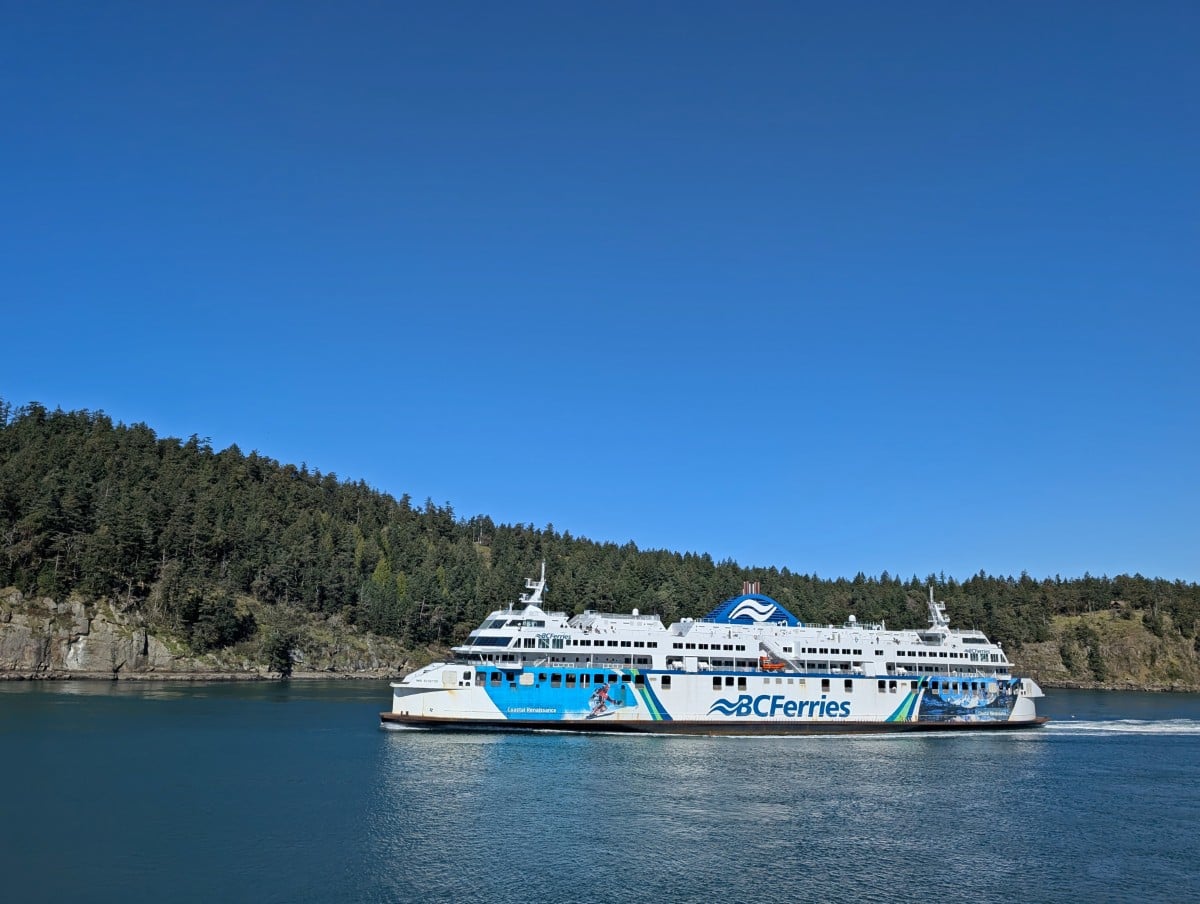
Nanaimo has two major ferry ports – Departure Bay is located just north of downtown Nanaimo, while Duke Point is 16km further south. BC Ferries operates large drive-on ferries to these terminals, which take both foot passengers and vehicles of all sizes.
Another option is to use the Hullo foot passenger ferry that runs from downtown Vancouver to downtown Nanaimo. This can be especially convenient if you need to rent a car. Take the Hullo to Nanaimo, then rent a car on Vancouver Island and avoid the high vehicle ferry fees.
BC Ferries also services Swartz Bay ferry terminal, which is 30km (about 35 minutes drive) from Victoria.
If you’re on a tight timeline, make a ferry reservation. This is particularly important if you’re travelling on a weekend. Reservations are mandatory when travelling from Horseshoe Bay to Departure Bay.
Nanaimo and Victoria both have large airports with plenty of flight options and connections to other Canadian destinations.
The most scenic way to reach either city is by floatplane. Harbour Air and Seair both operate regular services from Vancouver. Just keep in mind that luggage limits are usually a little less generous than bigger aircraft!

Where to stay between Victoria and Nanaimo
- Victoria – The Fairmont Empress Hotel is the most iconic property in the city, just across the water and adjacent to the British Columbia Parliament buildings. A more affordable alternative is the nearby James Bay Inn, a comfortable hotel with heritage features
- Cowichan Bay – The best location and best views can be found at Oceanfront Suites, just a short walk from everywhere in Cowichan Bay. We recently stayed at the Wessex Inn By the Sea and it was a great alternative
- Cowichan Valley area – One of the most reliable choices in the Valley is the Best Western Cowichan Valley Inn near Duncan
- Nanaimo – We like the Best Western Dorchester Hotel. Located downtown, it’s close to the Departure Bay ferry terminal and walkable to many local attractions. Some rooms have views of the harbour and all guests have access to free parking.

Planning a trip to Vancouver Island?

Our Vancouver Island Travel Guide features an interactive map with 150+ of the best things to see and do.
The itinerary builder tool makes it easy to create your perfect trip.
Download the app and use offline while travelling!


One half of the Canadian/British couple behind Off Track Travel, Gemma is happiest when hiking on the trail or planning the next big travel adventure. JR and Gemma are currently based in the beautiful Okanagan Valley, British Columbia, Canada. Consider buying us a coffee if you have find any of our guides helpful!