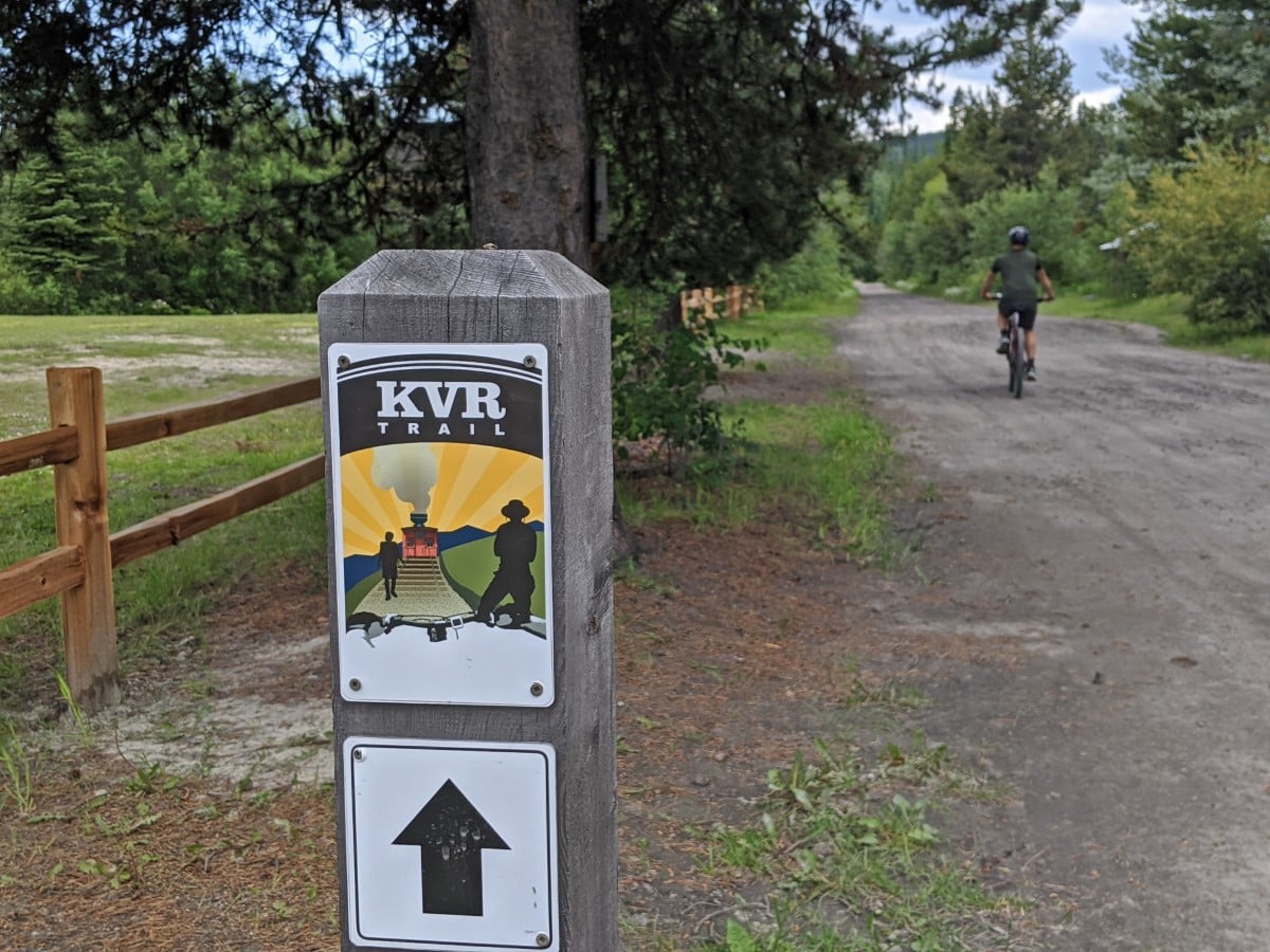
The Kettle Valley Rail Trail (KVR) is one of southern BC’s best assets. Part of the Trans Canada Trail, this multi-use path from Midway to Hope* provides access to spectacular viewpoints, historic railway features and a variety of landscapes ranging from lakeshores and vineyards to rivers and highlands.
As a rail trail, the majority of the KVR Trail enjoys gentle grades not exceeding 2%. The more popular sections feature wide, well maintained paths with facilities along the route, making the trail an accessible destination for so many different people.
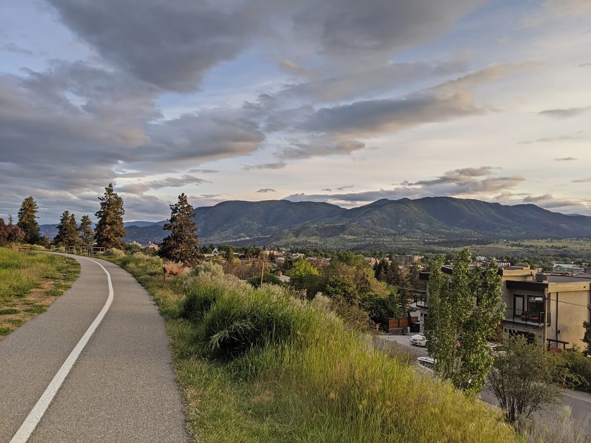
The KVR Trail is just 600m from our house in Penticton, giving us a real personal connection to it. We walk sections of the KVR Trail multiple times every week of the year. It’s really special to live so close and be able to enjoy it in every season.
Over the years, we’ve also visited many other sections of the trail by foot and bike. While reviewing content recently, I realised that we didn’t have an ‘all in one’ resource for the KVR Trail. This inspired the creation of this guide to help fill that gap.
So whether you’re looking to learn more about the KVR, find the best sections to explore or pick up a few trip planning tips, this post has you covered!
Here’s what to expect:
- KVR Trail overview
- Route details
- Where to stay
- Trail condition and closures
- Highlights
- Multi-day trip planning
Some of the following photos were taken on a hosted trip with Thompson Okanagan Tourism Association. This post contains some affiliate links. If you make a booking through one of these links, we may receive a percentage of the sale. *Please see trail condition and closures section

Discover the KVR Trail
Construction of the Kettle Valley Railway (KVR) began in 1910, creating a line extending nearly 500km from Midway to Hope. About 330km of the route runs through the Okanagan Valley. The KVR was originally built to serve communities and support mining interests in British Columbia’s southern interior.
A side benefit was to strength Canadian sovereignty, during a time when there were concerns about American miners gaining control of local resources. The KVR also served as an alternate route for the main transcontinental line during closures caused by avalanches and landslides.
Despite its importance, the KVR had a relatively short operational life. Highway construction and changing transport needs led to its decline from the 1960s, with the last train running on the Penticton section in 1989.
In the 1990s, the railway started to be transformed into the Kettle Valley Rail Trail, a multi-use path known for its trestles, tunnels and gentle grades. The most popular sections to explore by foot or bike are located in and around Penticton, Myra Canyon (near Kelowna) and Othello Tunnels (near Hope).
When exploring the KVR Trail, be sure to:
- Leave No Trace – bring out everything you bring with you
- Tell someone where you’re going and when you plan to be back
- Be bear aware, especially on weekdays and when venturing beyond the very busy sections
- Bring plenty of water, a sunhat and sunscreen during warmer days
Overview of the route
Mile 0 of the KVR Trail is located in Midway, within BC’s Boundary Country. The route heads west, passing through Kettle Valley and Rock Creek before turning north to Westbridge, Beaverdell and Carmi.
The KVR continues to the outskirts of southeastern Kelowna in the Okanagan Valley, where it skirts around Myra Canyon with a series of trestles and tunnels. This is also the highest point on the trail at 1274m. The trail passes next through the hilly Okanagan highlands on its way to Chute Lake.

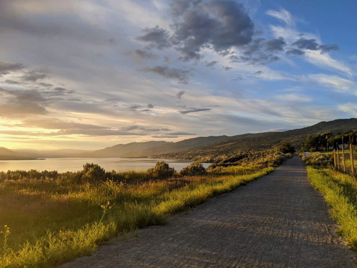
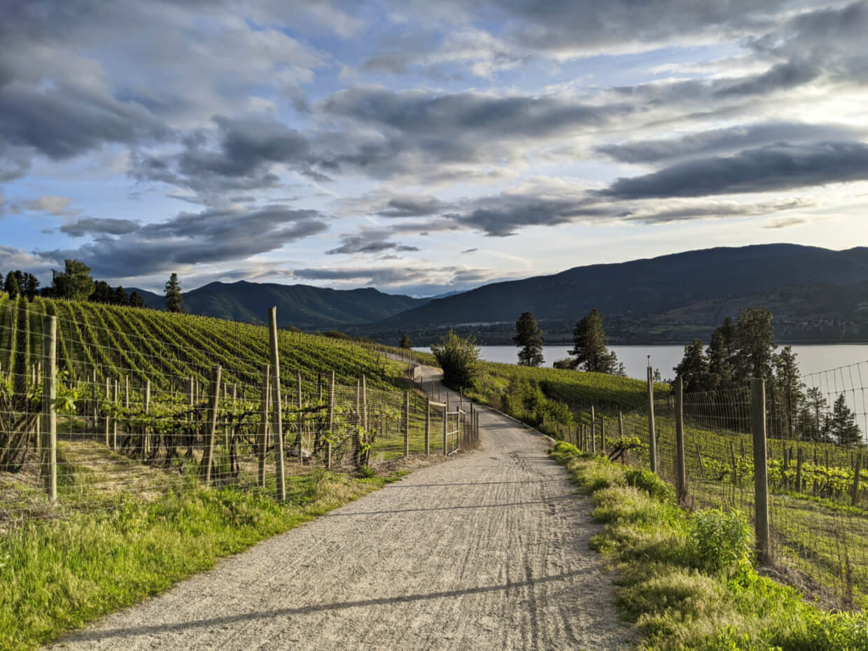
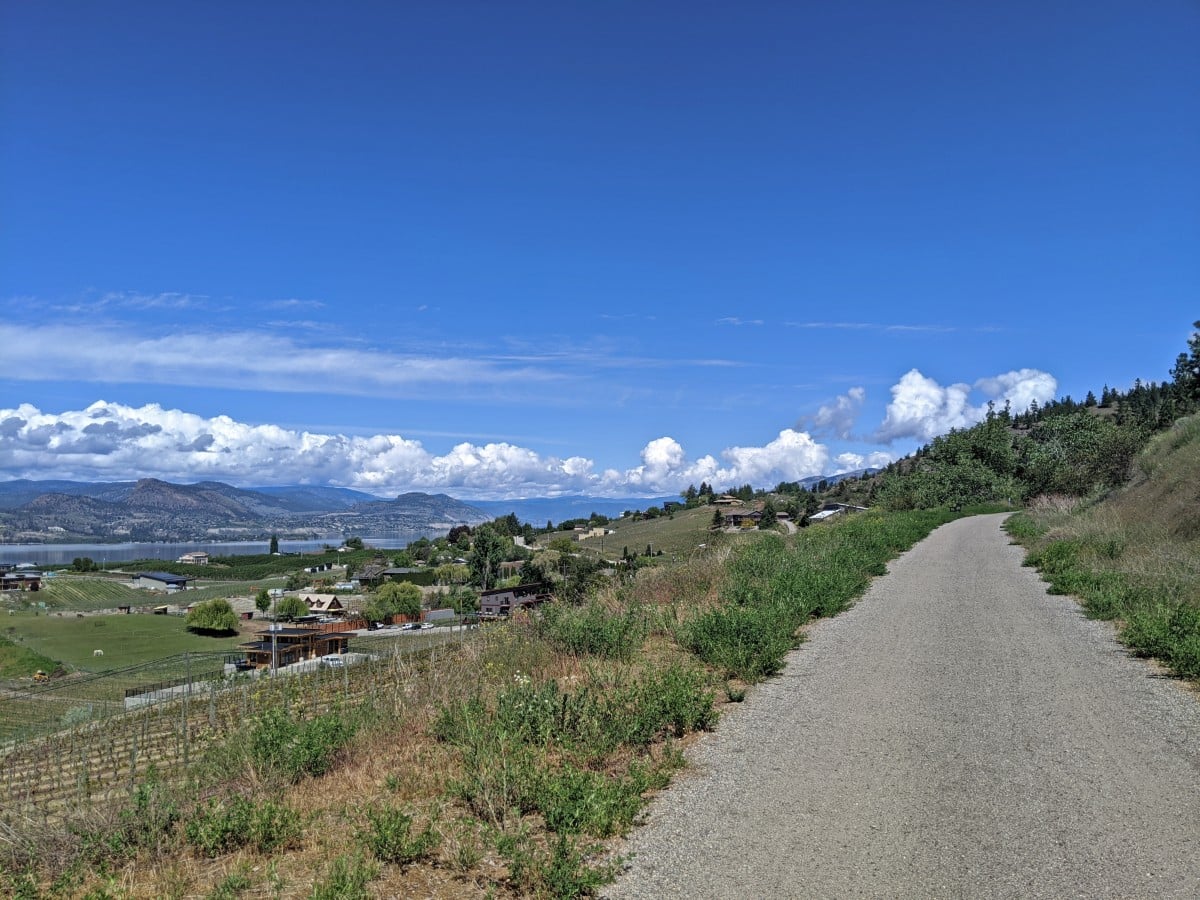
It’s all downhill from here to Penticton along the vineyard covered Naramata Bench, via Adra Tunnel and the Little Tunnel. Magnificent views of Okanagan Lake abound. In Penticton, the trail winds through the city and then up onto the West Bench towards Summerland (see closures section).
The Kettle Valley Steam Railway still operates on 14km of track in Summerland, but the Trans Canada Trail provides a detour. It’s then uphill most of the way across the high country terrain above Summerland to Osprey Lake (1,100m) and then downhill to Princeton.
The first section beyond Princeton closely follows the Tulameen River, Otter Lake and then Otter Creek. This wilder section of trail is now at risk of decommission due to flooding.
The final section of the KVR intersects and weaves alongside (and even directly on) the Coquihalla Highway. Old station signs dot the median, with names like “Lear,” “Portia,” and “Romeo,” reflecting McCulloch’s love of Shakespeare. The journey ends with the Othello Tunnels and a final forested stretch to the edge of Hope.
For a map, head to the BC Rail Trails website.

Where to stay
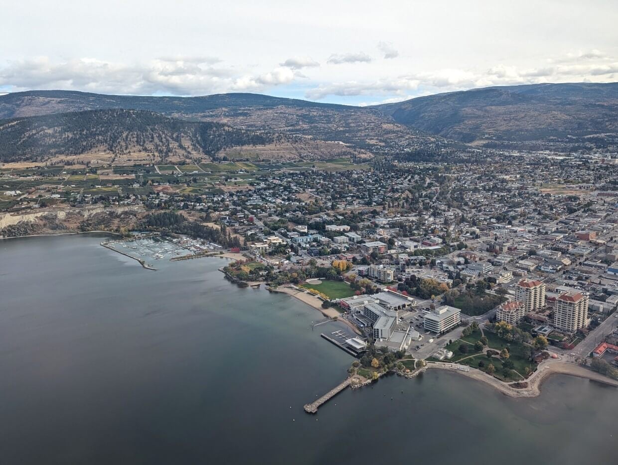
If you’re interested in exploring multiple sections of the trail, plan a trip to Penticton. This lakeside city was the regional headquarters for the railway and remains a great place to access multiple sections.
- Take a shuttle up to Chute Lake or Adra Tunnel and cycle back to Penticton
- Walk through vineyards from Vancouver Place to McCulloch Trestle
- Ride on a scenic steam train on the only remaining operating section in Summerland
- Visit the museum, see the old station building and then enjoy a beer at Tin Whistle Brewing
- Explore the South Spur from Penticton to Okanagan Falls (or beyond)
- More details about all of these options in the highlights section of this guide.
As for where to stay, our top recommendation is Penticton Lakeside Resort. It’s located right on Okanagan Lake and is walkable to everywhere downtown. There are three on-site restaurants as well.
If you’d prefer a more relaxed, wellness vibe, head to the Balcomo. It has a wonderful outdoor pool, sauna, cold plunge, hot tub and yoga studio area, surrounded by 2 acres of walking paths and gardens. An ideal place to recover after a day exploring the KVR Trail!
Trail condition and closures
Spanning such a long distance, the KVR Trail is managed and funded by a variety of local and national organisations. Maintenance is limited on the remote sections.
In November 2021, extreme flooding significantly damaged several stretches of the KVR Trail. More recent weather events have also damaged other areas of the route.
As of May 2026, the following sections are closed:
- Penticton to Summerland, south of Trout Creek – sinkholes and washouts, closure by the Penticton Indian Band in November 2025
- Princeton to Brookmere – proposed to be decommissioned by the BC government, severe damage from November 2021 floods (including multiple missing bridges). There is a petition operating
- Brookmere to Coquihalla Canyon – Multiple inaccessible stretches damaged by November 2021 floods and also impacted by the Trans Mountain pipeline construction
Temporary closures are possible on other sections due to construction or flooding. For example, there was a detour around the Adra Tunnel in early May 2026. This Sites and Trails BC page displays recent trail updates, with the last report in October 2025.
Kettle Valley Rail Trail highlights
The following locations showcase some of the most accessible, scenic and rewarding sections of the KVR Trail. From iconic trestles and tunnels to quiet lakes and viewpoints, we’ve personally visited each of these locations by foot or bike (sometimes both!)
Midway: the start of the KVR Trail
The community of Midway earned its name from being the midpoint between the Rocky Mountains and the Pacific Coast. As the western terminus of the Columbia & Western Railway (owned by CPR), it was a logical place to extend service towards growing settlements of southern BC.
Mile 0 of the KVR Trail is located at the Kettle River Museum next to Highway 3. The 2.5 acre museum grounds include the original station house (built in 1909), a CPR caboose, many artifacts and local stories. I believe it to be well worth a visit while in the area.
More infomation: Boundary Country rail trail guide (KVR and C&W)
Good to know: Parking is available at the Kettle River Museum for trail users, by donation
Top tip: Cycle or walk west from the museum to explore the KVR, east for the C&W. Keep in mind that there isn’t a lot of shade in this area, so start early/late and wear a hat in the summer months

Kettle River Recreation Area, Rock Creek
The Kettle River Recreation Area is an ideal place to access the KVR Trail in the Rock Creek area. A large day-use parking area sits just a short walk from a beautiful trestle bridge that is also a popular swimming spot.
Head north or south along the forested trail, which winds beside the river and occasionally opens up to scenic water views. The community of Rock Creek is 6.5km south – grab an ice cream at the Rock Creek Station or stop for lunch at the Prospector Pub before returning.
Good to know: There’s a 100+ site campground at this location, with most spots available to reserve in advance via the BC Parks website
Top tip: While travelling on the trail, look for evidence of once-thriving gold and silver mines on the east bank of the river
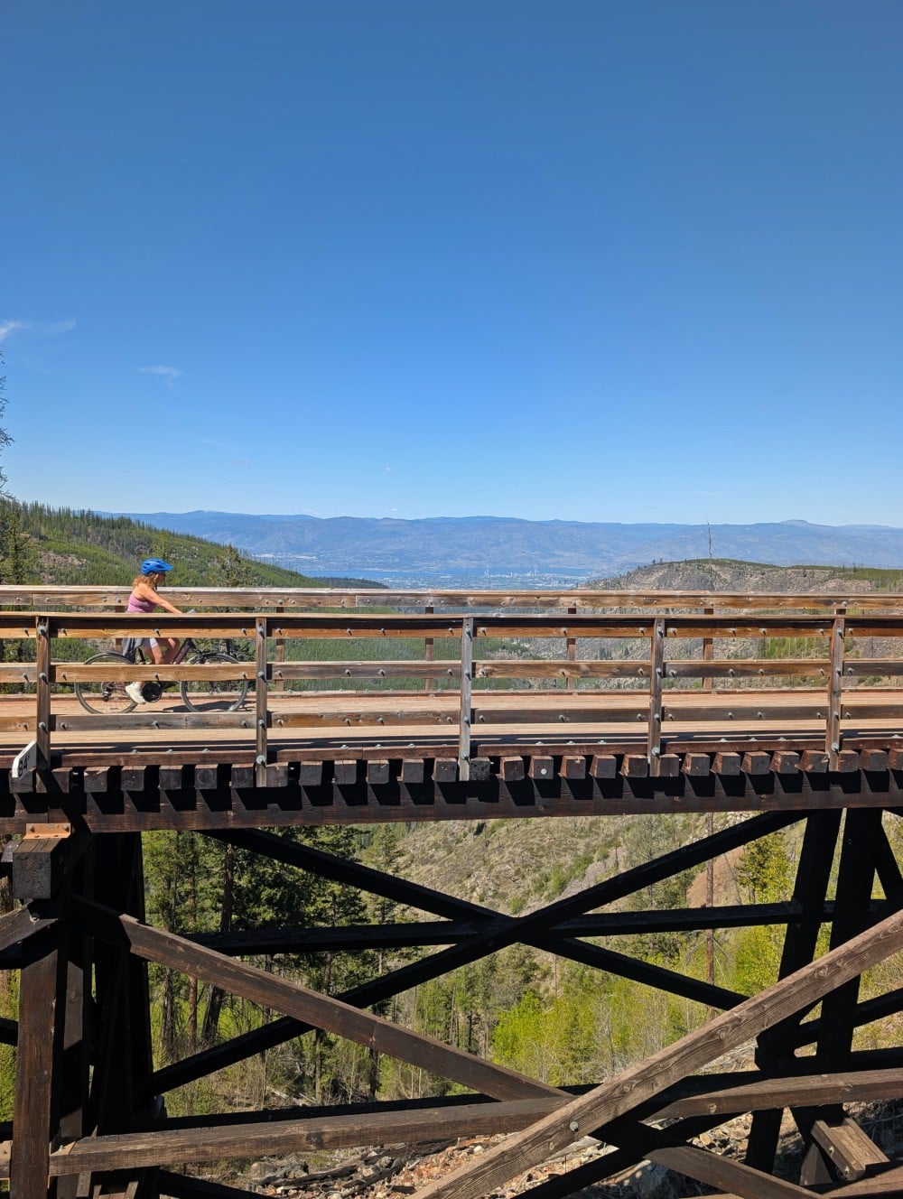
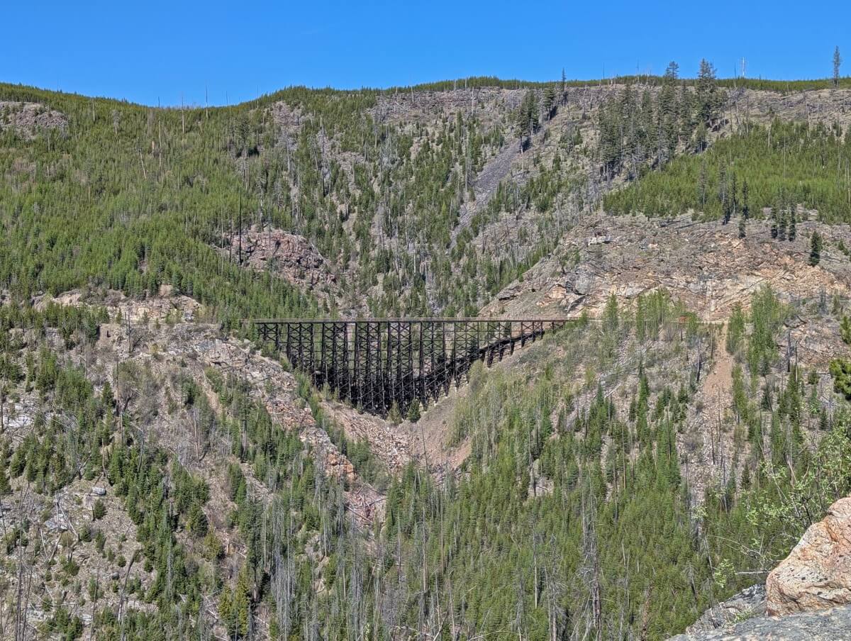
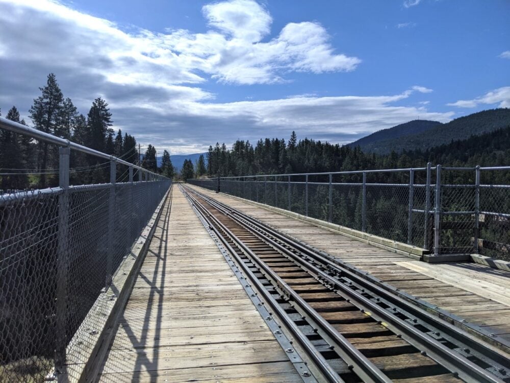
Myra Canyon Trestles, Kelowna
Myra Canyon presented a major challenge for railway planners to overcome. Crossing this long, wide chasm required an innovative solution – the construction of 18 massive trestle bridges and two tunnels.
Ranging from 8 to 55m tall, the trestles offer sweeping views of the valley and neighbouring bridges. They remain an impressive engineering feat, especially after 12 were damaged in the 2003 Okanagan Mountain Park fire. Thanks to BC Parks and a dedicated volunteer crew, the trestles were restored to their former glory by 2008.
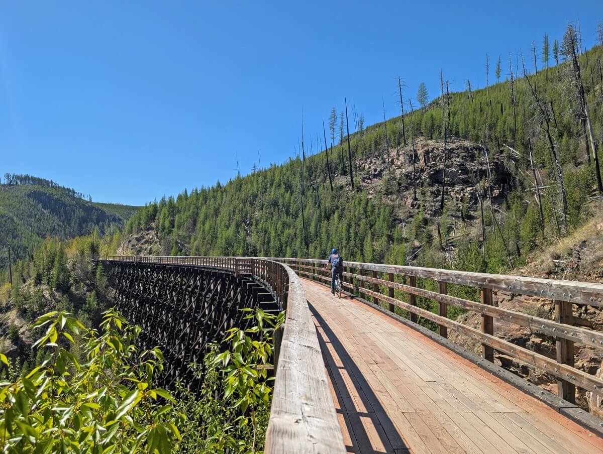
Myra Canyon attracts people of all ages and is especially popular with families. Most people cycle and visit all the trestles in an afternoon (24km return), but walking is also possible. Our favourite hike is 8km return from Myra Station and features 13 trestles and both tunnels. Allow at least two hours.
More information: Myra Canyon guide
Good to know: There is a shuttle service available from Penticton to Myra Canyon. The 80km cycle trip to Penticton takes in Chute Lake, Adra Tunnel and the Little Tunnel (details below)
Top tip: There are a few different access points, but Myra Station is closest to the largest amount of trestles (unpaved road access only). Bike rentals are available at Myra Station from May to October
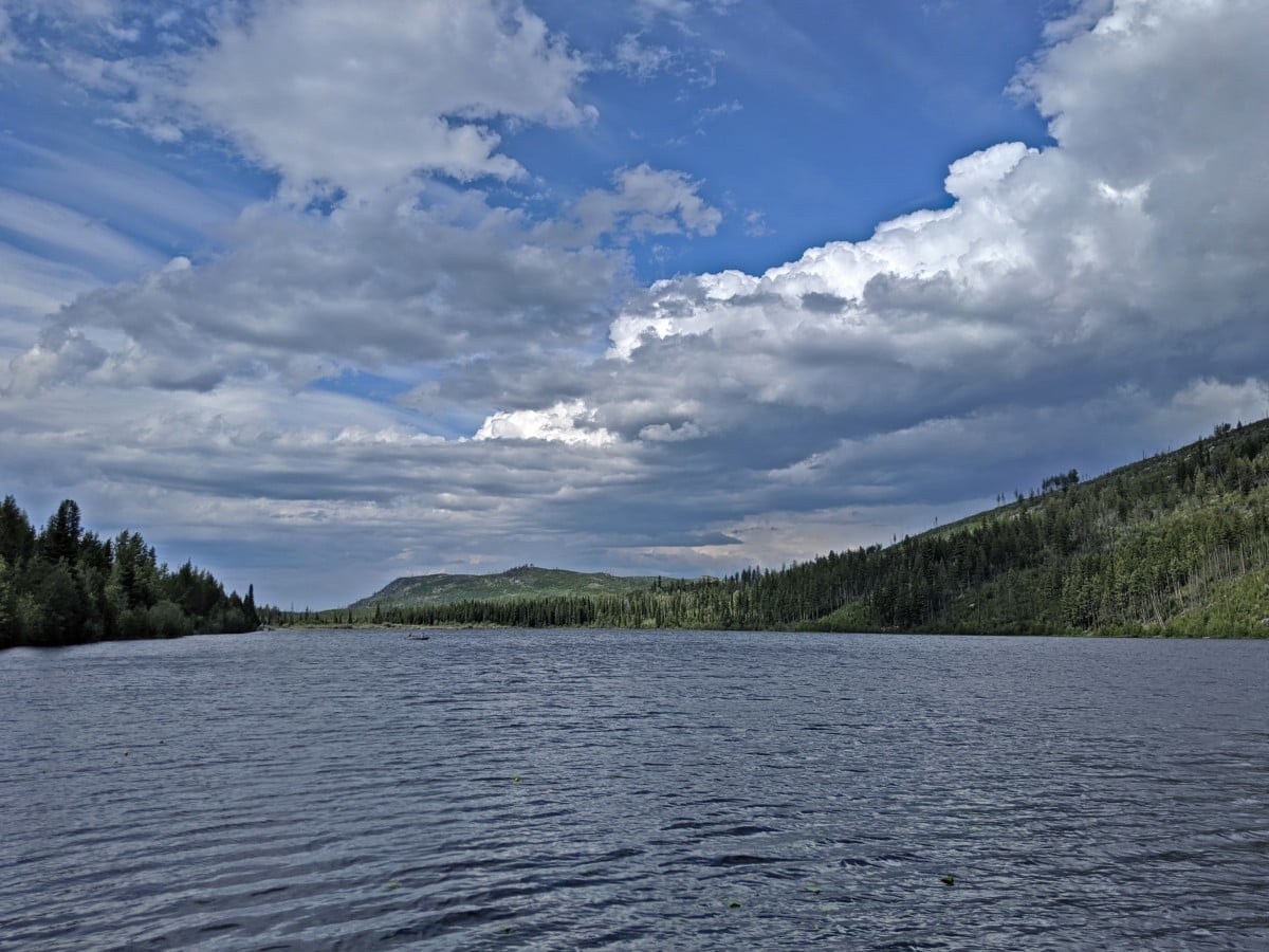
Chute Lake, Naramata
Located at 1270m elevation and surrounded by mountains, Chute Lake sits roughly halfway between Myra Canyon and Penticton. Back when the railway was running, trains would resupply water here. There was a sawmill too, with a bunkhouse for railway workers.
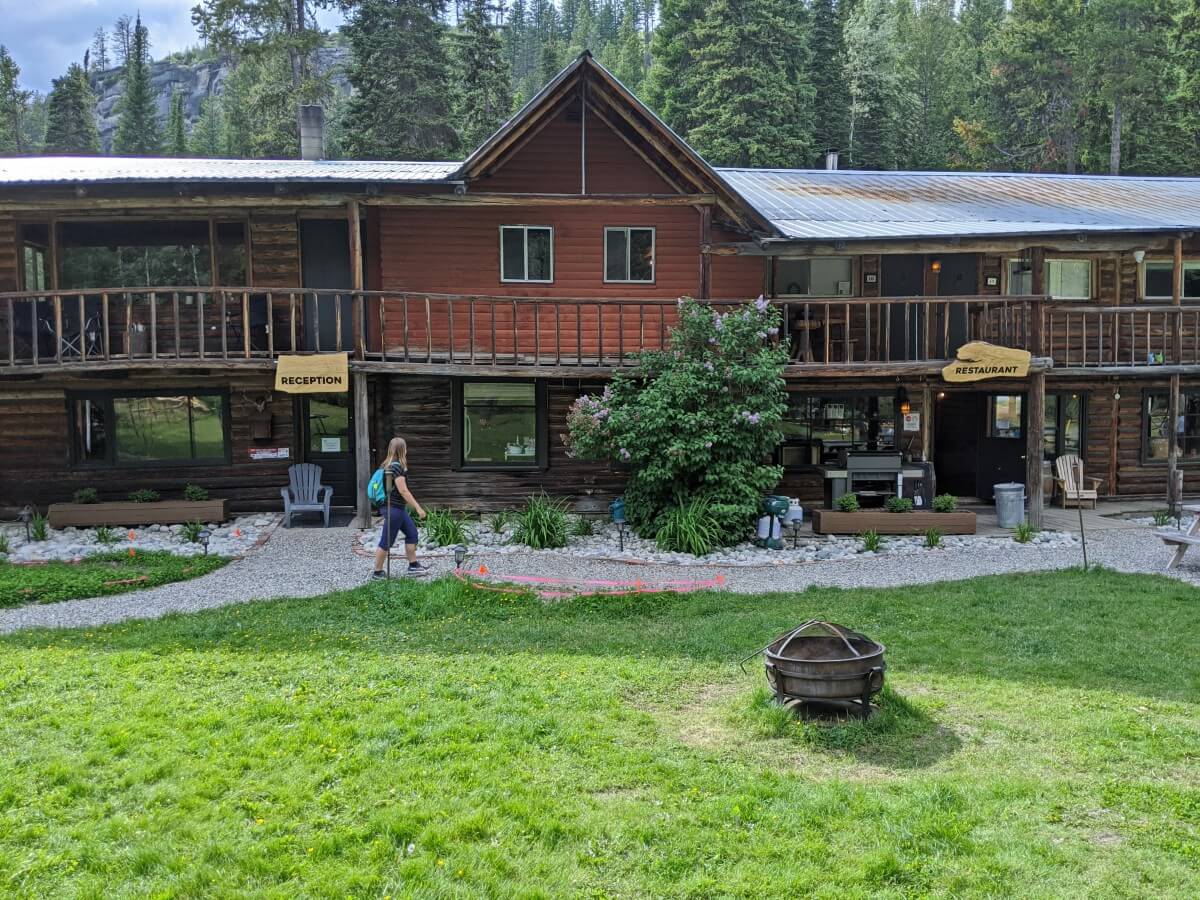
Now, it’s a scenic destination for cyclists and anyone looking to reconnect with nature. Historic Chute Lake Lodge, originally built for the logging camp, has a choice of rooms, cabins, yurts and glamping tents. There is also a family friendly restaurant, open for breakfast, lunch and dinner.
A bike shuttle runs from Penticton to Myra Canyon. Chute Lake is a very popular spot for enjoying a beer and burger on the 80km ride. Alternatively, start your bike tour at Chute Lake and cycle downhill back to Penticton (around 44km) – there are shuttles available for that too.
Good to know: The northern approach (from Myra Canyon) can be very wet in spring, with flooding possible. The southern approach is notoriously sandy
Top tip: There is no cell service at Chute Lake, which is also a higher elevation lake. Bring extra layers and be prepared for the weather conditions to potentially change quickly
Adra Tunnel, Naramata
Constructed in 1913, the 487m Adra Tunnel was the KVR’s longest tunnel. Thanks to the hard work of an amazing team of volunteers (led by the Woodwackers 2.0), it was recently reopened after a three decades long closure.
This historic horsehoe-shaped tunnel is located in the hills above Naramata, part of a long switchback section. By trail distance, it is 13km ‘up’ from the Little Tunnel (details below) but geographically further south.
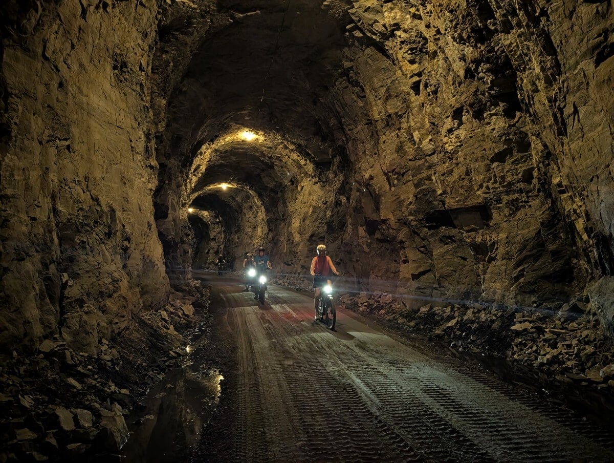
Given its length and dark entrance, the Adra Tunnel can appear quite imposing from the outside. Motion-activated lighting is installed throughout, helping to guide your way. Midway through, you’ll also see striking wooden and concrete support structures. As you go, notice the impressive wooden and cement supports in the centre.
More information: Adra Tunnel hiking and cycling guide
Good to know: For details of how to reach the Adra Tunnel, please consult the above guide. Cyclists can continue from the Little Tunnel, while hikers can approach via an unpaved access road
Top tip: While there is lighting inside the Adra Tunnel, a back-up light is a good idea. Also keep in mind that there is no phone signal in this area

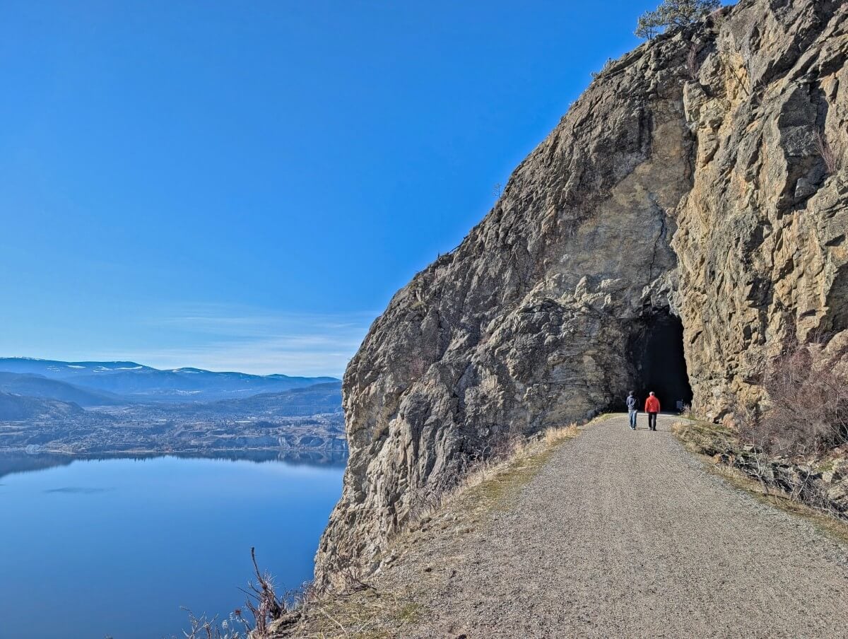
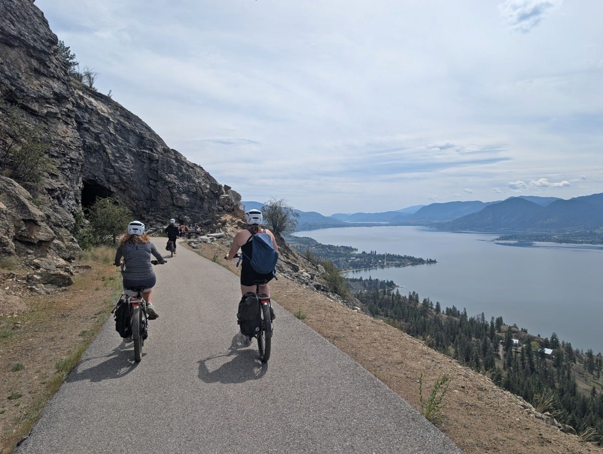
Little Tunnel, Naramata
Sitting high above Naramata, the 80m Little Tunnel is one of the most popular cycling destinations in the Penticton area. While the blasted tunnel is impressive in its own right, the spectacular views of Okanagan Lake are another highlight.
The closest trailhead to the Little Tunnel is located at Smethurst Road. The return walk or cycle is 8.8km. Allow around 3 hours if walking. There are picnic benches at the tunnel.
For a longer bike trip, start further south on the trail or combine it with Adra Tunnel (above). The one way distance from the Vancouver Place trailhead to the Little Tunnel is 18km. The return journey is downhill, through vineyards and past many winery tasting rooms.
More information: Little Tunnel hiking and cycling guide
Good to know: If you know just where to look, the Little Tunnel is visible from downtown Penticton!
Top tip: Vancouver Place can get very busy on weekends and during the summer. If you’re spending the whole day on the KVR Trail, plan to park on Vancouver Avenue or downtown instead
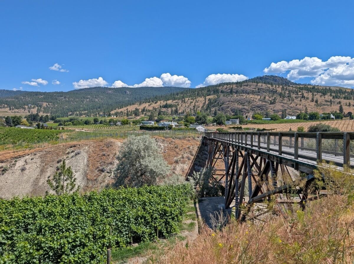
McCulloch Trestle, Penticton
The short but scenic McCulloch Trestle spans a canyon on the Naramata Bench, surrounded by vineyards and offering views of Okanagan Lake. It’s one of my favourite places to bring visitors during their stay with us in Penticton.
There are a few ways to access this beautiful trestle. My top pick is a 5km return walk from Vancouver Place, with the trestle being the turnaround point. Along the way, you’ll get even better views of the lake, more vineyards and even the Penticton sign on the side of Munson Mountain.
If timing or the distance is an issue, drive to Carder Road. This on-street parking area is only 300m from the trestle. Another option is combining a visit with a stop at Abandoned Rail Brewing, 650m north on the trail.
More information: McCulloch Trestle trail details
Good to know: The 5km return route from Vancouver Place features a very wide dirt/gravel path. It has two small hills and very little shade
Top tip: As mentioned above, parking can be hard to find on Vancouver Place on weekends and during the summer. Please be respectful to local residents. Park elsewhere if you can
Penticton
The KVR Trail snakes through the heart of Penticton. This is a lovely paved section that connects with various multi-use and bike paths, including the Lake to Lake Route. As mentioned, Penticton once served as the headquarters of the Kettle Valley Railway.
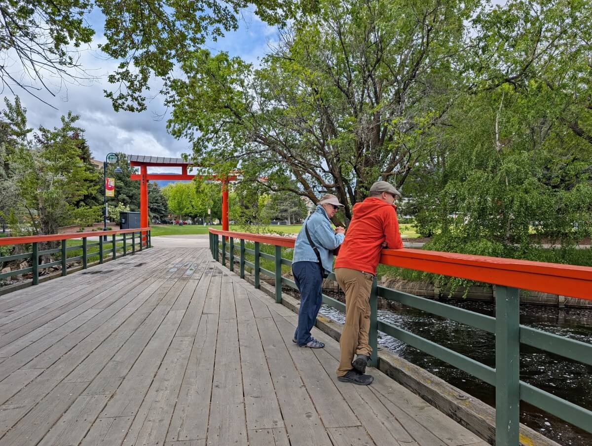
After crossing Penticton Creek, the Trans Canada Trail diverges from the KVR and follows the river toward the lakefront. In Okanagan Lake Park, look for the bridge leading into the Ikeda Japanese Garden. This crossing is one of the original KVR railway bridges – look for the historical plaque.
Back on the route, make a detour to the Penticton Museum. It has a detailed KVR exhibit. The urban KVR route ends at Calgary Avenue, close to the Penticton KVR Station on Hastings Avenue. This building was constructed in 1941 and is now the site of a daycare and RV rental company.
More information: KVR Trail and Penticton Creek Loop (3km)
Good to know: Fairview Avenue (adjacent to the station building) is part of the Lake to Lake Route. If cycling, continue 4km south to visit beautiful Skaha Lake
Top tip: Aptly named Tin Whistle Brewing is very close to the Penticton KVR Station and is a great stop for a post-trail beer
Trout Creek Trestle Bridge, Summerland
The Trout Creek Trestle Bridge was the highest structure on the KVR. Rising 73m above a deep canyon, it is an impressive sight. The trestle is only 250m walk from the parking area on Canyon View Road.
This is the only section of the KVR that is still active. A working 1912 steam train operates on the trestle from mid May to mid October and also for special events. Check the schedule before planning a trip and note that pedestrians are not allowed on the bridge when the train crosses.
Good to know: On the other side of the trestle is the Summerland Ornamental Gardens. While there is no way to access it from the bridge, I’d highly recommend making an effort to visit
Top tip: Round out your trip with a stop at nearby Summerland Sweets and/or Dirty Laundry Winery
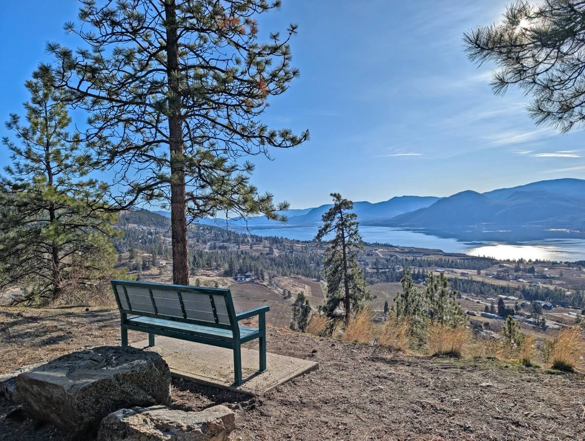
Conkle Mountain Gazebo, Summerland
The Conkle Mountain Gazebo provides a beautiful viewpoint over the vineyards and orchards of Summerland’s Prairie Valley and across to rugged Okanagan Mountain Park. It is located 1.5km from the nearest trailhead on Fenwick Road.
I don’t believe that this section of the KVR Trail is on the original route (it runs parallel to the live steam train track) but it is part of the Trans Canada Trail. The sagebrush lined path is mostly flat with a few short hills.
Good to know: The parking on Fenwick Road is on-street only (no parking lot) and limited, so please be sure to be mindful of local residents
Top tip: For a longer hike, combine the trip with one of the trails leading to the summit of Mount Conkle. The views of Okanagan Lake and Giant’s Head Mountain are fantastic

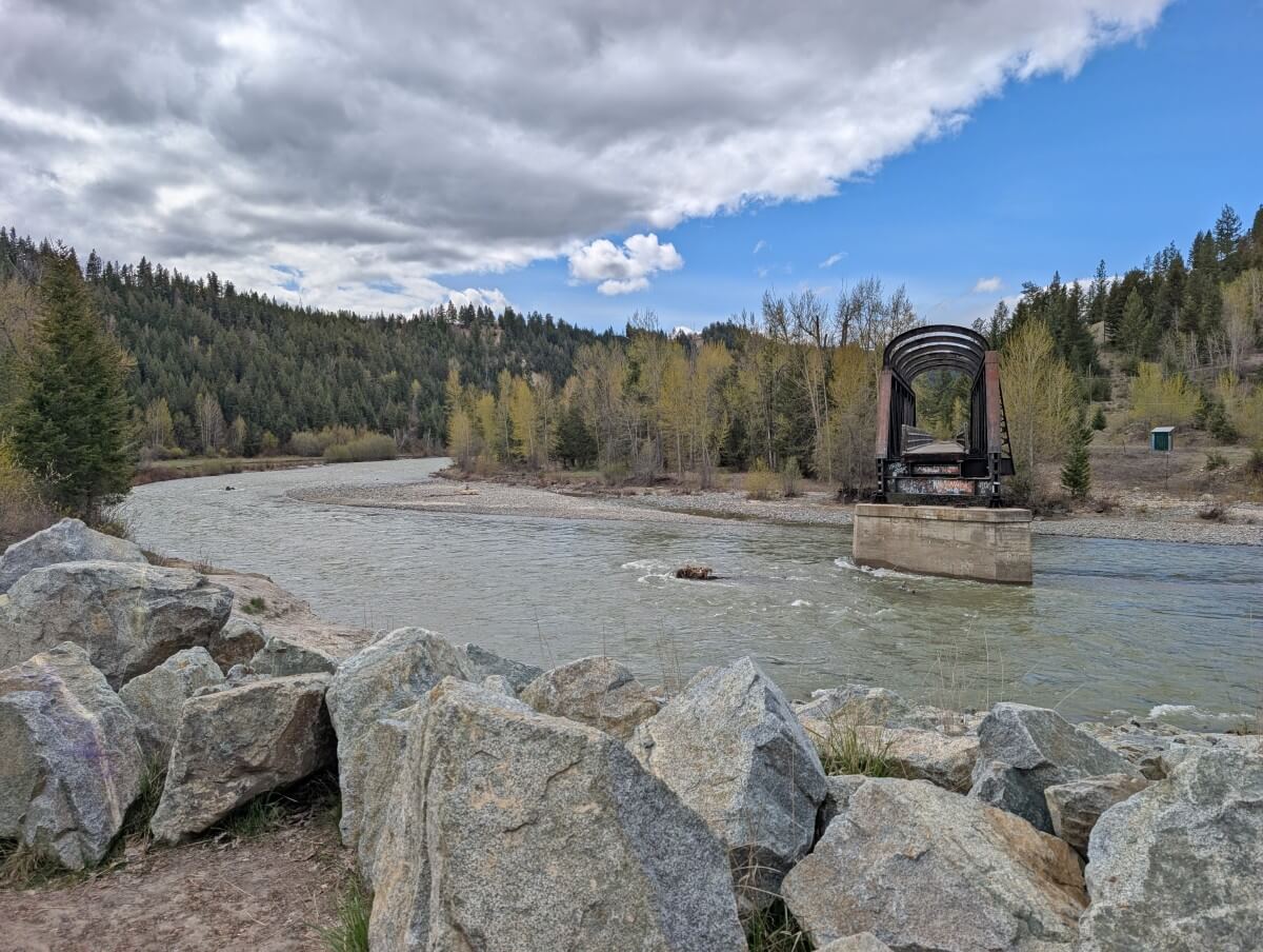
Princeton Tunnel and Bridge of Dreams
The Princeton Tunnel passes beneath Highway 3 to reach the edge of the Tulameen River. This 324m concrete-lined structure feels much more engineered and urban than the hand-blasted rock tunnels found elsewhere on the KVR.
The Tulameen River marks the start of the KVR’s most significant closure. The bridge, the first of a few along this section, was damaged in the 2021 flooding. I really hope that community support sways the BC government against decommissioning this section.
Another worthwhile stop in Princeton is the Bridge of Dreams, which transports KVR Trail cyclists and pedestrians across the Tulameen River. This version, which has won engineering awards, was completed in 2010.
Good to know: Access to the Princeton Tunnel is via River Road only. It may feel like the long way round but it is the only route
Top tip: The Princeton Visitor Centre is open every day of the week and is close to the Bridge of Dreams. On our last visit, the staff showed us photos of the 2021 flooding
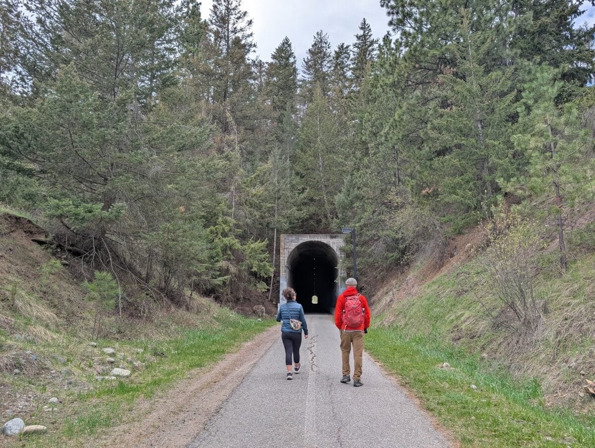
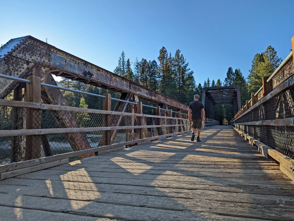
Othello Tunnels
Another major engineering challenge for the KVR was traversing the incredibly steep Coquihalla Canyon near Hope. The 90m high granite walls of this gorge rise above a rushing (and very cold) turquoise blue river.
Rather than constructing a bypass tunnel, McCulloch decided to carve straight through the canyon instead, creating a series of tunnels and bridges. A tribute to his love of Shakespeare, he named the tunnels ‘Othello.’
Today, the Othello Tunnels are one of the most loved sections of the KVR Trail. There are four rugged railway tunnels to explore, with the longest being 170m. The trail is incredibly scenic, wide and accessible for all. In early autumn, you can often spot salmon swimming up the river.
More information: Othello Tunnels guide
Good to know: The tunnels are usually open from mid May to early October
Top tip: Allow one hour for the 2.6km return trip. For a quieter visit on weekends and summer days, plan to arrive early (before 10am) or late (after 4pm)

Multi-day trip planning
The KVR Trail has been a popular multi-day cycling destination for many years. Part of the Trans Canada Trail, it also connects with the 160km long Columbia & Western Rail Trail (C&W) in Boundary Country.
While we haven’t done a multi-day trip ourselves, we’ve included some information here as resources can be tricky to find.
- Prior to the 2021 flooding, a KVR biking trip from Midway to Hope took around 10 to 14 days with 40-70km covered daily. Even back then, however, some of the western sections (such as between Brookmere and the Othello Tunnels) were a little sketchy.
- If you’d still like to take on the challenge of the full route, it’s possible with a few adaptations. The ‘Gravel Grinding Boys’ travelled between Midway and Hope over 6 days in August 2024 with some modifications and paved road sections.
- An alternative is to cover Midway to Penticton only, around 320km. This would be a leisurely 5 to 7 day bike trip, with no adaptations or detours required
- Another idea is to ride from Rock Creek to Penticton and then continue down to Osoyoos on the South Spur of the KVR. This would be around 360km. Rock Creek is 50km east of Osoyoos, so it’s almost a loop.
As mentioned, the vast majority of the KVR Trail is a mix of gravel and dirt, with some sandy sections. Maintenance and condition of the trail can vary a lot, depending on the location. Hybrid and mountain bikes are recommended.
Motorised vehicles (ATVs, dirt bikes) are permitted to use many KVR sections outside of the Penticton/Myra Canyon/Othello Tunnels areas. Dependent on recent weather and the level of recent use, ruts may be present.
Flooding can be an issue in the spring, especially around Chute Lake. July and August can be very hot. Water can be more difficult to find in September.
While there are a handful of private and provincial campgrounds located on or near the route (e.g. Rock Creek, Chute Lake, Beaverdell), many cyclists combine these with wild camping along the trail. Penticton is the most popular place for a rest day.
Other posts you may find helpful
23+ of the Best Things to do in Penticton (Recommended by a Local)
Boundary Country’s Rail Trails: KVR and C&W Hiking and Biking Guide
Vancouver to the Okanagan Valley Road Trip Guide: Best Places to Stop
32+ Fun Things to Do in Summerland, British Columbia
Okanagan Valley Road Trip: What to Do and Where to Stop


One half of the Canadian/British couple behind Off Track Travel, Gemma is happiest when hiking on the trail or planning the next big travel adventure. JR and Gemma are currently based in the beautiful Okanagan Valley, British Columbia, Canada. Consider buying us a coffee if you have find any of our guides helpful!