Wells Gray Provincial Park is a huge wilderness area in British Columbia, Canada, featuring as many as 41 spectacular waterfalls as well as pristine glacier-fed lakes, snow-capped mountains and more.
For the most part, Wells Gray is an untamed natural wonderland.
Three entrances allow visitors access to the southern section of the park, with established hiking trails, rustic ndnds and viewpoints.
The experience remains on the wilder side, however, with nature always taking centre stage.
Located just over halfway between Vancouver, BC, and Jasper, Alberta, Wells Gray makes for an excellent destination trip or part of a longer Canadian Rockies adventure.
This post will tell you everything you need to know to plan a visit, focusing particularly on the scenic Clearwater Valley Road drive through the park and the waterfalls that make Wells Gray so unique. It is part of our Wells Gray Provincial Park series.
Here’s what to expect:
Wells Gray Provincial Park is located on the traditional territory of First Nations including Ktunaxa, Lheidli T’enneh and Secwepemc Nation.
Introducing Wells Gray Provincial Park
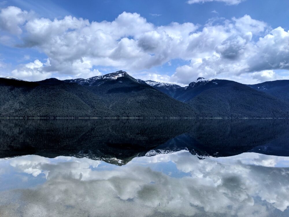
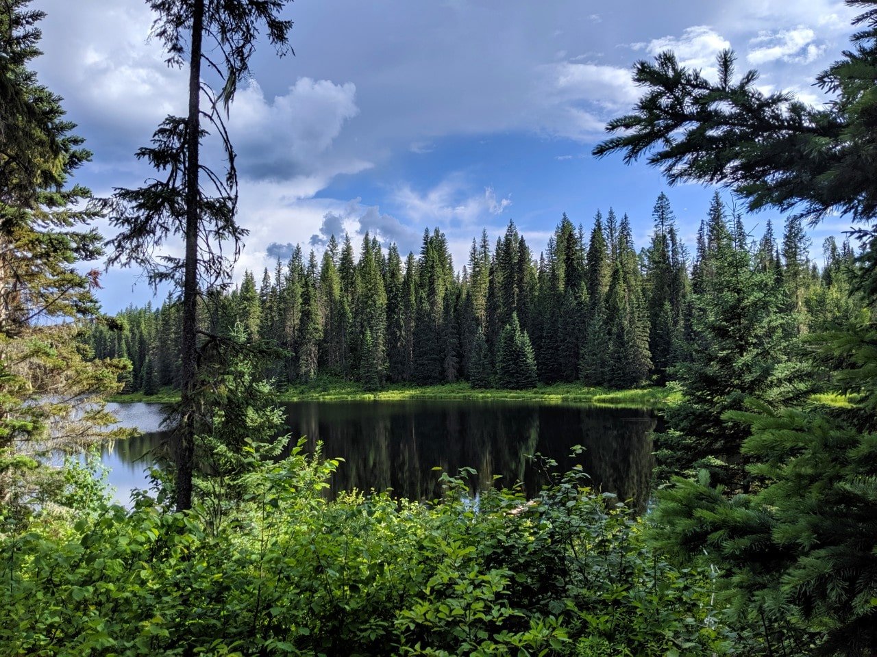
Wells Gray Provincial Park is a large wilderness area in British Columbia’s interior.
An incredible 541,516 hectares in size, the park is actually part of a volcanic field that started forming approximately 3.5 million years ago.
Since then, volcanic eruptions and glacial activity have carved the mountains and river canyons to reveal beautiful waterfalls.
Volcanoes remain in the park today, with some being officially classed as ‘potentially active.’
Pyramid Mountain last erupted 12,000 years ago. The park also features mineral springs, glaciers and lava beds.

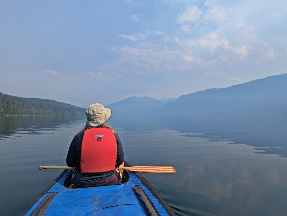
We first visited Wells Gray back in 2019. While I was aware of the park’s waterfall prestige, the real allure for me was Murtle Lake.
With only paddle boats (no motors) allowed on the lake, I was intrigued to find out how serene the canoe camping experience would be. Spoiler – serene is an understatement!
Before we headed to Murtle Lake, we spent a few days exploring the 68km long Clearwater Valley Road. We’ve since returned half a dozen more times!
Also known as the Wells Gray Corridor, this scenic drive takes in many of the park’s top natural attractions.
The Wells Gray Corridor makes for a beautiful half or full-day road trip, regularly punctuated with viewpoints, picnic areas and hiking trails.
It’s possible to do as much or as little as you like and still get to experience the unspoiled wilderness of Wells Gray.
Remember to Leave No Trace to help keep the wilderness wild! Pack out all of your trash with you and stay on marked trails

How to get to Wells Gray
Wells Gray Provincial Park is located north of Clearwater, west of Valemount and east of Williams Lake.
Further wilderness lies to the north, with the world-famous Bowron Lake and Cariboo Mountains provincial parks offering even more outdoor recreation opportunities.

- The main park access is via the Wells Gray Corridor, a 68km route taking in waterfalls, campgrounds, hiking trails and lakes. The Corridor starts just north of Clearwater, a small community of 2,500 people
- The second entrance is at Mahood Lake – 76km east of 100 Mile House
- The third main access leads to Murtle Lake – 27km west of Blue River
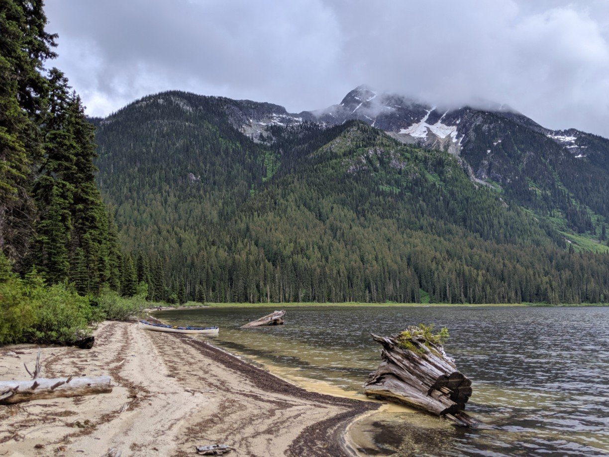
Important – The Murtle Lake area of Wells Gray offers backcountry opportunities only with no vehicle-accessible attractions. I am being careful to point this out because we met a dozen or so people who had driven the (somewhat rough) dirt road to the Murtle Lake parking lot only to be disappointed not to find extensive hiking trails and day canoe rentals. Blue River Campground rents canoes at the lake, but they must be pre-booked and there is a two-day rental minimum.

What to see in Wells Gray Provincial Park
Some of Wells Gray Provincial Park’s highlights include:
- 39 spectacular waterfalls, with one as high as 141m
- 68km scenic driving route through the core section of the park
- Pristine lakes, including the world’s largest paddle-only lake with over 100km of shoreline
- Dozens of hiking trails ranging from less than 1km to multi-day backpacking adventures
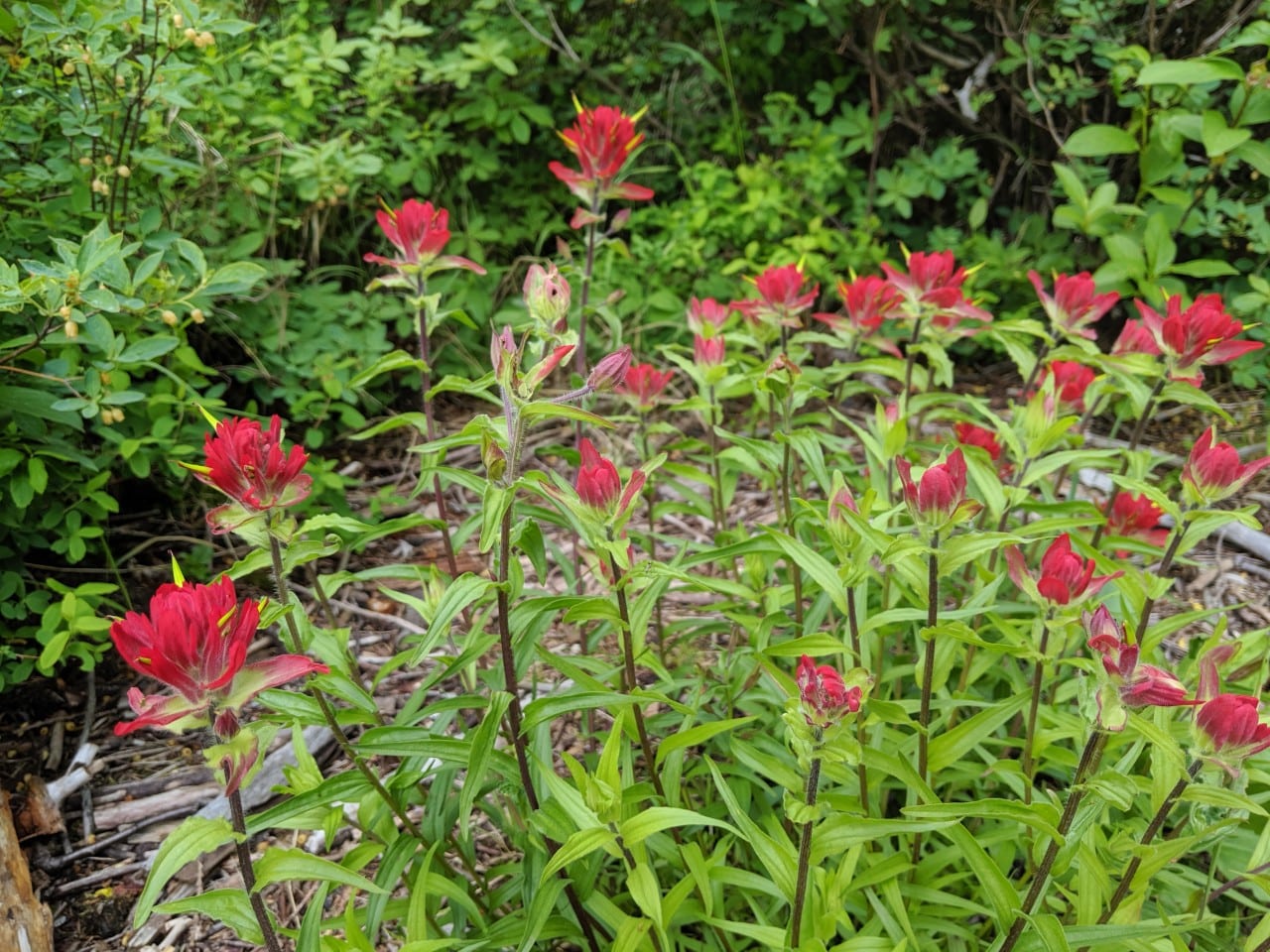
- Beautiful wildflowers and alpine meadows in summer
- Wildlife-watching opportunities including black bears, eagles, deer, salmon and more
- Interesting heritage sites, such as Ray’s Cabin – a 1929 era building that was once part of a working farm in the wilderness
- Action-packed whitewater rafting opportunities
- Four rustic vehicle-accessible campgrounds with plenty of well-spaced, private sites

Another fantastic aspect of visiting Wells Gray Provincial Park is that entry is completely free. There are camping fees for overnight stays.
Keep in mind, however, that the Wells Gray experience is a little wilder than that in Banff or Jasper National Park.
There are no hotels or gas stations within the park boundaries and only a few places with flush toilets.
Wells Gray is usually open year round although facilities and road access are limited from October to April.
July and August are the busiest months but keep in mind Wells Gray isn’t the kind of place that attracts huge crowds.
The park is quite popular with visitors from Germany. Most signs are translated into German and indeed, almost everyone we come across while exploring the Wells Gray Corridor is German!
Being that Germans are some of the most travelled people in the world, I can only confirm that they are onto a good thing.
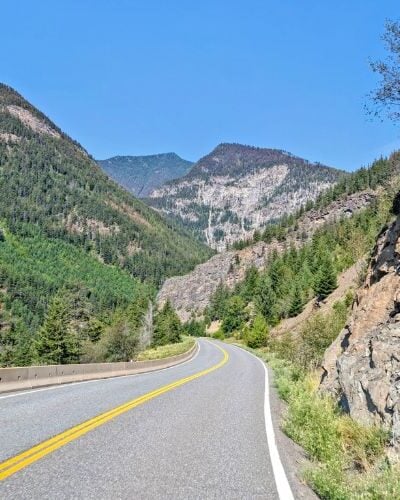
Driving the Wells Gray Corridor
The Wells Gray Corridor features breathtaking waterfalls, heritage sites, calming river views, picnic areas, lake access as well as multiple hiking trailheads.
The road finishes at 68.3km with no exit so visitors return the same way they came (twice the fun!)
The following kilometre readings are from the Wells Gray Visitor Centre, situated at the very start of Clearwater Valley Road. Be sure to fill up on gas and food before leaving Clearwater.
To drive from the Visitor Centre to the Clearwater Lake boat launch without stopping would take about 80 minutes. But I wouldn’t recommend doing that! Take your time to stop hike, picnic and take in the beautiful scenery.
I have italicized the most popular stops along the route to give you an idea of the busiest areas.
For a quieter visit, try to visit these places early (before 11am) or late (after 4pm). Wells Gray is, however, a lot quieter overall than other Canadian destinations such as Banff or Jasper.
The Wells Gray Corridor (Clearwater Valley Road) is paved for the first 42km to the Helmcken Falls turnoff. After this, it is gravel. The road surface is usually good, being regularly graded during the summer.
Kilometre road markers
10.4 – Spahats Falls turnoff
11.4 – Spahats Creek Forest Service Road turnoff (Trophy Meadows hike)
20.8 – Mouls Falls Trailhead (6km return hike)
30.6 – Flat Iron Trailhead (Trout Creek, Hoodoo Rim, West Rim, Clearwater River and White Horse Bluffs)
37.2 – Park entrance sign and information board
37.7 – Green Mountain Road turnoff (Placid Lake Trailhead, West Rim/White Horse Bluff Trailhead, Green Mountain Viewing Tower, Foot Lake Trail)
40.9 – Dawson Falls (1.4km return hike)
41 – Helmcken Falls Rim Trail (8km return hike)
41.4 – Mushbowl pull-out
42.1 – Pyramid Campground/Pyramid Mountain Trailhead turnoff
42.4 – Helmcken Falls turnoff
48.7 – Redspring Picnic Area
51.9 – Deer Creek Picnic Area
54.5 – Ray Farm/Mineral Spring (3km return hike)
56.8 – Baileys Chute Picnic Area, Trail (1.6km return hike) and West Lake Loop trail (6.5km return hike)
64.9 – Falls Creek Campground
65.4 – Clearwater Lake Campground and Day Use Parking (Osprey Falls, Chain Meadows trail)
68.3 – Clearwater Lake Boat Launch and end of road

Waterfalls in Wells Gray
Undoubtedly, it is the waterfalls that make Wells Gray the destination that it is.
The park is part of a volcanic field that started forming approximately 3.5 million years ago.
Since then, volcanic eruptions and glacial activity have carved the mountains and river canyons to reveal beautiful waterfalls.
Volcanoes remain in the park today, with some being officially classed as ‘potentially active.’ Pyramid Mountain last erupted 12,000 years ago.
Twelve of Well Gray’s waterfalls are relatively accessible from the Wells Gray Corridor. Read the overview below and then head to our Wells Gray waterfalls guide for more.
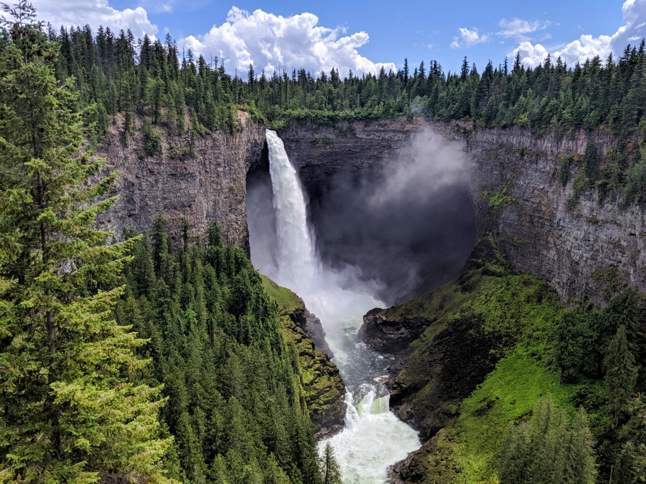
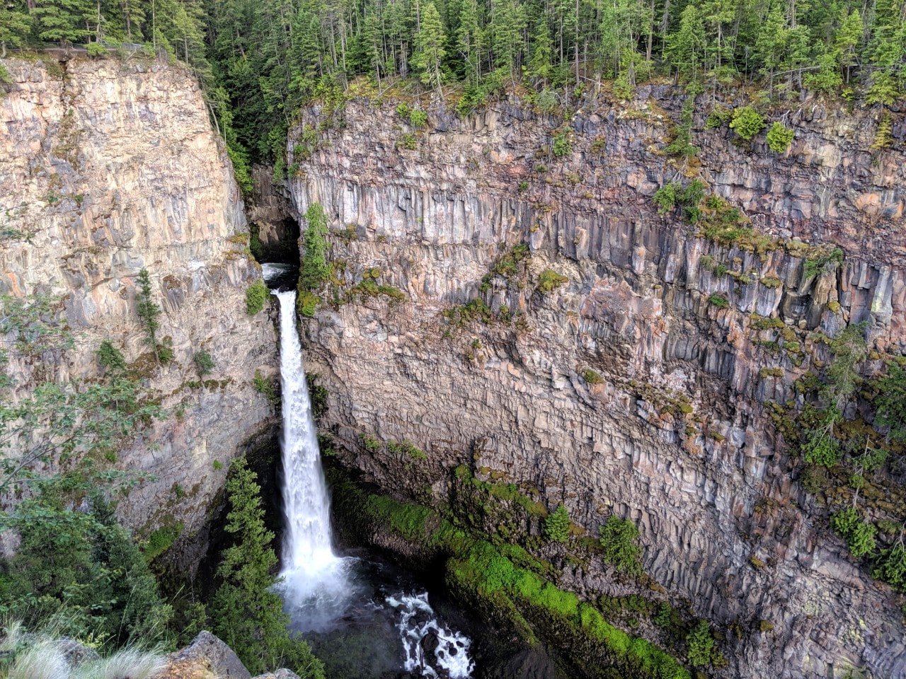
Helmcken Falls
Magnificent Helmcken Falls plunges 141m into a rugged canyon and is the most well-known of Well Gray’s waterfalls.
The view can be enjoyed from two different perspectives, with the most well known being just a short walk from the large parking lot located at kilometre 42 on the Corridor.
The second perspective can be found at the end of the Helmcken Falls Rim Trail (8km return) which is visited by a lot fewer people.
The reward is an up close and personal side view, often accompanied by plenty of mist! Be careful, there is no fence here.

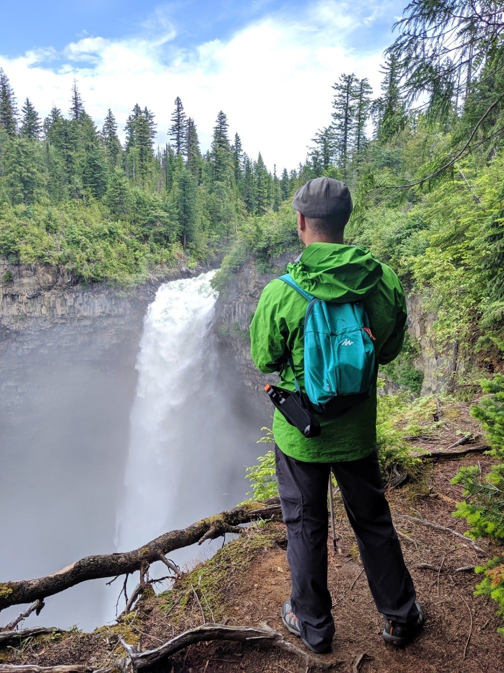
Moul Falls
The dramatic drop of Moul Falls is impressive to witness, especially in early summer. A little more effort is required to reach this waterfall as it is only accessible via a 6km return hike.
The official trail ends right in front of Moul Falls, which sits in a dramatic rock bowl. A thin path continues underneath the (potentially unstable) cliffs to the back of the waterfall.
Please note – Going behind Moul Falls is entirely at your own risk. BC Parks does not promote or recommend it. In late spring, the force of the waterfall is actually too strong to even think about approaching the cascade.

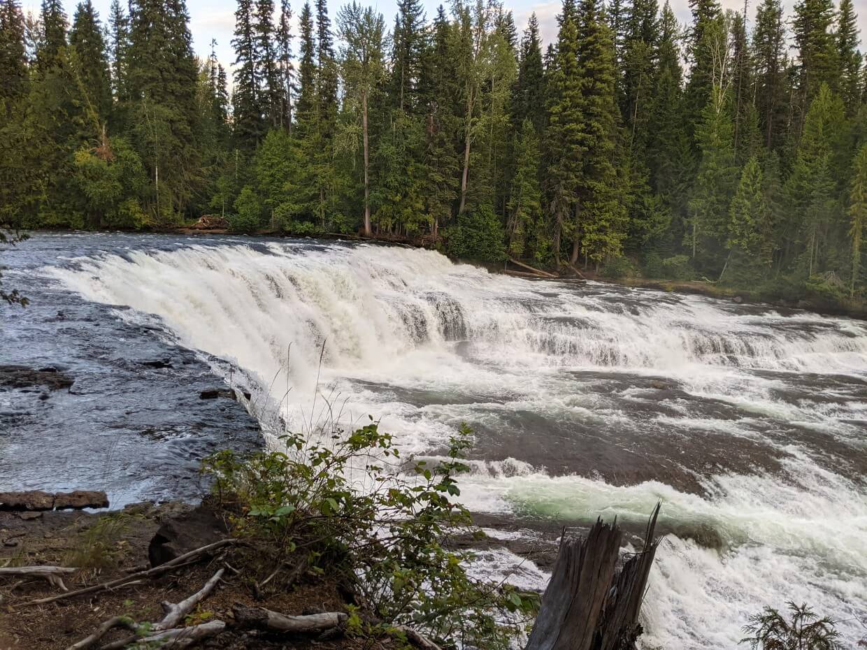
Dawson Falls
Stretching across the wide Murtle River and consisting of multiple cascades with a total height of 20m, Dawson Falls is a majestic sight. It’s easy to visit too, with the first viewpoint a short 450m walk from the parking lot.
There is another viewpoint another 250m or so further on, which is a good place to stop and take in the power of the fast-flowing water.
A third viewpoint is accessible via a short walk from Pyramid Campground.

Spahats Creek Falls
Helmcken Falls may be the most talked about of the waterfalls in Wells Gray but I was equally impressed by Spahats Creek Falls on our first visit. I had never heard of it and was completely awe-struck when we first visited.
Rushing through a narrow rock gap, the dramatic Spahats Creek Falls pours 75m straight into a yawning ravine. It is a spectacular view and there are numerous viewing platforms from which to admire it.
Reaching Spahats Creek Falls is easy – it is one of the most accessible of all the waterfalls in Wells Gray, with access at kilometre 10.4 on the Corridor road. The canyon rim is a very short 250m walk from the parking lot.
Other waterfalls in Wells Gray
- The Mushbowl is a fast, frothy and rocky waterfall, right next to the road at kilometre 41.4. There’s space to pull off the road right after the bridge over the Murtle River
- Baileys Chute combines both waterfall and rapids and is easily accessed on a 1.6km return trail. Further on, you can also visit Marcus and Myanth Falls (6.5km return)
- Immensely wide Osprey Falls can be found at the bottom of Clearwater Lake, with a viewpoint platform only a short walk from the vehicle-accessible campground.

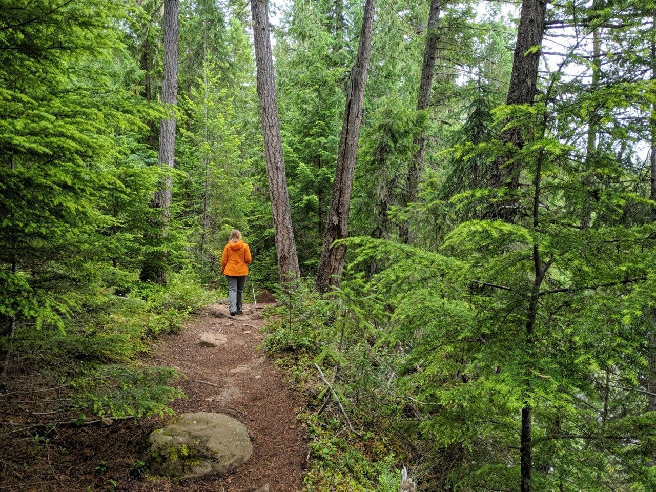
Hiking in Wells Gray Provincial Park
Hiking is a great way to go beyond the roadside sights of the Wells Gray Corridor. The following trails are my favourite day hiking trails in Wells Gray Provincial Park. Most are rated easy.
Trail closures and conditions are listed under the ‘Attention Visitors’ section at the very top of the BC Parks’ Wells Gray Provincial Park page.
Keep the following in mind when hiking in Wells Gray:
- Please note that paths can be muddy after rain, even the morning after
- Make noise to alert animals of your presence
- Be sure to provide plenty of space as well as an escape route
- Tell someone where you’re going and when you plan to be back
- Keep in mind that there is very little phone signal in the park
Dawson Falls – 1.4km return
More of a walk than a hike, this easy riverside stroll features two beautiful viewpoints of this wide, horseshoe-shaped waterfall.
Unlike some of the other waterfalls in the park, Dawson Falls is better viewed (in my opinion) in autumn when the cascading water is more defined.
If you’d like to see Dawson Falls from a different vantage point, hike the alternative trail from Pyramid Campground. The 2.4km loop provides access to the ‘other’ side of Dawson Falls.
Baileys Chute – 2km return
This relaxing riverside path features a series of rapids and a soundtrack of rushing water. Some hikers choose to approach the rock bed and witness the power of the water (keep pets and children close).
In late summer, chinook salmon can be seen migrating upstream. This trail also offers the chance to see two additional waterfalls further upstream – Marcus and Myanth Falls.

Moul Falls – 6km return
If you only have time to hike to one waterfall in Wells Gray, I’d recommend the trail to Moul Falls. And don’t be put off by the distance – half of the route is very flat and quick to hike.
A short and steep descent leads directly to the base of Moul Falls, where the water plunges 35m into a rock bowl. The cascading water is exceptionally powerful in spring, creating plenty of mist.

Ray Farm/Mineral Springs Trail – 3km return
See a different side to Wells Gray on the Ray Farm trail, which showcases the park’s homesteading history. An old farmhouse looks out over a gorgeously lush meadow area, which also features two mineral springs.
An easy walk through the forest leads to more mineral springs, this time bubbling out of a volcano-shaped cone. Wildlife is particularly prevalent in this area.
This trail can also be hiked as a 4km loop, either from the main Ray Farm parking area or the Alice Creek parking lot.

Helmcken Falls Rim Trail – 8km return
The Rim Trail offers an alternative perspective on the famed Helmcken Falls, but it’s definitely not for those afraid of heights!
The mostly flat path leads hikers right to the edge of the canyon where the huge waterfall plunges into the bowl below. It’s a spectacular sight.
The Rim Trail is usually pretty quiet so you’ll likely be alone at the end viewpoint. Be sure not to get too close to the edge as there is no barrier.
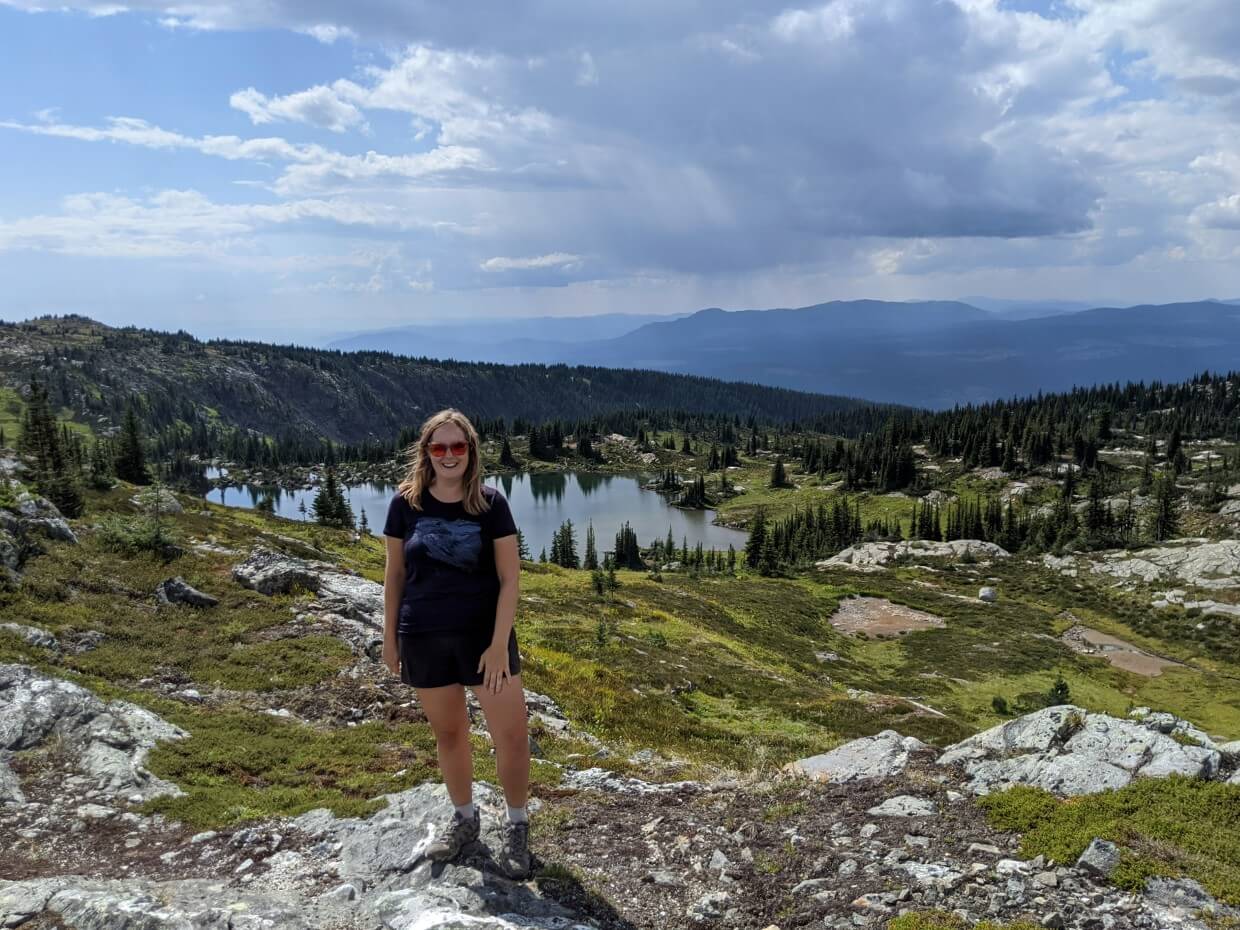
Trophy Meadows Trail – 2 to 12km return
From late July to early August, the southern sub-alpine slopes of the Trophy Mountains are covered in a carpet of vibrant wildflowers.
Even if you don’t get the timing quite right, this is still an absolutely beautiful place to hike. It’s the best non-waterfall trail in Wells Gray!
The meadows are accessed via a steady but short climb from the parking lot (2km with 230m elevation gain). Read all the details in our Trophy Meadows hiking guide.
The path continues another 2.8km to Sheila Lake, which is surrounded by pretty sub-alpine scenery. There is a backcountry campground at the lake, with further hiking opportunities just beyond.
Please note that the Trophy Mountain trailhead is located at the end of an unpaved dirt road. Expect loose rocks and washboard surfaces.

Wildlife in Wells Gray Provincial Park
Wells Gray Provincial Park is home to black and grizzly bears, moose, caribou, cougar, lynx, wolf, wolverine, bobcat, deer, mountain goat, caribou and smaller mammals like mink, weasel, squirrels and martens.
Over 200 species of birds have been spotted in the park.
Driving the Wells Gray Corridor offers the chance to see some of these amazing creatures. But park visitors MUST be careful to keep themselves and the wildlife safe.

Seeing a bear is exciting (and I still say that after living in Canada for 10+ years) but the welfare of the animal is way more important than any photo you could ever take of it.
To stay safe, follow these guidelines:
- Keep to the posted speed limits when driving
- Stay on marked trails and remain alert
- Pack out all of your trash with you
- Talk loudly or make noise when hiking to avoid startling wildlife
- Do not approach, follow, scare or feed animals – respect their space and give an escape route
- Never get out of your vehicle to get closer to an animal
- Watch wildlife only for a limited time to preserve natural behaviour
- Know what to do if you encounter a bear on a trail
- In backcountry areas, carry bear spray (in an easily accessible place) and know how to use it
The other creature you MUST be aware of in Wells Gray is the mosquito. They can be a real nuisance in the warmer months. Bring your repellent of choice and consider wearing long sleeves (and even pants) on forested hikes.
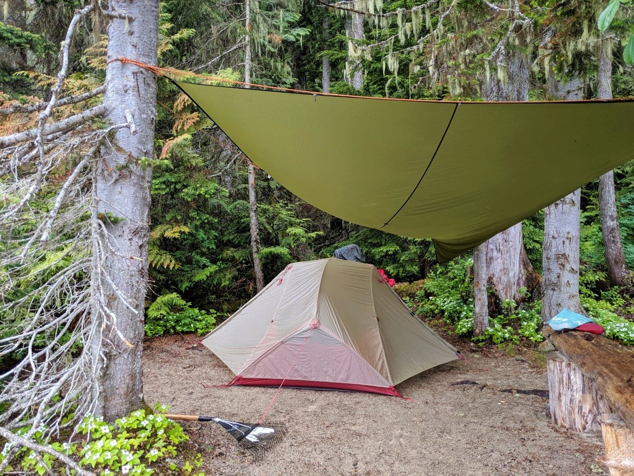
Staying overnight in Wells Gray Provincial Park
While it is true that many of Well Gray’s attractions can be enjoyed during one long day trip, staying overnight offers the chance to see and experience more.
Camping, in particular, really helps to capture the quiet and calming nature of the park.
This post includes affiliate links. If you make a purchase via one of these links, we may receive a small percentage at no extra cost to you.

Vehicle accessible campgrounds
There are three vehicle-accessible campgrounds in this area of Wells Gray Provincial Park.
In my opinion, Pyramid is the more centrally located for waterfalls and hiking while Falls Creek and Clearwater Lake are better for water-oriented visitors.
It is important to also keep in mind that Pyramid is accessed via a paved road while Clearwater and Falls Creek are not.
From 2026, non-BC residents will be charged an additional $20 per stay, per camping group, at provincial campgrounds.
Pyramid Campground
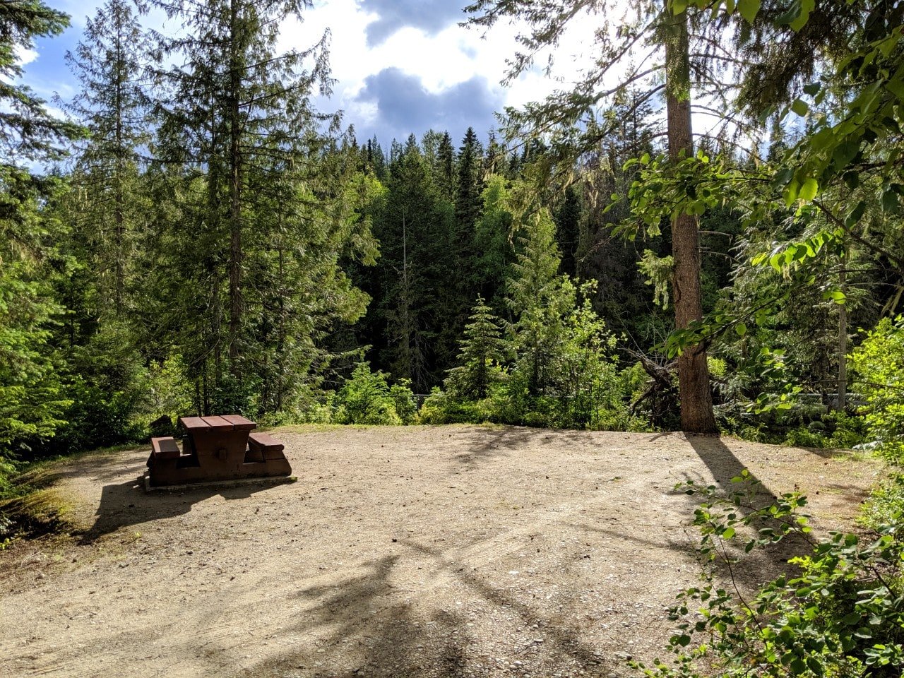
Set into a thick forest, Pyramid Campground is situated very close to Helmcken Falls. There are 50 well-spaced campsites. The Pyramid Mountain trailhead starts right in the campground.
The camping fee for Pyramid is $20/night per group. Each site has a picnic table and fire plug. There are outhouses and cold water taps around the campground but no RV hook-ups.
The campsites at Pyramid are allocated on a first-come, first-service basis. The last time we camped there, in early August one year, only six sites were being used (on a Friday night!)
Pyramid has a reputation for being buggy but we had no issues in early August.

Falls Creek Campground
Falls Creek Campground is located at the 64.9km marker on the Wells Gray Corridor. It is connected to the Clearwater Lake Campground by a short trail (200m) and bridge.
The campground is narrow, with all 40 reservable campsites being therefore close to the river.
The camping fee for Falls Creek is $23/night per group. Each site has a picnic table and fire ring plus access to outhouses and cold water taps (no RV hook-ups). Being so close to Clearwater Lake Campground, Falls Creek shares some of the same facilities (see below).
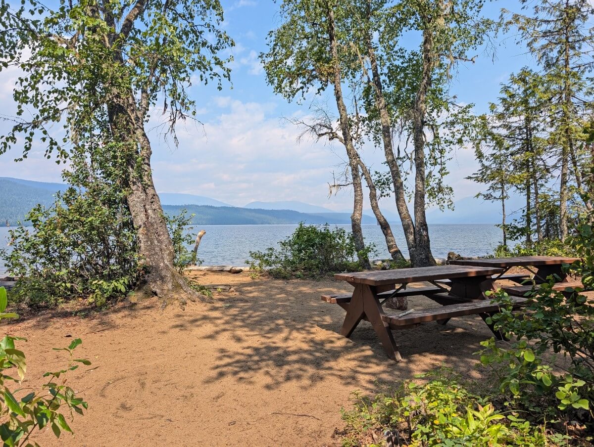
Clearwater Lake Campground
Clearwater Lake is the last vehicle-accessible campground and also has 40 reservable campsites.
Some are by the river but most are set a little further back into the forest. Trails lead from the campground to the eastern shore of Clearwater Lake and a viewpoint platform for Osprey Falls.
The camping fee for Clearwater Lake is $23/night per group. Each campsite has a picnic table and a fire ring. There are outhouses, cold water taps and coin-operated showers ($2) but no RV hook-ups. The campground also has a small store, café, canoe rentals and boat tours.
Backcountry camping options
The Wells Gray Corridor is surrounded by expansive backcountry areas with numerous camping opportunities accessed by water or hiking trails.
Clearwater Lake, at the end of the road, has 9 camping areas with 20+ tent sites along its 22km length. Each camping area has an outhouse, food cache and fire rings. Some also have picnic tables.
A 0.5km portage at the end of Clearwater Lake leads to Azure Lake. This lake, also 22km long, hosts 5 camping areas with 20+ tent sites, of a similar standard to those on Clearwater Lake.

Battle Mountain, Pyramid Mountain, Trophy Mountain and the Green Mountain Canyonlands offer backcountry camping areas for hikers.
More info is available on the BC Parks website and in our Trophy Meadows guide.

Other backcountry camping options
Beyond the Wells Gray Corridor area, there are marine campsites on Mahood Lake (3 sites) and Murtle Lake (69 sites), accessible from the water only. Murtle Lake is a canoe/kayak-only lake with no motors allowed.
Backcountry camping permits in Wells Gray are $5 per night, per person. Fees can be paid into self-registration vaults or via the online BC Parks Backcountry Registration system. All backcountry campsites are offered on a first-come, first serve basis only.
Campgrounds outside of Wells Gray Corridor area
With the Wells Gray Corridor being so relatively compact, it is still perfectly possible to visit as a day trip only. Here are some options for camping nearby.
North Thompson River Provincial Park
Compact North Thompson River Provincial Park is just a five-minute drive south of Clearwater, making it an excellent base camping spot for exploring the Wells Gray Corridor.
There are 69 vehicle-accessible campsites located close to the river, with access to four short hiking trails.
53 of 69 total campsites can be reserved via the Discover Camping website. The remaining 16 sites are available on a first-come, first-serve basis. The camping fee is $23/night per group. This campground has outhouses and cold water taps only – no showers or hook-ups for RVs.
Mahood Lake
As the only lake in Wells Gray Provincial Park that isn’t glacier-fed, Mahood Lake is the best destination for swimming.
Despite being geographically close to the Wells Gray Corridor area, however, the frontcountry campground at Mahood Lake is not accessible via the main park entrance. The campground is an 80-minute (76km) drive east of 100 Mile House.
All 35 campsites in the Mahood Lake vehicle-accessible campground can be reserved in advance on the Discover Camping website. This campground has outhouses and cold water taps only – no showers or hook-ups for RVs. The camping fee is $23/night per group.

Lodges, inns and B&Bs
Though there may not be any non-camping accommodation in Wells Gray Provincial Park itself, there are several lodges, inns and B&Bs located along the Wells Gray Corridor.
Wolfwood Guest Ranch is close to the main part of the park. There are four heritage cabins here, one almost 100 years old, sleeping 2-5 adults each. Breakfast is included.
Just down the same road is Battle Creek Ranch. The welcoming hosts (one of whom speaks German) provide accommodation in two comfortable suites on their farm.
A little further away is Across the Creek Cabins, featuring fully equipped individual cabins set into a forest.
Closer to Clearwater, there’s an even bigger choice of B&Bs, inns and motels. One of them, Grizzly Paw B&B, even has a waterfall in walking distance.
For hotels, our top pick is the Best Western Plus Gateway to the Falls in Clearwater. There is a restaurant very close by (Gateway Grill), so no need to go far after a long day exploring the park! The Wild Flour Bakery is fabulous as well.
Want to explore more of beautiful British Columbia?
A Complete Adventure Guide to Valhalla Provincial Park
Where to Find Big Trees on Vancouver Island
Lake O’Hara Hiking and Camping Guide, Yoho National Park
18 Must Do Revelstoke Attractions and Activities
Climbing the Via Ferrata at Kicking Horse Mountain Resort, Golden
Vancouver to Calgary Road Trip: Alternatives to Highway 1


Check out these recently published articles next


One half of the Canadian/British couple behind Off Track Travel, Gemma is happiest when hiking on the trail or planning the next big travel adventure. JR and Gemma are currently based in the beautiful Okanagan Valley, British Columbia, Canada. Consider buying us a coffee if you have find any of our guides helpful!
Great website you have. I just wanted to point out that all the links at the bottom of the page on the Wells Gray website lead to a WordPress account requesting a username and password.
Thanks for the catch! 😉 Glad you are enjoying the website
Very informative website. Thanks very much. Found the info to be very useful!
Thanks Dean! I truly appreciate you letting me know that you’ve found the website helpful!
Thanks so much – we are planning a trip next week and found this included all the stuff we were thinking about. Planning to base ourselves at pyramid campsite and ride out from there to other sites.
thankyou Brendan
Hope you have an awesome trip Brendan! Thanks for letting me know that you found this post helpful, it means a lot.
Heading to Wells Gray next week and very excited! Thank you for the detailed info, we will definitely use it to add to our itinerary!
Cheers 🙂
Hope you have an awesome trip Amy! Thanks for letting me know that you found this post helpful.
We are planning to visit Wells Gray next week. Way back in 1977, we were in a college course that took us to Murtle Lake for 8 days of canoeing, camping, hiking, geology & botany. Now in 2022, we are excited to return to Murtle Lake plus explore other lakes and waters. This time we’ll have kayaks to portage to Murtle Lake!
Hi Gary & Janice,
Lovely to hear from you! That’ll be an exciting trip for you for sure, returning to Murtle Lake after 45 years, wow! I wonder how much the park (and the access road!) has changed.
Fantastic post! Lot of useful information. Thanks!
Thanks for much Tamara! Have a great trip.