Moving back home, to university, relocating a car or heading to the West Coast for a summer trip?
This Toronto to Vancouver road trip guide highlights the top roadside stops on the 4,400km long journey across Canada.
A contrast of landscapes awaits on this transcontinental adventure, starting with the forested lakes of Ontario, the endless fields of the Prairies, the rugged Rocky Mountains and the temperate rainforests of British Columbia.

JR and I have driven across Canada four times in the last few years, with each journey taking place during a different season.
With this first-hand knowledge in mind, this post shares our favourite places to stop when driving between Toronto and Vancouver.
This post includes some affiliate links – if you make a purchase via one of these, we may receive a percentage of the sale.

Toronto to Vancouver road trip: Essential details
Via the fastest route (within Canada), Toronto to Vancouver is a 4,400km long road trip.
Without any stops at all (and zero traffic/construction delays), driving the full distance in one go would take around 47 hours.
But I certainly wouldn’t recommend doing that! This post suggests six places to stop overnight.
This breaks up the journey into a relatively approachable 7 day summer road trip:
- Toronto to Sault Ste. Marie – 700km
- Sault Ste. Marie to Thunder Bay – 700km
- Thunder Bay to Winnipeg – 700km
- Winnipeg to Regina – 570km
- Regina to Calgary – 757km
- Calgary to Revelstoke – 407km
- Revelstoke to Vancouver – 565km
If you have the time, I would suggest double the time (two weeks) to make the most of the trip.
In a rush? Some people drive from Toronto to Vancouver in five or six days instead (even four with multiple drivers!) Long daylight hours and favourable weather make this easier.
A winter road trip from Toronto to Vancouver is a whole other story. I would suggest seven days at an absolute minimum.
Toronto to Vancouver road trip map

What to expect when driving between Toronto and Vancouver
As mentioned, this post features the fastest and most straightforward route between Toronto and Vancouver.
- The journey utilises major highways, with most of the itinerary following the Trans Canada Highway (TCH).
- Expect single or double-lane highways (two or four-lane total), with divided sections in flatter areas. Some sections even have triple lanes (six lanes total).
- Speed limits vary from province to province. Some sections of the Trans Canada have a maximum speed of 90km/h (Ontario) while most others are 110km/h. The Coquihalla Highway in British Columbia has the highest speed limit (120km/h).
- Rest areas are reasonably frequent, though facilities range from developed (flush toilets, manned Visitor Centre, picnic areas, electric charging stations, Wi-fi) to basic (outhouses, picnic benches, bins).

- Gas stations are easy to find in urban areas but are less common in more rural areas, especially along Lake Superior in Ontario and in the mountainous regions of Alberta and British Columbia. Plan your next gas stop carefully.
- Phone service can be spotty (or non-existent) in rural areas as well, specifically those mentioned above
- Be sure to let someone know where you are going and when you plan to check in next.
- Bring extra food, water, clothing and First Aid supplies in case of construction/accident delays or closures.
- There are multiple time zone changes along the route – when driving west, you will change one hour each time. When driving east, you will lose one hour each time
- Watch for wildlife, especially when driving at dawn and dusk. It is possible to spot moose, elk, deer, bear and more

Toronto to Vancouver road trip: 24+ great places to stop
It’s time to share our favourite places to stop when driving between Toronto and Vancouver!
The majority of the following destinations are located close to the route or within 10 minutes drive of the main highway.
Of course, this is not a definitive guide of possible places to stop when driving between Vancouver and Toronto. These are just our favourite destinations located very close to the main highway.
I have included some worthwhile detours at the end of this guide. Again, there are so many possibilities but these are our favourite options.
Big Nickel (Dynamic Earth), Sudbury
Let’s start this big journey with something equally big….the Big Nickel in Sudbury!
The Big Nickel is a giant replica of a Canadian five-cent coin. Originally constructed to commemorate the 100th anniversary of the Canadian Confederation, the huge coin also represents Sudbury’s rich mining heritage.
Travelling with kids? Be sure to check out this Dynamic Earth science museum. The highlight of this interactive centre is the underground mine tour.

Sault Ste. Marie
A solid 700km drive from Toronto, the waterfront city of Sault Ste Marie is an ideal place to spend the night.
Take a stroll along the waterfront boulevard to the Sault Ste. Marie Canal National Historic Site. The first canal lock was built in this area in 1798. Guided tours are available during the summer months.
Walk across the lock to Whitefish Island, home to Indigenous settlements for more than 2000 years. The 22 acre teardrop-shaped island is crisscrossed by a network of easy walking trails maintained by the Batchewana First Nation.
Before leaving town, be sure to enjoy a meal at the Breakfast Pig. Go traditional or try one of the more inventive Egg Benedicts. As a non-meat eater, I love the Adonis version (goat cheese, red peppers, pesto and balsamic).
Where to stay in Sault Ste. Marie
Budget
Camping? Head north of Sault Ste. Marie to Pancake Bay Provincial Park. This campground is located behind a gorgeous golden sand beach on Lake Superior (more details below).
Mid-range
The Holiday Inn Express is a dependable choice in Sault Ste. Marie. It is situated a block from the waterfront, opposite a shopping mall.
High-end
The Delta Hotel (Marriott) is perfectly located to explore Sault Ste. Marie’s waterfront area. Some of the spacious rooms even have water views.

Pancake Bay Provincial Park
While walking the golden sands of Pancake Bay, you may wonder whether you have left Ontario and arrived somewhere in the Caribbean! On a calm, sunny day, this beach is absolutely gorgeous.
The long sandy beach was a delight for the Voyageurs too, who would have appreciated the ‘flat as a pancake’ landing (just one explanation for the name).
Just before Pancake Bay is the Voyageur’s Lodge and Cookhouse, which boasts the freshest and tastiest apple fritters around.
Heading towards Wawa, look out for the many scenic roadside lookouts over Lake Superior. A great example is the one at Agawa Bay.

Wawa Goose
The Wawa Goose is one of the most memorable landmarks on the Toronto to Vancouver drive.
The huge 8m high goose heralds the turnoff to Highway 101 and the small community of Wawa.
Take the opportunity to stretch your legs and use the facilities at this iconic roadside stop. The goose is a nod to Wawa’s history as a hub for goose hunting.

Aguasabon Falls & Gorge
This part of Ontario is full of impressive waterfalls! One of the easiest to access is Aguasabon Falls near Terrace Bay.
The byproduct of local hydro development in the 1940s, this 30m waterfall flows over a 2.6 billion-year-old rock face.
As the winter snow melts and rainfall increases, Aguasabon Falls‘ flow swells and becomes simply ferocious. Spring is the best time to visit but this cascade is impressive during every season.

Rainbow Falls Provincial Park
The star of Rainbow Falls Provincial Park is a series of soothing cascades. There is a boardwalk with multiple viewing platforms.
During sunny weather, you might observe rainbows forming due to the mist generated by the falls.Hiking beyond the main river leads to a pleasant viewpoint above Lake Superior.
A day-use pass is required to visit Rainbow Falls Provincial Park. If you’re on a strict budget and can only visit a few Ontario Park sites, I would prioritise visiting Kakabeka Falls instead (more information below).

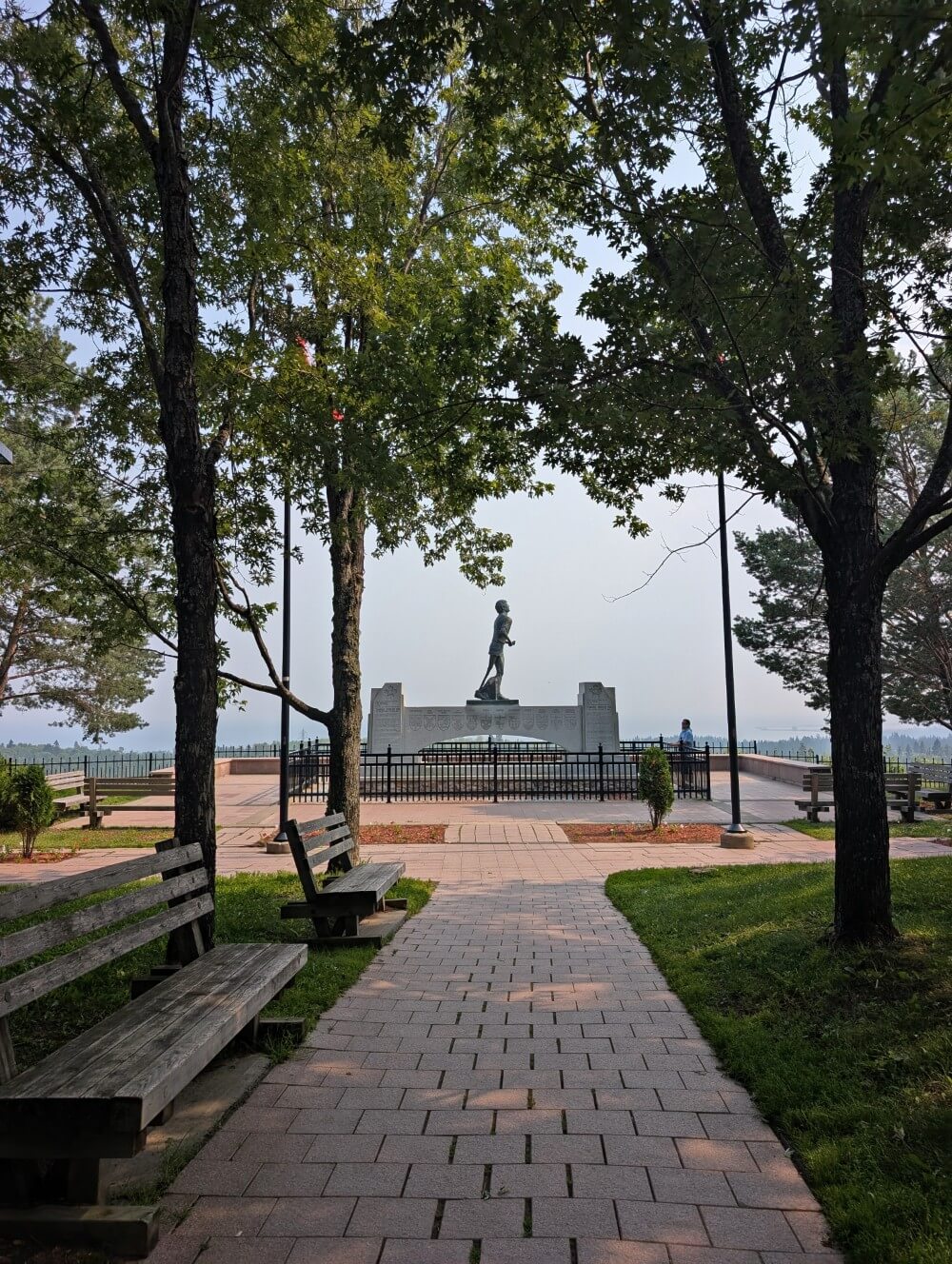
Terry Fox Monument and Statue
Pause for a touching moment at the Terry Fox Monument and Statue, just outside of Thunder Bay. This tribute commemorates Terry’s courageous spirit and determination to raise funds for awareness and funds for cancer research.
Terry Fox’s cross-Canada run ended in Thunder Bay in early September 1980. Starting in Victoria, British Columbia, he had covered approximately 5,373 kilometres over 143 days of running.
Not from Canada? Definitely read up on Terry Fox before starting your Toronto to Vancouver journey. It will make this stop much more poignant.
Thunder Bay
Thunder Bay is the most convenient place to overnight between Sault Ste. Marie and Winnipeg.
This sprawling lakeside city offers a great choice of hotels, motels and B&Bs. There are many big box stores and local boutiques as well.
Besides these amenities, Thunder Bay is an interesting destination in its own right. This is particularly true if you like waterfalls!
One of the most popular places to visit is Fort William Historical Park, which recreates the fur trading era. Check out this Thunder Bay guide for more of our recommendations.
Where to stay in Thunder Bay
Budget
Choose between three campgrounds in Kakabeka Falls Provincial Park (see below). The Fern’s Edge and Riverside campgrounds are very close to Kakabeka Falls
Mid-range
The Superior Shores Hotel is situated close to Lake Superior and within easy walking distance of many great restaurants. Breakfast is included with each stay.
High-end
The Delta Hotel enjoys a waterfront location on Lake Superior, with walking trails leading along the shoreline. Rooms are spacious, with some offering water views.

Kakabeka Falls
Kakabeka Falls is a must-see when driving between Toronto and Vancouver!
This wide roadside waterfall is Ontario’s second highest as it plunges 40m into the Kaministiquia River. The resulting gorge is studded with 1.6 million-year-old fossils.
A choice of elevated viewing platforms on either side of the river offers excellent vantage points. There are short hiking trails to explore as well.
TIME ZONE CHANGE! Adjust from Eastern to Central time near the community of Raith (northwest of Kakabeka Falls).

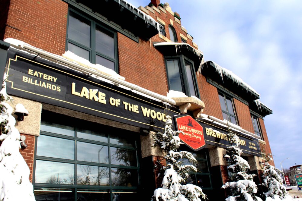
Kenora (and Huskie the Muskie)
Kenora is our favourite community in northwestern Ontario. Situated along the shoreline of Lake of the Woods, this friendly small city enjoys beautiful water views.
The downtown area features many late 19th-century red brick buildings. One of the most impressive is City Hall (previously the Post Office).
If you still have an appetite for huge things, be sure to check out Huskie the Muskie. This 12m tall muskellung pike sculpture looks out over Kenora Bay.
Manitoba border sign
It’s finally time to say goodbye to Ontario…and hello to Manitoba! Amazingly, you’re almost halfway to Vancouver at this point. Ontario is a huge province!
Take a second to reflect on your journey so far at the Manitoba border sign. The driving is pretty smooth across the Prairies, with long sections of flat, straight divided highway.

The Centre of Canada
Not too long into Manitoba and you’ll arrive at another major milestone – the longitudinal (east/west) centre of Canada!
This fun roadside stop comprises a small park area with a huge sign. Situated just off Highway 1, the park is very easy to access. There are big plans for development in this area in the coming years.

Winnipeg
Home to around 60% of Manitoba’s total population, ‘the Peg’ boasts a rich cultural tapestry. It is an ideal place to stop when driving from Toronto to Vancouver.
The Forks National Historic Site, where the mighty Red and Assiniboine rivers meet, is a must-visit while in town.
With more than 6,000 years of history as a meeting place, the Forks has played an important role in Manitoba’s development and Canada as a whole. Adjacent to the Forks is the cutting-edge Canadian Museum for Human Rights.
If you just want to relax after driving so far across Canada, head directly to Thermëa by Nordik Spa-Nature. This outdoor Scandinavian-style spa experience features thermal pools, saunas, and relaxation areas. It is open all year round
Where to stay in Winnipeg
Budget
The Town and Country Campground is located just east of Winnipeg. It is conveniently located just off Highway 1, on 48 acres of land
Mid-range
Modern, clean and comfortable, the Alt Hotel is close to everything downtown. There is parking close by but expect to pay a daily fee
High-end
The Inn at the Forks is perfectly placed to explore Winnipeg’s most popular attractions. The impressive Fort Garry Hotel is a nearby alternative

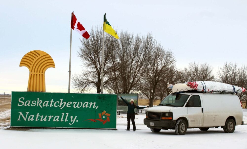
Saskatchewan border sign
Be sure to make a quick stop at the Saskatchewan border sign before leaving Manitoba! Green is the prominent colour, representing the province’s northern forested areas.
In my opinion, the most scenic and interesting parts of the Prairies are not found on Highway 1. Check out the detour suggestions at the end of this post if you have the extra time to explore beyond the highway.
Regina
Named after Queen Victoria, Regina is the capital of Saskatchewan. This approachable city is surprisingly green, with the huge Wascana Lake being a great place to walk and relax.
At the northwest edge of the lake is the Royal Saskatchewan Museum, home to the world’s largest T-rex. Scotty, as the T-rex is known, was also one of the most complete Tyrannosaurus rex skeletons ever found.
Even if you’re not interested in politics, the Saskatchewan Legislative Building is worth a look. The imposing structure is made from local Tyndall Stone and is naturally filled with ocean fossils. The grounds are also beautiful.
Where to stay in Regina
Budget
King’s Acre Campground is situated just off Highway 1, technically within city limits (15 minutes drive). This RV-orientated campground is open year-round and features large, level campsites
Mid-range
The DoubleTree by Hilton Hotel is a reliable pick located southeast of downtown. There is underground parking (great in winter) but there is an additional fee
High-end
We loved our stay at Regina’s historic Hotel Saskatchewan. Built in 1927, the hotel has welcomed numerous dignitaries, celebrities, and notable guests. It is ideally placed for exploring the city

Moose Jaw
The unassuming small town of Moose Jaw has a secret – an underground network of passageways and corridors. These tunnels date from the late 19th century and were first used for utility purposes for the nearby railway.
This network had a more sordid secondary use during the prohibition days for alcohol smuggling.
Though it’s not yet been proven, Al Capone was rumoured to have had a hand in the bootlegging operations here. The Tunnels of Moose Jaw brings all of this history to life.
Moose Jaw is also home to hot springs. The Temple Gardens Mineral Pool is the perfect place to relax during a road trip from Toronto to Vancouver.

Alberta border sign
Canada’s Wild Rose Country awaits! The landscape remains flat for the first part of the drive through Alberta, with oil pumpjacks visible alongside canola fields and cattle ranches.
Approaching Calgary, the towering peaks of the Canadian Rockies start to appear. It is a truly incredible sight and one of the best reasons to drive Toronto to Vancouver rather than Vancouver to Toronto!
TIME ZONE CHANGE! Adjust from Central time to Mountain time when crossing the Alberta/Saskatchewan border.

Calgary
Nestled between prairie grasslands and the Canadian Rockies, Calgary is a dynamic and vibrant city.
We’ve spent a lot of time in Calgary over the years. Our favourite activities for adults include the Calgary Tower, Studio Bell (National Music Centre) and a float down the Bow River.
Visiting Calgary with kids? The Heritage Park Historical Village or Calgary Zoo are also worth a look. Of course, the annual Calgary Stampede is a must for all visitors in July!
Where to stay in Calgary
Budget
The centrally located HI Calgary City Centre is a solid budget option. Breakfast is included. For camping, I would continue towards the Kananaskis Valley or Banff
Mid-range
Try the Hotel Elan or Alt Hotel East Village. Modern accommodation close to downtown with a very reasonable price tag
High-end
For the best stay in the city, look no further than the Hotel Le Germain. The rooms are spacious, the location is central and breakfast is complimentary

Banff
There are so many things to do in the Banff area. This driving day is the shortest to allow some time to explore this spectacular national park (day pass required).
The best vehicle-accessible viewpoint is the Mt Norquay Lookout. It’s completely free and offers amazing vistas of Banff and surrounding peaks.
Feel like a hike? The 2km uphill trail to the top of Tunnel Mountain is well worth the effort (300m elevation gain) as it ascends the slopes of this prominent landmark.

Johnston Canyon is a rewarding place to explore, but keep in mind that it is very busy during the summer months between 10am and 3pm.
While Lake Louise and Moraine Lake are some of the most popular destinations in the Banff area, they are a little tricky to visit without planning (or lots of $$).
Shuttle buses must be reserved in advance. Alternatively, take a side trip up the Icefields Parkway to see Peyto Lake instead. This alpine lake is just as impressive and much less planning is required!

BC border sign
Welcome to British Columbia! Make a quick stop at the border as you enter the final province of your Toronto to Vancouver road trip.
The BC/Alberta border also marks the Continental Divide, the natural boundary separating North America’s river systems. From here on, all rivers flow into the Pacific Ocean.
TIME ZONE CHANGE! Adjust from Mountain time to Pacific time when crossing the BC/Alberta border.

Field
The tiny community of Field is sandwiched between Highway 1, the CN railway line, the Kicking Horse River and huge, snow-capped mountains.
The Yoho National Park Visitor Centre is located just off the highway in Field, surrounded by wonderful views of nearby peaks.
Drive into the village proper to enjoy lunch or an ice cream at Truffle Pigs. There are more great views from the parking area.

Emerald Lake/Natural Bridge
Emerald Lake is a gorgeous turquoise-coloured glacier lake in Yoho National Park, 10 minutes drive from Highway 1. While not quite as well known as Lake Louise, I would say it is equally as beautiful.
With parking fees now charged at Lake Louise from May to October, Emerald Lake is a great alternative (national park pass still required).
On the way back to Highway 1, make a stop at the Natural Bridge, where the mighty (and very cold!) Kicking Horse River has carved a natural limestone bridge.

Rogers Pass
With an elevation of 1330m, Rogers Pass is the highest section of Highway 1. The are as many as 137 glaciers hiding within the huge mountains above the road.
The Rogers Pass Discovery Centre is well worth a stop – it’s one of my favourite small museums anywhere in Canada! Entry is free with a Parks Canada day pass.
While driving, look for the artillery mounts located by the side of the highway. In winter, the Canadian Armed Forces fire highly explosive rounds from these to control the avalanche danger and keep the road safe to drive.

Giant Cedars Broadwalk Trail
The best place to stretch your legs between Golden and Revelstoke is the short Giant Cedars Boardwalk Trail. This easy 500m path leads into the heart of the forest in Mount Revelstoke National Park.
Another short trail nearby is the Skunk Cabbage Boardwalk. Even if you don’t do the small hike, it’s worth stopping here for the flush toilets (most others in the area offer outhouses only!)

Revelstoke
The small mountain town of Revelstoke is surrounded by the Monashee and Selkirk ranges. Take some time to explore the historic downtown area, which hosts a diverse collection of independently owned shops and restaurants.
Train fans should stop by the excellent Railway Museum. If you don’t mind more time in the car, consider driving the scenic Meadows in the Sky Parkway into the subalpine of Mount Revelstoke National Park (national park pass required).
Travelling with kids? You may want to prioritise visiting Revelstoke Mountain Resort instead, home of the 42km/h Pipe Mountain Coaster.
Where to stay in Revelstoke
Budget
Snowforest Campground in Mount Revelstoke Park is convenient for the Meadows in the Sky Parkway. Alternatively, consider Martha Creek Provincial Park
Mid-range
We have stayed at the Swiss Chalet Motel several times. The property offers excellent value for families and larger groups. Basic breakfast included and the property is only 10-15 minute walk to downtown
High-end
The stylish rooms at the historical Regent Hotel are surprisingly spacious. The complimentary breakfast buffet is the best I’ve had anywhere in Canada

The Last Spike
Our favourite rest area between Revelstoke and Kamloops is the Last Spike, also a historical site celebrating the completion of the railway connecting eastern and western Canada.
Until the Trans Canada Highway was completed in 1962, the only way to travel across Canada was by rail. There is a large parking lot with a monument and rail car. Time it right and an operating train will pass right by!
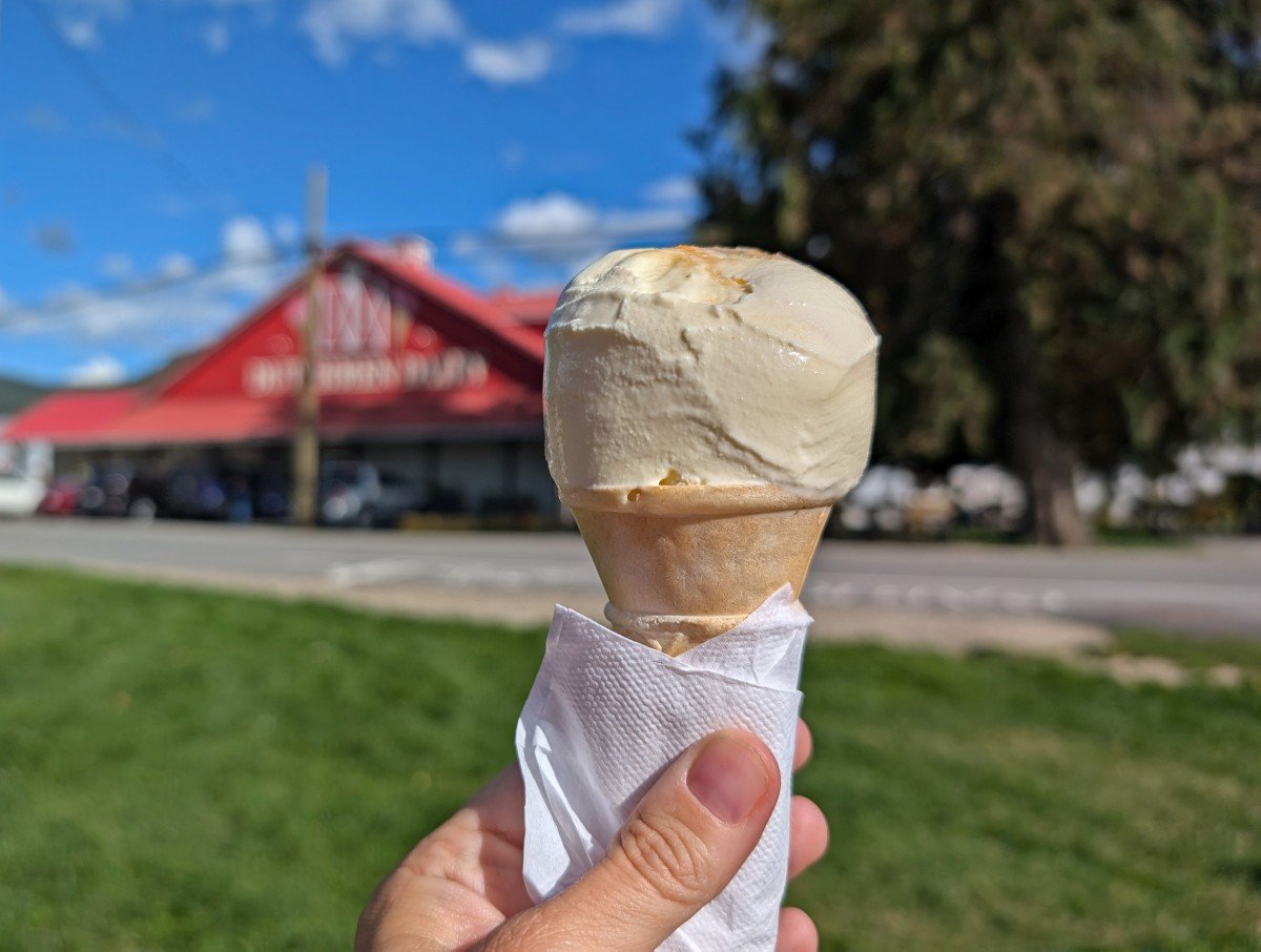
Heading into nearby Sicamous, consider a stop at D Dutchmen Dairy to pick up locally made ice cream and cheese.
Bridal Veil Falls
The drive between Sicamous and Vancouver is scenic, bordered first by huge Shuswap Lake and then dry desert-like hills.
Highway 5 offers the fastest route to Vancouver, through the legendary Coquihalla Canyon. Mountains soar above the double (sometimes triple) lane highway.
The small town of Hope is the place to go for a break from the road. Before the final push into Vancouver, make a stop at Bridal Veil Falls. The short but steep loop trail to the base of the impressive falls takes just 30 minutes.

Alternative stops and routes
Have some extra time on your Toronto to Vancouver road trip? I’d recommend the following detours.
Sleeping Giant Provincial Park, Ontario
Sleeping Giant Provincial Park is situated on a peninsula jutting into Lake Superior. It is best known for the scenic Top of the Giant Trail.
The challenging but rewarding 11km long trail (22km return) culminates at the summit of Ontario’s highest cliffs. The viewpoint offers magnificent views of Lake Superior and the vertical gorge below.
If you don’t have the time (or energy) for the full hike, check out the Kabeyun Trail. This mostly flat hiking path follows the shore of Lake Superior, with access to the beautiful Sea Lion Rock.

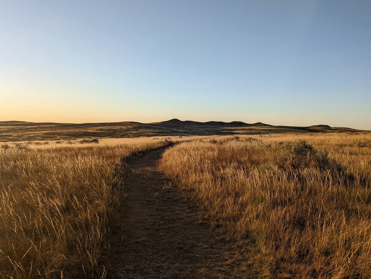
Grasslands National Park, Saskatchewan
Grasslands National Park stands out as one of Canada’s most distinctive national parks, yet it also remains among the least frequented.
This stunning natural area in southern Saskatchewan protects the endangered mixed-grass prairie, a landscape that once stretched across huge areas of North America.
The park’s West Block (best known for wildlife) is 90 minutes drive southeast of Swift Current. The East Block (renowned for badlands scenery) is a longer detour, two hours and 30 minutes south of Moose Jaw.
Time your Toronto to Vancouver road trip right and you may be able to join a Fossil Fever tour. These are fully hands-on palaeontologist-led experiences that allow guests to dig for dinosaur bones in the park (!!)
Dinosaur Provincial Park/Drumheller, Alberta
Dinosaur Provincial Park is a designated UNESCO World Heritage Site. More complete dinosaur skeletons (150!) have been discovered in Dinosaur Provincial Park than anywhere else in the world.
Hiking trails wind through the badlands scenery to fossil ‘houses’ where it is possible to view bones in situ.
There’s also a huge range of interpretive tours which take visitors beyond the public areas to fossil dig sites and secret viewpoints.
Consider stopping overnight in Brooks (instead of Calgary) and visiting Dinosaur Provincial Park from there. The round-trip drive takes around 90 minutes from Highway 1.
More beautiful badland scenery can be explored around Drumheller. The Royal Tyrrell Museum of Palaeontology is a must for anyone with even the smallest interest in dinosaurs.

Icefields Parkway, Alberta
Often cited as one of the best road trips in the world, the 230km long Icefields Parkway is lined with towering mountains and immense glaciers, providing jaw-dropping vistas no matter where you look.
The southern half of the Icefields Parkway is located in Banff National Park, with the northern section in Jasper National Park. A Parks Canada day use pass is required to drive this iconic road.
My favourite roadside viewpoints are Crowfoot Glacier, Bow Lake, Waterfowl Lake, Weeping Wall, the Big Bend, Tangle Creek Falls and the Goats and Glacier Lookout. Plan for the one-way journey to take around five hours with stops.

Okanagan Valley/Manning Park, British Columbia
Turn off Highway 1 at Sicamous and drive to Vancouver via the Okanagan Valley, BC’s premier wine region. Expect to see long, sparkling lakes, rugged mountains and plenty of vineyards.
Continue to Osoyoos and then head towards Vancouver on Highway 3. This road passes through Keremeos (the fruit stand capital of BC) and follows the winding Similkameen River to Manning Park (excellent hiking trails).
Another option would be to stay on Highway 1 after Kamloops and drive the Sea to Sky Highway via Whistler.

Other resources you may find helpful to plan your road trip:
Highway 17 Road Trip: 10 of the Best Ontario Parks
British Columbia Trip Planning: Essential Travel Tips to Know
2 Week BC Coast and Rockies Road Trip: Detailed Itinerary + Map
The Best Vancouver to Calgary Road Trip Routes: Highway 1 & Alternatives


One half of the Canadian/British couple behind Off Track Travel, Gemma is happiest when hiking on the trail or planning the next big travel adventure. JR and Gemma are currently based in the beautiful Okanagan Valley, British Columbia, Canada. Consider buying us a coffee if you have find any of our guides helpful!
Thankyou so much for this page. Great information as I am taking a road trip with my dog from Victoria to Toronto in August.
Hi Denise,
I hope you have a great trip! I’m glad you found the post helpful 🙂
Thank you for this fabulous information. I’ll be travelling/and moving with my 3 cats from St. Catharines, Ontario, (Niagara Peninsula) to Vancouver/New Westminster in early September. You are giving me hope that this will be affordable! I’m hoping to camp if not then simple motels will be more than adequate.
Excellent detail and I appreciate the links too! Kelley & Kitty Clan
Hi Kelley! I hope your move goes very well 🙂 West coast is the best coast!
Thanks for the interesting info. My son and I are taking a road trip from Toronto to Oliver in early Sept. Other cross Canada trips in 1973 and 1988 were those “no stopping” variety, so this time we’re planning on visiting a few of the spots you’ve suggested. Looking forward to some interesting vistas.
@Pat Buckland, we did it in 4 days from TO to Oliver BC. Fantastic tips for see Canada although we just followed lots of your suggestions from TO to the Alberta border. At stops you’d suggested we also found other suggestions. Given our long driving days some of your suggestions weren’t possible – too dark! The most impressive visit was to the Canadian Museum of Human Rights. We had 5 hours there – felt we needed to 2 days to take it all in!! Thanks so much for your suggestions.
Wow four days!! I’m so glad you had a good trip! Thanks for letting me know your thoughts and highlights.
Planning a week-long road trip from TO to Vancouver some time this summer. Thanks for the info.
You’re welcome Gurmukh! Hope you have a wonderful road trip!