The Cape Scott Trail is a muddy yet beautiful 47km backpacking journey to the northwestern tip of Vancouver Island, British Columbia, Canada. The highlights are varied and numerous.
Pristine golden sand beaches stretch into the distance. Campsites with panoramic views of the Pacific Ocean. A canopy of magnificent old-growth rainforest. A walk on the remains of a WW2 military road. A tranquil meadow with crumbling fences.

And at the end of it all, a lighthouse close to the edge of British Columbia’s wildest coastline.
Whether you’re looking for a spectacular coastal backpacking trip or a change from alpine hiking, Cape Scott is a great choice.

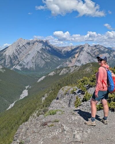
We’ve hiked the trail three times total, during three completely different seasons.
With that in mind, this comprehensive post offers a complete guide to planning a multi-day adventure on the Cape Scott Trail featuring a section-by-section breakdown, campground details, transportation options and more.
Here’s what to expect:
- Cape Scott Trail overview
- Location
- Trailhead
- Transportation
- Hike breakdown
- Trail difficulty
- Campgrounds
- Fees and permits
- Navigation
- Itineraries
- Best time to hike
- Historical sites
- Wildlife
- Safety information
- Packing list
- Where to stay pre and post-hike
- Things to do around Cape Scott Park
This article includes affiliate links. If you make a purchase through one of these links, we may receive a small percentage.

Planning a trip to Vancouver Island?

Our Vancouver Island Travel Guide features an interactive map with 150+ of the best things to see and do.
The itinerary builder tool makes it easy to create your perfect trip.
Download the app and use offline while travelling!
Backcountry necessities
- Always bring the 10 Essentials
- Know how to stay safe in the backcountry
- Remember to Leave No Trace to help keep the wilderness wild
- Understand how to avoid negative bear encounters
- Trying out backpacking for the first time? Read Backpacking 101
- Check out our packing guide with gear recommendations
- Sign up to our newsletter for a free backpacking checklist

Cape Scott Trail overview
Located on the traditional territory of the Kwakwa̱ka̱ʼwakw and Quatsino First Nations, Cape Scott Provincial Park is one of the wettest and muddiest places on Vancouver Island.
It’s also resoundingly remote, being accessible via gravel roads only and a good few hours from a town of reasonable size.
Hikers prepared to get their feet wet will find their efforts rewarded in many remarkable and unique ways.

The 47km long Cape Scott Trail intersects the main part of the park, travelling from the parking lot through old-growth rainforest, marsh and lowland bog before reaching a series of breathtaking sandy beaches. Midway, the connects with the challenging North Coast Trail (NCT).
The journey also includes the chance to explore sand dunes, a lagoon, a meadow and some fascinating local history (more details on that below).
While there may be no need to ascend any mountain peaks to see Cape Scott’s attractions, the challenges here include slippery boardwalks, lowland bogs, swathes of mud and giant fallen trees.

Despite that, I would say that Cape Scott makes for an approachable first-time backpacking trip. Indeed, it was our first-ever multi-day hiking trip back in 2014!
Today, we have now hiked the Cape Scott Trail three times – in April, August and October.
The trail’s condition was very different on each occasion and consequently the difficulty was as well. And each visit reminded me how much I love this rugged, weather beaten park.

Cape Scott Trail: Quick facts
- 47km from parking lot to Cape Scott Lighthouse
- Standard trip is 3 days/2 nights, many possible extensions
- Cape Scott Provincial Park is open all year round
- Lots of wildlife watching potential
- 6 campgrounds, mostly on beautiful beaches
- Camping fees are $10/per person/per night (May to Sept), no reservation system
- Moderate overall but lower difficulty in summer months, higher during off season due to trail conditions
- Accessible via public/shuttle transport
- Campfires are allowed when there is no fire ban in place
- No dogs allowed

A short history
For a place that remains so remote today, it is somewhat surprising to learn that Cape Scott has been settled several times.
The Tlatlasikwala, Nakumgilisala and Yutlinuk people first travelled and lived in this area.
Ethnically Danish settlers from the US arrived in 1897 with the intent to be self-sufficient with fishing and farming.

The lack of transportation links combined with the harsh climate forced a retreat a little over a decade later. Many of the current place names (such as Nels Bight) are remnants of that era.
Another wave of settlers arrived in 1913, this time a mixed group from the US, Canada and Europe.
The population across the Cape Scott locale peaked at 1000 people before suffering similar issues to the Danish pioneers.

The provincial government of the day backed out on several pledges to build local roads, dooming any chance of a successful settlement.
When leaving the area for the final time, the settlers could only take what they could carry on their backs. They left pots, pans, saws and other heavy items in the forest to rust, along with houses, wells and even a boiler.
Historical artefacts such as these still be seen today, next to the trail and in the forest beyond. Several informal paths lead to grave sites, house foundations and decaying farm equipment.

Cape Scott Trail hiking guide
Inspired to plan Cape Scott Trail hike? This section features everything you need to know to start planning your adventure!
Location
Cape Scott Provincial Park is located at the extreme northwestern tip of Vancouver Island, British Columbia.
Getting to the parking lot requires a little more effort than some of the more popular provincial parks on Vancouver Island.
Access to Cape Scott is via an unpaved industrial road from Port Hardy. Though the distance from Port Hardy to the Cape Scott Trailhead is only 67km, the drive takes around two hours.

- Be prepared to take your time and drive slowly (40-50km/h). The access road is bumpy in places and can be very slippery when wet
- A high-clearance vehicle is recommended. Drive with headlights on at all times and be prepared to pull over for industrial traffic. Use caution around corners and avoid the soft shoulders
- Bring a full-size spare tire and be familiar with changing it. One time, we passed two groups of people changing tires!
- Some of the roads leading to the park are occasionally closed for maintenance – check the BC Parks website for notices before heading out
Take the drive seriously – this is not a main highway. Visitors to Cape Scott Provincial Park should be completely self-sufficient.

If you don’t have an appropriate vehicle to drive to the Cape Scott Trailhead, consider taking the shuttle service from Port Hardy.
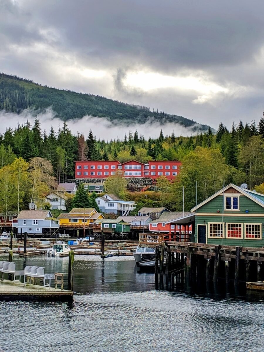
The tiny village of Holberg (pop. 200) is located about 13km from Cape Scott. It’s a base for the logging operations in the area and consequently has limited visitor services.
There is an excellent pub and a very well stocked general store. The latter has all the last minute supplies you may need – from isobutane gas and freeze dried food to chips and medical supplies.

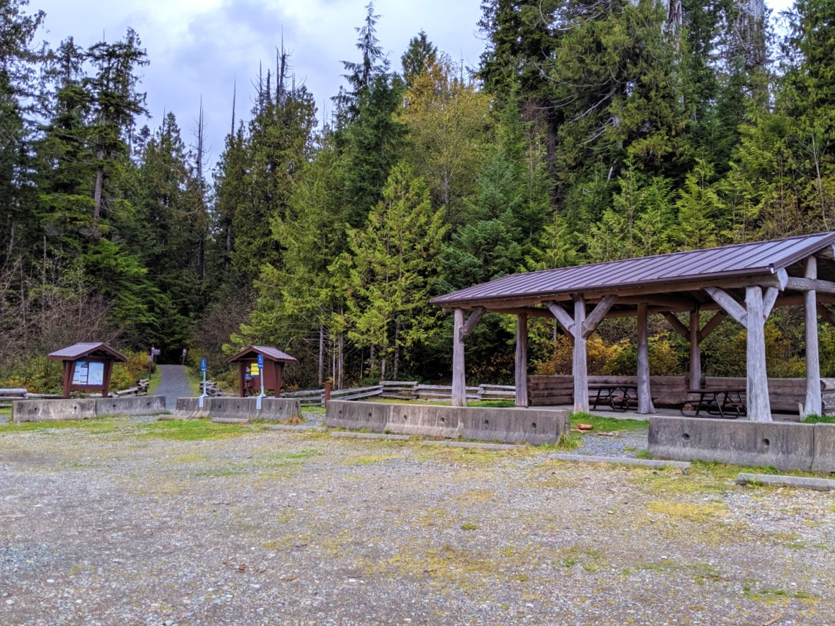
Cape Scott Trailhead
On arrival in Cape Scott Provincial Park, you’ll find a hiking trailhead, two fairly large parking lots, two outhouses, an information kiosk and a large covered picnic table area.
There is a vault for camping fee payments (cash only).
Don’t leave anything of value in your vehicle – there have been break-ins here. Some years are worse than others; sometimes there are no issues at all.
Camping overnight is prohibited in the Cape Scott parking lot. Luckily, there are other options nearby.
Transportation
The Cape Scott Trail is accessible via shuttle/public transportation, one of the few such backpacking trips in BC!
The North Coast Trail Shuttle operates from Port Hardy to the Cape Scott parking lot and vice versa. Reservations are required as it runs on demand only. The cost is $125 each way (subject to change in 2026).
The shuttle usually leaves Port Hardy in the morning for the Cape Scott parking lot and then returns at 12.30pm. The journey takes around two hours each way, usually with a stop at the Holberg Store.

The folks behind the North Coast Trail Shuttle also run a water taxi service to several beaches along the North Coast Trail. One of the destinations is Nissen Bight, just 2km from the Cape Scott Trail.
Island Link Bus offers services across Vancouver Island, including a shuttle from Campbell River to Port Hardy. It is possible to connect with this shuttle from many other Island locations, including Nanaimo’s Departure Bay Ferry Terminal.
Here’s an example of how to reach the Cape Scott trailhead from Vancouver:
- Take the 257 bus to Horseshoe Bay, then an early ferry crossing to Departure Bay
- Pick up the Island Link Bus at the Departure Bay Terminal, ride it to Courtenay, swap to the Campbell River bus, swap to the Port Hardy bus. Stay overnight in Port Hardy
- The next morning, take the North Coast Trail shuttle to the Cape Scott parking lot
- After hiking, take the 12.30pm shuttle back to Port Hardy. Stay overnight in Port Hardy before taking the Island Link Bus back to the Departure Bay Terminal

Cape Scott Trail breakdown
Here’s what to expect on the Cape Scott Trail, from the parking lot all the way to the Cape Scott Lighthouse.
Trail distances
| Cape Scott Trail location | Distance from Cape Scott parking lot | Distance from previous location |
| San Josef Bay | 2.5km (2km detour) | |
| Eric Lake Campground | 3km | 5.5km |
| Fisherman River Campground | 9.2km | 6.2km |
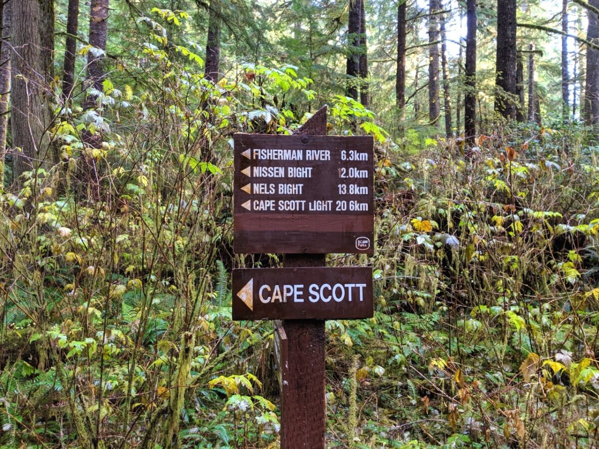
| Nels/Nissen Bight junction | 12.9km | 1.7km |
| Nissen Bight | 15km (2.1km detour) | 2.1km |
| Nels Bight | 16.8km | 5.9km |
| Guise Bay | 20.7km | 3.9km |
| Cape Scott Lighthouse | 23.6km | 2.9km |
Parking lot to Eric Lake (0km to 3km)
The Cape Scott Trail starts sedately, with a wide flat gravel path leading away from the parking lot and into the old growth forest.
After less than 600m, there’s a trail junction. San Josef Bay is an easy 2km hike to the left, while the Cape Scott Trail continues on the right.
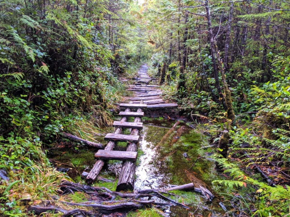
Now the real trail begins! Steps lead upwards and onwards to one of the most difficult parts of the trail (2026 update, I believe that this section is much improved with boardwalk).
This is the old corduroy road built by Danish settlers in 1908. Planks of wood are horizontally jammed together, creating an uneven and slippery surface (see below).

A little further on, the planks deteriorate and large pits of mud appear. Watch your step! There are some ‘bridges’ across the mud, though they are very slippery also. Try to keep on the trail as much as possible to avoid widening the path.
Depending on how much it has rained recently, the mud pits can be very wet and deep. Standing water is possible as well. In dry periods, the mud can be quite firm and much easier to cross.
This section of the Cape Scott Trail can feel like a slog, especially during wet weather. Luckily, it doesn’t last too long and Eric Lake will soon shine through the trees.

Eric Lake to Nissen Bight junction (3km to 13.1km)
The route around the lake mostly consists of a boardwalk and steps as well as an impressive giant tree bridge.
Note that any wooden structures can become exceptionally slippery when wet, so try not to rush.

Eric Lake campground is pleasant enough for a stop, though it can be buggy. Take a minute to admire the surrounding old growth trees. There is easy access to water here if you need it (treat before drinking).
About 20 minutes after leaving the campground, the trail passes a huge Sitka Spruce tree. It’s not the only giant tree to look out for in this area.

The next section slowly meanders up and down, with some long boardwalk and short muddy sections.
Around Fisherman River, the old-growth canopy starts to open and the moss dissipates.
The landscape transitions to grey pine trees and shrubs and then to marsh and lowland bog. The path is very, very straight.

This is the second wettest area so expect huge pools of standing water and mud from late September to May. In late summer, the mud is almost completely avoidable.
This section, the old telegraph route, is host to the biggest concentration of noticeable historical artefacts in the park. Look for rusting saws languishing in the grass and side trails leading to gravesites and building foundations.

Nissen/Nels junction to Nels Bight beach (13.1km to 16.8km)
The path splits again with one route to Nels Bight and Cape Scott, and the other to Nissen Bight and the North Coast Trail. Turn left for Nels Bight.
Again, the path ahead is very flat and straight. It is also very wide and mostly forested, with some new and old boardwalk sections.
The non-boardwalk sections are quite rooty, with old horizontal planks (see below).

The landscape changes again at Hansen Meadows, where 20th-century settlers cleared the land in preparation for farming.
Nowadays, Hansen Meadows is a tranquil place with wide open views into the distance. The tall grasses here can be misleadingly damp, so watch your step.

Back into the forest, the sounds of the ocean soon be heard. The path is mostly flat, wide and straight again with some more old boardwalk.
You’re teasingly close now but don’t forget to look around at the stunning old growth lining the trail.
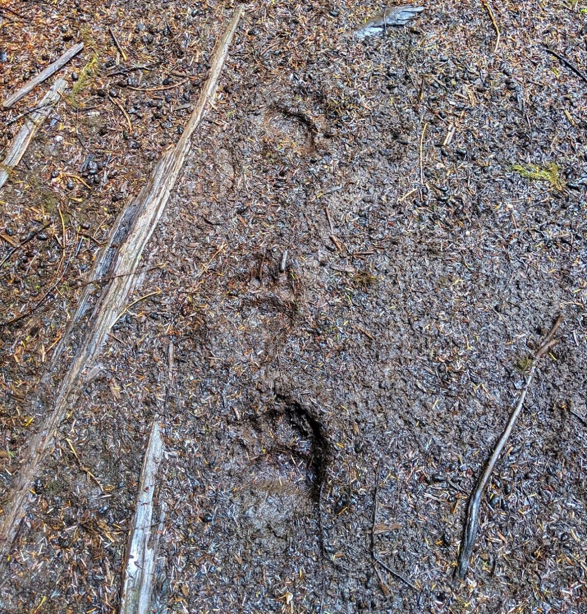
This flat, easy section of the trail is regularly used by wildlife too – we’ve spotted both wolf and bear tracks. Turn the final corner and colourful buoys will mark your arrival at the spectacular 2.4km long Nels Bight Beach.

Nels Bight Beach to Cape Scott Lighthouse (16.8km to 23.6km)
The trail to Cape Scott Lighthouse continues from the southwest end of Nels Bight.
The path ascends a small hill and continues through the forest until reaching the beautiful sands of stunning Experiment Bight. This section can be muddy, even in the height of summer.
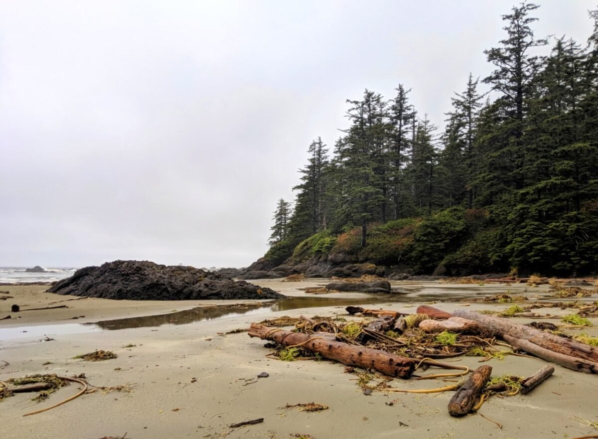
At low tide, you have a choice between an easy inland trail and an unsigned beach route. The latter heads to beautiful Guise Bay, a long sandy beach.

The beach route is less obvious and depending on how low the tide is, you may still need to use a short rugged inland trail around one headland.
Sand dunes mark the end of the coastal section – cross them to rejoin the main trail.
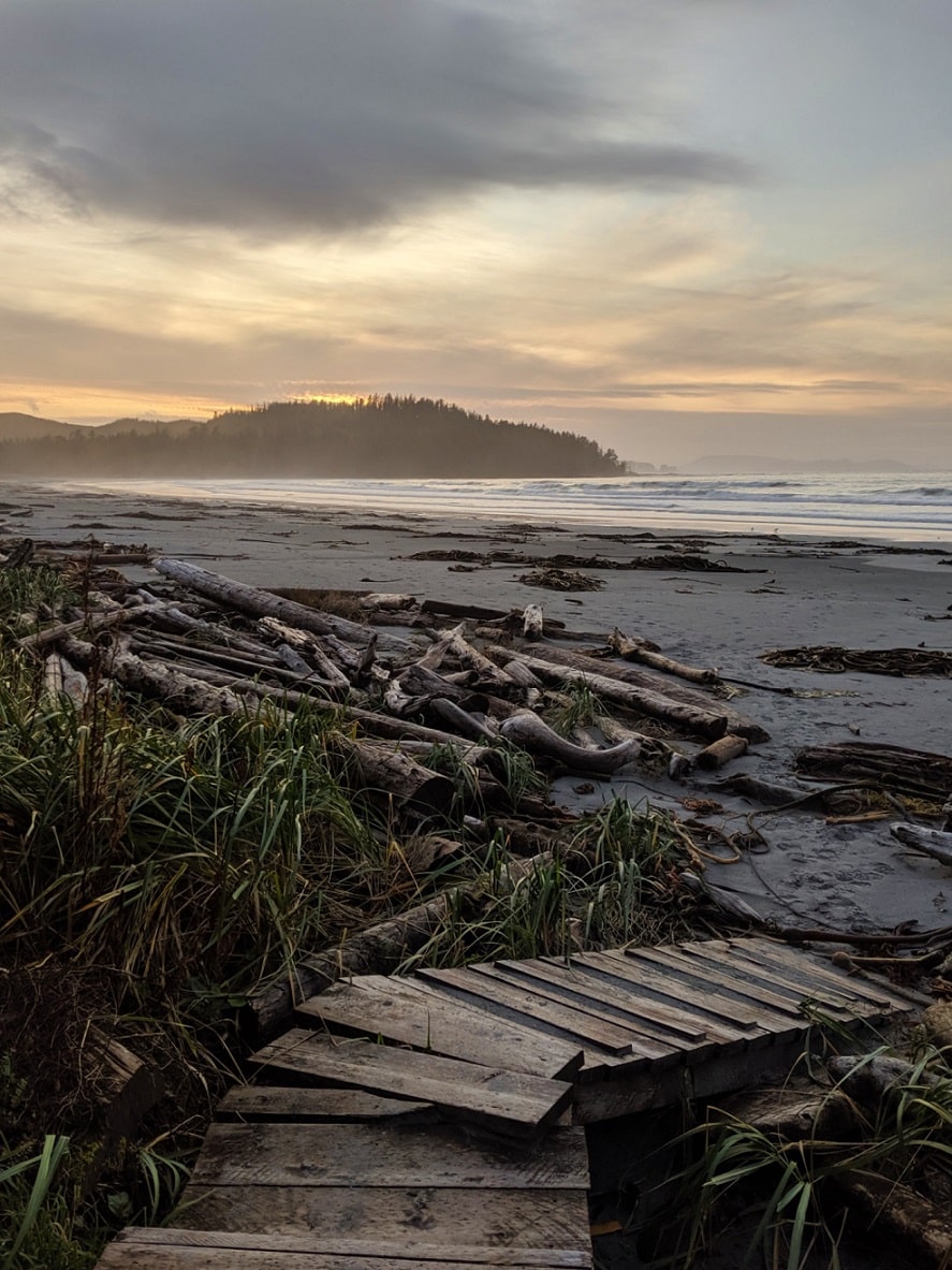
The final stretch follows an old military road. The path is, again, very wide and straight with a slight uphill gradient. Mossy planks line the way to the final destination.

The squat red and white Cape Scott Lighthouse is surrounded by a collection of wooden buildings. It is one of the last manned lighthouses in Canada. The lighthouse keepers, Harvey and Todd, are usually available to chat.
There are no coastal views from the Cape Scott Lighthouse but it’s a nice place to sit and stop for a while. There are a couple of picnic benches by the lighthouse and a drinking water tap on one of the buildings.
The return journey is the same route – over the military road, along the beaches, over the meadow and through the old-growth forest.

Trail difficulty
The Cape Scott Trail is a moderately difficult backpacking trail for most of the year. In the summer months, the difficultly reduces significantly.
While the trail is maintained during the main summer hiking season, hikers should still anticipate rugged backcountry conditions. Expect downed trees, broken boardwalks, massive mud pools and more, especially during the shoulder seasons.
There is very little elevation gain on the Cape Scott Trail. The main challenges of this trail are mud and slippery boardwalks. As you may imagine, these obstacles are tough to navigate during (or just after) rain.
Flooding is possible after heavy rain. And heavy rain for 12 hours or more is not uncommon here!
Backpackers should be prepared to see lots of mud. After rain, hikers must be prepared to have wet feet at some point during the hike. If you go into the experience mentally anticipating that, you’ll have a much better time.
One of the most technical parts of the trail is the approach to Eric Lake. This section follows an old corduroy route created in 1908 by Danish settlers. Deep pools of mud and water build up between the wood planks.

Another tricky section is located on the north side of the Fisherman River. The trail widens and becomes very flat. Unfortunately, it is also a boggy area and huge pools of water are usually present after rain and outside of the dry summer months.
As mentioned, we’ve hiked the Cape Scott Trail three times. Hiking it in late August after a few months of dry conditions was SO much easier than our previous trips in April and October.
There were only a few places with unavoidable mud and even then, the mud was not very deep. It honestly felt like a different trail in August.

Cape Scott Trail campgrounds
There are six established camping areas located on or close to the Cape Scott Trail.
All work on a first-come, first-serve basis with no reservations. A camping permit is required, details are in the next section.
Random wilderness camping is allowed in the provincial park but I’d highly recommend sticking to the established areas to reduce damage.
Be sure to pack out everything you brought in with you, including trash. The food caches are for day/overnight storage only. If you don’t pack out your trash, someone else has to.

San Josef Bay
Location: 2.5km from trailhead, off main trail
Facilities: Beach camping, 8+ large food caches and 5+ urine diversion outhouses (one with ramp)
Water source: Creek on second beach with limited access
San Josef Bay is a gorgeous stretch of golden sand, divided into two by a headland. At low tide, it is possible to traverse between the beaches easily and marvel at the ocean-eroded sea stacks topped with bonsai-like trees. There’s no other beach like it in the park.

It is an easy walk from the Cape Scott parking lot on a very flat, wide trail. For this reason, San Josef Bay is a very popular weekend camping destination.
Staying at San Josef Bay is convenient for Cape Scott hikers getting a late start or when catching the 12.30pm shuttle bus from the parking lot. Head to our San Josef Bay guide for all the details!
The lack of a real water source is the only downside of San Josef Bay. There is a creek on the second (western) beach, but at high tide it is only accessible via a short but challenging inland trail.

Eric Lake
Location: 3km from trailhead
Facilities: 11 wooden tent platforms, 4 small food caches, fire pit, outhouse
Water source: Lake
Eric Lake is the first ‘real’ campground on the Cape Scott Trail. It is most often used by hikers getting a late start or shuttle users trying to avoid a long morning hike to the parking lot.
The campground is set into an old growth forest and features an elevated network of boardwalks and wooden tent platforms. It is usually feels very damp. The lake is 100m from the campground and has a pebble beach.

Fisherman River
Location: 9.2km from trailhead
Facilities: 2 wooden tent platforms, 1 large food cache, outhouse
Water source: River
Fisherman River campground is just over half way to Nels Bight from the main trailhead. It features two wooden tent pads set into a dark forest next to the river.
There isn’t much space for hanging out here – I imagine most people head down to the edge of the nearby river.

The pebble beach does have some room for camping but I’d be careful if there is any risk of flooding.
Fisherman River is my least favourite Cape Scott Trail campground. I’d try and avoid staying here if you can. It’s worth pushing on to Nissen or Nels Bight!

Nissen Bight
Location: 15km from trailhead, off main trail
Facilities: Beach camping, 2 large food caches, 2 outhouses
Water source: Creek at eastern end
Featuring a long crescent of soft, golden sand and rocky headlands, Nissen Bight is a spectacular beach. It’s not technically located on the Cape Scott Trail but it is an easy 2km detour along a very flat path.
As of 2024, Nissen Bight has two camping areas – one at either end of the beach. I’d recommend camping on the eastern side as that is where the water source is located. The outhouse is newer too (and also one of the nicer urine-diversion ones so less smelly).
We stayed at Nissen Bight on our first Cape Scott trip as we weren’t sure we would make it to Nels Bight in the daylight. It was a good decision!

Nels Bight
Location: 16.8km from trailhead
Facilities: Beach camping, 9 large food caches, 4 urine diversion outhouses
Water: Creek at western end
Nels Bight is the Cape Scott Trail’s most popular camping destination. It’s easy to see why, with this golden sand beach stretching more than 2km into the distance. Sunsets are often stunning here.
Due to the long length of Nels Bight, there is plenty of space for campers amongst the driftwood.

Additional facilities have been built over the last few years to help, with four sets of food caches and outhouses hidden the forest behind the beach.
There is an extra food cache by the water source, which is in the forest on the far western side of the beach (look for signage). A ranger cabin is located around half way along the beach – the park facility operators check permits daily.

Guise Bay
Location: 20.7km from trailhead
Facilities: Beach camping, large food cache, outhouse
Water: Stream water source at western end, low tide only
If Nels Bight seems too busy for your taste, consider continuing onto Guise Bay. This lesser used campground is situated on the way to the Cape Scott Lighthouse.
While Guise Bay doesn’t have the same sunset views as Nels Bight, it does have a similarly beautiful golden sand beach.

There are camping spots in and amongst the driftwood at the western end of the beach, which is also where the food cache and outhouse are located.
The water source situation at Guise Bay isn’t ideal as the stream can only be used at low tide. Even then, it can apparently dry up during the driest months. The good news is that drinking water is available at the Cape Scott Lighthouse, a 5.8km return hike.

Fees and permits
It is free to hike in Cape Scott Provincial Park with no day-use permit required.
There is, however, a permit required for camping during the main backpacking season.
Backcountry camping fees are collected in Cape Scott Provincial Park from 1st May to 30th September. The cost is $10/per adult/per night.
There is a self-registration vault for fees in the parking lot, so bring cash or pay online for a Backcountry Camping Permit up to two weeks in advance (click the ‘backcountry’ tab then select ‘backcountry registration.’)
There is no reservation system for campsites in Cape Scott Provincial Park. All camping is available on a first-come, first-serve basis.
The beach campgrounds have plenty of space. The busiest time of year is the first weekend of August (BC Day long weekend). At that time, all of the food caches at Nels Bight and San Josef Bay are full.

Navigation
From the trailhead parking lot to the Cape Scott Lighthouse, the Cape Scott Trail is a well-marked hiking trail.
- There are kilometre markers to Nels Bight Beach, which helps to keep track of the journey
- Directional signs indicate where to go and the amount of remaining kilometres at important junctions
- There are also several information boards offering cultural and historical background at points of interest (such as the Cape Scott settlement site, Hansen Meadows etc.)
- The Cape Scott Trail is well-visited throughout the main hiking season (May to September) so you’ll likely cross other hikers, especially on summer weekends
- Park Facility Operators are based at a cabin at Nels Bight during the main hiking season. They check camping permits nightly and regularly perform maintenance on the trail
Cape Scott Trail itineraries
For most backpackers, the Cape Scott Trail is a three day adventure. But with so many campgrounds and other trails in the park, there are other potential options.
Standard 3 day Cape Scott Trail itinerary
- Day 1: Parking lot to Nels Bight – 16.8km, 5 to 7 hours
- Day 2: Nels Bight to Cape Scott Lighthouse day hike – 13.6km, 3 to 5 hours return
- Day 3: Nels Bight to parking lot – 16.8km, 5 to 7 hours
Optional side trip to San Josef Bay on day 3 – additional 4km return from junction, 1.5 to 2 hours
This three day trip includes just over 47km of hiking. With the elevation gain being very minimal and the ability to base-camp at Nels Bight, this is an ideal first-time backpacking trip.
If you have the flexibility, consider spending an additional night at Nels Bight (4 day, 3 night trip). It’s a wonderful place to relax.
3 day Cape Scott Trail itinerary with Guise Bay
- Day 1: Parking lot to Guise Bay – 20.7km, 6 to 8 hours
- Day 2: Guise Bay to Cape Scott Lighthouse day hike – 5.8km, 2 to 3 hours
- Day 3: Guise Bay to parking lot – 20.7km, 6 to 8 hours
Guise Bay is further away from the parking lot but is a quieter place to camp. In good weather, the additional distance isn’t too much of a challenge as the trail is mostly flat.

Fast 3 day trip for experienced hikers
- Day 1: Parking lot to Nels Bight – 16.8km, 5 to 7 hours
- Day 2: Nels Bight to Cape Scott Lighthouse day hike, Nels Bight to Nissen Bight – 30.4km, 7 to 10 hours
- Day 3: Eric Lake to parking lot via San Josef Bay – 7.5km, 2.5 hours
Experienced hiker on a time limit? See all of the highlights of Cape Scott Provincial Park with this quick 3 day itinerary.
The second day involves a lot of mileage but just under half is a day hike (without a large backpack). An early morning would still be required to reach Eric Lake in good time.
I wouldn’t recommend this itinerary during months with shorter daylight hours. And, as mentioned, experienced hikers only – 30km is a long day.
4 day trip with San Josef Bay
- Day 1: Parking lot to Nels Bight – 16.8km, 5 to 7 hours$
- Day 2: Nels Bight to Cape Scott Lighthouse day hike – 13.6km, 3.5 to 5 hours return
- Day 3: Nels Bight to San Josef Bay – 18.8km, 6 to 8 hours
- Day 4: San Josef Bay to parking lot – 2.5km, 45 minutes
Spending a night at San Josef Bay is a worthwhile ‘add-on’ to the Cape Scott Trail. Keep in mind that there is no water source on the first beach at San Josef so fill up at Eric Lake on the way there.
This is a good itinerary for hikers getting the shuttle from the Cape Scott parking lot. The shuttle departs at 12.30pm so San Josef Bay is a convenient place to camp the night before.

4 day trip with Nissen Bight side trip
- Day 1: Parking lot to Nissen Bight – 15km, 4.5 to 6.5 hours
- Day 2: Nissen Bight to Nels Bight – 5.9km, 2 to 2.5 hours
- Day 3: Nels Bight to Cape Scott Lighthouse day hike – 13.6km, 3.5 to 5 hours return
- Day 4: Nels Bight to parking lot – 16.8km, 5 to 7 hours
Optional side trip to San Josef Bay on day 4 – additional 4km return from junction, 1.5 to 2 hours
Try something different with a stay at Nissen Bight on the way to Nels Bight. This was our itinerary on our first trip to Cape Scott. Nissen Bight is smaller than Nels but also very beautiful.
6 day trip with North Coast Trail side trip
- Day 1: Parking lot to Nissen Bight – 15km, 4.5 to 6.5 hours
- Day 2: Nissen Bight to Laura Creek – 7.2km, 2 to 4 hours
- Day 3: Laura Creek towards Irony Creek day hike – More details below
- Day 4: Laura Creek to Nels Bight – 13.1km, 4 to 6.5 hours
- Day 5: Nels Bight to Cape Scott Lighthouse day hike – 13.6km, 3.5 to 5 hours return
- Day 6: Nels Bight to parking lot – 16.8km, 5 to 7 hours
Optional side trip to San Josef Bay on day 4 – additional 4km return from junction, 1.5 to 2 hours
Want a taste of the North Coast Trail while hiking the Cape Scott Trail? This itinerary covers the easiest sections of the North Coast Trail – be sure to read the hike breakdown before attempting.
The Laura Creek day hike is very flexible; hike as far as you like before turning around. The North Coast Trail route is on the beach for most of this section. Experienced hikers may want to go all the way to Shuttleworth Bight, one of the NCT’s best beaches (11.4km one-way, 3 to 4.5 hours with a day pack).

The best time to hike the Cape Scott Trail
While Cape Scott is open all year round, the main hiking season is May to September.
The summer months are the most popular time to explore the park when the weather is warmest and driest – I would agree that this is the best time to go.
As you can probably guess, weekends are usually much busier than weekdays.
One downside of visiting in summer is the risk of fog. This is caused by warm, moist air passing over the ocean.

Rain is possible at any time of year but is more frequent and heavier during autumn, winter and spring.
As mentioned, Cape Scott is one of the wettest places on Vancouver Island (already a pretty wet place!) The park receives more than 2.5m of rain annually. Huge amounts can fall in a single night, causing flooding.
Storms are common during the winter months, one reason why the trail is sometimes closed for safety. Trees may fall on the trail during storms, creating major obstacles for hikers.
Always check the weather forecast before heading to Cape Scott Provincial Park. In bad weather, even reaching the parking lot may be difficult.

Historical sites
Besides the rusting plows and pulley belts, there are other obvious signs of previous colonisation in Cape Scott Provincial Park.
South of Eric Lake, the trail follows the old corduroy route created by the Danish settlers in 1908.
Before a path was built around the lake, a boat ride across the lake was required to continue the journey north. The remains of a wharf can be seen on the shore of the lake.
After the Fisherman River, the path follows the very straight route of a telegraph line built in 1913.
The old Cape Scott settlement was located just north of here, where the Nissen/Nels junction now sits. The heaviest concentration of artefacts can be seen in this area. A faint trail near the junction leads to the Christensen grave site.

Hansen Meadows lies just around the corner. This wide-open area is quite a surprise after hours of hiking amid old-growth trees.
Previously tidal flats, dykes were used to drain the water away and create farmland. Old fence posts remain, a testament to the determination of the settlers to make this land agriculturally viable.
The final section of the Cape Scott Trail encounters another era of history. A small radar station was built at Cape Scott in 1942. The military road to the radar station, in use until the end of WWII, remains part of the trail today.

Cape Scott Provincial Park wildlife
Cape Scott Provincial Park is full of wildlife. Black bears, cougars, wolves, deer and elk live in and around the surrounding forest.
Like humans, animals also use the Cape Scott Trail to get around. Keep an eye out for tracks and scat on the path. On our last trip, a black bear was hanging out by our vehicle in the parking lot.
The easiest place to spot wildlife is on the beaches. We’ve seen black bears searching seaweed for food before.

While we never saw it, we did find wolf tracks next to our tent on Nissen Bight one time. The presence of wolves in this park is one of the main reasons why dogs are not allowed in most areas.
Cape Scott is a stopover location on bird migration routes. Whale sightings are also possible, more specifically orcas and grey whales. Seals, sea lions and sea otters can sometimes be spotted just offshore.
- Always make noise while hiking. This alerts wildlife to your presence and gives them a chance to avoid you. As a general rule, animals don’t want to be close to humans
- Give wildlife space. If you do see any animals, keep your distance – ideally 100m or more. This offers them an escape route
- Know what to do if a bear (or wolf) approaches you. Always remain calm. Depending on the behaviour of the bear, different techniques are required (read our bear safety post and this wolf safety guide for more info)
- Bring bear spray and store it in an accessible place. An aerosol deterrent made with chilli pepper oil, bear spray is a ‘last resort’ tool intended to be used only when other methods have failed
Safety information
While Cape Scott is a frequently visited park, it is still a remote area of Vancouver Island. Hikers should be self-sufficient. In an emergency, it could take a long time for help to arrive.
To help stay safe, keep the following in mind:
- There is no phone signal in the park. In fact, there is none after leaving Port Hardy! We always carry an InReach device in case of emergencies
- Tell someone where you’re going and when you plan to be back before leaving Port Hardy (check out our outdoor safety guide for more tips)
- Coastal weather can change quickly. Rain is possible at any time of year. Bring extra clothing in case of cold or wet weather
- Mud and standing water are usually present on this trail. Prepare to get wet feet, especially outside of the summer months
- Besides these hazards, it’s also important to be aware of wildlife, particularly bears and wolves (see previous section)
- Always purify or filter water before drinking. On our most recent trip, we utilised a gravity hydration bladder system with the MSR Thru-Link In-Line Microfilter
Cape Scott Trail packing list
The lighter your backpack, the easier (and likely more enjoyable) you’ll find this hike. Of course, you still need to ensure you have everything to be self-sufficient and comfortable. Backpacking is a balance!
Essential items
As well as your tent, sleeping bag, sleeping mat, cooking stove/fuel and 10 Essentials, I’d recommend bringing the following items:
- Hiking poles – The Cape Scott Trail features plenty of mud and slippery boardwalks. We found hiking poles to be very helpful for balance. We used Black Diamond’s Carbon Zs, which are super light and also pack down easily
- Satellite communication device – There is zero phone signal in this region. For emergency purposes, we always bring an InReach device on backpacking trips
- Bear spray – We always have bear spray in the backcountry. Bear spray is helpful to have as a last resort in the unlikely event you need it. Carry the canister in an accessible place and know how to use it
- Camping permit – Don’t forget to bring a copy of your camping permit if you purchased it online
- Tarp – A tarp (like this lightweight one) can provide shade on sunny days and shelter on rainier ones. Beach camping can feel very exposed. Bring some extra cord for attachment
- Waterproof backpack cover – Due to the amount of rainfall and the general misty/damp environment, I would suggest bringing a waterproof backpack cover to protect your gear
- Tent stakes – If your tent is not freestanding, consider bringing some sand stakes or extra cord to help secure your tent while camping on the beach. Some hikers use drywall screws to stake their tent to large driftwood instead
- Gaiters – As mentioned, the Cape Scott Trail is usually very muddy. For a cleaner and drier hike, use boot gaiters. They are also useful for keeping sand out of your shoes on the beach
- Extra socks – Take one more pair of socks than you usually would. Your feet will thank you after being in wet shoes for at least part of the day! We love merino wool socks
- Cash. The Cape Scott Lighthouse keepers usually sell candy, chips and pop cans during the main hiking season and accept cash only
For more multi-day hike packing tips, head to our comprehensive packing guide.

Where to stay before or after hiking the Cape Scott Trail
The closest place to stay to the Cape Scott trailhead is the Adventure Huts in Holberg. These small handcrafted cabins are on the basic side but have everything you need after some time in the backcountry (including access to a shower!)
Port Hardy has a range of accommodations, including a couple of inns, a backpackers hostel, guesthouses, B&Bs and hotels. My top picks are:
- North Coast Trail Backpackers – Comfortable hostel with great value dorms as well as private rooms. Walking distance to everything in Port Hardy
- Telco House B&B – Welcoming option located very close to the waterfront. Highly rated on Booking.com
- Kwa’lilas Hotel – Stylish modern hotel featuring Indigenous art and carvings, owned by the Gwa’sala ‘Nakwaxda’xw First Nation

Camping near the trailhead
Overnight parking is not allowed in the Cape Scott parking lot, with signs forbidding it.
One option is to hike in and camp at San Josef Bay via the very easy and flat 2.5km trail (45 minutes). Eric Lake, located at 3km, is also an option, though the trail is more difficult.
About five minutes (or less!) from the Cape Scott Provincial Park entrance is the Western Forest Products San Josef River Recreation Site campground.
While this basic campground is a little run down, it is completely free. There are about eight campsites as well as outhouses, picnic tables and fire pits. Be aware – this campground can flood quickly in heavy rain.

Another option is the privately run San Josef Heritage Campground just before the Cape Scott entrance. I haven’t visited myself yet but apparently, the owner is quite a character!
Our preferred camping spot is the Nahwitti Lake Recreation Site. This free campground is located right on the main road, about a third of the way to Cape Scott from Port Hardy and is set under a canopy of huge balsam and hemlock trees.

Things to do in and around Cape Scott Provincial Park
Cape Scott isn’t the only reason to visit this spectacular region of Vancouver Island. Extend your trip by a few days and explore other local trails and attractions.
Other Cape Scott hiking trails
- Hansen Lagoon was the main settlement location of the Danish pioneers and can be visited on a side trail (15.7km from the parking lot). Depending on the tide level, a dyke (built to reclaim land for pasture) can be spotted as well as fence posts and other relics from the past
- Mt. St. Patrick is the highest peak in the park at 422m. The rough, unmaintained 3km trail leading to the summit starts from San Josef Bay
- The North Coast Trail is a 43km extension to the main Cape Scott Trail, creating a 80km+ multi-day coastal backpacking experience. It is usually hiked in a westerly direction, with hikers being dropped at the Shushartie Bay trailhead by boat and then picked up at the Cape Scott trailhead. Details in our North Coast Trail hiking guide.

Ronning’s Garden
Not far from the entrance of Cape Scott Provincial Park, Bernt Ronning established a homestead here in 1910.
As part of his work to clear the rainforest, he ordered seeds from all over the world and established an eclectic mix of plants and trees (including BC’s largest monkey puzzle tree!)
Bernt remained here until the 60’s and the garden is now being maintained by Ron and Julia Moe.
Raft Cove
A short drive from Cape Scott, the main attraction at Raft Cove Provincial Park is accessed via a difficult 2km trail.
The path is exceptionally muddy, slippery and rooty and takes around an hour to hike. The reward is a gorgeous, long windswept white sand beach. Walk-in camping is $5/night/per person.
Scarlet Ibis Pub
Located in Holberg (don’t worry, you’ll be able to find it easily), this no-fuss pub is the only place serving hot food for miles around.
The hearty pub grub is immensely satisfying after the Cape Scott Trail hike! There’s an awesome view from the patio too.

Telegraph Cove
On your way to or from Cape Scott, take the detour to explore the tiny boardwalk community of Telegraph Cove. There was a fire here in early 2025 but it sounds like it will be fully redeveloped in time for summer 2026.
Whale-watching tours launch straight from the boardwalk and it is also possible to visit the Great Bear Rainforest by boat and see grizzly bears.
Just a warning – Telegraph Cove can be very busy in July and August.
Find more activity suggestions in our Campbell River to Port Hardy road trip guide.
Discover more amazing Vancouver Island destinations in these posts:
Hiking to Della Falls, Vancouver Island’s Highest Waterfall
How to find Big Trees on Vancouver Island
Nanaimo to Campbell River Road Trip Guide: 16 Great Places to Stop
A Complete Guide to Storm Watching in Tofino
27+ of the Best Things to Do in Campbell River, Vancouver Island
25+ of the Best Campgrounds on Vancouver Island
Check out these recently published articles next


One half of the Canadian/British couple behind Off Track Travel, Gemma is happiest when hiking on the trail or planning the next big travel adventure. JR and Gemma are currently based in the beautiful Okanagan Valley, British Columbia, Canada. Consider buying us a coffee if you have find any of our guides helpful!
Sounds like a great adventure Gem. I am (as always) super jealous. Although perhaps not of all the mud ! 😉 xx
Thanks Lucy, it was the first big adventure of the trip so despite the mud it was pretty special.
Please Continue to Write Gemma, it lights up my day.
we Are so glad we Met you two.
Christian
Thanks for the lovely comment!!
Did you manage to get out to San Josef Bay?
Hi Martin, our focus of our time in the Cape Scott area was the Lighthouse hike. Had the weather been better after our hike, we may have considered it!
The hooting bird is a Sooty Grouse.
Thank you Guy!
Just came back from five day trip. My girlfriend and I enjoyed this trip so much. We pretty much mirrored yours. This place is so magical and for us the mud and the difficulty of the hikes made it even more rewarding. And besides if it were easy think of how many people would go. Thx for pics and the story, it made it seem as if I were rite there while reading your story. Happy hiking.
Hiya! My guy and I are travelling from Toronto to Vancouver Island next week. We will be hiking from the trailhead to San Josef Bay and thenjoy North as long as we can. What equipment would you recommend that we bring?
Hi Jenne,
You’ll need everything to be self sufficient for as long as you plan to stay. There is absolutely no supplies in Cape Scott park and Port Hardy is a good couple of hours drive away.
About to hike the North Coast Trail with the Canadian non-profit Connected in Motion. This article is beautifully written and love all the photographs. I am worried about the mud but that is what makes it fun…right? Keep exploring you two.
Good luck for your hike Erik! In hindsight, the mud definitely made the hike more memorable for sure 😉 Thanks for your lovely comments about the article.
Hi!
We would like to hike the whole North Coast Trail next month. Problem is we have really small budget for 1 month in Canada, so we primarily want to hitchhike and sleep outside (as we do everywhere). Is it possible to do wild camping while hiking NCT without paying 10 dolars per night? I mean, not using the official camping places but just random places on the trail. Of course we keep the Leave no trace principle, camp without making noise, fire etc. How does the paying actually work? You need to pay all the cost before you enter the park or are there rangers who control people?
Thank you very much for response and for great trip report.
Hi Kristina,
You can wild camp (random camping) in Cape Scott Provincial Park outside of the campsites but you still need to pay the nightly backcountry camping fees. Think of it as a trail fee – it pays for the maintenance of the trail so you are able to hike it. You can pay online or self register at the San Josef trailhead. There is a ranger’s cabin on Nels Night beach so it is very possible that you may run into a ranger.
Beautiful and relatively unknown. Thanks to Landmark maps I found out about the Hotel in Port Hardy and then discovered this trail. Wow
Gemma: What a wonderful piece on Cape Scott, San Josef Bay and Nels Bight!! Your describe them well. Between 1956 and 1963 I lived in Holberg (7 years). I was 8 yrs old when we moved there. My dad was a logger. We knew Mr. Ronning and Mr. Jensen who were lovely people. I’ve flown all over the park and camped @ San Josef.
You’ve written an excellent article! I am so pleased that such a place of stunning beauty was designated a park and people like you are enjoying it’s beauty and history. Thank you.
Hi Laurie,
Oh wow, what a story! Thank you for sharing. I’m so glad you think I did Cape Scott Provincial Park justice in this post 🙂