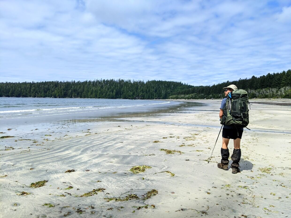
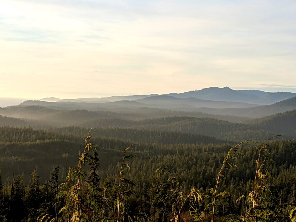
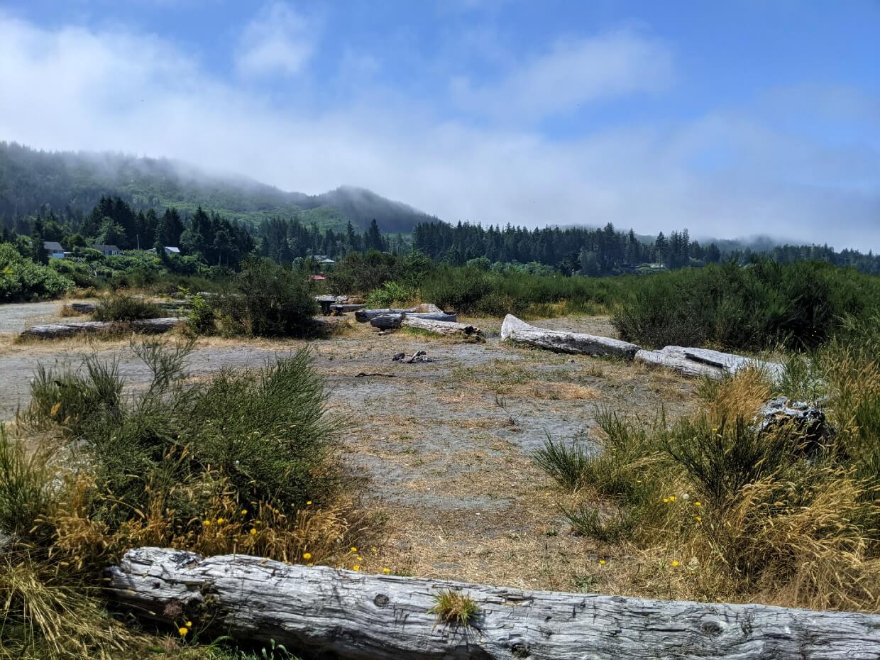
Famed for rugged, untouched coastal scenery, the West Coast Trail is a legendary 5-8 day backpacking experience.
But this wilderness setting does mean that the West Coast Trail (WCT) is somewhat tricky to access. Usually traversed in one direction only, WCT hikers start at one trailhead and then finish at another.

For this reason, it is absolutely necessary to think about logistics. This is especially true since all three of the West Coast Trail trailheads are reasonably remote.
Whether you’re from Vancouver Island or visiting from outside of Canada, getting your head around how to organise a hike on the West Coast Trail can be difficult.
Part of our West Coast Trail series, you may want to read these next:
West Coast Trail: Complete Hiking Guide
Ultimate West Coast Trail Campground Guide
WCT Itineraries – Ideas for 5, 6, 7 and 8 Days
West Coast Trail Packing List: The Best Items to Bring
This post will explain everything you need to know about West Coast Trail transportation, with trailhead directions, accommodation recommendations, bus transportation tips and more.
Here’s what to expect:
- Where is the West Coast Trail?
- Pachena Bay Trailhead
- Balaats’adt (Nitinaht Village) Trailhead
- Gordon River Trailhead
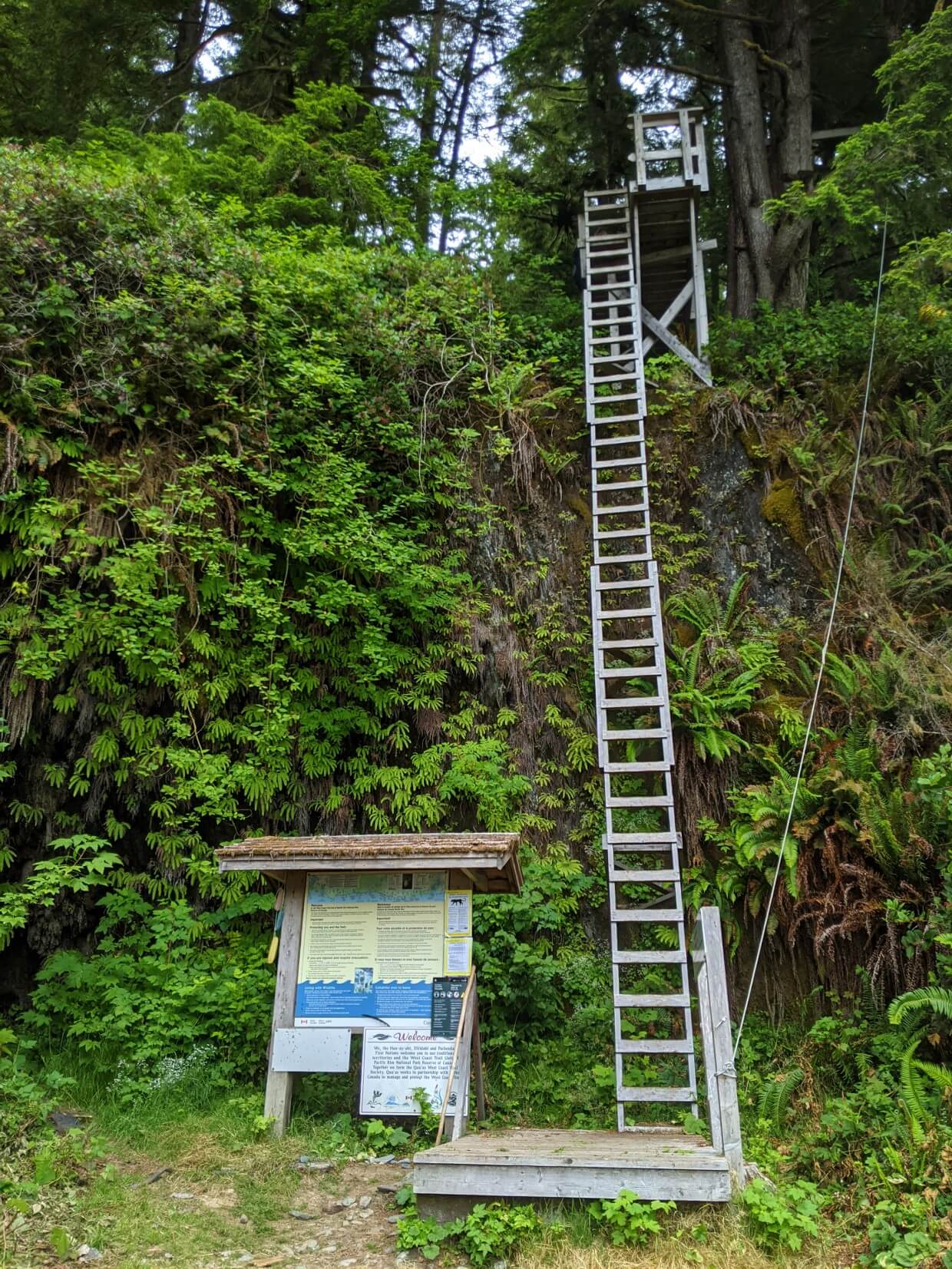
The West Coast Trail is located on the traditional territory of the Huu-ay-aht, Ditidaht, and Pacheedaht First Nations.
This post includes some affiliate links. If you click on one of these clicks and make a purchase, we may receive a percentage of the sale at no extra cost to you.

Where is the West Coast Trail?
The West Coast Trail is located on Vancouver Island, the largest island on the west coast of North America. Part of the province of British Columbia, Vancouver Island is about half the size of Ireland.
To get to Vancouver Island, you can either fly (by regular plane or seaplane) or take a ferry from the BC mainland/Washington State.
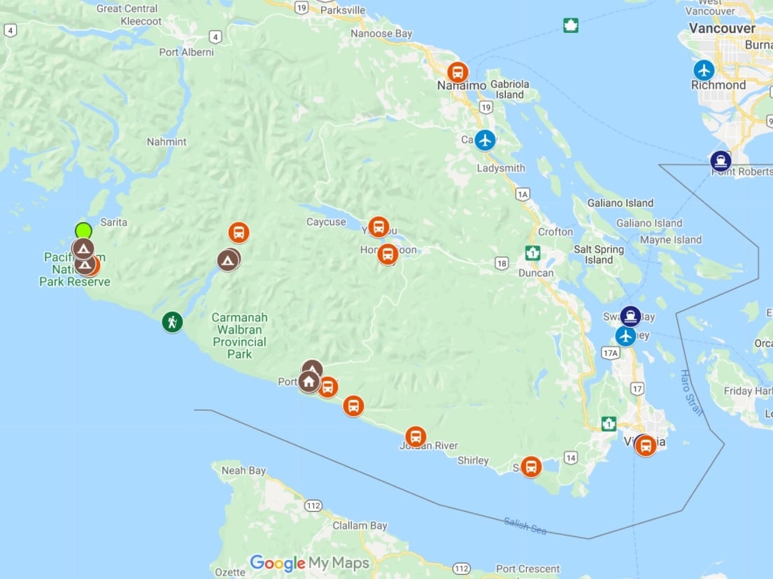
The West Coast Trail is found on the southern third of the island, between the remote communities of Bamfield and Port Renfrew. Part of the trail overlooks Washington State in the USA.
Here’s a map to help you get orientated:

Trailheads of the West Coast Trail
The West Coast Trail has three trailheads. Entry or exit at any other point is not allowed, unless during emergency evacuation. The three trailheads are:
- Pachena Bay (northern trailhead), near Bamfield
- Balaats’adt/Nitinaht Village (mid-point trailhead)
- Gordon River (southern trailhead), near Port Renfrew
When booking a hike on the West Coast Trail, you must specify which trailhead you will be starting from.
There is a maximum number of hikers allowed to start from each trailhead each day:
- 25 from Pachena Bay
- 25 from Gordon River
- 20 from Balaats’adt/Nitinaht Village
It is therefore important to decide which trailhead you’d most like to start from prior to the reservation launch. At the time of reservation, you’ll also need to know where you plan to exit the trail.
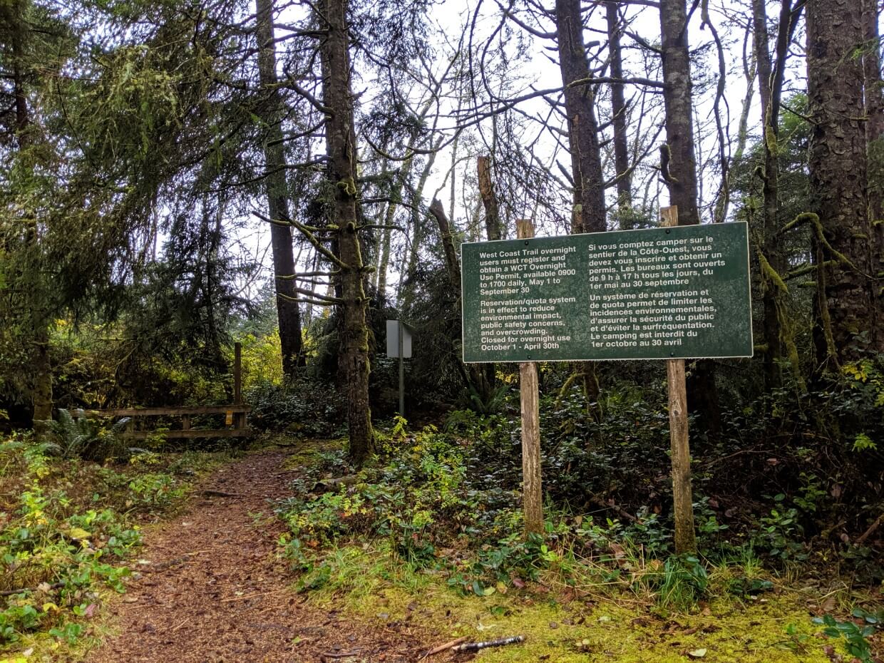
The West Coast Trail reservation system usually opens in January each year, with the date usually being announced in December of the preceding year. Look for updates on Parks Canada’s ‘Plan Your Visit’ page.
In 2026, the WCT reservation launch date was originally 19th January at 8am PT and then later rescheduled to 5th February 2026 at 8am PT after technical issues.
Hiking logistics
Finishing the West Coast Trail without a plan is pretty risky as onward transport options are limited. You may end up waiting at your finishing trailhead for a day or more for a ride or spot on the bus.
When choosing how to organise your West Coast Trail hike, consider the following:
- Where you’re travelling from (Vancouver Island? Vancouver? Outside of BC?)
- How you’re travelling to the West Coast Trail (flying or driving?)
- How many people are in your group (just you or a large group?)
- How many vehicles you have available to you (just one or two?)
- Whether you have a vehicle suitable for driving on unpaved roads (a high clearance vehicle is preferable)
- How much time you have (tight schedule or some flexibility?)
- What your budget is (frugal or money to spare?)
This post will take you through all the transportation options for each WCT trailhead so you can make an informed decision regarding the best solution for you.
Essential things to know
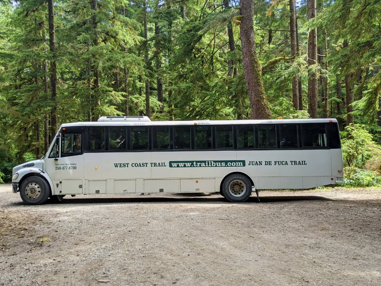
- There is no public transportation directly to the West Coast Trail. There is a private trailhead shuttle bus, however, called the West Coast Trail Express
- Despite the remoteness, the West Coast Trail is one of the easiest BC backpacking trails to access without a vehicle (thanks to the Express bus!)
- The West Coast Trail Express usually runs daily from May 1st to September 30th
- West Coast Trail hikers from outside BC can fly into Victoria Airport (YYJ) and then take public transport into the downtown area, to connect with the West Coast Trail Express
- Vancouver hikers (or those flying into Vancouver) can take a ferry to Departure Bay near Nanaimo and then connect with the West Coast Trail Express at the arrival terminal
- Driving between the trailheads can be time-consuming as the most straightforward route is via unpaved roads
- One of the most popular ways to travel between the trailheads is to park at one and take the bus to the other. Gordon River is the most popular trailhead to park at since it is accessible via a paved highway
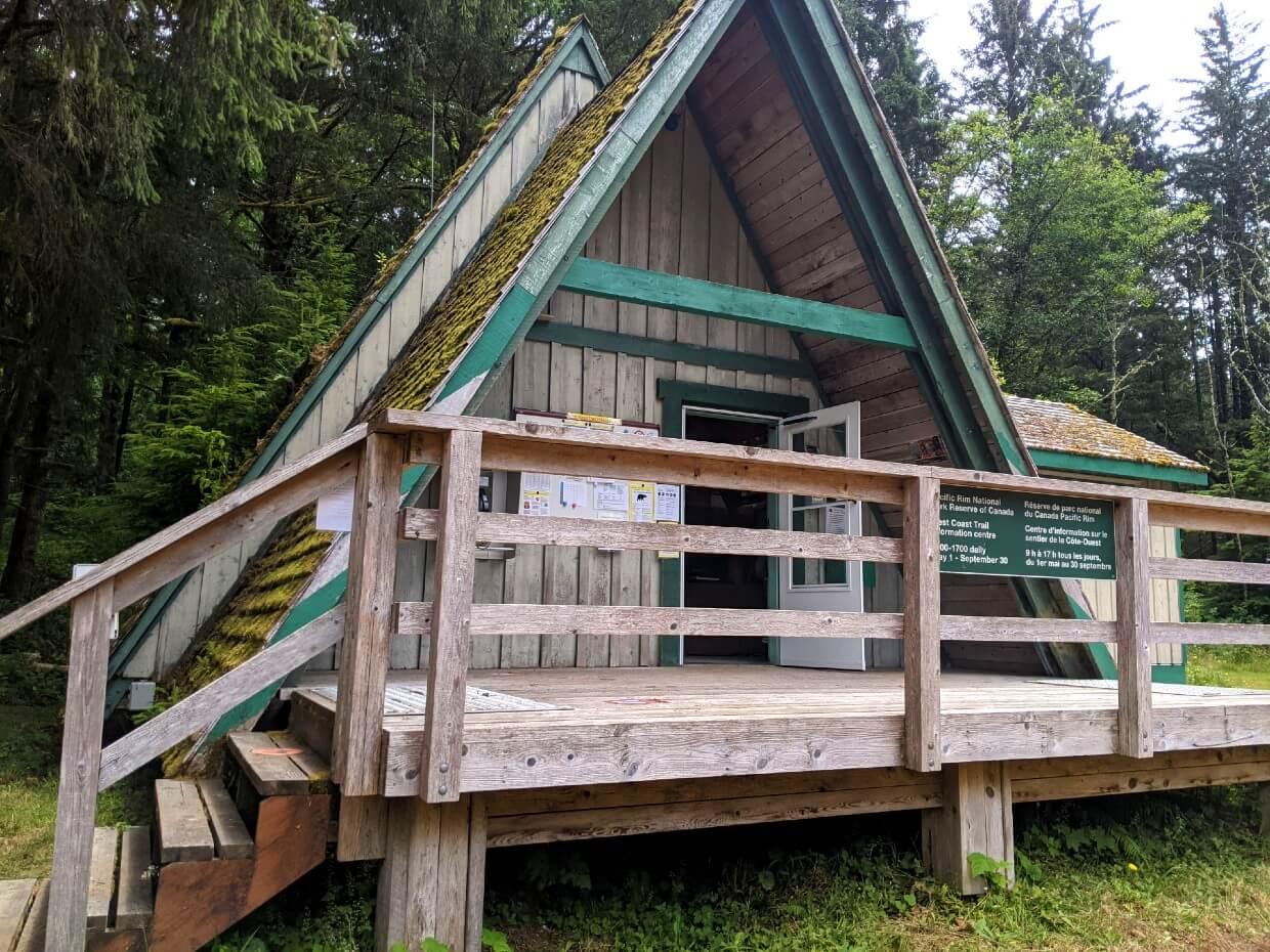
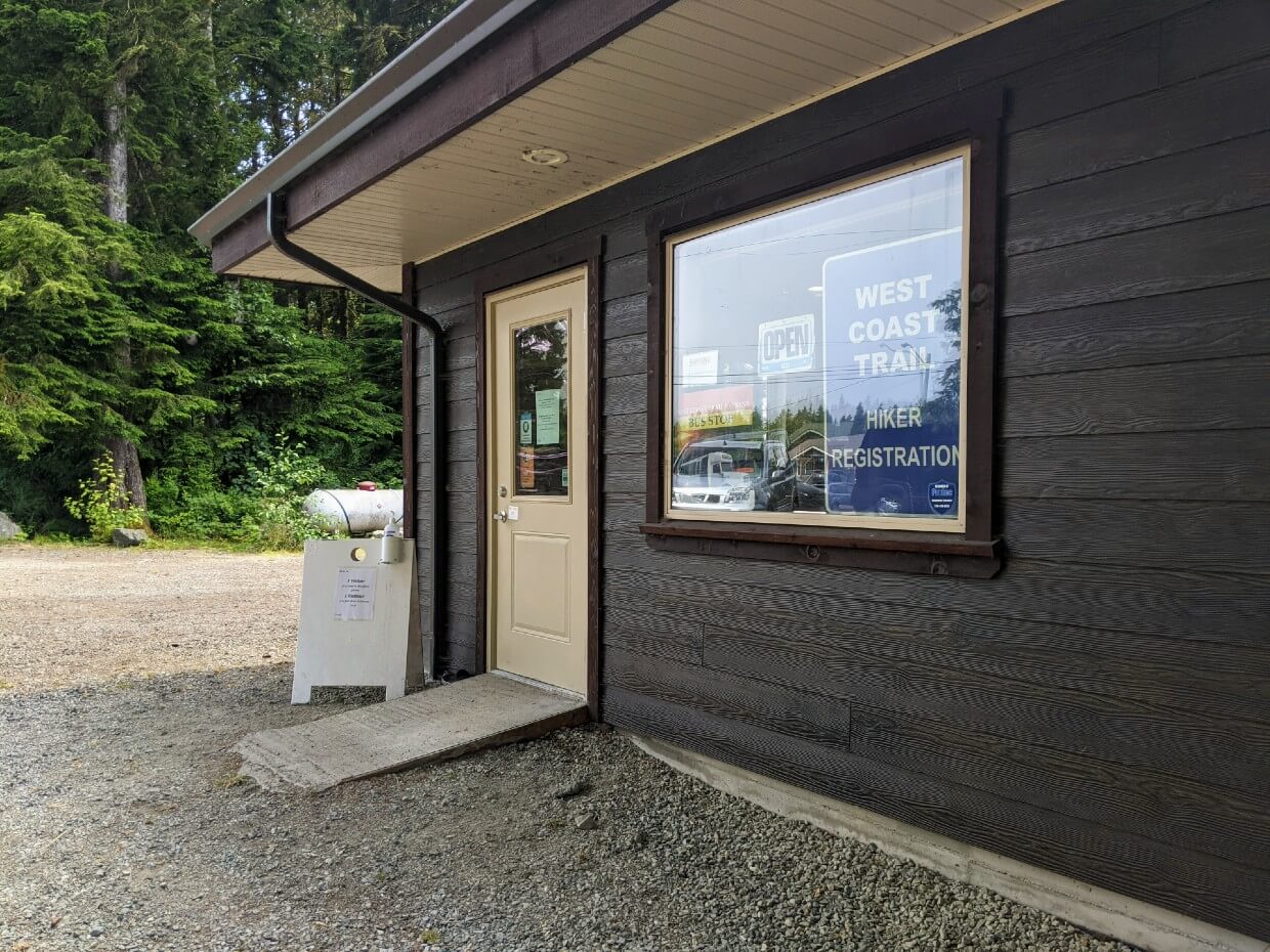
- Before starting the West Coast Trail, all hikers must complete an orientation (or ‘pre-hike briefing’ at their starting trailhead. Orientation sessions are at 10am and 2pm at Pachena Bay and Gordon River, and 7am at the Nitinaht Orientation Office.
- Hikers are allowed to attend an orientation the day before their hike, at either of the north and south trailheads. If you do this, you’ll still need to pick up your permit the next day
How to get to the West Coast Trail: What we did
My partner and I live in British Columbia, so driving to the West Coast Trail was the cheapest and easiest option for us.
With all thru-hikes (not just the WCT), my preference is to park a vehicle at the finishing trailhead. This offers complete flexibility regarding finishing time. It also means that we can continue to our next destination without hassle.
Since we wanted to hike the West Coast Trail in a northbound direction, we decided to park our vehicle at the northern trailhead (Pachena Bay).
Without a second vehicle, the most straightforward way to reach the southern trailhead (Gordon River) was by bus.
Due to bus schedules, however, that meant we needed to spend a night at Gordon River before starting our West Coast Trail hike the next day. For some people on a tight schedule, this may not be possible.
For us, this plan worked out perfectly. I was happy to get the bumpy bus journey over and done with before our hike. Most of all, I enjoyed finishing the trail to our own schedule.
When starting the WCT, we weren’t sure if we wanted to stay on the trail for seven or eight days.
Having our own vehicle at the end of the trail meant that we could make that decision during our hike. The weather improved during the week so we decided to stay for the full eight days.
After finishing, I also appreciated being able to change clothes, eat snacks, drink fresh water and clean up a little before driving directly to our hotel.
International visitors
Visiting Canada specifically to hike the West Coast Trail? This section is for you. The information may also be useful for Canadians planning to fly to BC to hike the WCT.
Arriving in Victoria
The easiest way for international visitors to hike the WCT is to fly to Victoria Airport (YYJ) on Vancouver Island. This way, you don’t need to rent a car to reach the trail.
After arriving at YYJ, plan to travel to downtown Victoria for the night.
The cheapest way to travel between the airport and downtown is to use the BC Transit bus (cash only with no change given).
Take the 88 to the McTavish Exchange and then change to the 72. The journey will take around an hour, depending on the time of day.
Alternatively, you can also take a taxi ($60-75, 30 mins) or Uber. Yellow Cab of Victoria have a very Uber-like app – download and set it up before you leave home.
Stay in Victoria overnight
One night in Victoria will allow you to get your bearings and pick up a few supplies. Since it is not possible to fly with bear spray or isobutane gas, you’ll need to get these in Victoria.
Downtown Victoria is host to the historic and local family owned Robinson’s Outdoor Store. There are Valhalla Pure Outfitters and MEC as well.
Accommodation recommendations in Victoria:
- Ocean Island Inn / Backpackers – Solid budget option in a convenient location. Multiple types of rooms with shared and private bathrooms plus access to kitchen (another money saver)
- Royal Scot Hotel and Suites – Our go-to place to stay in Victoria. Quiet area, easy walking distance to downtown. The suites offer great value for groups
- Fairmont Empress Hotel – Iconic waterfront property, just across the street from the Royal BC Museum and Legislative buildings
Travel to WCT trailhead via shuttle bus
Your journey to the WCT starts early next morning. The downtown Victoria pick-up location for the West Coast Trail Express bus is at the Capital City Bus Station on 721 Douglas Street (reservation highly recommended).
The WCT Express bus offers a bag storage service for passengers who have booked a return trip. The cost is $20/bag up to 10kg. *Bus drivers also sell isobutane and WCT guidebooks.
The bus leaves Victoria at 6.45am and arrives at the Gordon River trailhead at 9.15am and Pachena Bay trailhead at 12.30pm. After orientation, you will be able to start the WCT that same day.
Starting at the mid-point trailhead (Nitinaht)? The drop-off is a little more complicated – you will need to stay overnight in Balaats’adt/Nitinaht Village before starting the WCT. More details later in the guide.
Returning to Victoria
After finishing the West Coast Trail, you’ll need to reverse this process.
Reserve a West Coast Trail Express bus journey from your finishing trailhead back to downtown Victoria. Be sure to arrive at the trailhead at least 15 minutes before the bus is due.
The bus arrives back in downtown Victoria at 7.45pm. Plan to spend at least one night in Victoria after finishing the WCT before returning to the airport.
Pachena Bay Trailhead (North)
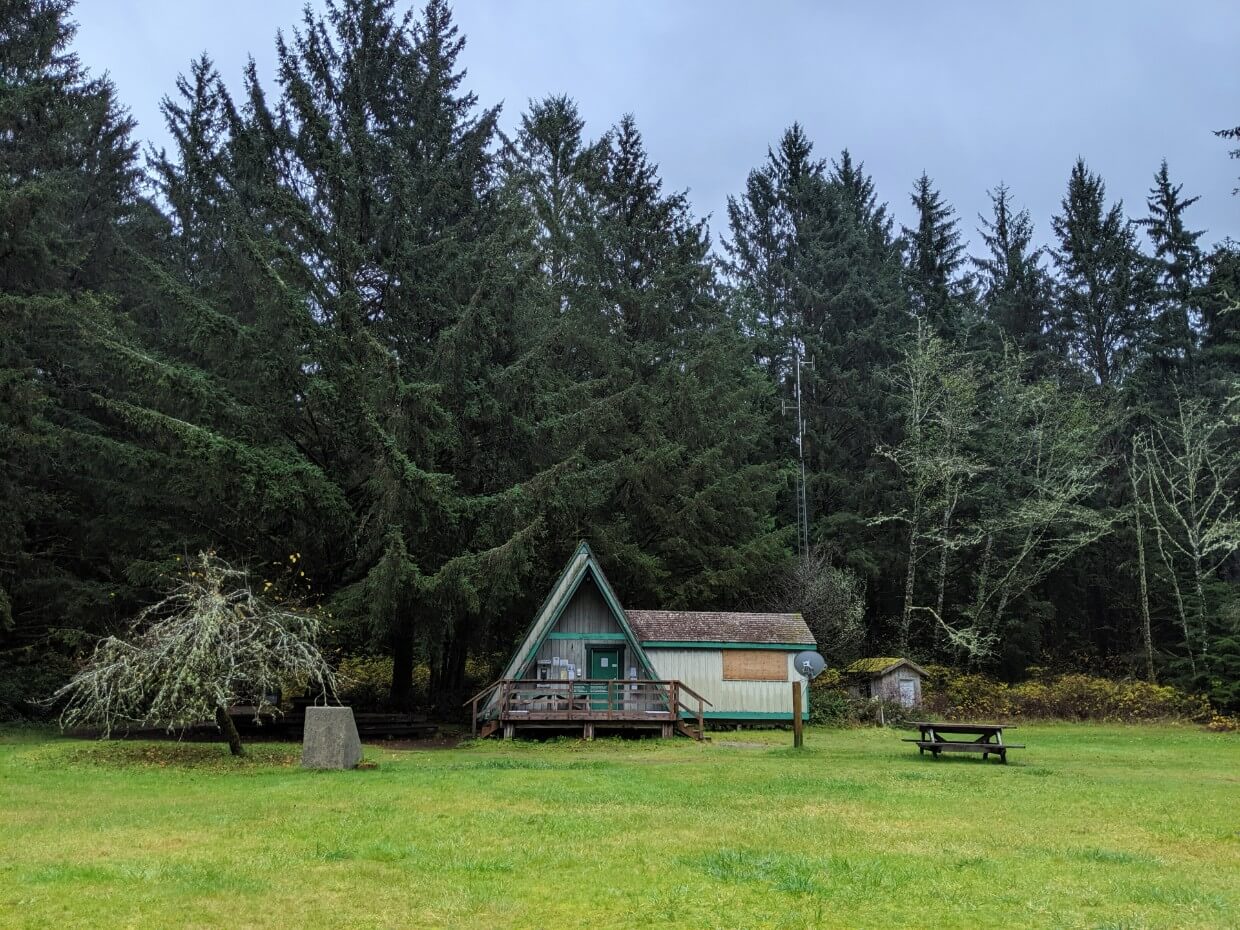
The Pachena Bay trailhead is close to the small community of Bamfield (pop. 179). The trailhead features a parking lot, Parks Canada information centre, outhouse facilities and beach access.
Pachena Bay is also home to the Huu-ay-aht First Nations community of Anacla and the Pachena Bay Campground.
Bamfield is 5km northwest of Pachena Bay and has a motel, gas station, market (with ATM), café, pub and 14 site campground.
Port Alberni is the closest city (pop. 25k) to Pachena Bay.
How to get to Pachena Bay
Most WCT hikers travel to/from Pachena Bay by road, using their own vehicle or via the West Coast Trail Express bus.
Alternatively, you can also take a passenger boat (the MV Frances Barkley) from Port Alberni to Bamfield and then travel the 5km to Pachena Bay from there, via foot or the local taxi service.
Driving to Pachena Bay
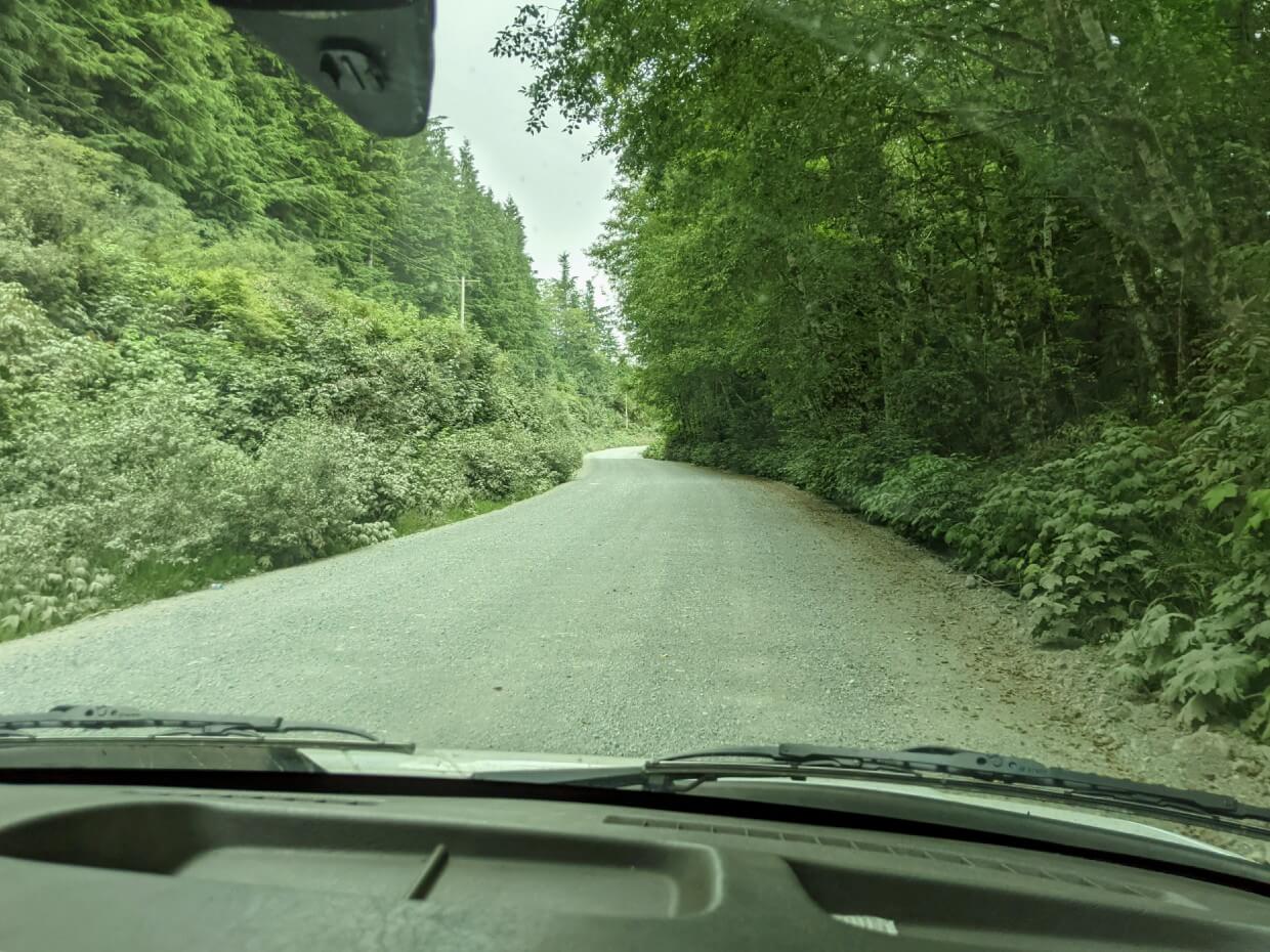
Until late 2023, road access to Bamfield and Pachena Bay was via potholed unpaved roads only.
Recent road upgrades have improved the route from Port Alberni greatly – it is now effectively paved (chip sealed)! There is an alternative route via Lake Cowichan as well but that is not paved. I’ll describe both routes below.
Even with the recent improvements on the road from Port Alberni, keep in mind that both routes to Bamfield are frequented by industrial traffic, including large logging trucks. Give way when you can.
Conditions still vary depending on recent weather and maintenance.
Potholes are very likely on the unpaved Lake Cowichan route, with slippery conditions in the rain and dusty conditions when dry. A higher clearance vehicle is definitely preferable. Drive with your headlights on at all times.
Driving slowly and carefully is the way to go, especially if you don’t have much experience driving on unpaved roads.
While there are some narrower sections, most of the road is relatively wide so it’s easy to let other vehicles pass. Stay away from the shoulders as they can be soft.
It’s a very good idea to have a full-sized spare tire with you and make sure you know how to change it. I’d also bring additional supplies in case of a breakdown. Make sure your gas tank is filled.
I highly recommend this Backroad Mapbook for navigating Vancouver Island’s complex logging road network. The directions listed below are subject to change and are followed at your own risk.
Via Port Alberni
Allow up to 2 hours for this 83km drive.
- From downtown Port Alberni, follow Stamp Ave to 3rd Ave then Ship Creek Road
- Exit the city on Franklin River Road
- Continue following until there is a fork, with Bamfield Road on the left
- Bamfield Road leads all the way to the Pachena Bay turnoff, which is on the left. If you miss it, you’ll end up in Bamfield about 5km later
As mentioned above, the highway was chip-sealed in 2023 and is easier to drive now. If you can, travel to Bamfield via this route rather than via Lake Cowichan.
Via Lake Cowichan
Allow three hours for this 110km mostly unpaved journey.
- From Lake Cowichan, follow North Shore Road to Youbou (13km)
- After Yobou, the road turns to gravel
- Look for signs to Nitinaht or Carmanah Walbran Provincial Park
- Follow along North Shore Road to the end of the lake, where the South Shore Road joins from the left
- Continue for 18km (passing Kissinger Lake Campground), until a major T-Junction
- Turn right on the Carmanah Main Road, towards Bamfield. The left turn is signed for Balaats’adt/Nitinaht Village
- After this point, there are signs for Bamfield – follow these.
- Drive the Carmanah Main Road for 22km
- At the 17km mark, the road follows the shore of Francis Lake, then Darlington Lake
- About 1.5km after passing Darlington Lake, you’ll reach a major junction. Turn left for Bamfield
- From here, it’s a 41km long drive along the Bamfield Road to the Pachena Bay turnoff on the left. If you miss it, you’ll end up in Bamfield about 5km later
It’s also possible to drive along South Shore Road instead of North Shore Road. The last time we drove it, the condition was very similar to Carmanah Main and North Shore Road. This is the route the West Coast Trail Express bus takes.
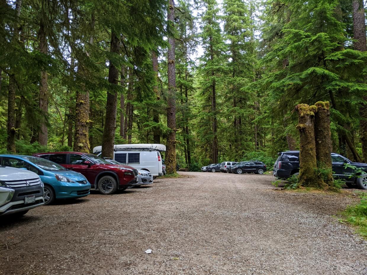
Where to park at Pachena Bay
Pachena Bay has a forested Parks Canada parking lot, with space for around 25 vehicles. Parking is free. The West Coast Trail Information Centre is less than two minutes walk from the parking lot.
When parking here, please be careful not to block the bus turnaround. It’s on the left-hand side of the parking lot (from the entrance) and is marked.
Taking the West Coast Trail Express Bus to Pachena Bay
The West Coast Trail Express bus picks up and drops off hikers at Pachena Bay, as well as Bamfield. Only one bus arrives and leaves each day.
The bus can be boarded in Victoria, Sooke, Port Renfrew, Gordon River, Lake Cowichan area and Nitinaht. There’s a connecting service with Nanaimo too.
- The incoming bus arrives at Pachena Bay at 12.30pm. This allows enough time to attend an orientation session at the Parks Office and then start the West Coast Trail the same day. The first campground, Michigan Creek, is an easy 12km hike from the trailhead – allow 3-4 hours.
- The outgoing bus departs Pachena Bay at 1.45pm. Most northbound hikers will stay at Michigan Creek or Darling River the night before to ensure perfect timing.
The bus journey is very bumpy, especially if you sit towards the back. If you suffer from travel sickness, you may want to bring medication.
All backpacks are stored at the back of the bus – be sure to take out any items you want during the journey before boarding.
Bus reservations
Reservations are highly recommended and can be made on the West Coast Trail Express Bus website.
Hikers with reservations have priority to board the bus. If you don’t make a reservation, there may not be a seat for you. In that situation, you’d have to wait until the next day (and again, there may not be a seat the next day either!)
At the time of this update (Feb 2026), the cost of bus transportation from Pachena Bay to Gordon River is $95/per person.
I know some feel that this is a bit expensive, but trust me, those buses take a lot of damage on the rough roads!
If you have a big group (7+ hikers), you may want to look at chartering your own West Coast Trail bus. This would offer more flexibility regarding bus schedules. Contact the West Coast Trail Express for more details.
Other Pachena Bay transport options
The Frances Barkley Ferry runs a year-round schedule from Port Alberni to Bamfield.
The ferry leaves Port Alberni at 8am and arrives in Bamfield at 12.30pm. It leaves again at 1.30pm, arriving in Port Alberni at 5pm. Hikers choosing this option will still need to travel to Pachena Bay from Bamfield.
The last method to reach Pachena Bay is seaplane. Pacific Seaplanes has a daily scheduled flight from Port Alberni to Bamfield at 11.45am.
The seaplane journey takes just 15 minutes. Again, you’d still need to find your own way between Bamfield and Pachena Bay.
Pacific Seaplanes also offers charter services, between Bamfield and Port Renfrew. Of course, this service doesn’t come cheap – it is one of the most expensive ways to get to the West Coast Trail (but also the most scenic!)
Where to stay near Pachena Bay
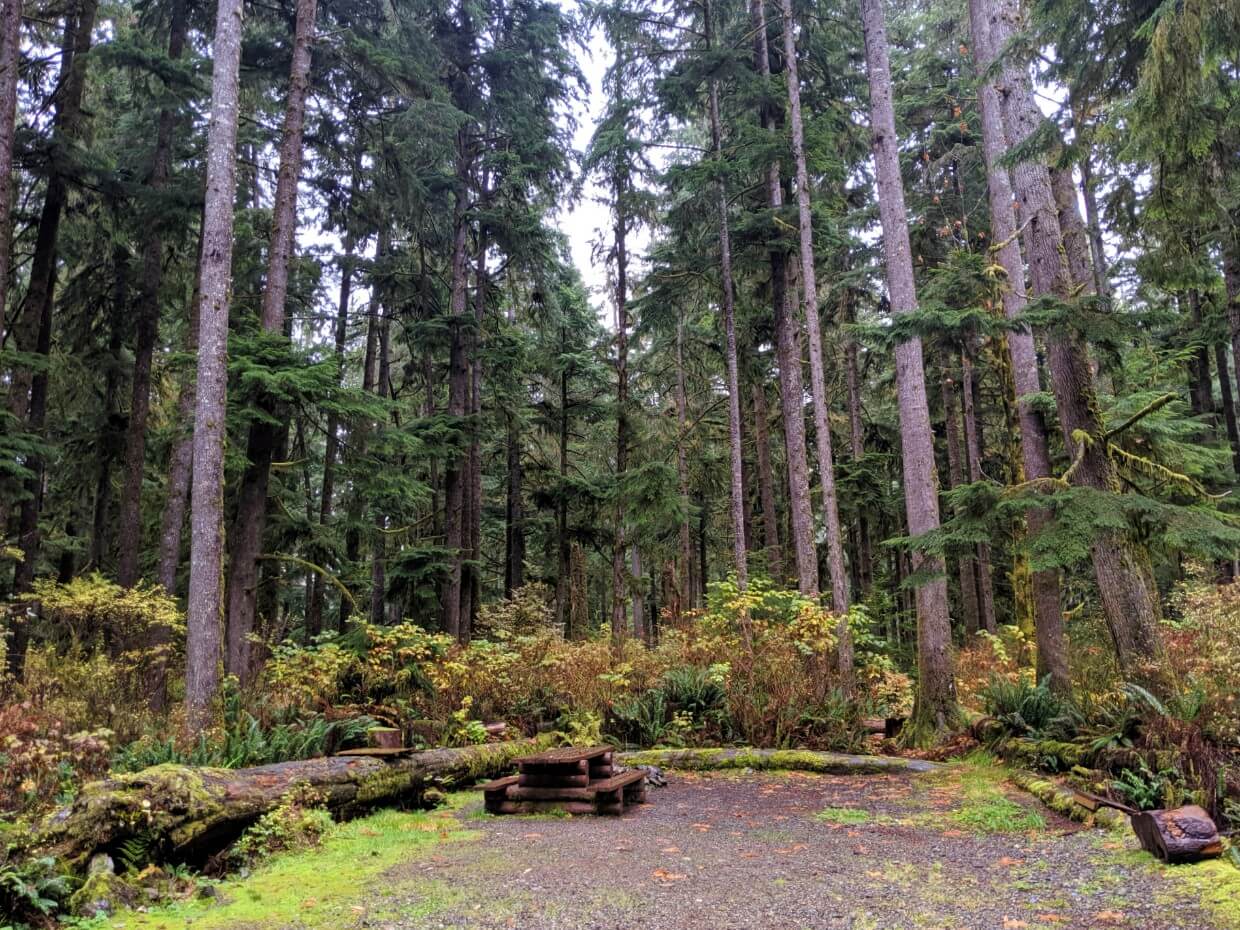
Pachena Bay Campground – This Huu-ay-aht First Nations campground is located right by the Pachena Bay Trailhead. It has both forest and beach tent sites, with potable water, coin-operated showers and washrooms available. Despite its large size, Pachena Bay Campground does get busy so I’d suggest reserving your site early. Reserve via BookYourSite.
Eileen Scott Centennial Park – Located in the heart of Bamfield, this municipal campground has just 14 sites. Campers have access to a cookhouse as well as washrooms and showers (by donation). Book via the Bamfield Parks website.
Hacas Inn – Bamfield’s only motel, the Hacas Inn offers standard, deluxe, kitchenette and backpacker rooms. Owned and operated by the Huu-ay-aht First Nations, all of the welcoming rooms have en-suite bathrooms, microwaves, fridges and coffee machines. The Malsit Public House is located in the same building (temporarily closed at the time of writing).
Upnit Lodge – Situated right on the waterfront, this upmarket inn has a choice of six rooms. Most have inlet views and one even has a private sauna. The Upnit Lodge is just a short walk from the pub.
Balaats’adt/Nitinaht Village Trailhead (Mid-point)
The Balaats’adt (Nitinaht Village) Trailhead is located parkway along the West Coast Trail at kilometre 32.2km (42.8km from Gordon Bay). Balaats’adt is home of the Ditidaht First Nation and has around 180 residents.
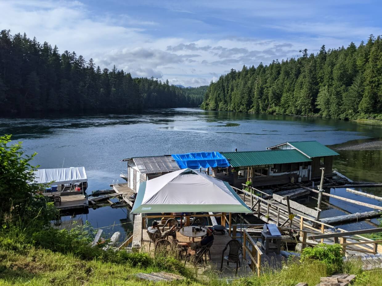
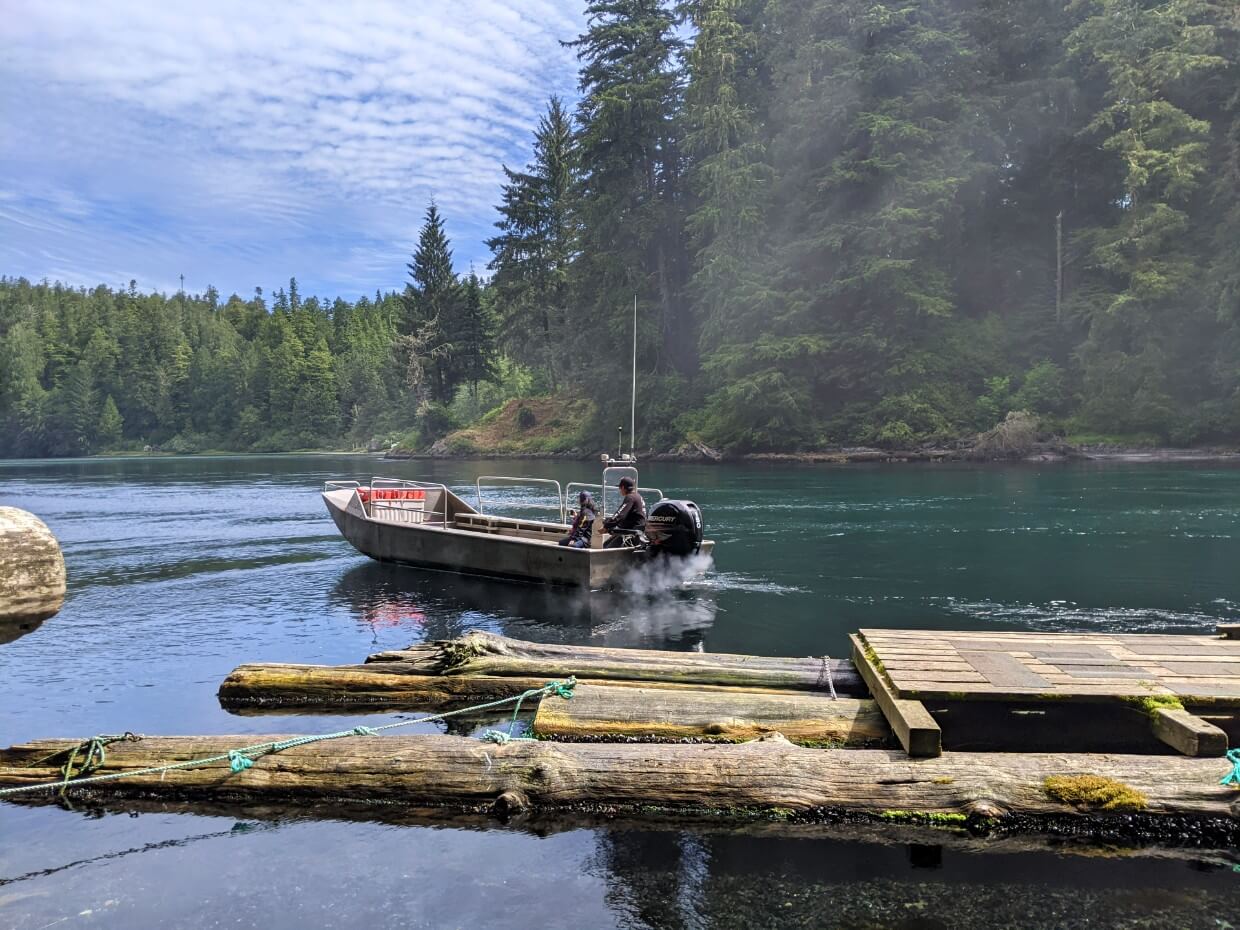
Hikers board a boat in Balaats’adt and travel to Nitinhat Narrows, a tidal channel that drains 23km long Nitinaht Lake into the Pacific Ocean. All WCT hikers cross the Nitinaht Narrows on a short ferry ride.
At the southern crossing point is the Crab Shack, a seafood restaurant. Accommodation is also available, in the form of cabins and a covered tent deck area.
At the other end of Nitinaht Lake is Balaats’adt/Nitinaht Village (pop. 120). This is the access point for WCT hikers starting or finishing at the Nitinaht Narrows.
Balaats’adt (Nitinaht Village) has a gas station, motel, B&B and Visitor Centre/Store/Café. Just a short drive from the village is a lakeside campground, where the Parks Canada Orientation Office is also located. There is no ATM in Balaats’adt.
How to get to Balaats’adt/Nitinaht Village
Balaats’adt is the most complex WCT trailhead to start at.
First, you must drive or take a bus to Balaats’adt/Nitinaht Village, which is accessible via unpaved roads only.
The next step is to take a 30 minute boat ride across the lake to Nitinaht Narrows with Nitinaht Lake Water Taxi.
All Balaats’adt hikers must attend the 7am orientation at the Parks Canada Orientation Office near the campground and then travel on the 8am boat to Nitinaht Narrows.
For that reason, it is almost required to stay overnight in Balaats’adt/Nitinaht Village the night before starting the WCT.
The one-way water taxi fee from Balaats’adt/Nitinaht Village to Nitinaht Narrows is $70.00. This fee is payable in Balaats’adt/Nitinaht Village only. Cash is preferred.
There is a 4.30pm boat service back to Balaats’adt/Nitinaht Village (extra charge) for hikers who wish to leave the WCT at the midpoint.
Driving to Balaats’adt/Nitinaht Village
Road access to Balaats’adt is by unpaved roads only. These roads are also used by industrial traffic, such as logging trucks.
Parking is available by the Parks Canada Orientation Office (near the Nitinaht campground) for $10/night.
For most hikers, the quickest route to Nitinaht will be via Lake Cowichan. It is also possible to reach Balaats’adt via Port Alberni or Port Renfrew. I’ll describe all three routes below.
Road conditions vary depending on recent weather and maintenance. Anticipate a bumpy drive, with dusty conditions when dry and potholes when wet. A higher clearance vehicle is definitely preferable.
Driving slowly and carefully is the way to go, especially if you don’t have much experience driving on unpaved roads.
Be prepared for fast-moving industrial traffic (or locals!) and give way as soon as you can. Drive with your headlights on at all times.
While there are some narrower sections, most of the road is relatively wide so it’s easy to let other vehicles pass. Stay away from the shoulders as they can be soft.
It’s a very good idea to have a full-sized spare tire with you and make sure you know how to change it. I’d also bring additional supplies in case of a breakdown. Make sure your gas tank is filled.
I highly recommend buying the Backroad Mapbook for navigating Vancouver Island’s complex logging road network. The directions listed below are subject to change and are followed at your own risk.
Via Lake Cowichan
Allow an hour and a half for this 61km drive.
- From Lake Cowichan, follow North Shore Road to Youbou (13km)
- After Yobou, the road turns to gravel
- Look for signs to Nitinaht or Carmanah Walbran Provincial Park
- Follow along North Shore Road to the end of the lake, where the South Shore Road joins from the left
- Continue for 18km (passing Kissinger Lake Campground), until a major T-Junction.
- Turn left on the Carmanah Main Road, towards Nitinaht Village. It is clearly signed
- Continue for 7km and you’ll arrive in Balaats’adt/Nitinaht Village
It’s also possible to drive along South Shore Road, below Cowichan Lake, instead of North Shore Road. When we last drove it, the condition was very similar to Carmanah Main and the North Shore Road. This is the route the West Coast Trail Express bus takes.
Via Port Alberni
If driving from Tofino, the Comox Valley or North Vancouver Island, you may find it more convenient to access Balaats’adt via Port Alberni. Allow two hours for this 72km long journey.
- From downtown Port Alberni, follow Stamp Ave to 3rd Ave then Ship Creek Road
- Exit the city on Franklin River Road
- Continue following until there is a fork, with Bamfield Road on the left.
- After 24km, there is a major junction
- Turn left onto Carmanah Main. It is signed for Nitinaht Village
- Follow this road for 29km.
Via Port Renfrew
Allow two hours and a half for this 115km drive.
- The easiest route from Port Renfrew is to drive the paved Pacific Marine until it meets with the South Shore Road below Cowichan Lake
- Head west along South Shore Road until it converges with North Shore Road (just after Heather Campground) – stay left
- Look for signs to Nitinaht or Carmanah Walbran Provincial Park
- Continue on North Shore Road for 18km (passing Kissinger Lake Campground), until a major T-Junction.
- Turn left on the Carmanah Main Road, towards Nitinaht Village. It is clearly signed
- Continue for 7km and you’ll arrive in Balaats’adt/Nitinaht Village.
Google Maps recommends ‘shorter’ routes between Port Renfrew and Balaats’adt/Nitinaht Village but these utilise lesser-used unpaved roads.
Taking the West Coast Trail Express Bus to Nitinaht Village
The West Coast Trail Express bus picks up and drops off passengers 6km from Balaats’adt/Nitinaht Village. The bus is met by a local Balaats’adt shuttle service, which costs an additional $20/per person (cash only).
The West Coast Trail Express bus can be boarded in Victoria, Sooke, Port Renfrew, Gordon River and the Lake Cowichan area. There’s a connecting service with Nanaimo too.
- The northbound bus (heading to Bamfield/Pachena Bay) arrives and leaves at the Balaats’adt/Nitinaht drop-off point at 11.45am
- The southbound bus (heading to Victoria/Port Renfrew) arrives and leaves at the Balaats’adt/Nitinaht drop off point at 2.25pm
Unfortunately, these bus times do not time well with the Balaats’adt/Nitinaht Village water taxi schedule.
Hikers must attend the 7am orientation at the Parks Canada office near the campground and then depart on the boat to Nitinaht Narrows at 8am. The boat back to Nitinaht Village is at 4.30pm, well after the bus departure.
This means that West Coast Trail Express bus riders must spend one night in Balaats’adt before travelling to the Nitinaht Narrows Trailhead.
The bus journey is very bumpy, especially if you sit towards the back. If you suffer from travel sickness, you may want to bring medication.
All backpacks are stored at the back of the bus – be sure to take out any items you want during the journey before boarding.

Bus reservations
Reservations are highly recommended and can be made on the West Coast Trail Express Bus website.
Hikers with reservations have priority when boarding the bus. If you don’t make a reservation, there may not be a seat for you. In that situation, you’d have to wait until the next day (and again, there may not be a seat the next day either!)
At the time of this update, it costs $80/per person to travel to Nitinaht Junction from Gordon River or Pachena Bay (and vice versa). You’ll also need to factor in the $20/per person for the local shuttle service to Balaats’adt.
If you have a big group (7+ hikers), you may want to look at chartering your own West Coast Trail bus. This would offer more flexibility regarding bus schedules. Contact the West Coast Trail Express for more details.
Other Nitinaht Village transport options
There are no other formal transportation options to reach Balaats’adt at this time.
Where to stay in Nitinaht Village
Nitinaht Lake Campground: Run by the Ditidaht First Nation, this rustic campground has a beautiful forested setting alongside Nitinaht Lake. It is very popular with windsurfers. There are campsites set aside specifically for West Coast Trail hikers for $20/night, very close to the Parks Canada Orientation Office.
Nitinaht Lake Motel: Located in the centre of Balaats’adt, this recently renovated motel has 9 rooms priced at $120-150/night. Reservations can be made online via the Visit Nitinaht website.
Nitinaht Wilderness Charters B&B: The Edgar family run the Nitinaht Narrows water taxi service. They have three bed and breakfast rooms for rent in Nitinaht Village. Rooms can sleep up to four people. Contact Nitinaht Wilderness Charters for more info.
Gordon River Trailhead (South)
The West Coast Trail’s southern trailhead is located at the mouth of the Gordon River, near Port Renfrew.
To reach the trailhead, hikers are transported across Gordon River by ferry – operating times are 8.45am to 3.30pm.
This ferry service is run by the Pacheedaht First Nation, who also operate an oceanfront campground on nearby Pacheedaht Beach.
The Parks Canada WCT Office is located in the same building as the campground office and market. There are flush toilets and coin-operated showers in another building opposite.
The community of Port Renfrew is less than 10 minutes drive away, on the other side of the Port San Juan inlet.
Port Renfrew (pop. 144) has a range of accommodations (B&Bs, cabins, guesthouses) as well as a general store, a couple of cafés, a gas station and a pub. There is, however, no ATM.

How to get to Gordon River
Gordon River is the easiest West Coast Trail trailhead to reach. Being just down the road from Port Renfrew, it’s also the trailhead with the most services (food, accommodation etc.)
For these reasons, a lot of hikers base their West Coast Trail experience around Gordon River.
Driving to Gordon River
Gordon River is accessible via two paved roads.
The Pacific Marine Road connects Gordon River with Lake Cowichan. It takes just over one hour to drive the 59km long road.
- At the end of the journey, you’ll cross the Deering Bridge
- Turn right onto Pachidah Road to enter the Reserve lands
- The Parks Canada office is located in the Pacheedaht Campground, 1.5km ahead
Highway 14 is the main road between Victoria and Port Renfrew. It takes just over two hours to drive to Gordon River from Victoria on this 112km long road.
- Before driving into Port Renfrew turn right onto Deering Road and cross the San Juan River
- Continue straight for 1.5km and then turn left onto Pachidah Road
- Drive straight for 1km and the Pacheedaht Campground office will be signed on your left
Both highways are two-lane roads, meaning one single-width lane in either direction.
Highway 14 stays close to the coast, with some gorgeous scenery visible along several sections.
If you have the time, I’d recommend stopping at Sheringham Point to see the lighthouse and Sombrio Beach to see the hidden waterfall. More recommendations can be found in our Pacific Marine Circle Route road trip guide.
The Pacific Marine Road is less scenic but it does have some worthwhile roadside stops. My favourite is the Harris Creek Sitka Spruce, which is located about 30 minutes from Gordon River (25km).
If you have extra time, I’d highly recommend a side trip to Avatar Grove as well. It’s about 10km north of Port Renfrew and features two short trails through an old-growth forest filled with cedars and firs.
For details on Avatar Grove and the Harrison Creek Spruce, read this next: How to Find Big Trees on Vancouver Island

Where to park in Gordon River
WCT hiker parking is available immediately adjacent to the Parks Canada office. The lot was fairly crowded when we visited. The price is $10/day, payable at the Pacheedaht Campground office (card or cash).
Before the pandemic, the parking lot was located closer to the Gordon River boat dock. I mention this for veteran hikers or anyone receiving information from an outdated source!
Taking the West Coast Trail Express Bus to Gordon River
The West Coast Trail Express bus picks up and drops off hikers at Gordon River, as well as Port Renfrew. Only one bus arrives and leaves each day.
The bus can be boarded in Victoria, Sooke, Bamfield, Pachena Bay, Lake Cowichan area and Nitinaht. There’s a connecting service to Nanaimo as well.
The incoming bus arrives at Gordon River at 9.15am. This allows plenty of time to attend an orientation session at the Parks Office and then start the West Coast Trail the same day.
The outgoing bus departs Gordon River at 5.15pm. This is timed well to meet southbound hikers who managed to get the last Gordon River ferry (3.30pm).
The bus journey is very bumpy, especially if you sit towards the back. If you suffer from travel sickness, you may want to bring medication.
All backpacks are stored at the back of the bus – be sure to take out any items you want during the journey before boarding.
Bus reservations
Reservations are highly recommended and can be made on the West Coast Trail Express Bus website.
Hikers with reservations have priority to board the bus. If you don’t make a reservation, there may not be a seat for you. In that situation, you’d have to wait until the next day (and again, there may not be a seat the next day either!)
At the time of writing, the cost of bus transportation from Gordon River to Pachena Bay is $95/per person. I know some feel that this is a bit expensive, but trust me, those buses take a lot of damage on the rough roads!
If you have a big group (7+ hikers), you may want to charter your own West Coast Trail bus. This would offer more flexibility regarding bus schedules. Contact the West Coast Trail Express for more details.

Other Gordon River transport options
Although there is no scheduled service, I have heard about WCT hikers chartering seaplanes to Port Renfrew from Bamfield.
While very convenient and, of course, very scenic as well, this would definitely be the most expensive way to get to the West Coast Trail.
Wondering how to get from Port Renfrew to Gordon River to start the WCT?
If you want to avoid the 5km walk, the easiest way is to contact the West Coast Trail Express a few days in advance. Ask if they can pick you up at the West Coast Trail Lodge for the short journey to Gordon River, which is part of the morning run from Victoria.
The owner advised in 2021 that there would be no fee for this service if you are ‘just a few people.’
Where to stay in Gordon River
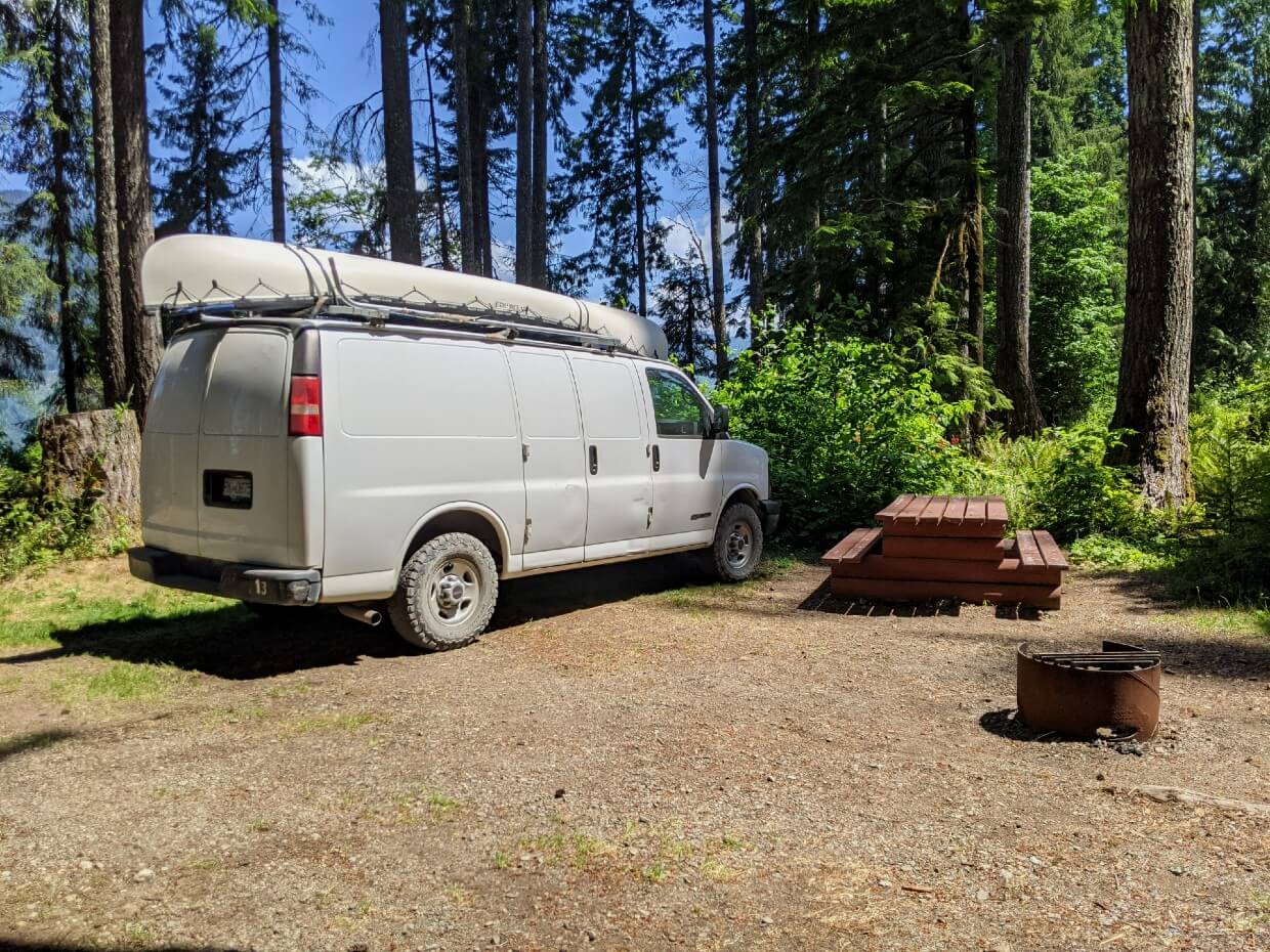
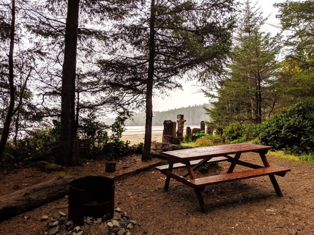
Pacheedaht Campground: Most of the 65+ campsites here are situated on or just behind a beautiful 2km long sandy beach. Facilities are rustic though there are coin operated showers available.
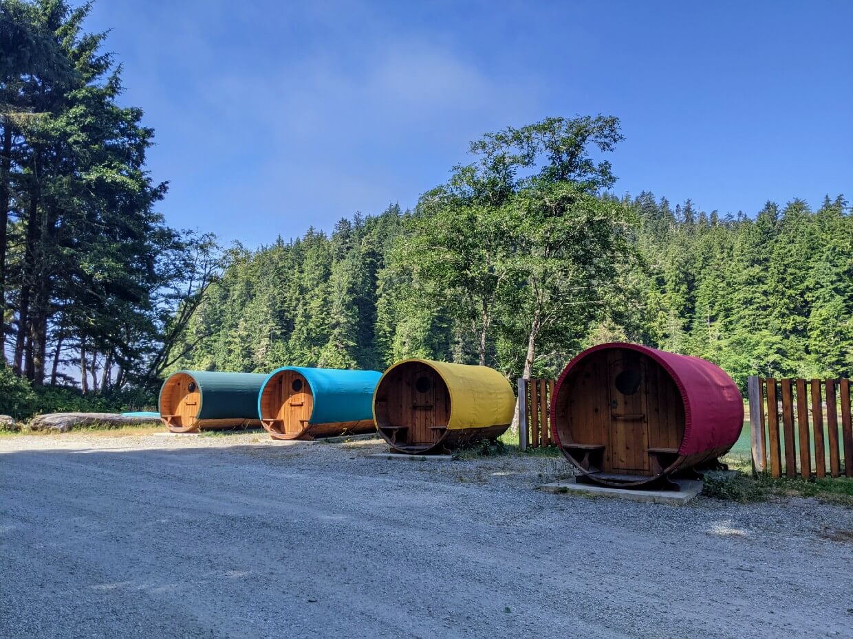
If camping isn’t your thing, there are also waterfront ‘camping barrels’ (approx. $100/night, see above photo). Reservations can be made via the campground website or by phone (250) 6470 090
Trailhead Resort: Choose between comfortable private cabins and suites at Trailhead Resort. Each features a full kitchen and deck, as well as access to hot tub, BBQ and fire pit areas. For those on a budget, there’s also a collection of ‘Hiker Huts’ with shared bathrooms (no hot tub access though!)
Wild Renfrew: Treat yourself to a stay at Wild Renfrew, where you’ll find private waterfront cottages (some with hot tubs) and luxury canvas tents. Better still, the Renfrew Pub is only a few steps away! It’s perfect for your first post-hike beer.
Booking.comCheck out these other BC backpacking guides next:
The HBC Heritage Trail, from Hope to Tulameen
Mount Assiniboine Provincial Park
Lake O’Hara, Yoho National Park
The Cape Scott Trail, Vancouver Island
The Iceline Trail, Yoho National Park
Eva Lake, Mount Revelstoke National Park
The Heather Trail, Manning Provincial Park

One half of the Canadian/British couple behind Off Track Travel, Gemma is happiest when hiking on the trail or planning the next big travel adventure. JR and Gemma are currently based in the beautiful Okanagan Valley, British Columbia, Canada. Consider buying us a coffee if you have find any of our guides helpful!
Hi Gemma, Great Blog! Do you have any advice on where to park at Port Renfew for 2x nights? Thanks in advance, Joe.
Hi Joe,
The best place to park for the West Coast Trail at the southern end is Gordon River, by the WCT Trail Office. If you’re looking to park in Port Renfrew itself, you’d be best to speak to local accommodation providers to see if they can help. As far as I know, there is no public facility for overnight parking in Port Renfrew.
Hey Gemma,
Is the parking fairly secure? A bit worried to finish the hike and not have our vehicle there!
Hi Carla,
The parking lots are not fenced and do not have controlled access. There is not a dedicated security team at any of them either. Having said that, parking lots at the northern and mid-point trailheads are pretty remote (accessible by dirt road only) and vehicle thieves would need to make significant effort to get there.
The Gordon River parking lot is a lot more accessible, but it is adjacent to the main road on Pacheedaht First Nation reserve land, right next to a busy campground, the WCT office and a couple of residential buildings. I have not heard of anyone having their vehicle broken into there. I believe the chance of vehicle theft would be quite low too (obviously not impossible though).
Vehicle break-ins do happen relatively often in the parking lots on the nearby Juan de Fuca trail but those parking areas are off the main road and surrounded by forest (the perfect quiet, isolated location for that kind of activity).
Amazing resource!! If we can’t make the bus at 1:45 in Pachena Bay after finishing the WCT where do you recommend staying the night?
Hi Jennifer,
The Pachena Bay Campground has a few tent spots set aside for WCT hikers (for a fee). Keep in mind that the most northern section of the WCT is the easiest part so as long as you leave early enough, you should have no issues to reach the bus on time.
Hi Gemma,
Thanks for sharing so much useful and amazing information. and just to ask if I miss the shuttle bus the last day in Gordon River, do you know will it be possible to stay in Gordon River for one more free night? Thanks.
Hi Robynn,
You’d need to check with the campground. Have a good hike!