The Pacific Marine Circle Route is one of Vancouver Island’s best road trips. It starts and finishes in Victoria, British Columbia’s characterful capital city.
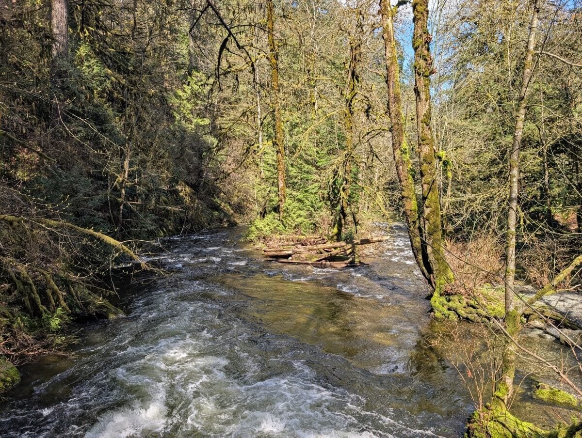
The scenic road winds through temperate rainforest as it follows the rugged coastline of the Juan de Fuca Strait.
Salty sea breezes, beach waterfalls, huge trees and ocean vistas abound, as well as potential whale sightings.

After arriving at the remote community of Port Renfrew, the journey turns inland and heads towards the expansive shores of Cowichan Lake and the bountiful Cowichan Valley. The finale is the spectacular Malahat Summit, high above the ocean.
We’ve driven the Pacific Marine Circle Route more than half a dozen times in the last few years.
In this post, I’ll share our top picks for places to stop along the 263km long route, as well as useful tips to make the most of the journey.
I’ve also put together some suggested itineraries, to help with your trip planning.
Here’s what to expect:
- Pacific Marine Circle Route: Essential details
- Best places to stop on the Pacific Marine Circle Route
- Suggested road trip itineraries
- Where to stay
There are affiliate links in this post. If you make a purchase via one of these links, we may receive a small percentage of the sale.

Planning a trip to Vancouver Island?

Our Vancouver Island Travel Guide features an interactive map with 150+ of the best things to see and do.
The itinerary builder tool makes it easy to create your perfect trip.
Download the app and use offline while travelling!

Pacific Marine Circle Route: Essential details
Before I get into my recommendations for the best places to visit on the Pacific Marine Circle Route (PMCR), I thought it would be a good idea to share some background information.
The Pacific Marine Circle Route travels across the traditional territory of multiple First Nations, including the Pacheedaht, Quw’utsu, Ts’uubaa-asatx, Hul’qumi’num, W̱SÁNEĆ, Sc’ianew, Te’mexw and MÁLEXEȽ.
The driving distance, without stops or detours, is 263km. The best time to drive the PMCR is June to September, when the weather is warmest and driest.
The route is usually open all year round. Keep in mind, however, that November to March can be very wet. The days are short, with cool temperatures. There may be ocean fog too.
While it is possible to drive the PMCR in one day, I’d personally recommend a minimum of two, with three being ideal. There are so many beautiful places to see along the way and it would be a shame to miss out!

Pacific Marine Circle Route map
The Pacific Marine Circle Route is a combination of five roads:
- Highway 14 between Victoria and Port Renfrew
- Pacific Marine Road between Port Renfrew and the South Shore junction
- South Shore Road from the Pacific Marine Road junction to Lake Cowichan
- Highway 18 between Lake Cowichan and Highway 1 (near Duncan)
- Highway 1 between Duncan and Victoria
When viewed on a map, these roads form a complete circle. The below Google Map shows the route, as well as the featured activities and attractions mentioned in this post.

How to get to Victoria
Officially, the Pacific Marine Circle Route starts and ends in Victoria. The city of Victoria is situated on the southeastern tip of Vancouver Island.
The easiest way to travel to Victoria from BC’s mainland is to take the ferry from Tsawwassen (Vancouver) to Swartz Bay. The journey time is 1 hour and 35 minutes. Swartz Bay is an easy 30 minute drive from Victoria.
If you have a specific ferry crossing in mind, I would suggest making a ferry reservation. This is particularly true on weekends, especially holiday weekends.
Alternatively, it is possible to take a ferry from Tsawwassen or Horseshoe Bay (both Vancouver) to Nanaimo, a city two hours drive north of Victoria. If you take this ferry crossing instead, it is possible to ‘cut in’ to the Pacific Marine Circle Route earlier at Duncan. This avoids double backing.
Visiting Vancouver Island from the USA? Consider taking the Black Ball Ferry from Port Angeles, Washington, to Victoria.

Pacific Marine Circle Route: What to expect
As mentioned, the Pacific Marine Circle Route utilises five roads – Highway 14, Pacific Marine Road, South Shore Road, Highway 18 and Highway 1.
The entire journey is paved. This section of the post will explain what to expect along the way. Click here to skip to the best things to do on the PMCR.
Victoria to Port Renfrew
Starting in a clockwise direction, the route leaves Victoria and heads west towards the harbourside village of Sooke on Highway 14.
After this point, the highway stays close to the ocean (specifically the Juan de Fuca Strait) for the rest of its winding journey to Port Renfrew. This is the most beautiful part of the PMCR, with glimpses of the ocean offered through surrounding lush temperature rainforest.
The road occasionally climbs and descends, crossing bridges and creeks on the way. A gas station signifies the arrival to Port Renfrew. Go straight to visit Port Renfrew and Botanical Beach. Make a sharp right to continue towards Lake Cowichan.
Highway 14 is a well used road. For the majority of the route, it is a single lane (two lanes total) highway. Phone signal is intermittant on this road and non-existent at the Port Renfrew end.
There are windy sections with some tight curves and blind spots. The speed limit is, for the most part, 60km/h. If you’re driving a larger or slower vehicle, prepare to pull over when you can to let others pass.

Port Renfrew to Lake Cowichan
The sharp right turn from Highway 14 leads to a long one-lane bridge over the San Juan River, the first of half a dozen on this section of the Pacific Marine Circle Route. Stay right when the road splits, cross another river bridge you’ll be on Pacific Marine Road.
This winding, narrow at times, road leads all the way to Cowichan Lake. Most sections are forested, though there are some stark clearcuts. These may not look great but they do open up the views.
Pacific Marine Road ends at a junction on South Shore Road, adjacent to Cowichan Lake. Turn right and continue to the community of Lake Cowichan.
Port Renfrew to Lake Cowichan is the quietest section of the PMCR. There are no services between Port Renfrew and the South Shore Road junction. Phone signal is also limited.
Both roads are single lane only (two lanes total), with some one lane bridges. There are some very wide sections as well as some narrow areas, with tight corners. It is common to see industrial traffic (logging trucks) – give them plenty of space.

Lake Cowichan to Highway 1 junction near Duncan
Lake Cowichan and Highway 1 are connected by Highway 18, a well-used road. I haven’t featured any stops or attractions along this section of the PMCR.
The highway is mostly flat and straight and therefore very easy and fast to drive. It is a one-lane highway with some two-lane sections. The speed limit along most of the highway is 100 km/h.

Highway 1 junction to Victoria
This section of the PMCR is the busiest. Highway 1 is Vancouver Island’s main highway. After leaving Duncan, it passes through the rural surroundings of the Cowicha Valley. The highway stays inland until Mill Bay.
The Malahat highway section, to the south, offers travels across rugged mountainside, with ocean views to the east.
Most of the suggested activities in this post are located a short distance from Highway 1 itself, so you will need to detour from the main route onto smaller roads. Considering how busy Highway 1 can be, that’s a good thing!
After the Malahat, Highway 1 travels through the centre of Goldstream Provincial Park. The city of Langford is next and then, finally, Victoria.
The majority of Highway 1 between Duncan and Victoria is two lane, with regular traffic lights in urban areas. Large sections of the road have a 50km/h-80km/h speed limit.
The Malahat section of the highway is narrow with wide curves. Opposing traffic is separated by a barrier.
Pacific Marine Circle Route tips
- Highway 14 has a low-speed limit and many tight corners. Some locals drive very fast on this road, so be prepared to pull over to let them pass
- It is common to see wildlife on both Highway 14 and Pacific Marine Road. Keep alert!
- As noted above, it is likely that you will see large industrial vehicles on South Shore Road and Pacific Marine Road. Slow down, give them lots of space and be prepared to pull over if necessary
- Phone signal is limited on Highway 14 and Pacific Marine Road. Tell someone where you are going and when you plan to be in touch
- Download the relevant Google Maps in advance so you can use them offline
- There are very few gas stations between Sooke and Lake Cowichan
- Check your spare tire before leaving Victoria and know how to change it
- It rains often in the Port Renfrew area, especially from November to May. Hiking trails and beaches can be very slippery
- As above, prepare to bring and wear wet weather gear while travelling on the coast, especially from November to May
- It is possible to drive the PMCR in either direction. I have written about it in a clockwise direction in this post
- If you find this guide helpful, you may also like our Nanaimo to Tofino Road Trip Guide
Public transport
Wondering if you can explore the Pacific Marine Circle Route by public transport? The quick answer is – kind of. It is possible to travel part of the route on the West Coast Trail Express, a shuttle bus designed for West Coast Trail hikers. I wouldn’t really recommend it for travelling around, however.

Pacific Marine Circle Route: Best places to stop
Read on to discover our top picks for places to visit on a Nanaimo to Tofino road trip.
I have included 17 different places, with some being quick sightseeing stops and others involving hiking trails.
All of the featured activities/trailheads are situated within 20 minutes drive of the main Pacific Marine Circle Route.
If you’re planning to drive the Pacific Marine Circle Route in one day (ambitious!), I would suggest picking just two or three of these suggestions.
For longer road trips, I have created two, three and four day itineraries to help with travel planning.
East Sooke Regional Park
Driving from Victoria, East Sooke Regional Park offers the first real taste of Vancouver Island’s wild west coast. 50km of hiking trails traverse the forest and coastline, taking in pocket beaches, tide pools and rocky bays.
For a short visit, I would suggest parking at Aylard Farm and hiking along the Coastal Trail to Creyke Point and then towards Alldridge Point (4km return, around 1.5 to 2 hours). A set of 3,000 year old petrogylphs are carved into the rocks just above the ocean at Alldridge Point.
The Coastal Trail features rugged terrain, with plenty of places where you need to step up and down. It can be slippery in wet conditions.
An easier alternative to East Sooke Regional Park is Whiffin Spit. The 2.4km trail along the natural breakwater is flat and takes less than one hour to walk.

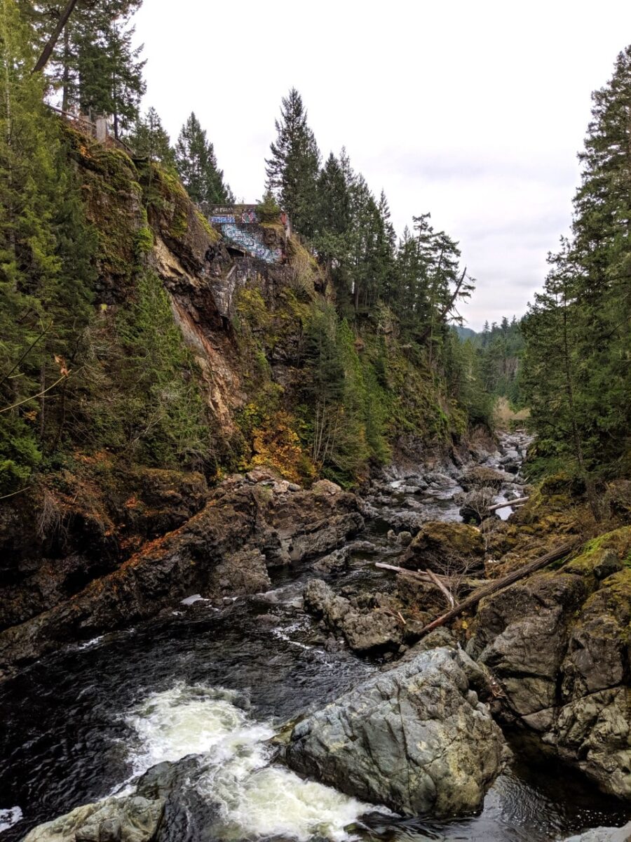
Sooke Potholes
Formed millions of years ago after the last ice age, Sooke Potholes is a unique geological formation of deep naturally carved rock pools, waterfalls and canyons.
The potholes are most impressive to see on sunny days, when the water is crystal clear. The rock pools are a very popular place to swim when it is hot.
There are a number of different (paid) parking lots, each with trail access to viewpoints and beaches. The signage can be a little confusing. I’d recommend heading to parking lot 2, as it has easy access to a scenic gorge lookout.
Sheringham Point Lighthouse
If you’re a fan of lighthouses, be sure to make a stop at Sheringham Point Lighthouse. The red and white building sits on a rocky bluff above the ocean and is the only lighthouse on this section of coastline. It is a great place to spot seals.
The small parking lot for the lighthouse is found at the end of Sheringham Point Road. The hike is 600m each way and is downhill to the lighthouse (10-15 minutes). It is an easy walk, with gravel and paved sections and some intrepretive signage.
Feeling hungry? Make a stop at Shirley Delicious, a super cute cafe perched in the forest at the corner of Sheringham Point Road. Pick up a coffee and some freshly baked treats (muffins, crossiants and more) or stop and enjoy sandwiches with house made focaccia.

Mystic Beach
This beautiful beach on the 47km long Juan de Fuca Trail definitely has a mystical touch! Mystic Beach is not large but features features impressive cliffs and caves, as well as a natural waterfall. And, of course, the Pacific Ocean crashes right onto the rocks.
The 2km hike down to the beach traverses a lush forest and crosses a suspension bridge. It’s downhill all the way (which does mean it is uphill all the way back…) and has some short muddy sections. The path is rooty in areas too so expect to step up and down.
You know that Mystic Beach is close, however, when the roar of the ocean filters through the trees and wooden stairs appear. Plan to spend around 45 minutes hiking the trail in each direction.
If you don’t have time to hike down to Mystic Beach, consider a stop at Sandcut Beach instead. The 400m trail leads to a long rocky beach with several waterfalls cascading down sandstone rock. Sandcut Beach is located between Sheringham Point Lighthouse and Mystic Beach.

Sombrio Beach and the Hidden Waterfall
Sombrio Beach is the longest beach along this stretch of the coastline and is a favourite of surfers. The sweeping views of the Pacific Ocean are spectacular! Sombrio Beach is also on the Juan de Fuca Trail, located around the half way point.
A must see at Sombrio Beach is the Hidden Waterfall. Walk 1.5km across the pebbles to the far eastern section of the beach. This takes around 30 minutes at a leisurely pace.
Look for a big pile of driftwood on a creek. Follow the rushing water up the creek to find a beautifully cascading waterfall at the end of a mossy canyon. Expect to get your feet wet.
The Sombrio Beach parking lot is accessed via an unpaved, downhill 1.7km long road from Highway 14. It is well used and can be a little bumpy. Drive slowly!

Port Renfrew
Port Renfrew is a community of 260 people, situated on the Port San Juan inlet. First Nation people have lived in this area since time immemorial.
With housing, accommodation, cafes and shops scattered along the hilly coastline, Port Renfrew has a remote and sleepy feel. There are two Pacheedaht First Nation (‘children of the sea foam’) reserves on the other side of the San Juan River.
The main industries in this area are forestry, fishing and tourism. The latter is focused on outdoor adventure, with Port Renfrew being the start (and end) trailhead for both the Juan de Fuca Trail and more famous West Coast Trail.
Port Renfrew is a great place to grab a bite to eat, pick up supplies and spend a night or two.
Go for a walk on the wharf and then pop into the Renfrew Pub for a local Island brewed beer. Renny’s Food Truck serves up super tasty fried favourites (burgers, clam fritters, onion rings and more), while the Coastal Kitchen Cafe is a local institution for coffee and breakfast.

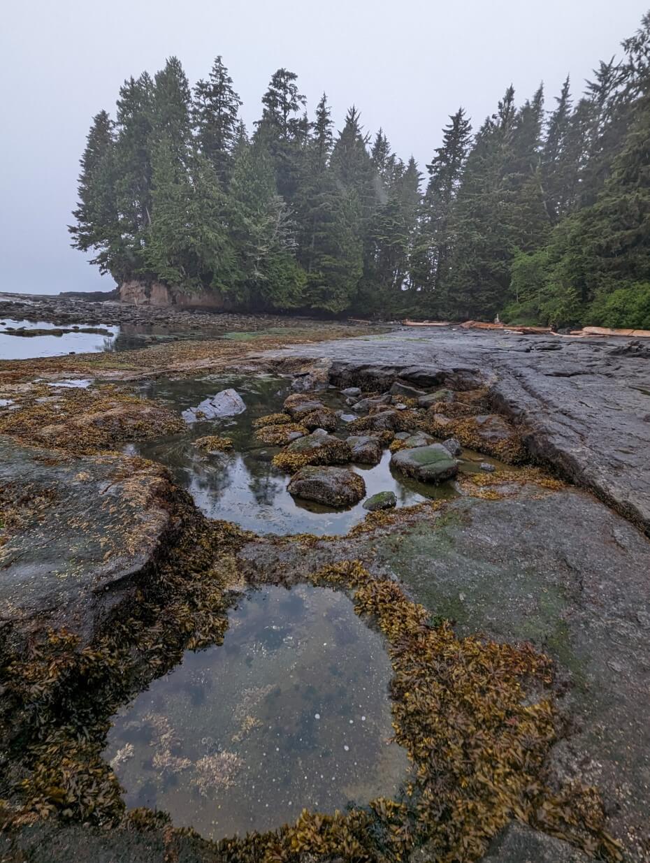
Botanical Beach
Botanical Beach is famous for its uniquely rich tide pools filled with marine creatures and plants. Located just 3km from Port Renfrew on a paved road, I’d say it is a must see when driving the Pacific Marine Circle Route.
The most direct route to the beach is the 1km long downhill trail from the eastern side of the parking lot (20-30 minutes). The trailhead on the other side of the parking is almost twice as long, leading first to Botany Bay and then Botanical Beach. Combine both trails for a 2.8km loop (1 hour).
Once at Botanical Beach, take in the ocean views and explore the rocky coastline. The tidepools are carved from soft sandstone and feature hundreds of plant species and marine animals. Be sure to only look and don’t touch!
Avatar Grove / T’l’oqwxwat
The Port Renfrew area is one of the wettest places on Vancouver Island. The enormous amount of rainfall and mild climate help huge trees to grow.
One of the most impressive and easily accessible locations to see some of these giant trees is Avatar Grove (called T’l’oqwxwat by the Pacheedaht First Nation).
Please note that Avatar Grove has been temporarily closed since 2022. The boardwalks are in a stare of disrepair. Use the trails at your own risk.
This protected area features two short boardwalk hiking trails through the forest. The Lower Grove Trail (on the right hand side of the road, 520m return) is mostly flat and features some enormous cedars and Douglas Fir trees.
The Upper Grove Trail (left side, 560m return) is the most popular as it leads to “Canada’s Gnarliest Tree,” a cedar with a gargantuan burl (knotty growth). The path is steeper and has multiple sets of stairs.
Avatar Grove is located on Gordon River Road, an unpaved industrial (logging road). It is a 7km detour from Highway 14 and about 15-20 minutes drive from Port Renfrew. Drive very slowly to avoid potholes and give way to industrial traffic.
Big Lonely Doug and Eden Grove
If you’re exploring the Pacific Marine Circle with a high clearance vehicle and good tires (AWD or 4X4 would be beneficial), consider continuing from Avatar Grove to Big Lonely Doug.
Big Lonely Doug is Canada’s second tallest known Douglas Fir. Sitting in a logged clear cut, it provides a dramatic contrast to Avatar Grove. It is both a magical and sad experience to witness this huge tree standing alone in a destroyed forest.
Further along the same road at Big Lonely Doug is Eden Grove. This ancient forest is home to more giant trees, with one particular redcedar being almost four metres in width. Unfortunately, Eden Grove is not yet protected.
From Avatar Grove, continue along Gordon River Road and then then take a left on Edinburgh Main. The road is decent for the most part but there is a steep hill close to Big Lonely Doug that is challenging. Consider parking and then walking the final 1km. Eden Grove is further along Edinburgh Main.

Fairy Lake Bonsai Tree
In an area filled with huge trees, the Fairy Lake Bonsai Tree offers something on the cuter side. This tiny tree is growing on a submerged log at the edge of Fairy Lake. It’s not really a bonsai tree, but a small Douglas Fir.
The easiest way to view the Fairy Lake Bonsai Tree is to simply pull up next to lake on Highway 14. There is a small path leading through the trees down to the shore of the lake as well, if you want a closer look.
The Fairy Lake Bonsai Tree is just 10 minutes drive from Port Renfrew, right on Highway 14. I’m going to include a Google Street View schreenshot of the Fairy Lake Bonsai Tree below, just to show how near it is to Highway 14!

Harris Creek Spruce
The last big tree stop in the Port Renfrew area is the Harris Creek Spruce. This giant Sitka Spruce tree sits in an old growth grove about 30 minutes drive northeast of Port Renfrew.
This mossy grove is found just off Highway 14. A short flat trail (less than 50m) leads from the small forest parking area to the Harris Creek Spruce. The tree is surrounded by a wooden fence, so you can’t get too close.
I think the Harris Creek Spruce is particularly impressive to see as most of the other trees in the forest are significantly smaller. The nearby creek provides a soothing soundtrack as well.

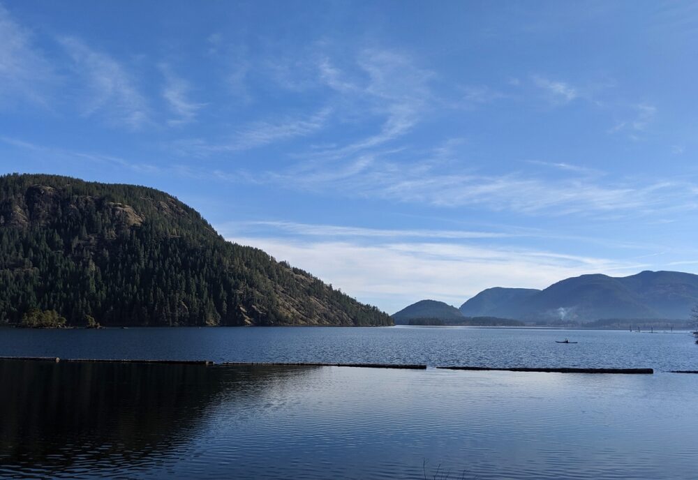
Cowichan Lake
Cowichan Lake is Vancouver Island’s second largest body of fresh water. It is a popular destination for fishing and idyllic camping vacations. It is circled by two main roads, with the Pacific Marine Circle Route following the South Shore Road for a short time.
The town of Lake Cowichan sits on the eastern shore of the lake and is a service hub. We love to stop in Lake Cowichan for ice cream and last minute supplies. Public washrooms and the Visitor Centre are located next to Saywell Park. Lake Cowichan is the end point of the Cowichan River tubing experience.
If it’s hot on your trip, Gordon Bay Provincial Park is a worthy detour before reaching Lake Cowichan. There is a large day use beach here with excellent swimming. When the Pacific Marine Circle Route reaches the South Shore Road junrtion, turn left instead of right and drive 10 minutes west to Gordon Bay.
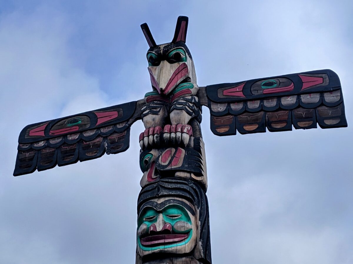
Duncan totem poles
The Pacific Marine Circle Route leaves Cowichan Lake on Highway 18 and joins Highway 1 just north of Duncan.
This small city is host to the world’s largest outdoor collection of publicly displayed totem poles. For me, that makes it well worth a short stop.
Note that while I call Duncan a city, it is technically Canada’s smallest city by area. It only has a population of 5k people!
Putting that fun fact aside, Duncan’s Totem Tour Walk features as many as 44 different totems. All but one are located in the downtown area. If you can, time your visit for the Farmers’ Market, held every Saturday year round.
Cowichan Bay
Southwest of Duncan is the scenic seaside community of Cowichan Bay. I mention Cowichan Bay for two reasons.
For one, it really is the cutest place to stop in this area. Think colourful shops and restaurants, artist studios, boardwalks, floating houses and buildings on stilts. Cowichan Bay has such a cosy fishing village vibe! Whale-watching, kayaking tours are offered during the warmer months.
Cowichan Bay is also a great base to explore the wider Cowichan Valley. This area is a foodie heaven, thanks to Canada’s warmest year-round temperatures.
There are award-winning wineries, cideries, breweries, restaurants, cafes and bakeries – consider joining a wine and cheese tour to discover the best local producers!
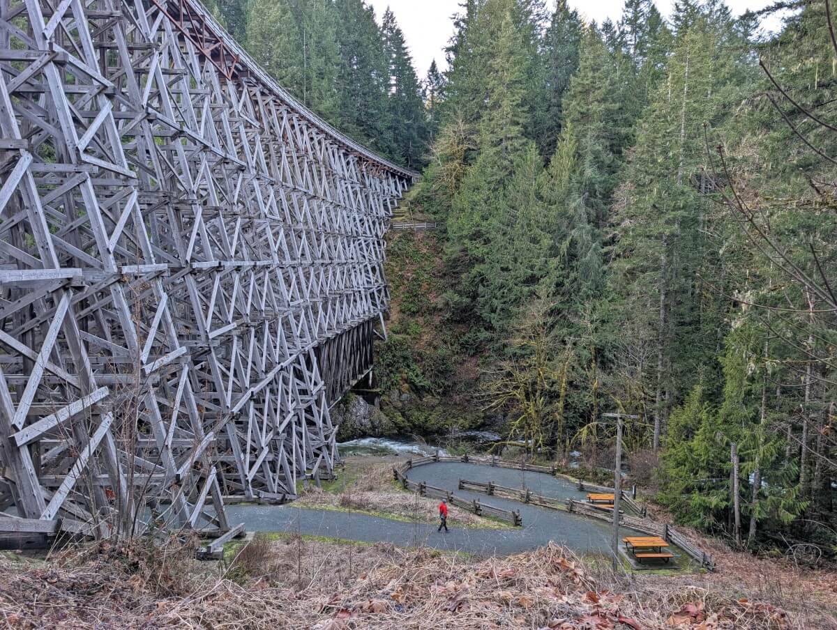
Kinsol Trestle
One of the tallest free-standing timber rail trestle structures in the world, the Kinsol Trestle soars 44m above and 187m across the Koksilah River. This manmade marvel is only 15 minutes drive and a short walk from the Pacific Marine Circle Route.
Built by the Canadian Northern Pacific Railway in the early 20th century, the trestle carried passenger and freight traffic across the river until 1979. It was restored and opened as part of a multi-use trail in 2011.
While the views from the trestle are beautiful, it is the views up to the bridge that are the most impressive. The multi-layered structure is just engineered so beautifully.
The Kinsol Trestle is 1.2km (20-25 minutes) from the south side parking lot. The trail is completely flat and open to cyclists, hikers and equestrians.
The Malahat Highway
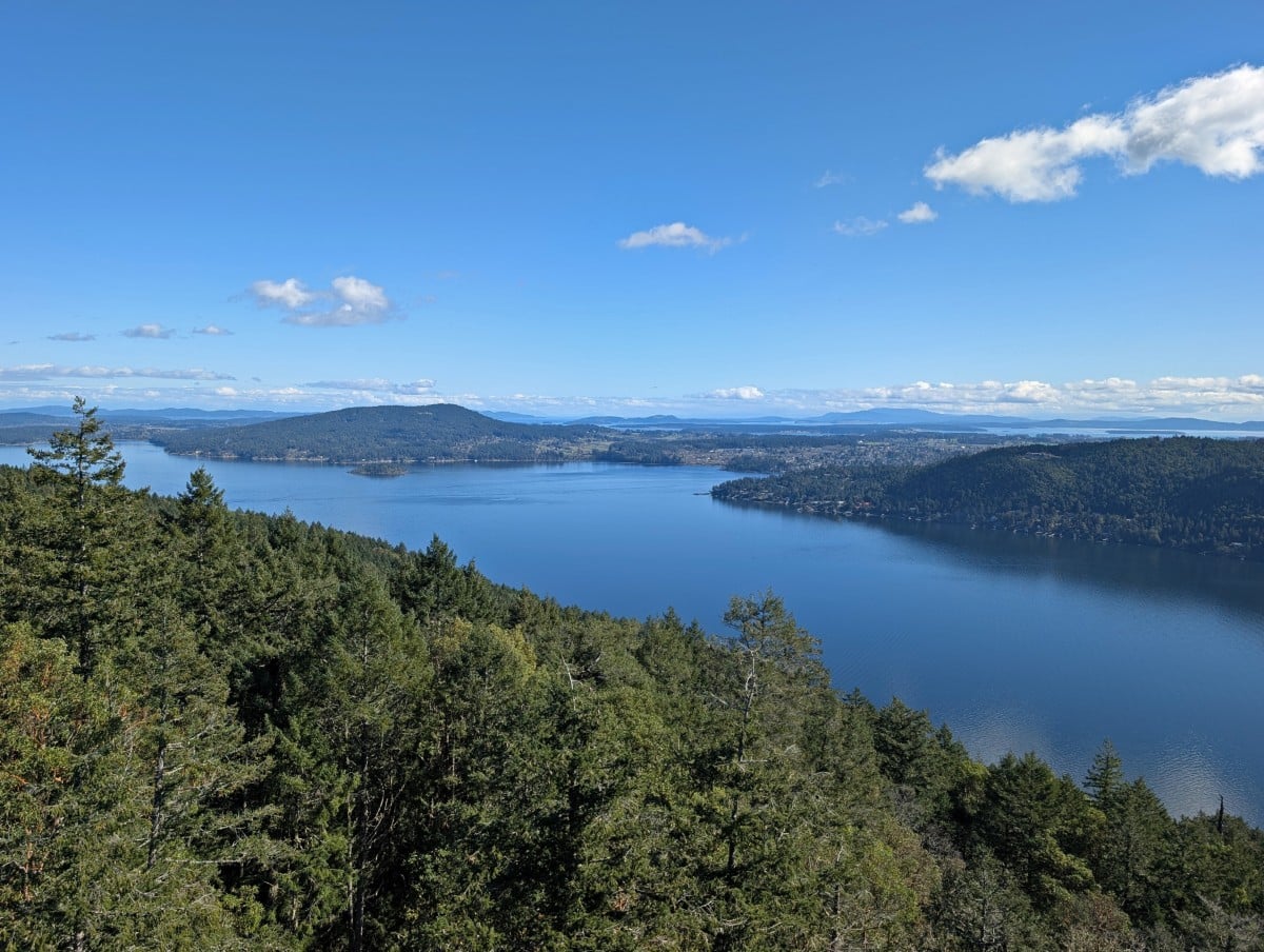
Heading south, Highway 1 climbs and descends the 356m high summit of Malahat Mountain. Named after the local First Nation community, the Malahat is considered one of the most sacred places on southern Vancouver Island.
For drivers, the Malahat section of highway is a winding and steep 25km long journey over rugged mountainsides, through the forest and along steep cliffs.
Several viewpoints (accessible northbound only) provide breathtaking vistas of Saanich Inlet, the Saanich Peninsula, Salt Spring Island and the surrounding Salish Sea.
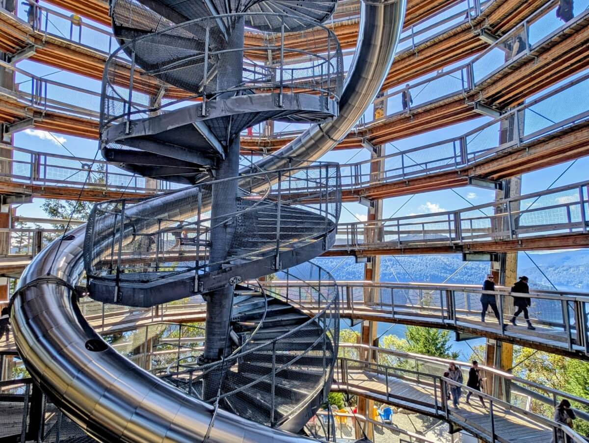
To see the best Malahat views, consider a trip to the Malahat SkyWalk. This sustainably built attraction boasts an elevated treetop boardwalk and 32m tall spiral observation tower with 360 degree lookout. For kids over 5 (and those young at heart), there’s a slide down from the top as well!
The SkyWalk is one of the few paid attractions featured in this guide, and in my view it’s well worth the cost – particularly for families and wheelchair users. Accessibility was clearly a top priority during construction and the views really are fabulous.
Keep in mind that when travelling southbound, you’ll need to follow some U-turn routes to access the SkyWalk (extra 20km or so total). There are no left turns on and off the highway in this area.
Goldstream Provincial Park
Our final recommended stop on the Pacific Circle Marine Route is Goldstream Provincial Park.
Despite being so close to Victoria, Goldstream still feels like a world away. There are massive old growth trees to admire, summits to climb, waterfalls to hike to and spawning salmon to watch (mid October to December).
The challenging hike up to Mount Finlayson offers a good workout, climbing 410m in just 2km. The summit views towards the Langford area are well worth the effort.
If that sounds like too much, I’d suggest a leisurely walk to the Visitor Centre (1.2km return). The trail passes a number of large trees and has some pretty river and inlet views as well. There is a short side trail to 47m high Niagara Falls.
The only downside about Goldstream is that the access to the main day use area is a bit tricky when travelling south. There is a dedicated lane to turn into the park but no lane or traffic lights to help when exiting. It’s much safer to turn right (north) and head 6.5km to the U-turn route.
Suggested road trip itineraries for the Pacific Marine Circle Route
There’s so much to see and do on the Pacific Marine Circle Route; a two or three day road trip is ideal. Here are some itineraries to help with your planning!
Note – I have tried to plan and time these itineraries as best I can. Keep in mind that everyone travels differently and you may spend/more less time at a place than others.
Two day itinerary
Want to see all the best places on the Pacific Marine Circle Route but don’t have a lot of time? This two day itinerary is for you!
Day 1: Victoria to Port Renfrew
From Victoria, head first to Whiffin Spit to walk the natural breakwater and take in the views.
Continue on to Sandcut Beach (via Shirley Delicious for lunch) to see the waterfall.
If you’re comfortable driving down an unpaved road (slowly!), consider Sombrio Beach as your next stop. Walk along the beach to the Hidden Waterfall if you have the time and appropriate footwear.
Your final stop of the day is Botanical Beach. Explore the tidepools before or after checking into your accommodation in Port Renfrew.

Day 2: Port Renfrew to Victoria
Avatar Grove is the first stop today, as long as you’re comfortable driving a few kilometres on an unpaved road. Walk one or both of the short trails here.
Back on Highway 14, pause at the Fairy Lake Bonsai Tree. Make another stop at the Harris Spruce, a little further along the road.
Follow the winding main road to Lake Cowichan. Enjoy lunch here or continue on to Cowichan Bay. An alternative idea would be to head to one of the many wineries/breweries/cideries in the Cowichan Valley area. Some serve food while others allow guests to bring picnics.
Stretch your legs at the Kinsol Trestle near Shawnigan Lake. Return to Highway 1 to drive the Malahat Highway or take the back road.
Please note that there aren’t any accessible viewpoints on the Malahat when driving the PMCR clockwise. If seeing ocean views is a priority for you, consider the Malahat SkyWalk. Of course, you could also drive this itinerary the other way around or double back.
Three day itinerary
Have a little more time? Check out this three day Pacific Marine Circle Route itinerary.
Day 1: Victoria to Port Renfrew
From Victoria, head first to Whiffin Spit to walk the natural breakwater and take in the views. Sooke Potholes is next. Enjoy lunch in Sooke or continue on to Shirley Delicious.
Check out Sheringham Lighthouse before heading to Sandcut Beach see the waterfall.
If you’re comfortable driving down an unpaved road (slowly!), consider Sombrio Beach and the Hidden Waterfall as your next stop (bring appropriate footwear).
Stay overnight in Port Renfrew. If you have time to explore the tidepools at Botanical Beach before or after checking in, I’d suggest doing that. If not, plan to go early on day two.

Day 2: Port Renfrew to the Cowichan Valley
If you haven’t been to Botanical Beach, make an early start and head there this morning.
Next stop is the beautiful trees and trails of Avatar Grove (unpaved road, drive slowly). If you have a high clearance vehicle and are comfortable to explore further, consider continuing on to Big Lonely Doug and Eden Grove.
Back on Highway 14, pause at the Fairy Lake Bonsai Tree. Make another stop at the Harris Spruce, a little further along the road.
Follow the winding main road to Lake Cowichan for a late lunch. If it’s a hot day, make the side trip to Gordon Bay to swim.
Make an afternoon stop in Duncan to see the totem poles before stopping for the night in the Cowichan Valley area or Cowichan Bay. If you have the time, visit one of the local breweries/wineries/cideries for a tasting.
Day 3: Cowichan Bay to Victoria
Not staying in Cowichan Bay? Head there this morning for a look around. Consider a whale watching or kayaking trip. Drop by one of the local breweries/wineries/cideries if you haven’t already.
Stretch your legs at the Kinsol Trestle near Shawnigan Lake. Return to Highway 1 to drive the Malahat Highway or take the back road.
Please note that there aren’t any accessible viewpoints on the Malahat when driving the PMCR clockwise. Of course, you could also drive this itinerary the other way around or double back. The best views in this area are seen from the Malahat SkyWalk.
The final stop on this itinerary is Goldstream Provincial Park. If you have the energy, climb to the top of Mount Finlayson for spectacular views. Alternatively, enjoy some of the flatter trails that lead from the parking area. As mentioned earlier, the main day use area at Goldstream is tricky to exit when travelling south, so plan to take the extra time and find a U-turn route instead.

Four day itinerary
This four day Pacific Marine Circle Route itinerary is aimed at road trippers who want to hike and explore further off the beaten path.
Day 1: Victoria to Sooke area
From Victoria, head first to East Sooke Regional Park and hike part of the Coastal Trail from Aylard Farm. Take a picnic or enjoy a late lunch in Sooke.
Spend the early part of the afternoon at Sooke Potholes. To finish off the day, I would visit Sheringham Point Lighthouse. If you have time, try to fit in Sandcut Beach as well.
If camping, spend the night at French Creek Campground, Jordan River Regional Park or China Beach Campground. Not camping? Backtrack to Sooke.
Day 2: Sooke area to Port Renfrew
Start the day with a hike down to Mystic Beach (if you missed Sheringham Point Lighthouse the day before, head there first).
There isn’t many places to find food in this area, but you could backtrack to the Cold Shoulder Cafe in Jordan River before continuing on.
If you’re comfortable driving down an unpaved road (slowly!), consider Sombrio Beach and the Hidden Waterfall as your next stop (bring appropriate footwear).
Your final stop of the day is Botanical Beach. Explore the tidepools before or after checking into your accommodation in Port Renfrew.

Day 3: Port Renfrew to The Cowichan Valley
Avatar Grove is the first stop today, as long as you’re comfortable driving a few kilometres on an unpaved road. Walk one or both of the short trails here. If you have the vehicle to do it, continue on to Big Lonely Doug and Eden Grove.
Back on Highway 14, pause at the Fairy Lake Bonsai Tree. Make another stop at the Harris Spruce, a little further along the road.
Follow the winding main road to Lake Cowichan for a late lunch. If it’s a hot day, make the side trip to Gordon Bay to swim.
Make an afternoon stop in Duncan to see the totem poles before stopping for the night in the Cowichan Valley area or Cowichan Bay. If you have the time, visit one of the local breweries/wineries/cideries for a tasting.
Day 4: The Cowichan Valley to Victoria
Not staying in Cowichan Bay? Head there this morning for a look around. Consider a whale watching or kayaking trip. Drop by one of the local breweries/wineries/cideries if you haven’t already.
Stretch your legs at the Kinsol Trestle near Shawnigan Lake. Return to Highway 1 to drive the Malahat Highway or take the back road.
Please note that there aren’t any accessible viewpoints on the Malahat when driving the PMCR clockwise. If seeing ocean views is a priority for you, consider the Malahat SkyWalk. Of course, you could also drive this itinerary the other way around or double back.
The final stop on this itinerary is Goldstream Provincial Park. If you have the energy, climb to the top of Mount Finlayson for spectacular views. Alternatively, enjoy some of the flatter trails that lead from the parking area.

Ideas for longer road trips
If you have even more time to spend in this area, here are a few more ideas:
- Consider camping at Sooke Potholes on your first night, enabling you to visit every viewpoint and beach along the scenic canyon
- Spend an extra night in Port Renfrew and take some time to relax next to the ocean
- Hike some of the Juan de Fuca Trail and camp overnight at one of the many backcountry campgrounds, such as Mystic Beach, Sombrio Beach or Bear Beach
- Spend one night at Goldstream Provincial Park and explore more of the trails

Where to stay on the Pacific Marine Circle Route
Here are my top picks for accommodation along the Pacific Marine Circle Route, ordered in a clockwise direction.
- Sooke – Accommodation is on the pricey side here. Salty Towers is one of the more affordable options. If budget isn’t a consideration, don’t miss SookePoint Ocean Cottage Resort
- Port Renfrew – Treat yourself with a stay at Wild Renfrew, where you’ll find private waterfront cottages, some with hot tubs. Wild Coast Wilderness Resort is a nearby alternative
- Cowichan Valley area – One of the most reliable choices in the Valley is the Best Western Cowichan Valley Inn near Duncan
- Cowichan Bay – The best location and best views can be found at Oceanfront Suites, just a short walk from everywhere in Cowichan Bay
- Victoria – The Fairmont Empress Hotel is the most iconic property in the city, just across the water and adjacent to the British Columbia Parliament buildings. A more affordable alternative is the nearby James Bay Inn, a comfortable hotel with heritage features

Campgrounds
Camping is not only cheaper than staying at accommodation, but it also offers more flexibility when it comes to overnight stops while driving the PMCR. Where possible, I’d recommend making a reservation during the summer months.
- French Beach Provincial Park Campground – A good option for campers looking to stay close to Sooke, French Beach Campground is just a short walk to the coast
- Jordan River Regional Campground – Oceanfront camping at rustic campground for only $25/night, with all sites allocated on a first come, first serve system
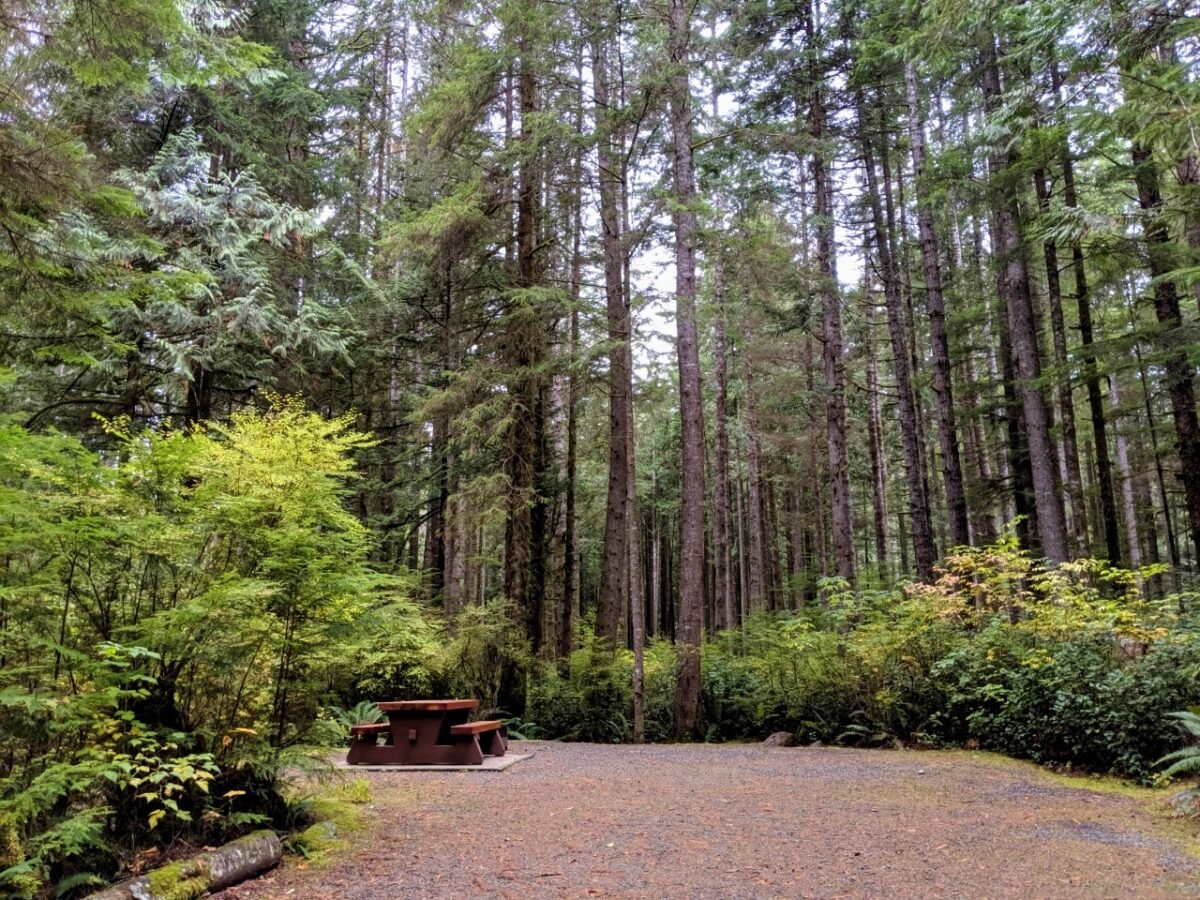
- China Beach Campground, Juan de Fuca Provincial Park – Set into the forest, this well spaced campground is 1km walk from the eponymous beach, where waterfalls cascade from cliffs into the ocean
- Sombrio Beach, Juan de Fuca Provincial Park – Get a taste of the Juan de Fuca Trail with a stay on this remote beach. The parking lot is 500m from the beach, so you’ll carry all of your gear in (no RVs)
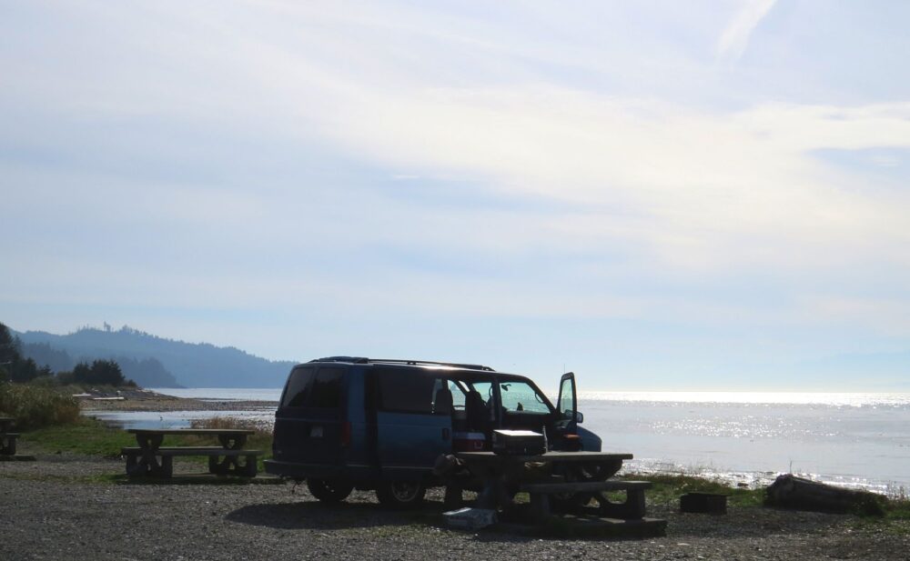
- Pacheedaht Campground – 65+ campsites situated on or just behind a beautiful 2km long sandy beach near Port Renfrew. Reservations can be made online or phone (250) 647-0090
- Fairy Lake Recreation Site – Famous for its ‘bonsai tree’, this paid Recreation Site is very close to Port Renfrew and has a sandy beach and 36 campsites
- Gordon Bay Provincial Park Campground – While a short detour from the main PMCR route, this campground is a good choice for road trippers wanting to swim and/or paddle on Cowichan Lake
- Stoltz Pool Campground, Cowichan River Provincial Park – The closest provincial campground to the Cowichan Valley, Stolz Pool is situated by a calming river
- Goldstream Provincial Park Campground: This very popular campground has short and long hiking trails leading to the day use areas of the park
Other resources you may find helpful to plan your Vancouver Island adventure:
23+of the Best Things to Do in Courtenay
Nanaimo to Tofino Road Trip Guide: 15 Amazing Places to Stop
25+ Amazing Vancouver Island Waterfalls You Must Visit
Where to Find Big Trees on Vancouver Island
22+ of the Best Campgrounds on Vancouver Island, BC
Ultimate 2 Week Western Canada Road Trip from Vancouver: Itinerary, Tips & Map


One half of the Canadian/British couple behind Off Track Travel, Gemma is happiest when hiking on the trail or planning the next big travel adventure. JR and Gemma are currently based in the beautiful Okanagan Valley, British Columbia, Canada. Consider buying us a coffee if you have find any of our guides helpful!