Featuring more than 2000 lakes and 500 portages, Quetico Provincial Park is a canoe tripping paradise.
Paddlers have the freedom to plan their own route through 1.2 million acres of wilderness, choosing a trip length and preferred style to suit, camping at 2,200+ rustic campsites along the way.

If the size of the park is hard to imagine, think of Prince Edward Island – this entire province almost fits into Quetico!
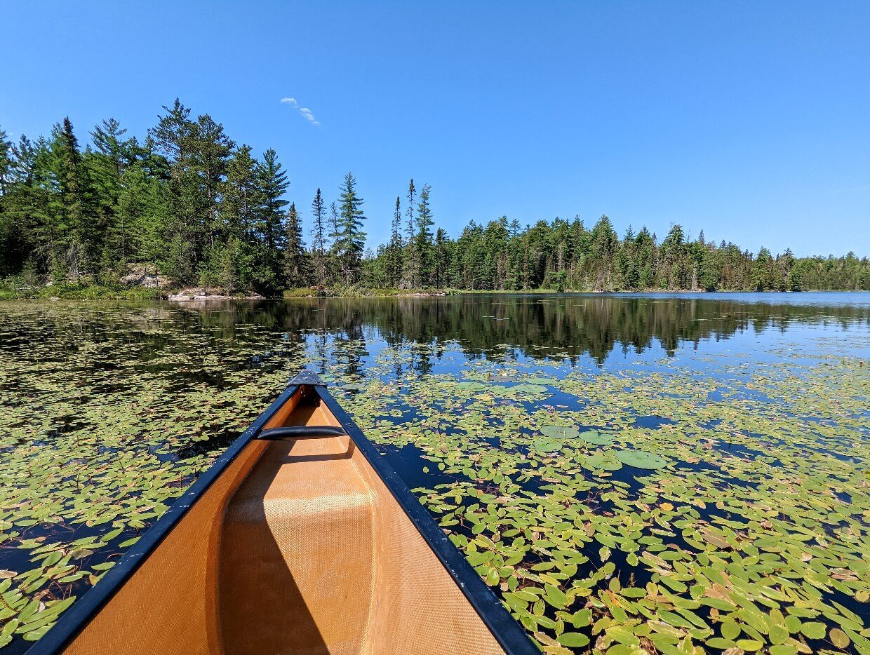
Canoeing doesn’t get much better – think picture picture lakes, preserved pine forest, cascading waterfalls, towering cliffs, wildlife sightings, excellent fishing and warm swimming.
And that’s not all. As an International Dark Sky Park, the starry nights here are some of the best in the world. This is a place to truly lose yourself in nature.

And it’s easy to do – while Quetico is legendary in the canoeing world, it’s still not busy. Expect to camp without another soul in sight or hearing distance. You may even have a lake (or three) to yourself.
This is a place where you really can ‘choose your own adventure.’ Do as much or as little as you like and you’ll still experience that Quetico magic.
In this post, I’ll tell you all about our own recent canoe tripping experience in the park and then share everything you need to know to plan your own Quetico canoe trip!
Here’s what to expect:
We visited Quetico Provincial Park in partnership with Ontario Parks.
This post includes some affiliate links. If you make a purchase via these links, we may receive a small percentage of the sale.
Backcountry necessities
- Always bring the 10 Essentials
- Know how to stay safe in the backcountry
- Remember to Leave No Trace to help keep the wilderness wild
- Understand how to avoid negative bear encounters
- Recommended gear is listed on our Shop page
- Check out our packing guide with gear recommendations
- Sign up to our newsletter for a free paddling checklist

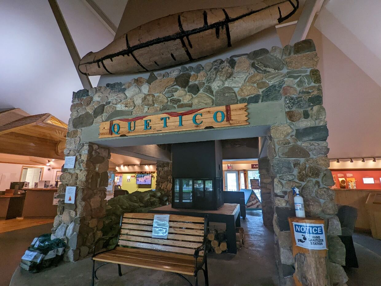
Introducing Quetico Provincial Park
Quetico Provincial Park is a protected area located in Northwest Ontario. The nearest city is Thunder Bay, two hours drive to the east (160km).
Best explored by canoe, Quetico features 460,000 ha of remote backcountry.
And it doesn’t stop there – the park borders the Boundary Waters Canoe Area in Minnesota, forming the largest international recreation area of its kind anywhere in the world.
While the park may feel like pristine wilderness, paddlers are stepping into the footsteps (or, indeed, paddle strokes) of many who have gone before.

Land of the Anishinaabe
Indigenous people have lived in this area for time immemorial. Quetico is located on Treaty 3 land, home of the Anishinaabe Nation.
The name of the park comes from the Ojibwe word, ‘Gwetaming,’ which describes a living spirit that inhabits beautiful places. Many lake names also reflect Ojibwe heritage, such as Batchewaung.
28 known pictographs adorn a number of cliffs faces across Quetico, most likely painted by people standing in canoes. Some may be thousands of years old.
Common pictographs include animals (moose, caribou), handprints, human figures, spirits (such as Mishipeshu) and abstract symbols.
French Canadian fur traders utilised Quetico’s waterways in the 18th and 19th centuries. Many lakes retain names given by the Voyageurs, such as Doré Lake, Lac la Croix and Maligne.
Wildlife and dark skies
Quetico became a provincial park in 1913. As well as being a top destination for wilderness canoeing, it’s also a sanctuary for hundreds of animal species.
Beavers, loons, frogs, snapping turtles and swans swim the lakes, with moose, deer and black bear roam the forests.
Free from light pollution, Quetico’s night skies are simply wonderous. So much so, that the park was was awarded International Dark Sky certification in February 2021.
That year continued to be eventful, with hot and dry weather conditions in summer sparking 35 wildfires.
Around 14% of Quetico’s total land area burned, forcing a temporary closure of the backcountry. Fire damage is visible today, with the biggest concentration in the south central area of the park.
Read Next: Highway 17 Road Trip: 10 of the Best Ontario Parks

Our Quetico canoe trip experience
Before getting into the paddling guide, I’m going to share an overview of our own Quetico canoe trip in late July/early August 2022. If you like, you can skip to the paddling guide by clicking here.
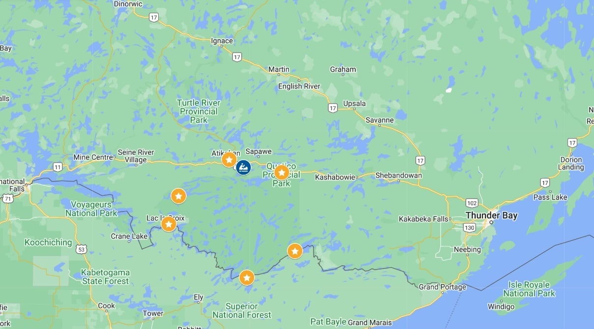
We explored the northern section of Quetico Provincial Park on a six and a half day, six night trip with a canoe rental from Canoe Canada Outfitters.
Starting and finishing at the Nym Lake access point, we paddled 120km (14 lakes) and portaged 7.3km (16 portages).
Our complete loop route was: Nym Lake, Batchewaung Lake, McAlpine Lake, Kasakokwog Lake, Quetico Lake, Conk Lake, Jean Lake, Little Jean Lake, Yeh Lake, Lonely Lake, Walter Lake, Elizabeth Lake, Jesse Lake, Maria Lake, Batchewaung Bay, Batchewaung Lake, Nym Lake.

Day 1 – Nym Lake to McAlpine Lake
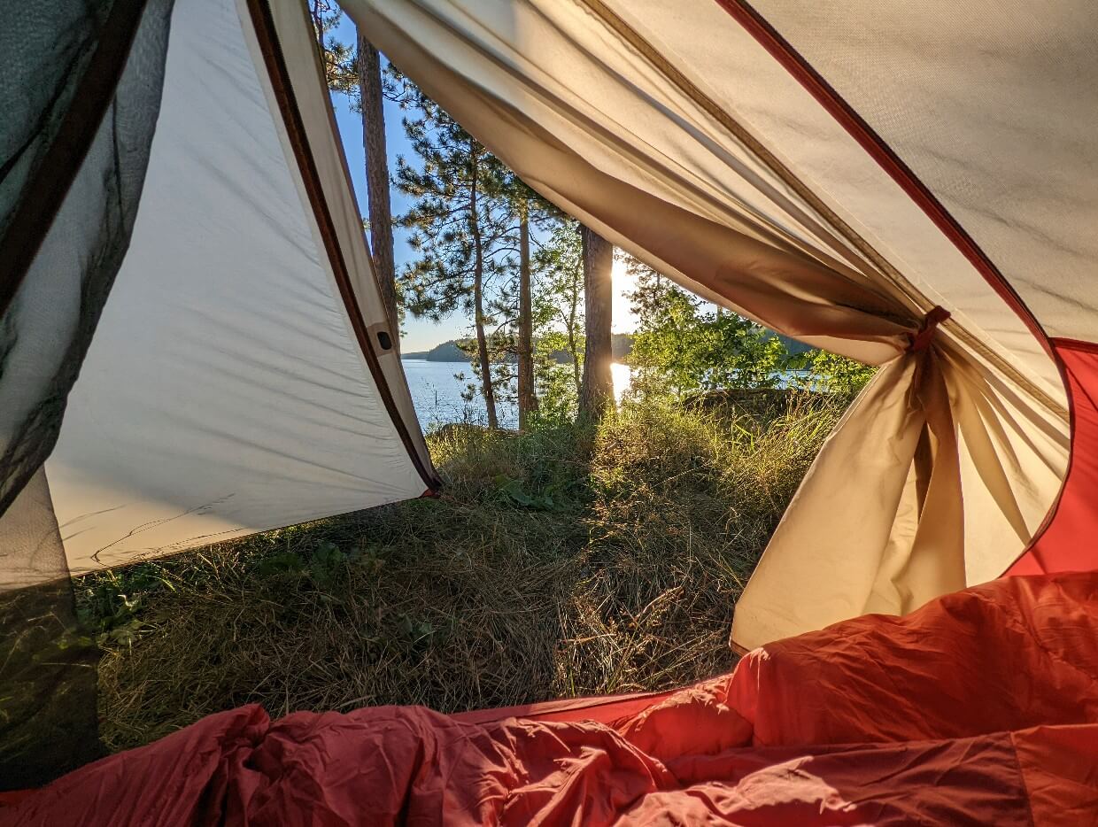
Bouncy waves greeted us at the Nym Lake launch as we started our long awaited Quetico canoe trip. The wind was against us, but the sun was not, shining bright and hot with cloudless blue skies.
A few steps into the 830m portage to Batchewaung Lake and we reached the Quetico park boundary. The portage route was a little muddy and consequently a touch buggy.
Batchewaung Lake was also windy, but things improved as we escaped into a side channel on the west hand side.

Though still technically on a large lake, it didn’t feel like it. We had 10km of glorious (but still bumpy) paddling along intricate bays and around jutting peninsulas before reaching the next portage.
The route to McAlpine Lake was less used and also a bit muddy/buggy. The blast of wind on the other side was refreshing after the heat of the forest.
With time getting on, we decided it was time to stop. The forecast looked pretty mixed and I wanted to enjoy the sun while we had it. The rest of the afternoon was dreamy, with a bit of fishing, some swimming and plenty of sunbathing.

Day 2 – McAlpine Lake to Quetico Lake
The weather forecast had us braced for rain all day. As it was, we only had a few downpours. And better still, no wind!
McAlpine Lake narrowed all the way down to a creek. A beaver dam crossing followed the portage, one of many impressive such dams in the area.
Kasakokwog Lake seemed pleasant through the rain, with gorgeous reflections on show. To access the portage at the end, we had to line the canoe along the creek, a fun and unexpected moving water moment.

I was happy to arrive on Quetico Lake, knowing that we had almost 30km of uninterrupted paddling ahead of us. We wouldn’t have to portage for quite a while!
Huge cliffs led the way to our campsite, where we enjoyed a gorgeous sunset and some semi-successful fishing.

Day 3 – Quetico Lake to Jean Lake
If day one was a little too hot and windy and day two a touch too wet, day three was just right!
This was our favourite day on the entire trip – we enjoyed beautiful blue skies all day, calm lake conditions, long stretches of paddling and two pictograph sites (no photos allowed)!
We caught up with some other paddlers at the end of Quetico Lake but lost them as we portaged to Jean Lake via Conk Lake. The first portage started right next to a beautiful waterfall, with additional cascades further upriver.
The first two campsites we tried were already occupied, but an even better spot awaited just behind the narrows. Largemouth bass was on the menu for dinner, a tasty end to an almost perfect paddling day.
The mosquitoes that night were positively ferocious, their buzzing almost drowning out our route plan discussion in the tent.
We needed to decide whether to continue on the longer route via Sturgeon Lake or take the shorter route via Lonely Lake. Wanting to spend more time on smaller lakes (and potentially have a rest day), we chose the latter.

Day 4 – Jean Lake to Lonely Lake
At first, it seemed like we had made the right choice regarding our trip route.
Little Jean Lake was filled with wildlife, namely swans and turtles. Conditions were calm again, so we took some time to explore some intricate bays.
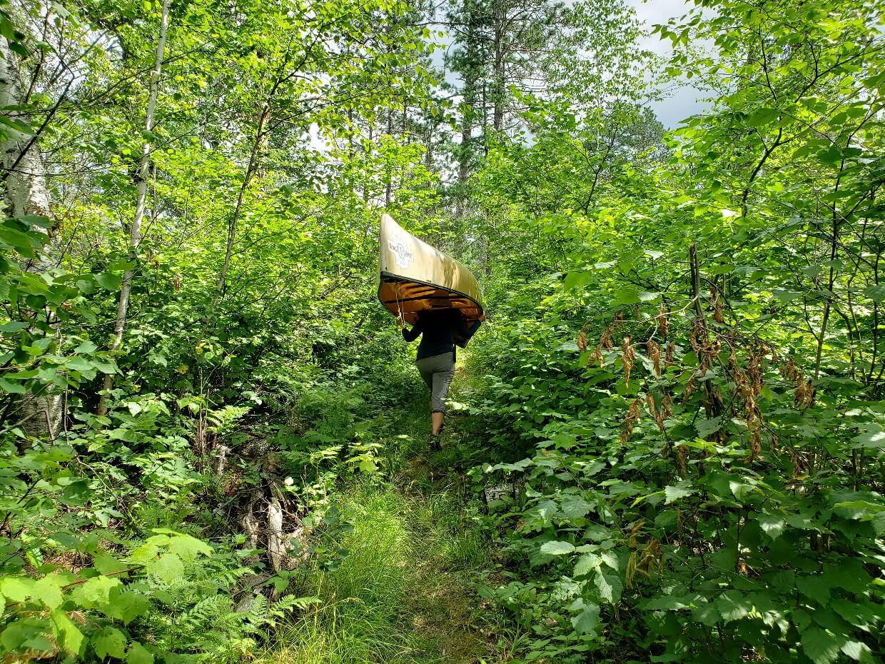
The first portage to Yeh Lake (20m) was over very quickly, as was the short paddle across to the next. And then things went downhill.
We knew the portage to Lonely Lake had not been maintained yet but we had no idea how bad it would be. Devastated by fire and wind, our path was obscured by dozens of downed trees.

JR sawed and axed his way through but we still had to climb over and under many trees, with 30lb on our backs. The second half of the trail wasn’t even decipherable, with the path completely hidden.
It took us one hour and twenty minutes to reach the end of that 1.38km long portage, more than three times what it should have done. And then we had to go back and do it again (unfortunately, we were double portaging).
Feeling exhausted, we nixed the idea of a rest day and stopped on Lonely Lake to tend to our scratches and recover.

Day 5 – Lonely Lake to Jesse Lake
Putting the memory of the last portage aside, we tried to focus on the paddle ahead.
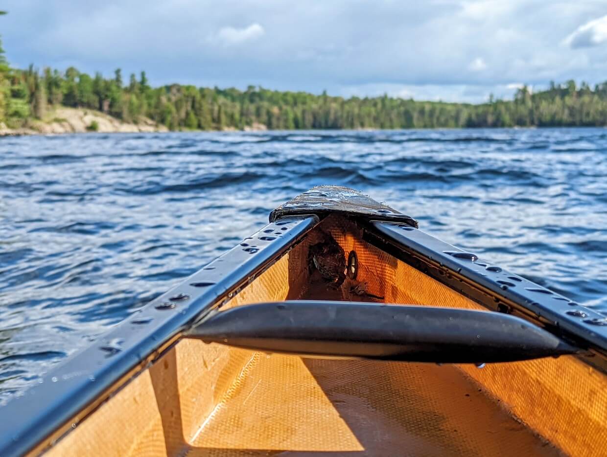
I was, however, a little distracted by a dark shape near the bow of the canoe. It was windy, but at least in our favour, so I kept watching this strange dark shape as I paddled.
Half way along Lonely Lake, the ‘dark shape’ suddenly moved and revealed itself to be a toad! He took us a ride with us all the way to end of the lake, where he promptly hopped out and hid under a rock.
On Walter Lake, the wind turned and we fought white caps all the way across. Elizabeth Lake, on the other side of another portage, was a little calmer, as was Jesse Lake, our final destination.
We’d been advised that Jesse had some of the best fishing in the park and it definitely delivered! We shared two Walleye for dinner, with baked potatoes fresh from the fire. Canoe tripping at its best!
Jesse was a wonderful spot to stay overnight – so many little islands and bays, plenty of campsites and still very quiet. Although our plan for a more relaxed trip hadn’t really worked out, I was still glad we made the decision to detour to Jesse.

Day 6 – Jesse Lake to Batchewaung Lake
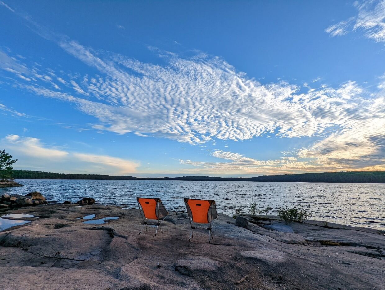
Our last full day in Quetico was an easy one to enjoy. Blue skies, calm conditions and only two relatively short portages! We took our time, making the most of our remaining time in the park.
We saw quite a few people padding that day, including some big family groups. I can understand why – you could paddle for days in the Batchewaung Bay/Pickerel Lake area without doing a single portage.

We had hoped to camp at the end of a peninsula on Batchewaung Lake, to limit the paddling distance on our last day. Sadly, it was already taken, but we found an alternative spot on the shore opposite.
Located within hearing distance to a waterfall, the new campsite offered some excellent fishing. It was sad to watch the sun go down on our last night in the park, but all good things must end.

Day 7 – Batchewaung Lake to Nym LAke
Sleeping without our tent fly, we both woke early – the best natural alarm clock! The wind was against us as we paddled towards our last portage. The waves grew even bigger on Nym Lake.
In our hurry to finish, we overshot the launch and had to fight the waves to get back. It was a bit of a dramatic ending to an otherwise (mostly) mellow and relaxing adventure.
Quetico was everything we hoped for and more. Next time (and there will be a next time), I would love to disappear for a few weeks or more.

Quetico canoe trip planning guide
Inspired to plan a Quetico canoe trip? This section will help you prepare for your Quetico adventure. It includes an overview of the park, route planning advice, reservation details and essential gear recommendations.
Location: Quetico Park map
Quetico Provincial Park is situated in northwestern Ontario, Canada. It is just less than two hours drive west of Thunder Bay, accessible from Highway 11.
Most of the park is backcountry wilderness but there is a day use area at Dawson Trail Campground, with hiking trails and lake access as well as two frontcountry campgrounds.
The nearest town is Atikokan, about 30 minutes from Dawson Trail Campground. The current population of the ‘Canoeing Capital of Canada’ sits at 2,600.
The southern side of Quetico borders the Boundary Waters Canoe Area Wilderness in Minnesota.
The nearest land border crossing is located at Fort Frances/International Falls, about two hours drive from the park.
How to get to Quetico Provincial Park
Most visitors arrive to Quetico by road. As mentioned above, the park is located two hours drive west of Thunder Bay. The city of Winnipeg (Manitoba) is six hours and a half hours drive to the northeast.
Though Quetico’s location may seem remote, it’s actually more accessible than you may think.
It is possible to fly to Thunder Bay from Toronto, with connections to many other cities in Canada. Some canoe outfitters offer shuttles from Thunder Bay airport.
Side note – if you have some extra time in the Thunder Bay area, I’d highly recommend a hike on the beautiful Top of the Giant Trail in Sleeping Giant Provincial Park or checking out all of these other great things to do.

Quetico is a popular destination for American paddlers too. The Fort Frances/International Falls border (Minnesota) is only two hours drive west of Dawson Trail Campground.
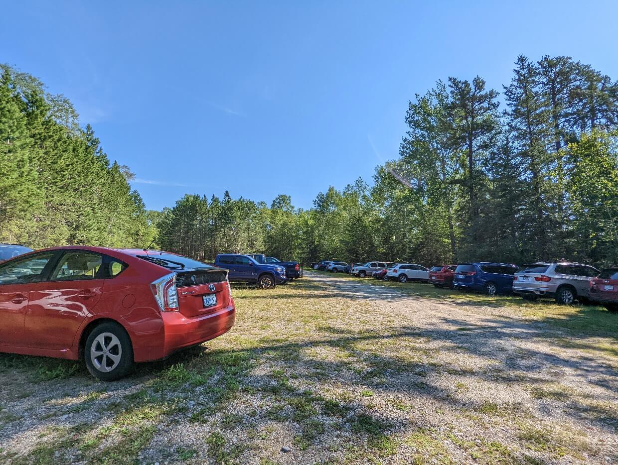
We saw plenty of Minnesota plates on vehicles parked at our launch point at Nym Lake (as well as California, Illinois and Wisconsin).
It is also possible to reach Quetico by canoe, from Boundary Waters Canoe Area Wilderness (BWCAW). To do so, a CANPASS Remote Area Border Crossing Permit must be organised in advance. Please note that this option is available for Canadian and American citizens and permanent residents only.
When to go paddling in Quetico Provincial Park
The Quetico paddling season runs from Victoria Day long weekend (third week of May) to the Thanksgiving long weekend (usually the second weekend of October).
The lakes thaw in mid to late May, with the ice-free date changing each year.
June is an ideal month for fishing but is also the time when blackflies and mosquitoes are most prevalent. Reservations are less competitive at this time.

Peak season is July and August. Early July is similar to June, but with more paddlers and warmer weather. The bugs usually reduce as the month goes on and the fishing is still good.
August is the busiest month in Quetico, with the warmest weather and a low amount of bugs. Fishing is still possible. Reservations are in highest demand so be sure to book early.
The first weekend in September is busy (Labour Day holiday). After this, the park becomes quieter. Enjoy pleasant weather, fewer visitors, great fishing and very few mosquitoes.

Planning a Quetico canoe trip route
Quetico offers true paddling freedom, with an infinite number of potential canoe trip routes.
Loops are popular, with the chance to see something different every day. It is also possible to arrange a shuttle with an outfitter to start at one access point and exit at another.
For a relaxing canoe trip, plan for 15km or less a day, with at least one rest day. Paddlers looking for a faster paced trip may plan to paddle 20km/day or more and change campsites every day.
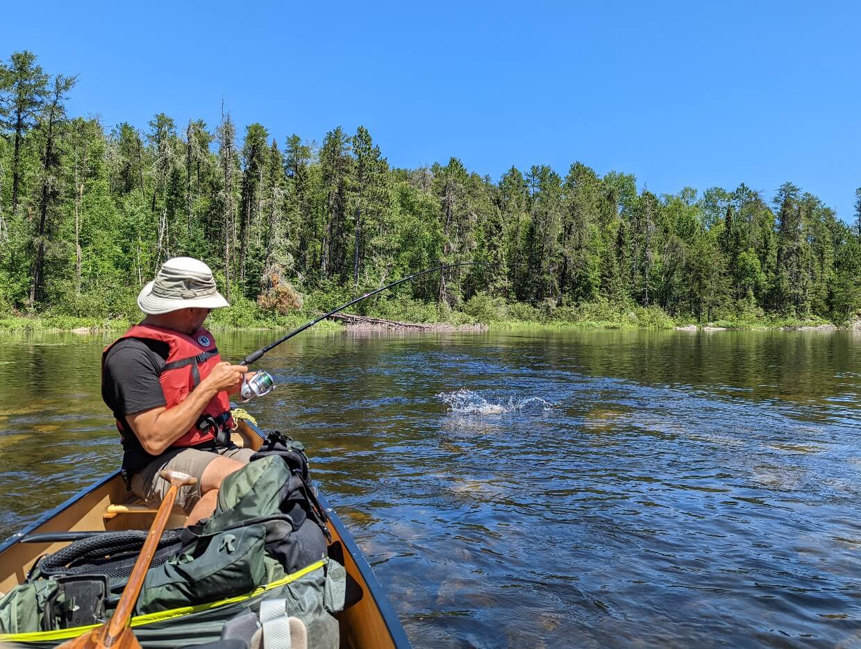
Fishing is generally good everywhere, but some lakes are more dependable than others. We really liked Jesse Lake and heard it is a favourite of many anglers.
Seeing some pictographs was a priority for us, a factor that influenced our route. We observed two sets of pictographs on Quetico Lake.
Don’t like to portage? No problem! There are multiple options for portage-free routes.
When it comes to trip length, more time is always preferable but there are plenty of shorter loops and routes (3-4 days) available. Personally, I’d recommend spending a week in the park, if not longer.
Quetico canoe trip planning resources
To start planning your route, first purchase a detailed map. We used Chrismar’s Adventure Map, the official map of Quetico Provincial Park. Then consult the Ontario Parks website for some route ideas.
Kevin Callen’s A Paddler’s Guide to Quetico and Beyond includes some route maps. Canoe outfitter websites, such as Quetico Outfitters, can also offer inspiration. Canoeing.com lists some popular routes as well.
If planning last minute, I’d suggest using the Ontario Parks’ portage maintenance map as a starting point.
Quetico portages: what to expect
According to the Quetico Foundation, there are exactly 587 portages in Quetico Provincial Park. 50% of these are shorter than 254m.
It is important to note that, like campsites, portages are not signed in Quetico.
We personally completed 15 different portages on our northern park loop during our late July/early August 2022 trip.
On the whole, we found that portages were relatively easy to locate with the use of a map. A couple were less obvious and we had to get pretty close (almost onshore) to confirm. Changing water levels can make finding some portages more difficult from year to year.
The portages we visited were almost always a mix of dirt trail and rock, with some small ascents and descents. Only a few were completely flat.
On most portages, we had to step over smaller fallen trees or push back brush/branches. Mud was pretty common as well.
One thing that did surprise me is that we saw no canoe rests along any of the 15 different portages we completed. So be prepared to find your own place to stop if needed.

Portage maintenance
Ontario Parks publishes a portage maintenance map, which is regularly updated during the summer.
If a trail has been maintained, it means that major tree obstacles have been removed. Of course, conditions can change suddenly due to wind, storms and wildfire.
We completed 15 portages during our late July/early August trip, with only two being unmaintained at the time.
Heavily damaged by fire, the unmaintained portage between Yeh Lake and Lonely Lake took us four times longer to complete than it usually would have.
Many trees had fallen over the established path, making it both difficult to follow and physically challenging to complete.

Quetico canoe rentals
A number of canoe outfitters service Quetico Provincial Park. We rented a canoe from Canoe Canada Outfitters, who have been operating since 1974.
As well as rentals, the company offers complete and partial outfitting packages. These can include camping gear, permits, mapping, float plane flights, food, shuttles and more.
Canoe Canada Outfitters provided us with a Quetico 17 Kevlar canoe, made by Souris River Canoes in Atikokan (i.e. just outside the park boundary!) It was shuttled directly to the Nym Lake launch and then picked up after we finished.
Weighing in at 44lbs, portaging was, relatively speaking, a breeze with this canoe. It also handled very well on windy lakes.
We’ve tried a lot of canoes over the years but the Quetico 17 really stood out. Watch this space, we may be adding one to our fleet of boats in the near future!

Quetico Provincial Park permits and fees
A permit is required to camp in the backcountry of Quetico Provincial Park. The permit displays the designated access point as well as the number of people in the permitted group and number of paid nights.
Quetico’s backcountry is accessible via 23 different access points. There is a limited number of paddlers allowed to launch at each access point every day. For that reason, permit reservations are recommended (see below for more details).

Each access point is controlled by one of six designated ranger stations:
- Beaverhouse
- Atikokan
- Dawson Trail Campground
- Lac La Croix
- Prairie Portage
- Cache Bay
Camping permits must be picked up in person at the designated ranger station.
Be sure to allocate at least 20 minutes to pick up the permit as you will be asked to confirm your route details and then complete a short park orientation. The latter includes safety information and advice.
Backcountry camping fees are charged on a per person, per night basis. In 2022, the rates were $14.97CAD for adults and $6.50CAD for children (age 6 to 17) Prices include taxes. Maximum group size is 9.
Quetico canoe trip reservations
Reservations are highly recommended to secure your preferred start date and entry point.
Dates are available five months in advance. So if you’d like to start a trip on 6th August, availability will open on 6th March.
Reservations are available online or by phone (1-888-668-7275). In 2022, online reservation fees were $11.00CAD, including tax. Additional fees apply for cancellations and changes. It is also possible to organise a reservation through an outfitter.

To book online, head to the Ontario Parks reservation website. Select the ‘Backcountry’ tab then click the circle next to ‘Quetico’ then ‘Quetico’ from the dropbox below. Choose your arrival and departure dates and party size.
On the next screen, select ‘Quetico Backcountry’ on the top left corner of the map. Then, choose your entry access point.
There are 23 different access points in Quetico, so it’s important to have an idea of your desired route before making a reservation.

Quetico Provincial Park camping
There are more than 2000 wilderness campsites located in the backcountry of Quetico Provincial Park.
Located across 600 different lakes, these campsites do not have formal facilities. Expect a flat space for a tent or two and an established rock firepit. There may also be logs close to the fire pit, to act as seating. Some campsites have room for three or four tents.
Please note that there are no outhouses at the campsites, so paddlers must practice Leave No Trace and dispose of waste properly.
All campsites are available on a first come, first serve system. Upon entering the park, paddlers can camp at any campsite on any lake.
The maximum number of people at any one site is 9. Campers should pack out everything they bring. Only deadfall should be used for fires.

Finding campsites
Good campsites are found, not made in Quetico. Paddlers are encouraged to use the established sites to reduce impact on the landscape.
To preserve the wilderness nature of Quetico, campsites are not signed. There are, however, many sites noted on the Paddle Planner website. Outfitters can also mark recommended sites on maps.
In our experience, we found most campsites to be located on peninsulas and points, with rock access. A gap in the trees was usually a good sign, with an established rock fire pit a confirmation.
When looking for camping, we first headed to the sites suggested by Canoe Canada Oufitters (who we rented a canoe from). On three occasions, the campsites were already full. We found alternatives within 30 minutes.

Quetico canoe trip: advice and tips
- When choosing a tent spot, be sure to look up. We often found ‘widowmaker’ trees (featuring dead or loose branches) right above ideal tent sites
- Cans and glass bottles are not allowed in backcountry areas of the park – adjust your drinking habits as required!
- Do not touch or take photographs of pictographs – they are spiritually sacred to the Anishinaabe People
- When heading to a recommended campsite, look out for alternatives on the way, in case it is already occupied
- Always leave campsites better than you found them – pack out your own trash and pick up any you do see
- Dogs are allowed in Quetico’s backcountry but should be kept on a leash and picked up after
- To prepare for your trip, consider purchasing A Paddler’s Guide to Quetico and Beyond by Kevin Callen. It’s filled with route maps and practical trip advice
- If you’ve already been to Quetico, how about trying Wabakimi Provincial Park? It’s in a similar area of Ontario – 3 hours north of Thunder Bay

Essential items to bring on a Quetico canoe trip
- Bring a good map. We used Chrismar’s Adventure Map, the official map of Quetico Provincial Park. Purchase online, at a local outfitter or one of the ranger stations
- Our Eureka NoBugZone CT11 tarp shelter proved invaluable on our late July/early August trip. We would have spent a lot less time outside of our tent without it as the mosquitoes were plentiful and turned ferocious after sunset
- Consider bringing a head net or bug jacket to protect against mosquitoes and blackflies, especially if paddling early in the season (May, June, early July)
- Planning to fish? Be sure to have a valid Ontario fishing licence and Outdoors Card. Quetico is located in Zone 5. Regulations require barbless hooks and artificial bait only
- There is zero phone signal in most of the park. Bring a satellite device for communication and emergencies
- There are no outhouses in Quetico’s backcountry. A small trowel will make light work of digging a 6 inch cathole
- If cooking on the fire is important to you, bring a camp grill. Fire pits at campsites are made of rock
- Plan to filter all of your water while paddling in Quetico. We used the BeFree filter

Check out these other paddling posts next:
Bowron Lake Canoe Circuit: Complete Paddling Guide
7 Canadian Canoe Trips That Should Be On Your Bucket List
Maligne Lake: Complete Camping and Paddling Guide
Kejimkujik National Park: Complete Paddling Guide
17 of the Best Canoe Trips in British Columbia
Murtle Lake, Wells Gray Provincial Park: Complete Paddling Guide
Algonquin Provincial Park: Overview Paddling Guide

One half of the Canadian/British couple behind Off Track Travel, Gemma is happiest when hiking on the trail or planning the next big travel adventure. JR and Gemma are currently based in the beautiful Okanagan Valley, British Columbia, Canada. Consider buying us a coffee if you have find any of our guides helpful!
Excellent write up. We did this exact route but in the opposite direction going down to Sturgeon. Last summer’s burn is heartbreaking to see. Thank god the beach campsite on lower Sturgeon was spared.
Thanks Steve! Yes, wildfire is always sad to see. I hope you still enjoy future trips to Quetico.