Crossing Canada is the road trip of a lifetime. More than 2000km of this epic journey takes place in Ontario. One of the most scenic (and direct) routes across Ontario is Highway 17, part of the Trans Canada.
The road through the Canadian Shield hugs the spectacular shores of Lake Superior and Lake Huron before turning inland and paralleling Algonquin Provincial Park. Highway 417 then continues beyond Ottawa to the Quebec border.

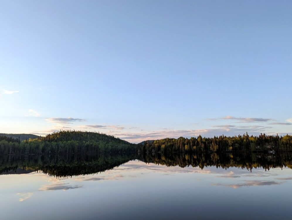
To see the best of Ontario’s natural beauty as you travel, plan to stop at provincial parks. More than two dozen Ontario Parks are situated on or very close to Highway 17.
These parks are the gateway to huge, cascading waterfalls, peaceful forests, pristine lakes and sweeping beaches. Each park is unique, showcasing diverse natural beauty and sharing important cultural connections.

Best of all, most parks host large, well organised campgrounds featuring affordable, private campsites with access to all of the necessary amenities after a long day on the road.
We recently drove from British Columbia to Nova Scotia (and back), visiting as many Ontario Parks alongside Highway 17 as we could.
I’ll be sharing details of 10 parks in east-to-west order, from the Quebec border to Manitoba. For the record, Pancake Bay was our favourite, with Rainbow Falls a close second.
Time to start planning your Highway 17 road trip across Ontario! The below map should help you get orientated.

Please note
Published August 2022. This post is in partnership with Ontario Parks.
There is one affiliate link contained in the text below. If you make a purchase via this link, we may receive a small percentage of the sale at no extra cost to you.
Indigenous people have lived on these lands for time immemorial. Today, the Anishinabek Nation represents 39 First Nations across this region of Ontario. These parks are located on treaty lands – 3, 60, 61, 27 and 57.

Voyageur Provincial Park
Situated right on the border with Quebec, Voyageur Provincial Park provides a quick escape for residents of Ottawa and Montreal (1 hour in either direction) as well as Highway 17 road trippers.
Despite that convenience, we found the Iroquiois Campground surprisingly quiet during our mid week visit in late July. Indeed, we saw more wild turkeys near our campsite than people!

Voyageur backs onto the peaceful Ottawa River, with four different beach areas. The largest hosts the Park Store, which also serves ice cream and hot food.
Swimming, fishing and paddling are the most popular activities in this park. I can confirm that the water was fairly warm mid-summer!
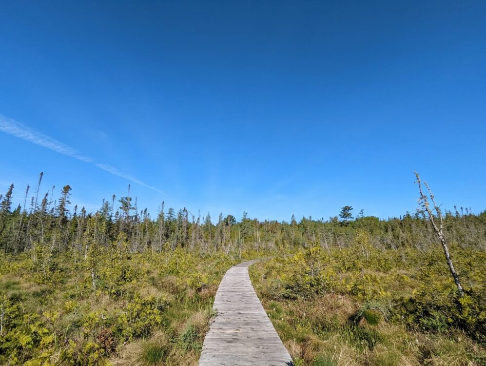
There’s a couple of short hiking trails as well. The Coureur des Bois Trail is an easy 1.5km loop that winds through the forest before skirting a marsh. Keep your eyes peeled for wildlife!
Number of campsites: 416
Number of campsites with electricity: 150
Roofed accommodation: None
Facilities: Showers, laundry, flush toilets, trailer sanitation station, boat launches, playground
Activities: Beaches, hiking, fishing, canoe rentals

Samuel de Champlain Provincial Park
Samuel de Champlain Provincial Park offers all the charm and beauty of Algonquin (think pristine lakes, forest and rivers) but with far fewer people.
And just as Algonquin is a favourite in fall, Samuel de Champlain shines at that time of year too, with stunning autumn colours (we plan to go back one day!)
The Mattawa River borders the park to the north, an important travel route for thousands of years. The Anishinabek used birch bark canoes, a style that was later copied by fur trading Voyageurs in the 18th and 19th centuries.
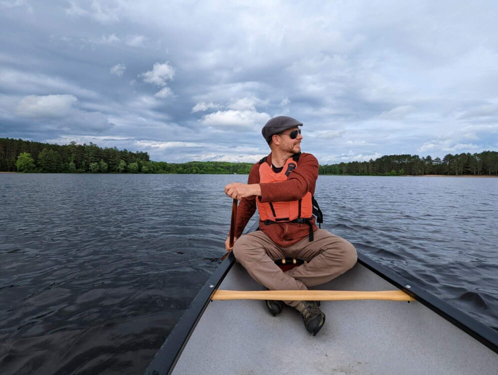
A 38ft Voyageur Canôt d’maitre is on display in the park’s visitor centre. In July and August, visitors have the chance to paddle a Voyageur canoe on a guided tour. Smaller rental canoes are also available for independent exploration.
The mosquitoes and blackflies were a little feisty during our early June visit, so I’d recommend bringing a bug tent if you’re tent camping here at that time (we used this one).
Number of campsites: 208
Number of campsites with electricity: 104*
Roofed accommodation: None
Facilities: Showers, laundry, flush toilets, trailer sanitation station, boat launches, playground
Activities: Beaches, hiking, fishing, canoe and kayak rentals, visitor centre with exhibits
*Please note that at the time of writing, all campsites at Samuel de Champlain are non-electrical. See the park’s alert page for more details

Chutes Provincial Park
Technically, Chutes Provincial Park is named for impressively long wooden log flume that once flowed here and not for waterfalls.
But it is the cascades that are the highlight today, with multiple rapids along the Aux Sables River culminating at a powerful waterfall above the park’s day use beach.
The Aux Sables was once used to transport many thousands of logs from forest to mill between the late 1800s and early 19th century. No roads existed at this time.
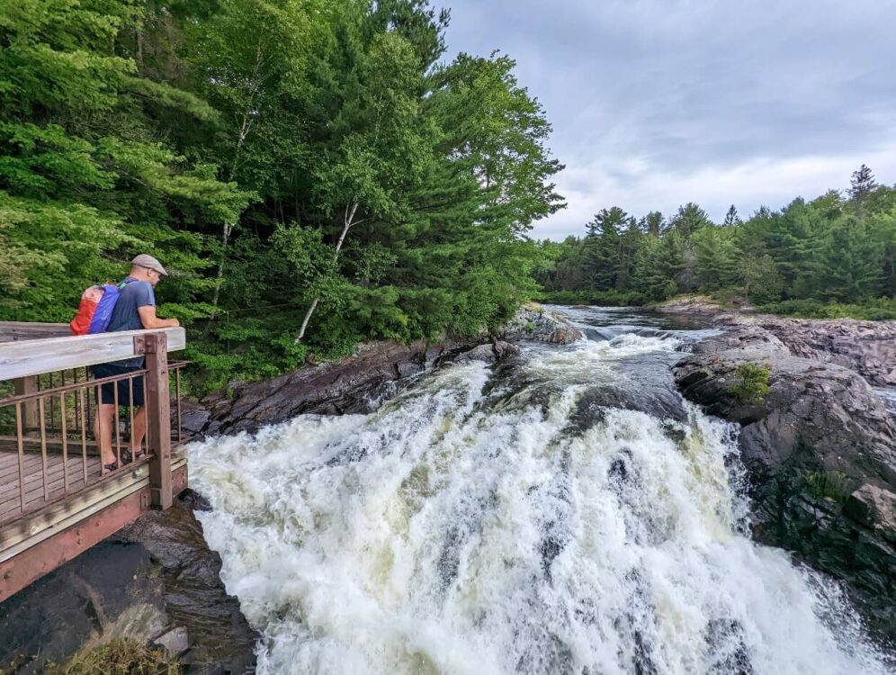
A hike on the Twin Bridges Trail is a must. The total distance is 6km but due to the nature of the route, it is possible to hike smaller sections if desired.
The path begins just behind the main falls and parallels the Seven Sisters cascades. Views can be enjoyed from two different platforms as well as two bridges. The trail is more rugged on the other side of the river, though even more views act as a reward!
Number of campsites: 128
Number of campsites with electricity: 79
Roofed accommodation: None
Facilities: Showers, laundry, flush toilets, trailer sanitation station, large picnic shelter
Activities: Beach, hiking, fishing, waterfall viewing

Pancake Bay Provincial Park
While walking the golden sands of Pancake Bay, you may wonder whether you have left Ontario and arrived somewhere in the Caribbean! On a calm, sunny day, this provincial park is the epitome of summer vacation.
The gorgeous beach was a delight for the Voyageurs too, who would have appreciated the ‘flat as a pancake’ landing. That’s just one theory of the origin of the park’s name. It may also link to the Voyageurs’ love of galettes, a savoury pancake-like dish.

The main campground sits directly behind the 3.2km long beach, with some campsites having a front row view. Indeed, we could hear breaking waves and see deep blue colours of the lake right from our tent.
If you can drag yourself away from the beach, Pancake Bay has some wonderful hiking trails to explore as well.
The Nature Trail may only be 3.5km in length but it traverses diverse scenery. Starting at the beach, it climbs up ancient beach ridges to a hilltop maple forest before descending to a wetland area.
Number of campsites: 325
Number of campsites with electricity: 156
Roofed accommodation: 1 cabin, 5 yurts
Facilities: Showers, laundry, flush toilets, trailer sanitation station, picnic shelter
Activities: Beach, hiking, fishing
Lake Superior Provincial Park
Although we didn’t stay in Lake Superior Provincial Park, I just had to include this spectacular protected area in this guide. After all, almost 90km of Highway 17 runs right through the park!
One of the highlights of visiting is the chance to see centuries old pictographs on cliffs above Lake Superior. These sacred paintings were created by generations of Ojibwe people with ochre, a vivid red natural earth pigment.
Old Woman Bay, a gorgeous sandy beach, is another must see. Agawa Bay is also home to a spectacular stretch of sand, 3km in length.
Lake Superior Provincial Park is a Dark Sky Preserve, so the beauty continues at night too. Look up for some of the starriest skies in Ontario!
There are two frontcountry campgrounds in Lake Superior Provincial Park – Agawa Bay and Rabbit Blanket Lake. The latter has its own beach area. Campers may miss out on the Lake Superior sunsets but the lake water is a lot warmer!
Number of campsites: 207
Number of campsites with electricity: 58
Roofed accommodation: None
Facilities: Showers, laundry, flush toilets, trailer sanitation station, boat launch
Activities: Beaches, pictograph viewing, hiking, fishing, visitor centre with exhibits, canoe rentals, outdoor amphitheatre, waterfall viewing

Neys Provincial Park
Neys is Pancake Bay’s wilder, northwestern cousin. The 2km sandy beach is just as stunning but you won’t have to share it with as many people. It’s also further from the highway, so there’s less noise (still expect a train or two).
Beyond the main beach, you’ll find a rugged shoreline featuring coastal rocks and pebble coves, backdropped by intensely green rolling hills.

The impressive scenery was popular with the Group of Seven. Lawren Harris’ Pic Island was inspired by views as seen on the Overlook Trail (9km return).
A shorter alternative is the Lookout Trail. Starting at the edge of the Area 4 campground loop, the path climbs through a thick spruce forest to a rocky highland. Panoramic vistas of Lake Superior await.
Number of campsites: 144
Number of campsites with electricity: 61
Roofed accommodation: 1 cabin
Facilities: Showers, laundry, flush toilets, trailer sanitation station, boat launch, playground
Activities: Beach, hiking trails, fishing, canoe rentals, visitor centre with exhibits

Rainbow Falls Provincial Park
The star of Rainbow Falls Provincial Park is a series of soothing cascades accessible via boardwalk, with multiple viewing platforms. On a sunny day, you may spot rainbows forming as a result of the mist on the falls.
Hiking beyond the main river leads to a viewpoint above Lake Superior. The path is part of the 52km Casque Isles Trail from Rossport to Terrace Bay.

Rainbow Falls hosts two campgrounds. Whitesand Lake Campground is located slightly inland, close to the namesake cascades. Rossport Campground is adjacent to Lake Superior, 5km further along Highway 17.
We stayed in the Whitesand Lake Campground and enjoyed the easy access to Rainbow Falls and several beach areas. The non-electrical loop (sites W71-W97) is a great choice for tents as it is the quietest area. The sites are also quite generous. It could potentially be buggier, however.
Number of campsites: 133
Number of campsites with electricity: 72
Roofed accommodation: None
Facilities: Showers, laundry, flush toilets, trailer sanitation station, picnic shelter, boat launch
Activities: Beaches, hiking, fishing, canoe and kayak rentals, water bike rentals, bicycle rentals, waterfall viewing

Sleeping Giant Provincial Park
Sleeping Giant was another park we didn’t stay overnight in, but we did visit to hike the famed Top of the Giant Trail. And we were certainly glad to have made the detour.
The challenging 11km long trail (22km return) culminates at the summit of Ontario’s highest cliffs, offering simply magnificent views of Lake Superior and the vertical gorge below.

It took us around 6 hours to complete the trail with a 30 minute lunch break. Anticipate 8-10 hours if you’re a slower hiker. The first (and last) 7km is relatively flat. If you have bikes, consider bringing them to cycle this part.
Sleeping Giant Provincial Park has one frontcountry campground, located on Marie Louise Lake. Some sites are right on the lakefront, with views of the Sleeping Giant. There are 27 backcountry campsites as well, some only a few kilometres from parking areas.
Number of campsites: 201
Number of campsites with electricity: 92
Roofed accommodation: 5 cabins
Facilities: Showers, laundry, flush toilets, trailer sanitation station, boat launch
Activities: Beaches, fishing, hiking, canoe and kayak rentals, outdoor amphitheater, visitor centre with exhibits

Kakabeka Falls Provincial Park
Situated just 30 minutes drive west of Thunder Bay, Kakabeka Falls Provincial Park provides an ideal base from which to explore the region.
The eponymous waterfall (Ontario’s second highest!) plunges 40m into the Kaministiquia River, visible from a number of different viewing platforms. The resulting gorge is studded with 1.6 million year old fossils.

Choose between three campgrounds in Kakabeka Falls Provincial Park. Whispering Hills is nestled in a forest about 1km uphill from the falls.
The Fern’s Edge and Riverside campgrounds are much closer to Kakabeka Falls, with the latter hosting some campsites with views (and accompanying mist in late spring!)
On the way to/from the Manitoba border, consider a stop at Aaron Provincial Park near Dryden. An alternative would be Rushing River, just east of Kenora.
Number of campsites: 174
Number of campsites with electricity: 90
Roofed accommodation: None
Facilities: Showers, laundry, flush toilets, trailer sanitation station
Activities: Hiking, waterfall viewing

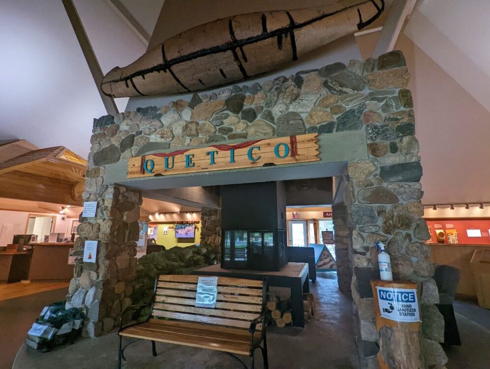
Quetico Provincial Park
On this trip, we also visited Quetico Provincial Park. While not on Highway 17 itself, I still thought it was worth a mention.
The park is located 2 hours west of Thunder Bay and features 1.2 million acres of wilderness, with more than 2000 lakes and just as many rustic backcountry campsites. An International Dark Sky Park, the starry nights here are some of the best in the world.
Located in the Dawson Trail Campground area, there are two frontcountry campgrounds – Chippewa and Ojibwa. Both are located on French Lake and offer easy access to 35km of hiking trails.

When checking in to the park, be sure to spend some time at the Dawson Trail Heritage Pavilion. The exhibits showcase the history of the park and the people who have lived and travelled here. The John B. Ridley Research Library is also located downstairs.
After one night at Ojibwa campground, we headed into Quetico’s backcountry for a week long canoe trip.
Number of campsites: 106
Number of campsites with electricity: 39
Roofed accommodation: 3 cabins
Facilities: Showers, laundry, flush toilets, trailer sanitation station
Activities: Beach areas, hiking, fishing, kayaks and SUP rentals, Heritage Pavillion with exhibits, playground, all terrain wheelchair rentals
Campsite reservations at Ontario Parks along Highway 17
Ontario Parks campsite reservations are recommended to secure a spot. Weekends are busiest, particularly holiday weekends (Canada Day in July, Simcoe Day in early August).
Reservations can be made up to 5 months in advance of your arrival date. So if you plan to camp on 6th August, availability for that date will open 6th March.

There is one exception, however. Reservations with arrival dates of July 29th, 30th or 31st become available in early March each year. Be sure to check for updates on the Ontario Parks rules and regulations page.
The cheapest way to reserve is to use the Ontario Parks Reservation website. The online reservation fee is $11.00 per booking (2022 pricing).

It’s also possible to reserve via the call centre or while in a provincial park. The reservation fee is little higher for these methods – $13.00 per booking.
Ontario Parks charges day use fees. When camping in the park, these day use fees are waived – campers only pay campsite fees (plus applicable reservation fee).

Other posts you may find helpful:
Car Camping 101: A Beginner’s Guide
The Best Things to do Outdoors in Thunder Bay, Ontario
Lake Huron Fishing with Angling Algoma, Northern Ontario
Quetico Provincial Park, Ontario: Complete Canoe Paddling Guide
Paddling the Trent Severn Waterway near Campbellford, Ontario
8 Must See Places On A Winter Road Trip Across Canada

One half of the Canadian/British couple behind Off Track Travel, Gemma is happiest when hiking on the trail or planning the next big travel adventure. JR and Gemma are currently based in the beautiful Okanagan Valley, British Columbia, Canada. Consider buying us a coffee if you have find any of our guides helpful!