Sometimes, the best ‘backcountry’ trips are the ones hidden just beyond civilisation. This is certainly true of the five days we spent kayak camping on Wallace Island, British Columbia.
This long and thin landmass lies less than 2km off Salt Spring Island (which, in turn, is just beyond Vancouver Island) and is one of the most idyllic places I have ever been.

Plan your own trip to paradise with the following experience and trip planning guide.
This post includes affiliate links. If you make a qualifying purchase via one of these links, I may make a small commission on the sale at no extra cost to you.
Published 2020

Backcountry necessities
- Always bring the 10 Essentials
- Know how to stay safe in the backcountry
- Remember to Leave No Trace to help keep the wilderness wild
- Understand how to avoid negative bear encounters
- Trying out backpacking for the first time? Read Backpacking 101
- Check out our packing guide with gear recommendations
- Sign up to our newsletter for a free paddling checklist

Wallace Island Marine Provincial Park
Though small, Wallace Island is beautiful from every angle. The folded rock formations provide an intricate and interesting coastline with scattered coves offering alluring landing points.
Wallace Island is almost entirely a marine provincial park, offering hiking trails, camping and sheltered paddling.
Stumbling across Wallace Island while searching for kayak trip ideas, I was amazed to find such a beautiful place to be so reasonably accessible.
We planned a five day trip, planning to basecamp at one of the island’s three campgrounds and explore the area from there. Read on to discover a comprehensive planning guide, preceded by our own trip report.
Kayak camping on Wallace Island
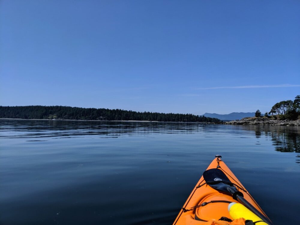
With a never ending forecast of 23c degree sunny days (in May!), our kayak trip to Wallace Island was looking fortuitous before we’d even left shore.
The wind was also agreeable, allowing for an easy paddle across from Salt Spring to the shore of Wallace Island.

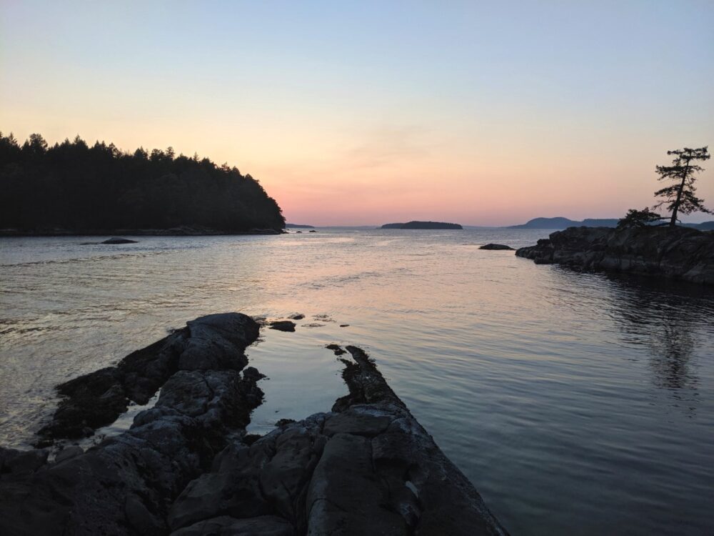
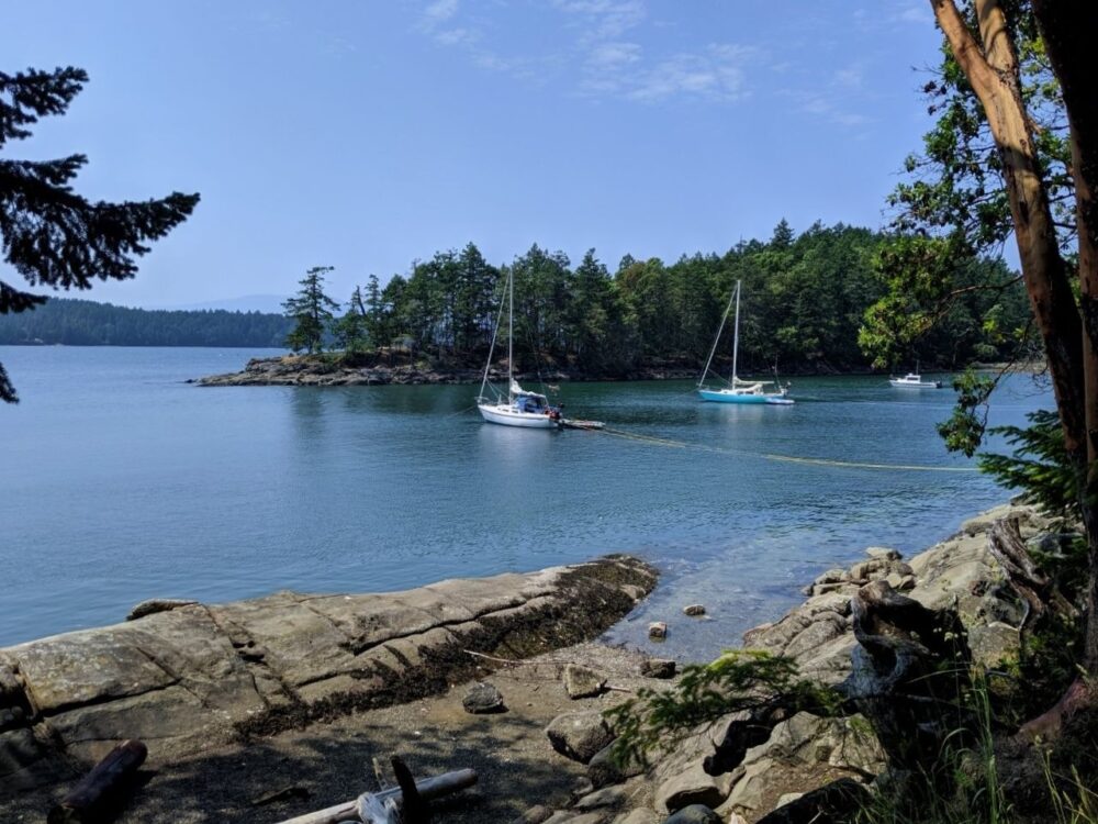
As we pulled our kayaks onto the beach just alongside Chivers Point at Wallace Island’s most northern tip, I couldn’t believe we’d arrived less than two hours after launching from Hudson Point.
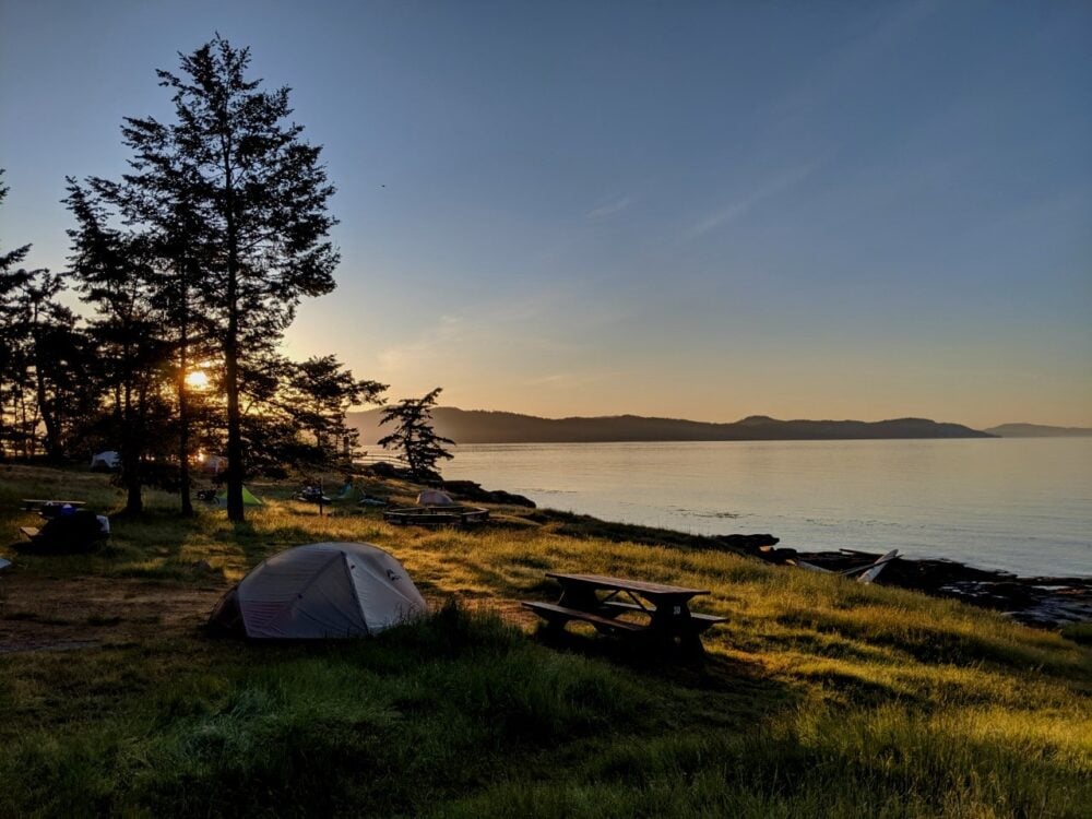
And the campground location was better than I imagined – an easy, sheltered beach landing with crystal clear water and a glimpse of empty tent pads and picnic tables through the trees.
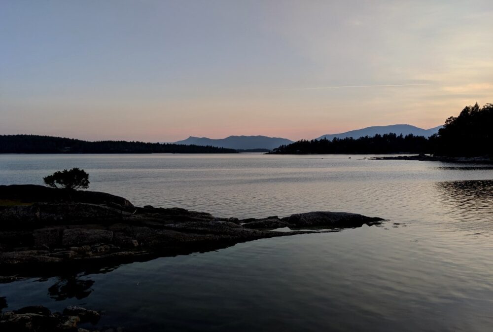
Scrambling up onto the point itself, the view almost blew both of us away. We could see for miles, the horizon studded with islands and boats. I knew immediately that this was going to be a great trip. The rose coloured sunset that night just confirmed it.

Exploring the island
Wallace Island may have felt like a secluded paradise made just for us, but a trip to Conover Cove the next day taught us a different side to the story.
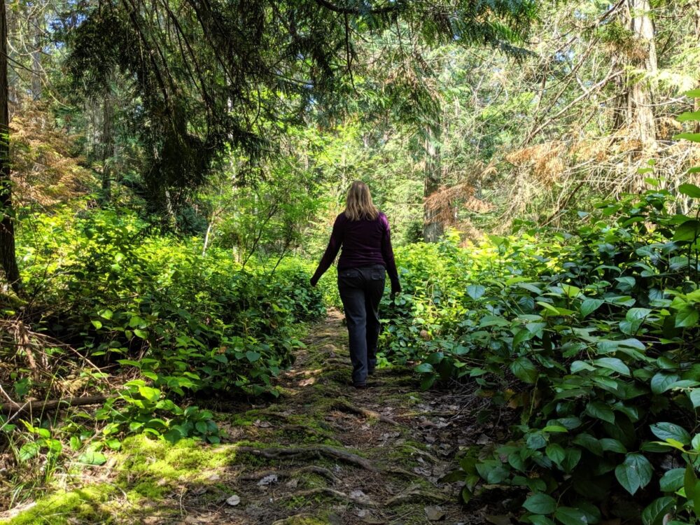
Following the forested hiking trail through the centre of the island, we eventually found a sunny meadow, punctuated by a rusting truck.
A vehicle is a curious sight anywhere without roads but especially so when the truck in question is almost certainly 50 years or so old!
Further along the path, the trees opened up even more to reveal a handful of buildings as well as a boat dock.

David and Jeanne Conover used their life savings to purchase Wallace Island in 1946 and turned it into the ‘Royal Cedar Cottages’ resort.
David became a successful author after writing a trilogy of books (starting with ‘Once Upon an Island‘) about their struggles and triumphs as island owners.

Panther Point
A BC Parks map indicates the former layout of the Royal Cedar Cottages resort, with 23 different structures scattered around the area.
One of the cottages still standing is the Conover’s, still keeping watch over the anchored boats in the cove.
I’m forever fascinated by the amount of places in British Columbia that have been developed so relatively recently but have since been abandoned or returned to the earth. Wallace Island is a good example.
The former resort area is now a spacious tent campground and day use area for boaters.
A shelter almost completely covered in carved driftwood affirms how much this island is beloved by visitors.

Before heading back our campsite, we continued a little further to the most southern part of the park – Panther Point.
The merchant coal carrier HMS Panther ran aground here in 1874. No wreck is visible today, only spectacular views towards Salt Spring Island.
Three days of bliss on Wallace Island
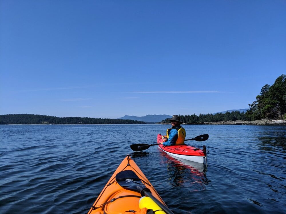
The next three days leisurely passed with a mixture of sunbathing, kayaking, fishing, crabbing, reading and sunset watching.
Oh, and how we ate! Fresh crab, rock fish, oysters and more, all under an endless blue sky.
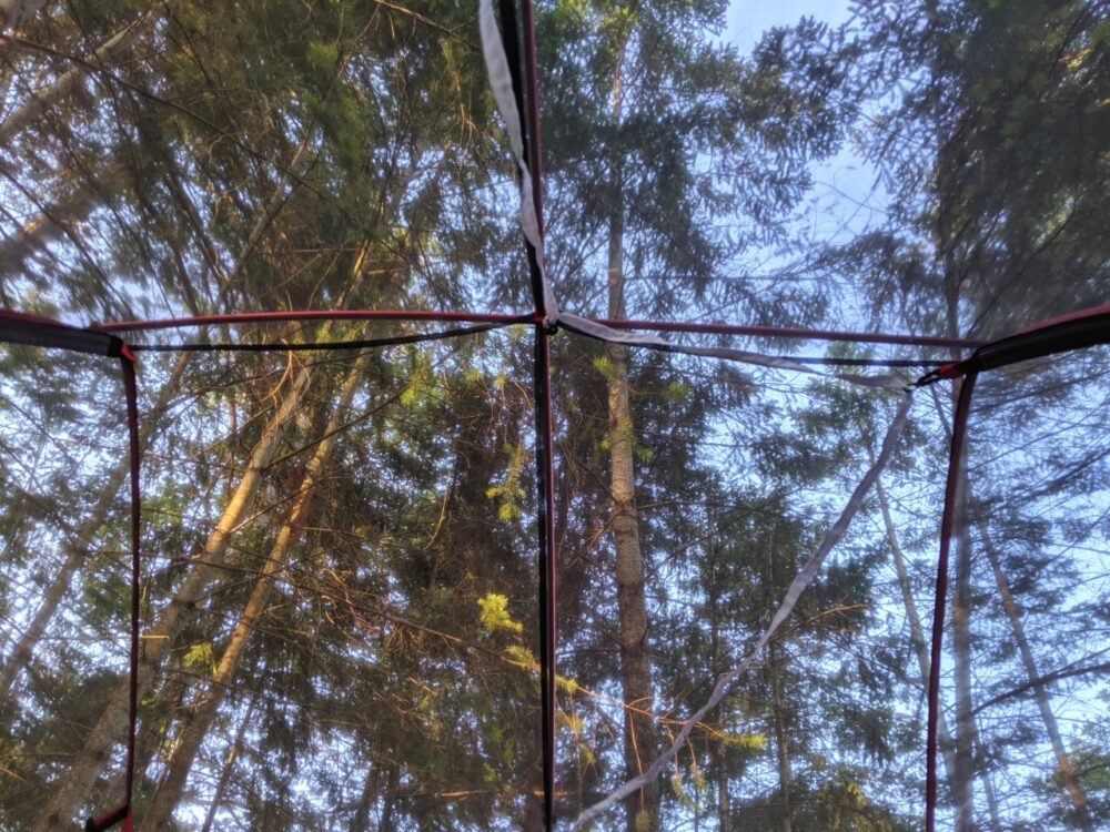
With the weather being so unexpectedly predictable, we were able to do something we’ve never been able to do on any camping trip – sleep with the tent fly off!
We had four nights of blissful sleep on Wallace Island, with just a mesh cover separating us from the trees above. Waking up to see the ocean right there was a truly a special thing.
Besides a smattering of kayakers and few dozen sailors (pun totally intentional) on the first few days, we saw hardly anyone. No whales were anywhere to be seen either, but that is always hit and miss.

Meeting the locals
Whales or not, I’d still consider our luck to have been in for this kayaking trip. I could’ve have picked a better place to be and the weather seemed to reward us.
We were sad to leave, wanting just one more day (or two, who am I kidding?) of solitude and relaxation on what felt like our own island.

Choosing to paddle back via Jackscrew Island, we came across a huge pod of seals resting on the coast of the most southern Secretary Island.
Despite keeping our distance, dozens scrambled into the ocean and proceeded to follow us on our journey.

Returning to Salt Spring Island
Inquisitive seals are not uncommon but when approaching kayakers yelled to us ‘do you know how many seals you have following you?!’ it became apparent that this pod was a little curious than the average.
Agile, incredibly fast and remarkably large, seals are actually quite intimidating when sitting in a kayak.
I love to watch them from a distance but it is always a little startling when they resurface less than a metre away! Luckily, they lost interest as we approached the shore of Salt Spring Island.
With friends waiting for us at Fernwood Cafe just down the way, we landed and packed up as fast as we could.
It was JR’s 40th birthday and plenty of good food and merriment was waiting. With almost a week of bliss on Wallace Island and a day of celebrations on Salt Spring, that birthday will be a hard one to beat.

A Paddling Guide to Wallace Island
If you’re planning a kayaking trip to Wallace Island, keep reading to discover everything you need to know.
I’ve written this section with overnight paddlers in mind, though I think day trippers will still find this section helpful.

A brief history of Wallace Island
Wallace Island is situated within the traditional territory of numerous First Nations, including the sc̓əwaθenaɁɬ təməxʷ (Tsawwassen), W̱SÁNEĆ (Saanich), Stz’uminus and Hul’qumi’num Treaty Group.
The name we now use is in honour of Captain Wallace Houstoun who first surveyed the area in the 1850’s. He originally named it ‘Narrow Island.’
The first known resident was Jeremiah Chivers, a Scotsman who lived alone on the island until his death in 1927 at the age of 92.
In the mid 1960s, the Conover family sold 94% of the island’s acreage to a group of teachers from Seattle.
Unfortunately for them, island ownership didn’t prove to be a successful venture with internal disputes preventing any development.
Wallace Island was up for sale again in 1990 (this time by court order) and became a marine provincial park with the help of the volunteer run BC Marine Parks Forever Society. 6% of the island (11 of 180 acres) remains private land.


How to get to Wallace Island
Wallace Island is located in the Trincomali Channel between Galiano Island and Salt Spring Island. All three islands are found in the Salish Sea between Vancouver Island and the British Columbia mainland.
The easiest and most direct way to reach Wallace Island by is from Salt Spring Island. There are three main BC Ferries routes to Salt Spring Island –
- Tsawwassen (Vancouver) to Long Habour – schedule here and here
- Swartz Bay (Victoria) to Fulford Harbour – schedule here
- Crofton (near Chemainus, Vancouver Island) to Vesuvius Bay – schedule here
Some of the ferry services on the Tsawwassen to Salt Spring Island route are non-stop while others stop at other Gulf Islands (Galiano, Mayne, Pender) first.
A BC Ferries Experience card offers a discount on all three of the above routes. To receive the discounted fare, you must load a minimum amount of dollars on the card before using the ferry.

Kayak launching locations
The two most convenient kayak launching sites for Wallace Island are Hudson Point and Southey Point on Salt Spring Island.
There are other options for launching on Salt Spring but these two are the closest and make the paddle across both short and straightforward.
Hudson Point
Hudson Point is a public boat ramp located on North Beach Road, Salt Spring Island and seems to be the favoured launch for kayaking to Wallace Island. The shortest paddling distance to reach the shore of Wallace Island is around 2km, a quick half hour paddle in calm conditions.
The easiest way to find Hudson Point is to head to the Fernwood Cafe and then follow the road north until the gap in the trees appears after around 1km. There is off road parking for four or five small vehicles.
At low tide, the beach is quite extensive and provided us with plenty of space to load the kayaks onto the van. This launch can apparently get quite busy with sport fishermen.
North Beach Road is quiet and we had no issues with security, though I’d recommend not leaving any valuables in your vehicle.

Southey Point
Somewhat confusingly, Southey Point is actually the most northern tip of Salt Spring Island.
Follow North End Road to Southey Point Road and then finally onto Arbutus Road. Southey Point can be found at the end of this road. The launch is on a small wedge of stony beach.
From Southey Point, the paddle to Wallace Island skirts Jackscrew Island as well as the southern Secretary Islands. Be considerate with parking to ensure that this launching point remains possible for kayakers.
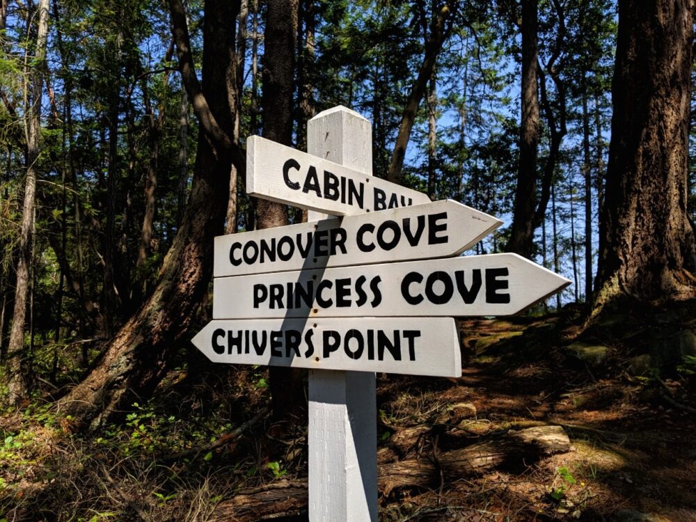
Wallace Island camping
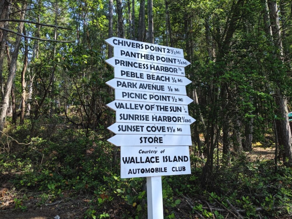
There are three camping areas on Wallace Island – Conover Cove, Cabin Bay and Chivers Point.
Camping fees on Wallace Island are $5/per person/per night. Fees apply year round. There are self registration vaults at all three camping areas (cash only). I personally consider it a steal of a deal!
Approximate hiking distances between the campgrounds are:
- Conover Cove to Cabin Bay: 2.5km (40 minutes)
- Conover Cove to Chivers Point: 3.2km (50 minutes)
- Cabin Bay to Chivers Point: 700m (10 minutes)
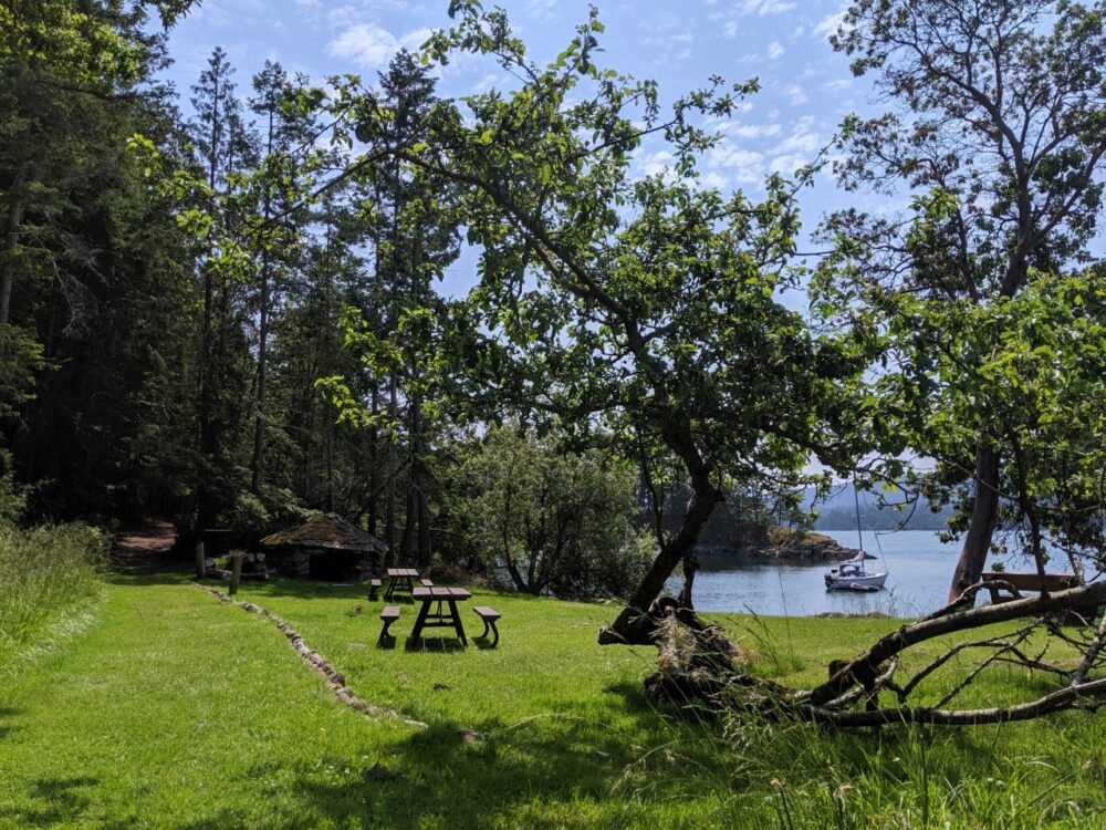
Conover Cove
The Conover Cove campsite is located at the southern end of the island, in the old resort area. It is a large grassy, open area with views towards Salt Spring Island.
Conover Cove is a popular anchorage for boats and there is a dock leading to land here.
- The field camping area offers reasonable privacy even for a large number of tents. The BC Parks website mentions ‘8 open sites’ but there are no designated spots and I believe there to be space for many more camping groups
- It is possible to access the camping area both from Conover Cove itself or another beach on the eastern side of the island (Honeymoon Bay). Both landing spots would be easy to use
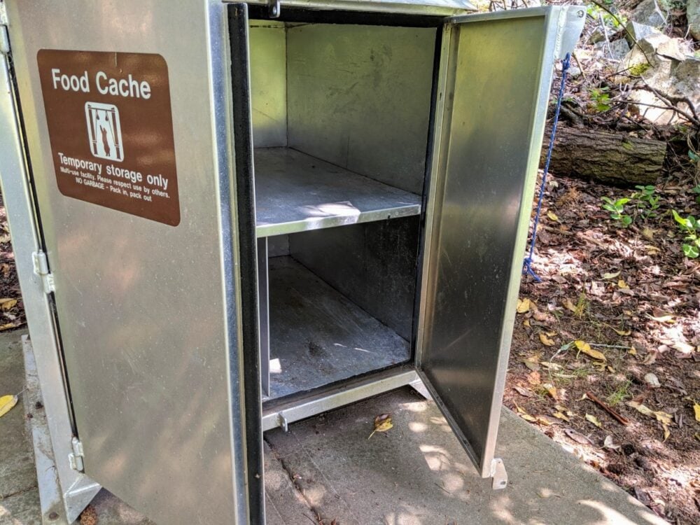
- There are numerous picnic tables, with some near the boat dock and others tucked near Honeymoon Bay. Campers have access to two outhouses and a metal food cache

Cabin Bay
The smallest campground on Wallace Island, Cabin Bay is on the northeastern coast. There are lovely views across to Galiano Island and beyond. I imagine the sunrises could be very pretty to watch here.
- Cabin Bay can be accessed from two angles, offering easy landing on a stony beach. The southern access has less water at low tide
- In a shady forested area just above the beach, there are two wooden tent platforms with two picnic tables. The outhouse is located slightly up trail from the camping area
- The camping area is quite intimate. If there was another group already here, I’d probably keep paddling to Conover or Chivers
- To reach the main island hiking trail, there is a set of stairs to climb

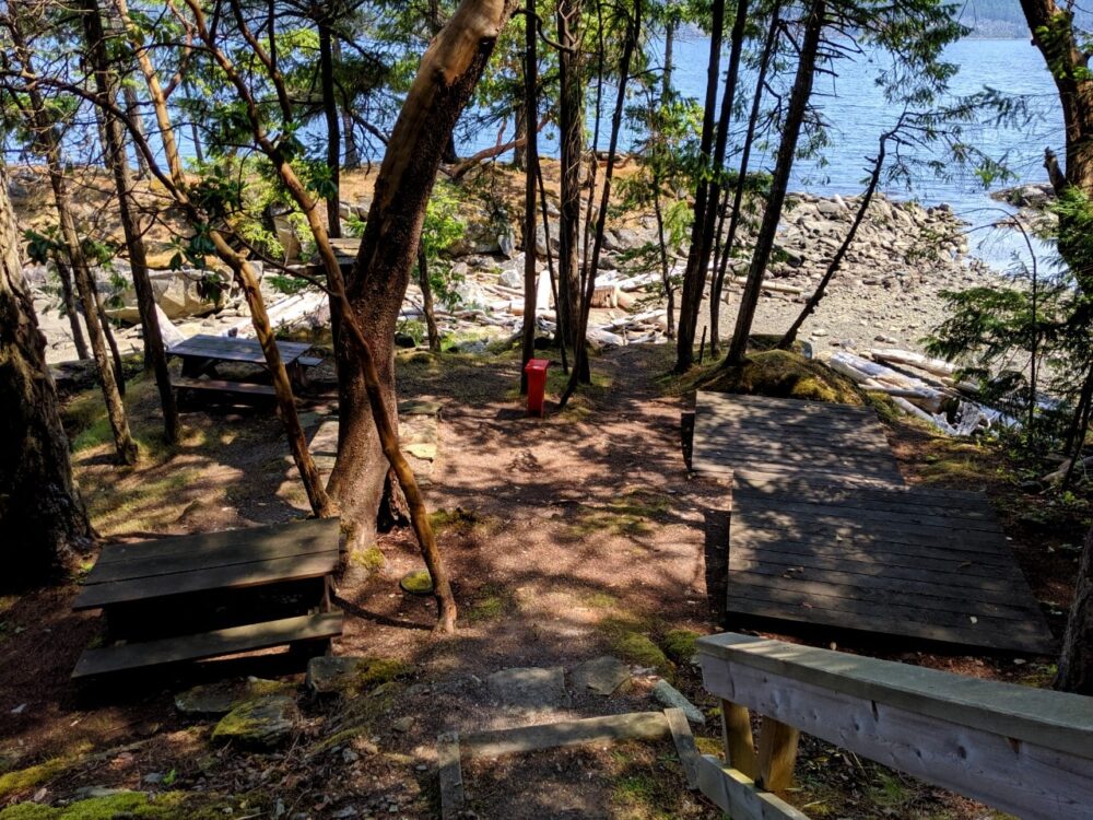
Chivers Point
Chivers Point is definitely my favourite Wallace Island campground.
Being the northwestern tip of the island, Chivers Point offers beautiful views along the Trinocomali Channel and across to Galiano Island, as well as spectacular sunsets. It is named after one of the first residents of Wallace Island.
- The campground is set into the forest, just behind the landing area. A peninsula (Chivers Point itself) runs parallel to the rocky beach and is easy to reach
- Chivers Point has seven wooden tent platforms and one tent pad. The pad and two tent platforms are waterfront, while the others line the trail heading into the forest
- This campground also has eight picnic tables, an outhouse and a metal food cache
- Chivers Point is a popular hiking destination for boaters staying in Conover Cove. We met five different groups of people on one day and then none for the rest of our trip!


Essential things to know about Wallace Island
Wallace Island is an awesome paddling destination (especially for multi-day trips) but there’s a few things you should know before you go:
- We had cell phone coverage the length of Wallace Island and also to/from Salt Spring Island
- Campfires are not allowed anywhere on Wallace Island
- Tidal currents are not pronounced for the crossing from Salt Spring to Wallace (thy flood northwest and ebb southeast), but kayakers should beware of of strong northerly winds when the weather is clear and hot
- Wallace Island is mentioned in John Kimantas’ excellent Wild Coast 3 recreation guide. Another good book is Whelks to Whales, a handy reference to the most common species of marine life in the area
- The primary purpose of the campground food caches is to prevent raccoons and other small critters accessing food. Bear sightings are unlikely on Wallace Island (but obviously not impossible)
Must have items
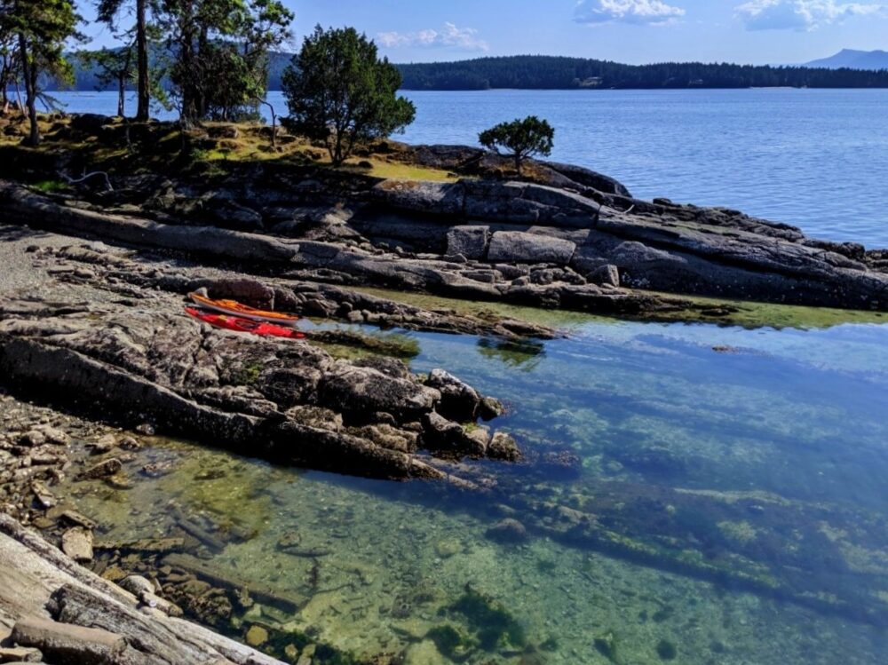
The shore of Wallace Island is rocky and covered in oysters. We both wore neoprene boots to protect our feet while getting and out of our kayaks.
There is no potable water available on Wallace Island. Bring all of your drinking water with you. We always bring 6/l day for the both of us. Realistically, we use about 4l/day, but having extra is always a good idea.
A freestanding tent is preferable (like this one) if you plan to camp at Chivers Point or Cabin Bay due to the wooden tent platforms. If you don’t have one, be sure to bring some extra rope to secure the tent ends as needed.
A sun hat is an essential for any paddling adventure.
We use a mix of durable dry bags and thinner, lightweight ones. Remember to double bag everything!
No matter the time of year, we always wear lots of merino wool on paddling trips like this one. Not only does it have natural SPF protection, but merino dries reasonably fast, holds warmth even when wet and doesn’t stink.
For more outdoor gear recommendations (and to see what we use), check out our Shop page
Fishing regulations
- Wallace Island is located in Pacific Region Tidal Area 17-2. Obtain a Tidal Waters Fishing Licence and check the relevant fishing regulations before dropping a line.
- The coastal waters around Wallace Island are designated Rockfish Conservation Areas. We kayaked northwest to the boundary (closer to the Secretary Islands) and fished there instead
- Before collecting mussels, clams and oysters, check the sanitary contamination closures (at time of writing, there is one for Conover Cove) as well as the biotoxin closures first. We collected and ate huge oysters at Chivers Point during our visit
- There are plenty of Red Rock Crab in the waters surrounding Wallace Island. JR brought his wetsuit with him and skin dived to collect some. The minimum size is 115mm and only males can be caught


Other fun things to do around Wallace Island
Besides providing a launching point for beautiful Wallace Island, Salt Spring Island has plenty to offer visitors. Here are a few of my favourite activities:
- Grab a bite to eat at Fernwood Cafe after finishing your kayaking trip to Wallace Island. Open 7 days a week from June to September, they serve breakfast all day as well as lunch. The cheesy Veggie Bake was SO good after five days of camping on Wallace Island!
- St Mary Lake is the largest on Salt Spring and is a great place to swim on a hot day. There is a small public beach on North End Road. The lake is also accessible from the end of Tripp Road, on the other side of the lake. It is possible to stay right on the lake – Maple Ridge Cottages is my pick
- Ruckle Provincial Park is both a lovely spot for hiking and tent camping. There’s a large open grassy area right next to the water with walk-in camping, with most spots available on a first come first serve basis only. We stayed here before and after our Wallace Island kayaking trip
- The Salt Spring Saturday Market is one of the best in British Columbia. All vendors have to make, bake or grow their items, creating a fascinating mix of pottery, art, food, jewelry, clothing and woodwork stalls. The market runs 9am-4pm rain or shine from April to October
- Sip, taste and savour Salt Spring’s local produce. My favourite spot is Salt Spring Island Cheese, where the shop is located right on the farm. The samples are generous and the prices substantially discounted compared to the grocery store. Salt Spring also has three wineries, two cideries, a brewery and a distillery
Head over to Sand In My Suitcase to discover even more things to do on Salt Spring Island!

Planning more adventures on British Columbia’s coast? You may find these posts helpful
How to Find Big Trees on Vancouver Island, British Columbia
25+ of the Best Campgrounds on Vancouver Island
A Guide to Hiking the Sunshine Coast Trail, British Columbia
Paddling the Sayward Forest Canoe Circuit, Vancouver Island


Check out these other paddling posts next
Kootenay National Park is one of the lesser-known parks in the Canadian Rockies, yet its northern boundary lies just 30 minutes drive from Banff townsite. It also has some of the most distinctive features of any of the Rockies parks.
Just a short drive south of Penticton, the Peach Cliff hike is short, rewarding and surprisingly interesting. The panoramic views span Vaseux Lake and McIntyre Bluff, stretch across Okanagan Falls and Skaha Lake, and reach all the way to Penticton. As locals, this is one of our favourite trails for a quick early morning summer hike, before the heat sets in.
Part wine tour, part fun run, timing isn’t everything for the Half Corked Marathon. In fact, timing isn’t even recorded, with the warning that ‘if you come first, you’ve actually lost.’
Mountains, ocean and rainforest meet in Prince Rupert, Northwestern BC. Over 16 hours drive from Vancouver (or less than 2 hours by plane), this small city is a gateway to both the Pacific and untamed wilderness. It is also Canada’s rainiest – or, as I prefer, the one with the most rainbows!
The Kettle Valley Rail Trail (KVR) is one of southern BC’s best assets. Whether you’re looking to learn more about the KVR Trail, find the best sections to explore or pick up a few trip planning tips, this guide has you covered.
For many travellers, the drive from Victoria to Nanaimo is seen as a simple 90-minute trip between Vancouver Island’s two largest cities. But there’s far more to this route than just getting from A to B. Speeding along Highway 1 means skipping past countless worthwhile stops, such as one of BC’s best provincial parks and the world’s largest outdoor collection of totem poles.
There’s no shortage of incredible sights and scenery to see in New Brunswick, Nova Scotia, PEI, Newfoundland and coastal Quebec. While iconic spots like Peggy’s Cove, Gros Morne National Park, Toronto and Hopewell Rocks often take the spotlight, there are so many hidden gems as well. Here are our top picks!
Visiting Tofino during storm season offers can be an exhilarating experience, whether you choose to witness the ferocious weather from the beach or a hot tub. Here’s everything you need to know!
Over the past decade, the backcountry has taught me more than any guidebook ever could. The reality is, our early backpacking and multi-day paddling adventures were full of missteps. Behind the scenes of 10+ years of outdoor adventure, featuring the mistakes and unexpected events that taught us what really matters on the trail.
Snowbird Pass is the most popular day hike from Berg Lake and it’s easy to see why. With spectacular alpine scenery from start to finish, this trail is about the journey as much as the destination. Huge glaciers, lush alpine meadows, marmots, mountain goats and more!

One half of the Canadian/British couple behind Off Track Travel, Gemma is happiest when hiking on the trail or planning the next big travel adventure. JR and Gemma are currently based in the beautiful Okanagan Valley, British Columbia, Canada. Consider buying us a coffee if you have find any of our guides helpful!