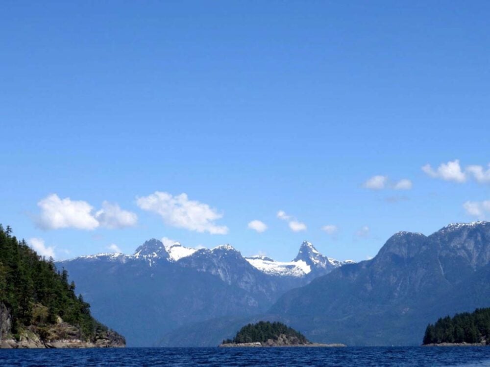
One of our favourite paddling destinations has to be Desolation Sound on British Columbia’s Sunshine Coast.
If you’re planning an adventure (and trust me, you should be!), here’s everything you need to know when organising your paddling trip Desolation Sound, British Columbia.
Some links within this post are affiliate links which means if you purchase an item through these, I may receive a small percentage of the sale at no extra cost to you.
Backcountry necessities
- Always bring the 10 Essentials
- Know how to stay safe in the backcountry
- Remember to Leave No Trace to help keep the wilderness wild
- Understand how to avoid negative bear encounters
- Trying out backpacking for the first time? Read Backpacking 101
- Check out our packing guide with gear recommendations
- Sign up to our newsletter for a free paddling checklist

Highlights of Desolation Sound, Sunshine Coast
Desolation Sound is truly a paddler’s paradise. Why? Some of the best reasons include:
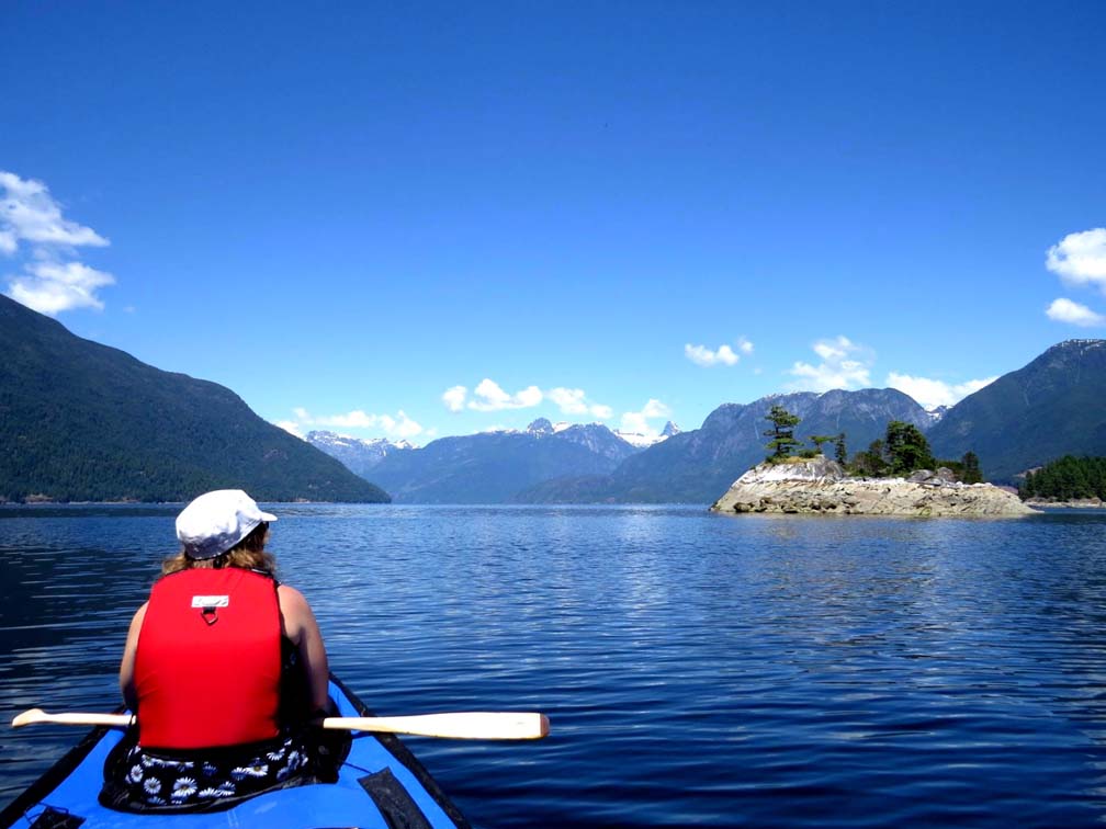
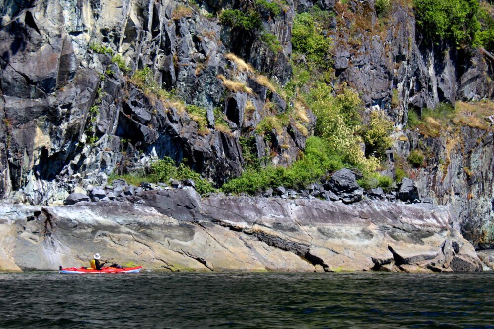
- Natural beauty. Protected bays, towering rock bluffs and idyllic islands framed by a mountainous backdrop….paddling in Desolation Sound is breathtaking.
- Scenic campsites. Situated on small islands, dramatic headlands and nestled into cosy bays, Desolation Sound’s camping areas are all picture perfect in some way or another. Desolation Sound camping areas lend themselves well to easy base camping trips as well as touring adventures.
- More than a paddling trip. Desolation Sound isn’t just limited to exploration on the water. Combine your paddling with hiking, swimming, fishing and wildlife watching!
- A warm welcome. The warmest waters north of Mexico can be found in Desolation Sound. It’s possible to swim in the ocean (comfortably!) as early as May here.
- Great for all paddlers. Desolation Sound’s calm, warm waters, sheltered bays and comfortable campsites are perfect for first-time paddlers. The area is also a good launching point for longer and more challenging BC coastal trips (Toba Inlet, Discovery Islands).

How to get to Desolation Sound, British Columbia
Desolation Sound is located at the top of British Columbia’s Sunshine Coast. A minimum of two ferries are needed to get here from the BC mainland. Powell River is the last major refuelling place for groceries and other paddling supplies.
The two main launching sites for Desolation Sound are located at opposite sides of the Malaspina Peninsula, at the top of BC’s Sunshine Coast.
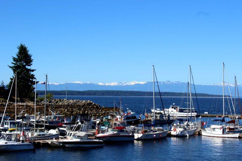
Launching Choice 1: Lund
Highway 101 ends at the tiny town of Lund. Here, you’ll find a handful of hotels, restaurants and shops plus a paid long-term parking lot and all important boat launch.
The marina kayak launching and pick-up fee is $5 per kayak ($10 return trip), payable in an honesty box.
There is a small amount of parking by the marina, with the pay and display parking lot being operated by The Lund Resort. The fee is $10/24 hours, up to 96 hours. The payment machines take cash and credit but no debit cards. In case of late arrival, the Lund Resort gave us the cell phone number of the parking lot attendant.
Lund Parking offers also long term parking from $13/day, a very short drive away from the dock (1 minute!) I’d recommend booking in advance. During our most recent visit, there was a note with a phone number on the door to call for service.
Looking to book a stay in Lund before or after your kayaking trip?
Malaspina Bed and Breakfast – Great value
Historic Lund Hotel – Fantastic location
Launching Choice 2: Okeover
A little further south of Lund on the eastern side of the Peninsula is Okeover Arm harbour. There is a government dock and boat launch here, with a $2 fee for kayakers ($4 return trip). A large (free) parking lot is located on the other side of the road. We had no problems parking here for 5 days.
A very short walk away from the boat launch is Okeover Arm Provincial Park. There are 14 first-come first-served vehicle accessible campsites available for $14/night.
Looking to stay near Okeover?
Desolation Resort (Okeover) – Ideal location and highly rated on Booking.com


Lund vs. Okeover
Having launched paddling trips from both Lund and Okeover, my personal preference would be to leave from Lund.
Both are equally convenient for paddling in Desolation Sound and have all the facilities needed, but I think the experience is more interesting from Lund overall.
While Lund may have more boat traffic, the narrower parts of Malaspina Inlet can have currents up to 4 knots at times. There are also more camping and accommodation options closer to Lund than Okeover, handy if starting late on the first day.
The perfect solution would be to start at Lund and end at Okeover (or vice versa!) if you are able to have two vehicles.

Camping in Desolation Sound
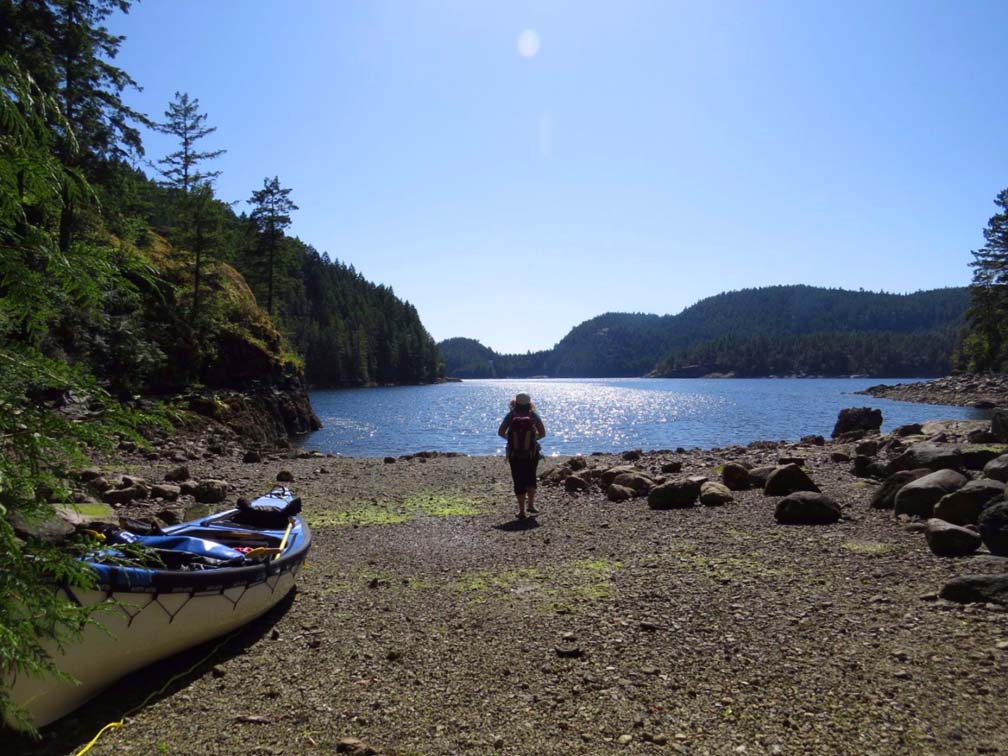
Campsites in Desolation Sound generally come in two forms: Marine Provincial Park sites and informal camping areas. The latter offer no organised facilities but have been previously established by other boaters.
Wild camping on crown land outside of the Provincial Park is allowed, but suitable land (easy access with flat, cleared space) is in short supply.
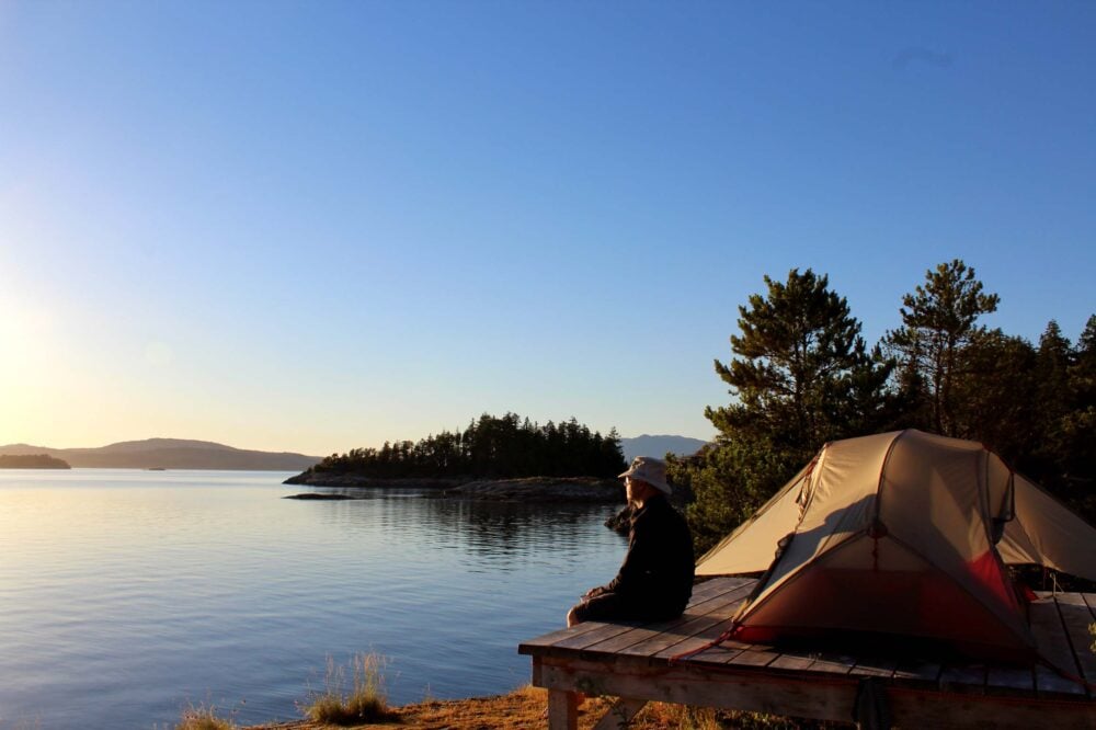
Camping in Desolation Sound Marine Provincial Park
There are 11 designated backcountry camping areas in Desolation Sound Marine Provincial Park with almost 70 tent pads total. Fees are $5 per person, per night, payable between June 1st to September 15th every year.
The camping fees are payable online on the BC Parks Backcountry Registration Service website. Note that buying a permit does not constitute a reservation.
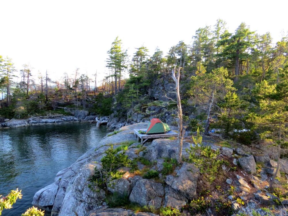
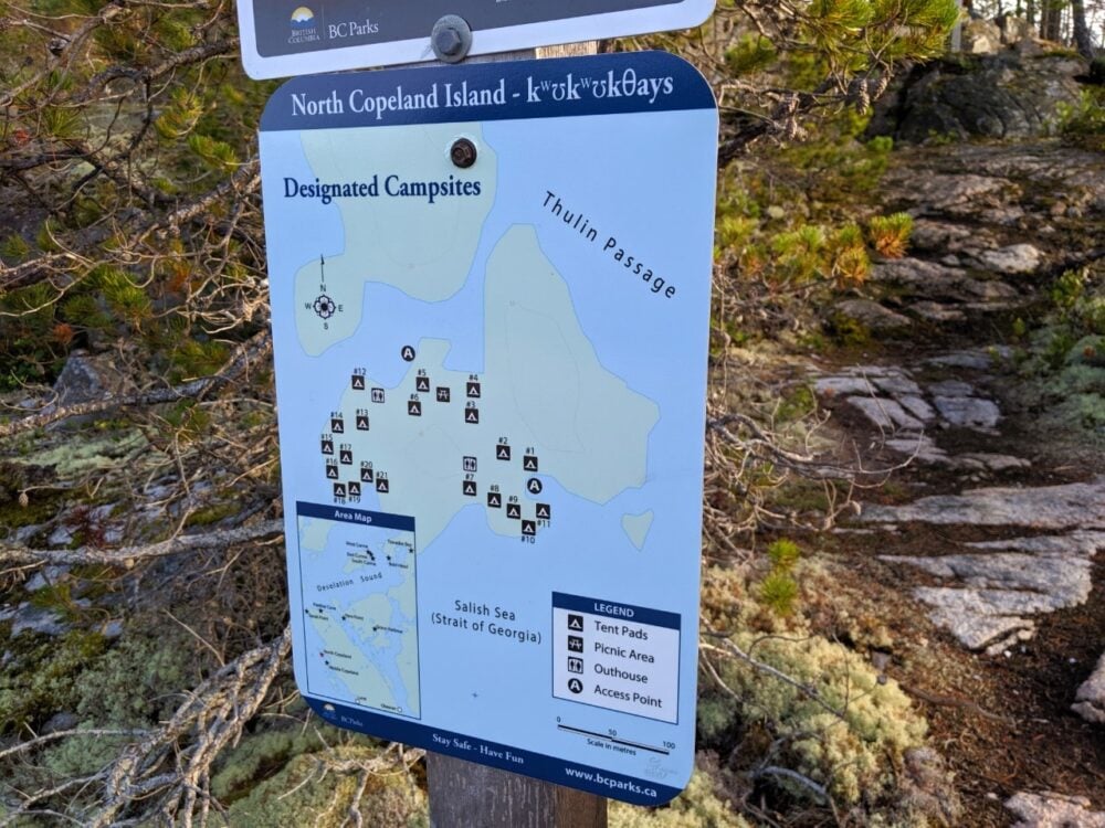
The camping areas are split into three general groups – the Copeland Islands, around Malaspina Inlet and the Curme Islands. Tent pads must be used due to the delicate ecosystem in each location.
There are outhouses at all Desolation Sound camping areas. No fresh water or food caches are available at any of the camping areas.
The Curme Islands are a top destination for a lot of Desolation Sound kayakers. With a central position in the Sound, great campsites and epic views of the mountain, it’s easy to see why.

Alternative camping in Desolation Sound
Aside from Desolation Sound, there are a few other Provincial Parks in the wider area. Roscoe Bay, to the north of the Curme Islands, has space for 4-5 tents (with an outhouse) at the far west of the inlet. The fee is $5/per person/per night.
There are a few completely free unofficial camping areas outside of the Provincial Park. Martin Island and Kinghorn Island both have a couple of areas each (note that the latter also has an eco resort).
To the north, there is an informal camping spot near the waterfall in Teakerne Arm. For more detail on these sites and others in the Desolation Sound area, check out the most excellent Wild Coast 3 book by John Kimantas.
Thinking of books, if you’re looking for more reading material about Desolation Sound, check out the hilarious Adventures in Solitude by Grant Lawrence. Whelks to Whales is a great identification tool if you’re interested in Desolation Sound’s marine biology.
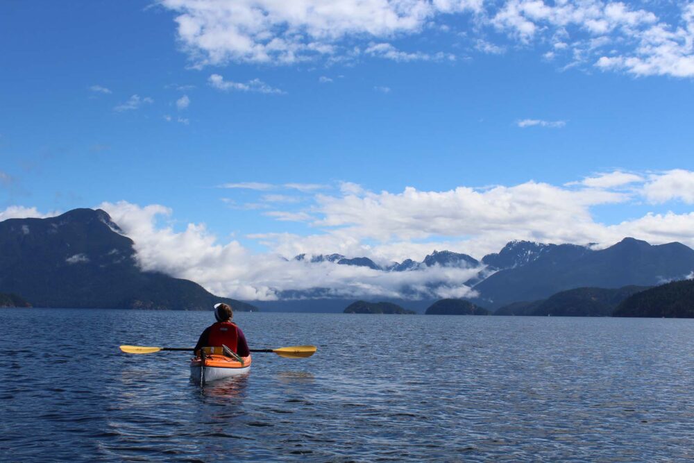
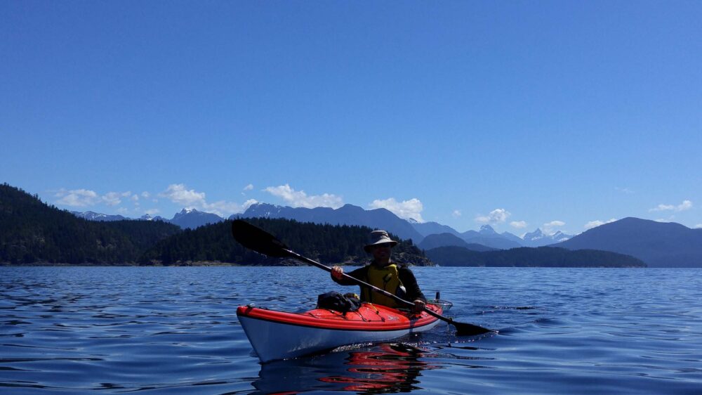
Paddling in Desolation Sound
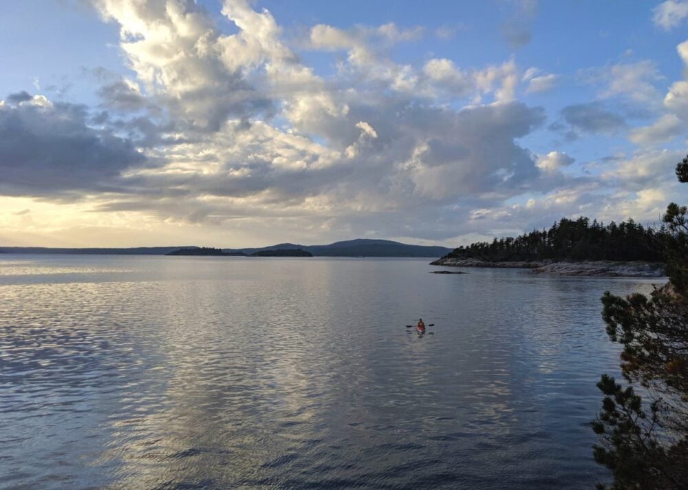
Paddling in Desolation Sound is easy. The water is generally warm, calm and sheltered.
There are a few open sections that must be paddled to reach the most popular camping locations (Curme Islands), but these are very short (2-3km). That all said, we have experienced some wild windy days on the water on Desolation Sound.
On our first trip, gale force winds were predicted to arrive on the afternoon of our last day (thanks, VHF radio). So we packed up quickly and got onto the water early for a quick exit.
The winds came in earlier than expected and we battled some metre and a half swells before finally turning into the much calmer Malaspina Inlet.
There was also one ferociously windy day during our last trip, this time in the northern Desolation Sound area. Luckily we had nowhere to be so we were able to leisurely wait it out.
Some very tired kayakers joined us at our Martin Islands campsite that afternoon, having taken almost the whole day to paddle the relatively short distance from the Curme Islands in high winds.
Moral of the story: always allow more time for your trip than necessary and assess the weather conditions (and forecast) before setting out. Desolation Sound may be one of the most sheltered and calm areas of the BC coast, but it still can be hit by high winds and dangerous paddling conditions like everywhere else!

Safety considerations for kayaking Desolation Sound
Cell phone signal is prevalent (as are other boats) throughout the Desolation Sound area. Even knowing this, we still like to carry a basic VHF radio.
It’s useful for checking the weather and tides as well as listening to what the larger boats are up to! Of particular interest, at least for us, is the local whale watching boats…
There are several places to find fresh water while paddling in Desolation Sound. The most obvious sources are Unwin Lake and Black Lake, accessible via short trails from Tenedos Bay and Roscoe Bay respectively.
Not just great for collecting water, both lakes are also perfect for a swim! Keep in mind that the lake water should be treated before drinking.
Fully treated water can be found at the boater’s supply village of Refuge Cove.

When to visit Desolation Sound
The best time for Desolation Sound kayaking is May – September. The summer months are busy, with hundreds of touring pleasure boats addition to many private and guided kayaks paddling Desolation Sound.
With the limited availability of sites in summer, choosing a base camp and day touring from there may provide a less stressful experience.
If you prefer to avoid crowds and have your pick of sites, plan a mid-week Desolation Sound kayaking trip in May, June or September. Shoulder season weekends can still be fairly busy so try and avoid leaving on a Friday if possible.
Our first kayak adventure in Desolation Sound was mid-week in late May. We had a whole Curme Island to ourselves for camping and we only saw a handful of other paddlers.
Our second Desolation kayaking trip was in mid June, again in mid-week. We saw more passing kayakers this time, but still camped alone every night bar one.
We’ve also explored Desolation Sound in September too. We camped alone and didn’t see any other paddlers.
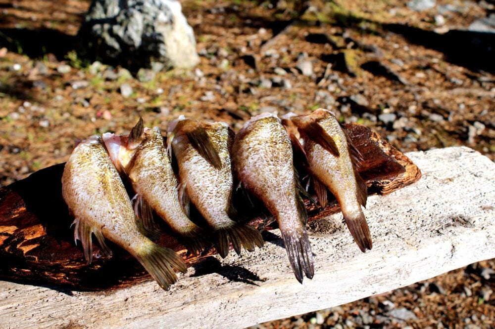
Fishing opportunities
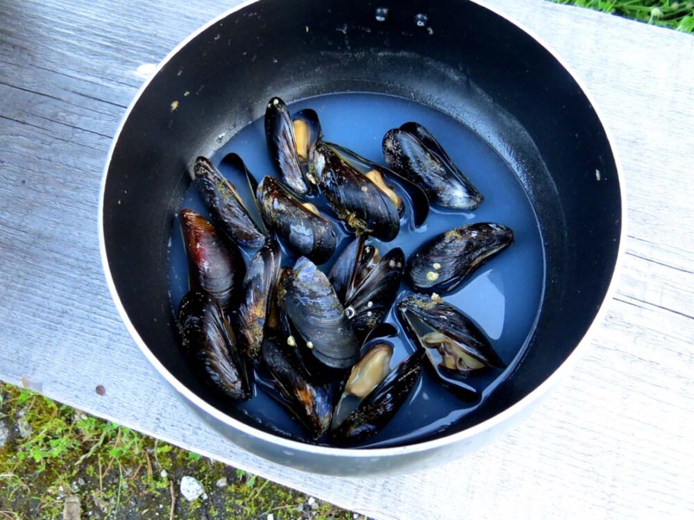
Shellfish collecting has long been a favourite of Desolation Sound paddlers. We have feasted on many an oyster during our trips; they are large, plentiful and flavoursome.
Mussels are much less common, with only small ones sighted on our last trip. Rockfish fishing was more successful, particularly just to the west of Kinghorn Island, just outside of the Conservation boundary.
The Desolation Sound region is located in BC Tidal Area 15. There are some quite specific rules and regulations concerning fishing and collecting shellfish to follow while paddling in Desolation Sound.
Quite simply, you can’t just do it everywhere. For example, there is a large Rockfish Conservation Area covering much of Desolation Sound that restricts any fishing of Rockfish at all.
It is very important to always read and understand the area closure maps and collection limits before fishing and collecting shellfish.
For the latter, it is also vital to check that there are no biotoxin (‘red tide’) shellfish contamination warnings in place. Eating contaminated shellfish can be fatal.
To fish or collect shellfish, you must hold a BC Tidal Waters License. These are currently $22 for an annual pass for BC residents.

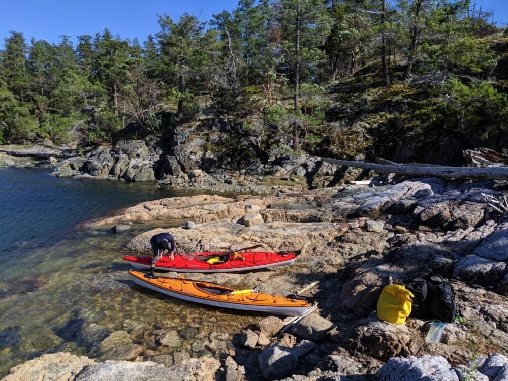
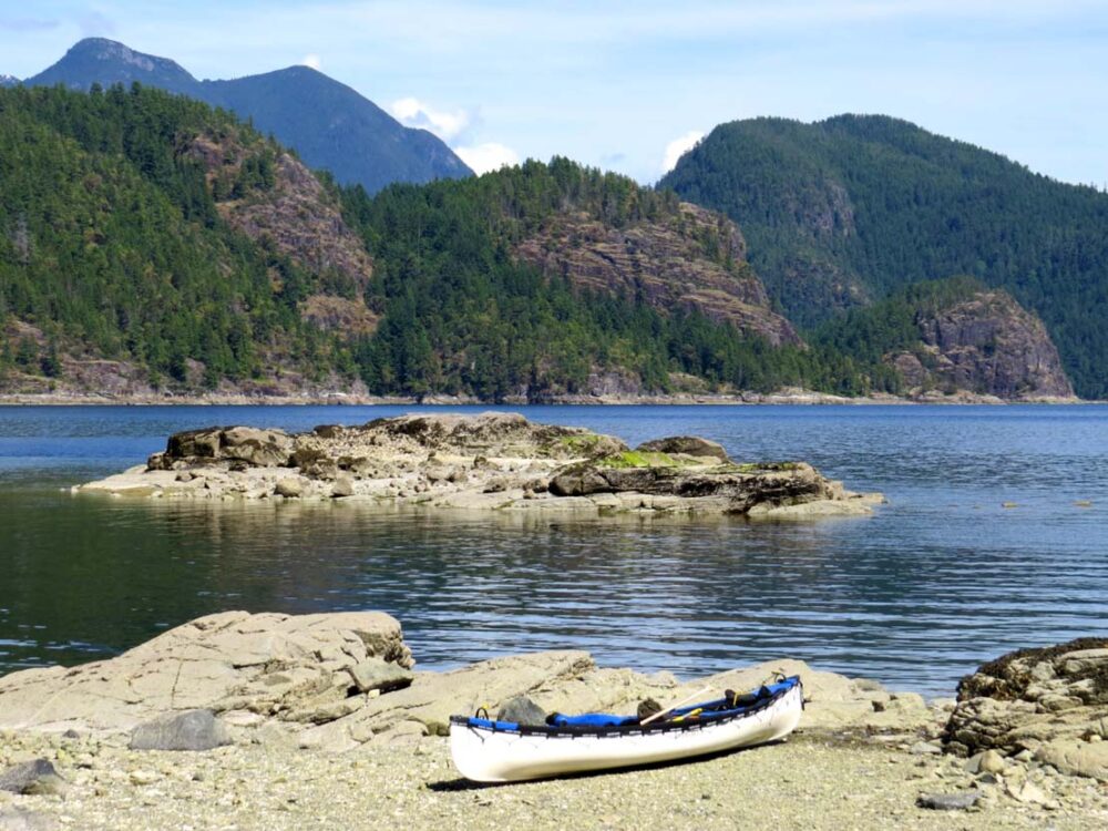
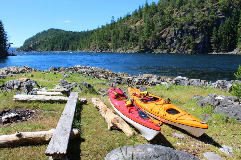
Canoe vs. kayak: paddling Desolation Sound
Lucky enough to own both canoes and kayaks, we have visited Desolation Sound with each type of boat.
The vast majority of people paddling in Desolation Sound are equipped with kayaks, but we did spot one other canoe on our first trip. We paddled a little faster in the kayaks than the canoe and felt that they handled better in rougher water.
Most campsites in Desolation Sound are on rock bluffs or headlands. Accessing them was easier in the kayaks, with one person getting out of their kayak and then helping the other.
Moving the kayaks to higher ground was also a simpler process as they weigh only 45lb each compared to the 80lb canoe and spray deck.

Outdoor gear we’ve used paddling Desolation Sound
For the curious, I thought I’d compile a list of some of the outdoor gear we used on our most recent paddling trip in Desolation Sound.
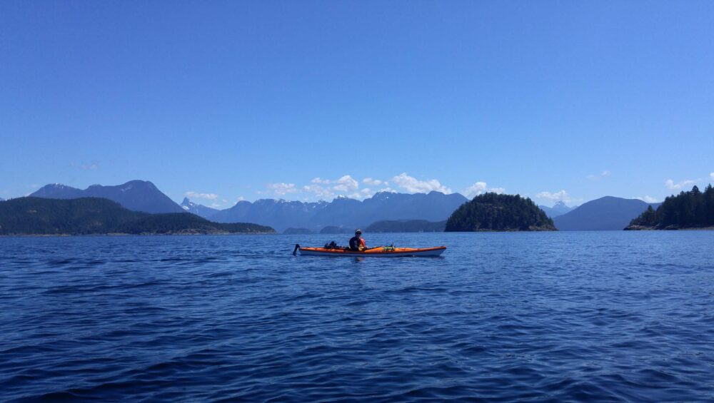
- Kayaks – We use 14 feet Delta kayaks. They are thermoformed (ABS acrylic) kayaks made in Maple Ridge, Vancouver. Lightweight, durable and easy to manoeuvre, we love our Deltas. And they look great too!
- Camp kitchen – On this trip, we used a Jetboil Genesis cooking stove. It’s a bit of a luxury set-up for the backcountry but we really liked the quick cooking time and convenience of having two burners
- Tent – Our MSR Freelite 2 is standing the test of time so far, with over 150+ nights of successful use over six camping seasons. The weight (2lb 11oz packed) is ideal for any backcountry trip we do. The floor space is not as roomy as the Hubba series equivalent, which prioritises space over ultralight weight
- Sleeping – We both sleep well on our Exped Synmat HL Duo and love how it enables us to use the (relatively small) living space of our tent to its full potential. Sleeping bag wise, we use a couple of MEC sleeping bags (similar to this one for Gemma and this one for JR)
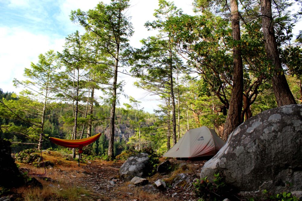
- Hammock – Our ENO Doublenest hammock is perfect to bring on paddling trips when we have a little more flexibility with space and weight. It’s great to have somewhere else to hang out and relax
- Clothing – No matter the time of year, we always wear lots of merino wool. Not only does it have natural SPF protection, but merino dries reasonably fast, holds warmth even when wet and doesn’t stink
Check out our Shop for more outdoor gear recommendations for trips like this

If you’re planning a trip to Desolation Sound, let me know in the comments!


Check out these other paddling posts next:
Bowron Lakes Canoe Circuit: A Complete Paddling Guide
Wallace Island: An Idyllic Kayaking Destination in British Columbia
Kayaking the 100 Wild Islands, Eastern Shore, Nova Scotia
Paddling Murtle Lake in Wells Gray Provincial Park, British Columbia
A Intro Paddling Guide to Algonquin Provincial Park, Ontario


One half of the Canadian/British couple behind Off Track Travel, Gemma is happiest when hiking on the trail or planning the next big travel adventure. JR and Gemma are currently based in the beautiful Okanagan Valley, British Columbia, Canada. Consider buying us a coffee if you have find any of our guides helpful!
Hey!
Thanks for the great info. I have paddled to the Curmies from Cortez, but this year we are going to go from Lund. How long is the average paddle assuming no big winds?
Thanks,
Barri
Hi Barri!
It would take around five hours, hugely dependent on your paddling speed and also the weather.
Hi Gemma,
I am glad to discover your blog -it’s highly informative, just what I need to prepare for a solo trip to Desolation Sound. I have quite a few questions which I hope you can help me with? I have included my email so you can reach me there if that’s more convenient.
Sure! Feel free to ask here as the answers may help others with their own trip planning. If the questions are more personal than you’d like to share, do email me direct at gemma[at]offtracktravel.ca
Hi Gemma,
Would you know where a good place to pick up charts of Desolation Sound? We are paddling there next week and would like a better chart than the ones we have found. I am especially interested in ones that show the strength of the tidal currents..
At this point so close to our trip, I’m thinking that our best option would to buy one from a shop in your area. We will be putting in at Okeover. Thanks for any advice you can give.
Bruce
Hi Bruce! The last time I was in Lund, the Terracentric Coastal Adventures sold some. I would give them a call first, though, just in case they don’t have any.
Thanks for getting back to me!
I’m thinking of launching from Lund and potentially setting a basecamp at Copeland Islands. It’ll be a short trip (4 days) and I am worried about the lack of campsites in August. So I’m thinking its best to be sensible, especially with a solo trip.
Logistically, do you know if its possible to travel from Vancouver to Lund and launch the same day (considering wind, weather, double ferry crossings etc)
Let me know your thoughts!
Hi Melissa! I would say it is possible, but I would not recommend it. It puts a LOT of pressure on the ferry journeys going well and the weather conditions still being OK by the time you reach Lund. You would have missed the calm conditions that are likely in the morning. It is true that the Copeland Islands aren’t far and the journey is pretty sheltered, so it does also depend on your kayaking skills and confidence. For me personally, I wouldn’t like having to rush the ferries, the driving, the packing etc. I also wonder if you’d be better off looking for a campsite in the morning rather than the afternoon (this does depend on the day of the week though too).
Hi Gemma,
I think I will plan according to conditions the day of. I am intending to arrive this Sunday and keeping my fingers crossed that camp sites are still available on Copeland Island if I am to launch in the late afternoon. That being said, it IS mid summer…
Did you have any issues with critters like bears or raccoons? Should I attempt a bear hang or keep my stuff tight in my kayak hatch?
Are there any freshwater sources at/near Copeland Islands? I’ll be bringing water but just wondering.
We didn’t have any issue with racoons or bears, but we’ve always used a bear hang or kayak hatches in Desolation Sound. Note that the trees on the islands tend to be small. I am not aware of any freshwater sources on the Copelands. On our most recent trip, we went to Refuge Cove for water.
I’d love if you could let me know how your trip goes, especially regarding the availability of camping. The campsite we stayed at on the Copelands (the most northerly island) had many tent pads so I’m interested in how busy they really get.
ah, thanks for the tip on the tent pads. i spoke to the rental associate at Powell River Kayaks and they said no one’s had issues being turned back this season due to a full campsite.
i will for sure update you on my trip. thanks again for your help and i’m glad i found your website!
i’m back!
first things first, it wasn’t busy when i went to Copeland Islands (Sunday-Wednesday). I set base at Middle Copeland and was the only one for the night which is an interesting experience. There were maybe 3-5 other campers between Middle and North Copeland Islands the entire time I was there. there are definitely more recreational boaters and day trippers.
the haze from the forest fires took from the views on Desolation Sound, as well as visibility. it was one mile visibility at best-i couldn’t even make out Kinghorn Island from Sarah’s Point! so i had to abandon my initial plan of paddling to Refuge Cove.
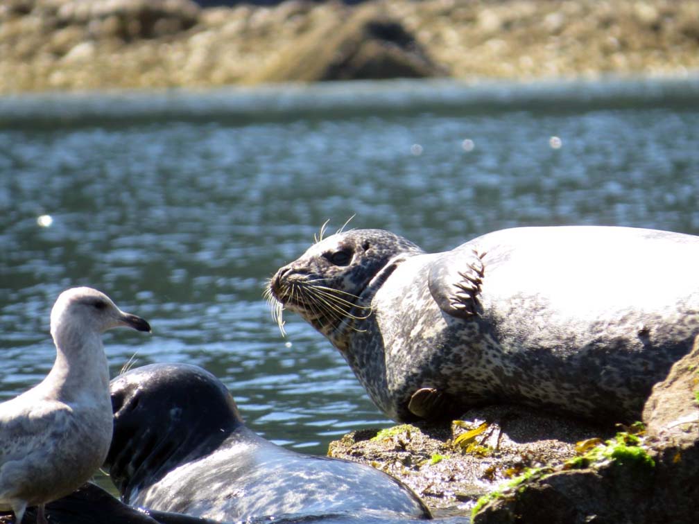
i had the privilege of seeing a pod of orcas go past Thulin Passage one morning-amazing! definitely alot of seals around. they were particularly boisterous at night-slapping, breaching, grunting and sometimes making eerie human like noises. not sure if you noticed this but there are snakes on Middle Copeland. they’re tiny but quite the surprise when you least expect them.
weather was cooperative. no crazy winds even though the forecast called for 1.0-1.5 knots.
so, next time, i think i’ll plan a late spring trip to avoid the haze. looking at your pictures, i feel like i’ve missed a special part of the Desolation Sound, i.e. the crystal clear waters. i’ll be bringing my snorkelling gear then!
Thanks for giving me an update Melissa! Sounds like you had a good trip despite the smoke. So interesting that the Copelands weren’t busy with campers – sounds like the same amount of people that were there in June. I wonder how much of that was smoke related? SO jealous about you seeing orcas!!! I always seem to miss them. I’ve been on a number of paddling trips in the area (including a 5 day kayaking trip in Johnstone Strait, specifically to see Orcas) and they always allude me. Good to know about the snakes, I haven’t come across any around the Desolation Sound area.
according to the kayak company i rented from, there’s usually enough camping space in the Copelands, as you know especially North Copeland. i think it’s the timing as well. couple of ladies i met told me the Middle Copeland’s were completely full the day before i arrived so i guess most of the camping traffic is over the weekends? and i think the smoke definitely was a factor too.
thanks again for your input-i’m sure I’ll have many other questions down the road for future trips!
Hi guys,
I am curious if you know a good launch spot from quadra or cortes island? Or is it just best from Lund?
Thanks,
Ed
Hi Ed!
Squirrel Cove on Cortes seems to be a reasonably popular place to launch from. Quadra, I think, would be a touch too far for the average paddler.
Hi Gemma,
Thanks for your blog and responsiveness to questions! We have a large group — 8 people, maybe 4 tents and two hammocks — planning on taking off from Okeover. Five days, four nights. We’d like to base camp. Any suggestions? The Curme Islands would be a perfect location, but are there enough tent pads clustered in one place?
Thanks again!
Val
Hi Valerie,
I would definitely head to the Curme Islands as it offers the most choice of sites. Of the three different campgrounds there, West Curme has at least three/four tent pads along the same shore. South Curme Island also has the tent pads set pretty close together.
Hi Gemma, thanks a lot for your article!
We are considering kayaking for 8 days in August but want to avoid crowds and be alone, or not in the middle of 100 paddlers,
DO you have area to advise ?
Best!
Hi Diane,
Glad this article helped you! I’m not sure of your kayaking experience but with that amount of time, I would look into heading up Toba Inlet!
Hi Gemma,
Thanks for your willingness to answer questions! Like Melissa, we paddled to the Copelands in the smoke last August and had the place nearly to ourselves for 4 days. The haze did clear before we left, luckily, but we enjoyed the lack of wind during that smoky time. This year we’d like to go back to the Copelands, but also to go farther into Desolation Sound. We have an 18′ voyager canoe and a young-ish son with us, so I am hesitant about the waters around the tip of the Malaspina Peninsula. Are those waters rougher than the journey out to the Copelands (from Lund)? I assume yes, but don’t really know! And in your opinion, what would be the logical next campsite for a heavy canoe after we leave the Copeland Islands? We have a week or so to play. Thanks for your thoughts!
Hi Shannon!
The waters at the end of the Malaspina Peninsula are more exposed (so, in theory, more rougher in wind), but we sometimes find that the narrow approach to the Copelands has a wind tunnel effect. So much of a muchness, in our experience. We haven’t experienced much wind in either locations, however. I would consider Feather Cove (or Hare Point) as your next destination (1 night?) and then head to Tenedos Bay or the Curme Islands if you feel comfortable and the weather is favourable. Hare Point is a really lovely sheltered spot with great views and lots of sunshine.
Hi Gemma!
We are doing a 5 day/4 night trip in Desolation sound, our first time there. Sounds like heading to Tenedos Bay or Curmes Islands are your suggestions for destination for a base camp, anything else you recommend? We are mid-range kayakers, love wildlife and the idea of swimming. Thank you!!
Hi Maura,
There are so many great base camp locations in Desolation Sound. The Curmes Islands are wonderful but you must keep in mind that most other paddlers in Desolation Sound are heading there too. So you need to time it right. Tenedos Bay is great for swimming.
We are partial to the Martin Islands as we really enjoyed our last trip there. It is a little ways from Curmes. On our next trip, we plan to explore from the Copelands as it is a very pretty spot. You can’t really go wrong in Desolation Sound!
Hi,
I have a few questions and would be happy if there is someone with answers for me. We (two people) want to do a small tour (maybe 3-4 days) next summer. We are rather new to kayaking and therefore I wanted to ask if you think an individual tour is still possible? What would you recommend? Is there any site to find distances and examples for routes upfront? And is there any recommendation for kayak rentals?
Thanks in advance,
Jenny
Hi Jenny,
To rent kayaks, some experience is required. An example of the definition of ‘experienced’ can be found on the Terracentric Adventures website (a Desolation Sound rental company I’ve only heard good things about) here http://www.terracentricadventures.com/tours/kayak-rentals/ If possible, I’d recommend emailing or calling them to discuss. It’s hard to say whether or not an independent kayaking trip would be right for you without personally knowing your experience and skill level.
My partner and I are on the novice side when it comes to rescue skills (something we need to practice) but consider ourselves to be reasonably knowledgeable when it comes to understanding tides, currents, weather issues as well as our own limits. My partner is stronger than I as a kayaker. As a consequence, we are VERY cautious when it comes to overnight kayaking trips and always paddle at my speed rather than his. When I’m not comfortable, we stop.
On our last trip to the Desolation Sound area, we decided to limit our trip to the Copeland Islands area only as we knew high winds were approaching. As it was, we still had to finish our trip a day earlier than planned, deciding to play it safe rather than fight against waves and wind above our level.
I don’t know of any specific site to find distances, I’ve always estimated with on maps.
Hi Gemma, Thanks for the great website. I am trying to decide whether to do just the Copeland Islands or explore the Malaspina Inlet (Grace Harbour & Hare Point and possibly further). I am a fairly cautious kayaker and trying to figure out which is more protected for paddling. We have 3 nights to camp. From what I read online, it seems that there are some currents North and South of Hare Point that we should watch for. How was your experience there? Also how protected/exposed did you feel going up the shoreline to Copeland Islands? My experience is mostly the Sechelt Inlet and Deep Cove area for the last couple of years.
Thanks for your help.
Alison
Hi Alison! The route to the Copelands is almost entirely sheltered from the west with the exception for the first 2.5km or so from Lund and even then, Savary and Hernando Islands can help a lot. When we were there last, we had a super strong southeastern wind so all worked against us in that it was one big wind tunnel! But that is unusual I believe.
We haven’t personally experienced any currents around Hare Point but I’m aware that they are there. This has some really good info though you’ve probably seen it already! http://westcoastpaddler.com/community/threads/malaspina-inlet.7073/
Hi Gemma! Thank you for all of the information – it has been super helpful! We’re planning our trip next week, and aren’t sure how far we’ll get paddling (may only make it to Hare Point). The only other kayaking trip we’ve done is from Deep Cove to Granite Falls (18 km), and so we may not make it to a fresh water source (may only go from Lund Harbour to Hare Point). Do you have any suggestions for how much water to bring? And do you think it’s worth pushing through to Curme Island?
Hi Sara!
We bring around 3 litres of water per person, per day. The average person needs around 2 litres, but when exerting yourself (kayaking!) more is better. The extra also covers other uses such as cooking. We always prefer to have more than less! The Curmes are beautiful but whether it is worth pushing on depends on your abilities and the weather.
Hi Gemma,
This is a great resource for planning our trip to Desolation Sound next weekend. I’m an experienced kayaker, but for this first trip to the Sound, we’ll be leaving from Squirrel Cove in my “new” 19 foot Sea Ray to explore the area. Are the campsites still open Sept 17-21? Which campsite would you recommend using for a base camp, with good shelter for anchoring our small boat? Curves?
I’ve signed up for your newsletter. Really good information here.. Thank you.
Kent
Mill Bay, B.C.
Hi Kent,
I’m so glad you found this post helpful for your Desolation Sound trip planning 🙂
The BC Parks campgrounds in Desolation Sound are open all year round. No fees will be required during your visit since they are only collected between 1st June to 15th September.
I’m not a boater but most of the Desolation Sound campgrounds are in sheltered areas. Roscoe Bay is super sheltered but the campsite isn’t that picturesque. Tenedos Bay is also very sheltered.
Thanks for the prompt reply. We’ve kayaked often around Cortes Island. Only 4 miles across from Squirrel Cove to Desolation Sound. FYI… Navionics is a great App for power boaters and kayakers. Easy to plot your “Trips” and calculate distances.
Kent
Cowichan Kayak Club paddler, Mill Bay, B.C.
Thanks for the Navionics trip Kent! 🙂
Hi there…..I’m planning a sea kayak trip to the Copeland Islands about third week of Oct. this year (2020). Do you think there will be humpbacks still? Main question: if we leave Lund and want to spend three nights out…….does everyone carry all their water in their sea kayaks for a trip like this? I assume so, but that will take lots of room. Doesn’t seem like one could carry that much water plus all their camping gear. Maybe most people are headed to Desolation Sound where there are water sources. Any info would be appreciated. Thanks, Steven
Hi Steven,
Great to hear you’re planning a trip! The peak humpback whale season is August and September, before they migrate south. There is, apparently, a small group that stays around the general Salish Sea area (between Vancouver Island and the BC mainland) all year round. So it is unlikely but you never know! We have not been lucky enough to see whales during any of our Desolation Sound trips.
Yes, we personally take all of our water for any kayak trip up to five/six days. We paddle 14 foot Delta Kayaks, which offer plenty of space to fit the amount of water we bring. Our camping equipment is, admittedly, on the lightweight/compact side.
Hey Gemma and JR! Thank you for all the helpful information. My partner and I are planning a kayak trip to Desolation this coming summer. the “Complete Guids to DS”…are those books you have written?
Hi Meganne,
Great to hear you’re planning a trip! This blog post is called the Complete Guide to Paddling Desolation Sound and was written by me. The graphics at the bottom of the post are corresponding Pinterest pins.
Hi Gemma,
Great site with so much helpful info!
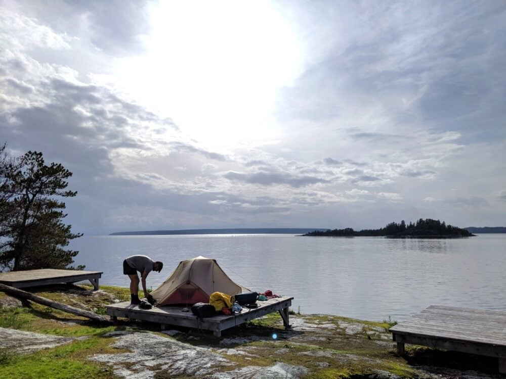
Just one question… Do you know the size of the tent pads? We’re coming up for our first visit to Desolation Sound with our two sons. Just trying to figure out if we should bring the 6-person Marmot or go for two smaller tents…
Thanks gain!
Fred
Hi Fred,
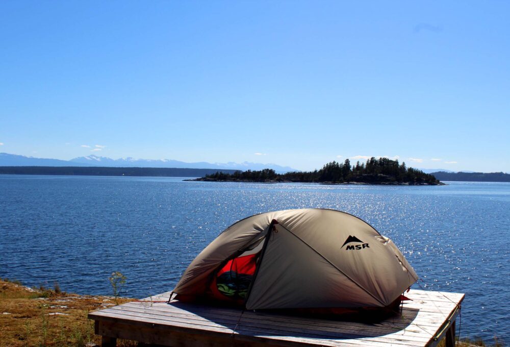
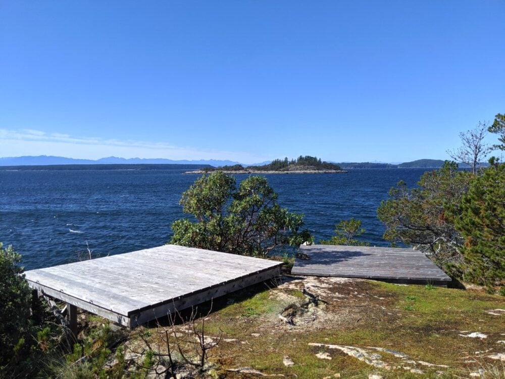
That’s a great question! We’ve never measured them so I don’t know for sure, but I believe they are 10 x 10 (feet), 3 x 3 (metres). This photo shows one of the tent pads on the Copeland Islands with our tent. Our tent is the Freelite 2 by MSR – 2.13m length, 2.79m width (with the latter including vestibules). I hope that helps with your decision!
Hi there! Looking to paddleboard Desolation Sound after my trip to Jasper and Banff went south due to the wildfires and smoke. Do you have any good suggestions for a day trip? Or two day trips? Thanks!
Hi Lisa,
Sorry to hear about your cancelled trips. For a day trip (though keep in mind I’m a canoe/kayak paddler) I would head to the Curme Islands or explore Okeover Inlet.
Hi Gemma – change in plans forced by Kid two needing research for uni – so goodbye broken group- hello desolation sound – mid aug – argh – going to be busy right? In your non-binding opinion, is staying at the Marine park camping the better option? this trip has been on my bucket list for so long – looking forward and only slightly freaking out about planning new kayak routes – length of day trip – planning – arghhh – but hey this web page is great – cheers
Hi Dave,
Sorry to hear that your plans for a Broken Group trip didn’t work out. Desolation is sure to be busy. I’d avoid heading out on a weekend if you can. I would aim for the marine park sites but keep some informal sites in mind if you get super stuck.
Hi Gemma – We are thinking about using a canoe for Desolation Sound so I was hoping to read your article about that canoe trip you did but the link at the bottom of this article doesn’t send me to that other article – it loops back to the same one. This is the text I was clicking: Read More: Paddling Desolation Sound in a Canoe, Our Experience. Could you please share the correct link with me please?
Thanks, Shannon
Hi Shannon,
Thanks for pointing out that dead link! I recently removed that article from our website as part of our annual audit. I still have the post text – I can email it to you if you’re interested. Please let me know and I will send it on.
Do you know what the thickness of the boards used on the platforms is? I read about these fishbone stakes, but I think they can only be used with 2x boards. https://www.amazon.com/BONANA-Fishbone-Lengthen-Tensioner-Accessories/dp/B07SN211SD “Its fit for the max depth of wood is 1.97”
Hi Chris,
Standard BC Parks tent pads are made from 2×4 or 2×6, which are 1.5″ thick after production.
My friend and I are planning to go to desolation sound for kayaking early July 2024
Hope you have an amazing trip!
@Gemma,
Hi,
Thanks for the information
Also all the Q and A are helpful
Just to clarify we can’t book the campsites in advance? We just show up and see if any site available?
Also what level of experience we need? We got our level 1 certificate and are doing our first kayak trip ever with a tour guide to broken group islands end of this month.
In your non binding opinion Do you think we could do this say in august mid week on our own?
Thanks
Hi Nasim,
Yes, that is correct. There is no reservation system for the campsites.
With level 1, the recent Broken Islands experience and a favourable weather forecast, I think you’d be fine (non-binding opinion ;))
Thank you Gemma!
I’m thinking about taking this on with our Clipper Tripper. Any other words of wisdom that you would have for someone going with a canoe?
Hi Joel,
Be prepared to tie up your boat every night (compared to lakes where we wouldn’t!), carry some weight in the canoe when paddling on day trips without all of your gear (better for cross winds), be cautious, carry a marine VHF to check conditions often, wear water shoes as most of the landings are not beaches. If you haven’t paddled on the ocean much, I’d suggest researching how to read ocean waves. I really liked (and still do) having a spray deck on our canoe for ocean paddling.