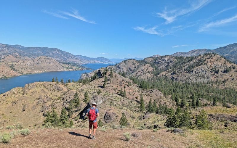
The sun drenched landscape of British Columbia’s southern Okanagan Valley lends itself perfectly to scenic hiking trails, with a concentration around the community of Penticton.
This post showcases our favourite fast and fun Penticton hikes, all of which have beautiful viewpoints and are 10km or less in length.
Think sparkling lakes, dramatic rock formations, bronzed grassland, gorgeous vineyards and more, showcased on short, easy and accessible trails.
Here’s the complete list of trails:
- KVR Trail: McCulloch Trestle
- KVR Trail and Penticton Creek Loop
- Munson Mountain
- Campbell Mountain Summit
- Campbell Mountain Traverse
- G-Spot Trail
- Canyon View Trail
- KVR Trail: Skaha Lake
- Skaha Bluffs Loop
- KVR Trail: Kaleden to Okanagan Falls
- KVR Trail: Little Tunnel
- Naramata Creek Falls
- Trout Creek
- KVR Trail: Trout Creek Trestle
- Giant’s Head Mountain
- KVR Trail: Fenwick Road to Conkle Mountain Gazebo
- Mount Conkle – Full Frontal Loop
- Peach Cliff
- Even more Penticton hiking trials
Hiking necessities
- Always bring the 10 Essentials
- Know how to stay safe in the backcountry
- Remember to Leave No Trace to help keep the wilderness wild
- Understand how to avoid negative bear encounters
- Recommended gear is listed on our Resources page
- Need a packing list? Sign up to our newsletter for a free one!

Finding Penticton hiking trails
Use the map below to locate the trailheads of these Penticton hikes.
The closest hike to downtown Penticton is only 1km away and the furthest 20km.
Living in Penticton for 7+ years, JR and I have explored the southern Okanagan pretty extensively and still continue to find new trails.
Please be sure to read the ‘essential tips’ section before heading out for a hike.
Even if you’re regular hiker elsewhere in BC, hiking in the Okanagan comes with some unique challenges!
This post includes affiliate links. If you make a qualifying purchase through one of these links, I may receive a small commission at no extra cost to you.
Penticton is located on the traditional territory of the Syilx Okanagan People.

KVR Trail: McCulloch Trestle
Length of hike: 5km return
Difficulty: Very easy (mostly flat, wide trail)
Trailhead location: Vancouver Place, Penticton
Facilities: Benches, bins, flush washroom building en route (around 1.5km)
The decommissioned route of the Kettle Valley Railway (of which Penticton was once the headquarters) is now an incredible multi-use trail network.
Our go-to hike for visitors to Penticton, this section of the KVR is super close to downtown, is almost completely flat and offers wonderful views of Okanagan Lake, Okanagan Mountain Park, Summerland and Penticton.
This trail offers the chance to get close to the iconic Penticton sign and learn some KVR history along the way from the interpretive placards.
The turnaround point is the impressive wooden McCulloch Trestle bridge, named after the Kettle Valley Railway’s chief engineer Andrew McCulloch.
Parking at the trailhead can be limited, so if you can, walk from downtown Penticton instead. The climb up Vancouver Hill is the perfect warm up!
KVR Trail and Penticton Creek Loop
Length of hike: 3km loop
Difficulty: Easy, paved trail with several sets of stairs, short road section and a hill
Trailhead location: Penticton Art Gallery
Facilities: Benches, public toilets near by
This little loop walk is a creation of our own, combining two of downtown Penticton’s urban trails. It features wonderful elevated view of Penticton from the KVR and then a relaxing stroll along the Penticton Creek.
I’ve suggested to start at the Art Gallery as there is a public parking lot nearby. From here, walk back to the roundabout and head up Vancouver Ave. You’ll pass the popular Bench Café, so consider picking up a coffee on the way up the hill.

The sidewalk intersects the KVR Trail at the top. Turn right onto the KVR. After 400m, the views of Penticton appear. At the next set of stairs, head down to Wade Avenue. Continue straight ahead to the corner and you’ll see a path crossing the creek.
Turn right after the bridge (look for salmon at the bottom of the ladder in autumn!) and follow the creek back to downtown Penticton. The path comes out very close to the roundabout in front of the Art Gallery.

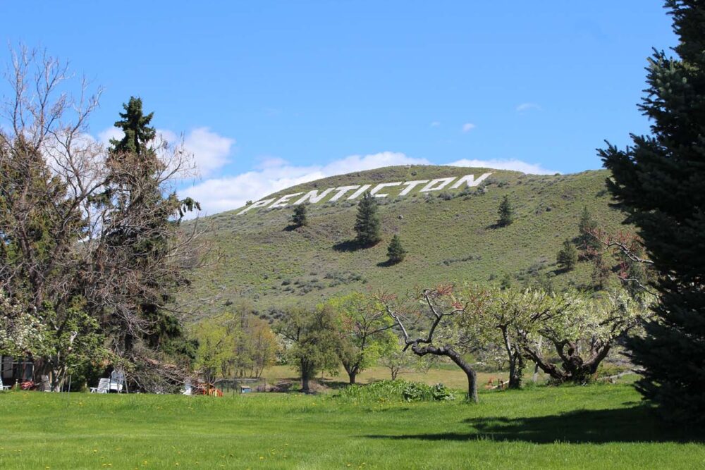
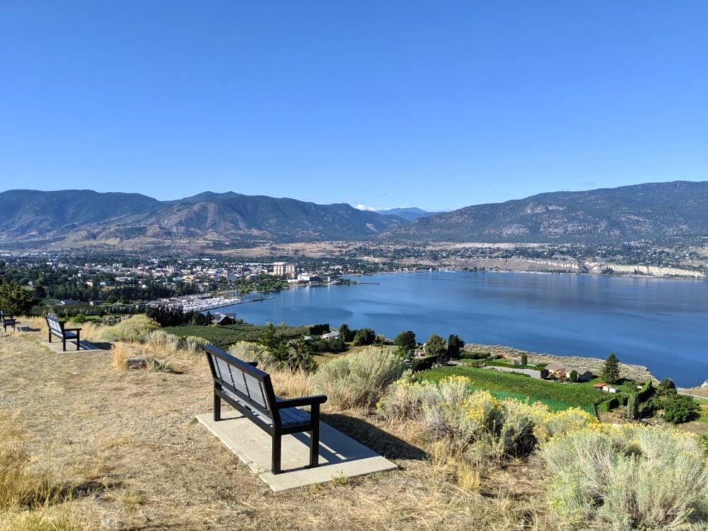
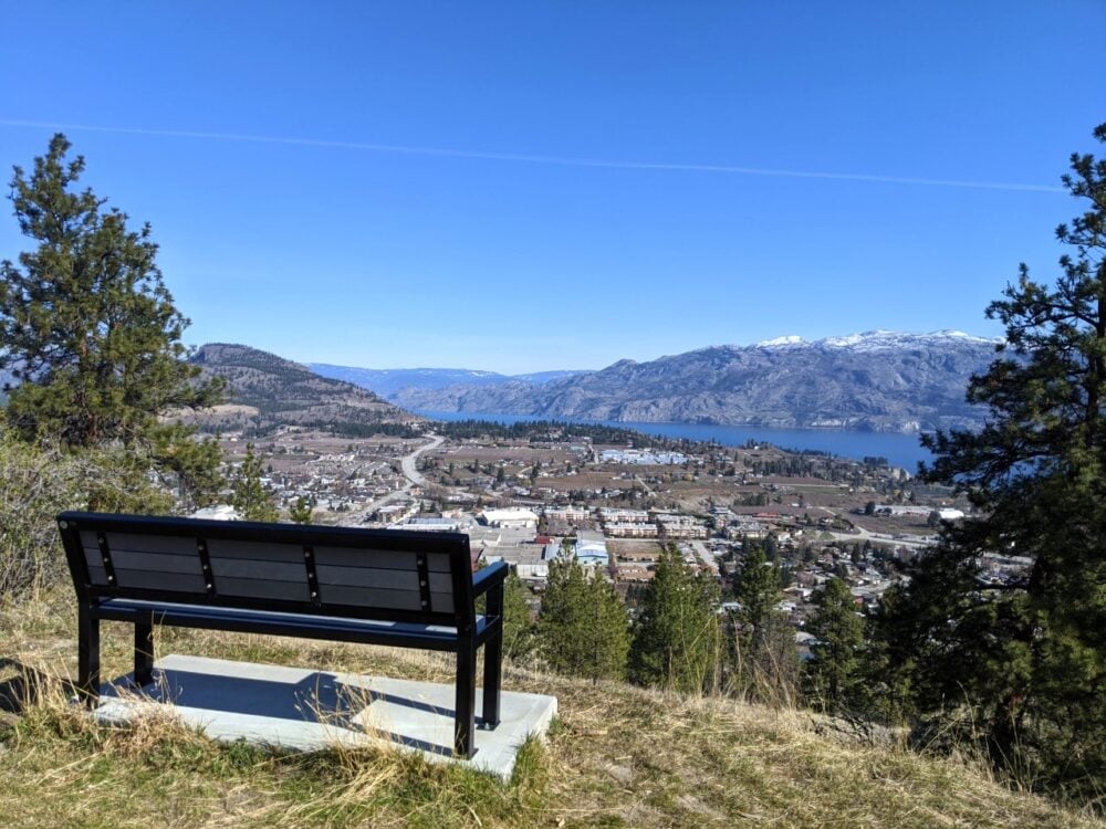
Munson Mountain Viewpoint
Length of hike: 900m return
Difficulty: Easy (short, uphill trail)
Trailhead location: Munson Mountain Road, Penticton
Facilities: Benches, shelter
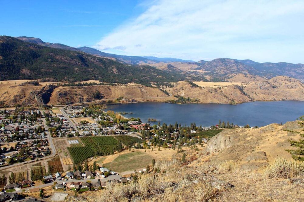
OK, so this one is more of a short stroll but it’s still a must do. Munson Mountain is home to the giant Penticton sign and provides panoramic views of Okanagan Lake, Naramata Bench vineyards and Penticton itself.
Originally built in 1937, the iconic landmark is actually larger than its Hollywood counterpart.
From the parking lot, it’s an easy walk to the first viewpoint. There’s a shelter and benches here.
More adventurous visitors should continue up the hill to the summit of Munson Mountain itself. The views get remarkably better and you can even look down on the startling white Penticton letters.
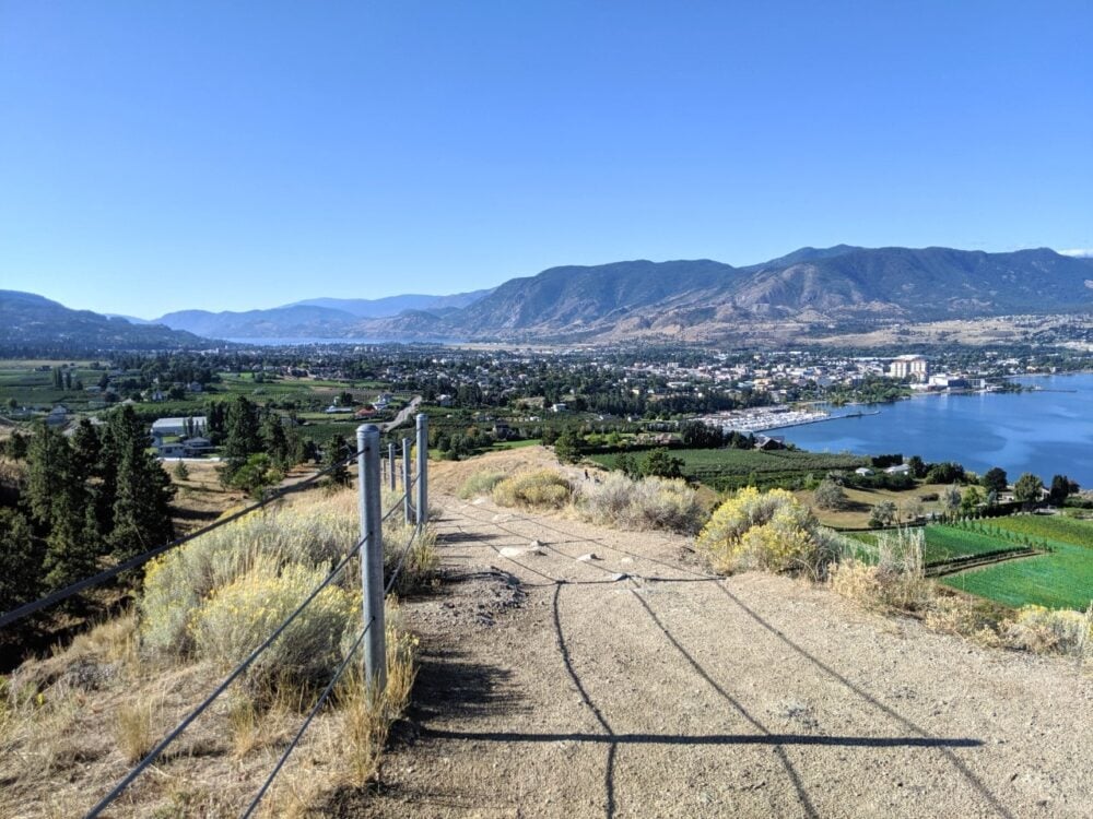
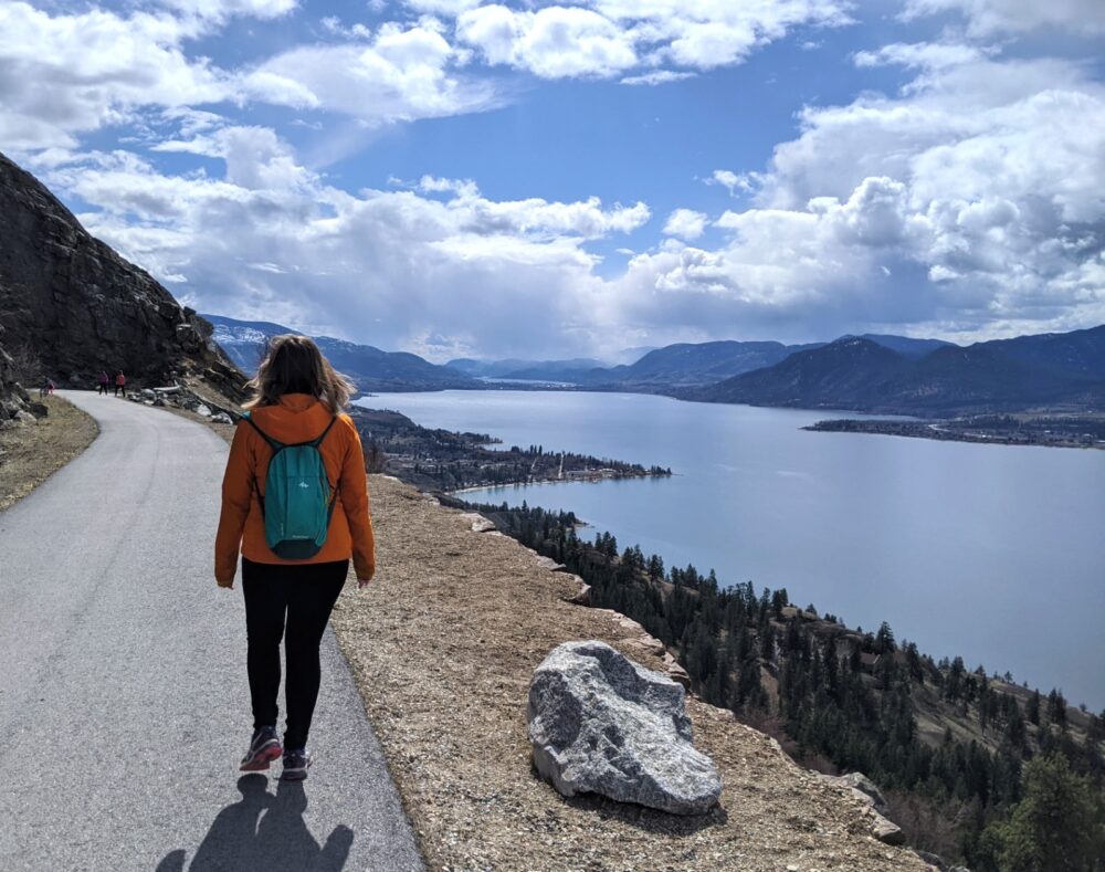
Campbell Mountain Summit
Length of hike: 6km return
Difficulty: Easy but does feature constant elevation gain (200m)
Trailhead location: Greyback Mountain Road, Penticton
Facilities: Bin in parking lot
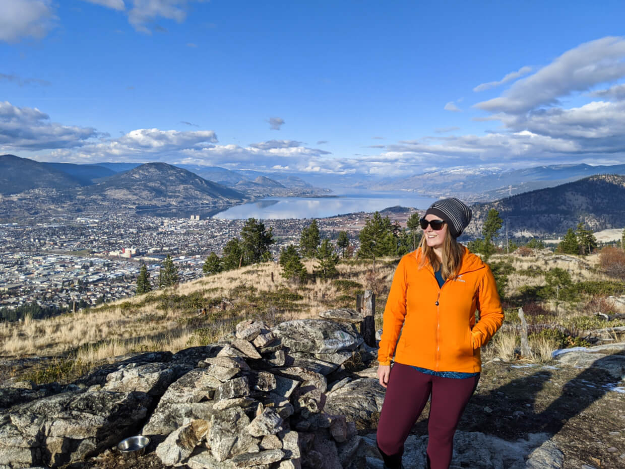
Campbell Mountain is the peak that looms closest to downtown Penticton and is an excellent choice if you’re looking for a short workout combined with city panoramas.
The ascent to the 844m summit isn’t steep but it is steady. The rewards are seen quickly as the trees dissipate just beyond the cell phone towers at the top to reveal wide ranging views of towards Skaha Lake.
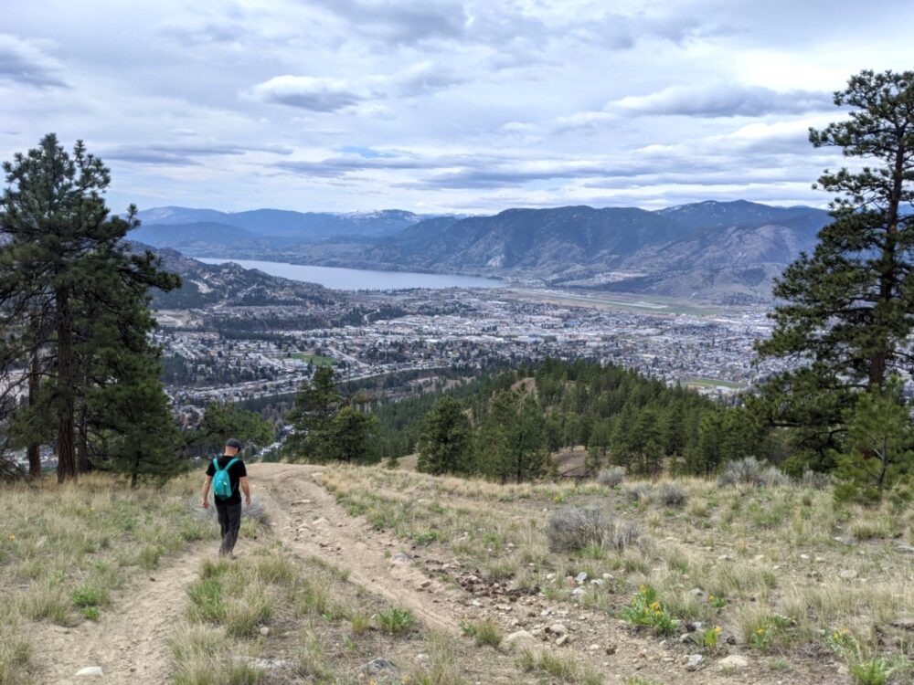
This is a popular mountain bike area. There are many routes to the top, but if you want to play it safe, walk up the gravel service road. It leads all the way to the cell phone towers at the top.
From the main parking lot just beyond Campbell Mountain Landfill, walk across the cattle grid and look for the turn off on the right. A yellow gate signifies the start of the summit hike.
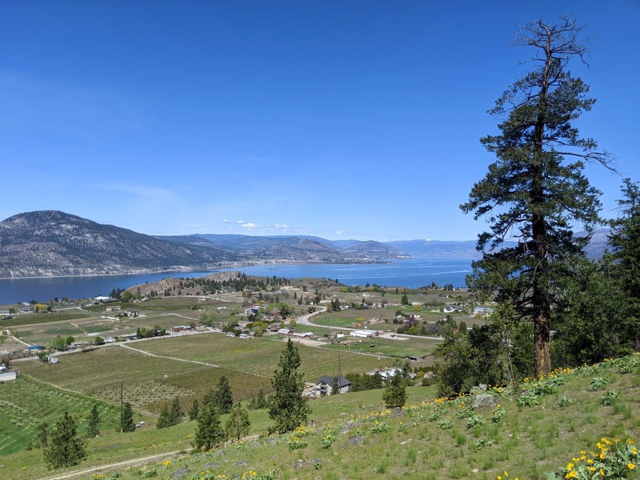
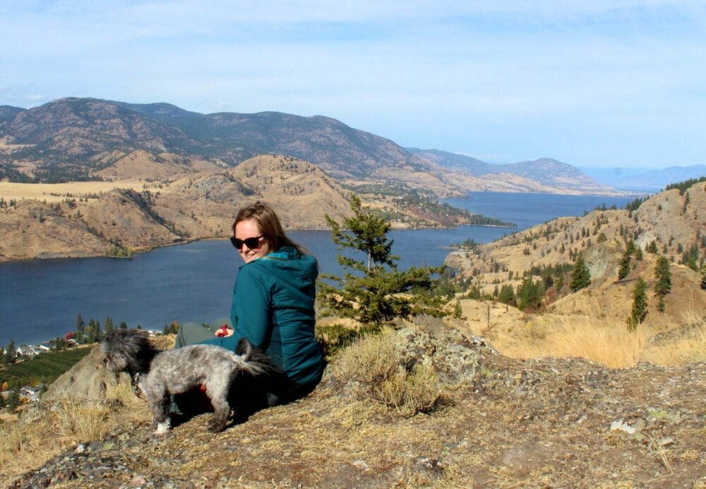
Campbell Mountain Traverse
Length of hike: Approx 6km (but free to turn around at any point) return
Difficulty: Mostly flat path, but winding and narrow
Trailhead location: Reservoir Road, Penticton
Facilities: None
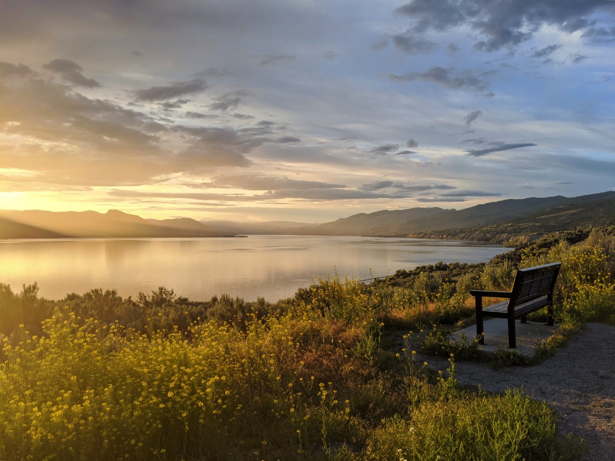
This lovely trail offers something a little different in that it is not a summit climb nor part of the KVR. Instead, you’ll find a winding traverse along the side of Campbell Mountain with stunning views of the Upper Bench as well as both Skaha and Okanagan Lakes.
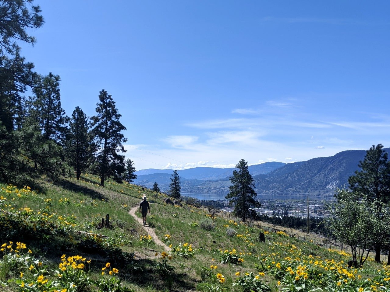
This hike is particularly beautiful in April and May, during the arrowleaf balsamroot (a type of sunflower) bloom.
The trailhead is at 1550 Reservoir Road, at the end of a private driveway – look for the old farm equipment. Being that the small parking lot is on private land (thanks Dave), please be extra respectful to help keep this trailhead open.
To reach the trail, go through the gate and head left and then right at the junction. This path continues for about 2.5km along the base of the mountain. There are quite a few forks so be mindful of the route you take. When the path finally petered out, we decided to head up the hill and then took another parallel trail back.
Please note that this trail is a lot narrower than other paths mentioned here. It is also used by bikes, so keep alert!
G-Spot
Length of hike: 9.5km loop (or 8km out and back to the summit)
Difficulty: Low side of moderate, features switchbacks, narrow paths, rocky sections, 300m elevation
Trailhead location: Skaha North Parking, Evergreen Drive, Penticton
Facilities: Bin and outhouse in parking lot
The G-Spot Trail treats hikers to surprisingly epic views of Okanagan Lake and downtown Penticton. Dozens of short switchbacks lead the way to the summit, though the lack of trees allows for plenty of scenic stops along the way.
As well as offering incredible panoramas, the G-Spot Trail is a great training hike, if you’re looking for that kind of thing.
We hike the G-Spot Trail as a fast loop in just over two hours, with a 20 minute break at the top. An out and back route would be slightly shorter.
There is a huge parking lot at the Evergreen Drive trailhead. It’s also used for northern access into Skaha Bluffs Provincial Park. Alternatively, start from the smaller parking lot at the end of the Wiltse. There are various loops you can do from here, most around 6.5km to 7km.
From the Evergreen Drive trailhead, start from the yellow gate in the parking lot. 600m later, the trail divides. Keep right. The first G-Spot sign (painted on a rock) is another 1.2km ahead and marks another right turn. There are rock signs all the way to the summit. I’d recommend following one of the suggested routes on All Trails.

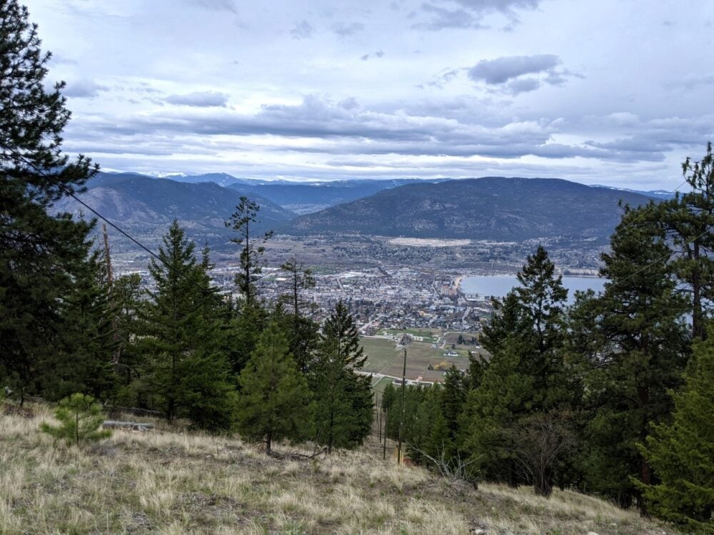
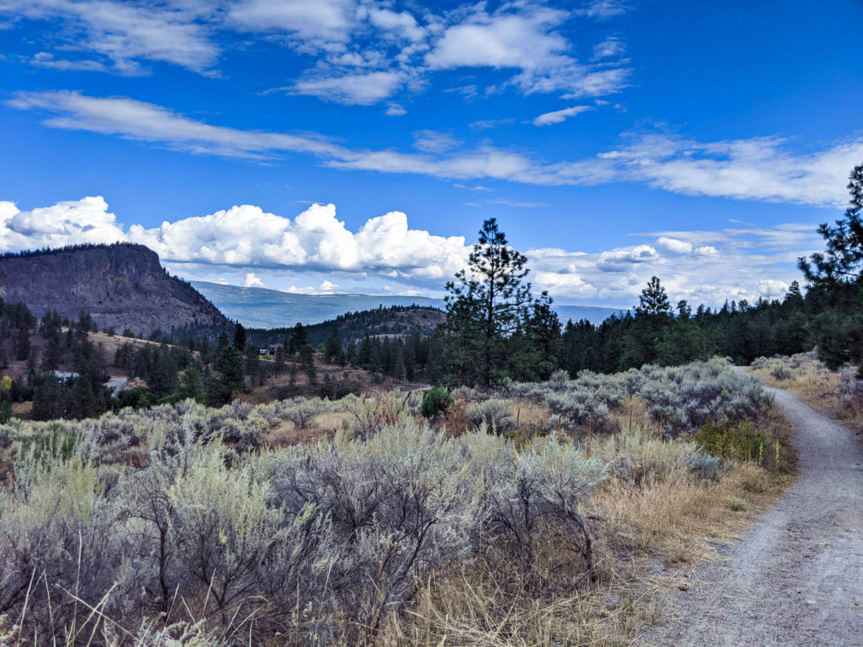
Canyon View Trail
Length of hike: 1.5km loop
Difficulty: Easy (some short descents/ascents)
Trailhead location: Garnet Fire Recreation Site on Beaverdell Road
Facilities: Outhouse, picnic table, trailhead signage
This short scenic trail offers great ‘bang for buck,’ since the trailhead is located high in the hills above Penticton. Excellent panoramas of Penticton and Okanagan Lake can seen within a few minutes of leaving the trailhead.
The Canyon View Trail features a 1.5km loop, which can be hiked in either direction. Personally, I find clockwise to make the most sense. The best viewpoint is located about two thirds along the route (going clockwise), on a side trail.

If you’d like to extend your hiking experience, consider hiking the Ellis Ridge Trail as well – here’s the AllTrails map.
There are many other unofficial routes branching off from the main trails. A wildfire blazed in this area back in 1994 so trees are pretty thin on the ground, making navigation easier.
Please note that this trail does venture near (but not on) some steep cliff edges. Keep dogs and children close.

KVR Trail: Skaha Lake
Length of hike: 5km return (but up to you!)
Difficulty: Very easy (flat, wide path)
Trailhead location: Wright’s Beach Camp
Facilities: None
This section of the KVR Trail follows the shore of Skaha Lake. I’ve suggested a round trip of 5km above, but honestly, you can go as far as you like. The path is situated right at lake level, offering great views.

As with the rest of the KVR Trail, this surface is very flat and suitable for all abilities. This section is a little narrower than others, so keep an eye out for bikes.
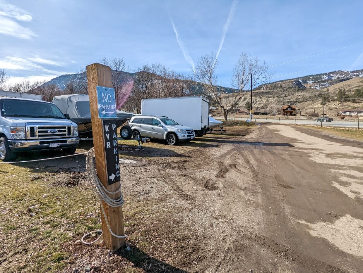
The trailhead for this hike is located at the southern end of Wright’s Beach Camp. There is dedicated parking just beyond the main office, backing on to Highway 97. Look out for the black ‘KVR Parking’ signs. If you’re found yourself in the main campground, you’ve gone too far.
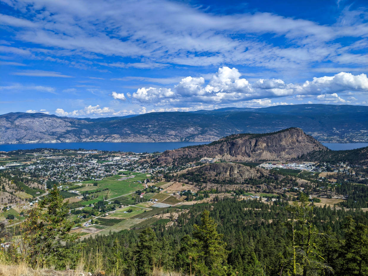
Skaha Bluffs Loop
Length of hike: 3.4km loop
Difficulty: Low side of moderate, features switchbacks, narrow paths, rocky sections, 150m elevation gain
Trailhead location: Skaha Bluffs Provincial Park
Facilities: Outhouses in parking lot
Skaha Bluffs Provincial Park is one of the most popular places for rock climbing in British Columbia. Multiple narrow canyons of gneiss host over 1000 climbing routes, mostly sport.
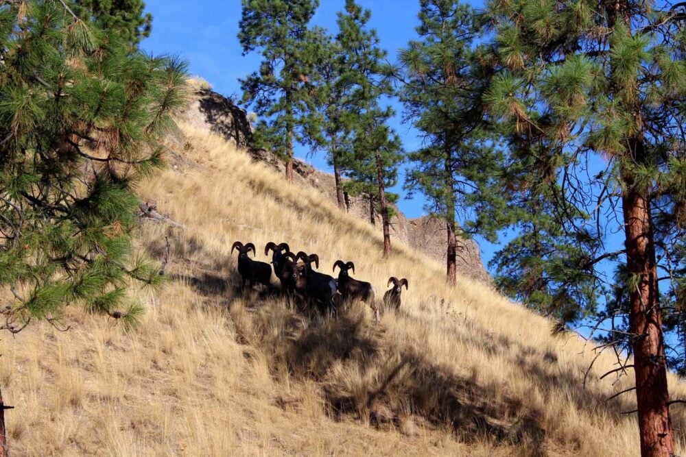
Not protected only for its recreational value, this park is also home to many provincially or federally listed at-risk species, such as the night snake, Western screech owl, bighorn sheep and Western rattlesnake.
The climbing crags are connected by trails, which can also be utilised by hikers. There are too many route possibilities here to list, but I’d suggest not to be too ambitious on your first visit. The trails are not marked super well and with the rocky terrain, it’s very easy to get lost.

To get a taste of the Bluffs, start at the lower parking lot. The trail travels through an open area before reaching the bluffs. Follow the signage for Red Tail.
This section features very large rocks. Don’t miss the staircase on the left hand side leading up to the Red Tail wall. There are usually a lot of climbers here from April to October.
Continue ahead until you reach an open space with an outhouse on the right. It’s possible to scramble up one of the nearby rocks to get a view. Stay right after the outhouse and follow the signs to Go Anywhere.
At the top of the hill, look for a right hand turn. This leads back to the upper parking lot past the Day Care crag. I’d recommend using Organic Maps for navigation in the Bluffs.

KVR Trail: Kaleden to Okanagan Falls
Length of hike: 9.2km return
Difficulty: Very easy (flat, wide path)
Trailhead location: Pioneer Park, Kaleden
Facilities: Benches, public washrooms at trailhead (in season)
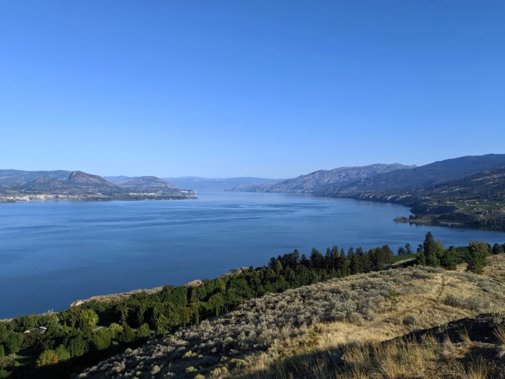
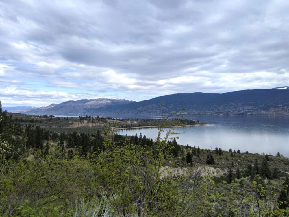
Another wonderful section of the KVR Trail, this time staying low and close to the edge of Skaha Lake.
Views abound across the water, highlighting the peculiarly shaped Peach Cliff alongside vineyards and other rocky outcrops. At the end, a long wooden trestle bridge leads to the community of Okanagan Falls.

Though I have noted above that the trailhead is Pioneer Park, the hike starts properly at the end of Ponderosa Ave. There is a dead end street with no parking and little turnaround space, so it’s best to walk from Pioneer Park.
Alternatively, you could start this hike in Okanagan Falls and walk to Kaleden and back. For a shorter walk, turn around at any time.
KVR Trail: Little Tunnel
Length of hike: 8.8km return
Difficulty: Very easy (flat, wide path)
Trailhead location: Smethurst Road, Naramata
Facilities: Benches, outhouse at trailhead, en route and just beyond the tunnel
My second favourite section of the KVR features an impressive railway tunnel and stunning Okanagan Lake views.
Despite being the smallest of two tunnels in this area, this tunnel is so big that it’s actually visible from downtown Penticton if you know where to look! The rocky area just beyond the Little Tunnel is the perfect location to take a break.
Like the rest of the Kettle Valley Railway trail, the Little Tunnel route is exceptionally flat and easy to hike. It’s more shaded than some of the other sections and the higher elevation can mean it is a little cooler in the spring and autumn too.

Naramata Creek Falls
Length of hike: 2.5km return
Difficulty: Easy with some harder sections (see details below)
Trailhead location: Just off Naramata Road, Naramata
Facilities: Outhouse at trailhead, benches
In an area where waterfalls are uncommon, the Naramata Creek Falls trail is particularly unique. The forested path follows the creek to a stunning multi-layered cascade.
The cooling spray from the falls and shaded trail makes this an ideal hike for warmer days. This also means that snow can linger later here.
The approach to the falls starts as a fairly wide, well defined flat path and crosses several bridges. After 1km, the path splits and you can choose to continue ahead on a dusty, narrow uphill trail (steep in sections, with drop-offs) or stay along the creek (right)

The latter involves crossing the water a couple of times, using rocks and logs to prevent wet feet.
In spring, the water is knee-height so wading is necessary if you go this route. Note that the water current can be strong. Plenty of viewpoints await, though be cautious of slippery moss and rock.
The trailhead for this hike can be easily missed. Slow down after passing the Naramata Fire Department and keep watch on the right. The road leading to the trailhead is in between the bus stop and the green ‘Creek Park’ sign.

Trout Creek
Length of hike: 2km
Difficulty: Very easy (flat, wide trail)
Trailhead location: Just off Green Lake Road, Summerland
Facilities: None
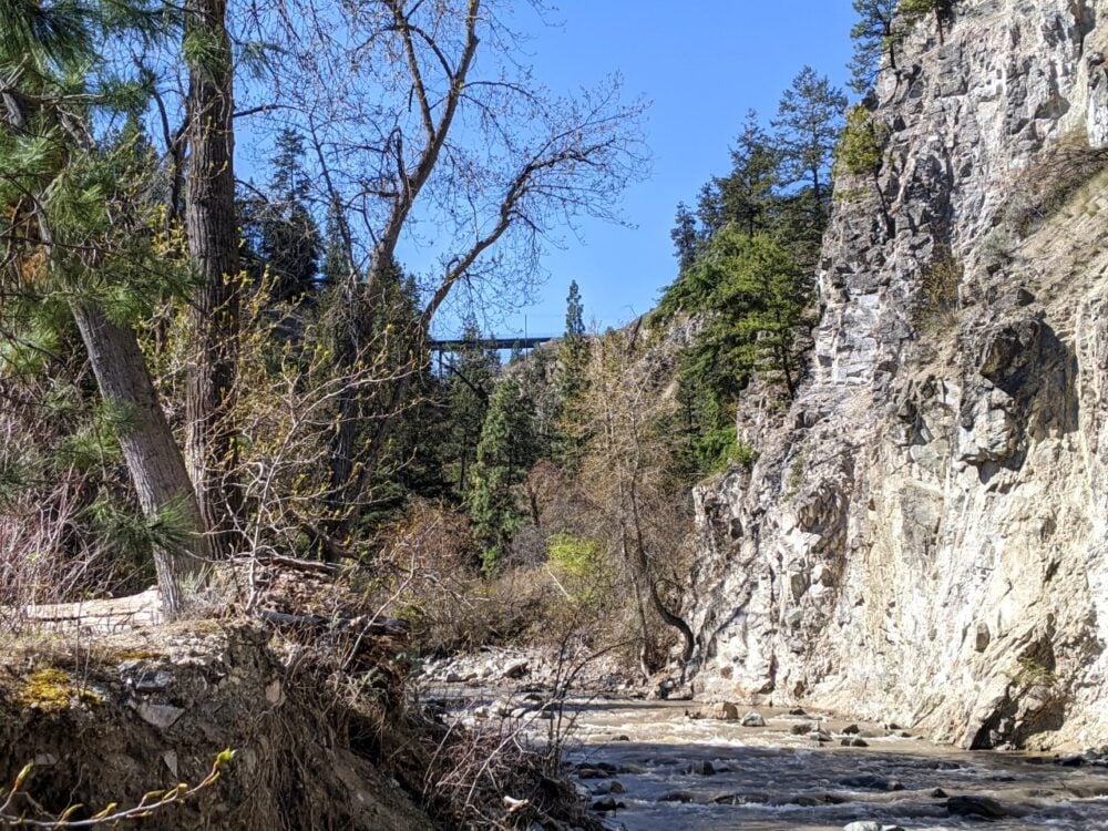
This relaxing short stroll follows Trout Creek as it heads west into the dramatic canyon of the same name.
The hike starts on a wide, exposed path with views towards Giant’s Head Mountain (you can see the face from here!) and the relaxing noise of the creek.

About 500m in, the path heads into the trees and the canyon itself before abruptly finishing at the side of the creek. If you look carefully, it’s possible to spot the Trout Creek Trestle (below) upstream.
If you’d like to extend the walk, it’s possible to walk further along Trout Creek (from the parking area) towards Okanagan Lake, via Sun-Oka Beach Provincial Park. This adds approximately 2km return.
KVR Trail: Trout Creek Trestle
Length of hike: 6km
Difficulty: Very easy (flat, wide trail)
Trailhead location: Canyon View Road, Summerland
Facilities: None
The highlight of this hike is the Trout Creek Trestle, a 73m high, 76m long deck truss bridge across a deep canyon. This was the highest structure on the Kettle Valley Railway.
Follow the flat path beyond the impressive trestle to take in scenic views of Okanagan Lake, Okanagan Mountain Park and the Sun-Oka Beach peninsula.
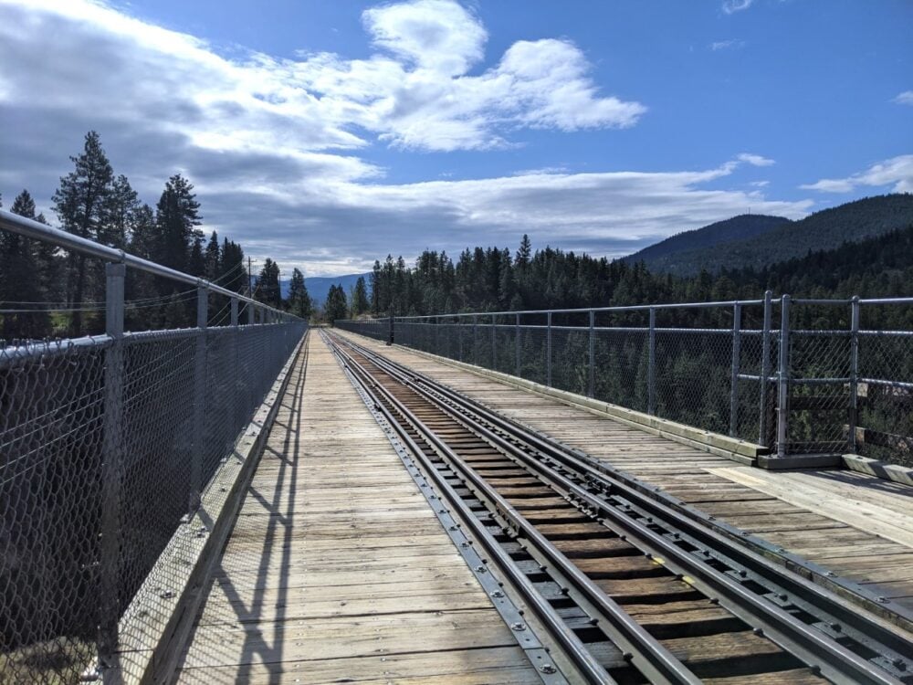
This section of the KVR still features a working 1912 steam train during the summer and special events throughout the year (check the schedule here). No pedestrians are allowed on the bridge when the train crosses.
From the trestle, the KVR trail continues all the way back to Penticton. In reality then, you could walk as far as you like before turning back and returning to the trestle. We found the best views to be around the 2.5-3km mark.
Giant’s Head Mountain
Length of hike: Varies (details in our guide)
Difficulty: Easy to moderate but does feature constant elevation gain (350m)
Trailhead location: Milne Road, Summerland
Facilities: Benches, bins, outhouses near summit
The short and steady climb to the top of Giant’s Head Mountain offers a satisfying workout as well as stunning views of Okanagan Lake, Summerland and across to the Naramata Bench.
A local landmark, Giant’s Head Mountain is the remnant of an ancient volcano eruption. When approached from the southeast, there is a face-like profile visible on the side of the mountain – it can be seen from the Trout Creek Trail.
The surrounding scenery is a constant reward all the way to the 850m summit, where a Canadian flag, time capsule and numerous viewpoints await.
Hikers can choose to hike the paved road or numerous side trails to reach the top of Giant’s Head. The paved route is the easiest route and also the best path to take in early spring when the trails are still thawing out.
I really enjoy hiking on the road to start and then switching to the Friendly Giant Trail after 860m and then the East Ridge at the viewpoint.
Giant’s Head is my favourite training hike and you’ll often find me hiking up the Grind route in spring with a fully loaded backpack.

KVR Trail: Fenwick Road to Conkle Mountain Gazebo
Length of hike: 3km return
Difficulty: Very easy, gravel path with very little elevation gain
Trailhead location: Fenwick Road, Summerland
Facilities: Picnic tables and outhouse at gazebo
This relaxing walk along the sage brush lined KVR Trail culminates at a gazebo with an outstanding view of Summerland. It makes for a lovely short outing on a well established route. Of course, you can continue further along the path for a longer hike.

The trailhead for this hike is located on Fenwick Road. Look for the large Trans Canada Trail sign with ‘Fenwick Trailhead’ noted on it.
There is space for 4/5 vehicles on the other side of the road (parallel parking). Be careful not to block the road as it continues to several houses.
From here, walk past the Trans Canada sign and continue around the corner of Fenwick Road. The road eventually narrows into a trail, with KVR signage. Keep right when the trail splits.
Mount Conkle – Full Frontal Loop
Length of hike: 12km return
Difficulty: Moderate, features some loose gravel sections and slow elevation gain (400m)
Trailhead location: Fenwick Road, Summerland
Facilities: Picnic tables and outhouse located 1.5km from end (or start)
Mount Conkle is situated inland of Summerland, just behind Giant’s Head. There are a number of trails crisscrossing the front and back slopes of this 670m peak, while the KVR Trail skirts around the base (see trail description above).
The Full Frontal Loop features a long, steady climb (or descent) on the front of Mount Conkle, providing impressive panoramas of Summerland, Okanagan Lake and Giant’s Head. The best views are actually found about 200m/300m beyond the true summit.
The other side of the loop winds down on the back of Mount Conkle, on the ‘Conkle Bonk’ Trail. The switchbacks are long, but there are some established shortcuts. At the 7.5km point (ish), the KVR runs parallel. We prefer to cross over at this point and return to the trailhead via the KVR.
The trailhead for this hike is on Fenwick Road, shared with the KVR (see above hike for details). When the trail splits (with the KVR on the right), stay left to head up to Mount Conkle.
Note – Black bears are commonly seen in this area. We have personally seen a lot of scat on the trail

Peach Cliff
Length of hike: 5km return
Difficulty: Moderately easy, features uneven surfaces and elevation gain (200m)
Trailhead location: McLean Creek Road, Okanagan Falls
Facilities: None
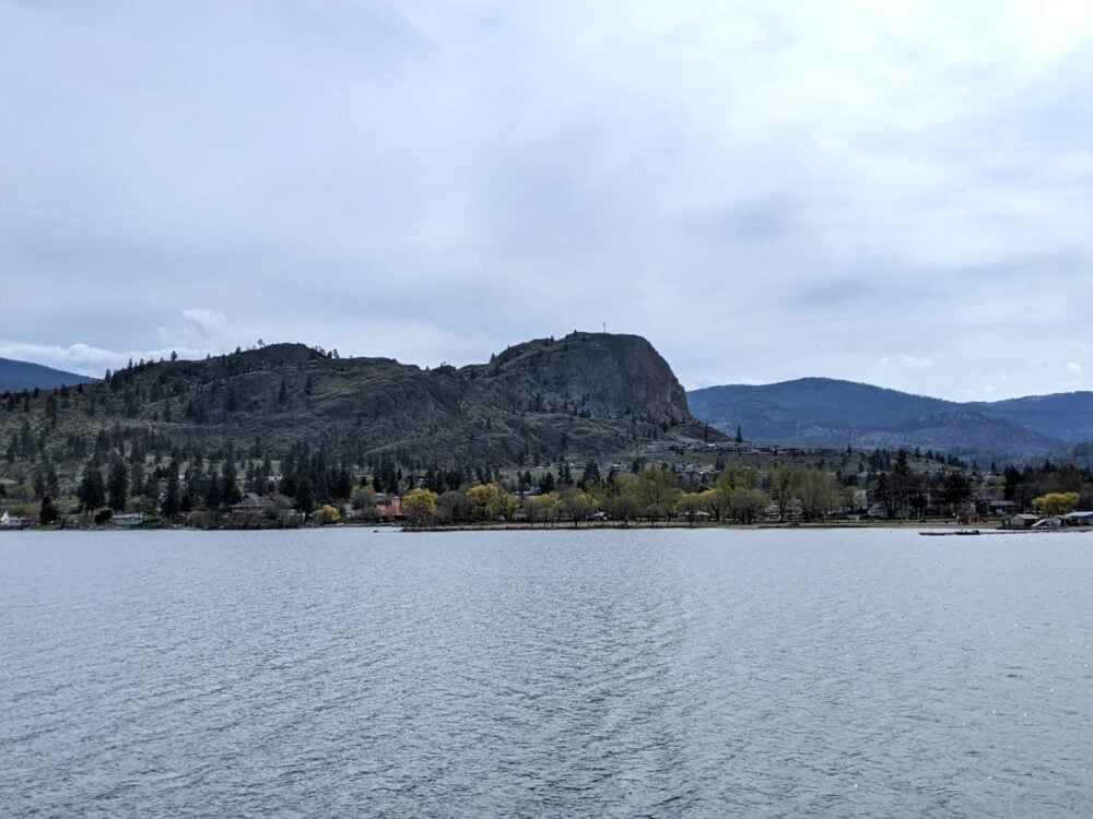
One of the most distinctive rock faces in the southern Okanagan is Peach Cliff, created from a violet history of volcanoes, earthquakes and glacial melt.
As well as providing a backdrop for Okanagan Falls, Peach Cliff also offers hikers spectacular panoramas of Skaha Lake.
The trail approaches the top of the cliff from behind, meaning that the views are only revealed towards the end of the hike.
Think of it as a reward for making the trip! An interesting side trail takes in an old quarry pit, usually sparkling green and turquoise in the sun.
The final section of the Peach Cliff trail becomes quite narrow and steep at times, but it is not necessary to go to the top for the best views. For more info, check the below post.
Even more Penticton hiking trails
Looking for more hiking inspiration? The following trails are located a little further away from Penticton (and some are a little longer than those mentioned above) but are tried and tested favourites.
More information can be found in our South Okanagan hiking trails guide.
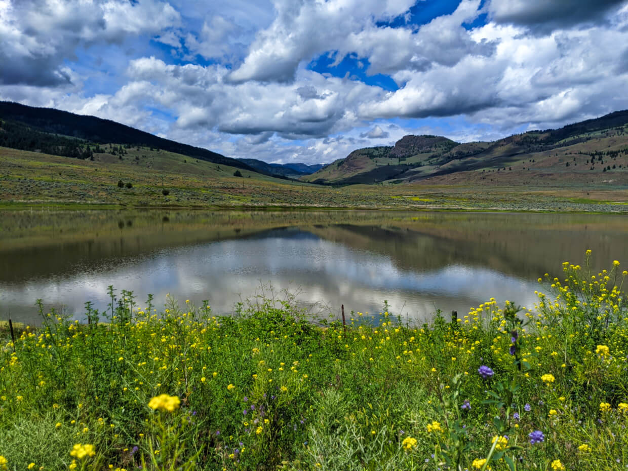
Guy’s Cache Loop in the White Lake Grassland Protected Area – 6.8km with 300m elevation gain. Features an amazing display of arrowleaf balsamroot sunflowers in late April.

White Lake Loop in the White Lake Grassland Protected Area – 12.3km with 400m elevation gain. Easy going trail with interesting alkaline lakes.
Please note that the White Lake Grassland Protected Area is used for cattle grazing. Hikers may encounter loose cows along the trails.
Dogtown Trail in the White Lake Grassland Protected Area – 7km with 430m elevation gain. Moderately challening trail leads to the picturesque summit of Mt Keogan.

Essential tips for hiking in Penticton
- Please be aware that the majority of these trails (with the exception of the KVR) have very limited signage. Navigation and attention is needed. This post is intended to be a starting point, not a definitive guide. We utilise AllTrails and Organic Maps for navigation on these Penticton trails
- All of these Penticton hikes have cell phone signal but it’s still a smart idea to tell someone where you’re going as well as your expected return time
- Unless posted otherwise at the trailhead, leashed dogs are allowed on these trails. Please be careful to pick up after your dog
- Remember to Leave No Trace of your visit on any these beautiful Penticton hikes. This means staying on trail at all times and taking care to pack out everything you bring in (including trash)
- A must on any challenging trail, hiking poles have many benefits (balance, impact reduction, endurance, speed). We usually share a pair of collapsible, superlight Black Diamond Carbon Z hiking poles

Weather
- When hiking during the summer months in Penticton, be prepared to start early (ideally around 8am or earlier) to beat the heat
- Most of these Penticton hikes are very exposed, with little shade – bring plenty of water, sunscreen and a hat. We use and recommend Just Sun – all natural sunscreen made in Canada!
- In my opinion, March, April, May, September, October and November are the best months to hike in Penticton. The temperatures are cooler, the majority of local trails are free of snow and there are less people around

Wildlife and nature
- Black bears, snakes, deer, bighorn sheep and other animals live on and around these trails. Take appropriate precautions, stay alert, make noise and keep your distance from wildlife
- We personally carry bear spray on every single hiking trail. Of these Penticton trails, I’d definitely recommend it for Mount Conkle and Campbell Mountain. If you decide carry some, learn how to use bear spray properly first
- Ticks are common in this region, with both deer and wood ticks being present. Cover up, avoid grassy areas where possible and check your clothing (and body) after hiking
- Poison ivy can be found on some of these Penticton hikes – make sure you know how to identify it
Looking to book a stay in Penticton?
Penticton Lakeside Resort – Awesome lakefront location on north side of town, within walking distance to beach, shops, entertainment, restaurants, trails
Wesbert Winery and Guest Suites – Upscale property located on the Naramata Bench, perfect for romantic getaways. Enjoy vineyard views from the rooms and wine tastings downstairs!
Casa Grande Inn – Highly rated B&B situated across from Okanagan Lake with large outdoor patio
Read these articles next:
A Perfect Summer Weekend in Penticton
A Local’s Guide to the Best Okanagan Valley Wineries
The Complete Guide to Craft Breweries in Penticton
The Best Restaurant Patios in Penticton
9 Fast and Fun Hikes in Vernon, BC
Predator Ridge Hiking: Best Trails + Essential Info
Check out these other hiking posts next

One half of the Canadian/British couple behind Off Track Travel, Gemma is happiest when hiking on the trail or planning the next big travel adventure. JR and Gemma are currently based in the beautiful Okanagan Valley, British Columbia, Canada. Consider buying us a coffee if you have find any of our guides helpful!