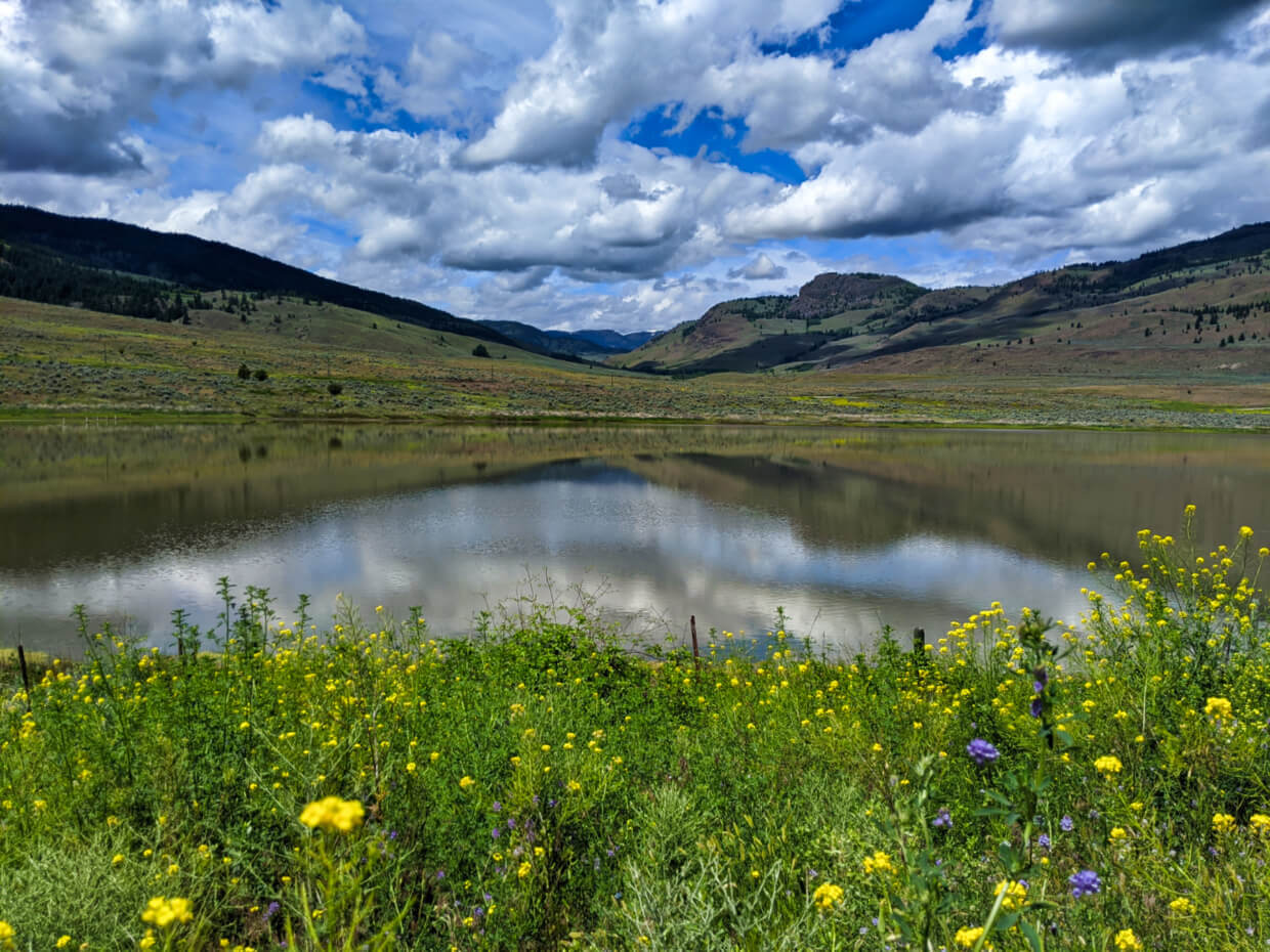
The beautiful lakes, vineyards, mountains, pine forests and grasslands of British Columbia’s South Okanagan region are best seen from the many local hiking trails.
This list showcases our top picks for South Okanagan hiking trails, from easy rail trail paths to challenging subalpine routes.
We have lived in this region since 2015 and have personally hiked each of the following trails multiple times (as well as many others!)
Here’s what to expect in this post:
- Pincushion Mountain, Peachland
- Giant’s Head Mountain, Summerland
- Mount Conkle, Summerland
- McCulloch Trestle (KVR Trail), Penticton
- G-Spot Trail, Penticton
- Naramata Creek Falls, Naramata
- Little Tunnel (KVR Trail), Naramata
- Little White Mountain (Canyon Lakes Trailhead)
- Brent Mountain Trail, near Apex
- Skaha Lake (KVR Trail), Kaleden
- Peach Cliff, Okanagan Falls
- White Lake Loop, White Lake Grasslands
- Guy’s Cache Loop, White Lake Grasslands
- Mount Keogan, White Lake Grasslands
- Golden Mile Stamp Mill Trail, Oliver
- Osoyoos Oxbows, Osoyoos
- Mount Kobau Lookout Trail, Osoyoos
The South Okanagan is located on the traditional territory of the Syilx Okanagan People.
Before you hike
- Read the South Okanagan hiking safety tips section first
- Bring the 10 Essentials
- Know how to stay safe in the backcountry
- Remember to Leave No Trace
- Understand how to avoid negative bear encounters
- Recommended gear is listed on our Resources page
This post includes some affiliate links. If you make a purchase via one of these links, we may receive a percentage of the sale at no extra cost to you.

16 incredible hiking trails in the South Okanagan
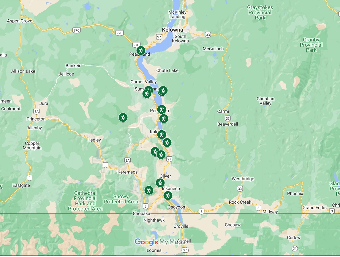
The map below features all of the featured South Okanagan hikes.
For the purposes of this post, I have defined the South Okanagan as everything in the Okanagan Valley between Peachland and Osoyoos. I have tried to spread the hikes throughout the different regions as much as possible.
Most of the featured trails are moderate difficulty involving some elevation gain. I have, however, included some almost completely flat, easy trails as well.
The longest trail on this list is 13km, with the shortest being 1.8km. Most are around 5-7km.
The majority of these featured trails are snow free from April to November (depending on recent weather conditions), with the exception of Mount Kobau and Brent Mountain.
Please note that the following South Okanagan hiking trails are either located on crown land or protected land. Some of the trails overlap with our Penticton hiking trails post.
Without any further ado, let’s get into our list of the best South Okanagan hiking trails!
Pincushion Mountain, Peachland
Length: 4km return
Difficulty: Low side of moderate, trail features some rocky sections, steep drop-offs and 245m elevation gain
Trailhead location: End of Ponderosa Drive, Peachland
Facilities: Outhouse in parking lot during main hiking season, picnic table at summit
More information: Pincushion Mountain trail guide
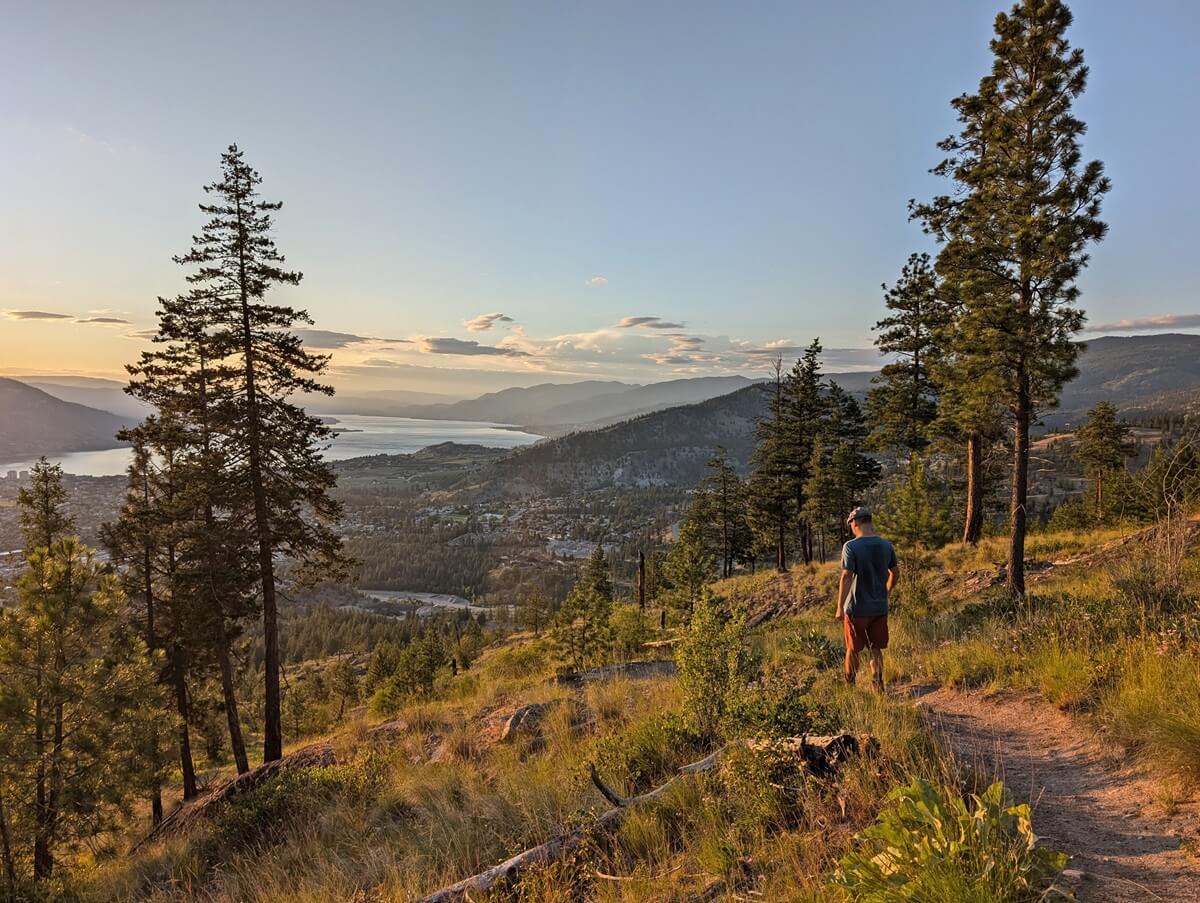
The short yet moderately challenging hike to the summit of 815m high Pincushion Mountain has an incredible payoff, with gorgeous panoramas of Okanagan Lake and rugged Okanagan Mountain Provincial Park.
The current name of the mountain dates back to the 19th century, when a wildfire swept through this area and left very few trees standing. As a result, the mountain looked like a pincushion from afar!
The 2km journey to the top is uphill almost the entire way, but thankfully, the views appear quickly. Allow two hours for the return hike, with a short break at the summit.
The Pincushion Mountain trailhead is only a few minutes drive from Highway 97, so you don’t need a lot of time to do this rewarding South Okanagan hike.

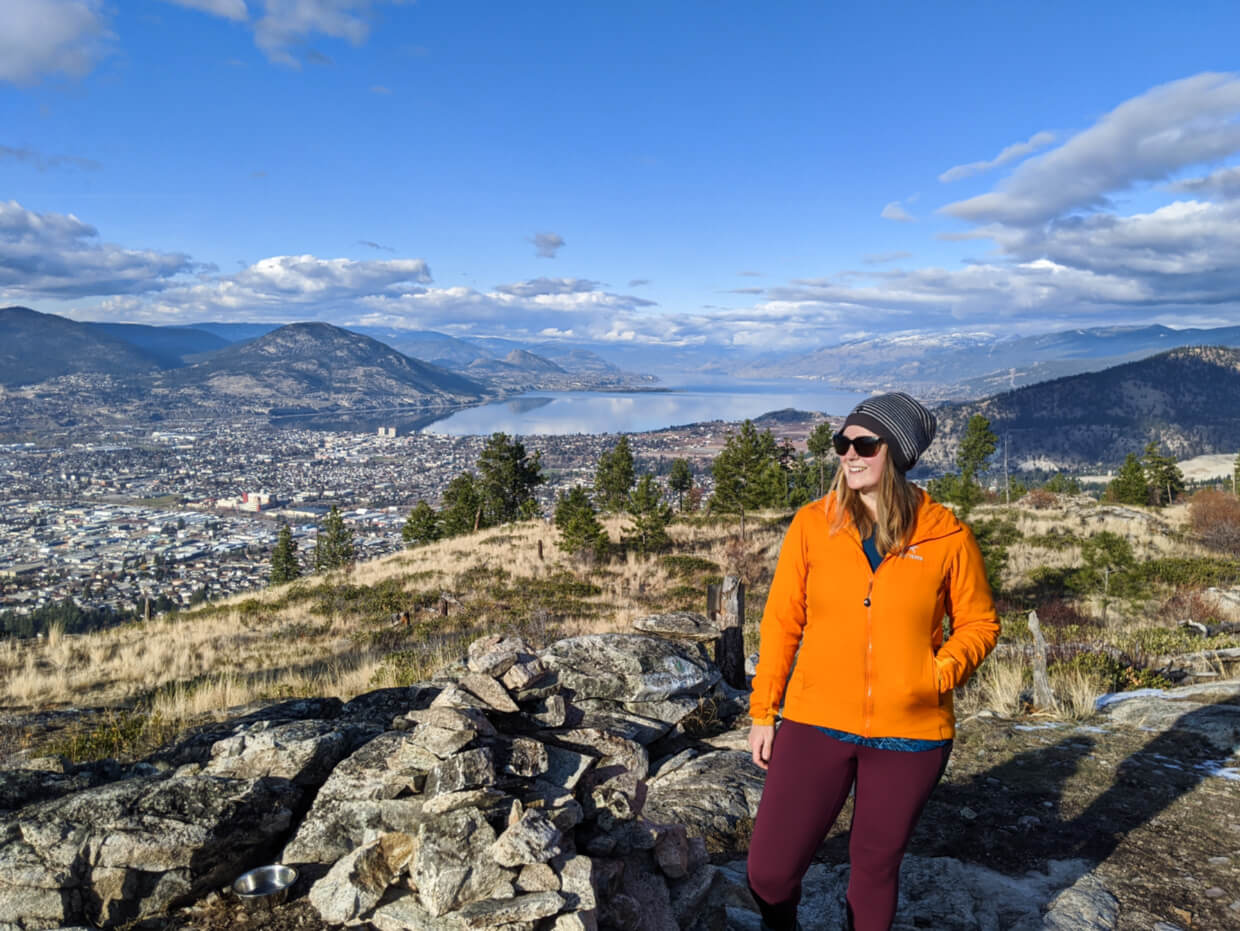
Giant’s Head Mountain, Summerland
Length: Variable (5.6km return route described below)
Difficulty: Easy to moderate (around 350m elevation gain)
Trailhead location: Milne Road, Summerland
Facilities: Benches, bins, outhouses near summit, signage
More information: Giant’s Head Mountain trail guide
Giant’s Head Mountain is a 850m high extinct volcano situated in Summerland. When approaching from the southeast, it’s possible to spot a profile of a man naturally carved into the side of the mountain.
One of the best places to hike in the South Okanagan, Giant’s Head features a well signed interconnected trail system offering multiple ways to hike to the scenic summit.
If you don’t have the time/fitness/ability to hike the entire route, a paved road leads almost all the way to the top. From the parking lot, a short (500m) dirt trail leads uphill to the summit area, which features a time capsule and Canadian flag.
Our favourite return hike on Giant’s Head involves starting on the paved Roadway. At the 1.4km mark, we turn onto the Friendly Giant Trail. At the first viewpoint (2km), we switch to the Ridge Trail and follow it all the way to the summit (3km). We return via the Grind and paved Roadway (total hike distance of 5.6km).

Mount Conkle Full Frontal Loop, Summerland
Length: 12km loop
Difficulty: Low side of moderate, features some loose gravel sections and slow 400m elevation gain
Trailhead location: Fenwick Road, Summerland
Facilities: Picnic tables and outhouse located 1.5km from end (or start)
For a quieter version of Giant’s Head, consider a hike on Mount Conkle instead. It is situated not far behind the aforementioned mountain and also features an interconnected trail system.
Unlike Giant’s Head, however, almost none of the trails on Mount Conkle are signed. It’s pretty easy to end up on the wrong trail or get lost if you don’t know where you’re going! I would recommend using AllTrails and Organic Maps for navigation.
The Full Frontal Loop features a long, steady climb (or descent) on the front of Mount Conkle, with beautiful views of Okanagan Lake, Summerland and Giant’s Head. The best panoramas are found about 200m/300m beyond the true summit.
For an easier hike from the same trailhead, consider the 3km return trip to the Conkle Mountain Gazebo on the Kettle Valley Rail (KVR) Trail.
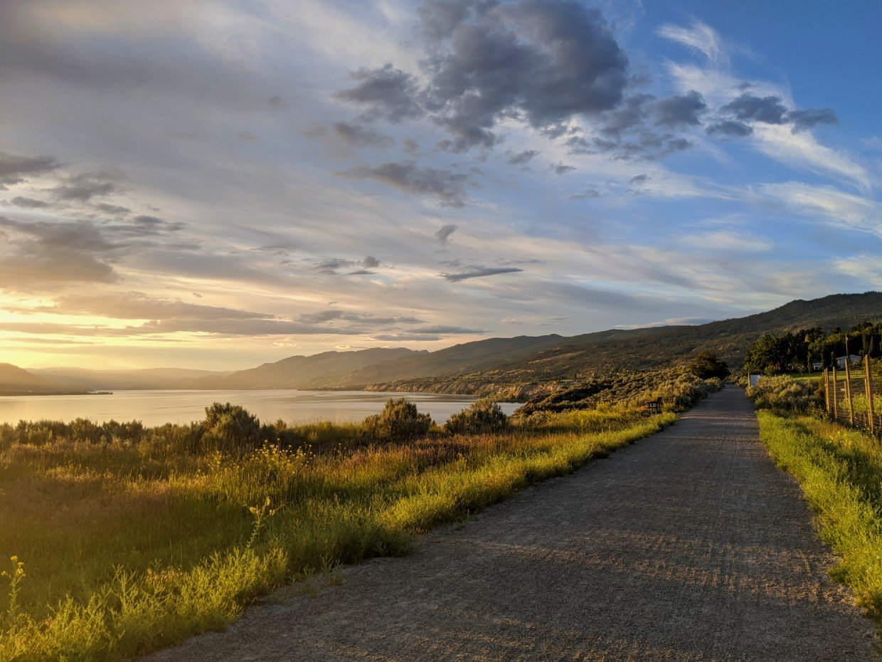
McCulloch Trestle (KVR Trail), Penticton
Length: 5km return (+1.2km to brewery)
Difficulty: Very easy with almost completely flat, wide trail
Trailhead location: Vancouver Place, Penticton
Facilities: Benches, bins, flush washroom building at 1.5km mark, signage
More information: KVR Trail guide
This South Okanagan hike is more of a walk, but it’s still a very worthy entry onto this list. This is our go-to hike when we have visitors to our Penticton home.
This section of the Kettle Valley Rail (KVR) Trail is close to downtown, is almost completely flat and showcases fabulous views of the city of Penticton, Okanagan Lake, Okanagan Mountain Park and the Penticton sign.
The turnaround point is the impressive wooden McCulloch Trestle bridge, named after the Kettle Valley Railway’s chief engineer Andrew McCulloch.
Feeling thirsty? Abandoned Rail Brewing sits 600m further up the trail. Enjoy a beer on the sunny patio before returning the way you came.
Parking at the Vancouver Place trailhead can be limited, so if you can, walk from downtown Penticton instead. Alternatively, you could start at Abandoned Rail instead.
G-Spot Trail, Penticton
Length: 9.5km loop (or 8km out and back to the summit)
Difficulty: Low side of moderate, features switchbacks, narrow paths, rocky sections, 300m elevation gain
Trailhead location: Skaha North Parking, Evergreen Drive, Penticton
Facilities: Bin and outhouse in parking lot
If the KVR Trail (above) doesn’t sound challenging enough, check out the G-Spot Trail. The trailhead for this scenic South Okanagan hike is just 15 minutes drive from downtown Penticton.
Situated in the suburban Wiltse area, the first section of the trail is almost completely flat. The climb then begins in earnest, with dozens of short switchbacks lead the way to the summit.
Impressive views of the city and Okanagan Lake appear quickly. The real reward is at the summit, however, where beautiful unobstructed panoramas await.
Like most hiking trails in the Penticton area, the G-Spot Trail is not officially signed (some may say that the G-Spot is hard to find). The only navigation aids are painted rocks at important junctions.
I’d highly recommend following one of the suggested routes on All Trails to avoid getting lost.
Little Tunnel (KVR Trail), Naramata
Length: 8.8km return
Difficulty: Very easy with completely flat, wide trail
Trailhead location: Smethurst Road, Naramata
Facilities: Benches, three outhouses along route, signage
More information: Little Tunnel hiking guide
If you’re looking for a longer but still rewarding section of the Kettle Valley Rail Trail to hike, look no further than the Little Tunnel. This popular walk starts at Smethurst Road and travels to an impressive railway tunnel above Okanagan Lake.
Like the rest of the KVR trail, the Little Tunnel route is exceptionally flat and easy to hike. Beautiful vineyard and lake views appear at the 650m mark, with most of the rest of the trail lined by forest and/or rock.
The path reveals sweeping views again as it approaches the Little Tunnel itself. Hinted by the name, the Little Tunnel is the smallest of two tunnels in this area.
Despite that, this ‘Little’ Tunnel can still be spotted from downtown Penticton if you know where to look! A picnic area awaits just beyond the Tunnel, the perfect place for a break before returning to the parking lot.

Naramata Creek Falls, Naramata
Length: 2.5km return
Difficulty: Easy with some harder sections (see details below)
Trailhead location: Just off Naramata Road, Naramata
Facilities: Outhouse at trailhead, benches, signage
More information: Naramata Creek Falls hiking guide
Waterfalls are not commonly found in the South Okanagan, with this featured trail being the only one ending at a cascade.
Naramata Creek Falls is a local favourite, with the spray from the falls and shaded trail providing cool relief on hot summer days.
The trailhead is found just before the big left hand turn into Naramata – look for the green ‘Creek Park’ sign. Though the trail is fairly wide and well defined at first, it splits after 1km.
At this point, choose to continue on a dusty, narrow uphill trail (steep in sections, with drop-offs) or stay along the creek (right). If you choose the latter, several water crossings are required. When the water level is low, it is usually possible to avoid wet feet.
During the spring melt, however, the water can be knee-height so wading is necessary if you go this route.

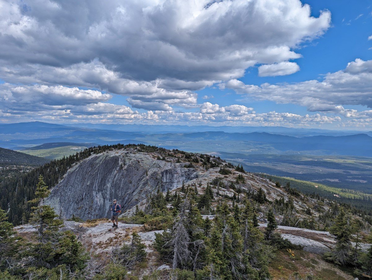
Little White Mountain (Canyon Lakes Trailhead)
Length: 10.2km return
Difficulty: Steady ascent with 520m elevation gain
Trailhead location: Canyon Lakes (49.70111, -119.2885)
Facilities: None
More information: Little White Mountain hiking guide
Little White Mountain is the ‘baby brother’ to the much more famous Big White (the one that hosts a ski resort of the same name).
Located between Kelowna and Penticton, Little White is one of the highest peaks in this area of the South Okanagan (2171m). Dense snow covers the summit from November to June, the likely origin of the mountain’s name.
One of the trail’s highlights is the massive exposed slab of granite rock found at the tip of the mountain. It’s an impressive sight to take in and from which to enjoy 360 degree views of the surrounding area.
The hike itself is a good challenge for intermediate hikers, with some steep sections. Wildflowers usually border the path in early July.
The 58km drive from Penticton takes around 1.5 to 2 hours, almost entirely on unpaved roads. The last 6.6km of road is narrow and uphill, with rocky sections and around a dozen cross-ditches. High clearance and good all-terrain tires are essential.
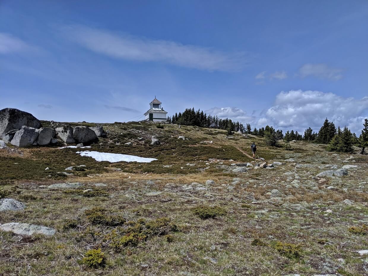
Brent Mountain Trail, near Apex
Length: 9km return
Difficulty: Steady ascent with 444m elevation gain
Trailhead location: Brent Mountain Protected Area (49.46669, -119.86569)
Facilities: Shelter and outhouse at the summit
Brent Mountain is one of the most easily accessible alpine destinations in the Penticton area.
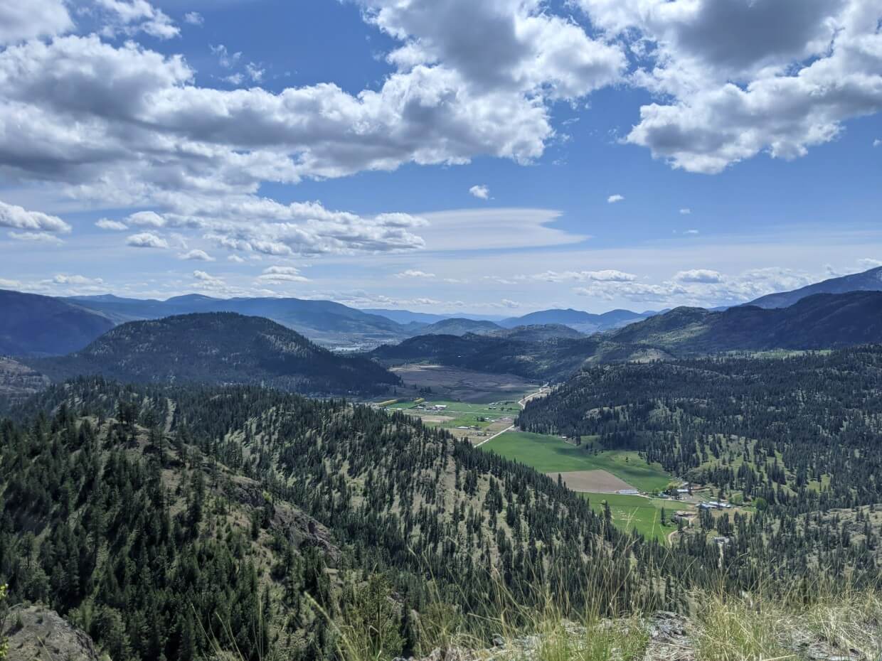
Situated in a protected area of the same name, this South Okanagan hike follows a well-defined route up to the 2,203m Brent Mountain summit.
Beautiful alpine meadows and panoramic views of distant peaks are the reward for the steady climb. An old Forest Service fire lookout perches on Brent’s summit, providing shelter on windy days.
Depending on the winter snowpack, there may still be snow present on the Brent Mountain Trail in early July. Indeed, we were snowed on during our most recent 1st July hike!
A high-clearance vehicle is needed to reach the trailhead, which lies approximately 8km from Apex Mountain Road. The dirt access road is narrow and rough at times.
Skaha Lake (KVR Trail), Kaleden
Length: 9.2km return (or shorter)
Difficulty: Very easy with completely flat, wide path
Trailhead location: Pioneer Park, Kaleden
Facilities: Benches, public washrooms at trailhead (in season)
More information: KVR Trail hiking guide
This is my top pick for the KVR Trail outside of Penticton. This section borders the edge of Skaha Lake, providing unobstructed views of the lake itself as well as the rugged peaks and vineyards across the water.
As with the rest of the KVR, this trail is very flat and wide. Though the hiking is easy (more of a walk), keep in mind that there isn’t a lot of shade. At the end of this section, a long wooden trestle bridge leads to the community of Okanagan Falls.
For a shorter walk, turn around at any time. We like walking all the way to Okanagan Falls to see the trestle bridge. Alternatively, you could start this hike in Okanagan Falls instead.
Though I have stated that the trailhead is Pioneer Park, please note that the hike actually starts at the end of Ponderosa Ave. There is a dead end street with no parking and little turnaround space, so it’s best to walk from Pioneer Park.

Peach Cliff, Okanagan Falls
Length: 4km return
Difficulty: Low side of moderate, trail features uneven surfaces and steep section
Trailhead location: McLean Creek Road, Okanagan Falls
Facilities: None
More information: Peach Cliff hiking guide
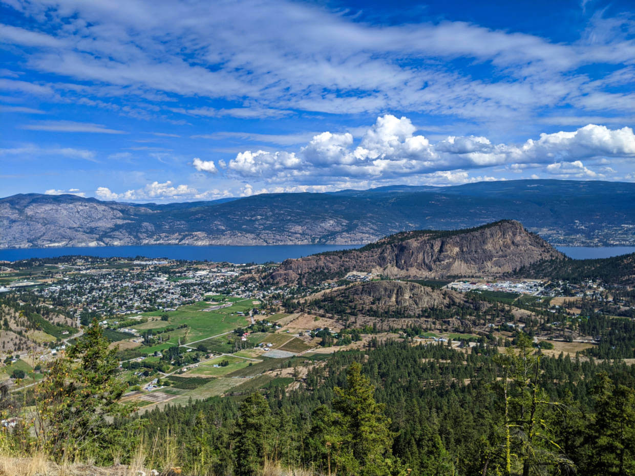
Peach Cliff towers over the small community of Okanagan Falls. This rugged 600m high rockface is approximately two billion years old, originally formed by earthquakes and volcanoes before being shaped by glaciers and ice melt.
Two thirds of the hike to the summit is easy and fairly flat. An interesting side trail takes in an old quarry pit which sparkles turquoise on sunny days.
To access the best views of Skaha Lake, Okanagan Falls and Vaseux Lake, you must traverse a very steep switchback section with lots of loose rock. Hiking poles can be very helpful for the descent.
Since this trail has zero signage, I would recommend following the AllTrails route. For a longer hike in this area, check out the Fire Mountain Loop. It starts at the same trailhead and is 7.5km long.

White Lake Loop, White Lake Grasslands
Length: 13km loop
Difficulty: Low side of moderate, with several steady climbs and 450m total elevation gain
Trailhead location: White Lake Road
Facilities: Information shelter in the parking lot, some trail signage
Showcasing several distinct ecosystems, the White Lake Loop is a rewarding day hike in the White Lake Grasslands Protected Area near Okanagan Falls.
Starting in a clockwise direction, the meandering path passes dramatic rock outcroppings and alkali ponds before heading into a Ponderosa pine forest and up to a lookout. The finale of the hike features views of the Dominion Radio Astrophysical Observatory and White Lake itself.
While we personally like to hike clockwise from the White Lake side, it is possible to hike in the other direction and/or start at Mahoney Lake.
This trail has very little shade. Even in spring, I would recommend starting this South Okanagan hiking trail early to avoid sun exposure during the hottest part of the day.
While the White Lake Loop is the most defined trail in the White Lake Grasslands area and has some signage, it’s still easy to miss the correct path. I would still suggest loading up the AllTrails route to stay on track.
As noted above, it is important to note that the White Lake Grasslands area is used for ranching. There may be cows present on the trail – give them plenty of space and keep dogs on a leash.
Guy’s Cache Loop, White Lake Grasslands
Length: 7km loop
Difficulty: Moderate trail with 320m elevation gain, with some short sections featuring loose rock, narrow trail and steeper ascents/descents
Trailhead location: White Lake Road
Facilities: None
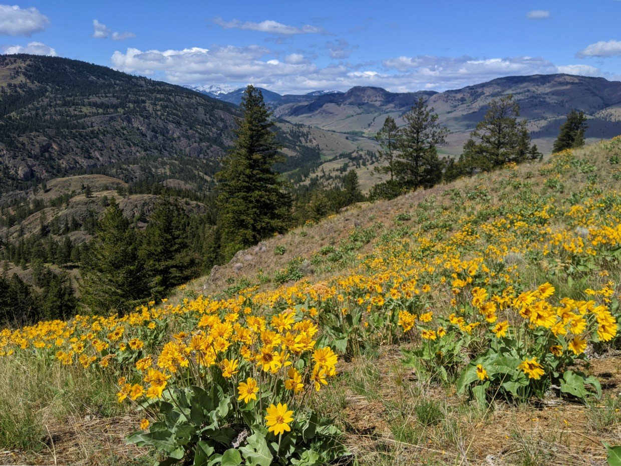
Named in honour of local man Guy du Vent, the Guy’s Cache Loop is my go to hike for wildflower viewing. The grass hills bordering this trail are covered in bright yellow arrowleaf balsamroot flowers in late April and early May.
Even without the flowers, this trail remains one of my favourites. The ascent to the lookout area is fairly steady in the clockwise direction. Sweeping views towards Mount Keogan, McIntyre Bluff, Mahoney Lake, Willowbrook and Oliver wait at the top.
We generally prefer to hike in a clockwise direction (to get the main climb done early) but honestly, both directions are great. There is zero signage on this trail so be sure to load up the AllTrails route or prepare to get lost finding it!
Please be aware that the White Lake Grasslands area is also used for ranching. There may be cows present on the trail – give them plenty of space and keep dogs on a leash.
Dogtown Trail (Mount Keogan), White Lake Grasslands
Length: 7.2km
Difficulty: Moderate, trail features rocky sections and steady ascent with 470m elevation gain
Trailhead location: South side of Mahoney Lake
Facilities: Limited signage
Another great hike in the White Lake Grasslands area, the challenging Dogtown Trail leads to the summit of Mount Keogan. I say challenging as the trail is pretty much just up, up, up all the way!
A ponderosa pine forest shades the first part of the trail. As the path ascends, the views begin to open up. A sprinkling of wildflowers dot the edge of the trail.
There are spectacular views of Oliver, McIntyre Bluff and Rattlesnake Lake from the large flat summit area.
Due to the nature of the trail, I would suggest getting an early start during the warmer months. Like the other South Okanagan hikes located in this area, the Dogtown Trail has very limited signage (utilise the AllTrails route).

Golden Mile Stamp Mill Trail, Oliver
Length: 1.8km return to the viewpoint, 2.4km to the Stamp Mill
Difficulty: Easy, though uphill with one steep section
Trailhead location: Tinhorn Creek Winery
Facilities: Signage
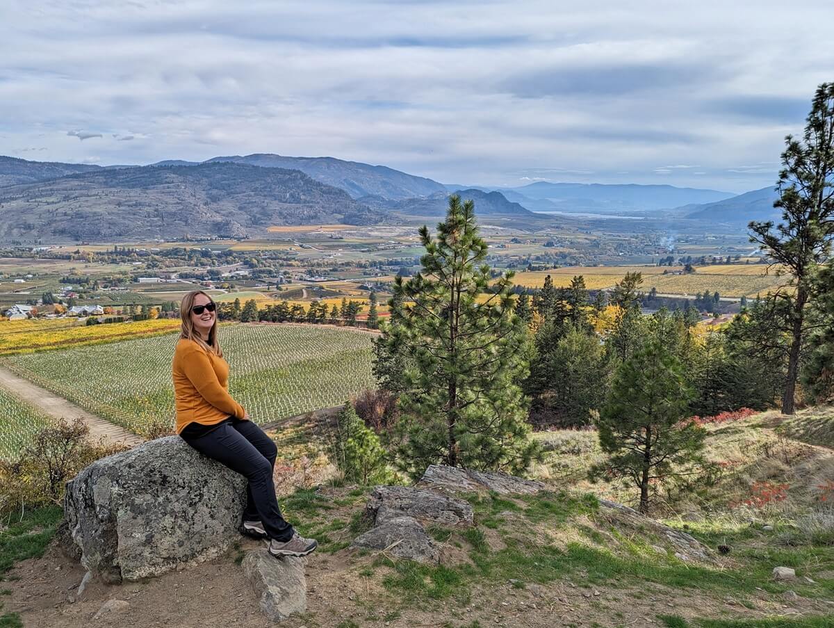
If you don’t have time for a ‘proper’ hike in the South Okanagan, check out the Golden Mile Stamp Mill Trail.
This easy but uphill trail begins at Tinhorn Creek Winery and follows the edge of the vineyards to the end of the property. Climb over the snake fence and then choose to follow the creek to the remains of the old Stamp Mill (left) or head up a steep section of trail to an amazing viewpoint.
After taking in the incredible valley views from the latter, you can continue further along the ridge as desired.
Another of our favourite hikes in this area leads to the Oliver Tower Viewpoint. The unmarked trail system is located close to Oliver Elementary School.
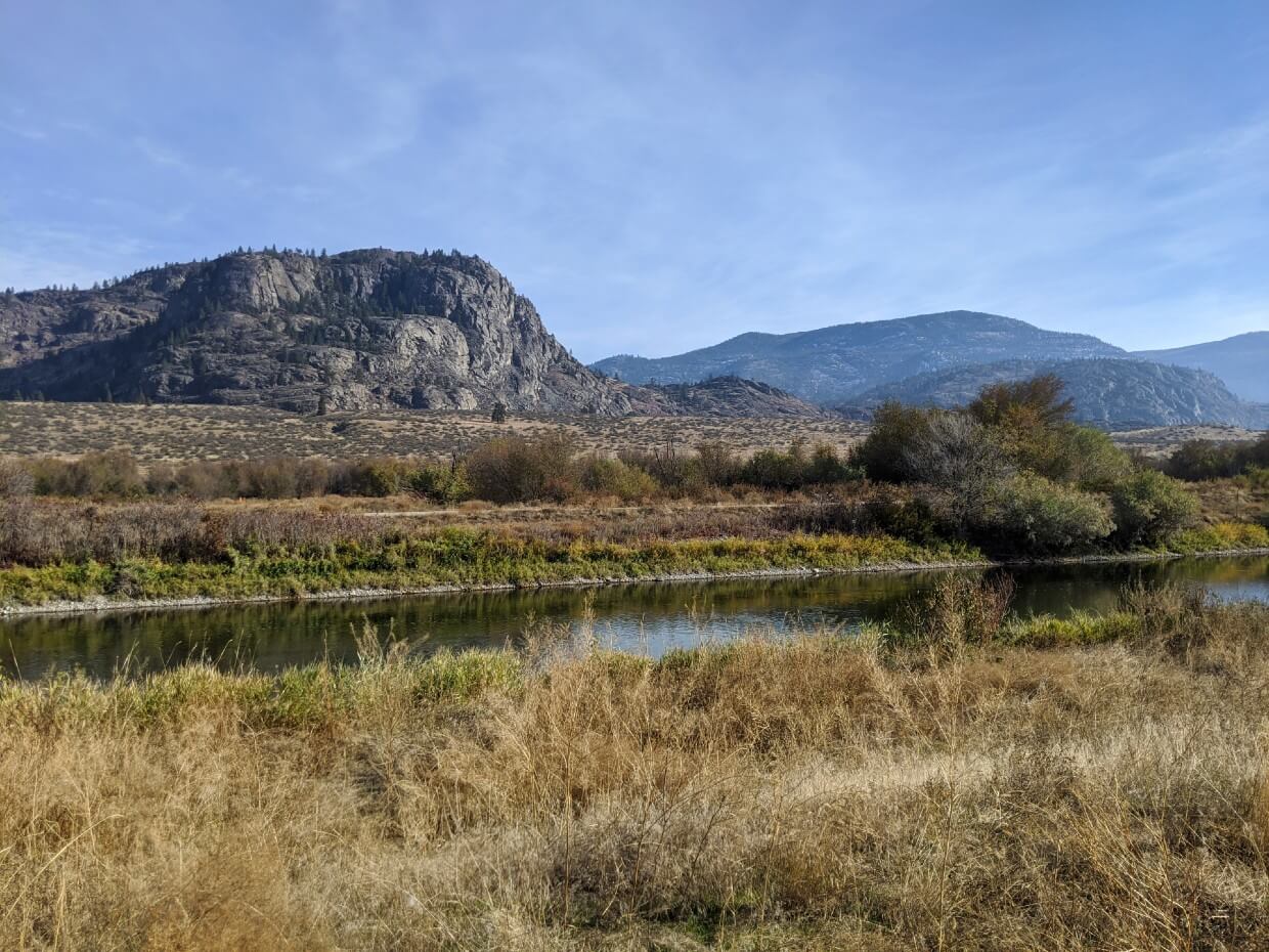
Osoyoos Oxbows, Osoyoos
Length: 5km return
Difficulty: Very easy with a completely flat path
Trailhead location: Road 22, Osoyoos
Facilities: Trailhead signage
The Okanagan River once flowed along wide oxbows from Oliver to Osoyoos. The surrounding wetlands were filled in after the free-flowing path was straightened in the 1950s.
Fast forward to today and an extensive restoration project is underway to recreate the historic oxbows and recover some of the marsh areas at the northern end of Osoyoos Lake.
The easy Oxbows trail starts on the right hand side of Road 22, just before the bridge. The path offers views of the recreated wetlands as well as surrounding vineyards and hills.
This trail offers a wonderfully relaxing walking experience. The wetlands are a critical habitat for many amphibians and birds so keep an eye and ear out for wildlife as you go.
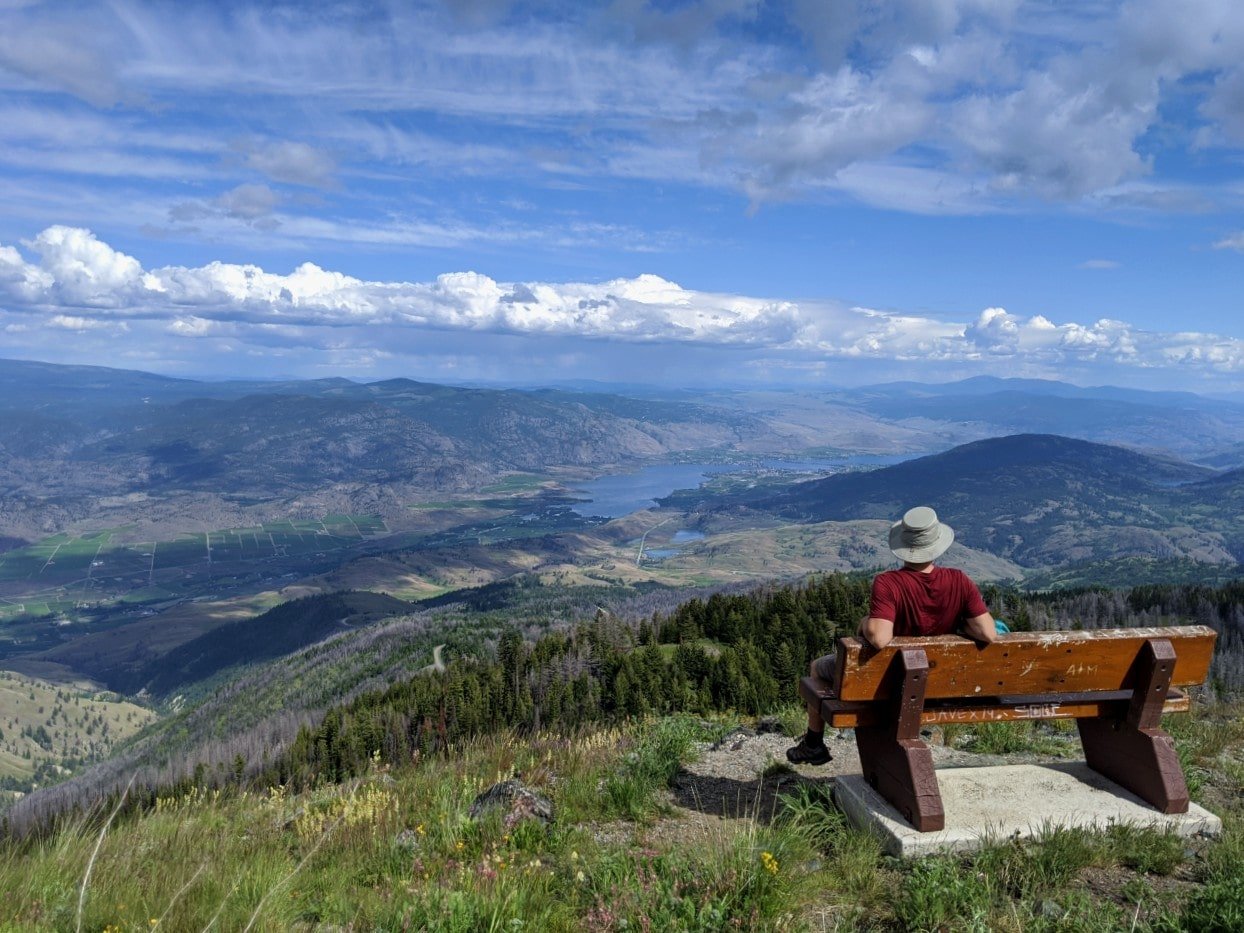
Mount Kobau Lookout Trail, Osoyoos
Length: 1.3km
Difficulty: Easy with established mostly flat path, narrow at times
Trailhead location: Mount Kobau summit
Facilities: Outhouse, trailhead signage
Did you know that you can drive up a mountain in Osoyoos? Mount Kobau is accessible by road, with a short trail leading to the 1845m high summit. As you can imagine, some of the best views of Osoyoos can be found here.
The higher elevation means that it is distinctly cooler at the top of Mount Kobau in the summer months compared to the valley below. The wildflowers bloom here later too.
Mount Kobau is part of the South Okanagan Grasslands Protected Area, safeguarding one of the four most endangered ecosystems in Canada. This area is part of the the proposed South Okanagan National Park Reserve.
If you’re still wanting more after the Lookout Trail, check out the 3.5km Chopaka Lookout Loop. This trail is less used and hence a bit overgrown, but offers gorgeous views towards the Similkameen Valley.
The Mount Kobau summit area is accessible via an unpaved 20km long Forest Service Road. Allow 45 minutes to an hour to drive the full length as the surface can be rough and bumpy in places.
South Okanagan hiking safety tips
Whether you’re a local just getting into hiking or a visitor to the South Okanagan, the following safety tips may be helpful:
- Most of these South Okanagan trails have very limited signage. Attention and basic navigational skills are required to stay on the correct path
- Hiking in the South Okanagan can be a VERY hot experience in the summer months. Most trails have no shade and the dry exposed ground reflects heat
- In my opinion, spring and fall are the best seasons to hike in the South Okanagan
- If you really want to hike in the summer months, start hiking early (9am or earlier) to beat the heat or stick to shorter, easier trails
- Due to the dry terrain, some steep descents feature loose rocks. I find that having a hiking pole is helpful
- Always bring plenty of water, sunscreen and a sun hat
- Black bears, snakes, deer, bighorn sheep and other animals live on and around these trails. Take appropriate precautions, stay alert, make noise and keep your distance from wildlife
- We personally carry bear spray on every single hiking trail. If you decide carry some, learn how to use bear spray properly first
- Ticks are common in this region, especially in spring. Cover up, avoid grassy areas where possible and check your clothing (and body) after hiking
Other things to keep in mind:
- Unless posted otherwise at the trailhead, leashed dogs are allowed. Please be careful to pick up after your dog
- Rattlesnakes live in and around many of these trails. They are generally passive but it is not uncommon for inquisitive dogs to get bitten
- The majority of these trails have reliable cell phone signal but you should always tell someone where you are going and when you expect to return
- Remember to Leave No Trace of your visit on any these South Okanagan hiking trails. This means staying on trail at all times and taking care to pack out everything you bring in (including trash)
- On the longer and more challenging trails, you may find a pair of hiking poles to be helpful with balance, impact reduction and endurance. We usually share a pair of collapsible, superlight Black Diamond Carbon Z hiking poles
You may find these other Okanagan Valley posts helpful:
18 Fast and Fun Hikes in Penticton
22+ of the Best Campgrounds in the South Okanagan, BC
Hiking the Kettle Rail Trail in Penticton
53 Amazing Things to Do in Osoyoos, British Columbia
The Best Okanagan Valley Wineries: A Local’s Guide
49 Fun Things to Do in Summerland, British Columbia


One half of the Canadian/British couple behind Off Track Travel, Gemma is happiest when hiking on the trail or planning the next big travel adventure. JR and Gemma are currently based in the beautiful Okanagan Valley, British Columbia, Canada. Consider buying us a coffee if you have find any of our guides helpful!