Uncover the essence of BC’s beautiful Salish Sea on a Coastal Circle Route road trip, taking in both Vancouver Island and the Sunshine Coast.
The Coastal Circle Route is an ideal road trip for anyone looking for a satisfying and scenic driving loop located slightly off the beaten path.
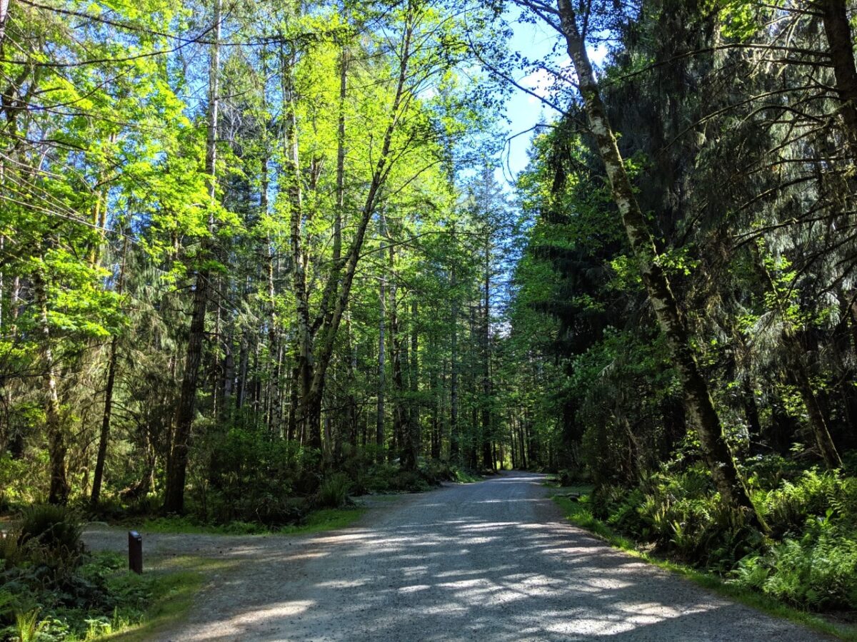
Spectacular beaches, calming waterfalls, sweeping mountain views, unforgettable sunsets, lush temperate rainforests and coastal communities await travellers who choose to embark on this 270km long route.
Wildlife watching opportunities are numerous, with the possibility to see bald eagles, whales (including orcas), seals, black bears and more.
Further immersion into nature is possible with a wide choice of hiking trails, both long and short.
Exploring BC for more than a week? It would be very easy to combine or extend a Coastal Circle Route itinerary with a longer BC road trip to Tofino, North Vancouver Island, Port Renfrew or the Rockies.
In this post, I’ll share the best places to stop while driving the Coastal Circle Route as well as driving tips and accommodation recommendations.
We have driven this loop five times now and keep coming back for more!
This post includes some affiliate links – if you make a purchase via one of these, we may receive a percentage of the sale.

Planning a trip to Vancouver Island?

Our Vancouver Island Travel Guide features an interactive map with 150+ of the best things to see and do.
The itinerary builder tool makes it easy to create your perfect trip.
Download the app and use offline while travelling!
Coastal Circle Road Trip Route: Essential details
Intrigued by the idea of the Coastal Circle Route? Here are some things you need to know to start planning a trip.
If you’re familiar with the area and just looking for ideas of where to go, feel free to skip ahead.
The Coastal Circle Route is a road trip in British Columbia, Canada. It traverses the east-central shoreline of Vancouver Island as well as the mainland Sunshine Coast with the help of several highways and four ferries.
The total driving distance of this scenic loop is around 270km.
Of course, this distance does not take into account any stops. For that reason, I’d estimate the average road trip along the Coastal Circle Route to be closer to 300-320km.
With side trips to Cathedral Grove and Campbell River (I’d highly recommend both), plan for an additional 160km.
I would suggest a five-night road trip with overnight stays in Nanaimo/Parksville, the Comox Valley (x2), the Powell River area and Sechelt.
If you prefer to keep moving locations each night, drop the second night in the Comox Valley and spend it in Campbell River instead.
Travellers who like to explore from a base may enjoy spending three nights in the Comox Valley (dropping the night in Nanaimo).
Coastal Circle Route map

Coastal Circle Route: What to expect
The Coastal Circle Route can be driven in either direction. I have suggested clockwise as you’ll be closer to the ocean while driving. Most of the road trip route takes place on major highways.
Highway 19 on Vancouver Island is double-lane (four lanes total), with divided lanes or a concrete barrier along most of the route. I would suggest, however, detouring to the more scenic Highway 19A, a secondary route closer to the ocean.
Highway 19A is a smaller road with only two lanes total, one in each direction. There are intermittent passing sections. Travelling through numerous residential areas, the 19A is a slower drive (40-80km/h limit compared to 110km/h on the 19).
The Sunshine Coast Highway (101) is also almost entirely two-lane. It is a curvy road with many turns, some of them quite sharp. The section between Earls Cove and Halfmoon Bay is the most winding.

There are four ferry crossings on the Coastal Circle Route:
- Horseshoe Bay to Departure Bay (OR Tsawwassen to Duke Point) – 1 hour 40 minutes
- Comox (Little River) to Powell River (Westview) – 1 hour 30 minutes
- Saltery Bay to Earls Cove – 50 minutes
- Langdale to Horseshoe Bay – 40 minutes
All ferry routes are operated by BC Ferries. I would highly recommend making ferry reservations unless you have a very flexible schedule.

Coastal Circle Route: good to know
- There is a limited number of reserved spots on each ferry crossing* and once these are gone, the rest of the space is allocated with a first come, first serve system
- Be sure to double-check what time you need to arrive at the ferry terminal to confirm your reservation. 60 minutes before the scheduled departure is the usual requirement. Miss the arrival window and your reservation disappears
- *The ferry between Earls Cove and Saltery Bay (and vice versa) is first come, first serve only, with no reservation system
- When driving clockwise, the ferry from Langdale to Horseshoe Bay is free (reservations are still available)
- When driving counter-clockwise, the ferry from Earls Cove to Saltery Bay is free
- Head to our BC trip planning guide for more general tips and advice
The Coastal Circle Route travels across the traditional territory of multiple First Nations, including the K’ómoks, Homalco, Liǧʷiłdax̌ʷ, We Wai Kai, We Wai Kum, Snuneymuxw, Snaw-naw-as, shíshálh, Homalco, Tla’amin and Skwxwú7mesh-ulh Temíx̱w.

Coastal Circle Road Trip: Best things to do
Read on to discover an overview of the Coastal Circle Route and the best things to do along the way. The route is written in a clockwise direction (Vancouver Island first) but you could drive counter-clockwise too (Sunshine Coast first).
While sharing similar landscapes and climates, Vancouver Island and the Sunshine Coast are unique destinations.
Vancouver Island has the best opportunities for visiting waterfalls, joining wildlife tours and exploring beaches while the Sunshine Coast offers incredible paddling and spectacular sunsets. Both locations have excellent hiking trails.

Vancouver to Nanaimo
Start your journey at the Horseshoe Bay ferry terminal in West Vancouver. Arriving at Departure Bay a couple of hours later, make your first stop at Saysutshun – Newcastle Island.
Only boats, bikes and hikers are allowed access to this beautiful provincial park located just across the water from downtown Nanaimo.
Alternatives to Sayshutshun include a hike to the Abyss (an impressive 50cm wide fissure) and Neck Point Park (36 acre protected coastal area).
Before leaving Nanaimo, be sure to make a stop at Petroglyph Park.

Nanaimo to the Comox Valley
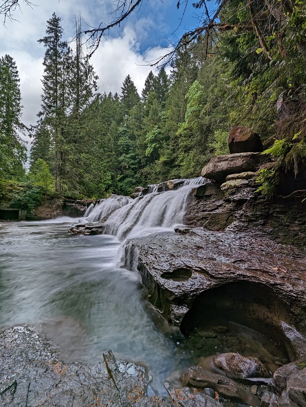
It’s time to head north on Highway 19 towards the Comox Valley! There are many great places to stop along this short journey including several beautiful beaches, waterfalls and more.
30 minutes after leaving Nanaimo, you’ll need to make a choice. Highway 19 provides the most straightforward drive but is less scenic. The secondary highway, the 19A, is located closer to the coast.
If you have the time, I’d stay on the 19A. It’s a slower journey but the views are wonderful around Qualicum Beach and also between Buckley Bay and Courtenay.
More spectacular ocean and mountain views await in the Comox Valley. Kayak, golf, hike, swim, fish….you can do a bit of everything here, including skiing and snowboarding in the winter.
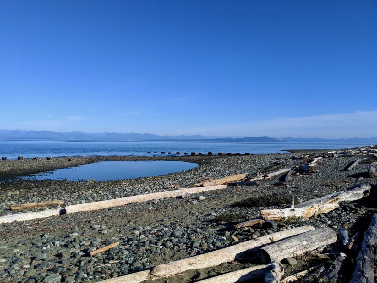
Take a trip out to Goose Spit for views of both Vancouver Island and the mainland mountains behind the ocean. Point Holmes and Kye Bay also offer fantastic panoramas.

For cooler temperatures and alpine flowers, make the side trip up to Mount Washington and explore the Paradise Meadows area. There is a beautiful boardwalk trail, ideal for all abilities of hikers.
If you just want to enjoy some spectacular ocean and mountain views, head up the scenic chairlift to the summit of the mountain (admission fee). There’s an exhilarating zipline course too!
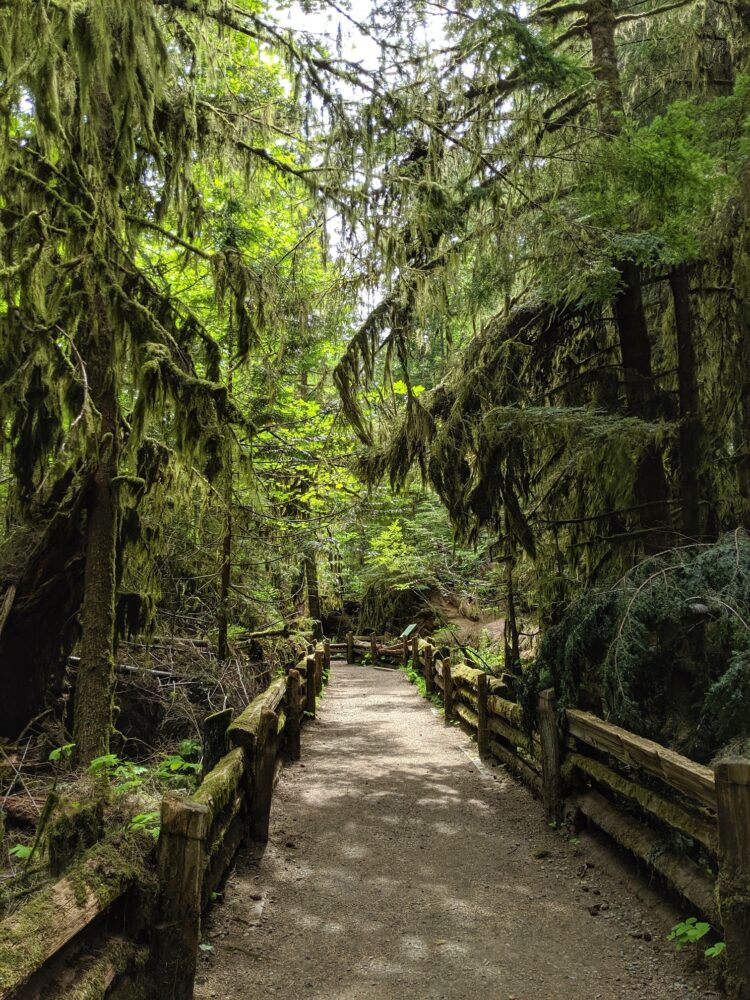
A worthwhile detour in the Parksville area is Cathedral Grove. This roadside-protected area is Vancouver Island’s best-known old growth tree grove.
Officially known as MacMillan Provincial Park, the trees in Cathedral Grove are amongst the oldest and tallest in Canada. Allow at least 1 hour (40km) for the return trip from Highway 19.
Campbell River side trip
Consider a day trip to Campbell River from the Comox Valley (45-60 minutes drive). The beautiful coastal views on the slower Highway 19A are well worth the journey alone.
Campbell River is the gateway to northern Vancouver Island. Here, things start to get a bit wilder. The northern side of the Island is far less visited than the southern and western regions.

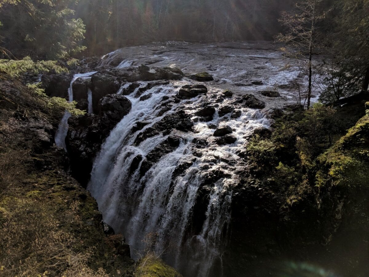
Book in for an afternoon whale and bear-watching tour before heading out of town for a trip to Elk Falls. This magnificent waterfall can be viewed from a 60m-long suspension bridge (free access!) Prepare to have your breath taken away.
If you like the sound of Campbell River, consider spending a night here. The drive back to Comox (for the next ferry crossing) does not take long.

Comox Valley to Powell River
Say goodbye to Vancouver island and take the ferry over to Powell River (qathet) on the British Columbia mainland.
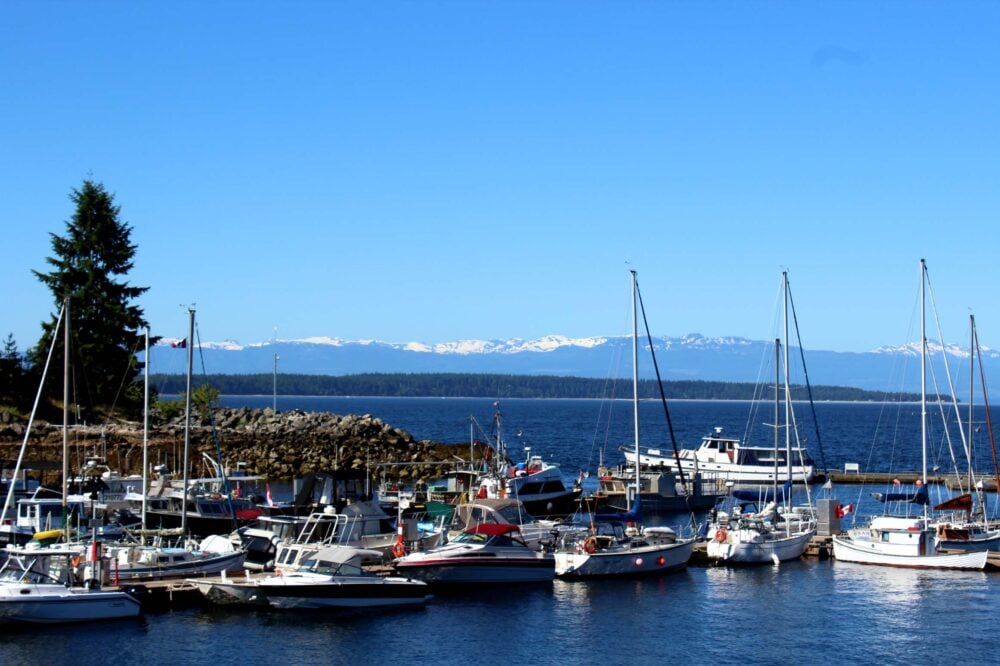
Perched where the mainland mountains and the waters of the Georgia Strait meet, Powell River is a little gem of a town. Once reliant on heavy industry, Powell River is now a haven for creatives and those who love the water.
If you want to go paddling, this is the place, with Desolation Sound to the north and the Powell Forest Canoe Circuit to the southeast (additional days required).
Kayak rentals and tours are available in Lund, a cute harbour village at the end of the highway. A day trip destination is the sandy (and almost tropical paradise-like) Savary Island. Water-taxis are also available.
Hikers are well catered for in Powell River, with the nearby 180km long Sunshine Coast Trail. Go on a day hike or stay overnight in one of the free trail huts. Tin Hat Mountain is a definite highlight.
Powell River to Vancouver
There are two more ferries to take on the way back to Vancouver, but whatever you do, be sure not to rush.
The highway winds its way along the coves and bays of the pretty coastline, offering wonderful views everywhere you look.
A must-stop along the way is the Skookumchuck Narrows, a whitewater wonder of the world.

An easy and mostly flat 8km return hike leads to a viewing area where, twice a day, you can watch as the saltwater flow changes direction and creates huge waves and whirlpools. Be sure to time it right during your own visit!
Other things to do include a hike up Soames Hill and a boat trip to the incredible Princess Louisa Inlet. The latter is one of the most beautiful places I have been anywhere in the world. A huge waterfall sits at the very end of the fjord.

The communities of Sechelt and Gibsons are both worth a stop, boasting independent boutiques, craft breweries, Farmers’ Markets and more.
If you like cider, take the time to stop by Brickers. This family-owned cidery has a beautiful patio overlooking the orchards. Just south of town is Davis Bay, a great place for a walk along the waterfront.
Gibsons is best known for being the location of the long-running TV show The Beachcombers. I love Gibson’s artsy vibes and ocean views. My favourite local spot is Persephone Brewing, an 11-acre farm-based brewery.

Where to stay on the Coastal Circle Route
For overnight stays in Nanaimo, we like the Best Western Dorchester Hotel.
Located downtown, this hotel is also close to the Departure Bay ferry terminal and walkable to many local attractions. The Coast Bastion Hotel is another good option. An alternative would be to stay in nearby Parksville.
In the Comox Valley, I’d recommend staying at the waterfront Kingfisher Resort and Spa near Courtenay. A more centrally located alternative is the Old House Hotel.

Our top pick is the Above Tide Motel in Campbell River. While not fancy, the oceanside location of this property is incredible and the prices are pretty reasonable. Each room has a balcony with uninterrupted views of the Salish Sea.
For something a little more upmarket in Campbell River, try Painter’s Lodge.
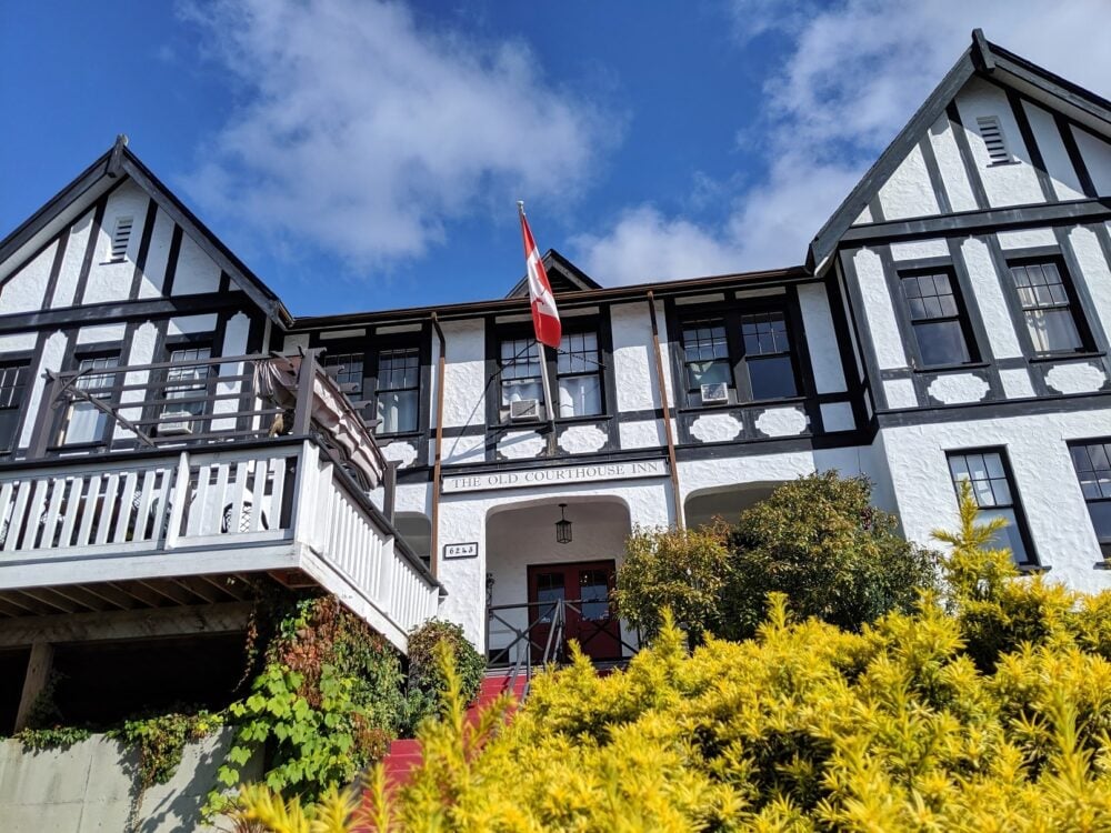
Over in Powell River, I’d highly recommend the historic Old Courthouse Inn. It’s a very short walk from the excellent Townsite Brewery.
On the lower Sunshine Coast, choose between Sechelt and Gibsons. If I had to pick, I’d stay in Sechelt at the recently renovated the Spot at Porpoise Bay.
While the Spot is not right in town, the location is pretty. I also like the Oceanside Hotel in nearby Davis Bay.
Campgrounds
Camping can be a great money saver when exploring British Columbia’s Coastal Circle Route.
I’d recommend making a reservation during the summer months, especially if you have no flexibility with your schedule.
- Rathtrevor Beach Provincial Park, Parksville: Most of the spacious forested campsites are less than five minutes walk from a gorgeous, wide sandy beach. Beautiful sunsets! Very, very popular (reservation essential from May to September)
- Kitty Coleman Provincial Park near Comox: Incredible oceanfront campground with an unbelievably low price tag. First come, first serve only
- Quinsam Campground, Elk Falls Provincial Park: Forested campground next to a river within 10 minutes drive of Campbell River
- Inland Lake Provincial Park near Powell River: Spacious and usually quiet campground next to a peaceful lake with a loop trail, easy access to the longer Sunshine Coast Trail
- Willingdon Beach Campsite, Powell River: Urban campground within walking distance to downtown, not very private but right on the ocean
- Saltery Bay Provincial Park near Powell River: Small collection of shady campsites with access to a rocky beach. Convenient for the ferry to Earls Cove
- Porpoise Bay Provincial Park, Sechelt: Beautiful forested campground with a long pebble beach on Sechelt Inlet. Very short drive to town

In addition to the above recommendations, there are numerous free or low-cost Recreation Site campgrounds to be found around Campbell River and Powell River.
The easiest way to find Recreation Sites is to use a Backroad Mapbook (Vancouver Island | Sunshine Coast). Most are located on unpaved roads, so be sure you have an appropriate vehicle to access them.
FarOut Wilderness rents fully kitted out high clearance 4X4 trucks with rooftop tents, ideal for reaching remote Recreation Sites. Contact FarOut with the code FOW-OTT-5 for a 10% booking discount.
Other resources you may find helpful to plan your road trip:
Where to Find Big Trees on Vancouver Island
22+ of the Best Campgrounds on Vancouver Island
25+ Amazing Vancouver Island Waterfalls You Must Visit
Campbell River to Gold River Road Trip Guide: 12+ Beautiful Places to Stop
23+ of the Best Things to Do in Courtenay, Vancouver Island


One half of the Canadian/British couple behind Off Track Travel, Gemma is happiest when hiking on the trail or planning the next big travel adventure. JR and Gemma are currently based in the beautiful Okanagan Valley, British Columbia, Canada. Consider buying us a coffee if you have find any of our guides helpful!