The Nanaimo to Tofino road trip is one of British Columbia’s very best and it is easy to see why.
The curving route travels from one side of Vancouver Island to the other, passing peaceful lakes, old-growth forests, golden sand beaches and misty mountain ranges.
And the final destination of this road trip is just as important as the journey to get there.
The small yet characterful community of Tofino sits on the very edge of Vancouver Island’s wild western coast. Think crashing waves, windswept beaches, rugged headlands and more. There’s nowhere else quite like it in Canada!
We’ve driven this scenic road trip over two dozen times over the last few years. In this post, I’ll share our top 15+ places to stop along the 207km long route, as well as useful tips to make the most of the journey.
There are affiliate links in this post. If you make a purchase via one of these links, we may receive a small percentage of the sale.

Planning a trip to Vancouver Island?

Our Vancouver Island Travel Guide features an interactive map with 150+ of the best things to see and do.
The itinerary builder tool makes it easy to create your perfect trip.
Download the app and use offline while travelling!
Nanaimo to Tofino road trip planning
Before I get into my recommendations for the best places to visit between Nanaimo and Tofino, I thought it would be a good idea to share some background about the route.
This Nanaimo to Tofino road trip route travels across the traditional territory of multiple First Nations, including the Snaw-naw-as, Snuneymuxw, K’ómoks, Tla-o-qui-aht, Tseshaht, Hupacasath, We Wai Kai and Yuułuʔiłʔatḥ.
The driving distance between Nanaimo and Tofino is 207km.
Most people drive this trip in one day. Without stops, the journey takes around three hours.
But with so many places to see along the route, you’ll definitely want to stop at least a few times.
As mentioned, this post will suggest 15 different stops along the Nanaimo to Tofino road trip route.
If you’re really dedicated and have the time, it would be possible to visit all of these places on one road trip.
Realistically, however, I would suggest 2 to 4 stops in each direction. This would increase your one-way journey time to around 5 to 7 hours.
Keep in mind that:
- Snow is possible at higher elevations from November to March
- Port Alberni is located around the halfway point
- Phone signal is patchy between Port Alberni and Tofino (non-existent between Sproat Lake and the main Ucluelet/Tofino junction)
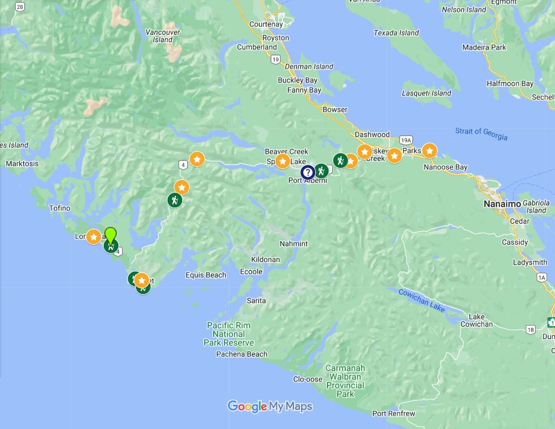
Nanaimo to Tofino road trip map
Nanaimo to Tofino road trip: Best places to stop
Read on to discover our top picks for places to visit on a Nanaimo to Tofino road trip.
I have included three places off the main Nanaimo to Tofino road trip route, all in or close to the small community of Ucluelet.
If you can, consider spending a night or two in Ucluelet to make the most of your West Coast adventure.
- Neck Point Park
- Englishman River Falls
- Rathtrevor Beach
- Goats on the Roof
- Little Qualicum Falls
- Cameron Lake
- Cathedral Grove
- Hole In The Wall Waterfall
- Port Alberni
- Sproat Lake petroglyphs
- Taylor River Rest Area
- Wally Creek
- Kennedy Lake Lookout
- Ancient Cedars Loop Trail (detour)
- Ucluelet (detour)
- Wild Pacific Trail (detour)
- Rainforest Trails
- Long Beach
- Tofino
Neck Point Park
Neck Point Park is a great Nanaimo area family-friendly, scenic coastal walk. If you have more time, Newcastle Island (Saysutshun) is another great option.
Neck Point Park is a 36-acre protected waterfront area featuring rocky cliffs, pebble beaches, and the rare Garry Oak forest. The park’s namesake ‘neck’ is at its tip, made up of a sandbar and rocky headland.
Walking trails weave across the peninsula, with interpretive signs that share insights about the park’s natural features and fascinating history. This location is also popular for scuba diving, thanks to the vibrant sea life found beneath the headlands.
While I consider Neck Point Park to be family-friendly, just be sure to keep an eye on young children, as there are some steep drop-offs!
Distance from Nanaimo: 11km
Distance from Tofino 200km
Suggested time: 30 minutes to 1 hour, depending on your desired trail

Englishman River Falls
This stop on the Nanaimo to Campbell River road trip requires a 30-minute round-trip detour from Highway 19, but trust me, it’s well worth it!
A short 300-meter walk from the parking lot leads you to a stunning viewpoint of the Upper Englishman River Falls, where the river cascades dramatically into a canyon. Mist rises above as the water roars below.
From here, you can either head back to the parking lot or complete a 1.7km loop that also includes the lower falls.
The loop features a fantastic view of the water plunging into a crystal-clear pool, along with the algae-covered basin walls and overhanging trees.
Just a heads-up: don’t confuse this park with Englishman River Regional Park. While that’s another lovely spot, you won’t find these waterfalls there!
Distance from Nanaimo: 49km
Distance from Tofino: 172km
Suggested time: 15 minutes driving detour (each way), 15 minutes for Upper viewpoint, 1 hour for loop

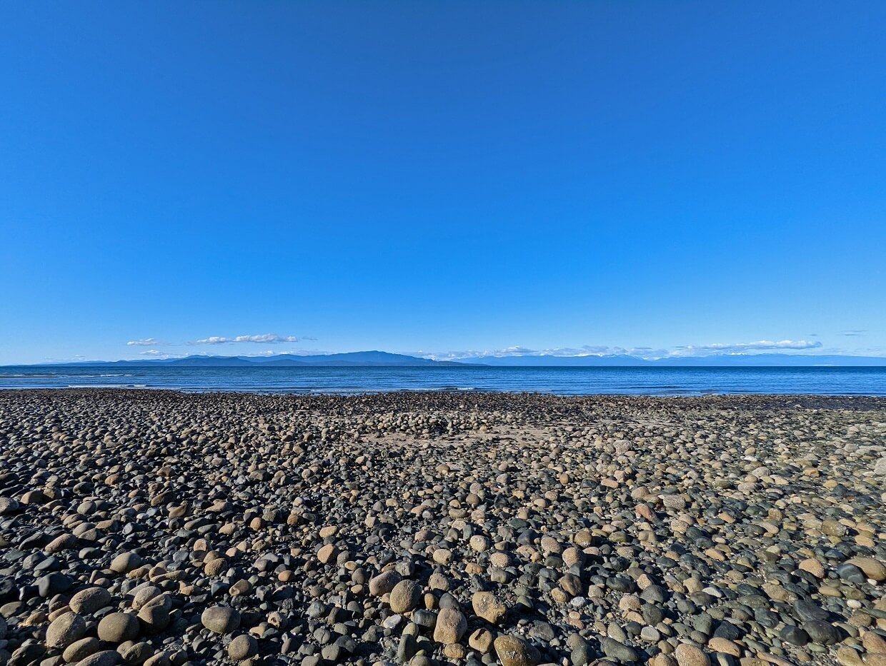
Rathtrevor Beach Provincial Park
Need to stretch your legs after the ferry ride? Head to Rathtrevor Beach in Parksville. This long beach is a mix of golden sand and pebbles and is breathtaking at any time of the year.
When the tide is out, it feels like you can walk for miles. The views stretch endlessly too, towards offshore islands and distant mountain ranges.
Rathtrevor isn’t the only gorgeous beach in this area, but I recommend this one specifically as it has a large amount of parking (in the provincial park of the same name) and relatively easy access from Highway 4.
Distance from Nanaimo: 34km
Distance from Tofino: 179km
Suggested time: 10 minutes detour (each way) plus beach walking time
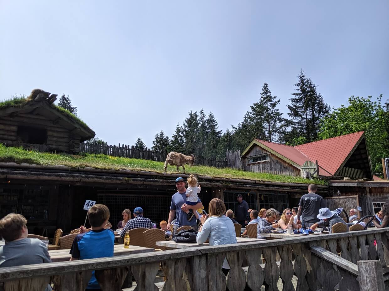
Goats on the Roof / Coombs Country Market
A few glasses of wine inspired the owners of the Coombs Old Country Market to utilise goats to cut the grass on their Norwegian-inspired sod roof. More than 40 years later, Goats on the Roof is a Vancouver Island institution!
The Country Market is a shopping destination in its own right, showcasing artisan food items from around the world as well as locally made products.
The on-site restaurant (with views of the goats) is very popular, as is the bakery, ice creamery shop and doughnut shop.
Personally, Goats on the Roof isn’t my cup of tea and I find the crowds to be pretty overwhelming in summer (parking can be tricky). For many people, however, Goats on the Roof is an essential Nanaimo to Tofino road trip stop.
If you’re on the fence about visiting, consider making the five minute detour to see how busy it is. It is usually possible to spot the goats without stopping.
Distance from Nanaimo: 44km
Distance from Tofino: 161km
Suggested time: 30 to 45 minutes (+ additional time for food)
Little Qualicum Falls
There’s nothing ‘little’ about this Nanaimo to Tofino road trip stop! Little Qualicum Falls showcases a series of waterfalls rushing through a dramatic, mossy gorge.
A 3.2km loop from the main parking area takes in both the Upper and Lower waterfalls plus numerous spectacular viewpoints of turquoise pools, roaring rapids, moss covered cliffs and more.
Bridges and elevated viewpoints are provided to help see the action along the way. The full loop takes around an hour to walk. Be sure to stay on established trails at all times and keep well back from drop-offs.
Distance from Nanaimo: 57km
Distance from Tofino: 153km
Suggested time: 1 to 1.5 hours
Cameron Lake
Just around the corner from Little Qualicum Falls is Cameron Lake.
Surrounded by forested hills on one side and the highway on the other, Cameron Lake is a convenient place for a picnic. On hot days, you may even want to go for a swim!
Cameron Lake is also popular for fishing. The lake is calmer in the mornings, so keep that in mind if you plan to swim or paddle.
One of the main access points for Cameron Lake is Beaufort Picnic Site, about half way along the southern shoreline. There is water access here, as well as picnic tables and plenty of shade.
Distance from Nanaimo: 62km
Distance from Tofino: 145km
Suggested time: Up to an hour for a picnic and/or swim
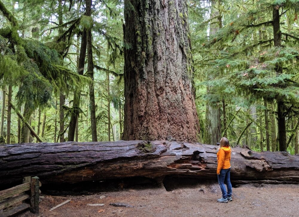
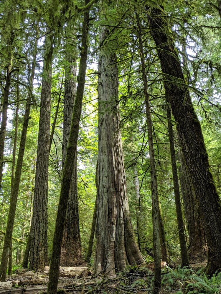
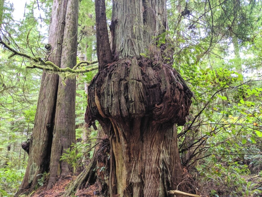
Cathedral Grove (MacMillan Provincial Park)
Cathedral Grove is the most popular place to see old growth trees on Vancouver Island. Officially known as MacMillan Provincial Park, the trees in Cathedral Grove are amongst the oldest and tallest in Canada.
It’s definitely a humbling experience to stand next to these incredibly tall and gnarled tree trunks. The tree canopy is up to 80 metres high in places, with some of the trees as wide as a car!
Cathedral Grove is very busy during the summer months, on weekends and especially in the middle of the day. If you can, visit early (before 10am) or late (after 4pm).
Plan to try and stop at Cathedral Grove on your outgoing journey to Tofino. If there is no available parking, you’ll have a second chance on the way back.
Allow at least 30 minutes to walk the 1km loop trail to see the biggest tree on the south side of the park.
Distance from Nanaimo: 67km
Distance from Tofino: 141km
Suggested time: 45 minutes to one hour
Hole In The Wall Waterfall
While the Hole in the Wall is not technically a waterfall, it remains one of the most beautiful spots in this area to visit.
Naturally created from the remnants of Port Alberni’s old water system, a stream of water rushes out of an oval opening in a rock.
The Hole in the Wall is accessed via a short rocky path from Highway 4. On our last visit, there were small wooden signs providing directions. The 2km return hike takes around 30 to 45 minutes.
The hardest part of visiting the Hole in the Wall is finding parking and safely crossing the highway.
There is a small unpaved parking lot near Coombs Country Candy, on the other side of the highway. Be very careful when crossing the busy road.
Distance from Nanaimo: 79km
Distance from Tofino: 128km
Suggested time: Around one hour
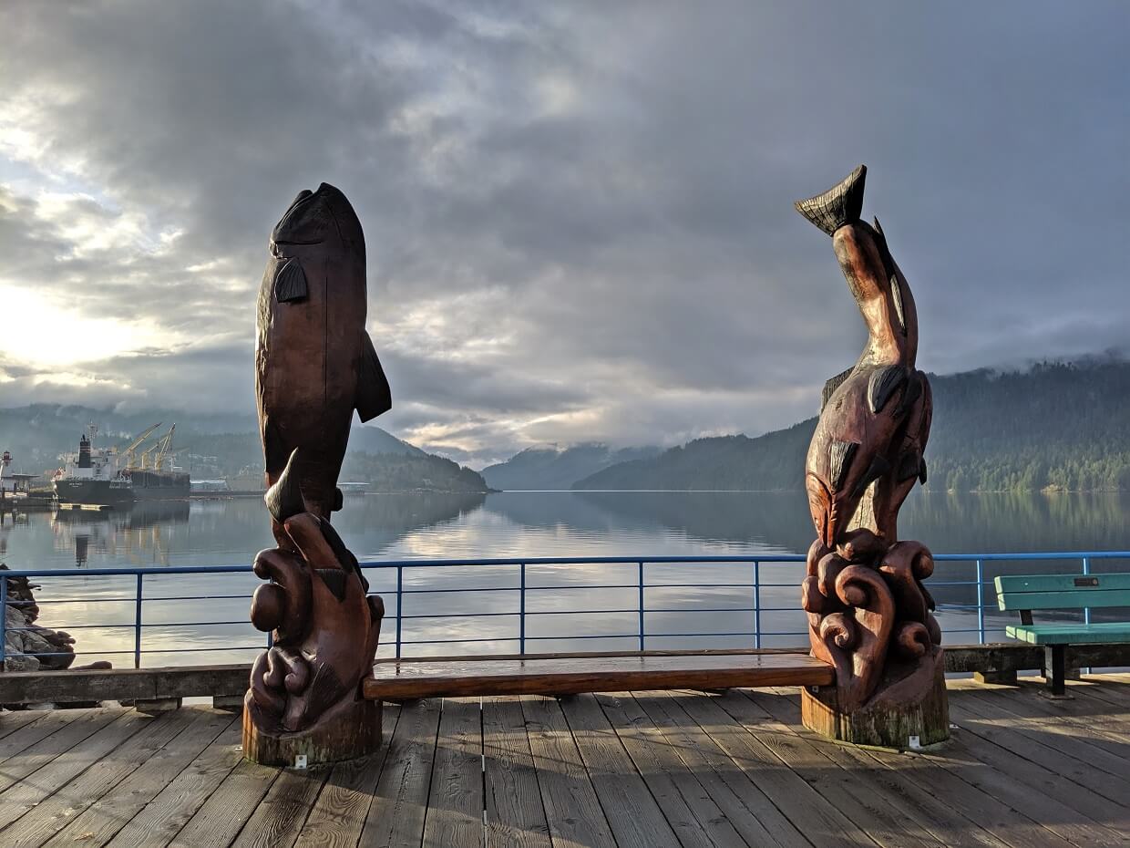
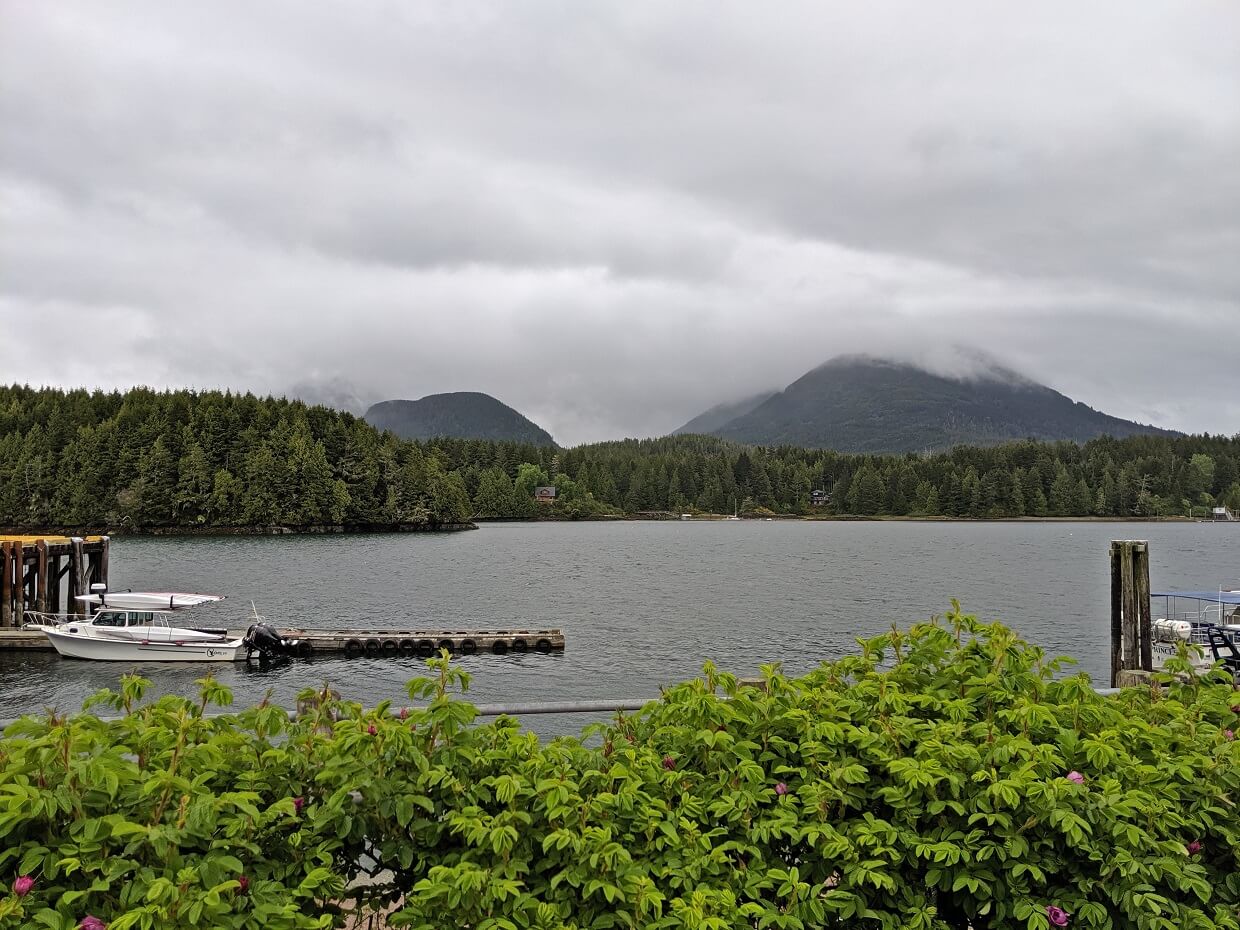
Port Alberni
As the largest service centre in the area, Port Alberni is the ideal place to pick up groceries, coffee, gas and other essential road trip supplies. Please note that cell phone signal is patchy after Port Alberni.
Despite its mid-Island location, Port Alberni is technically an oceanside city! It sits at the head of the Alberni Inlet, which stretches 40km from Barkley Sound on the Pacific Ocean.
Highway 4 runs right through the north end of town, with easy access to big box stores as well as independent cafes and shops. There are two breweries as well!
For scenic views of the city and the inlet, make the short (5 minute) detour to Alberni Harbour Quay.
Distance from Nanaimo: 85.5km
Distance from Tofino: 126km
Suggested time: Depends on shopping requirements
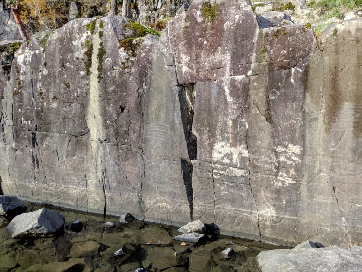
K’ak’awin (Sproat Lake petroglyphs)
Highway 4 follows the edge of Sproat Lake, a popular destination for swimming, camping and boating.
Sproat Lake is also host to some of British Columbia’s best preserved petroglyphs (rock carvings), a reminder that people have been living in this area for time immemorial.
The petroglyphs at Sproat Lake are known as K’ak’awin. The deep grooves in the rock are believed to have been made with a sharpened stick, with wet sand as a abrasive. The area was traditionally occupied by the Hupacasath First Nation.
To see the petroglyphs, head to the parking lot adjacent to the Lower Campground in Sproat Lake Provincial Park. The 600m walk to the petroglyphs is almost completely flat. A floating platform sits in front of the carvings.
For context, I would highly recommend reading the interpretive displays leading to the petroglyphs. One of the boards explains the individual petroglyph designs, which is helpful to understand what you are looking at.
Distance from Nanaimo: 95.5km
Distance from Tofino: 113km
Suggested time: 30 to 45 minutes
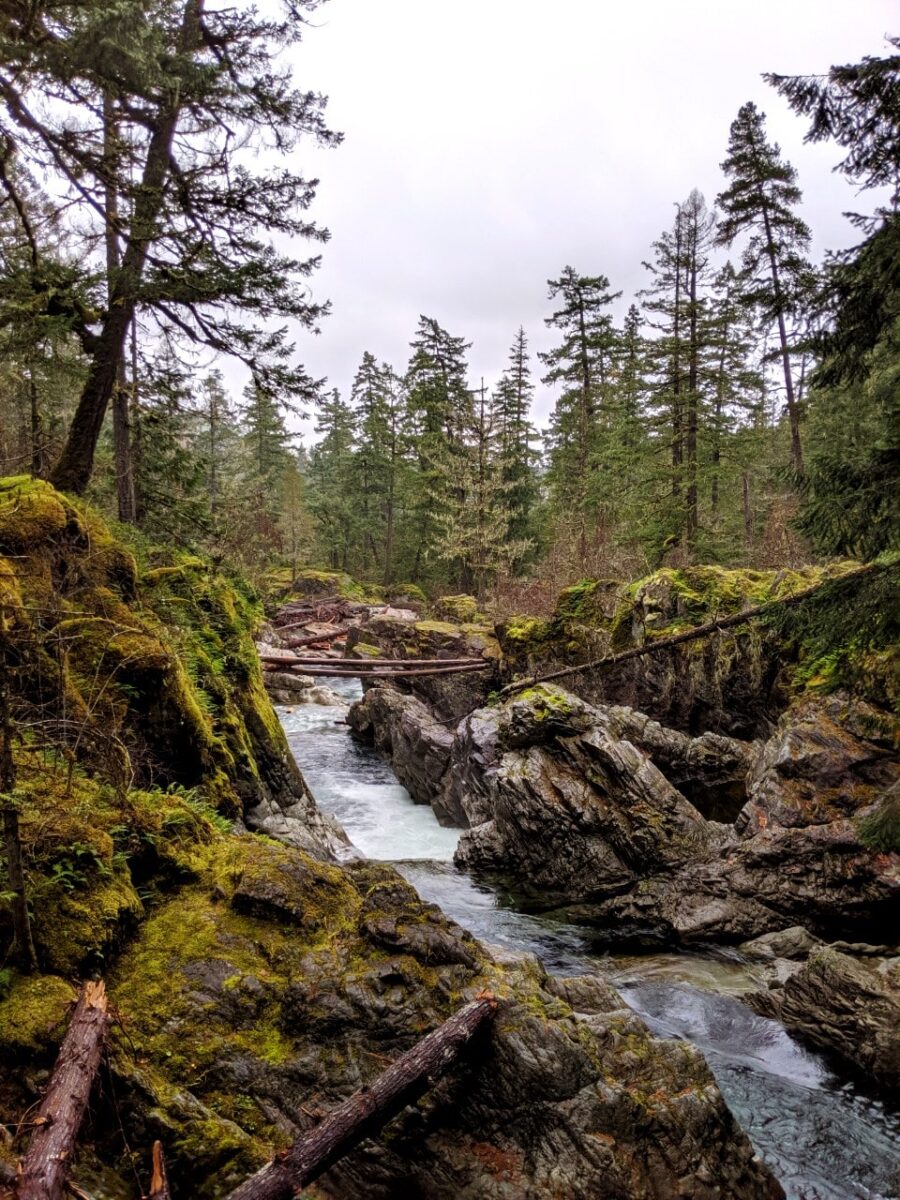
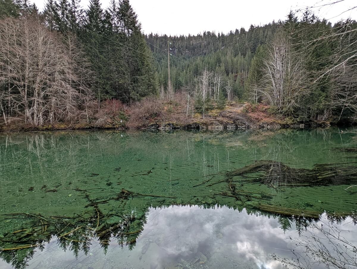
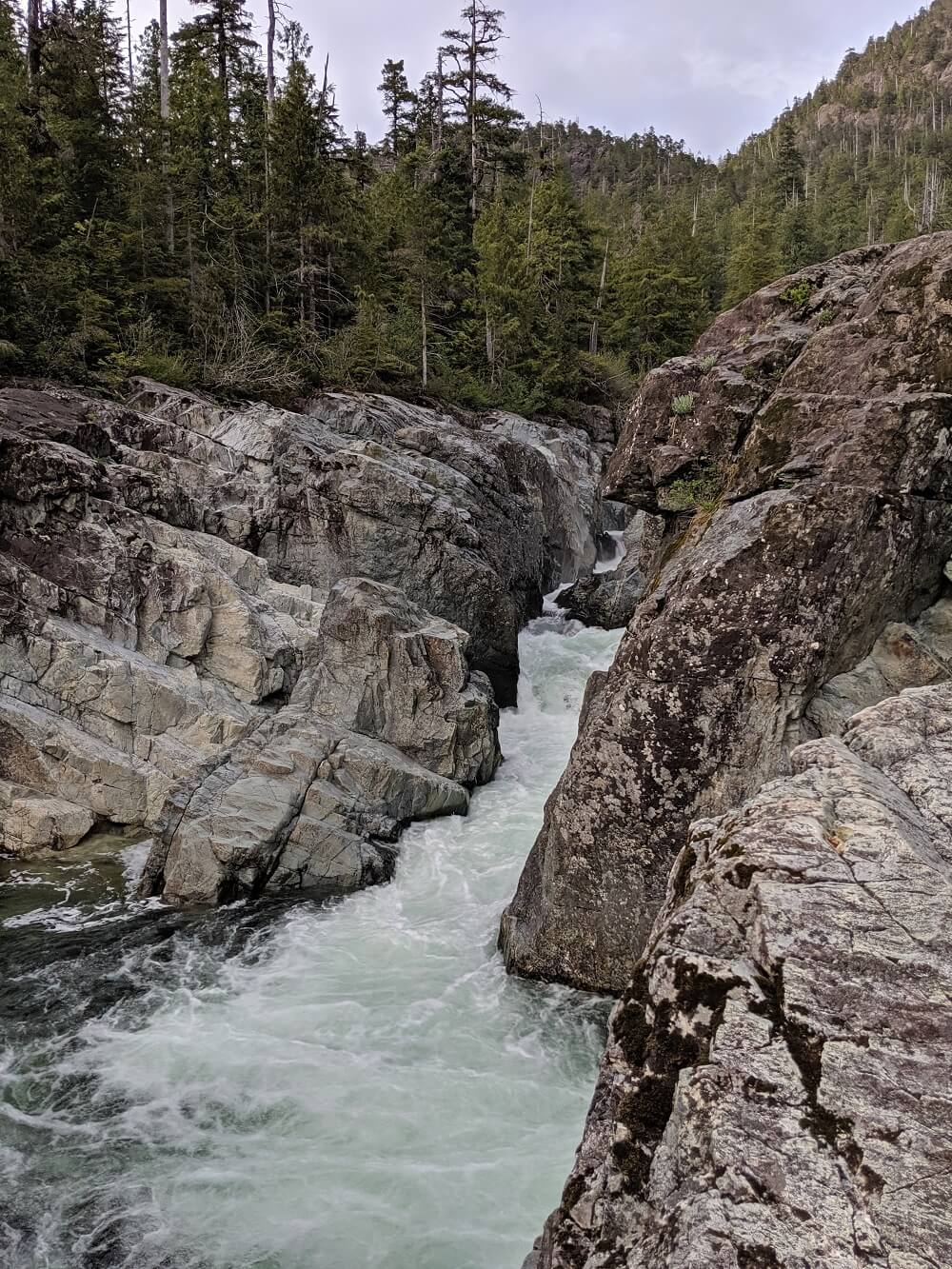
Taylor River Rest Area
It may seem odd to recommend a particular rest area, but the one at Taylor River is a little special.
The main rest area features a large paved parking lot with picnic tables and washroom building. Backdropped by forest and hills, the rest area is already pretty scenic.
Just below the rest area, however, is the most turquoise coloured river you could imagine. It almost doesn’t look real! The water is absolutely crystal clear and completely calm. It is possible to swim here but keep in mind that the water is very cold!
Distance from Nanaimo: 124km
Distance from Tofino: 85km
Suggested time: Allow 30 to 45 minutes
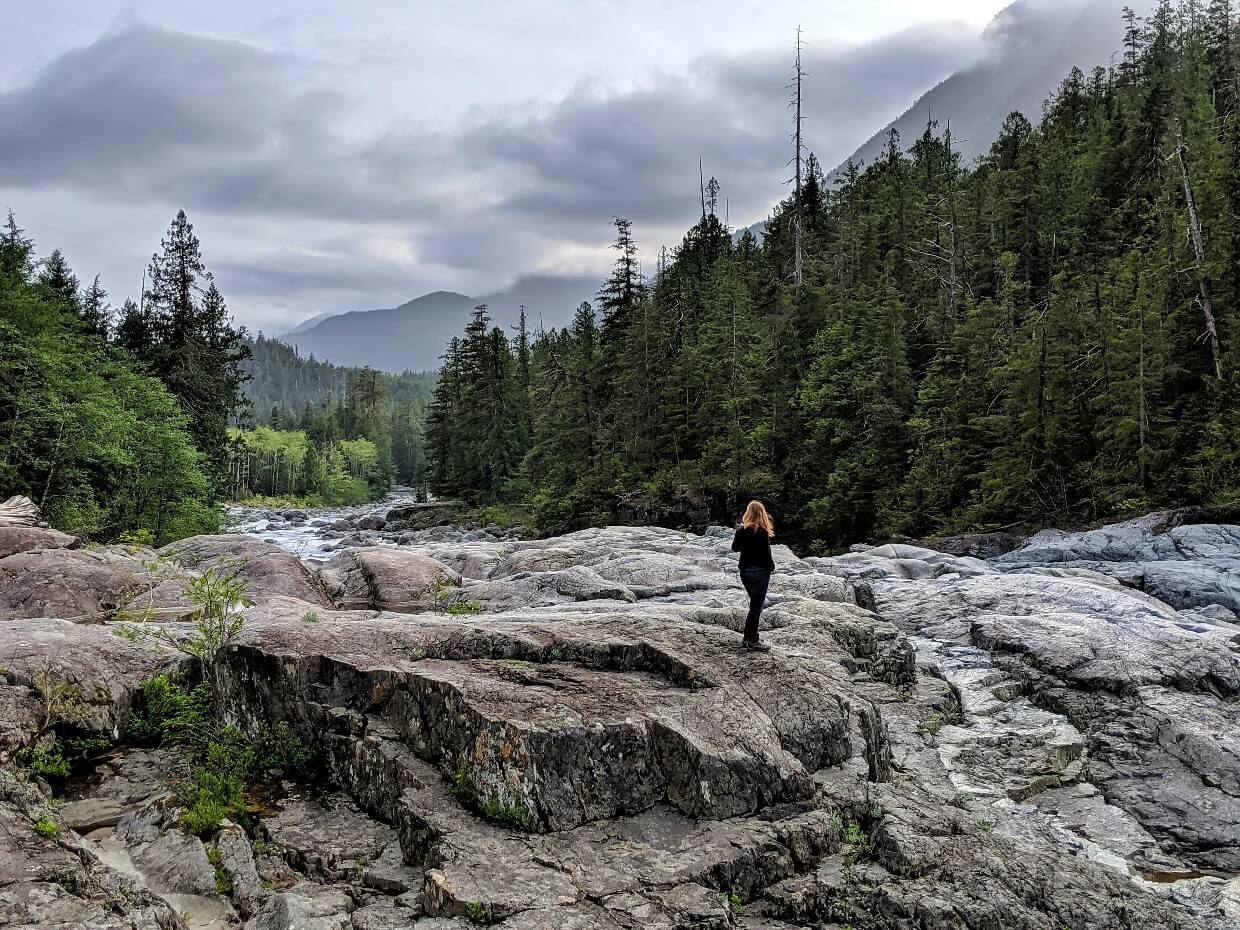
Wally Creek
Part of the ?a?ukmin Tribal Park, Wally Creek is a scenic roadside stop with expansive views of rugged mountains and huge boulders. The latter have been carved by hundreds of years of erosion.
On sunny days, the water here is just as turquoise as Taylor River. Some people like to swim, though keep in mind that the water is usually very cold and there is a pretty fast waterfall.
Wally Creek is located about 14km after Taylor River Rest Area and is best visited on the way to Tofino. There is space for about 8-10 vehicles to park on the right hand side of the road.
Although Wally Creek is right by the highway, don’t rule out seeing wildlife here. We spotted a black bear on our first visit!
Distance from Nanaimo: 137km
Distance from Tofino: 69.6km
Suggested time: 15 minutes to 1 hour
Giant Cedar Trail [NOW UNMAINTAINED]
Located close to Kennedy Lake, Giant Cedar Trail was previously one of my favourite stops between Nanaimo and Tofino. I described it as a great alternative to Cathedral Grove.
Unfortunately, I visited it in March 2025 and the signage has been removed and the trail is overgrown. The forest is still wonderfully mossy with some beautiful large trees, but I can’t really recommend it as a place to go now.
I’m still mentioning it in case you have read about it in other guides.
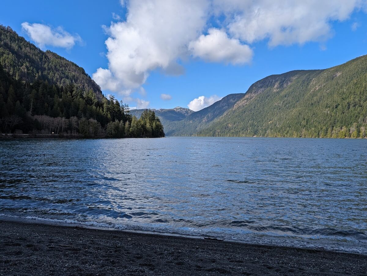
Kennedy Lake Lookout
On the approach to Kennedy Lake, Highway 4 becomes very twisty with many sharp turns as it starts to wind down towards the Pacific Ocean.
Kennedy Lake is Vancouver Island’s largest, at an incredible 16,000 acres! It outflows into Tofino Inlet and is an important spawning area for salmon and trout.
Some great views of the lake can be spotted from the highway but I’d recommend heading to the Kennedy Lake Lookout. The newly built parking area (no facilities) offers beautiful panoramas across this huge lake.
Stopping here also gives drivers a break from one of the most difficult section of the drive!
Distance from Nanaimo: 160km
Distance from Tofino: 47.3km
Suggested time: 5 to 10 minutes
DETOUR – Ancient Cedars Loop Trail
Eventually, Highway 4 comes to a stop at the Ucluelet/Tofino junction. Even if Tofino is your final destination, you may want to consider a side trip to the Ucluelet area.
The Ancient Cedars Loop Trail is a worthwhile stop and is only 5km from the junction. Part of the Wild Pacific Trail (see below), this section takes only 15-20 minutes to walk.
For such low effort, the reward is surprisingly high with large cedar trees appearing next to the trail almost immediately. Some are over 800 years old.
Distance from Nanaimo: 180km
Distance from Tofino: 38km
Suggested time: 30 to 45 minutes
DETOUR – Ucluelet
Ucluelet is a small community (pop. 2200) situated on the northern edge of Barkley Sound. The name comes from the Nuu-chah-nulth phrase, Yu-clutl-ahts, meaning ‘safe harbour’ or ‘safe landing place.’
Tucked into a calm inlet, Ucluelet is fairly sheltered. It is has a less touristy feel than Tofino and is less busy too. The waterfront area is host to a not-for-profit aquarium that runs on a catch and release basis only.
Our favourite place to eat in Ucluelet is Jiggers Fish & Chips. Don’t underestimate this food truck; it produces the best fried fish and fries anywhere in British Columbia. Think local seafood and homecut fries – simply delicious!
Distance from Nanaimo: 182km
Distance from Tofino: 40km
Suggested time: 30 to 45 minutes (+ additional time for food, aquarium)
DETOUR – Lighthouse Loop, Wild Pacific Trail
The Wild Pacific Trail is Ucluelet’s premier walking path, showcasing where the temperate rainforest meets the ocean.
The full trail is 8km long (one-way). For your Nanaimo to Tofino road trip, I’d suggest walking the 2.6 km Lighthouse Loop.
This popular section of the trail leads through mossy old-growth rainforest to the rugged rocky coastline, with sweeping views of the ocean, pocket beaches, crashing waves, distant islands and Amphitrite Lighthouse. Start this easy hike at the parking lot mid-way down Coast Guard Road.
If time is tight, I would recommend walking the Ancient Cedars Trail (above) and then extending your route along the coastline in that area instead. It will give you a good taste of the spectacular coastal scenery that characterizes this beautiful area.
Distance from Nanaimo: 185km
Distance from Tofino: 42.6km
Suggested time: 1.5 hours with driving time from Highway 4 junction

Rainforest Trails, Pacific Rim National Park
Haven’t seen enough big trees yet? Pacific Rim National Park hosts two short boardwalk trails leading through the forest, appropriately named ‘Rainforest A’ and ‘Rainforest B.’
Both Rainforest trails are 1km in length and feature undisturbed old growth forest, with big trees, mossy undergrowth and thick ferns. There are a number of steps to climb on either trail.
I like both trails fairly equally but if I had to choose, I’d say I prefer ‘Rainforest B’ over the other.
Please note that a Parks Canada pass is required to hike either trail. Passes can be purchased in the parking lot. In 2025, the daily admission fee is $11/adult and $22/group. Children and youth are free.
Distance from Nanaimo: 184km
Distance from Tofino: 24km
Suggested time: 15 to 30 minutes for each loop

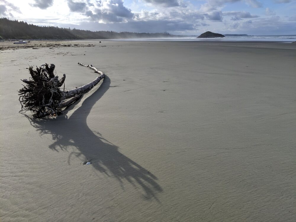
Long Beach, Pacific Rim National Park
The largest and longest beach in Pacific Rim National Park, Long Beach is a must see on any Nanaimo to Tofino road trip.
True to its name, the golden sands of Long Beach stretch into the distance for 16km! With this in mind, there’s plenty of space for surfers, walkers and beachcombers.
There are many places to access Long Beach. There are three large beachside parking lots near the airport turnoff and more at the Kwisitis Visitor Centre.
Alternatively, you can hike through the old growth forest to Long Beach from the Schooners Cove and Combers Beach trailheads.
Distance from Nanaimo: 190km
Distance from Tofino: 17km
Suggested time: Allow 30 to 45 minutes
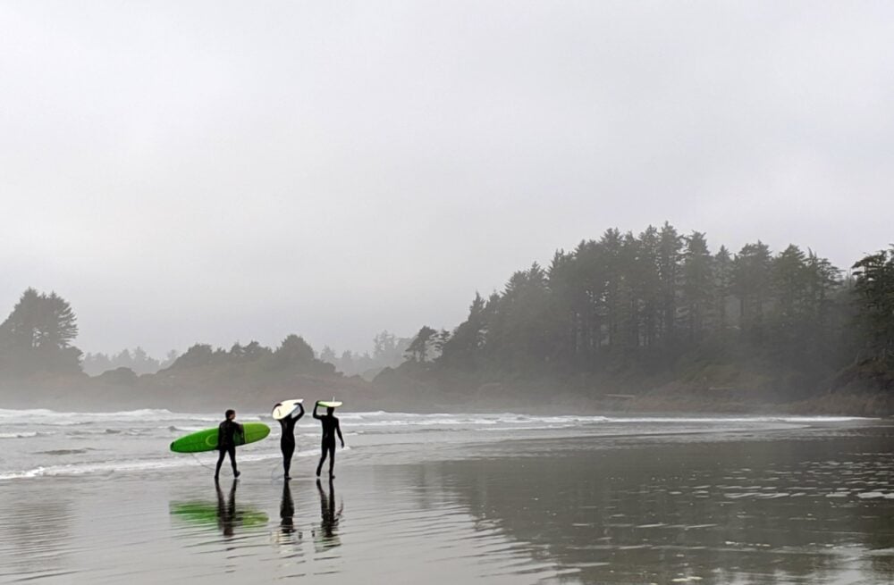
Tofino
The small village of Tofino (pop. 2500) is perched on the very western edge of Vancouver Island.
The very walkable downtown area is surrounded by long sandy beaches, old-growth temperate rainforest, misty mountains, rocky headlands and pounding surf.
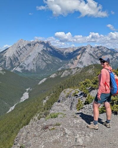
There are so many things to do in Tofino, from surfing and kayaking to hiking and whale watching.
If you’d prefer to relax, there are boat-accessible hot springs and plenty of calming beaches to enjoy. Cox Bay is our favourite local beach (there’s a great hike up to the headland), but Mackenzie Beach is wonderful as well.

Nanaimo to Tofino road trip: Essential details
Now you have some ideas of what to do between Nanaimo and Tofino, here are some important details about the road trip!
What to expect on the drive
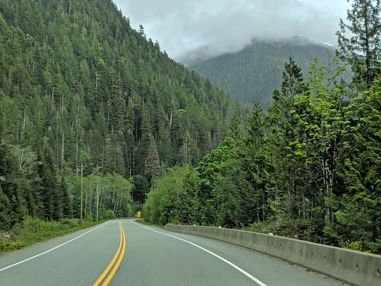
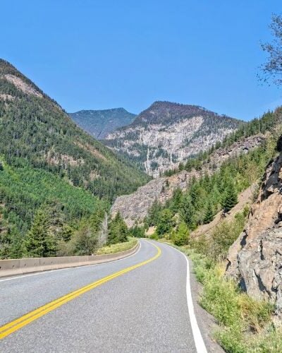
The drive from Nanaimo to Tofino follows two major roads – Highway 19 and Highway 4.
Highway 19 is a busier road and is a divided double-lane highway (four total lanes). There are quite a few traffic lights around Nanaimo and Nanoose Bay, so expect a slower start to the drive.
Highway 4 is a road of two halves. The section between Coombs and Port Alberni is pretty busy. The latter section, between Port Alberni and Tofino, is still well-used but definitely quieter. Notably, there is less industrial and commercial traffic.
Both parts of Highway 4 have only two lanes, with one in each direction. There are intermittent passing sections.
Some elevation is gained between Cameron Lake and Port Alberni. The section of road bordering Kennedy Lake features many tight curves. If you suffer badly from motion sickness, you may want to bring medication.
Highway 4 ends in Tofino, 207km from Nanaimo. In this post, I have also suggested a detour to the nearby community of Ucluelet (20km return).

Public transportation
Curious whether you can take the bus between Nanaimo and Tofino? Yes, you can, but only from May to October.
The Vancouver Island Connector runs between Nanaimo and Tofino on a seasonal basis, also stopping at Parksville, Coombs, Port Alberni, and Ucluelet.
While you won’t be able to stop at most of the attractions featured in this post, the bus journey still offers some beautiful views along the way.
Where to stay in Tofino
Tofino is one of the most popular places to stay in British Columbia.
For this reason, I would highly recommend making a reservation early (6+ months). If you can, plan your trip for the shoulder seasons. Not only will the prices be cheaper, but there will be more choices too.
Tofino is well known for its luxurious beachfront resorts, such as Middle Beach Lodge (adults only), Pacific Sands Beach Resort (dreamy beach houses with floor-to-ceiling windows) and Long Beach Lodge Resort (soaker tubs, fireplaces).

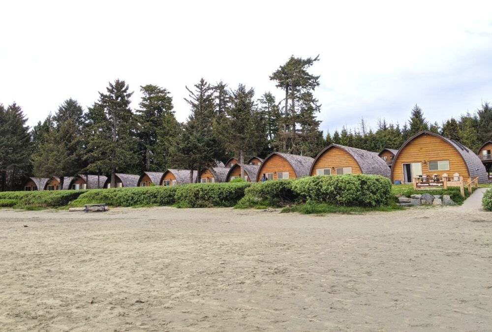
If your budget doesn’t stretch that far, check out Ocean Village on Mackenzie Beach. The distinctive ‘beehive’ cabins sit right behind the sand, offering spectacular perspectives of crashing waves and sunsets.
Green Point is the one and only vehicle-accessible campground located in Pacific Rim National Park (park pass required). The campsites are set into the forest above the beach, with a handful having ‘peek through’ views. Reservations usually open in January and the competition can be pretty fierce!
For more information about staying in Tofino, head to our dedicated accommodation guide.
Other resources you may find helpful to plan your road trip:
Where to Find Big Trees on Vancouver Island
25+ Amazing Vancouver Island Waterfalls You Must Visit
22+ of the Best Campgrounds on Vancouver Island, BC
Ultimate 2 Week Western Canada Road Trip from Vancouver: Itinerary, Tips & Map
Check out these recently published articles next


One half of the Canadian/British couple behind Off Track Travel, Gemma is happiest when hiking on the trail or planning the next big travel adventure. JR and Gemma are currently based in the beautiful Okanagan Valley, British Columbia, Canada. Consider buying us a coffee if you have find any of our guides helpful!
Thank you both. This listing is very helpful. We will be staying in Nanaimo with a day trip to Ucluelet and Tofino. The stops you have suggested are in sufficient detail to make some choices and the time specified for some of the walks helps in the choosing.
I’m so glad you found this helpful Linda.
@Gemma, this reply should be removed as it could be confusing to non-locals.
Edited the comment regarding temporary closures in July 2023, thanks!
Hello Gemma and JR – is this road difficult to drive during late June with dangerous bends and sharp gorges? Thanks.
Hi Raj,
This road has plenty of sharp corners. If you’re prone to motion sickness, definitely bring medication.