The Berg Lake Trail, one of the most iconic hikes in the Canadian Rockies, has finally reopened after major reconstruction due to flash flood damage in 2021. And it’s just as spectacular as before.
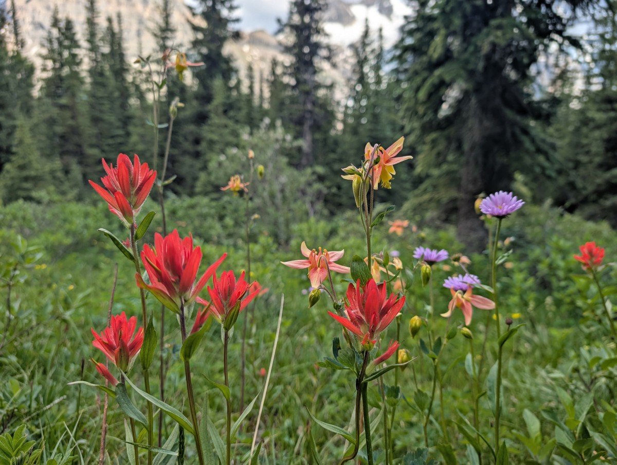
This 22km long trail, most often backpacked over several days, has it all – massive glaciers, jagged mountain peaks, steep forested valleys, dramatic waterfalls, and turquoise coloured lakes.
Put simply, it’s a showcase of the very best the Canadian Rockies has to offer.
The adventure doesn’t end at Berg Lake. A network of incredible day hikes reveals even more of the area’s glaciers, lakes, and mountain vistas.
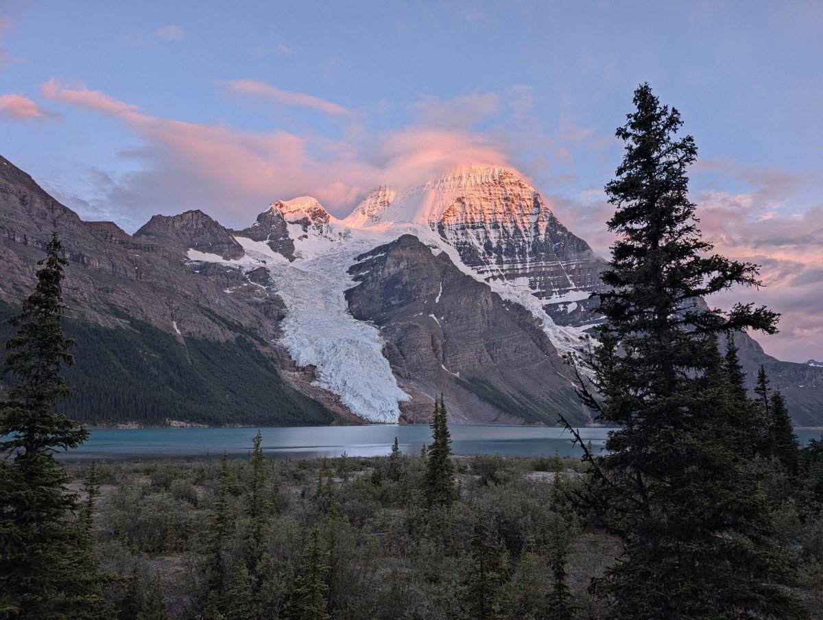
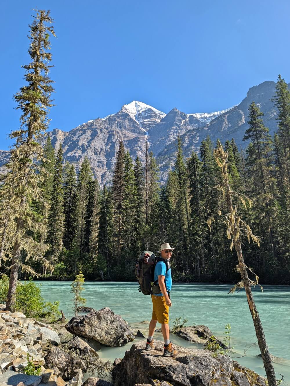
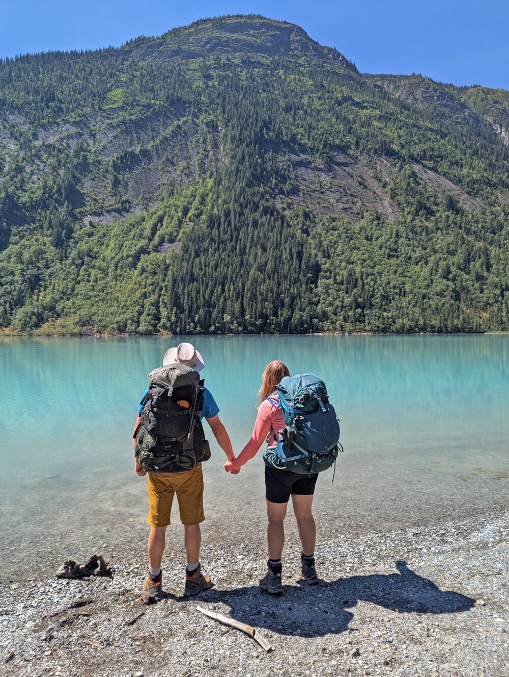
We hiked the Berg Lake Trail in mid July 2025, spending five days in this sub-alpine wonderland. Blessed with good weather, we saw the peak of Mount Robson every day and hiked almost every trail in the area.
It was a long awaited adventure for us, with our original 2021 reservation being cancelled after the flooding. Since then, we hiked almost all of BC’s premier backpacking trails. The Berg Lake Trail was a major gap.
In this comprehensive hiking guide, I’ll share what you need to know about hiking British Columbia’s incredible Berg Lake Trail, including all the details about the new route (with an accurate map and GPX track), reservation tips, campground info, day hiking opportunities and more.
- Berg Lake Trail overview
- Map with GPX route (2025 trail)
- Location and trailhead
- Reservations
- Check-in procedures
- Section-by-section trail breakdown
- Backcountry campgrounds
- Day hikes
- Itinerary ideas
- Navigation, safety and other essential info
- Difficulty
- Recommended items to bring
- Where to stay before/after
This post includes some affiliate links – if you make a purchase via one of these, we may receive a percentage of the sale.
Backcountry necessities
- Always bring the 10 Essentials
- Know how to stay safe in the backcountry
- Remember to Leave No Trace to help keep the wilderness wild
- Understand how to avoid negative bear encounters
- Trying out backpacking for the first time? Read Backpacking 101
- Check out our packing guide with gear recommendations
- Sign up to our newsletter for a free backpacking checklist
Berg Lake Trail overview
The Berg Lake Trail is located in Mount Robson Provincial Park in British Columbia, Canada, on the traditional territory of the Simpcw First Nation, the Lheidli T’enneh Nation and the Red Bluff Indian Band.
This provincial park is BC’s second oldest and is home to Mount Robson, the highest peak in the Canadian Rockies at 3,954 meters.
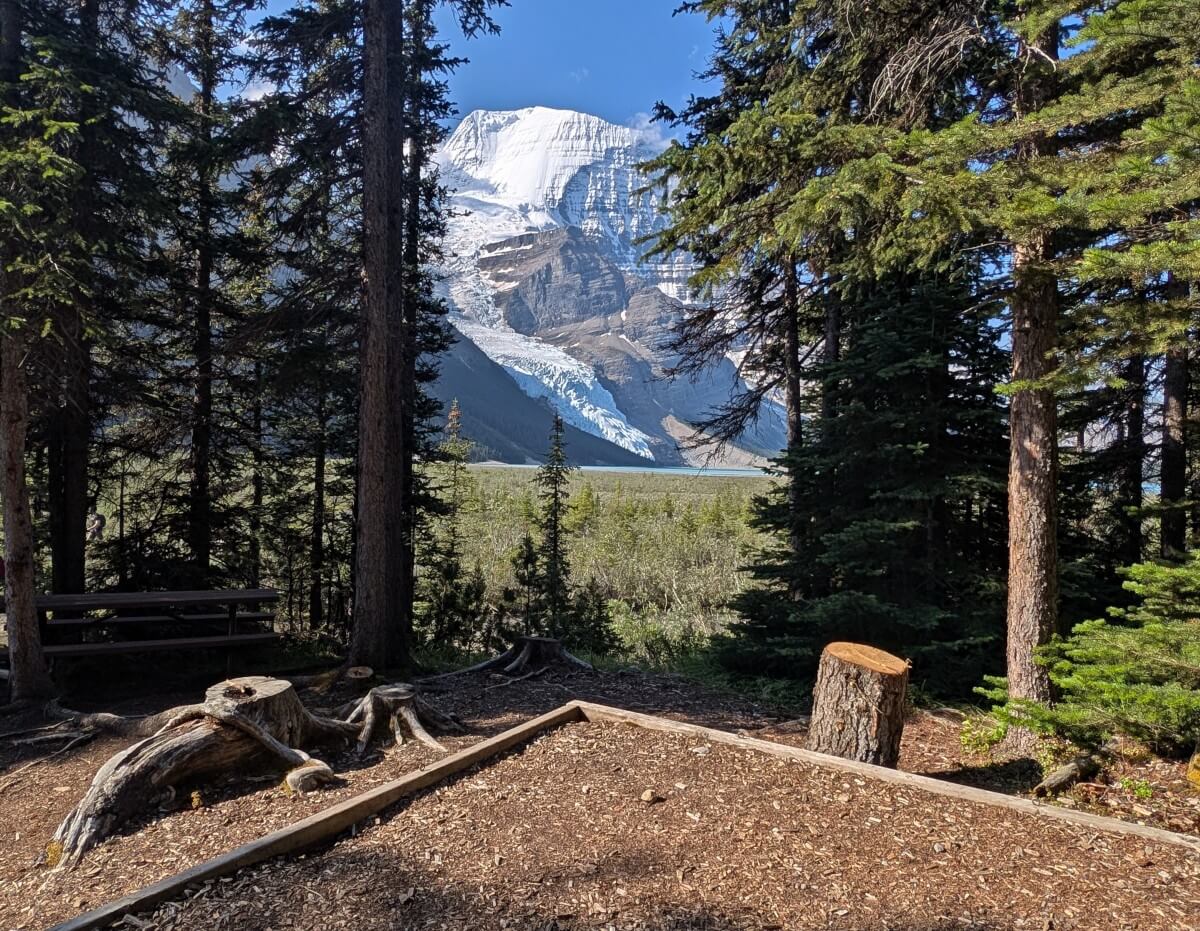
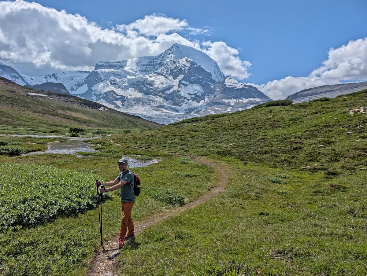
The mountain is known by the Secwepemc people as Tsyécelcten, ‘mountain of the spiral road,’ referring to its layered appearance. On clear days (which are rare!), the snow-capped summit of Robson is visible from numerous spots along the trail.
Being so large, Mount Robson has its own microclimate. I’ve heard this area is wetter than other areas of the Canadian Rockies and usually cooler too. Having said that, the Berg Lake Trail is snow-free earlier than many other popular backpacking trails in the mountains.
Stretching 22km, the Berg Lake Trail has long been celebrated as one of BC’s classic multi-day hikes. And the adventure doesn’t end with the main trail; the Berg Lake area offers a choice of rewarding day hikes for those looking to explore even more of this sub-alpine paradise.
A well paced Berg Lake Trail trip is around 5 days, with at least one day ‘spare’ to hike around the Berg Lake area. Due to demand for campground spots, however, a lot of hikers have to make the most of whatever dates and sites they can reserve.
The Berg Lake Trail is best hiked from mid June until September, with July and August being the prime time due to the chance for warmer, drier weather (and Snowbird Pass being open).
In my opinion, the Berg Lake Trail is an ideal first time backpacking trip. The trail is very well maintained, the campgrounds are well equipped, the elevation gain relatively approachable over 2 days and the reward to effort ratio is high.
If you’re pressed for time in the Canadian Rockies, the Berg Lake Trail is a great pick for a backpacking trip. It packs in all the must-see scenery in one go!
Quick facts
- 22km from trailhead to Robson Pass (only 20km from trailhead to Berg Lake Campground)
- Around 800m elevation gain, moderate difficulty
- 3-5 days ideal, longer is better for day hiking opportunities
- 7 backcountry campgrounds
- Campground reservations required from late May to late September
- $10/per person/per night camping fees plus $6 reservation fee
- Best time to go is mid June to late September
- Dogs not allowed overnight
Berg Lake Trail damage and reconstruction
Disaster struck the Berg Lake Trail in early July 2021, shortly after BC’s record breaking heat dome weather event.
The intense heat led to rapid snowmelt, which was further intensified by heavy rainfall.
The resulting flash flood caused extensive damage to the trail, prompting the evacuation of all hikers on 1st and 2nd July. Thanks to the quick and efficient work of the rangers, everyone was safely assisted out of the area.
Reconstruction began in 2022 using a multi-phase strategy (check out this BC Parks’ YouTube video for more details). The initial section up to Kinney Lake, following the original route, reopened in 2023.
The following stretches, to Whitehorn Campground and beyond, involved significant rerouting to reduce the risk of future flooding. The trail was opened as far as Whitehorn in 2024 and then the full route to Berg Lake, Rearguard and Robson Pass in late June 2025.
We originally booked a 4 night hike on the Berg Lake Trail for August 2021. I was so pleased to finally experience the brand new trail in mid July 2025.
It was everything I imagined and more – definitely worth the wait! The reconstruction is impressive and clearly involved a lot of hard work and planning.
We shared our Berg Lake Trail experience with Ashlyn (Lost Girl’s Guide to Finding the World) and her partner Aaron. Photos of JR and I together in this post were taken by them – thank you!
Berg Lake Trail map
Recent reconstruction has changed significant sections of the Berg Lake Trail. Most navigation apps still reflect the old route. Surprisingly, the Mount Robson Welcome Centre does not sell trail maps.
The below map features my Berg Lake Trail GPX track from the trailhead to the Berg Lake Campground. While it is not the full length of the trail, the remaining 2km (to the Robson Pass Campground) follows the old route and is almost completely flat.
Berg Lake Trail Hiking Guide
Inspired to hike the Berg Lake Trail? Read on to discover what you need to know to start planning your trip, from reservation details to essential items.
Location and trailhead details
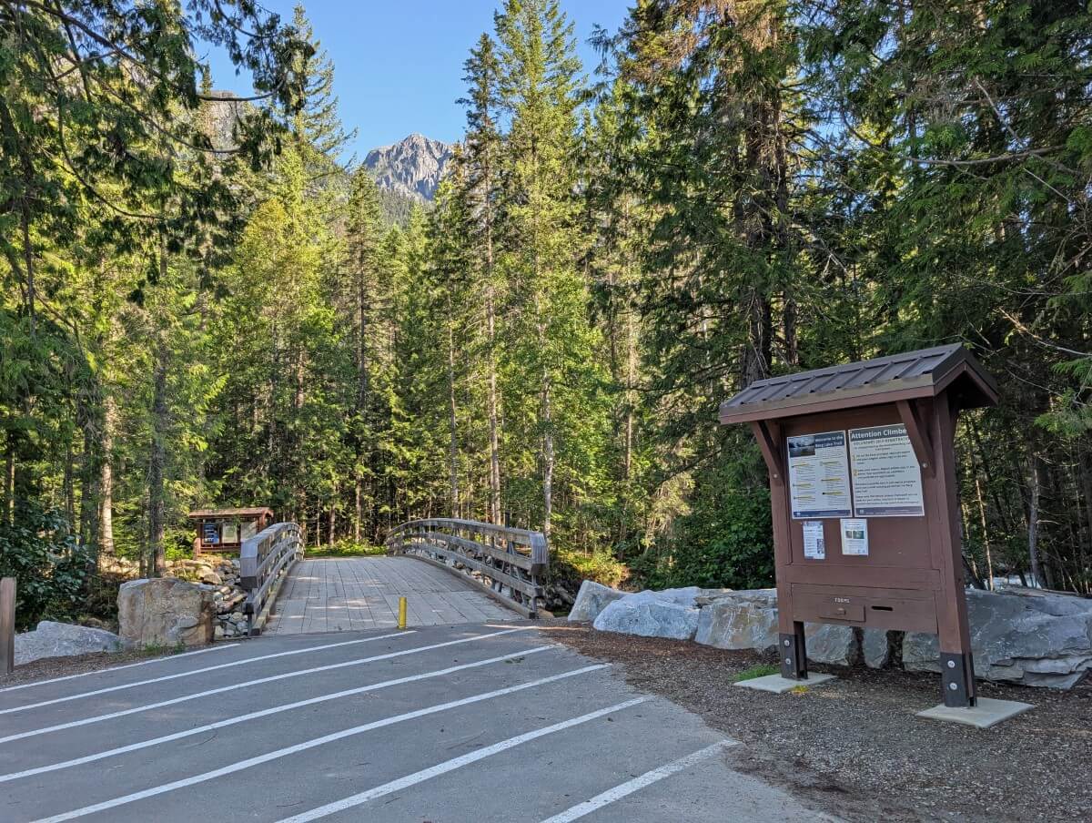
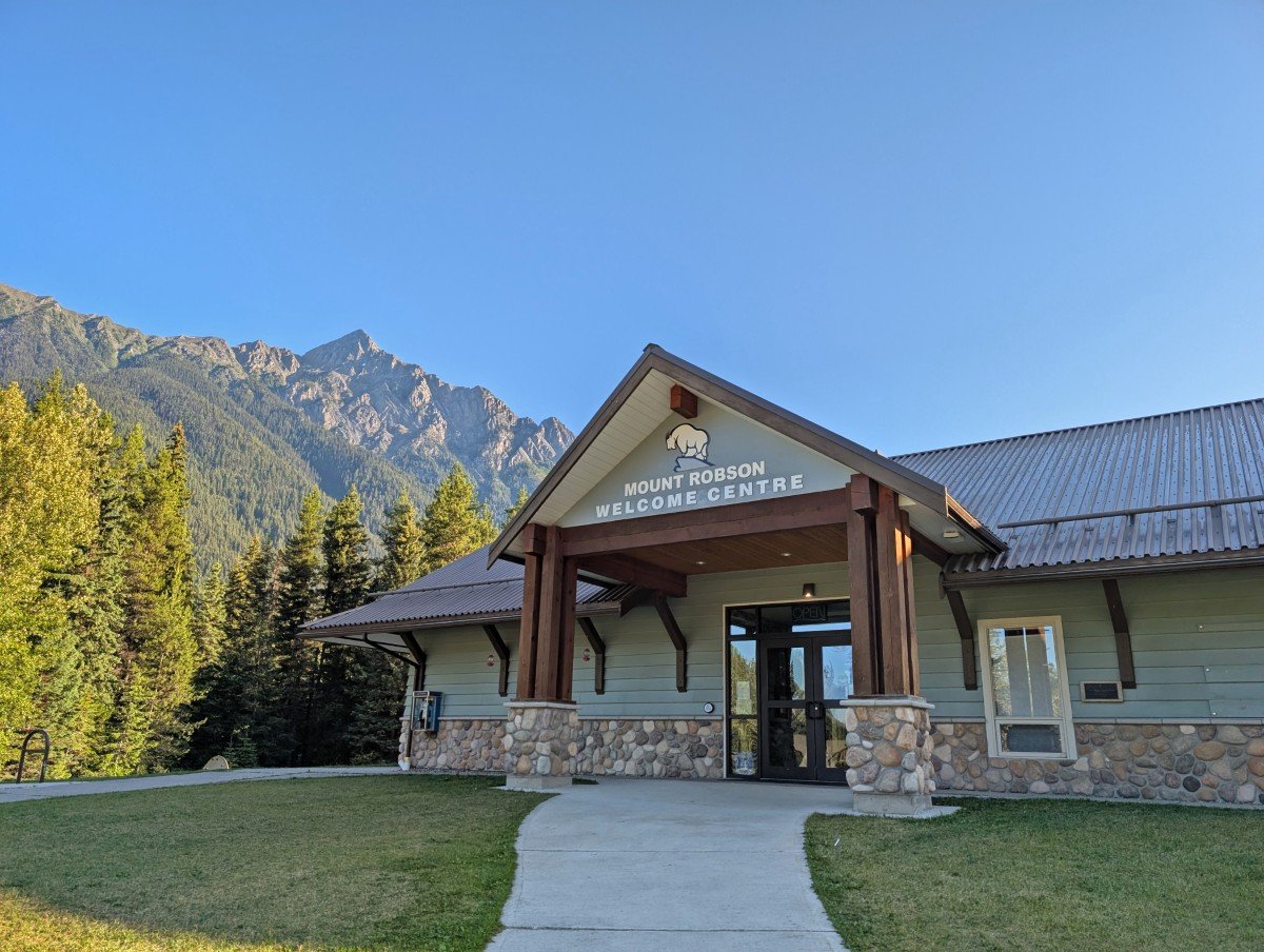
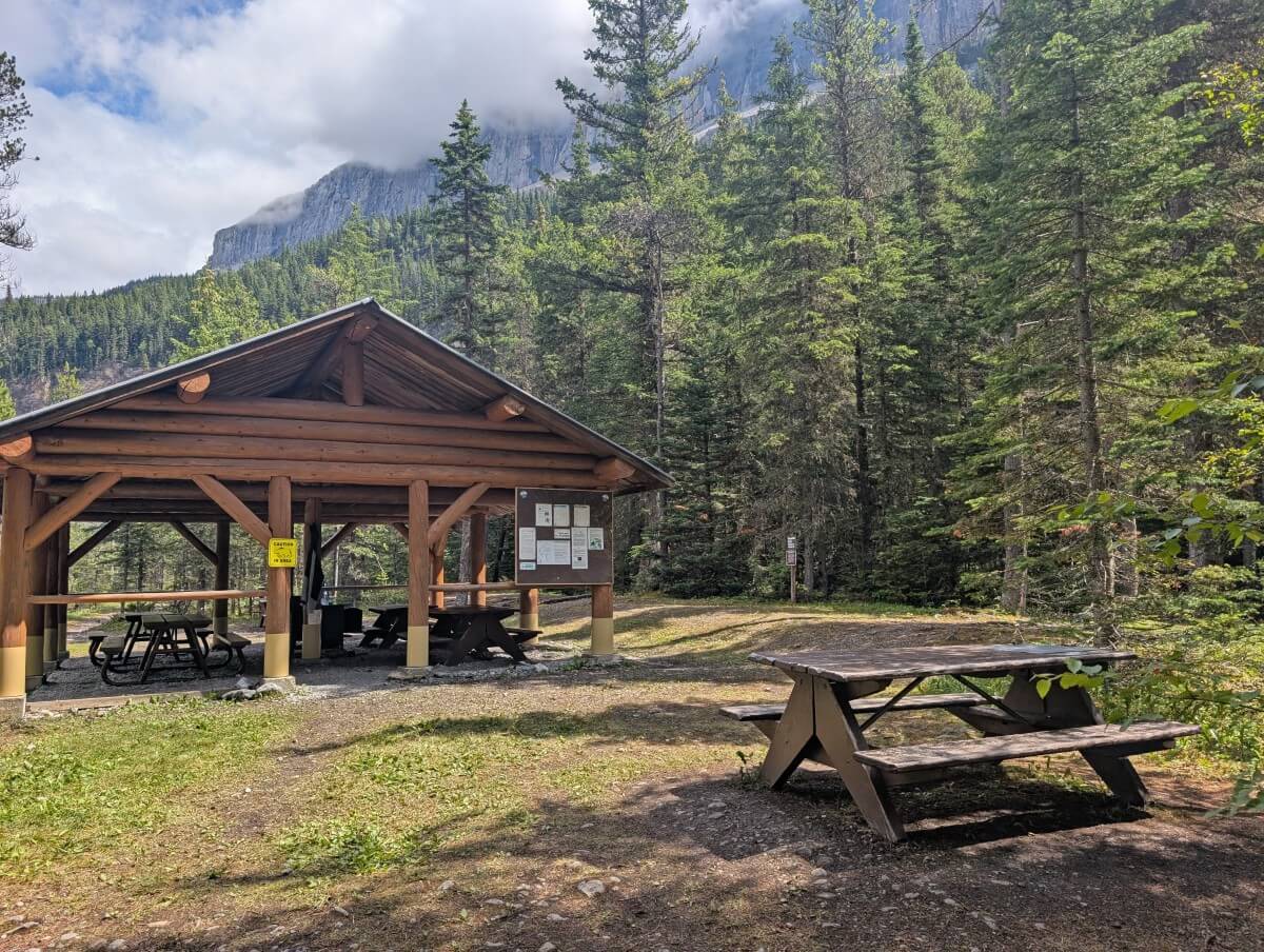
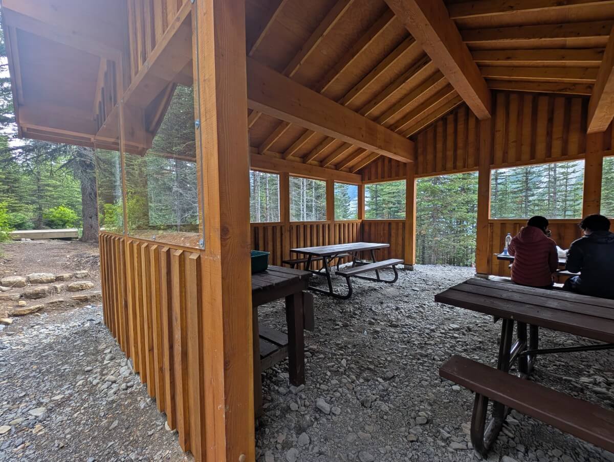
The trailhead for the Berg Lake Trail is situated at the end of Kinney Lake Road in Mount Robson Provincial Park, very close to Highway 16. It’s just a few minutes drive from the Welcome Centre, where all overnight Berg Lake hikers must check-in before hitting the trail (more info below).
There is a large parking lot with space for around 100+ or so vehicles, though it is obvious that the approach road is used as overflow as well.
The parking area has two outhouses, plus an open-sided shelter with picnic tables, trash bins and trail signage. Please note that there is no phone signal in Mount Robson Provincial Park.
The closest community with services (food, hotels, gas) is Valemount, about 30 minutes drive south.
Driving distances to the Berg Lake trailhead:
- Vancouver, BC – Approx. 7 to 7.5 hours, 711km
- Kamloops, BC – 3 hours 50 minutes, 360km
- Jasper, Alberta – 1 hour, 88km
- Edmonton, Alberta – 4 hours 40 minutes, 453km
- Banff, Alberta – 4 hours 20 minutes, 374k (national park pass required for Icefields Parkway*)
*Free entry until 2nd September due to the Canada Strong promotion.
Just so you know, Mount Robson Provincial Park is on Pacific time (PDT during summer), which is one hour ‘behind’ Alberta and the other Canadian Rocky Mountain national parks.
Berg Lake reservations and fees
It’s no secret: the Berg Lake Trail is one of the most popular hiking trails in Western Canada. While it was difficult to get a reservation before the flooding, it is even more competitive following the four year closure.
To camp on the Berg Lake Trail, you must have a valid permit for one of the seven backcountry campgrounds. There are 103 tent pads available each night.
Reservations are required from late May to late September – the exact dates vary from year to year.
Another option is the ACC Robson Pass Hut, just north of Berg Lake.
The Berg Lake Trail has a different reservation process than other backcountry campgrounds operated by BC Parks.
For the 2026 season, Berg Lake Trail reservations will open 2nd December 2025 at 7am.
At this time, all campgrounds along the trail will be available to reserve for the entire summer hiking season – 27th May to 29th September 2026.
- Reservations can be made via the BC Parks website only. Select ‘backcountry,’ then ‘Berg Lake Trail.’
- Be sure to create a BC Parks account before the reservation launch.
- Get some practice in before reservations open – spots go really fast! The more familiar you are with the process, the better your chances of grabbing a site quickly.
- Not successful? Wait 15-20 minutes after the launch – many people hold spots in their baskets and confer with friends before booking. After the hold time runs out, some availability will reappear.
- Camping fees are $10/per person/per night. The reservation fee is $6/night for the first three nights (so up to $18 total) in one booking.
- Still no luck? Keep an eye out for cancellations – or use an automated service to do the work for you. I used CampNab to snag three nights at Berg Lake in mid July. It takes some flexibility and quick timing, but it really works. You’d be surprised how often people cancel!
- ACC Robson Pass Hut reservations open in late winter (2nd March for 2026) and the member fee is $50/per person/per night.
Welcome Centre check-in (mandatory)
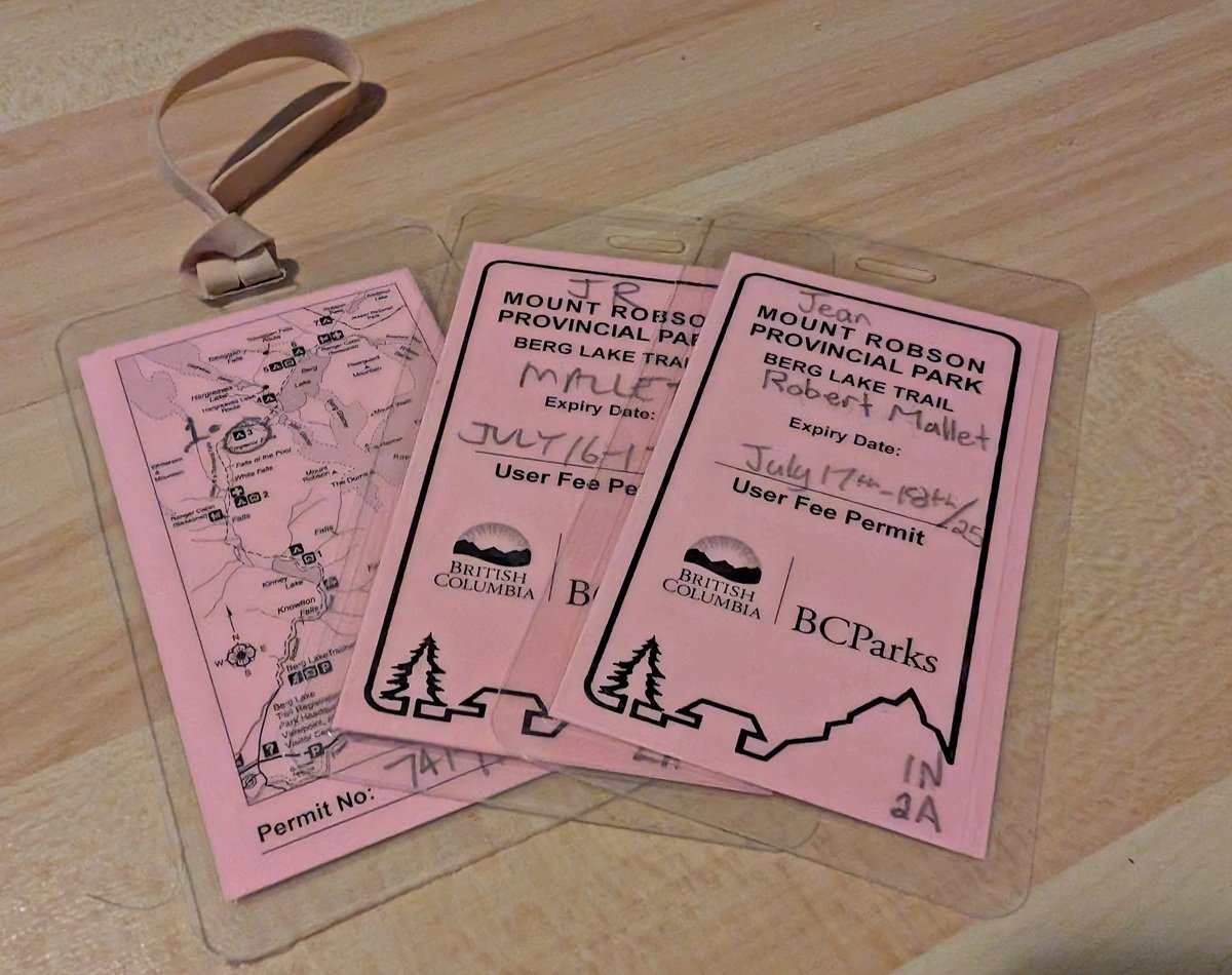
All Berg Lake Trail campers must check-in at the Mount Robson Welcome Centre to receive a permit before starting. These are laminated pink cards with your reservation details on one side and a map on the other. The permit needs to be hung outside your tent.
The Welcome Centre is open from 10am to 4pm every day during the operating season.
My biggest tip? Check-in the day before, especially if you have anything ‘unusual’ with your booking e.g. a large group, extra people to pay for, multiple reservations.
The Centre is pretty chaotic between 8-10am, when most Berg Lake hikers are trying to head to the trail. The staff allow hikers to check-in the day before after 11am – I’d recommend doing so if you can.
We checked in the day before and I was very glad we did. It took us over 30 minutes to receive our permits. This was due to the fact that we had 4 x 1 night reservations rather than just one reservation for 4 nights.
During check-in, the staff ask for your first name (then last), how many permits you have and the dates they are for. According to the reservation information, we were meant to watch an orientation video but we weren’t directed to view it. It is available on the BC Parks website, however.
The Welcome Centre has free wi-fi, so if you need to contact anyone before/after the trail, this is the place to go (there’s no phone signal).
Berg Lake Trail hike breakdown
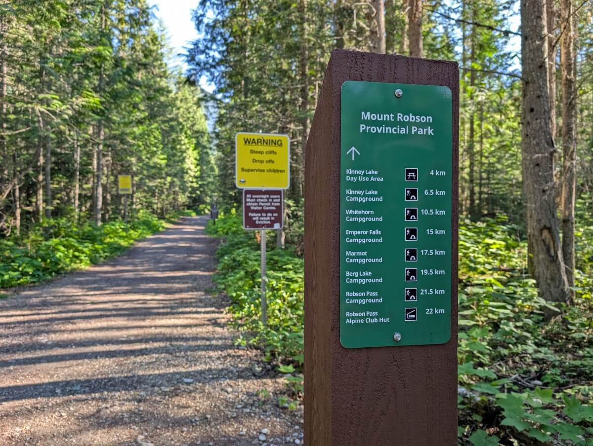
Read on to discover what to expect when hiking the 22km long Berg Lake Trail in Mount Robson Provincial Park. The distances displayed below refer to the new trail, opened in late June 2025.
| Berg Lake Trail location | Distance from trailhead |
| Kinney Lake Day Use Area | 4.4km |
| Kinney Lake Campground | 6.5km |
| Whitehorn Campground | 10.5km |
| Emperor Falls Junction | 14.4km |
| Emperor Falls Campground | 15km |
| Marmot Campground | 17.5km |
| Berg Lake Campground | 19.5km |
| Rearguard Campground | 20.5km |
| Robson Pass Campground | 21.5km |
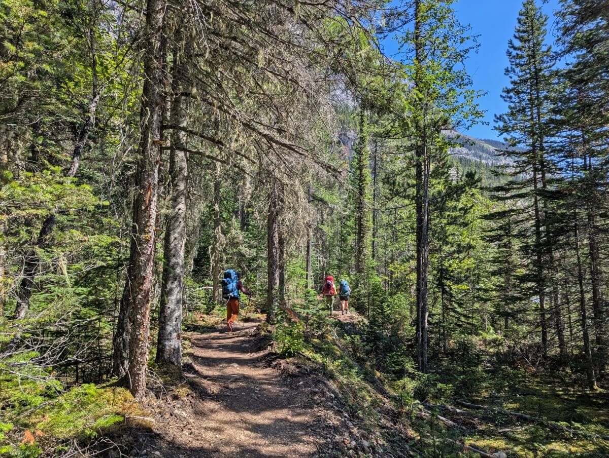
Trailhead to Kinney Lake Campground
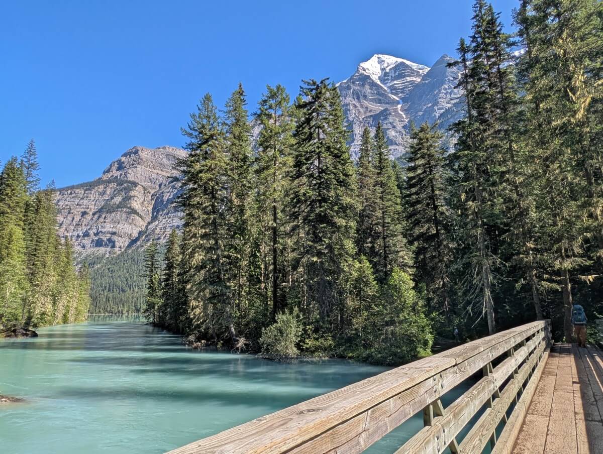
The first section of the Berg Lake Trail is the easiest. While it’s not completely flat (it has some rolling hills), the path is very wide and well graded. And when I say wide, I mean it – there’s room for 5 hikers to walk side by side!
Bikes can be used on this stretch of trail. Also expect to see strollers and carts. The hike to Kinney Lake is very popular with families, day hikers and overnight campers – for more details, check out this dedicated Kinney Lake trail guide!

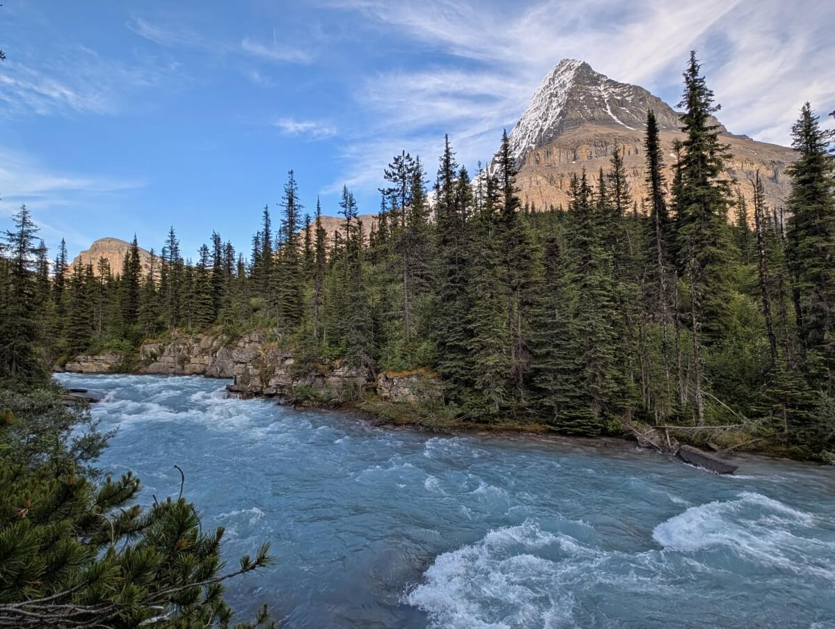
The path runs beside the chilly, fast-flowing Robson River and through some lush strands of cedar and hemlock forest. On a clear day, Mount Robson’s snow capped peak can be spotted at several openings.
Just after a bridge (around the 4.2km mark), there is a junction. The left path leads along the shoreline of Kinney Lake for about 400m, while the forest route is slightly shorter. The distances are incredibly similar so I would recommend the lakeshore route.
Kinney Lake Campground to Whitehorn Campground
It’s may be difficult to drag yourself away from Kinney Campground on a sunny day – the reflections are stunning and the lake itself perfect for a cold dip.
From Kinney, the trail becomes a little narrower but it still two hikers wide. Veering away from the lakeshore, the path crosses a bridge (look right for a waterfall view!) and then reaches a fork. Cyclists must dismount here.
The left route leads across the Kinney Flats (low water levels only) while the right path leads up and over a bluff (about 70m elevation gain).
Of the two, the Kinney Flats way is more scenic (and also easier).

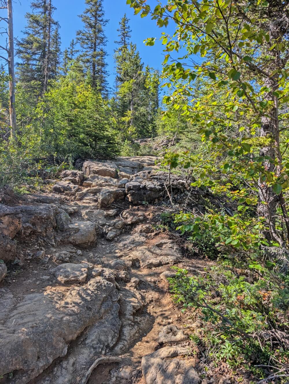
The next stretch of trail is newly constructed, weaving through the forest with gentle rises and dips. It then crosses a creek, skirts the bottom of a rocky slope and transitions into a series of switchbacks.
The trail climbs steadily, gaining just over 100 metres of elevation over the course of a kilometre, before easing off before the final approach to Whitehorn Campground.
Whitehorn Campground to White Falls base
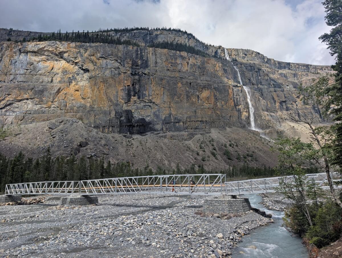
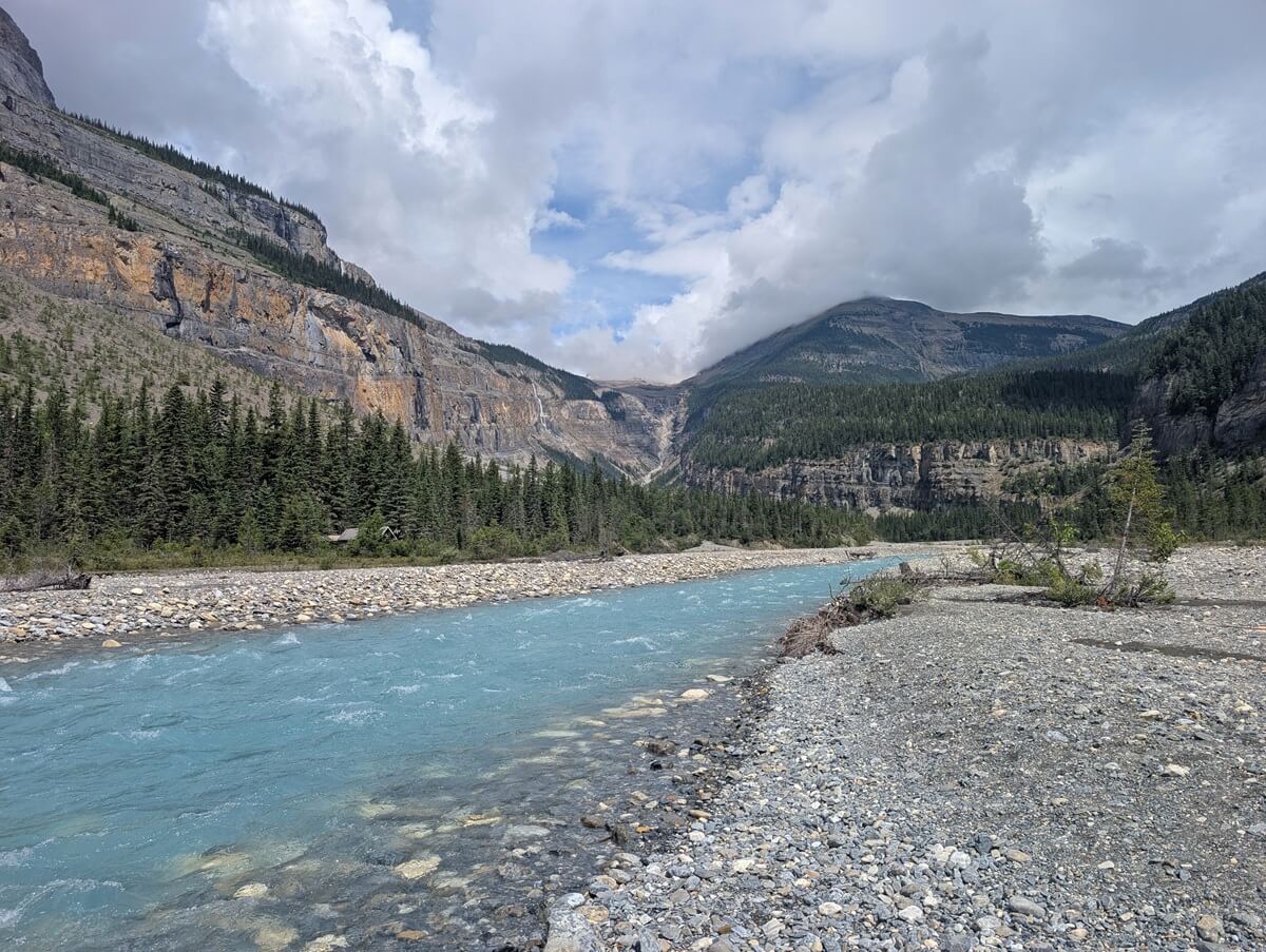
Even if you’re not staying overnight, Whitehorn Campground makes a perfect spot for a longer rest. The expansive river bank area has amazing views of the Valley of a Thousand Falls ahead.
This next section of the Berg Lake Trail is also newly built. It starts with a bridge crossing (once a suspension bridge), then follows a traverse beneath a rocky slope.
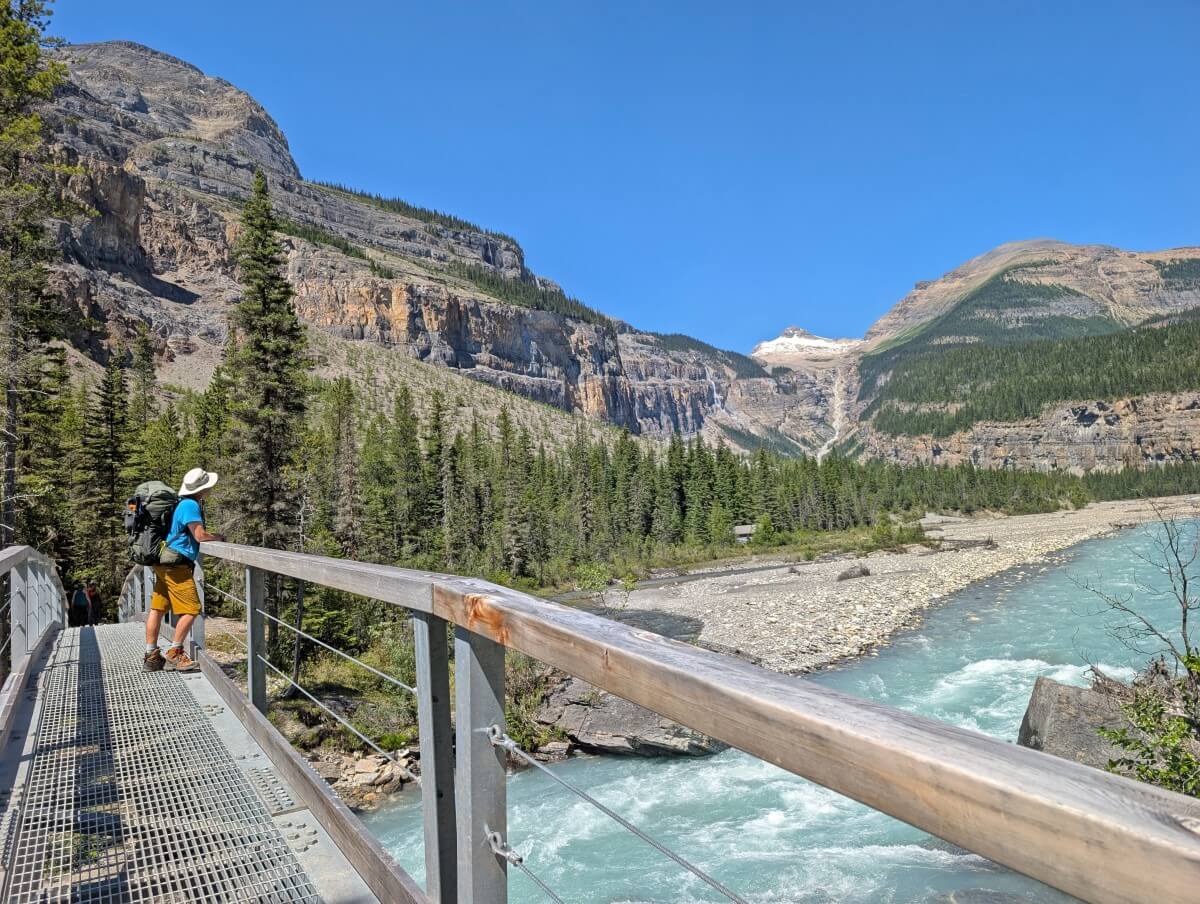
The path is well graded, mostly flat and makes for easy walking. The views are incredible – multiple waterfalls, steep forested hills and snowy mountain peaks.
This section lasts a full kilometre and it’s one of my favourite stretches of the entire trail!
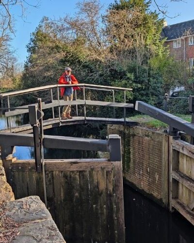
A very long metal bridge beckons hikers back across the river flats, towards the original Berg Lake Trail and also the most challenging section of the entire route.
The bright yellow ‘Rockfall Area’ warns of the terrain and climb to come.

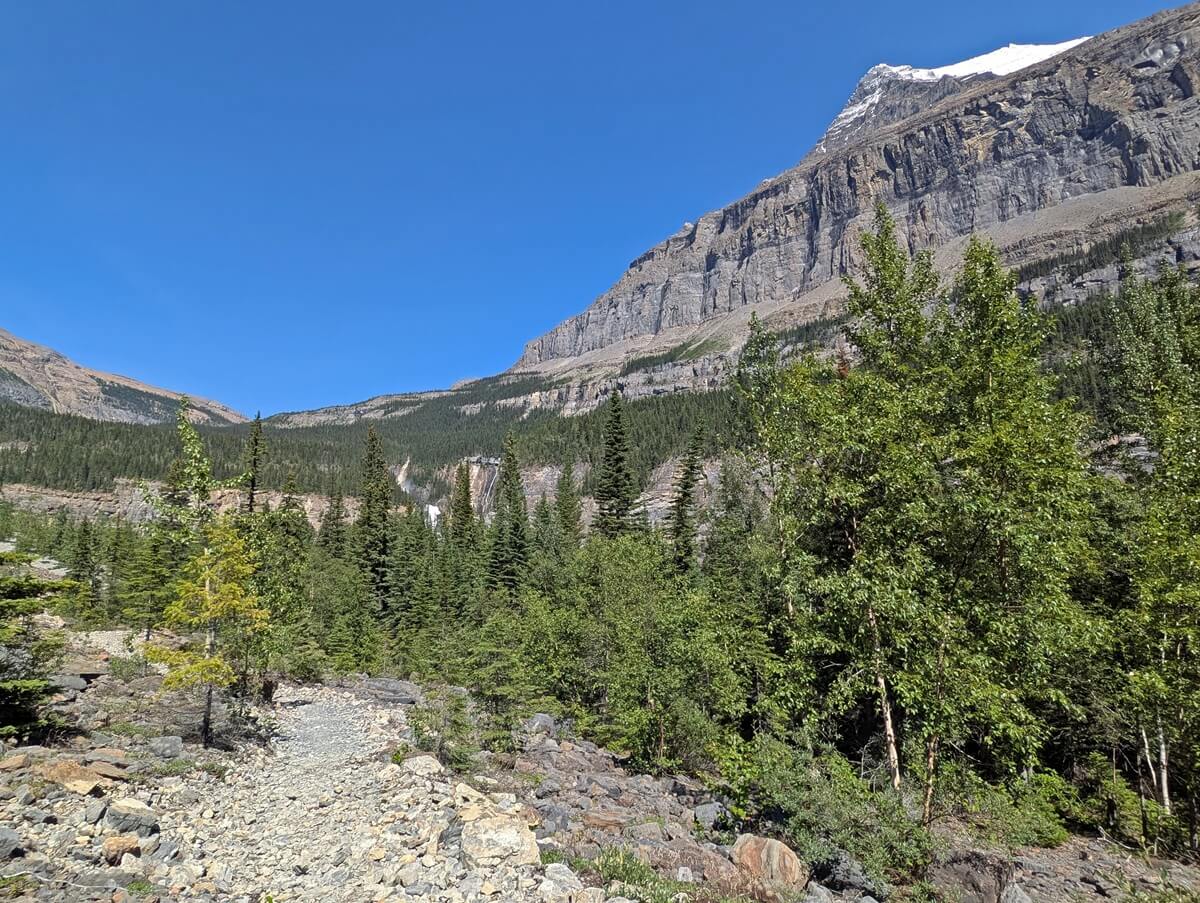
White Falls base to Emperor Falls Campground
The ascent between the base of White Falls and Emperor Falls is about 3.5km long with around 500m elevation gain. It starts with some short switchbacks.
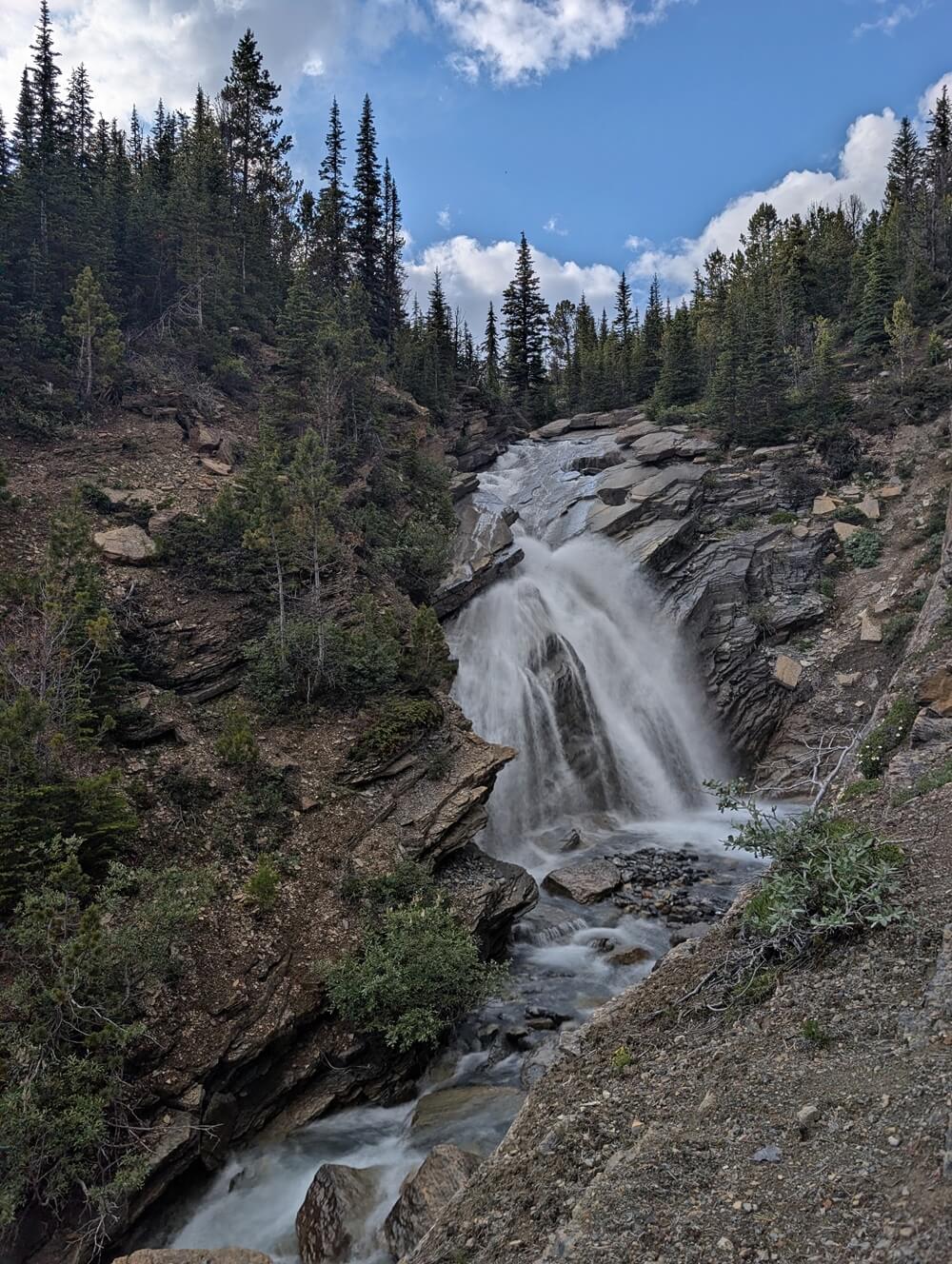
At this point, you can hear the roar of White Falls but not really see it. A side trail leads to a rocky viewpoint overlooking the huge waterfall – be very careful on the rocks, especially in wet weather.
Returning to the main trail, the climb continues. Several additional viewpoints provide varying perspectives of White Falls, one with a side aspect of Mount Robson as well.
Between kilometres 13 and 14, the trail becomes increasingly steep, rocky and rooty. Watch your step, especially on rainy days. There are some potentially muddy areas too.
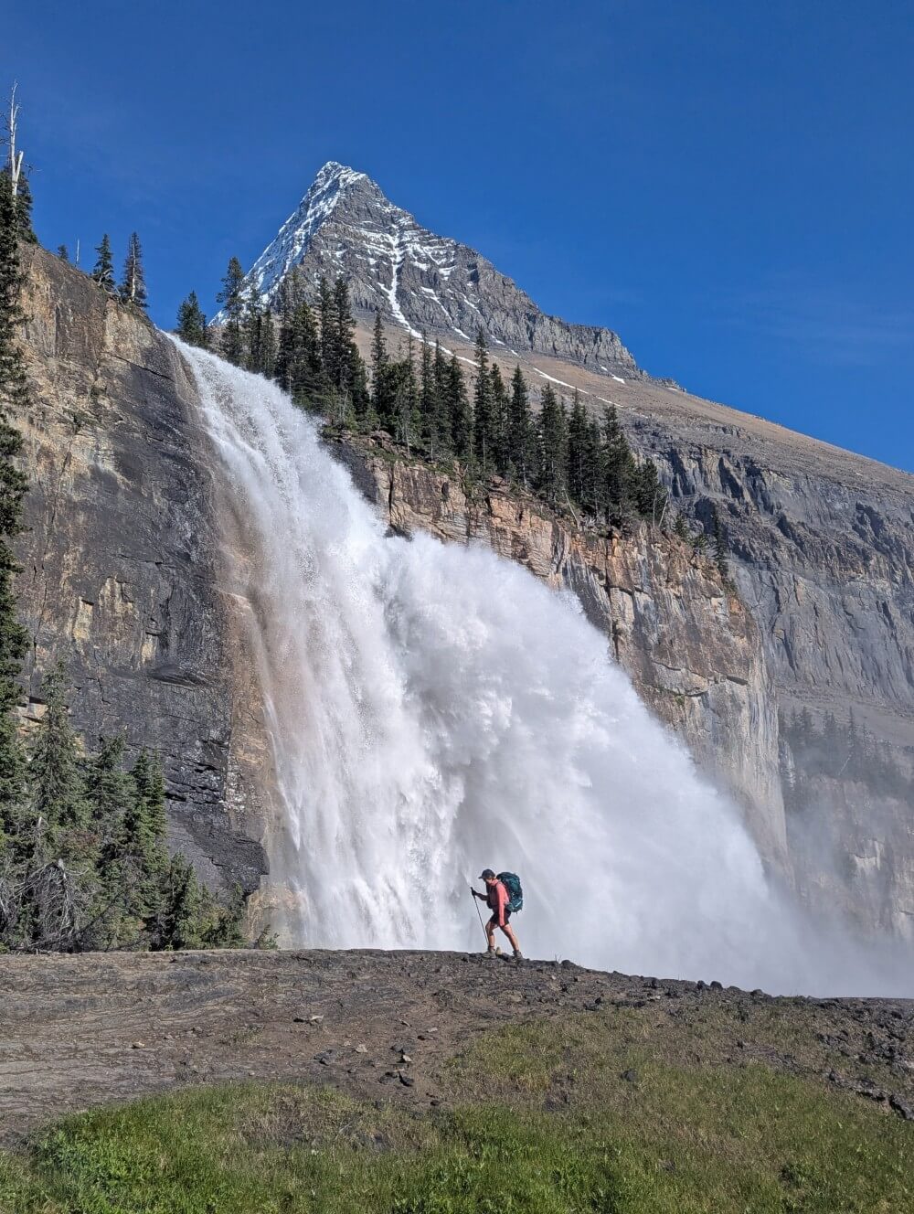
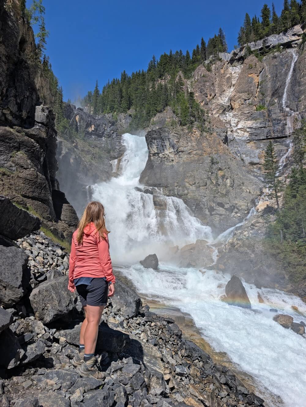
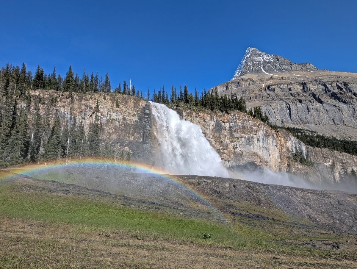
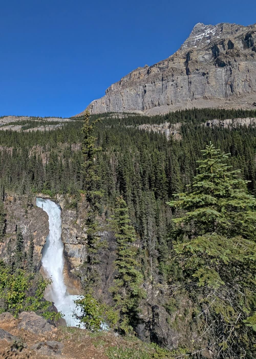
Emperor Falls is a sight to behold when it appears. Likewise the somewhat precarious ‘one person at a time’ bridge! The side trail is Emperor Falls is a must – 150m one-way and downhill on the way there. On sunny days, Mount Robson towers above this majestic waterfall.
Back on the main trail, Emperor Falls is another 500m further ahead. It’s uphill all the way, with some more switchbacks and even a set of stairs.
Emperor Falls Campground to Berg Lake Campground
Getting to Emperor Falls Campground is satisfying, with nearly all the trail’s ascent now complete. And the views just get better from here as well.
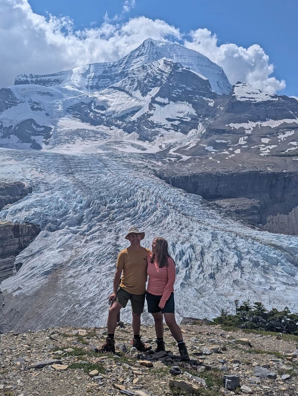
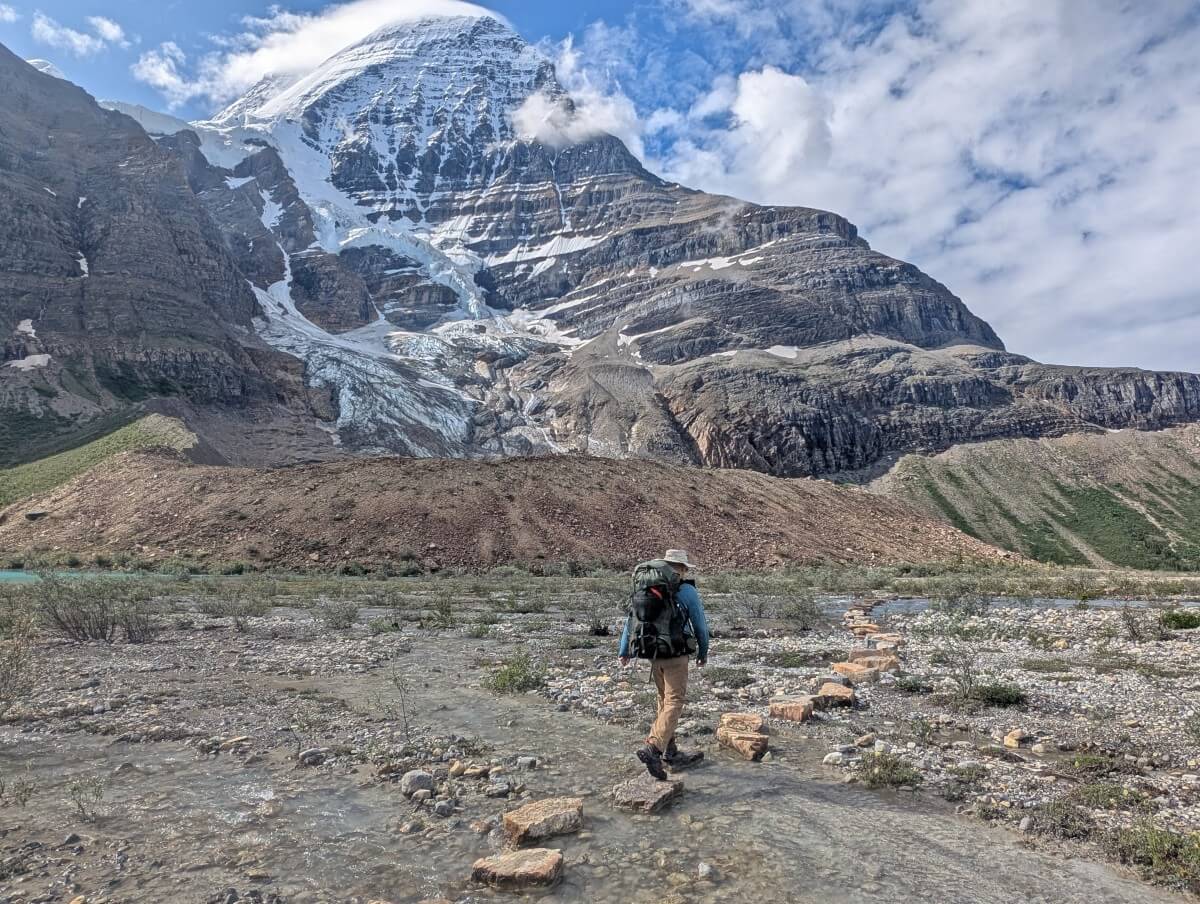
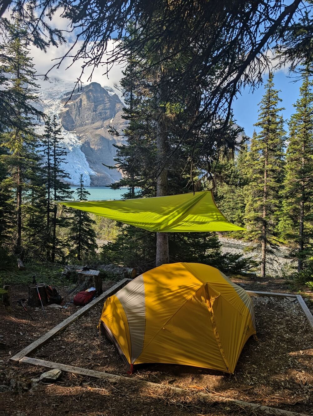
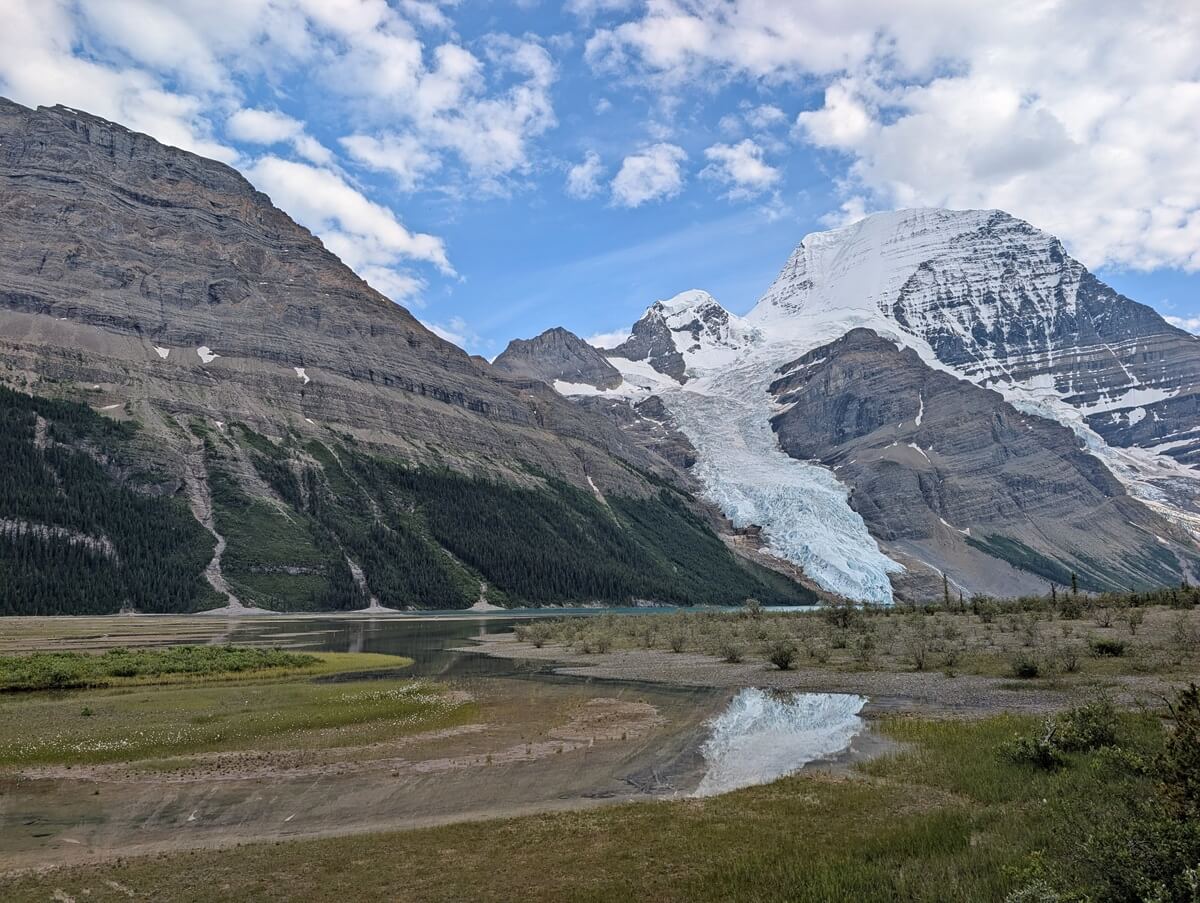
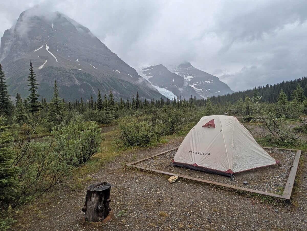
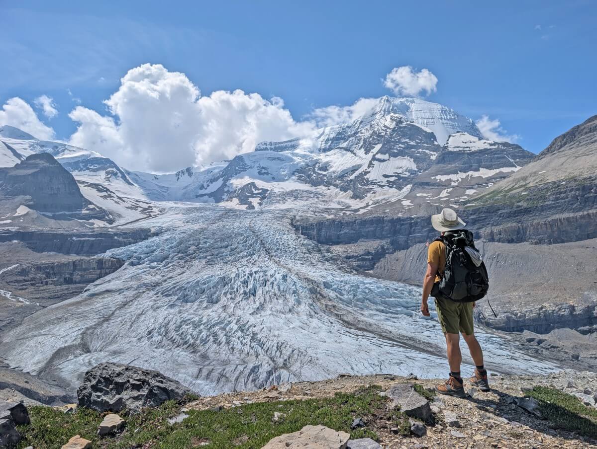
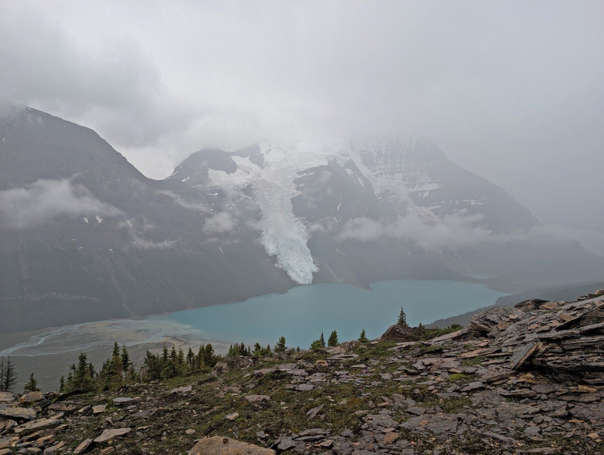
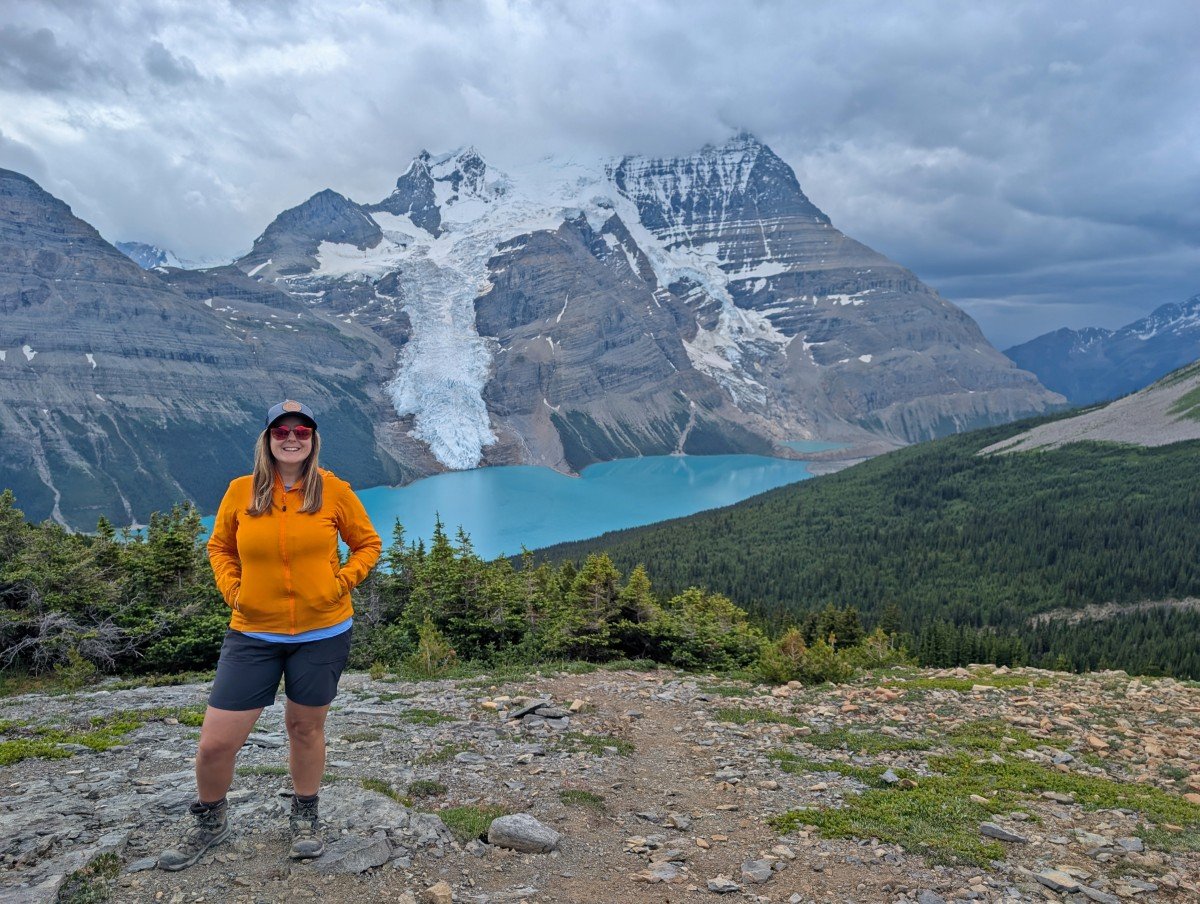
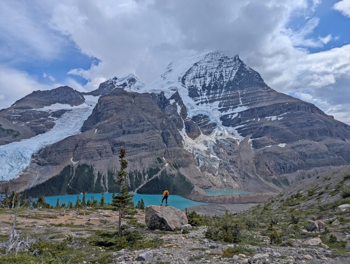
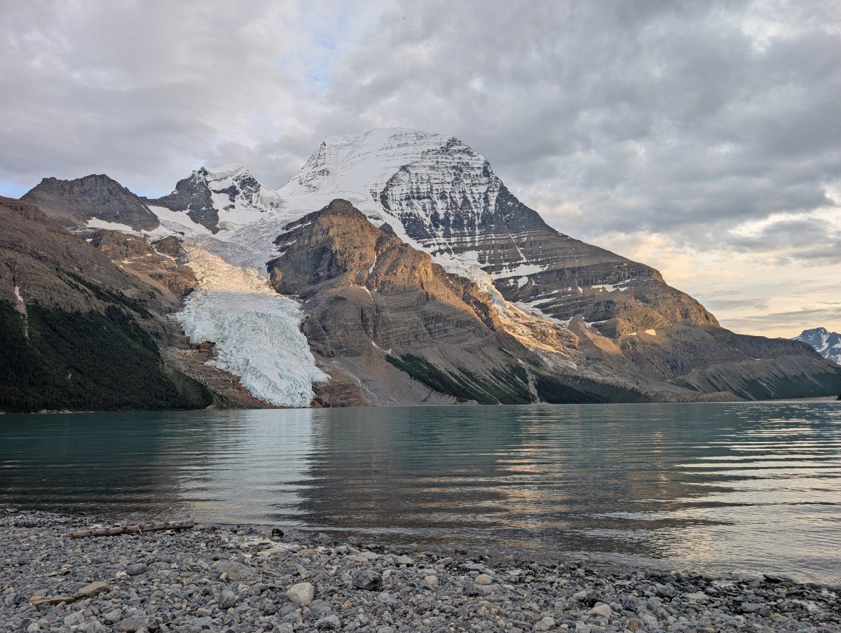
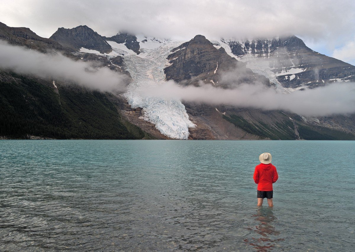
Less than 200m from camp, Mount Robson’s snowy north face comes into view, with the Mist Glacier cascading down its rocky slopes.
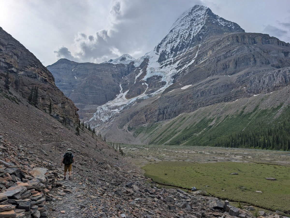
The path winds along the bottom of a talus slope, the route protected by an intricate retaining wall.
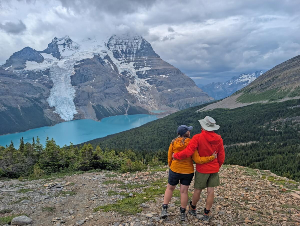
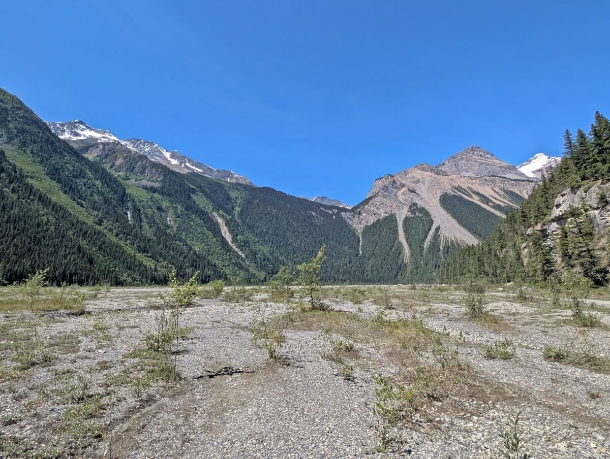
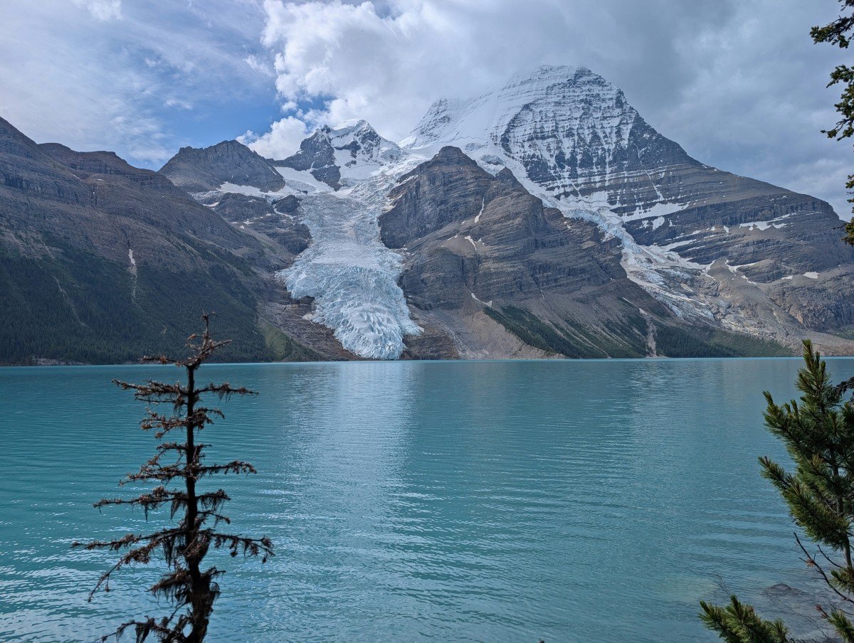
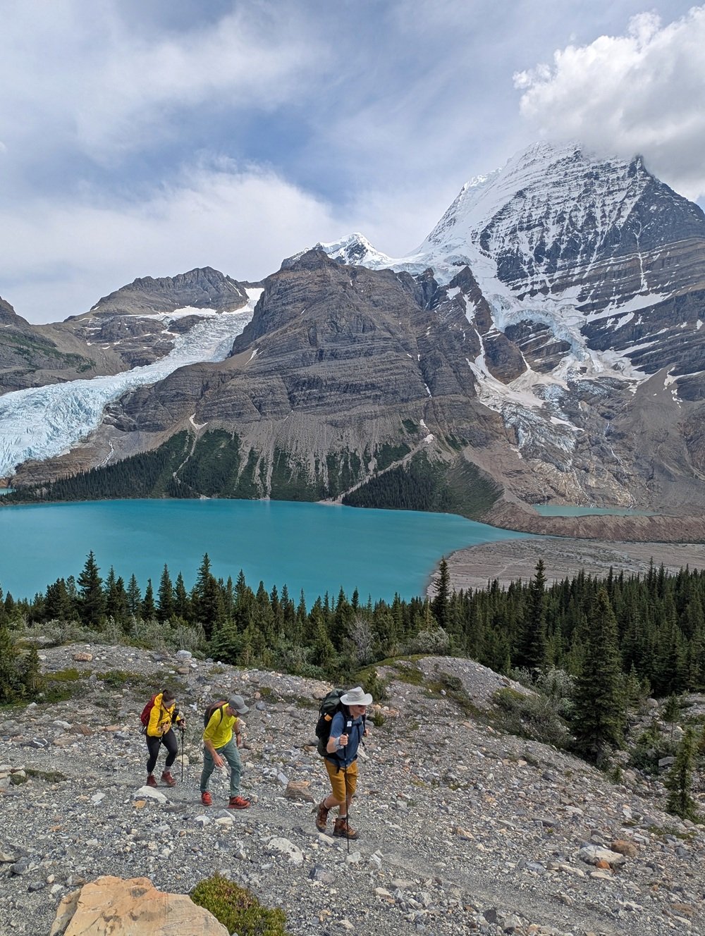
A turn in the trail reveals the spectacular Berg Glacier for the first time. The next section is completely new, with the path crossing the river flats near Berg Lake’s outlet.
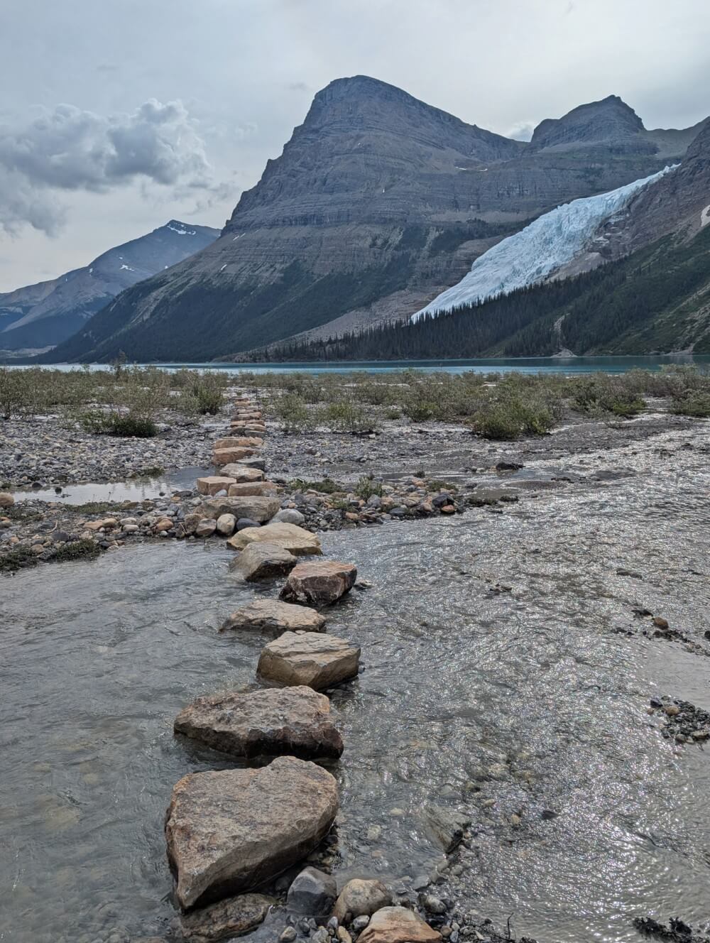
About 600 metres of this stretch require rock-hopping across large, carefully positioned boulders. Most of these rocks are flat and dry in good weather, but a few are uneven or partially submerged.
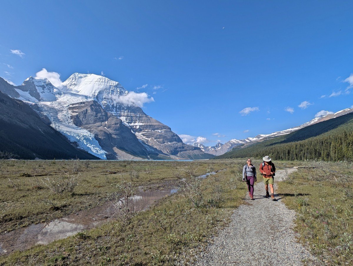
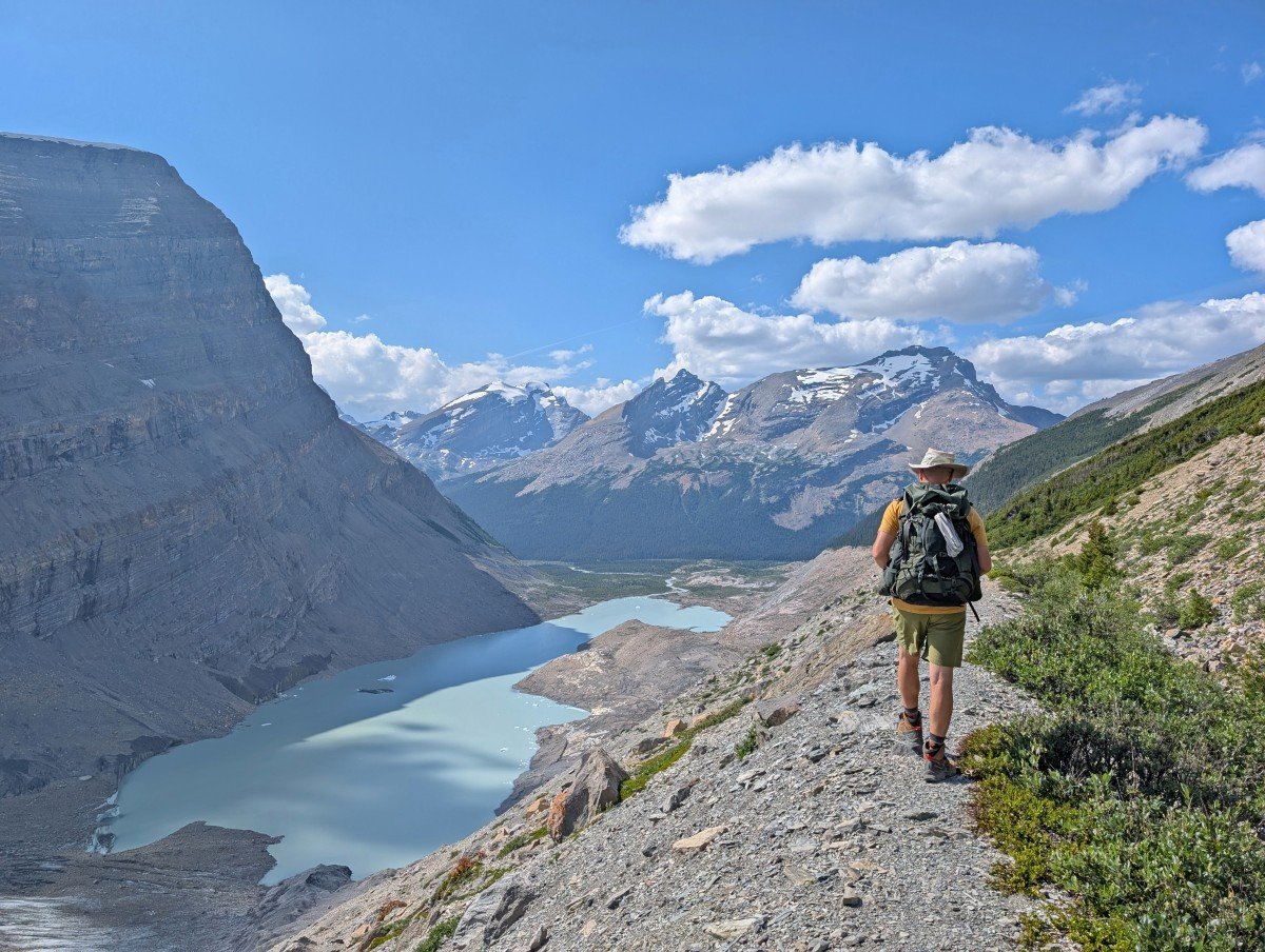
Eventually, the turquoise colours of Berg Lake come into view. Marmot Campground is hidden in the nearby trees. From here, it is a straightforward 2km walk along the gentle shoreline path to the Berg Lake Campground.
Berg Lake Campground to Robson Pass
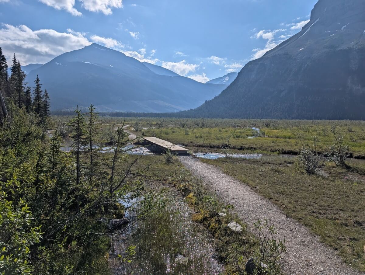
The final 2 kilometres of the Berg Lake Trail are straightforward, with the path being almost completely flat. There are a couple of bridge crossings.
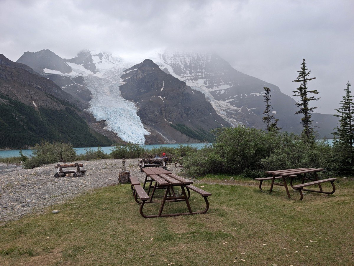
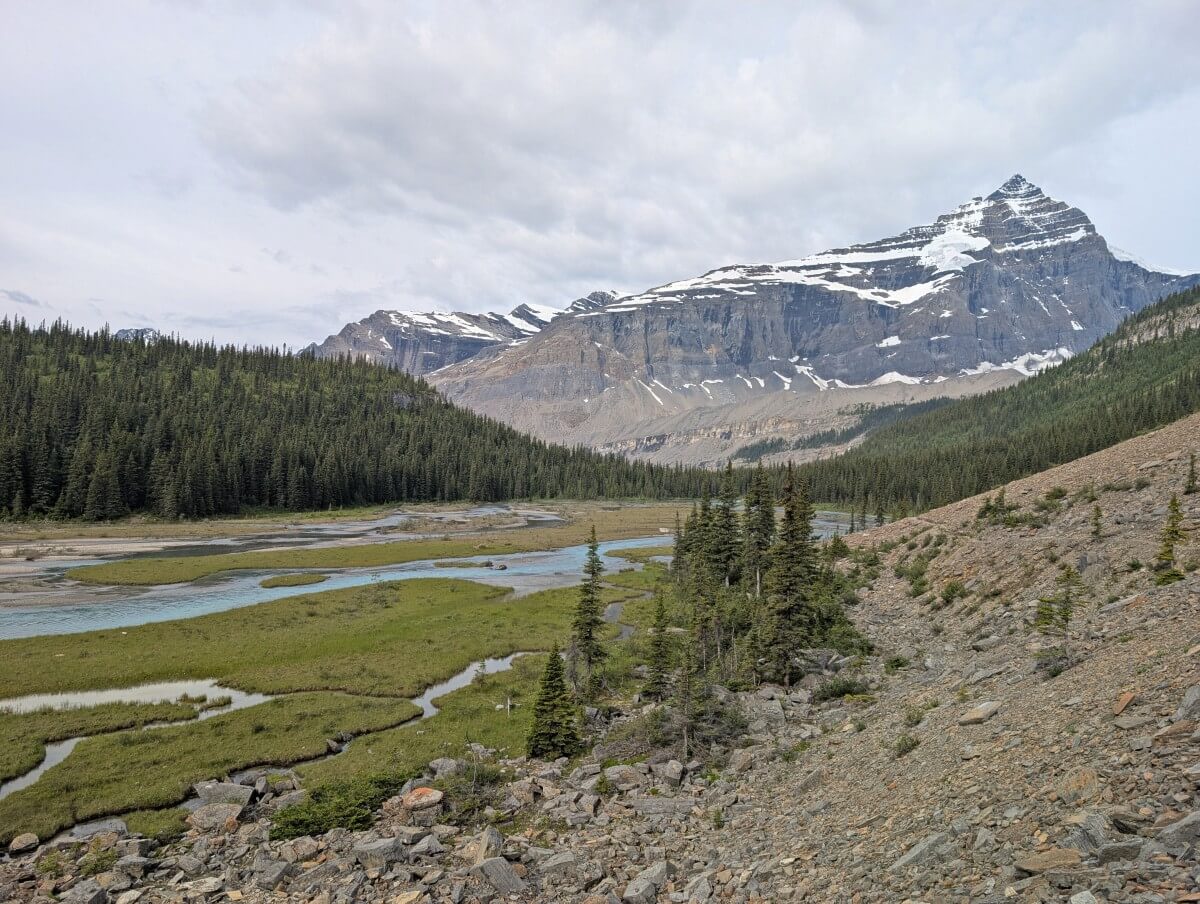
The open landscape provides great views back to Mount Robson, Berg Lake, Berg Glacier and also Rearguard Mountain.
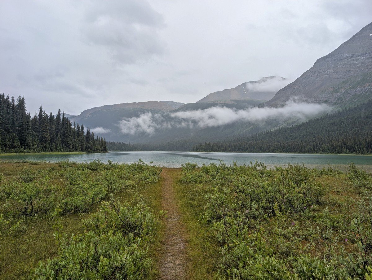
Rearguard is the first campground along this stretch, accessible via another bridge. There is a junction shortly after with the right turn leading to Snowbird Pass. Continue along the main trail to pass by the Berg Lake Ranger Cabin.
Robson Pass is the next and final Berg Lake Trail campground. The Berg Glacier can still be seen from here, as well as other peaks in nearby Jasper National Park.
The 22km trail marker can be found just past the campground. Beyond this point is the Robson Pass Cabin (opening in 2026), the heli-pad and the provincial border.
Berg Lake Trail campgrounds
The Berg Lake Trail has seven backcountry (hike-in only) campgrounds, with most situated in the Berg Lake area itself.
Reservations are required from late May to late September and usually open at the end of the previous year (so December 2025 for the 2026 season).
There is also one nearby campground in Jasper National Park at Adolphus Lake, about 2km north of Berg Lake. Reservations for Jasper NP open in January each year.
Kinney Lake, Whitehorn and Emperor Falls are usually used as stopping points to break up the journey or camping destinations in their own right (Kinney is particularly dreamy).
Marmot, Berg, Rearguard and Robson Pass are all suitable for accessing day hiking opportunities in the Berg Lake area.
Located 2km from Berg Lake and very close to Rearguard, Adolphus Lake campground in Jasper NP is also an option for hikers wanting to day hike around Berg Lake. The information below relates to BC provincial park campgrounds only.
- Campers must stay on designated pads only
- The tent pads are mostly framed dirt, with a few elevated wooden platforms
- Berg Lake Trail tent pad sizing varies; most around 10 feet by 10 feet (3m x 3m), some are smaller. Two tents are allowed per pad but both tents must fit entirely on the pad itself
- A reservation guarantees a spot in the selected campground but specific tent pads are first come, first serve
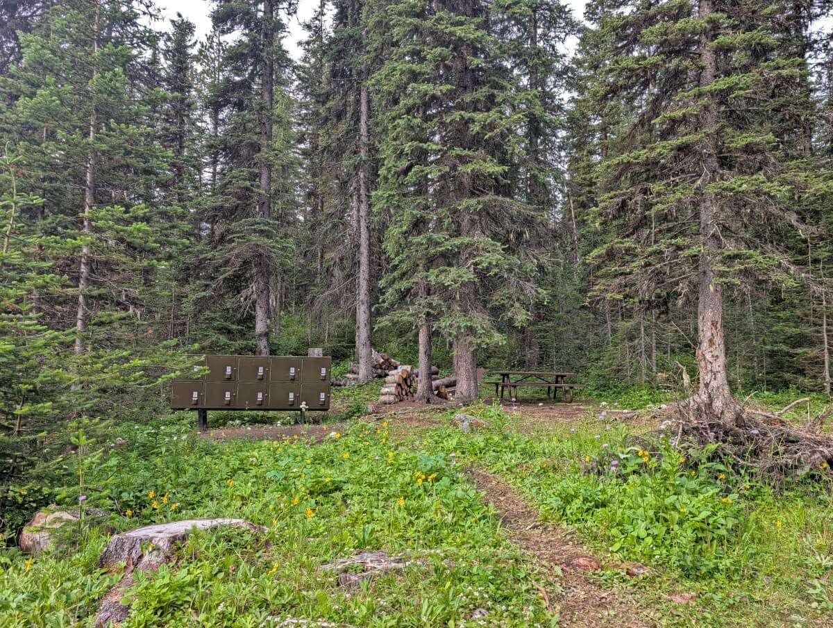
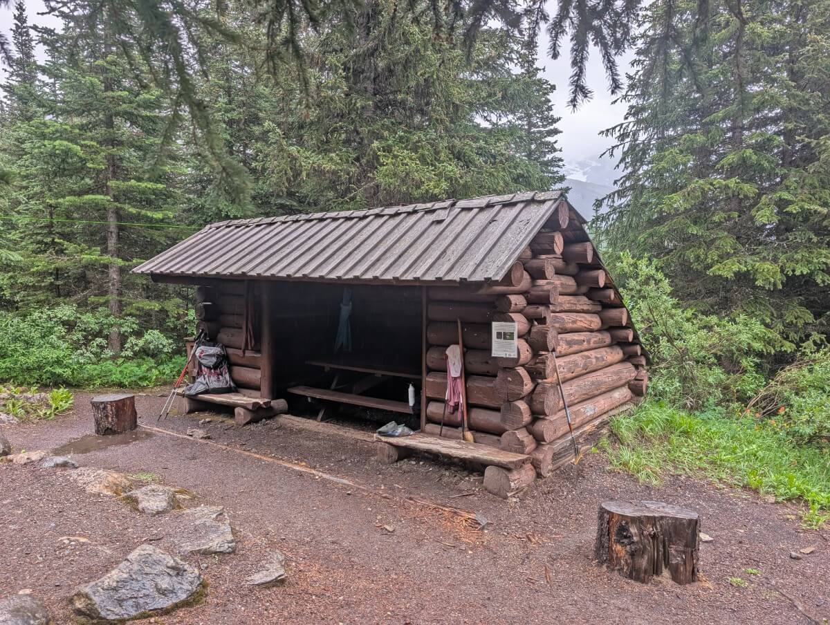
- No campfires allowed at any time, even if there is no fire ban. Most campgrounds have a shelter with a woodstove for emergencies
- Each campground has at least one outhouse, the larger ones have two or three. No toilet paper provided
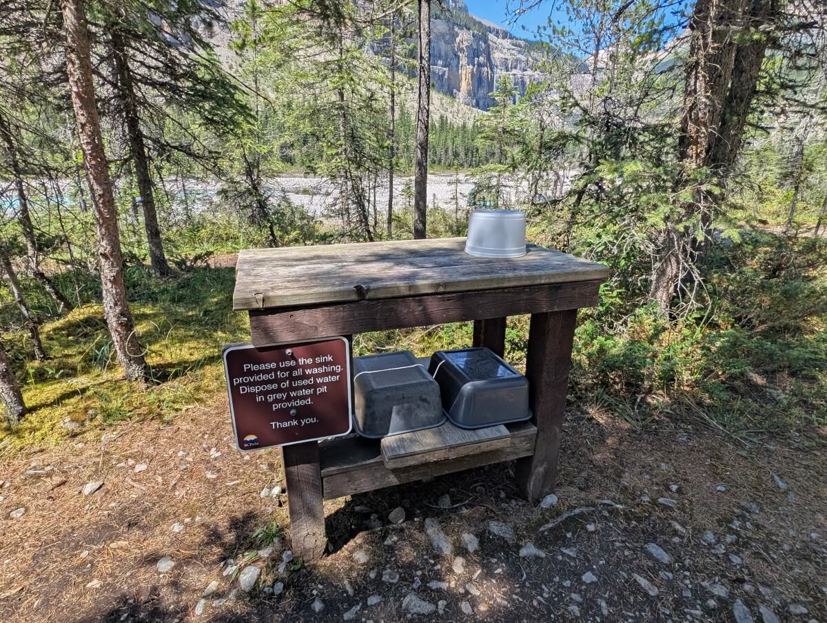
- There is a cooking area in each campground, with multiple picnic tables as well as a washing up station and grey water (waste water) disposal point
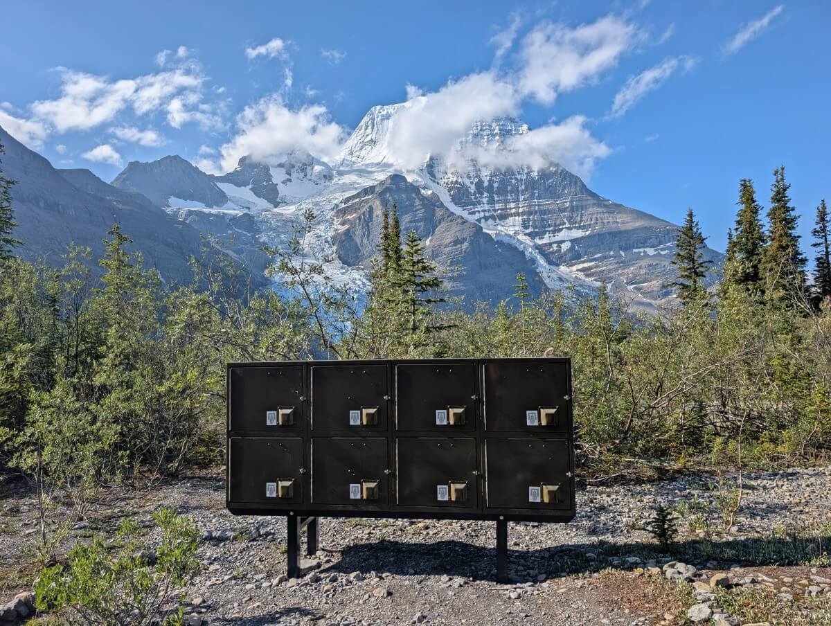
- One front opening metal food cache is provided for each tent pad, usually close to the cooking area
- Hang your laminated camping permit outside of your tent
The camping fee is $10/per person/per night. There is a reservation fee of $6/night for the first three nights (so up to $18 total) in one booking.
Kinney Lake
Distance: 6.5km from trailhead
Number of sites: 18
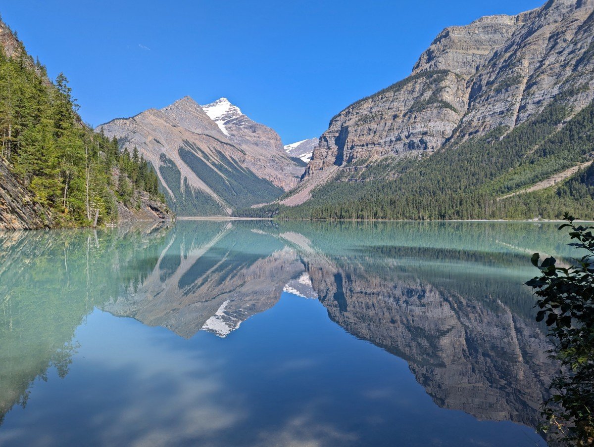
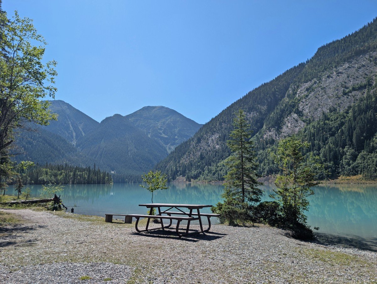
Kinney Lake is the ideal destination for first time hikers, weekend trippers and anyone wanting to split up the hike to Berg Lake. It really is a gorgeous place to stay, with the cooking area and shelter set very close to the shoreline of the turquoise coloured lake.
A couple of tent pads are lakefront as well, providing premier views and access. The others are scattered in the forest behind.
The hike to Kinney Lake is manageable, featuring several long, gently graded stretches. Bikes (both pedal and e-bike) can be used on this section, as well as strollers and other wheeled devices. This makes the campground particularly popular with families.

Whitehorn
Distance: 10.5km from trailhead
Number of sites: 22
Whitehorn Campground is a very popular overnight stop on the way to/from Berg Lake. Located just over halfway, a stay here makes the approach to Berg Lake much more manageable (especially for beginners).
Not only convenient, but it’s also pretty picturesque too. Situated on the banks of the rushing Robson River, there are sweeping views of the Valley of a Thousand Falls from the wide pebbly beach.
One of the largest campgrounds on the trail, Whitehorn has a shelter with woodstove and multiple outhouses. The tent pads are found in the forest behind the river area; some quite close to each other.
Emperor Falls
Distance: 15km from the trailhead
Number of sites: 9
Despite the name, Emperor Falls is actually a little further up the trail from the eponymous waterfall. Not to worry, this smaller campground has its own charms.
Sandwiched between the trail and the icy cold Robson River, the campsites lack seclusion and privacy but enjoy wonderful white noise as well as views of Mount Robson on clear days.
We stayed at Emperor Falls to get most of the climb out of the way on the first day of hiking. In a pinch, it could also be used for day hiking to Berg Lake – the following section of trail is mostly flat. Being on the smaller side, however, means that it’s just as hard to reserve or grab a cancellation.
Marmot
Distance: 17.5km from the trailhead
Number of sites: 7
Marmot Campground is a small but mighty campground with beautiful views of both the Berg Glacier and Mount Robson. While only 2km from the Berg Lake Campground along a mostly flat path, it’s a little further from most day hiking trails in the area (Snowpass, Mumm).
The tent pads are situated in the forest, though a few have views of the lake and glacier. I did notice that this campground had more wooden tent pads, by ratio, than others.
As of 2025, Marmot has a large shelter (no woodstove) and two outhouses (generous for its size). If I went to Berg Lake again, I’d strongly consider staying here for the facilities and quiet ambience.
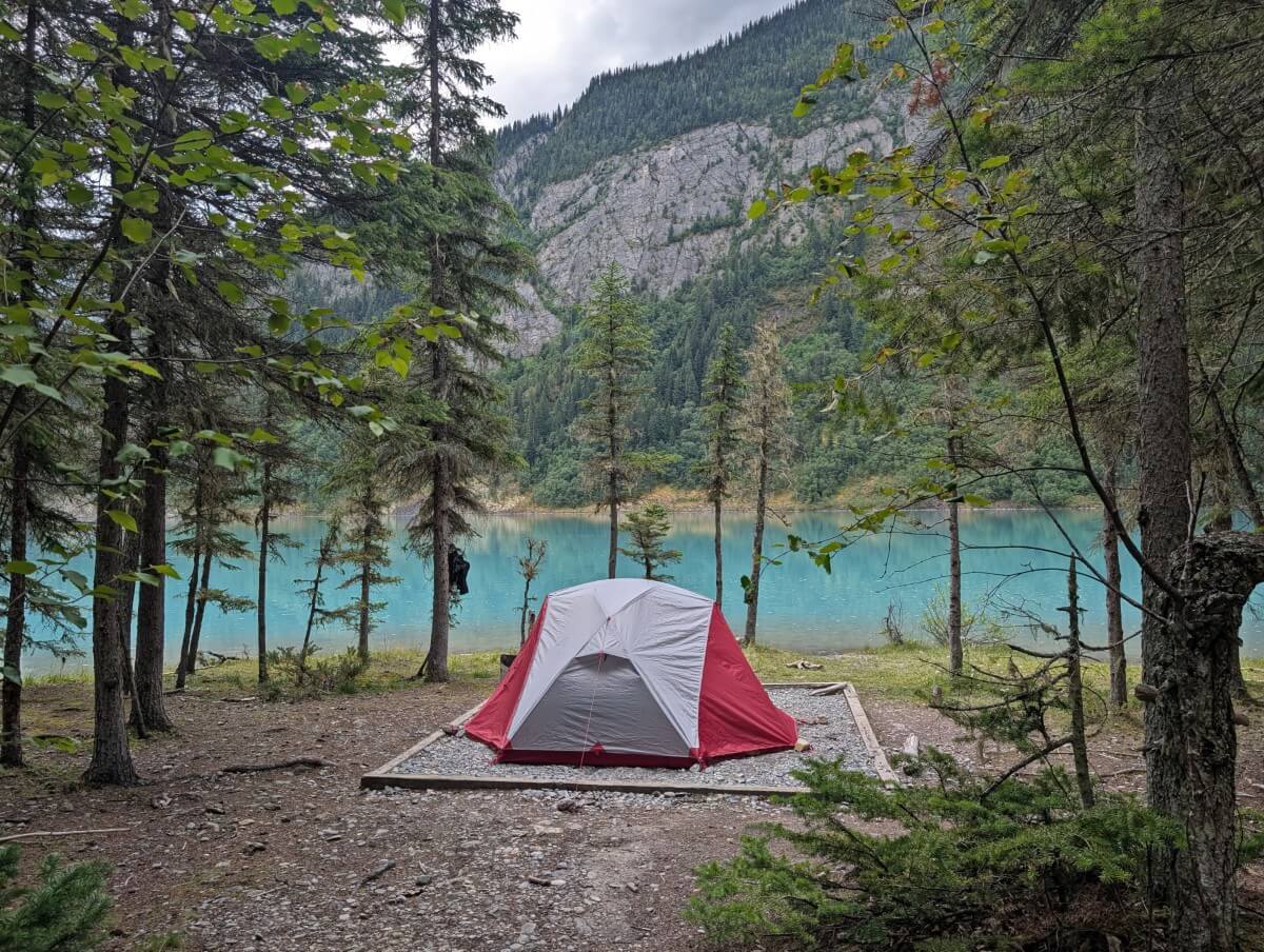
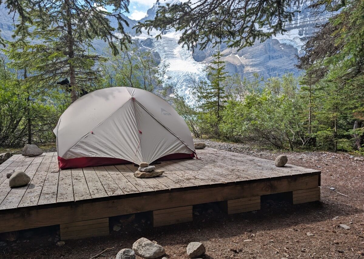
Berg Lake
Distance: 19.5km from the trailhead
Number of sites: 26
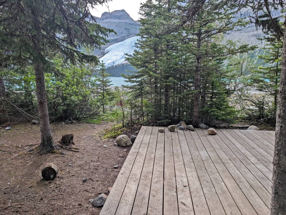
The Berg Lake Campground is the largest on the trail, with the most facilities and the best lakeshore access. The views of Berg Glacier, Berg Lake and Mount Robson are truly fantastic.
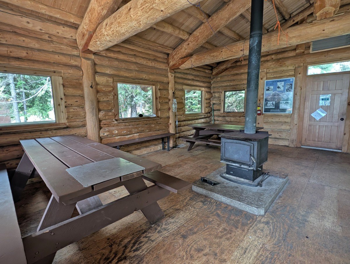
A draw for many people is the Hargreaves Shelter (day use only), a large 100+ year old enclosed shelter. Inside, it has a woodstove, four picnic tables and a couple of long benches. Personally, I found it a bit musty on rainy days and preferred the covered porch area.
Most of the campsites are found on the south side of Toboggan Creek, with only eight on the other side.
There’s one wooden tent pad with an amazing view next to the main trail, before the shelter, as well as a few hidden spots above the creek (let me know if you find them!)
Rearguard
Distance: 20.5km from the trailhead
Number of sites: 6
As the smallest Berg Lake Trail campground, Rearguard has a cosy feeling. There are a couple of tent pads located immediately across the river at the campground’s entrance, one with lovely views of Berg Glacier. The remaining sites are found further into the forest.
Rearguard is only 1km from Berg Lake along a flat trail. This makes it easy to enjoy everything the Berg Lake Campground has to offer (more seating, shelter, lakeshore access) as well as access to the day hiking trails.
With so few sites, this campground is pretty quiet. If I had the choice between Marmot, Rearguard and Robson Pass, I would choose Rearguard for the small size and day hiking convenience.
Robson Pass
Distance: 21.5km from the trailhead
Number of sites: 15
Perched almost at the very end of the Berg Lake Trail (and the provincial border), the Robson Pass campground is surprisingly large. It is home to one of the Mumm Basin trailheads.
A significant amount of the tent pads are situated in an open area at the front of the campground, with views of Rearguard Mountain. The rest are scattered in the trees behind – less scenic but better protection from the elements.
The campground’s cooking area hosts a small shelter with walls on three sides; while helpful, it’s not nearly as appealing as those in the other campgrounds.
Day hikes from Berg Lake
Getting to Berg Lake is just the start. The surrounding area is filled with incredible day hike options. I would recommend spending at least one day hiking in this area, two if you can manage it. Snowbird Pass is the most famous trail here, but there are other easier options as well.
For day hike navigation (and planning), we used Organic Maps. We found the routing to be accurate in July 2025.
Signage of these trails is also excellent, with markers at every junction. Cairns can often be seen in rocky areas, but always evaluate the route before following them (they may not always be the best way to go).
Snowbird Pass
Length: 20km return from the Berg Lake Campground
Elevation gain: Around 870m
Approx time: 6 to 10 hours
Difficulty: Challenging (due to length, elevation and trail condition)
Snowbird Pass is Berg Lake’s most popular day hike. Please note that it is closed annually between 1st May and 1st July to reduce disturbance to the caribou calving.
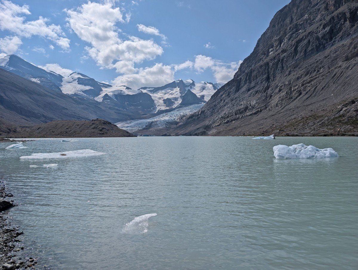
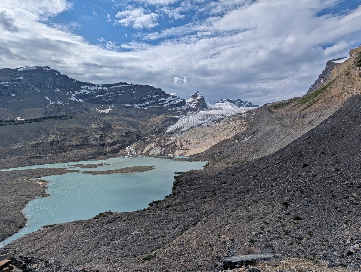
The first part of the trail parallels the immense Robson Glacier before climbing up to a gorgeous meadow area and finishing on the pass itself, overlooking the seemingly endless Reef Icefield. The lake below Robson Glacier is filled with icebergs (take a dip if you dare!)
The great thing about this trail is that you don’t have to go all the way to have an exceptional hiking experience.
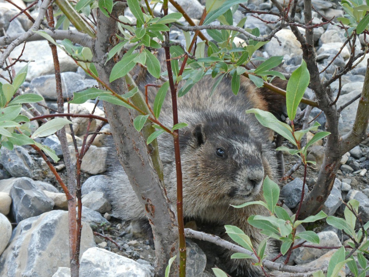
I loved the ridge sections and the stretch through the meadows (around kilometre 7.5), with the rushing creek, wildflowers, squeaking marmots and distant mountain goat sightings.
Snowbird Pass is a decently challenging route – after the first few kilometres, it is pretty much uphill all the way to the pass. There are plenty of steep switchbacks, loose rocks, narrow paths with drop-offs and a short chain section as well. More information in our Snowbird Pass guide.
Don’t feel up for the full Snowbird Pass experience? Here’s my recommendation – hike the Hargreaves Lake Lookout Loop in the morning (details below) and then explore the first, mostly flat, section of the Snowbird Pass Trail to get a good view of Robson Glacier in the afternoon (or vice versa).
Hargreaves Lake Lookout/Toboggan Falls Loop
Length: 6km loop from the Berg Lake Campground
Elevation gain: 340m
Approx time: 2 to 4 hours
Difficulty: Moderate
In my opinion, the Hargreaves Lake Lookout/Toboggan Falls Loop is the best ‘bang for your buck’ day hike around Berg Lake! We took our time on the trail, spending four hours soaking in the breathtaking views.
Not only does this loop feature several cascades and amazing elevated views over Berg Lake, but it also offers the chance to see another glacier, a bright teal coloured lake and more impressive mountain peaks.
Access the trail from Berg Lake Campground (by Toboggan Creek) or the junction near Marmot Campground.
We hiked clockwise, though in hindsight, I think counterclockwise would be better for the best views. The elevation gain is completed faster in this direction and the signage is more obvious as well.
Mumm Basin Loop
Length: 7.2km from the Berg Lake Campground
Elevation gain: 520m
Approx time: 2.5 to 5 hours
Difficulty: Moderate
Full disclosure, this is the only trail that we didn’t hike due to an incoming storm. It also technically has a partial closure due to landslide damage in 2018.
There is a turnaround point on the Robson Pass campground side. We were advised by other hikers that while the trail is technically passable, there are some large boulders that have not settled yet. Hike at your risk.
From what I researched, the highlights of the Mumm Basin Trail include a beautiful meadow and an above treeline traverse with amazing views of Berg Lake, Robson Glacier and Adolphus Lake. It’s pretty exposed for the most part with some shale and rock sections.
This trail can be combined with the Hargreaves Loop and/or the Berg Lake Lookout and Cave Loop (see below).
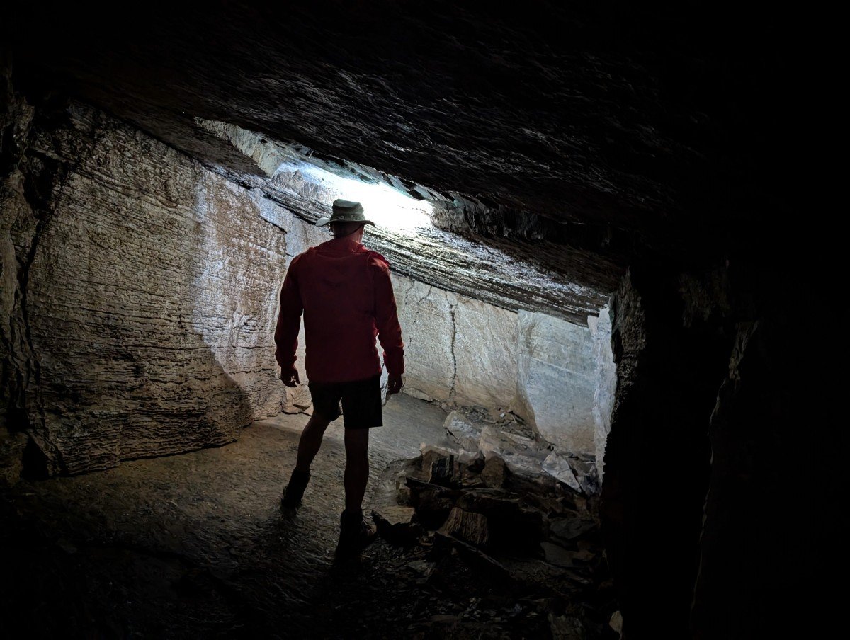
Berg Lake Lookout and Cave Loop
Length: 4.2km from the Berg Lake Campground
Elevation gain: 475m
Approx time: 2 to 3 hours (plus cave exploration time!)
Difficulty: Moderate
When we spotted the ‘cave’ sign at the Hargreaves Lake Lookout/Toboggan Falls junction, we knew we had to find it! And it’s one of the most interesting caves I’ve ever been in.
The cave sits very close to the Berg Lake Lookout, a rocky outcrop with 360 degree panoramas.
The hike to see both is reasonably short and is easily combined with the Hargreaves Lake Loop or Mumm Basin (when fully open).
The entrance to the cave is very visible from the loop when hiking clockwise. The actual cave is reasonably big, with multiple chambers to explore, some accessed by narrow openings. The walls are unlike any I’ve seen before – very blocky and vertical. We didn’t find any stalagmites or stalactites.
Robson Pass and Adolphus Lake
Length: 5.4km from the Berg Lake Campground
Elevation gain: Very little (less than 30m)
Approx time: 1 to 2 hours
Difficulty: Easy
Looking for a mellow adventure close to Berg Lake? Follow the almost completely flat path north along the river towards Robson Pass and the Alberta/BC provincial border. The mountain views are expansive, the hiking easy and the experience still interesting.
At the border, the trail enters Jasper National Park. Just 500m ahead is Adolphus Lake, a shallow lake fringed with peaks. While it’s not as dramatic as Berg Lake, it’s certainly a pretty view and the water is certainly warmer!
Berg Lake example itineraries
Most hikers spend 3-5 days in the Berg Lake Trail area. Personally, I think a 5 day trip is ideal as it allows time to day hike on the incredible trails surrounding Berg Lake.
There are so many ways to structure a Berg Lake hike, but the biggest challenge is navigating the reservation system.
With high demand, it can be tough to get your ideal dates or itinerary. We met many hikers who were only able to stay one night at Berg Lake because they couldn’t book any more than that.
For this reason, flexibility is key when planning your trip. Plan your ideal itinerary but also have alternative options in mind. Cancellations are common so you may also be able to tweak your trip later.
5 day intermediate itinerary
Our mid July 2025 Berg Lake Trail adventure looked like this:
- Day 1 – Trailhead to Emperor Falls Campground
- Day 2 – Emperor Falls to Berg Lake Campground, afternoon hike (Hargreaves Lake loop)
- Day 3 – Day hike from Berg Lake Campground (Snowbird Pass)
- Day 4 – Day hike from Berg Lake Campground (Lookout, Cave, Mumm Basin)
- Day 5 – Berg Lake Campground to trailhead
For us, this was a great itinerary. We hiked most of the way to Berg Lake in one go, allowing time for an additional day hike on day 2.
The Berg Lake Campground is almost interchangeable with Marmot and Rearguard, so be sure to consider these campgrounds as well when making reservations.
Strong and experienced backpacker? Hiking from the trailhead to the Berg Lake Campground is possible in one long day. This would enable you to plan for a 2-4 day itinerary instead.
5 day novice itinerary
If you’re new to backpacking, this is the itinerary I would recommend. It breaks up the hike to Berg Lake into two manageable sections. There is slightly more elevation gain on day 2.
- Day 1 – Trailhead to Whitehorn Campground
- Day 2 – Whitehorn Campground to Berg Lake Campground
- Day 3 – Day hike from Berg Lake Campground
- Day 4 – Day hike from Berg Lake Campground OR hike to Whitehorn/Kinney Campground
- Day 5 – Hike back to trailhead
On the way out, consider breaking up the hike again or returning to the trailhead in one day. Yes, it is a fairly long distance but it is mostly downhill. Most hikers starting around 9am will finish between 3-7pm.
Of course, you could make this itinerary shorter by reducing the stay at Berg Lake by one day. In my opinion though, there is a lot to see around Berg Lake and it is worth the time to stay a little longer. This also allows some flexibility in case of bad weather.
Navigation, safety and other essential information
Prepare to have no phone signal anywhere in Mount Robson Provincial Park. Tell someone where you are going and when you plan to be off the trail again. There is free wi-fi at the Welcome Centre – when closed, you can still connect outside the building. We carried a satellite Inreach device for emergencies.
Stay on the trail and look for signage. The Berg Lake Trail is very popular and the trail is well established. The day hikes around Berg Lake are also well used but can be harder to follow in steeper areas (particularly Snowbird Pass).
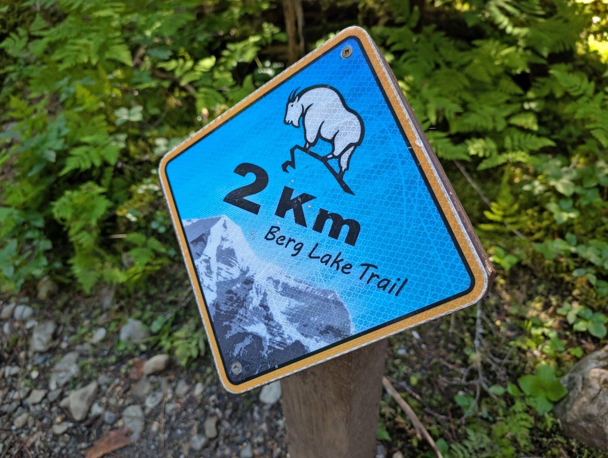
Count down the kilometres. Colourful signs mark each kilometre along the trail.
There may be more obstacles on the trail after storms and in late spring. The trail receives regular maintenance but you may encounter fallen trees, mud and slippery surfaces.
Weather can change quickly in the mountains. Snow and cold temperatures are possible even in summer. Check the predicted weather on Mountain Forecast but be prepared for all conditions, with plenty of layers. Campfires are not allowed along the trail.
42 species of mammals live in the park, including grizzly bears, black bears and elk. Mountain goats can be found at higher elevations, such Snowbird Pass (we saw over a dozen!)
Be sure to store food properly. Use the provided metal caches to store all your smelly items (food, toiletries, trash) overnight and when not in use.
Keep a clean camp and Leave No Trace while hiking. After eating, make sure you haven’t left any food or wrappers around.
Make noise while hiking. This alerts wildlife to your presence and gives them a chance to avoid you. As a general rule, animals don’t want to be close to humans.
Give wildlife space. If you do see any animals, keep your distance – ideally 100m or more. This offers them an escape route.
Berg Lake Trail difficulty
I would rate the new Berg Lake Trail as moderate if hiked over two days. In one day, it would be more difficult.
While some sections are very straightforward, mostly flat and graded well, the overall trail length (20km to Berg Lake) is decently long and the elevation gain significant (around 800m).
The uphill stretches, especially near Emperor Falls, feature more difficult terrain (rocks, roots, steps, potential mud). Most of the elevation gain is found in one short section – about 500m in just 3.5km. It’s a pretty relentless climb with continual switchbacks and steep uphill trail.
If you don’t hike often, this ascent will likely feel really tiring. This is particularly true if it’s a hot day and/or you decide to hike all or most of the trail in one day.
Breaking up the outbound journey with an overnight stay at Whitehorn Campground can be a really good idea to reduce the amount of distance and elevation on day 1.
Experienced backpackers can hike to Berg Lake in one long day. Plan for it to take around 6 to 10 hours.
As for the day hikes around Berg Lake, I rate them easy (Adolphus Lake) to difficult (Snowbird Pass), with a few moderate options inbetween (Hargreaves Lake Lookout Loop, Berg Lake Lookout). There’s something for everyone!

Recommended items to bring
The lighter your backpack, the easier and likely more enjoyable your Berg Lake Trail hike will be. That said, it’s all about balance, as you still need to carry everything necessary to stay self-sufficient and comfortable.
There are some items that I would specifically recommend to bring on a Berg Lake Trail hike. Head to our Berg Lake Trail packing list guide for more details!
Whatever you put in your backpack, don’t forget to collect your pink laminated permit from the Mount Robson Welcome Centre before hitting the trail.
I’d also highly recommend hiking poles as there are some steep descents on this trail. We used Black Diamond’s Carbon Zs, which are super light and also pack down easily.
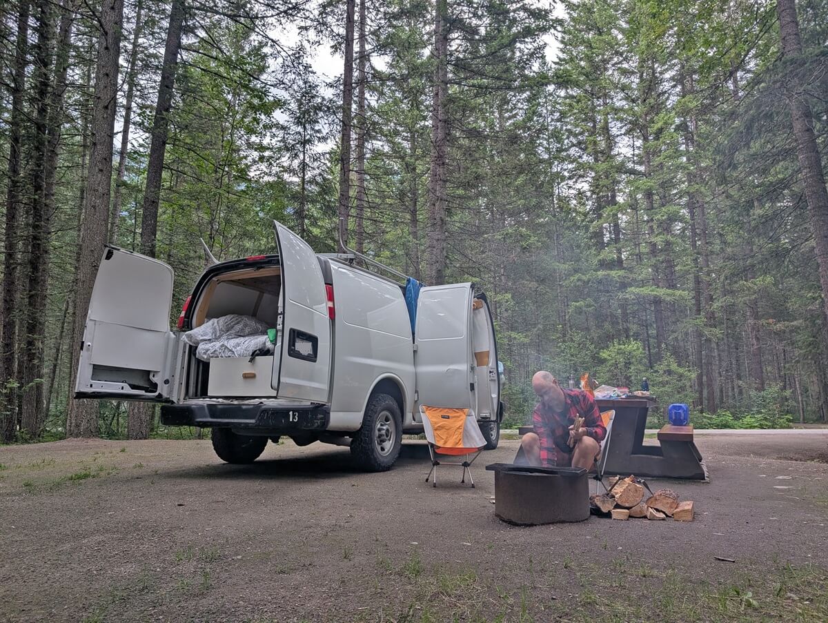
Where to stay before and after the Berg Lake Trail
There are two frontcountry (vehicle accessible) provincial park campgrounds located very close to the Berg Lake trailhead.
Robson Meadows is the larger campground, with 125 sites set into a circular shape south of the highway. Robson River campground is smaller, with only 40 sites. It is on the north side of the highway, slightly closer to the trailhead.
Both campgrounds are great options for hikers looking to stay somewhere before/after hiking the Berg Lake Trail. There are free showers in each campground and the camping fee is $28/site. Robson River has some electrified sites (extra $8).
Reservations can be made three months in advance via the BC Parks website. Being smaller, Robson River gets booked out quickly for July and August dates. Robson Meadows has a little more flexibility, except on weekends.
The closest town to the Berg Lake Trail is Valemount (30 mins drive), which has a collection of chain motels and hotels as well as some local B&Bs and inns.
The most upscale place in Valemount is the Best Western Plus, with Canadas Best Value Inn being a decent budget option. If you’re looking for something a little more unique and local, try Valemount Mountain Retreat Guesthouse.
Jasper is also an option (one hour drive), though accommodation is typically more expensive there due the the popularity of the park and the recent wildfire (less choice). Whistler’s Inn is a solid mid-range downtown accommodation pick.
Other hiking guides you may find helpful
West Coast Trail
Mount Assiniboine Provincial Park
The Rockwall Trail
Juan de Fuca Trail
North Coast Trail
Turbine Canyon Loop
Check out these recently published posts:


One half of the Canadian/British couple behind Off Track Travel, Gemma is happiest when hiking on the trail or planning the next big travel adventure. JR and Gemma are currently based in the beautiful Okanagan Valley, British Columbia, Canada. Consider buying us a coffee if you have find any of our guides helpful!