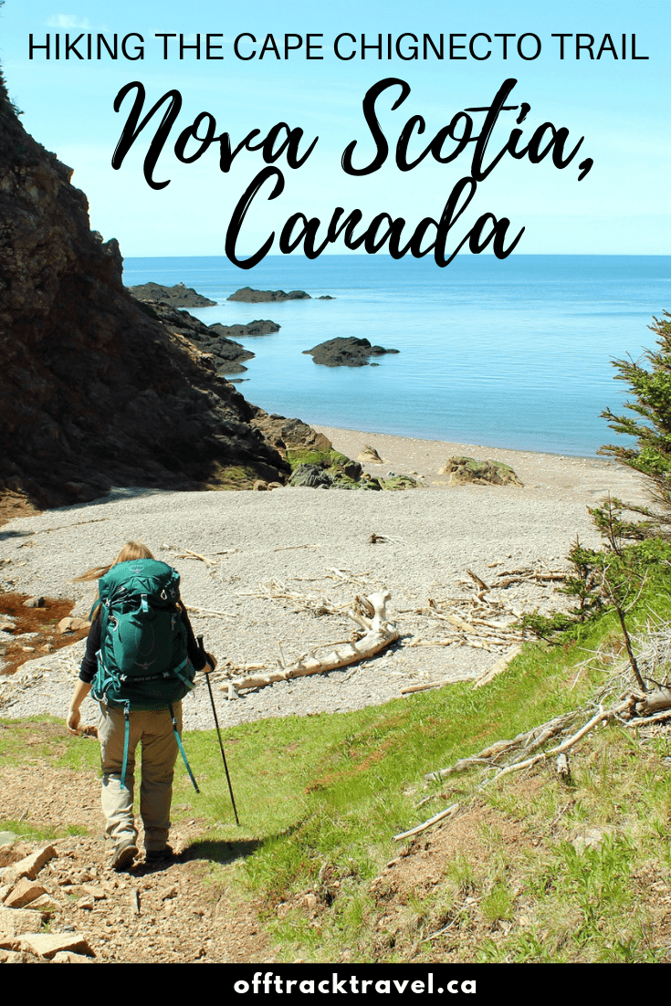
The Cape Chignecto Coastal Trail is a spectacular backpacking path in Nova Scotia, providing a beautiful, varied and challenging hiking experience while showcasing the power of the huge Bay of Fundy tides.
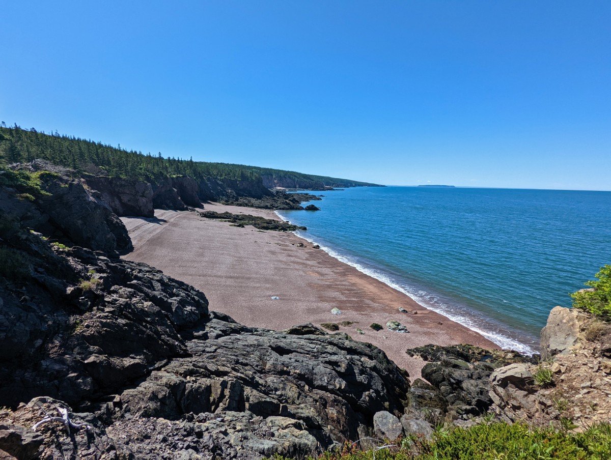
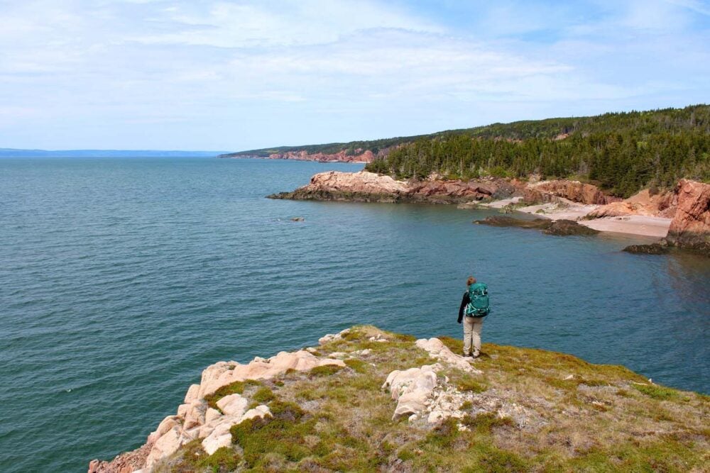
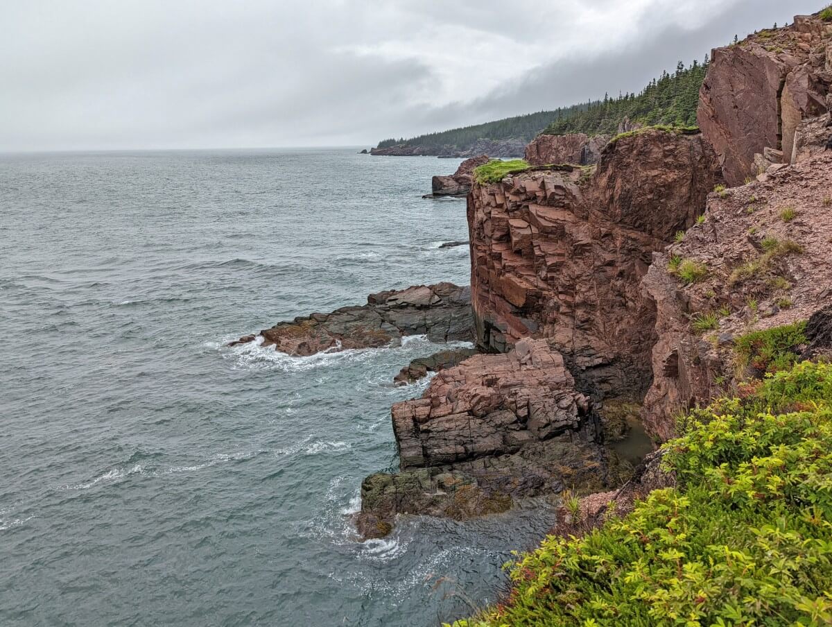
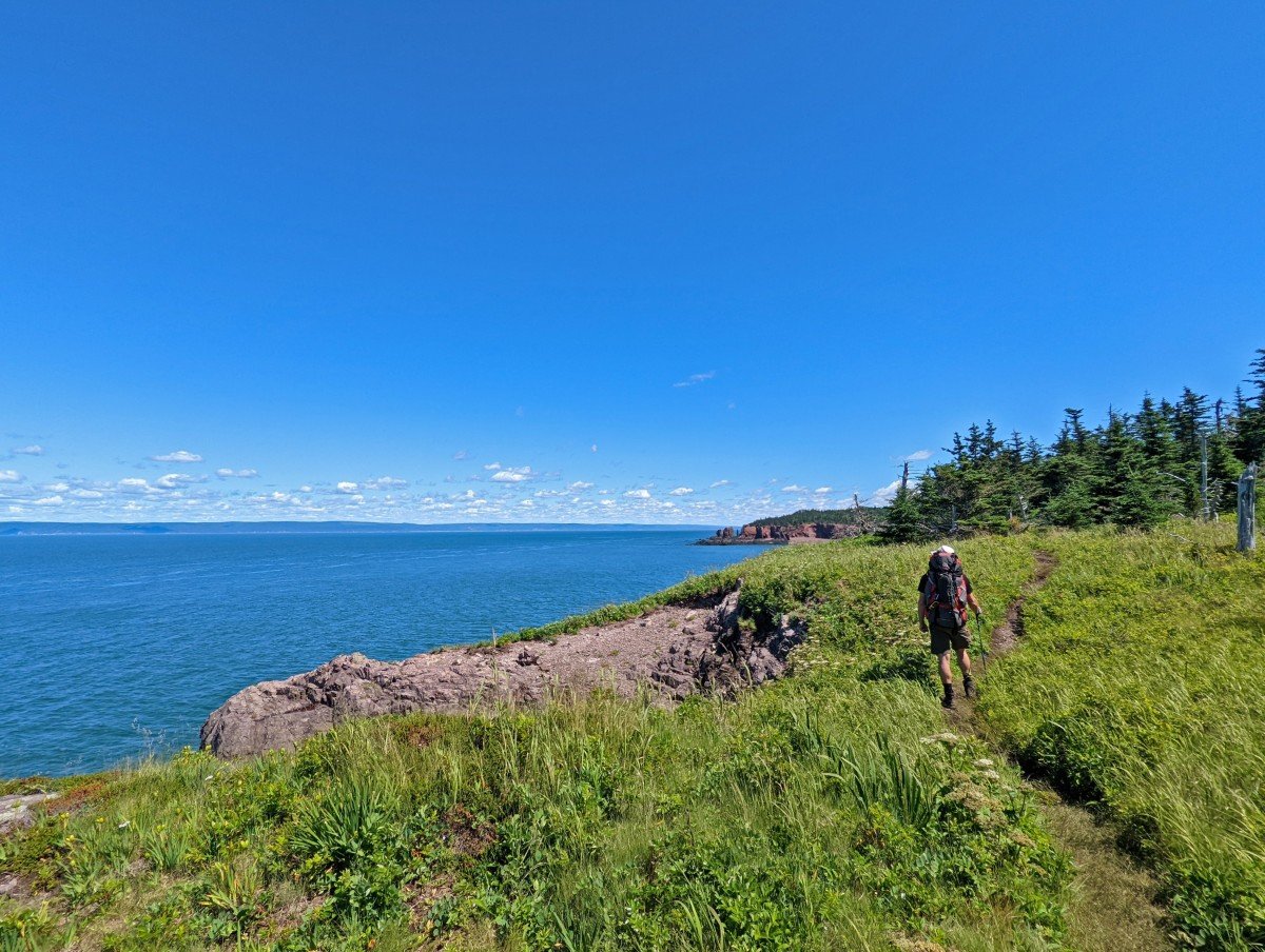
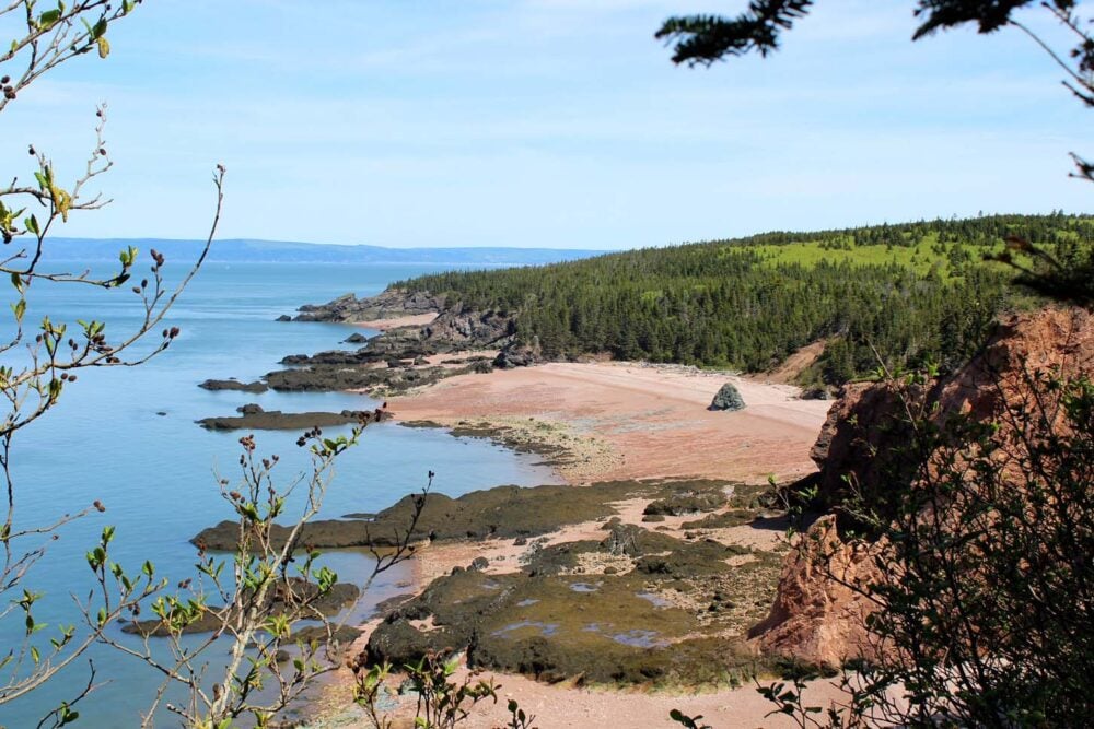
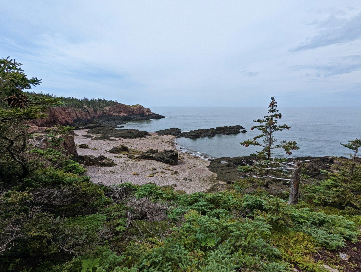
This 51km circular trail leads hikers to the top of towering cliffs and dramatic rock formations, overlooking pebble and sand beaches tinged with pink and red.
The ocean backdrops it all, sparkling aquamarine blue in the sun.
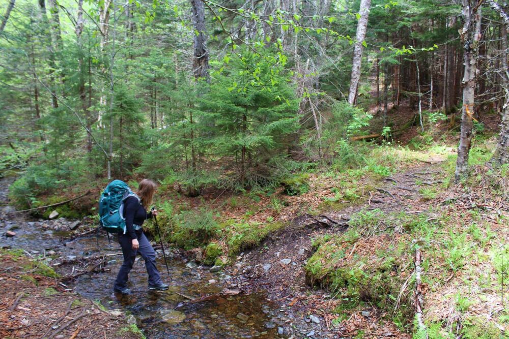
As is a necessity with most coastal hiking, you have to sometimes to leave the coast. The trail meanders through lush boreal forest and over rushing streams.
Some of these creeks continue on and cascade down the cliffs towards the ocean. It’s a wonderful sight, wherever you look.

We’ve hike the Cape Chignecto Trail twice, in both directions. For our first trip, we mostly camped. On the second trip, we stayed exclusively in the cabins. I absolutely love this trail and would recommend it to anyone looking for an overnight coastal hiking experience in the Maritimes.
This post includes trip reports from both experiences plus a comprehensive trip planning guide.
There are affiliate links in this post. If you make a qualifying purchase through one of these links, I may receive a small commission at no extra cost to you.
Backcountry necessities
- Always bring the 10 Essentials
- Know how to stay safe in the backcountry
- Remember to Leave No Trace to help keep the wilderness wild
- Understand how to avoid negative bear encounters
- Trying out backpacking for the first time? Read Backpacking 101
- Check out our packing guide with gear recommendations
- Sign up to our newsletter for a free backpacking checklist
The Cape Chignecto Coastal Trail
The Cape Chignecto Coastal Trail is a 51km hiking loop in Nova Scotia, Canada.
The majority of the route stays close to the Bay of Fundy, providing regular sweeping views of dramatic coastal scenery. The mostly forested path is intersected with short beach and headland sections.
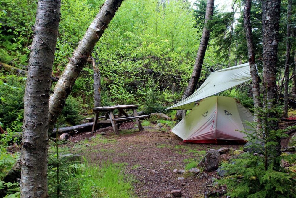
Seven campsites are located along the way, with three cabins and a bunkhouse providing extra luxury for some.
The full circuit is popular to hike as a 4 to 5 day backpacking trip. With two vehicles (or use of a shuttle), it is also possible to hike a 39km version of the trail. The latter is usually hiked as a 3 to 4 day adventure.

Our experience on the Cape Chignecto Coastal Trail
We have hiked the Cape Chignecto Trail twice. On our first trip, we had zero expectations and were pleasantly surprised by the spectacular coastal scenery and remote location.
We hiked the full 51km circuit over four days in early June, in a counter-clockwise direction. As it turns out, this was a somewhat unusual choice since almost all the hikers were met were travelling clockwise and also chose to skip a significant section of the trail.
The section in question is the forested section between Red Rocks Visitor Centre to Eatonville.
I was aware (from previous trip reports) that a lot of people choose not to hike this section but since we had no second car and were not aware of an existing shuttle service, the only choice we had was whether we should hike it first or last.
We chose to hike it at the beginning, in order to travel towards the coast rather than away from it.
For our second trip, we decided to try the shortened route as mentioned above. We started at Red Rocks and finished at Eatonville, avoiding the 12km of forest.

Red Rocks to Seal Cove – Day 1
Most of our first day hiking on the Cape Chignecto Trail was entirely in forest. While the forest section to Eatonville from Red Rocks is not remotely difficult by any means (and does have some pretty moments), I can understand why so many would make the choice to skip.
It is pretty unremarkable compared to the rest of the Cape Chignecto trail. It also made our first day’s distance total to be 19km, which is reasonably high.
My favourite parts of day one? Starting the hike with a walk along the beach, lunch in Eatonville’s sunny meadow, finally spotting the ocean after almost 16km in the woods, admiring the impressive Three Sisters rock formation.
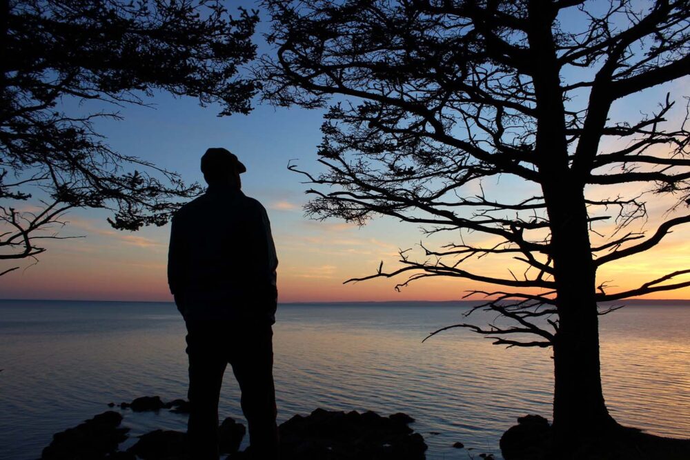
We camped at Seal Cove, a welcome sight after being in the trees for much of the day. The campsites are high above the beach itself, which offers a wide stretch of stones and sand bordered by soaring cliffs. A lookout close to the trail offers the perfect spot to watch the sunset.

Seal Cove to Big Bald Rock – Day 2
Whether it was the aftermath of hiking the 19km the day before or simply the ever changing trail, the Seal Cove to Big Bald Rock section was the most taxing for us.
You may be surprised to hear it was also my favourite, for the trail stayed on the coast for almost the entirety and the views were fantastic, all day long.
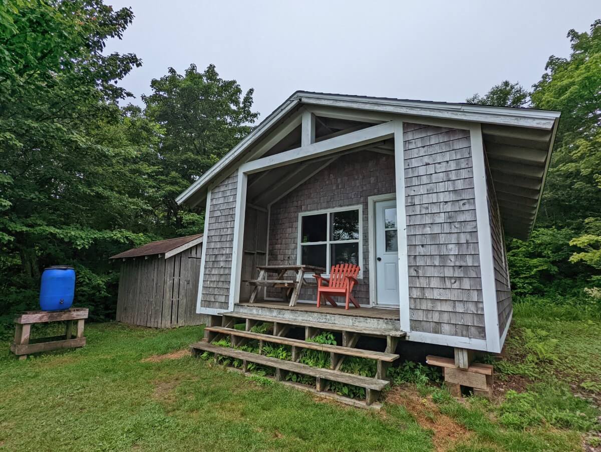
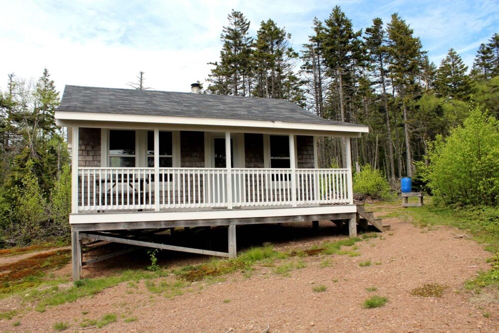
We visited every lookout and admired each ocean panorama. This day also had the best reward, since we had booked the Big Bald Rock cabin for the night.
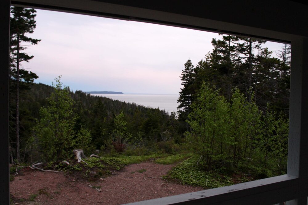
The Cape Chignecto trail has three cabins and one bunkhouse en route. The Big Bald Cabin is located a short distance inland, up a short hill. The views from the deck were pretty sweet!
When the rain came in that evening, we felt very cosy indeed, in a warm cabin with ocean views, tortilla pizzas cooking on top of the wood stove and no tent to put up.
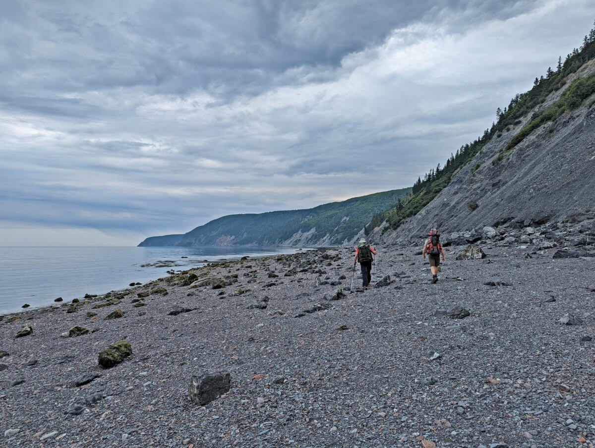
Big Bald Rock to Refugee Cove – Day 3
Day three was one of mud. Now, we have a high tolerance for mud after hiking to BC’s Cape Scott (one of the wettest places around) so this wasn’t too much of a big deal.
It did, however, reaffirm my choice in bringing my waterproof boots on this hike. Also verified was our decision to hike the Cape Chignecto trail in a counterclockwise direction as soon as we descended the steep, rooty hill entering Refugee Cove.
But I’m skipping ahead. Before that, we visited the famed Cape Chignecto. The Cape itself isn’t much to write home about (a trail of rocks leading out to sea) but we enjoyed watching the waves collide and the seabirds ride the air currents.
The Refugee Cove campsite is a dark little place in a valley; the real highlight here is the rocky beach a short walk away. For hikers travelling the trail in the clockwise direction, this would be the first real direct shore access (besides the beginning, if the tides are right).
Arriving pretty early at 3.30pm, we probably could have continued on the last 8km and finished that day. But I’m glad we didn’t, for two reasons. The first is the two hills that follow Refugee Cove – they’re pretty steep (200m straight up)!
Second, we were able watch a group of porpoises over breakfast the next morning! Magic!
Refugee Cove to Red Rocks – Day 4
With porpoises on the brain, the rest of the trail was easy going. Those two aforementioned hills were the only real challenge, with flat intervals in the forest. There were less coastal views than I expected during this part, but it hardly mattered.
Before we knew it, we were ascending the steps to the beach and walking final couple of kilometres of sand to the Visitor’s Centre. The tide was way, way out and we were able to jubilantly wander the beach and look back at the distance we had come.

Planning a Cape Chignecto Coastal Trail hike
In this section, you’ll discover everything you need to know to start planning a Cape Chignecto backpacking trip.
Location
The Cape Chignecto Coastal Trail can be found in Cape Chignecto Provincial Park in western Nova Scotia, on the edge of the Bay of Fundy.
The main park entrance (Red Rocks) is located just 3.8km west of Advocate Harbour, a small community. Parrsboro is the larger regional service center, 45 minutes drive to the east.
Trailheads
The main trailhead for the Cape Chignecto Trail is found at the Red Rocks Visitor Centre, 3.8km west of Advocate Harbour. The access to the Red Rocks entrance from Highway 209 is paved.
There is a large parking lot at this trailhead, with a staffed Visitor Centre, picnic area and flush toilets.
All Cape Chignecto hikers need to check in at the Red Rocks Visitor Centre before starting the trail. Staff provide a short safety briefing and provide vehicle permits and cabin keys.
The secondary trailhead for the Cape Chignecto Coastal Trail is located at Eatonville, about 10km north of Red Rocks – GPS coordinates 45°24’53.1″N 64°53’25.1″W. There is a smaller parking lot here with outhouses.

Note that this trailhead is NOT ‘Eatonville Day Use Park.’ That is a separate entrance to another area of the park.
The Eatonville trailhead can be accessed via Eatonville Road or a combination of Highway 209 and Apple River Road.
Eatonville Road is unpaved, on the narrow side and a bit bumpy in places. The distance from the Red Rocks Visitor Center is 10.8km. I would recommend a high clearance vehicle on this route.
The Apple River Road is also unpaved but is a well maintained two lane road. It’s a nicer drive than Eatonville Road. The distance from the trailhead to the Red Rocks Visitor Centre is 27km via Apple River Road.

Cape Chignecto Coastal Trail difficulty
I would class the Cape Chignecto Trail as moderately difficult. The biggest challenge is the consistent elevation gain/loss along the entire route. There are some flatter areas but the path is never very level for long.
To view the trail’s elevation gain and loss, I’d recommend using the Organic Maps app. As well as being useful for research purposes, the maps can be used offline while hiking the trail.
Besides this, other notable challenges are wet terrain (mud, streams) and exposure to the ocean. On a windy day, I can see some of the coastal sections becoming uncomfortable to walk.
Cape Chignecto trail conditions
In general, we find that the Cape Chignecto coastal trail is well maintained.
The majority is of backcountry standard with steep, rocky and muddy sections. It is necessary to cross small streams and creeks, but rock hopping is usually possible unless there is flooding.

The muddiest sections are found between Cape Chignecto and Big Bald Cabin.
There is the possibility to walk along Red Rocks beach at the start/end of the trail (1.5km stretch), but only when the tide is out.
When the tide is in, there is a 2.6km (153m elevation gain) detour. If you do walk along the beach, be sure to not to miss the exit stairs that lead back to the main trail.
Reasonable phone signal is available throughout most of the trail.

Fees and permits
While there is no charge to hike any of the trails in Cape Chignecto Provincial Park, it is necessary to have a valid permit to stay overnight at any of the campsites, cabins and bunkhouse.
2026 Cape Chignecto campsite permit fees are $26.50/night. Up to six people can share each backcountry campsite.
2026 cabin and bunkhouse fees are $58.90/night (up to four people). A maximum of eight people can share the cabins and bunkhouse – the fee is $11.75/night per additional person. The Arch Gulch and Big Bald Rock cabins can also accommodate four people camping in tents outside.
There is also a reservation fee if you’d like to avoid the chance of disappointment. The reservation fee is $8.95 per booking. More information about the reservation system can be found below.
Cape Chignecto Coastal Trail reservations
Cape Chignecto cabin and campsite reservations usually open in April every year.
In 2026, reservations opened on 8th April at 9am AST (Atlantic Standard Time).
Reservations can be made via the Nova Scotia Parks reservation website or by phone (1-888-544-3434).
While the Cape Chignecto Coastal Trail is well used by hikers, campsite availability does not disappear as fast as many other Canadian backpacking trails.

Based on my experience in the last few years, it is not usually necessary to book campsites on the reservation launch day.
Having said that, if you have very specific dates in mind for your trip (and no flexibility), I would suggest trying to secure dates on the reservation launch day, just to be sure.
If you are planning a trip with a big group (3 or more campsites required), I would also recommend doing so.
As for the cabins, I would highly recommend making a reservation on the launch date. Since the cabins are rented on an exclusive use basis, availability disappears much faster than the campsites.
The Eatonville Bunkhouse seems to be less popular than the cabins, but I’d still suggest making a reservation as soon as possible.

When to hike the Cape Chignecto Coastal Trail
The operating season for Cape Chignecto Provincial Park is usually mid May to early October.
In 2026, the park is open 15th May to 12th October.
The weather is warmest in Nova Scotia in July and August and the trail is usually driest at this time. June and September can be warm too, but are generally wetter.
We experienced a rare frost while camping at Seal Cove on our first trip (June). The weather for the rest of the trip was mild, with rain showers as well as bursts of sun.
Our second hike, in early July, was sunny, warm and stormy. We experienced torrential rain on day two, which created huge pools of mud on the trail near Big Bald Cabin. Some of the creeks flooded as well.

Which way to hike the Cape Chignecto trail
It is possible to hike the Cape Chignecto Coastal Trail clockwise or counterclockwise direction.
We hiked in a counterclockwise direction when we completed the full circuit. I was happy with this choice. I think I would have found hiking through the Eatonville forest section on the last day a bit anti-climatic.
On our second trip, we skipped the forest part. When doing this, I don’t think it matters as much which direction you hike. Walking the Red Rocks beach at the start is pretty fun, however.
Before starting on the trail, hikers must check in at the Red Rocks Visitor Centre.
Luckily, the Centre is usually open long hours in the summer months – 8.30am to 8 pm. Some hikers then choose to park or leave from the Eatonville trailhead.
If you wish to skip the Eatonville forest section but do not have two vehicles, there is a shuttle service run by the Advocate Country Store in nearby Advocate Harbour (reservation recommended, on request only).
Navigating the Cape Chignecto Trail
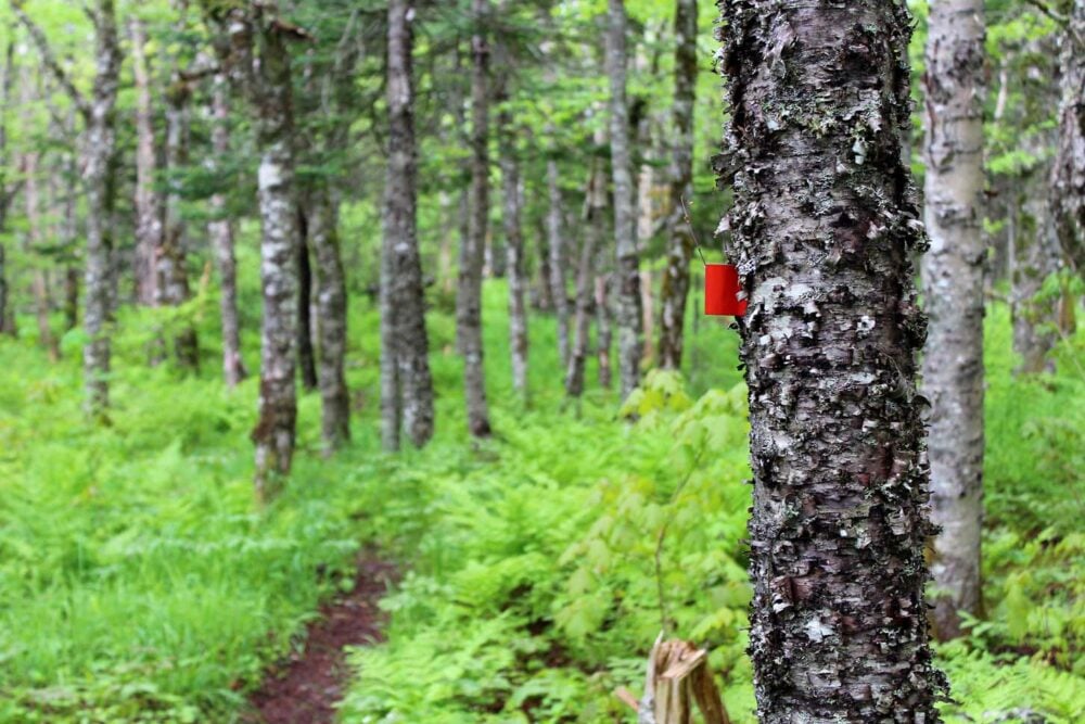
The Cape Chignecto Trail is a well marked and generally well maintained coastal hiking path.
Orange trail markers are attached to trees at regular intervals to help guide hikers in the right direction.
The path is well defined for the entire route, with directional signs at junctions. There are kilometre markers as well, which help to keep track of progress.
We used Organic Maps for on-trail navigational ‘checks’ on our most recent trip. Download the app and relevant maps before heading to the trailhead since phone signal is intermittent along the path itself.
Where to stay on the Cape Chignecto Trail
Unless you’re a trail runner or a super fast hiker, you’ll need to stop overnight while hiking the Cape Chignecto Trail.
There are two types of accommodation available – campsites and cabins. Hikers must have a valid permit to stay at any of the campsites and cabins, issued by park staff at check-in.
Backcountry camping
There are nine backcountry campgrounds in Cape Chignecto Provincial Park. Seven of these are located on the coastal trail route:
- Mill Brook
- Refugee Cove
- Little Bald Rock
- Big Bald Rock Brook
- Keyhole Brook
- Seal Cove
- Eatonville
There are 4 to 11 individual campsites in each campground, most with a picnic table and a flat spot for a small tent.
Each campground has at least one outhouse, plus nearby water (usually a stream/river) suitable to treat with a filter.
Campers should bring their own means to hang food/smelly items to avoid bear and rodent issues.
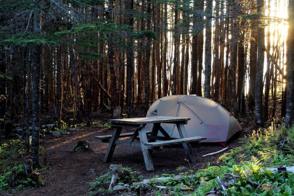
Our favourite campgrounds were Seal Cove, Big Bald Rock and Little Bald Rock. Refugee Cove is also nice, though the campsites are set back into a dark forest.
Campfires at not allowed at any of the Cape Chignecto Coastal Trail campgrounds.
As mentioned, it is necessary to have a permit to camp at any of the campgrounds (it is not a first come, first serve system).

Trail cabins and bunkhouses
The Cape Chignecto Coastal Trail hosts three cabins and one bunkhouse:
- Arch Gulch Cabin – 8.9km / 44.1km
- Big Bald Cabin – 22.6km / 30.4km
- Carey Brook Cabin – 30.1km / 22.9km
- Eatonville Bunkhouse – 38.9km / 14.1km
The first distance noted is from the clockwise distance from the Red Rocks Visitor Centre and the second is the counter-clockwise distance.
So, for example, the Arch Gulch cabin is 8.9km from Red Rocks in a clockwise direction but is 44.1km along the trail from the counter-clockwise direction.
Due to their convenient locations, it is possible to hike the Cape Chignecto Coastal Trail and stay only in the cabins. I would highly recommend this to anyone who wants to lighten their backpack and/or introduce others to backpacking (as we did!)

Cabin facilities
While they may appear basic accommodation normally, these cabins are luxury after ascending and descending elevation with a backpack all day.
Each of the cabins have four wide bunks, a woodstove, a deck and seating. Outside, there is an outhouse and water container (treating the water is recommended).

Since the cabins are pretty basic, you’ll still need to bring almost everything you would for camping (sleeping mat, sleeping bag, cooking equipment etc). That is, of course, everything but the tent!
The Eatonville Bunkhouse is set up a little differently than the cabins. It provides sleeping space for eight, with a small deck outside with seating.
The cabins and bunkhouse are locked, with the keys issued on registration to reservation holders. So when you book a Cape Chignecto cabin, you have exclusive use of it.

Suggested hiking itineraries
There are many ways to hike the Cape Chignecto Trail. Stay at campsites along the entire route or enjoy the relative luxury of the cabins. It’s also possible to do a bit of both!
Full circuit itineraries
The most popular itinerary for the full circuit is:
Day 1 – Red Rocks to Seal Cove (via Eatonville), 20km
Day 2 – Seal Cove to Big Bald Rock, 9km
Day 3 – Big Bald Rock to Refugee Cove, 9km
Day 4 – Refugee Cove to Red Rocks, 13km
This is the route we followed on our first trip (with a stay at the Big Bald Rock Cabin in lieu of the campground). It allowed us plenty of time to enjoy the scenery without rushing, and included a number of shorter days for recovery.

Strong hikers (or those in a tight schedule) may consider this shorter ful circuit itinerary:
Day 1 – Red Rocks to Seal Cove (via Eatonville), 20km
Day 2 – Seal Cove to Refugee Cove, 18km
Day 3 – Refugee Cove to Red Rocks, 13km
Hikers planning to use the cabins and hike the full circuit in a counter-clockwise direction may choose an itinerary like this:
Day 1 – Red Rocks to Eatonville Bunkhouse, 14.1km
Day 2 – Eatonville Bunkhouse to Carey Brook Cabin, 8.8km
Day 3 – Carey Brook Cabin to Big Bald Cabin, 7.5km
Day 4 – Big Bald Cabin to Arch Gulch Cabin, 8.9km

Partial circuit itineraries
For hikers planning to skip the Eatonville forest, a suggested itinerary would be:
Day 1 – Eatonville trailhead to Seal Cove, 7km
Day 2 – Seal Cove to Big Bald Rock, 9km (or Little Bald Rock, 11km)
Day 3 – Big Bald Rock to Refugee Cove, 9km (or 7km from Little Bald Rock)
Day 4 – Refugee Cove to Red Rocks, 13km
This plan would be particularly good for anyone trying out a multi-day hike for the first time as the distances are short.
Alternatively, an alternative three day itinerary for strong hikers is:
Day 1 – Eatonville trailhead to Seal Cove, 16km
Day 2 – Big Bald Rock to Refugee Cove, 18km
Day 3 – Big Bald Rock to Red Rocks, 13km
Hikers exclusively using cabins along the shortened route would follow an itinerary like this:
Day 1 – Eatonville trailhead to Carey Brook Cabin, 7.8km
Day 2 – Carey Brook Cabin to Big Bald Rock Cabin, 7.5km
Day 3 – Big Bald Rock to Arch Gulch Cabin, 13.7km
Day 4 – Arch Gulch Cabin to Red Rocks, 8.9km
This is the reverse of the itinerary we followed on our last trip. Though Day 3 is longer, there are a number of great places to stop (Refugee Cove, viewpoints near Little Bald Rock and Cape Chignecto).
Equipment we used on the Cape Chignecto Coastal Trail
On our first trip, we both tried out new backpacks. I used the Osprey Aura 65, Jean Robert the Osprey Aether 70.
These packs were larger than what we used previously for hikes of this length. While this amount of space was certainly not needed, the support was much appreciated.
For the curious, other outdoor gear we used on our first trip included:
Rab Siltarp 2 for shelter
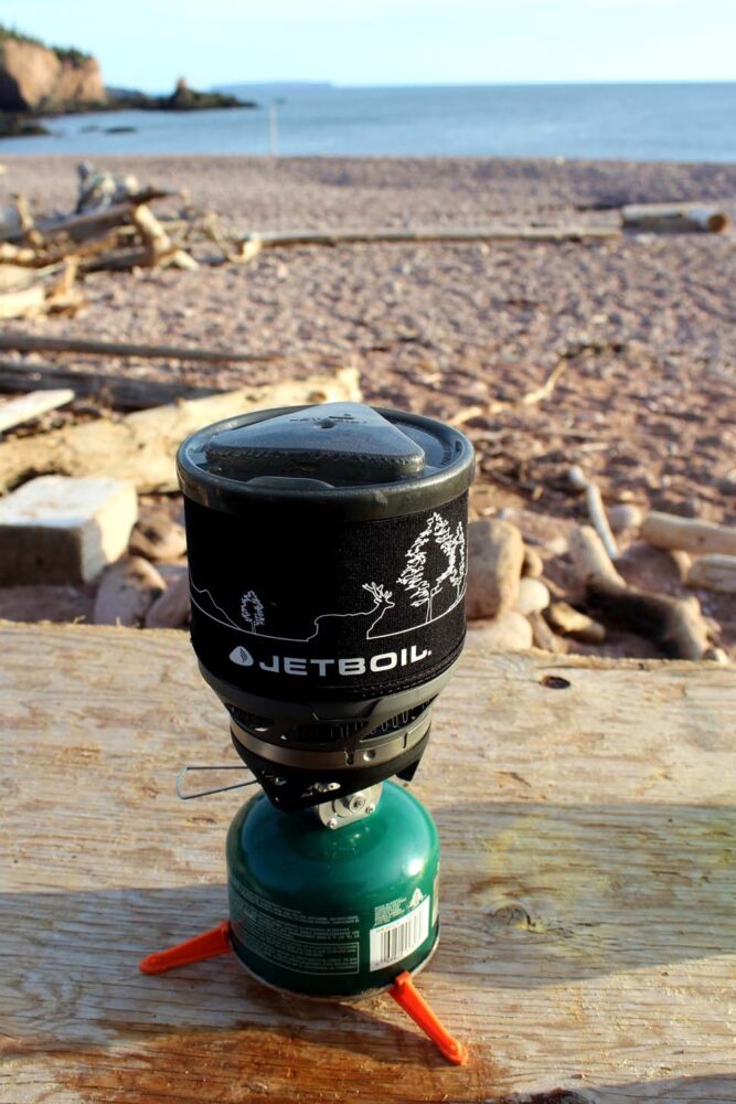
Jetboil MiniMo for boiling water
Carbon Z hiking poles (we shared a pair)
Exped Synmat Hyperlite Duo (double sleeping mat)
MEC sleeping bag – the closest are this one for me and this one for JR
Clothing-wise, we wear a lot of Icebreaker merino wool base layers and socks, plus Prana hiking pants, Arc’teryx jackets and hiking boots by Salomon and Oboz.
For more info and recommendations, check out our Resources page
Check out these other Nova Scotia posts next:
Whale Watching in Nova Scotia: Why, How, Where And More
7 Must Do Nova Scotia Road Trips
6 Fast and Fun Hikes in Nova Scotia
Kayaking the 100 Wild Islands near Halifax
11 of the Best Campgrounds in Nova Scotia
East Coast Canada Road Trip: 2 and 4 Week Itineraries
A Week in the Wilderness of Kejimkujik National Park
13 of the Best Beaches in Nova Scotia


One half of the Canadian/British couple behind Off Track Travel, Gemma is happiest when hiking on the trail or planning the next big travel adventure. JR and Gemma are currently based in the beautiful Okanagan Valley, British Columbia, Canada. Consider buying us a coffee if you have find any of our guides helpful!
Excellent trail journal & wonderful photos! I look forward to hiking Chignecto in 2020.
Thanks Douglas! I’m sure you will have a wonderful experience. I loved hiking this trail
Very informative and helpful!
Would love a copy!
Hi Stacey,
Thanks for your comment but I’m not sure what you mean 🙂 This post is our Cape Chignecto guide and I hope it is helpful to you!
Hello,
Thank you so much for this very informative and detailed post! It is helped me plan my trip to hike Cape Chignecto. In your post you mentioned a shuttle service between Advocate Harbor and Eatonville. I was doing some online research and couldn’t find any more information out about this shuttle service. I was wondering if you have any other intel or information on how to find out about times/price?
Thanks so much!
Katia
Hi Katia,
There is not a lot of info around about that shuttle indeed! The last time we heard about it, the shuttle was run by the folks behind the Advocate Country Ritestop Store. I would also suggest that you call the Cape Chignecto office – (902) 392-2085
Very useful info!
Thanks for letting us know Melissa! Happy hiking
Very useful info for us to prepare!
Dear Gemma, I am with the Cliffs of Fundy UNESCO Global Geopark. Would it be possible to use your ohotoof the garter snake on our new interpretation panels? You’d receive credit of course!
Hi John,
Thanks for contacting me to ask! If you send me an email to gemma[at]offtracktravel.ca, I’ll send you the full size version to use (I have to minimise size on the website for speed reasons).