Forest fires, also known as wildland fires (and abbreviated to wildfires), are a natural part of the forest ecosystem. 9% of the world’s forests are found in Canada. Wildfires are therefore relatively common here.
Some years are worse for wildfires than others. The 2023 wildfire season was the most destructive in British Columbia’s recorded history.
What does this mean if you have plans to travel BC in the summer months?
In this post, I’ll share some useful resources, tips and information to help with your summer trip planning. I’ve lived in BC for over 10+ years now.
While I primarily put this post together for BC-bound travellers, some of the content is relevant for anyone exploring Canada (search for provincial equivalents of the mentioned resources).
Disclosure: The following information is based on British Columbia government sources with the addition of my personal experiences as a BC resident. Be sure to check for current guidance and follow all emergency alerts and orders.
Last updated August 2024
An introduction to BC’s summer wildfire season
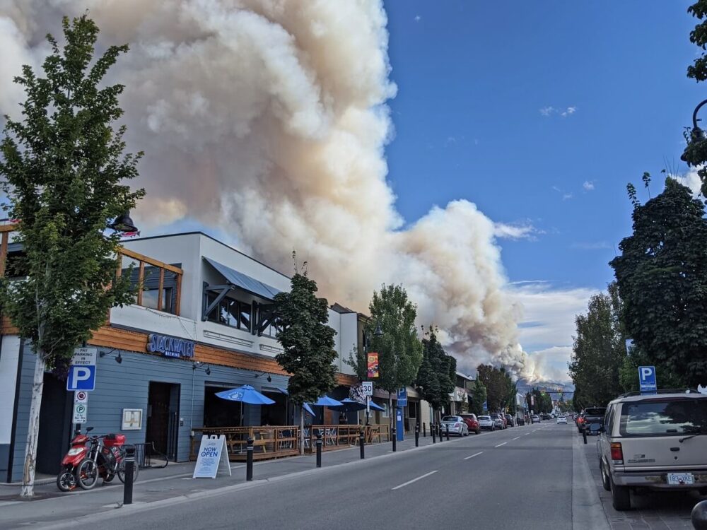
There are usually hundreds of wildfires every summer in British Columbia. Wildfires cause smoke, which can drift thousands of kilometres away from the epicentre.
The vast majority of wildfires are naturally started (lightning). Some are human-caused (carelessness or otherwise). Sometimes, forest managers intentionally set fires to mimic natural fire processes.
Technically, BC’s ‘wildfire season’ runs from March to March. Wildfires are possible all year round, but fire activity in the late autumn and winter months is usually very low.
The main wildfire season takes place during the dry summer months, from mid-June to September. In recent years, however, it seems that the summer wildfire season is starting earlier and earlier.

What to expect when travelling BC during the summer wildfire season
The ferocity of BC’s wildfire season varies from year to year.
2017, for example, was a particularly bad year with over 1.2 million hectares burned. We saw about two weeks of smoky days that summer in the South Okanagan region. 2018 was worse still.
On the other hand, 2019 was not so bad. It was one of the least active wildfire seasons in the decade. We experienced only one smoky day that summer.
2020 was also relatively quiet, though it was still smoky for a time. The smoke in the air was actually from wildfires in Washington and California.
The BC Wildfire Service has published annual wildfire season summaries since 2009.
As to what to expect, it has become inevitable that most BC communities will experience some wildfire smoke during the summer months. Some towns and cities will experience a wildfire nearby.
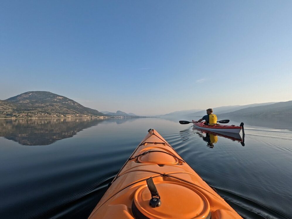
Wildfire location and smoke levels are impossible to predict. You may experience some smoky days while travelling BC in the summer months. You also may not. We still extensively travel BC at this time of year and see plenty of clear days.
A few things to keep in mind:
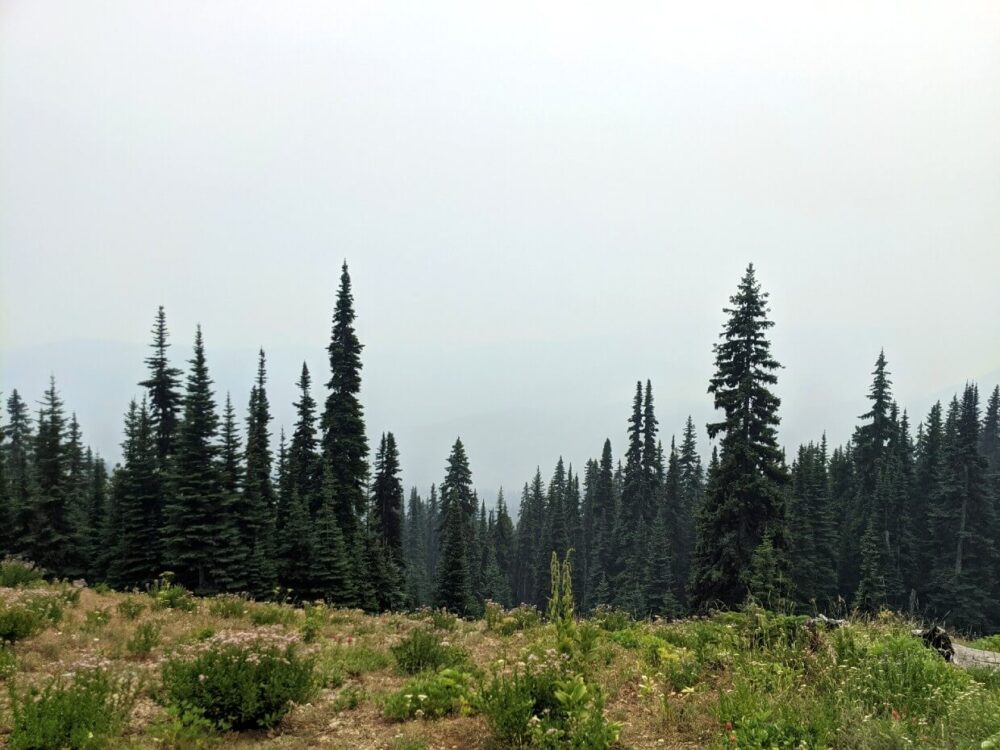
- In my experience, wildfire smoke is more common in August
- There is a huge difference between light haze and thick smoke
- Smoke conditions can change from one valley to the next, as it can become trapped between mountain ranges
- Wildfire smoke lingers less in coastal regions
BC wildfire season: Essential travel planning resources
Before you head out on a trip, I’d recommend reviewing the following resources.
This post includes affiliate links. If you make a purchase via one of these links, we may receive a percentage of the sale at no extra cost to you.
BC Wildfire Service website
Your first step when planning travel in BC during the summer wildfire season should be to check the BC Wildfire Service website and map.
This constantly updated resource displays all active wildfires as well as evacuation orders and alerts. It is also possible to add a ‘smoke forecast’ layer to the map as well.
Each wildfire on the map is given a ‘stages of control’ rating:
- Wildfire of Note (fire symbol) – Highly visible or poses a potential threat to public safety
- Out of Control (red) – Continuing to spread and is not responding to suppression efforts
- Being Held (yellow) – A wildfire that is not likely to spread beyond predetermined boundaries under current conditions
- Under Control (green) – Not likely to spread beyond predetermined boundaries under current conditions
- Out (grey) – A wildfire that is extinguished. Suppression efforts are complete
For travel planning, the top two ratings (Wildfire of Note and Out of Control) are the most crucial. Keep in mind, though, that a wildfire rated ‘Being Held’ or ‘Under Control’ can still produce a lot of smoke.

BC Wildfire Service app
The BC Wildfire Service app also utilises the above map. It has other functionality as well, including the option to report a fire and set ‘near me’ notifications.
The only downside of the app is that the majority of the functions only work with an internet connection.
The BC Wildfire Service app can be downloaded for free via Google Play and the Apple Store.
DriveBC website
Wildfire season or not, checking DriveBC before heading out on a BC road trip is essential!
DriveBC lists current road and weather conditions for BC’s highways, with all closures and construction noted. There are webcam links too.
Wildfires can develop close to highways, forcing road closures. This happened on the Coquihalla Highway back in 2021. As one of the main routes between BC’s Lower Mainland and Interior regions, this had a significant impact on many summer travellers.
Though I think DriveBC works fine on a computer, the mobile version is a little finicky. Unfortunately, there is no app version at this time.
Offline Google Maps
If you don’t already have the habit of downloading relevant Google Maps sections for travel, make sure you do when travelling BC in the wildfire season.
In the event of a road closure, these maps may prove to be very helpful when planning an alternative route. Phone signals can be very limited outside of urban areas in BC, even on major highways.
BC Wildfire Service Fire Ban and Restrictions website
Due to the fire risk, campfires are often banned in summer in British Columbia. The timing of bans varies from year to year, depending on recent weather conditions.
The province is divided into six areas, with fire bans individually issued to the different regions as required. Find the current status of restrictions on the BC Wildfire Service website.
We live in the Kamloops region, one of the driest areas of BC. A campfire ban was initiated in June in 2021, August in 2022 and June in 2023. There was no ban for this area in 2019 or 2020. So it does vary.
Park and recreational area websites
The presence of wildfires can force closures of protected parkland and recreational areas, which include day-use areas, campgrounds and hiking trails.
Before heading out on a trip, be sure to check the relevant agency websites for any provincial, national or municipal parks you are visiting.
- Parks Canada administers BC’s national parks/reserves and national historic sites. Search the specific park sections for updates (e.g. Mount Revelstoke, Pacific Rim), as well as official social media accounts (e.g. Mount Revelstoke/Glacier, Pacific Rim)
- BC Parks operates BC’s provincial parks. Check the ‘advisories’ section at the top of the specific park’s page (e.g. Wells Gray, Manning Park)
- Recreation Sites and Trails BC maintains a huge network of trails and free/low-cost campsites. There is a dedicated ‘alerts, closures and warnings’ website section

Resources for smoky skies
British Columbia is a large place but wildfire smoke can travel far. The following resources will help you determine the air quality at a destination.
Firesmoke.ca website
Wildfire smoke often comes and goes during the season, even when big fires are burning. The Firesmoke.ca map displays smoke predictions for the whole of Canada (and the USA) for the next two days.
An experimental system produced by modelling, this type of smoke forecasting is not an exact science. Subject to ‘uncertainties in fire data and emissions, weather forecasts, and smoke dispersion,’ think of it as a best educated guess.
I have personally found Firesmoke to be reasonably accurate over the years and it has helped us pinpoint some smoke-free areas to visit.
BC Air Quality Index website
Visibility isn’t the only issue when it comes to wildfire smoke. It can impact your health too.
The BC Air Quality Index website shares a provincial summary of the latest Air Quality Health Index values and forecast maximums. A numbered scale shows the health risk associated with current and forecast air pollution in BC communities.
People with heart or breathing problems are at greater risk and, according to the advice, should reduce or reschedule strenuous activities outdoors when the scale hits 7 or above (sooner, if symptoms like coughing and throat irritation are experienced).
The general population should consider reducing or rescheduling strenuous outdoor activities at this point, with this recommended above a 10 rating.
Visitor Centers and DMOs
Weather and smoke forecasts do not always tell the full story.
There are 132 Visitor Centres situated across British Columbia. For an instant, local perspective on the wildfire smoke situation, call the nearest Visitor Centre to your destination.
It may also be worth checking local Destination Marketing Organisation (DMO) websites and social media for updates e.g. Tourism Victoria, Tourism Squamish.
Live webcams
Local people, as mentioned above, are great resources for wildfire smoke information. Webcams offer a visual perspective. The live kind is always preferable (as opposed to still images) as conditions are better seen.
One of the best examples is on the Destination Osoyoos’ website. The same webpage also has an air quality index report.
As previously mentioned, the DriveBC website has webcams along major highways (still image only).

Top tips for travelling BC during wildfire season
- If you spot a fire or a column of smoke while travelling, call and report it to the BC Wildfire Service at 1-800-663-5555 or *5555 on a cell phone
- Pack extra food and water in your vehicle in case of any wildfire-related delays or road closures. Construction and accidents can also cause travel setbacks
- Always wear sunscreen, even when it is smoky or hazy. It’s easy to forget since the smoke-filled air blocks the sun and temperatures are therefore cooler
- It is still possible to do some outdoor activities when it is smoky (air quality and personal health dependent), though keep in mind that your hair and clothes may end up smelling of smoke. We personally avoid hiking when it is smoky, preferring to swim or paddle
- Consider researching indoor activities at your destination, just in case wildfire smoke rolls in. For visitors to Penticton (our hometown), I’d suggest checking out the SS Sicamous sternwheeler, wineries, breweries, restaurants and the museum
- If you’re sensitive to smoke, have pre-existing respiratory conditions or need to travel during a period of low air quality, bring an N95 mask
- As previously mentioned, it may not be possible to have a campfire while camping in BC during the summer months. Do not plan on cooking food on a campfire – bring a camping stove
- If having a campfire while camping is essential for you, consider buying a propane firepit. They look so real that I really thought someone was having a campfire once!
- Be sure to check accommodation/activity cancellation policies before booking
- Heading into the backcountry? Let someone know where you’re going and when you plan to be back. Ask them to check the BC Wildfire Service map regularly, with a plan to get in touch with officials if a wildfire breaks out near where you are. Consider carrying an Inreach satellite device, so they can directly contact you
- Check the small print of your travel insurance to make sure travel disruption caused by wildfire is covered. If unsure, contact your insurer
Other posts you may find helpful:
Bear Safety in Canada: What You Need to Know
How to Stay Safe in the Outdoors
How to Leave No Trace When Exploring the Outdoors
The 10 Essentials for Exploring the Backcountry


One half of the Canadian/British couple behind Off Track Travel, Canada. Jean Robert (JR) is up for anything, but you’re most likely to find him either snowboarding, fishing or building something. Gemma and JR are currently based in the beautiful Okanagan Valley, British Columbia, Canada.
Outstanding article. Thank you!
Thanks Scott!
Hello Jean, thank you so much for your article, it is very interesting ! We would like to come in september 2024 to do backpacking in backcountry and on hiking trails. We would like to know if the scenery in BC is still beautiful after the disastrous year of 2023, and if there is a big risk for tourists in general to come this year to hike ? Thank you so much !
Hi Joelle,
Answering for JR here, but no, there are still many beautiful places to visit across BC that have not been affected by wildfires.
If you’re planning to visit any of BC’s provincial parks, be careful to note the advisories at the top of the relevant BC Parks page.
Two locations that I know have had significant damage include Tsútswecw Provincial Park on the Adams River near Shuswap Lake (partial closure) and Cathedral Provincial Park near Keremeos (completely closed for now). The hiking trails are closed in Bear Creek Provincial Park near West Kelowna.
@Gemma, thanks again !! We look forward to come !