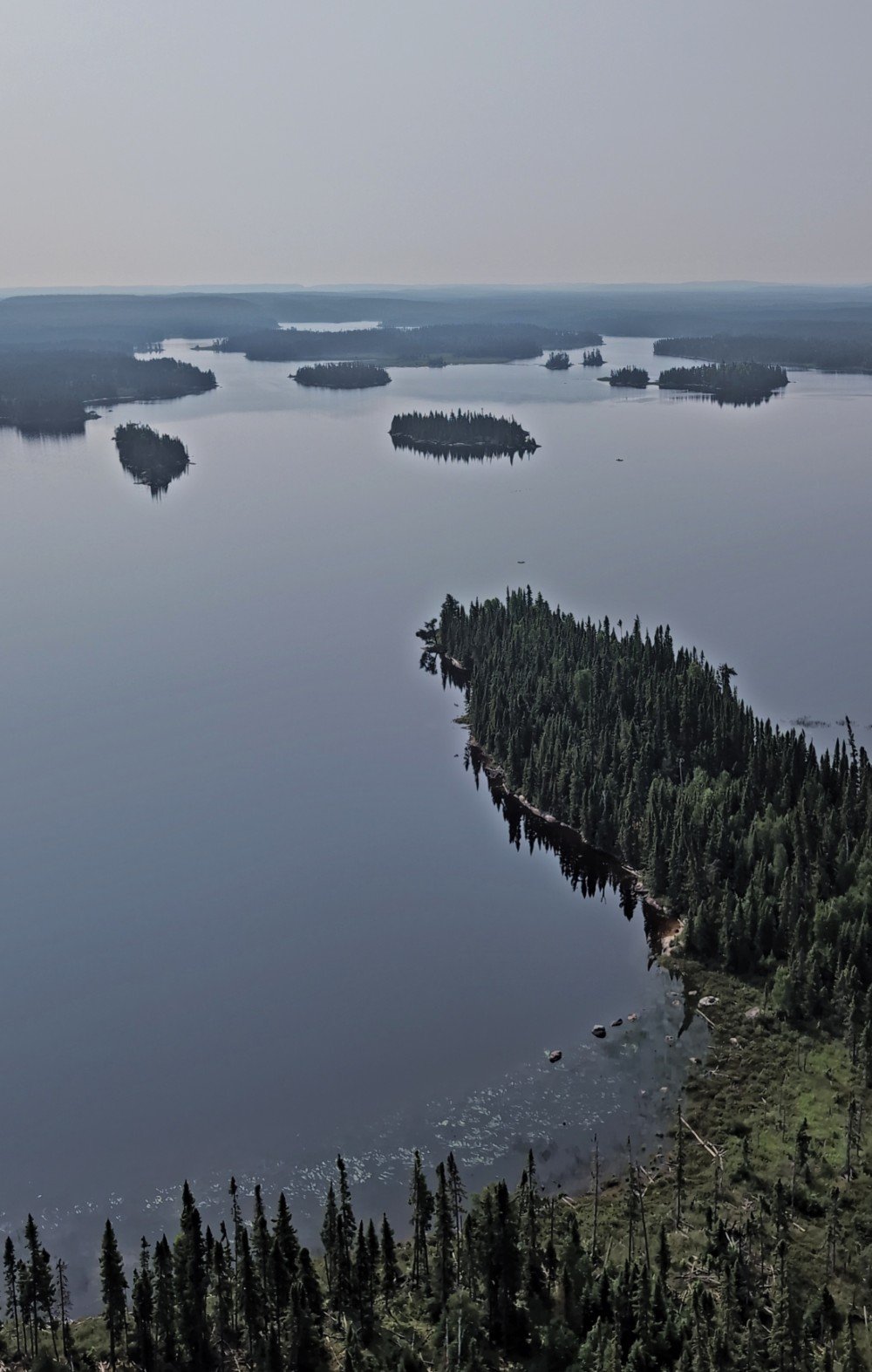
With 10,000 lakes, 2000 km of rivers and lake routes and 2.5 million acres of land, Wabakimi Provincial Park is a wilderness haven for paddlers, nature lovers and anglers.
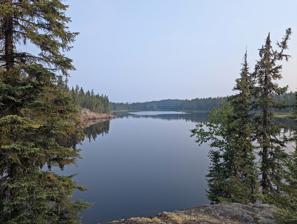
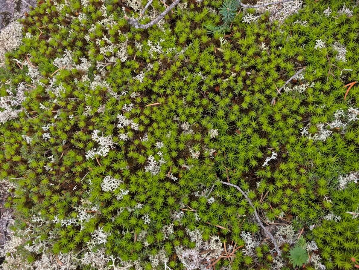
This is pure northern grandeur, with boreal forest stretching as far as the eye can see, ground blanketed by moss and lichen, punctuated only by lakes and slabs of granite rock.
The sheer scale is remarkable, but it’s only the start of what makes the park so special. Located in Northwestern Ontario, Wabakimi is accessible only by plane, train and canoe.
Far from being a hindrance, the remoteness helps keep crowds at bay and safeguards both the wildlife and the wilderness experience. Around 300 to 350 threatened woodland caribou roam the park’s vast forest.
Wabakimi offers truly world class canoeing, with endless possibilities for routes and the freedom to camp wherever you find the perfect spot. Choose to paddle peaceful smaller lakes or mix in some exciting whitewater. This park has it all and it’s your choice to make.
The fishing opportunities here are unmatched, with abundant walleye, northern pike and lake trout. And they’re hungry too; no expert angling skills required.
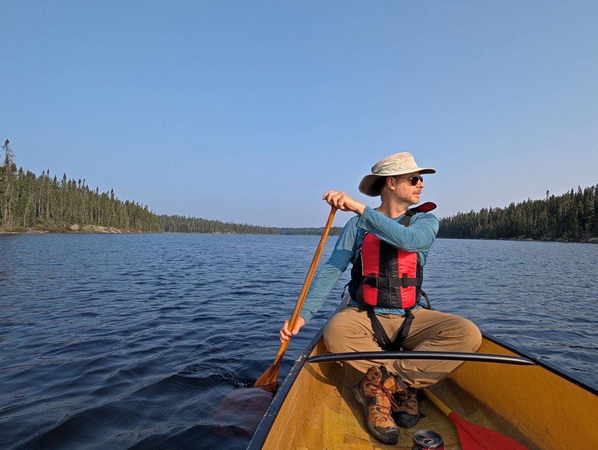
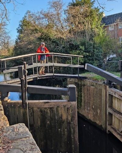
JR and I recently spent six days exploring Wabakimi. After checking out Quetico Provincial Park a few years ago, we thought we had a handle on Ontario’s wilderness paddling experiences. Wabakimi Provincial Park raises what was already a pretty high bar.
In this post, I’ll share more about beautiful Wabakimi and everything you need to know to plan your own trip to this pristine paddling reserve.
We visited Wabakimi Provincial Park in partnership with Ontario Parks, Wabakimi Outfitters and Tourism Thunder Bay.
A quick note – there was a lot of smoke drifting into the Thunder Bay region from wildfires in the Prairies during our visit. Our photos are therefore a bit hazy, giving the landscapes a slightly muted look.
Backcountry necessities
- Always bring the 10 Essentials
- Know how to stay safe in the backcountry
- Remember to Leave No Trace to help keep the wilderness wild
- Understand how to avoid negative bear encounters
- Trying out backpacking for the first time? Read Backpacking 101
- Check out our packing guide with gear recommendations
- Sign up to our newsletter for a free backpacking checklist
Introducing Wabakimi Provincial Park
Wabakimi is Ontario’s second largest provincial park, protecting 2.5 million acres of boreal forest, lakes and rivers. It sits about 240km north of Thunder Bay.
With attached nature reserves, conservation reserves, and waterway parks included, the total conserved area is over 5 million acres. That’s about three times the size of Prince Edward Island. Less than one thousand people visit every year.
The park was originally created in 1983 to safeguard a huge expanse of pristine boreal forest, the largest land-based ecosystem in the world.
Black bear, moose, woodland caribou, deer, beaver, lynx all live here, as well as plenty of waterfowl, eagles, hawks and owls.
A key figure behind the campaign to protect this area was Bruce Hyer. Conservationist, former politician and owner of Wabakimi Outfitters, he pushed for the creation of the park in the face of proposed logging.
Although Bruce was disappointed with the park’s initial size, the boundaries were expanded six fold in 1997. This increase helped the Ontario government move toward its goal of protecting 12% of the province’s total land area.
The name of the park may come from the Ojibwe words waubishkaugimi (whitewater) or wabishkkegin (the sheet is white). This is the Treaty 9 and Robinson-Superior Treaty area, territory of the Anishinaabe people.
For thousands of years, travellers have navigated these waterways, leaving traces such as pictographs and artifacts. Traditional use still continues today.
Wabakimi is the perfect destination for canoe paddlers looking for a true wilderness experience. Its legendary fishing also attracts many non-paddling anglers. Scattered throughout are multiple fly-in lodges offering access to prime fishing spots.
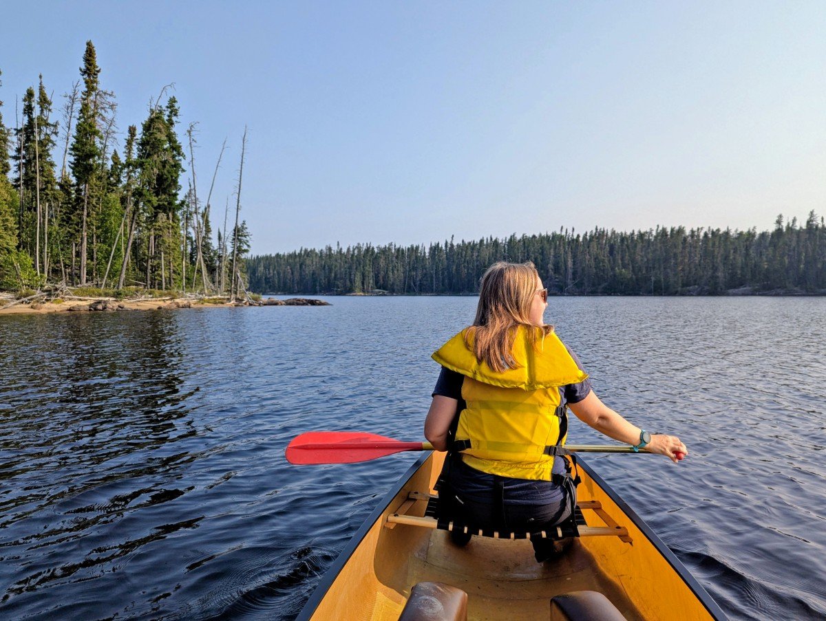
Our Wabakimi canoe trip experience
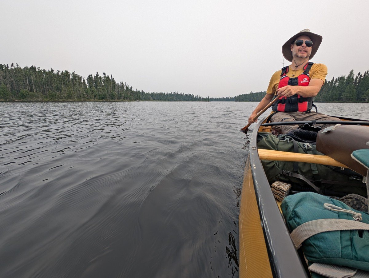
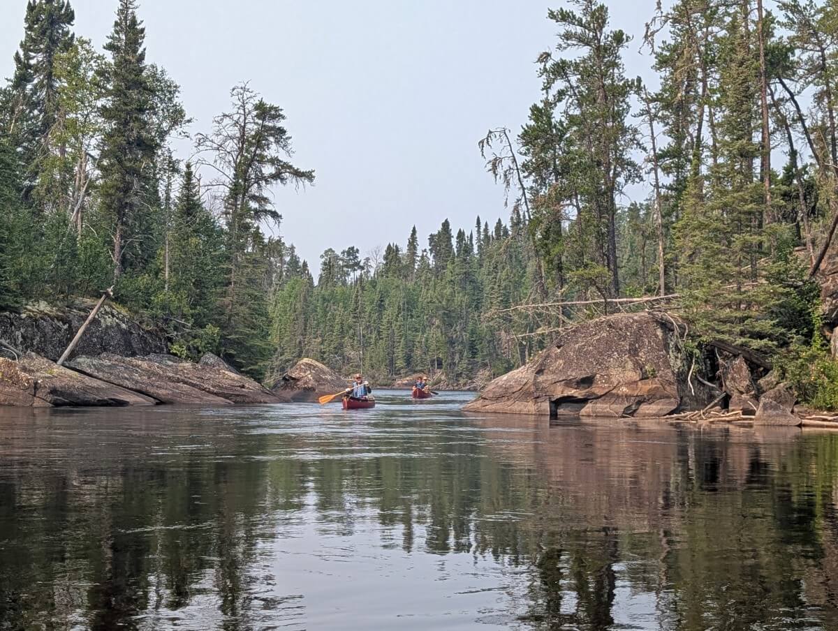
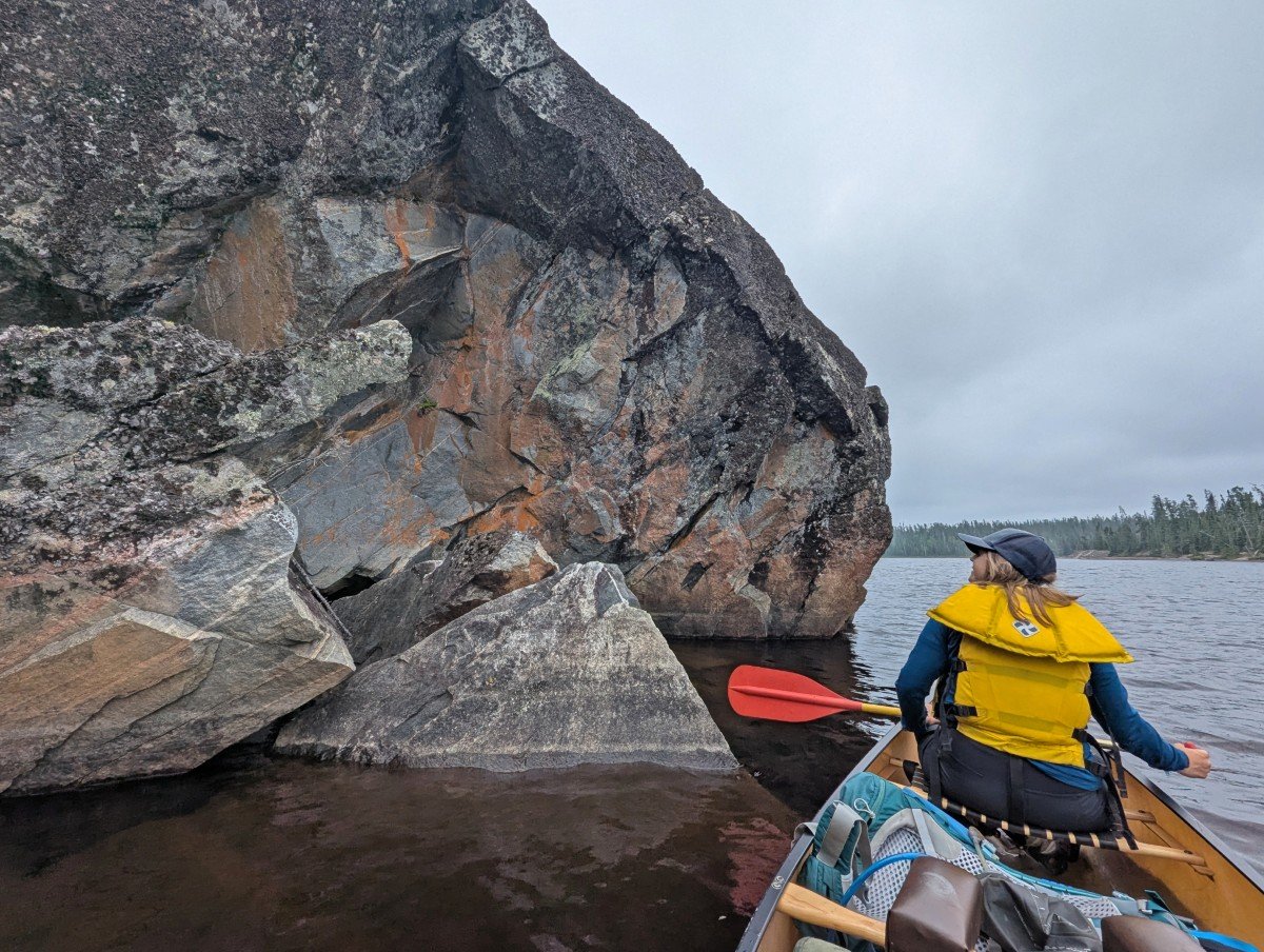
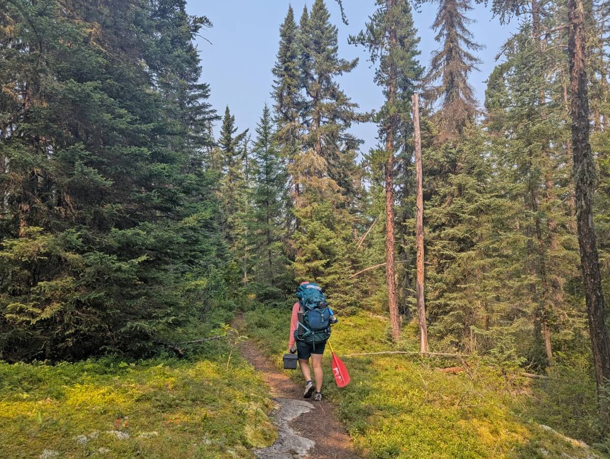
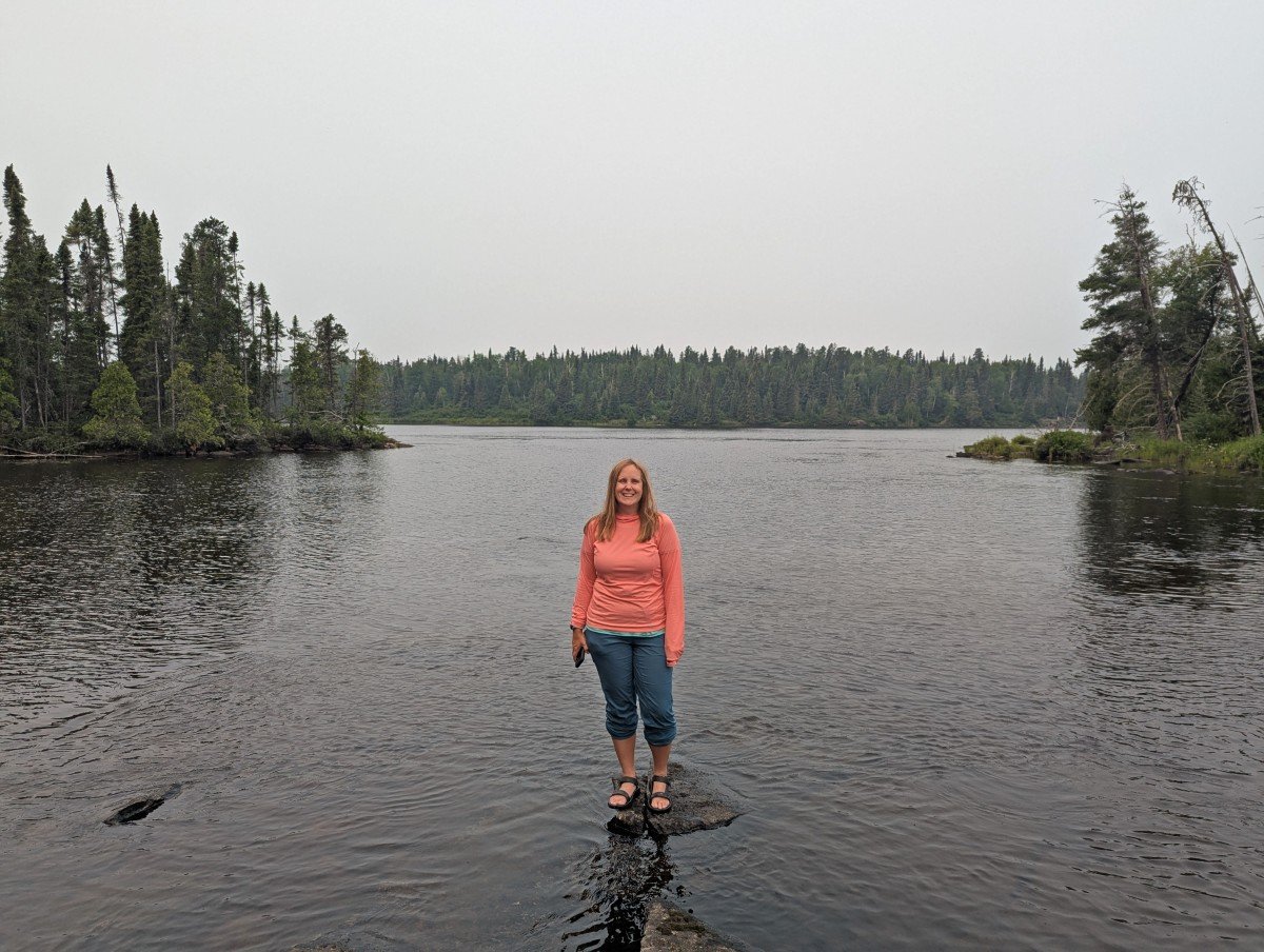
We paddle a southeast section of Wabakimi Provincial Park on a six day, five night trip with a canoe rental from Wabakimi Outfitters. In total, we explored about 50km across 5 lakes and multiple river/creek sections with 12 portages.
This was on the short side for us in terms of distance but in this case, we were happy to take our time to explore. It was quality over quantity.
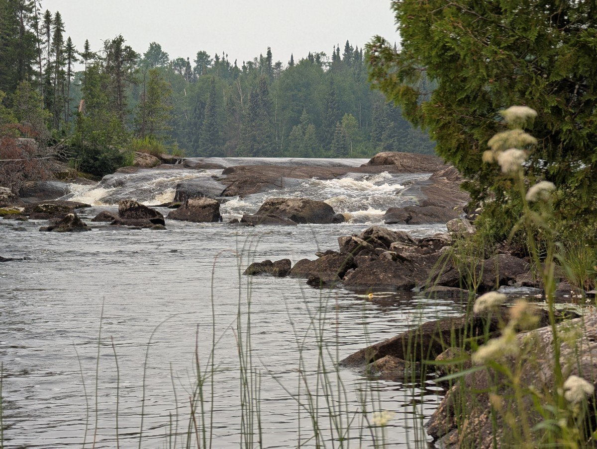
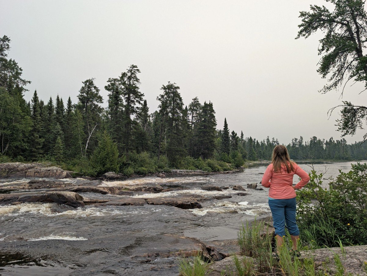
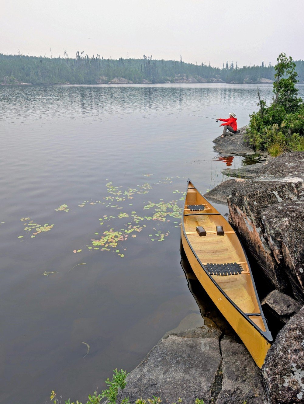
I enjoyed the more relaxed pace and JR loved the fishing opportunities. We had so many magical moments on the trip, from an exceptional river section with multiple chutes to the most beautiful portage I’ve ever seen (not words often said!)
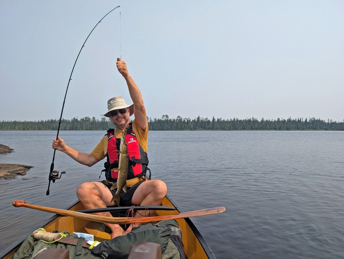
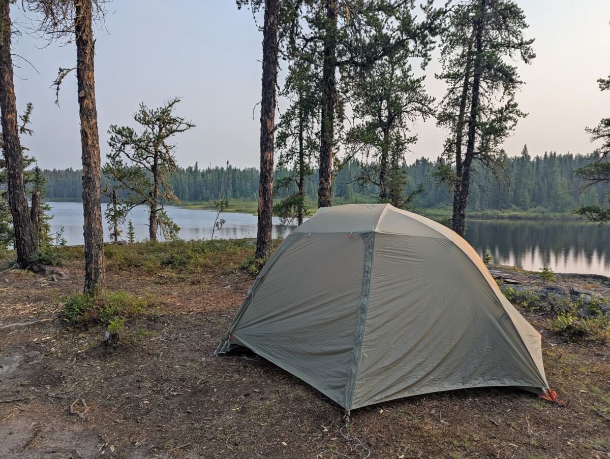
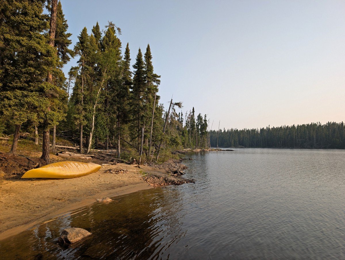
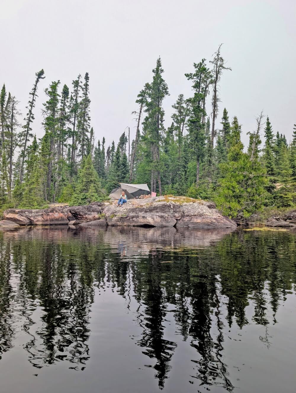
Every campsite had a view and we were never in doubt of finding a good one. We ate fish almost every day, catching and keeping a total of three pike and three walleye.
While we didn’t see a lot of ‘big’ wildlife, we met other canoeists who did (black bear, moose, caribou).
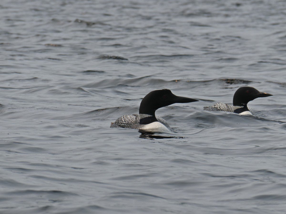
Within the park boundaries, our highlights included many bald eagles, garter snakes, lots of frogs, beaver and endless loons. On our way in, we saw a lynx and two kittens plus two moose.
As for humans, we encountered only five other paddle groups and two power boats over six days. We definitely felt alone for the majority of the trip (just the way I like it!)
The only drawback to this adventure was the wildfire smoke drifting in from the prairies. It fluctuated daily but never became overwhelming.
Despite the haze, the warmth remained, swimming was enjoyable, and the fishing excellent. The wilderness spirit stayed strong throughout.
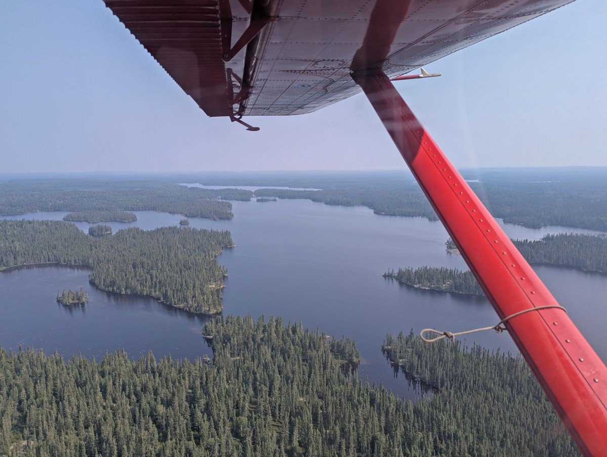
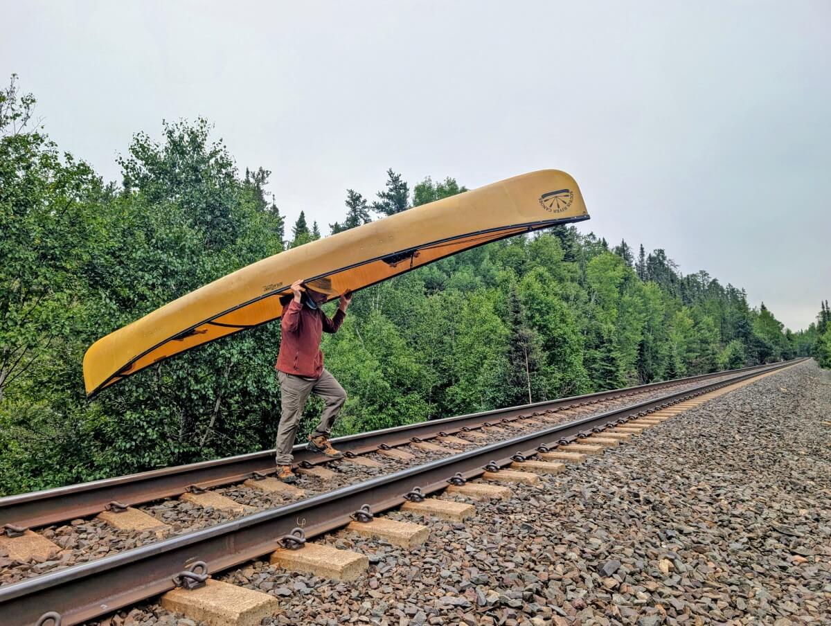
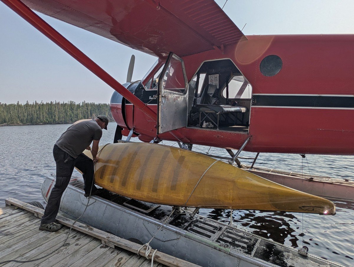
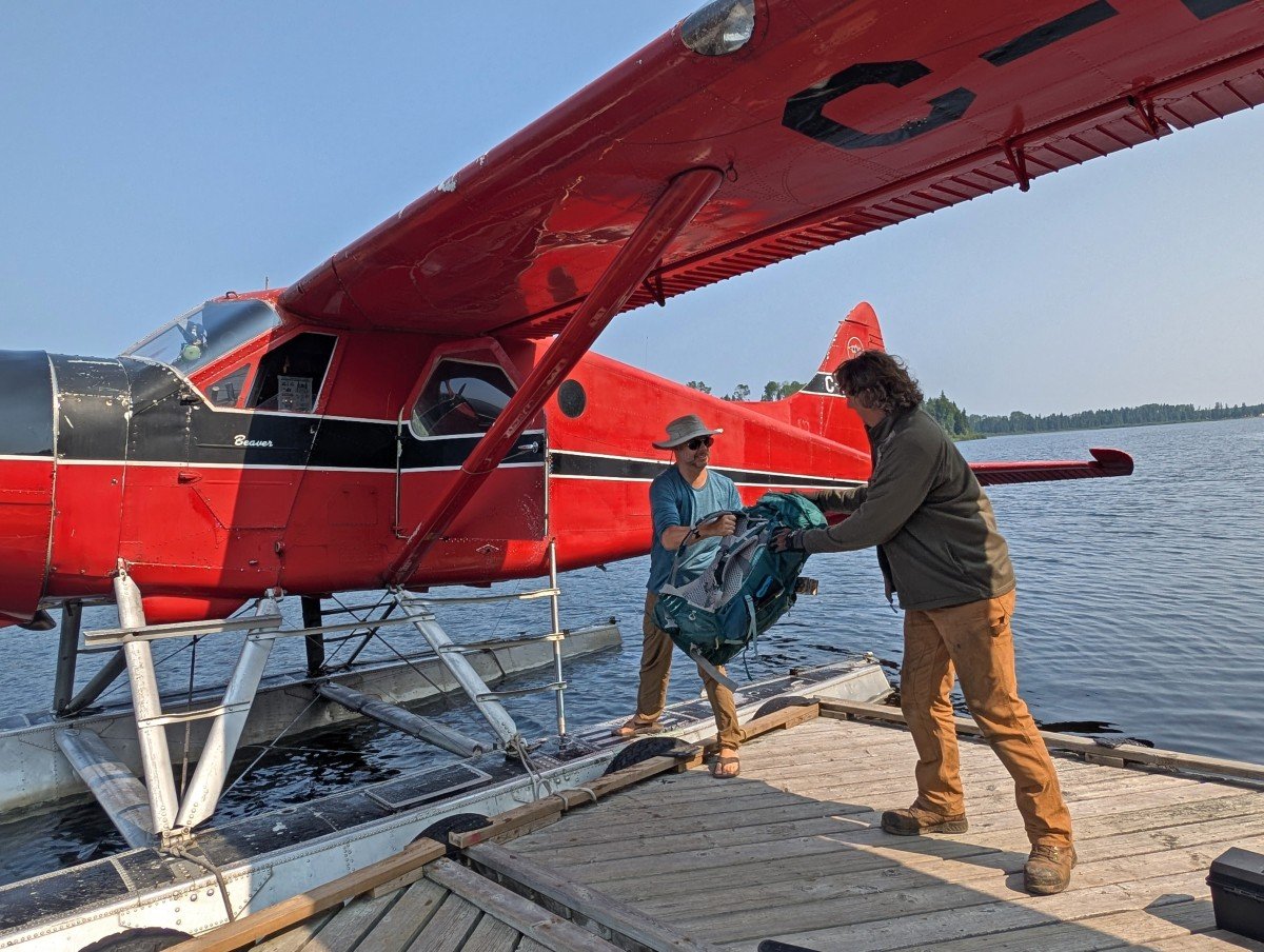
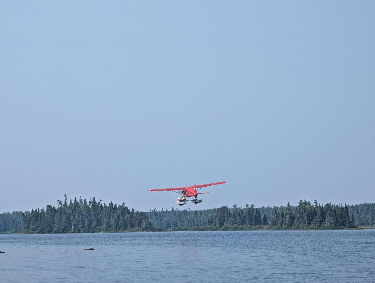
The final leg of our Wabakimi canoe trip was truly unique. We began by portaging over a railway line, then made our way to one of Wabakimi Outfitters’ outposts.
The next morning, a floatplane picked us up for the flight back to the main lodge. It was an unforgettable way to wrap up an already remarkable adventure.
Wabakimi Provincial Park canoe trip planning guide
Inspired to plan a Wabakimi canoe trip? This section will help you prepare for your adventure in the park. It includes route planning advice, permit details and essential gear recommendations.
There are affiliate links in this section – if you make a purchase, we may receive a percentage of the sale.
Location
Wabakimi Provincial Park is situated in Northwestern Ontario. Thunder Bay is the closest city. As I’ll explain below, there is no formal road access into the park. Wabakimi is pure backcountry wilderness.
Armstrong is the nearest community to Wabakimi on the eastern side. It is pretty small, with a population of around 150 people. There is a post office, convenience store, motel, two restaurants and, most importantly for Wabakimi paddlers, a Via Rail stop.
On the western side is Savant Lake. Again, it is small (less than 100 residents) but there is a Via Rail stop here too.
Both Armstrong and Savant Lake are connected to Thunder Bay by paved roads. The drive from Thunder Bay to Armstrong takes around 3 hours, while Thunder Bay to Savant Lake is about 4 hours.
How to get to Wabakimi Provincial Park
Wabakimi is a backcountry wilderness park without formal road access. Organising your entry/exit into the park is one of the key aspects to planning a trip. Utilising an outfitter definitely simplifies this process.
There are three ways to access the park:
- Floatplane (bush plane)
- Train
- Canoe (via old logging roads)
The limited access is one of the reasons why Wabakimi is so special. And it’s a reason to stay longer too!
Floatplane flights are fast, convenient and, of course, very scenic – plus they allow access to much more remote locations (and spread the visitor pressure around).
Flying in a bush plane is also an iconic northern experience. It is the most expensive option, however, around $1000 one-way. Two local companies offering this service include NDK Air (jennifer.borgs[at]gmail.com) and Wilderness North.
The Canadian National Railway (CNR) northern line runs through the southern section of the park. There is a twice weekly Via Rail service between Savant Lake and Armstrong.
This makes it possible to access Wabakimi by rail from many major Canadian cities, including Toronto and Winnipeg. Armstrong is the most popular start or end point.
Paddlers can be dropped or picked up at any location along the route, as long as the staff are given the exact location (nearest tenth of a mile west of Armstrong) and there is evidence of access to a waterway or portage route. More details in this guide put together by the Friends of Wabakimi.

Amazingly, the cost to bring a canoe on board the train is only $100, no matter how long the journey is. The downside of the train? The eastbound service is usually delayed a few hours, the westbound typically runs closer to its schedule.
There are no facilities at the rail stops in Savant Lake or Armstrong, so keep that in mind in relation to possible delays.
The third method to access Wabakimi is via canoe. There are some rough, overgrown former logging roads that lead to lakes or portages that connect to lakes within the park. The one we went on definitely wasn’t one I’d want to tackle on my own – get a shuttle from an outfitter instead.
When to go
The Wabakimi paddling season runs from May to late September. Each month has its advantages.
In an average year, the lakes thaw the second week of May. According to Bruce Hyer, the last two weeks May are a great time to go to enjoy flowers, fishing and birding without bugs. Swimming is somewhat limited (more a dip!) due to the cold temps.
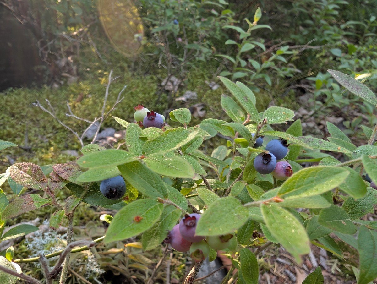
June is warmer but buggier, though exactly how much varies from year to year. July is popular as is August. The weather is warm and dry, the lakes ideal for swimming. Our trip was at the very start of August, just as the blueberries were ripening.
The fishing apparently slows down with the summer heat. We still had plenty of success during our trip and the mosquitoes and blackflies were less aggressive than I imagined, with only one of campsites being a little buggy. I was surprised that the portages were almost bug free (and I say this being very reactive to blackflies!)
For Bruce, the first two weeks in September are ‘paradise.’ The last section of the month can be a bit variable when it comes to weather. Regardless, the fishing is better than August.
Planning a Wabakimi canoe trip route
Being so large and connected to many other navigable waterways, Wabakimi has endless potential for canoe trips.
In my opinion, organising your transportation in and out of the park is the best place to start. The train, for example, runs only twice a week (Mondays and Thursdays on the current schedule).
Wabakimi Outfitters is the only canoe focused outfitter for the park. As mentioned, the owner, Bruce Hyer, knows the park inside out. His team takes care of transportation arrangements and offers rentals for everything from canoes and stoves to tents and other essentials.
The first step to planning a trip is to buy the park overview map. Once you have that, the Wabakimi Outfitters team will organise a phone call or Zoom to discuss your trip and then narrow down the possibilities.
Detailed maps of your route will be sent to you nearer the time, featuring recommended campsites, portage information, the best fishing spots and more.
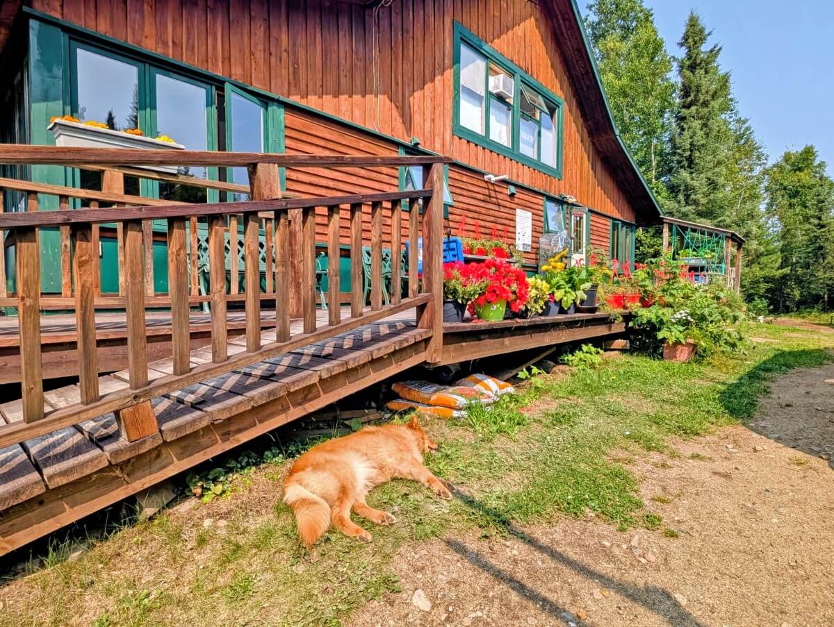
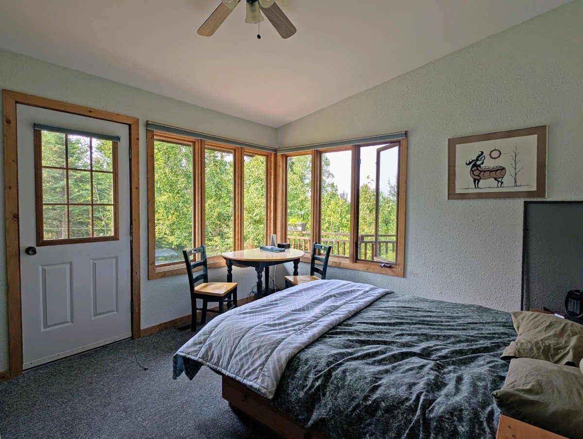
A popular way to start or end a Wabakimi trip is to stay at the Wabakimi Wilderness Lodge on Mattice Lake. It’s an easy 2 hour 45 minute drive from Thunder Bay. The 8 room lodge has its own dock, where floatplanes can land. The Armstrong Via Rail stop is 10 minutes drive away.
Trip planning resources
- Wabakimi Outfitters has a park overview map, with more detailed route versions available for clients
- Ontario Parks also has a general trip planning map
- The Friends of Wabakimi have produced a trip planning map as well as PDF route maps
- There is one dedicated guidebook – Wabakimi Canoe Routes by Laurence Mills. It can be purchased via the Friends of Wabakimi
- The Paddle Planner website has Wabakimi as an option
- This Northern Ontario Travel article has some good route suggestions
- Be sure to check the alerts page on the Ontario Provincial Parks’ website
Wabakimi portages: what to expect
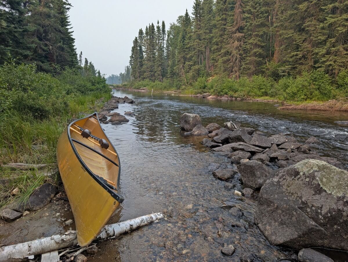
There are hundreds of portages within Wabakimi Provincial Park. We explored just 12 of them but were impressed how established they were. I imagine this is because we were visiting the more accessible southeast corner of the park.
Though portages in Wabakimi are not marked, we found most easy to spot with a map in hand.
A few were less obvious, and we had to paddle close, almost to shore, to confirm their locations. Water level changes from year to year can make some portages harder to find.

Most of the portages we completed were quite short – less than 200m. There was one that was 1km long but it was actually the best one of all! Nice and flat, with a well defined dirt path surrounded by forest.
A lot of the portages were rocky, especially at the start and end. A couple had some small hills. We only had to step over a couple of fallen trees. Some of the portages were a bit muddy, especially at the put-in and take-out.
Wabakimi canoe rentals and outfitters
A number of outfitters service Wabakimi Provincial Park. We rented our canoe from Wabakimi Outfitters. They are the only full service paddling focused outfitter in the area.
As well as rentals, the company offers complete and partial outfitting packages including camping gear, shuttles, flight bookings, mapping, permits, accommodation and more.
We were providded with a Prospector 16 Kevlar canoe, made by Souris River Canoes in Atikokan. Being a light 40lbs, it was perfect for portaging in Wabakimi. It also handled really well in the water.
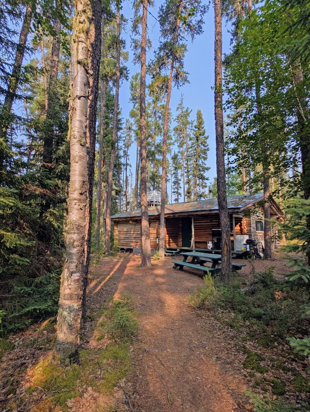
Wabakimi Outfitters has four outposts within the park boundaries and another two just beyond the boundaries. These outposts are private and well equipped, with the one we visited having hot showers powered by solar (such a treat!) It also has a wood burning sauna, dock and spacious lodge.
As previously mentioned, we stayed at Wabakimi Outfitter’s Wilderness Lodge at the end of our trip. It was the perfect way to wind down after six days in the park. Think buffet meals, lakeside sauna, off the dock swimming and more.
Wabakimi Provincial Park permits and fees
All paddlers must have a park permit to visit Wabakimi. This can be obtained by completing an online backcountry registration on the Ontario Provincial Parks website within two weeks of the start of your trip. You’ll need to know:
- Arrival date
- Entry point
- Which of eight park zones you’ll be exploring each day
- Exit point
The cost of the permit is $9 per adult, per day plus tax. If you’re not from Canada, the rate is $13.25 per adult, per day plus tax.
Wabakimi does not have an entry quota, so there is no reservation system. Just be sure to get a permit and you’re all set! If you’re using an outfitter, they will assist with the permit.
There are no campsite assignments either – the permit covers the entire park, no need to decide on a particular lake to camp on. Indeed, you can completely change your route at will (as long as your transportation arrangements still work!)

Wabakimi Provincial Park camping
Officially, Wabakimi paddlers are ‘permitted to camp at any location as long as the site is returned to the same or better condition as it was found.’
In practice, there are many established campsites (500+) and I would recommend using them. This reduces impact on the landscape. And honestly, these campsites will be the most comfortable spots to stay!
Previously used campsites are not signed. There are, however, many sites noted on the Paddle Planner website. Outfitters can also mark recommended sites on maps.
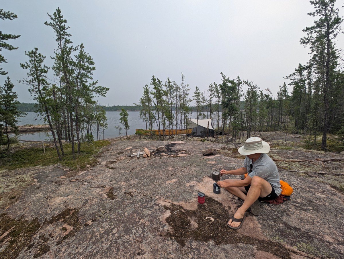
In our experience, we found most campsites to be located on peninsulas and points, with rock or beach access. An established rock fire pit was usually the confirmation of a campsite.
Expect a flat space (or mostly flat) for a tent or two as well as the rock fire pit. There may also be logs close to the fire pit, to act as seating. Some campsites have room for three or four tents.
Please note that there are no outhouses anywhere in the park, so paddlers must practice Leave No Trace and dispose of waste properly.
All of the previously used campsites are available on a first come, first serve system.
When choosing a tent spot, be sure to look up for ‘widowmaker’ trees (dead or loose branches).
When heading to a recommended campsite, look out for alternatives on the way, in case it is already occupied (not common but it can happen!)
Wabakimi tips and recommended gear
- Always leave campsites better than you found them – pack out your own trash and pick up any you do see
- Dogs are permitted in Wabakimi’s backcountry but should be kept on a leash and picked up after
- Planning to fish in the park? Be sure to have a valid Ontario fishing licence and Outdoors Card. Wabakimi is located in Zone 2
- We loved having our Eureka NoBugZone CT11 tarp shelter at one particularly buggy campsite on our early August trip. It provides an additional living area, to avoid being stuck in the tent!
- Plan to filter all of your water while paddling in Quetico. We used the BeFree filter
- Consider bringing a head net or bug jacket to protect against mosquitoes and blackflies, especially if paddling early in the season (May, June, early July)
- There are no outhouses. A small trowel will make easier work when digging a 6 inch cathole
- If cooking on the fire is important to you, consider a camp grill. Fire pits at campsites are made of rock
Other posts you may find interesting:
Quetico Provincial Park, Ontario
Bowron Lake Canoe Circuit, BC
Kejimkujik National Park, Nova Scotia
Murtle Lake, BC
Maligne Lake, Alberta
Clearwater/Azure Lake, BC
Check out these recently published posts:


One half of the Canadian/British couple behind Off Track Travel, Gemma is happiest when hiking on the trail or planning the next big travel adventure. JR and Gemma are currently based in the beautiful Okanagan Valley, British Columbia, Canada. Consider buying us a coffee if you have find any of our guides helpful!