Canada’s Vancouver Island is the ideal place for a road trip. There are opportunities to explore huge lakes, lush rainforests, jagged mountain peaks and pristine sandy beaches that stretch for days.
Contrary to many first-time visitors’ expectations, however, Vancouver Island is a pretty big place.
At a length of 460km, it is more than 5 times the size of Prince Edward Island on Canada’s East Coast. Vancouver Island also has five times the population of PEI.
Despite the size, most visitors to Vancouver Island only see Victoria and the coastal town of Tofino. I can totally understand why, especially when short on time.
The coastal scenery around Tofino is simply stunning and British Columbia’s capital city has plenty of attractions of its own.
But Vancouver Island has much, much more to offer beyond Tofino and Victoria.
With all this in mind, here are my top picks for alternative Vancouver Island road trip itineraries for those who want to explore beyond the beaten path.
JR and I used to live on Vancouver Island and still visit often (typically twice a year). We have personally tried and tested every suggestion on these itineraries.
This post includes some affiliate links. If you click on these links and then purchase an item, we may receive a percentage of the sale.

Planning a trip to Vancouver Island?

Our Vancouver Island Travel Guide features an interactive map with 150+ of the best things to see and do.
The itinerary builder tool makes it easy to create your perfect trip.
Download the app and use offline while travelling!
Road tripping on Vancouver Island: What you need to know
Despite the large size of Vancouver Island, there are only a few major highways.
The most obvious is Highway 19, running from Victoria at the southern tip to Port Hardy in the north. It connects the majority of Vancouver Island’s larger communities, such as Duncan, Nanaimo, Courtenay and Campbell River.
The most northern section of the highway, from Campbell River to Port Hardy, is far less travelled than the southern part.
Other major roads include Highway 4, which cuts through the centre of the island from Parksville to Tofino via Port Alberni and Highway 17, a short spur from Victoria to Swartz Bay.
A quieter but still important route is Highway 14 from Victoria to Port Renfrew via Sooke.
Beyond Vancouver Island’s main highways is a huge network of backroads. These unpaved routes are the real key to exploring beyond the beaten path on Vancouver Island. More details later on in the guide.
When planning a Vancouver Island road trip, I would recommend making ferry reservations early. And yes, I would consider reservations essential if you have a set itinerary.

Vancouver Island Road Trip 1: Pacific Marine Circle Route
Starting point: Victoria
End point: Victoria
Total kilometres: Around 300km
Length of road trip: Two to four days
Best time of year: March to November
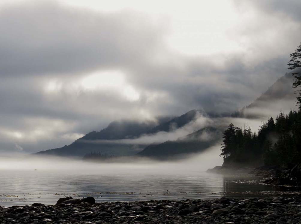
The Pacific Marine Circle Route is ideal for travellers who want to take in Vancouver Island’s stunning coastal scenery as well as the lush temperate rainforest.
Starting and ending in Victoria, this off-the-beaten-track road trip also provides an opportunity to visit Vancouver Island’s capital.
The total trip length is a lot shorter than the classic Victoria/Tofino combination, which saves both time, gas and money.

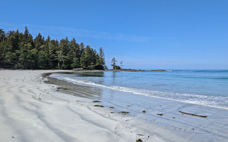
The highlights of this road trip include several old-growth forest groves, a lighthouse and half a dozen spectacular beaches.
While most of the beaches are rockier than those in Tofino, they remain wonderfully wild and windswept. One even has a hidden waterfall!
If you’re short on time, the Pacific Marine Circle Route is an excellent road trip choice. While it’s not as remote as some of the other suggestions in this post, it still certainly feels like it!

Vancouver Island Road Trip 2: Coastal Circle Route
Starting point: Vancouver
End point: Vancouver
Total kilometres: Around 400km
Ideal length of road trip: Five to seven days
Best time of year: April to October
This off-the-beaten-track road trip features a loop on Vancouver Island and the Sunshine Coast. The latter is a stretch of British Columbia’s mainland located on the other side of the Salish Sea.
The combination of the two coastal areas makes for a particularly scenic road trip. Additional ferry journeys are required (four total, but one is free) to complete the loop but trust me, this adventure is more than worthwhile!

I personally really like the contrast between Vancouver Island and the Sunshine Coast. While they have lots of similarities, the communities feel quite different and the attractions are complementary.
Vancouver Island is an ideal destination for waterfalls, wildlife tours and beaches, while the Sunshine Coast offers incredible paddling and sunset-watching opportunities. Both have excellent hiking trails.
Beginning and ending in Vancouver, this route can easily be combined with a longer road trip to the Canadian Rockies.

Vancouver Island Road Trip 3: Campbell River to Cape Scott (and Beyond)
Starting point: Campbell River
End point: Campbell River
Total kilometres: Around 750km
Ideal length of road trip: Four to seven days (or more)
Best time of year: May to early October
Looking for a Vancouver Island road trip that is truly off the beaten track? This is the one.
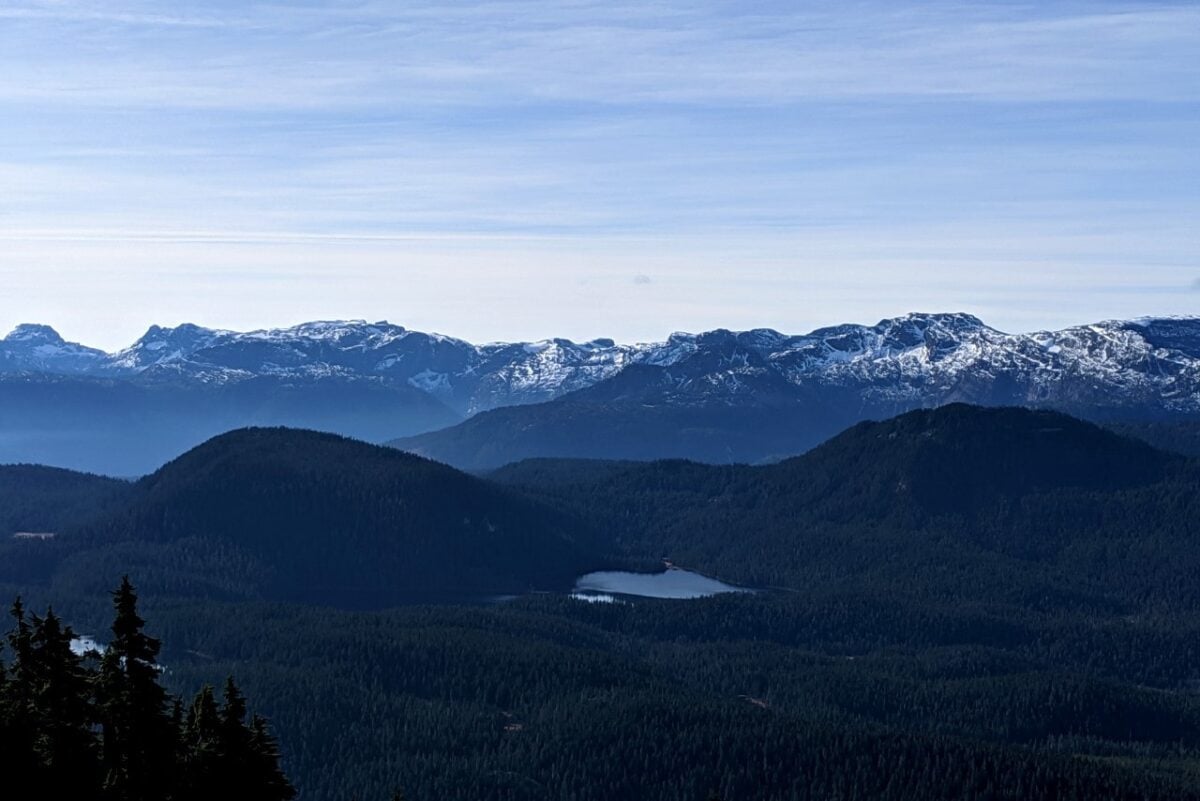
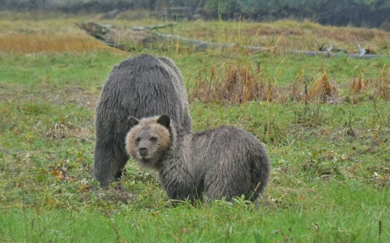
Northern Vancouver Island is almost a different world to the southern parts with huge mountain ranges, rugged rainforest and very few communities.
The linked guide describes the road trip between Campbell River and Cape Scott. At the end, there are several listed ‘side trips,’ with Cape Scott being the first (and best).
Cape Scott is the very northwestern tip of Vancouver Island, situated in a remote provincial park of the same name that protects pristine golden sand beaches, old-growth forest groves, sea stacks and more.
To reach Cape Scott, you’ll need a reliable vehicle, ideally one with high clearance, as the access road is unpaved. I’d also recommend the Vancouver Island Backroads Mapbook for navigation.
Need a rental vehicle? FarOut Wilderness offers fully kitted out high clearance 4X4 trucks with rooftop tents, ideal for travelling the unpaved backroads of Vancouver Island. Contact FarOut with the code FOW-OTT-5 for a 10% booking discount.
Please note that phone signal is very limited beyond Campbell River. Bring extra supplies (food, water, clothing etc) in case of emergency or delay. Be sure to have a good spare tire and know how to change it. Tell someone where you’re going and when you plan to be back.

How to extend your Vancouver Island road trip
Here are some additional ideas to extend and enhance your road trip on Vancouver Island:
Salt Spring Island – Laid back and artistic with a side of hippy, Salt Spring is the third largest of the Gulf Islands between Vancouver Island and the BC mainland. Be sure to check out Ruckle Provincial Park and the Salt Spring Island Cheese Company shop. If you have a kayak, consider a trip to Wallace Island
Denman and Hornby Islands – Located just south of the Comox Valley, relaxed Denman Island is accessible via a short cable ferry ride. Marvel at the magnificent old-growth trees in Fillongley Provincial Park. Hornby Island is just another ten-minute ferry ride away. On Hornby, a trip to the beautiful white sand shores of Tribune Bay is a must

Quadra and Cortes Islands – Easily accessible from Campbell River, these islands offer fantastic coastal views and a slower pace of life. Visit the Cape Mudge lighthouse on Quadra and canoe on the Main Lakes network. On Cortes, take a refreshing swim at Hague Lake
Explore Horne Lake caves – Vancouver Island has the highest concentration of caves in North America. Guided tours (both short and adventurous) are available at Horne Lake
Strathcona Park: Big on hiking? Take a scenic drive from Campbell River along Highway 28 to Strathcona Provincial Park. Enjoy waterfalls and alpine trails, most starting right from the main road. Continue along the highway to visit Upana Caves and Gold River
Victoria – Staying in Victoria for a while? Enhance your trip with a wine tour, a trip to Butchart Gardens, some zipling, a harbour kayak tour or a guided hike
The Inside Passage – For the ultimate departure from the Island, consider travelling up the Inside Passage via Port Hardy. It’s expensive, but a great alternative to driving to Prince Rupert and Haida Gwaii!


Check out these other Vancouver Island posts next

One half of the Canadian/British couple behind Off Track Travel, Gemma is happiest when hiking on the trail or planning the next big travel adventure. JR and Gemma are currently based in the beautiful Okanagan Valley, British Columbia, Canada. Consider buying us a coffee if you have find any of our guides helpful!
this is ALL amazing. I’m planning a trip incorporating approx 10 nights on vancouver Island. What would your route be if you were planning on staying in one place for 5/6 nights?
If it’s your first time to Vancouver Island, you could easily spend 4/5 days around the Tofino area and see some amazing places. If it’s off the beaten path you’re specifically looking for, I’d head to North Vancouver Island.
Very well done. Just one correction: at approx. 32,000 square km, Vancouver Island is nearly 6x the size of PEI (not 2X)
Hi Lance,
Vancouver Island is more than twice the size of PEI, but yes, saying more than five times is more accurate. 🙂 Thanks!
It’s these types of post that cause over crowding and ruin the areas. Thanks for posting.
This is a concern for us too, which is why we don’t use Instagram or feature any places not already mentioned in publications like Backroad Mapbooks or on government websites like Sites and Trails BC. Even then, we are careful to avoid mentioning more sensitive locations or those with limited facilities. We also encourage readers to follow Leave No Trace principles. This post was originally published (and since updated) in 2014.
Please remember that the people living in the smaller communities on Vancouver Island do not have hospitals that can deal with Covid 19 outbreaks. Until everyone is vaccinated we are being asked to stay in our own health zones. If you see fit to travel anyway, please do not drag the virus along with you!
Absolutely! This article, like all our blog posts, are intended for to be used for inspiration and planning during the pandemic. And, of course, local residents may also find these type of articles helpful to discover new places in their backyard. As noted at the top of the article, it was last updated in early 2020. We are following BC government public health recommendations to stay local at this time and assume our readers are too.
Greetings from Arnegard, ND.
We will be travelling around Vancouver Is., this summer, in a 26.5 ft (Oliver Travel Trailer). Entering at Part Hardy, then travel around the island.
The question is, what are the road (paved vs. gravel) conditions on what you have shown as the ‘Pacific Marine Circle Route’.
Hi Bryan,
Sounds like a great trip! The Pacific Marine Circle is completely paved. Read more about it in our dedicated Pacific Marine Circle road trip post.
Hi Gemma, we have plans to visit Vancouver Island in September 2025.
That means two couples 75+ for 5 nights. Do you have suggestions for us?
We are traveling in a normal car and like to spend our nights in a hotel with breakfast, two separate rooms with bathroom.
Hi Martin,
September is a great time to visit! Thanks for your interest in a custom itinerary – you can read about my custom itinerary services on the Rexby platform here. Hope you have a wonderful trip, whatever you decide.