The tiny Bavarian-styled village of Leavenworth in Washington is an outdoor adventure utopia. And being nestled in the spectacular Cascade Mountains, hiking in Leavenworth is a natural fit.
With dozens of trails leading high into the alpine, the range of backpacking (overnight hiking) opportunities are particularly impressive. But don’t worry, day hikers are looked after well in Leavenworth too.


Backcountry necessities
- Always bring the 10 Essentials
- Know how to stay safe in the backcountry
- Remember to Leave No Trace to help keep the wilderness wild
- Understand how to avoid negative bear encounters
- Trying out backpacking for the first time? Read Backpacking 101
- Check out our packing guide with gear recommendations
- Sign up to our newsletter for a free backpacking checklist

Day hiking in Leavenworth: Six fast and fun trails
If you’re limited on time (or energy), here are six fast and fun hikes near Leavenworth that are guaranteed to offer a good time. These Leavenworth hikes are also ideal for early (May, June) or late season hiking (October), when the presence of snow is more likely on the higher elevation trails.
The best thing about hiking in Leavenworth? Being situated in a valley, many Leavenworth hikes are uphill. This does mean that a little more effort is required but the payoff is quite immediately obvious.
Mountains as far as the eye can see, intersected by raging rivers and rugged canyons. Hiking in Leavenworth is a perfect way to see more of this beautiful area and experience beyond the downtown delights of beer gardens and bratwurst.
Icicle Ridge Hike
6 miles / 10km (around 3 hours)
If you only have time for just one Leavenworth hiking experience, the Icicle Ridge hike should be a strong contender. Uphill for almost all of the way, it can be a tough workout but one with an exceptional reward of stunning panoramas over the town of Leavenworth and surrounding peaks.
At six miles, Icicle Ridge is the longest trail suggested here. It is so close to town, however, so there is no time wasted driving to the trailhead. It’s also one of the earliest higher elevation Leavenworth hikes to become snow-free in spring.
The trail starts off with a fairly steady incline through the pine forest before increasing in pitch and the switchbacks begin. Don’t worry, there are plenty of valley views to keep things interesting as the height increases. The path winds in and out of the trees, offering valuable shade on hot days.
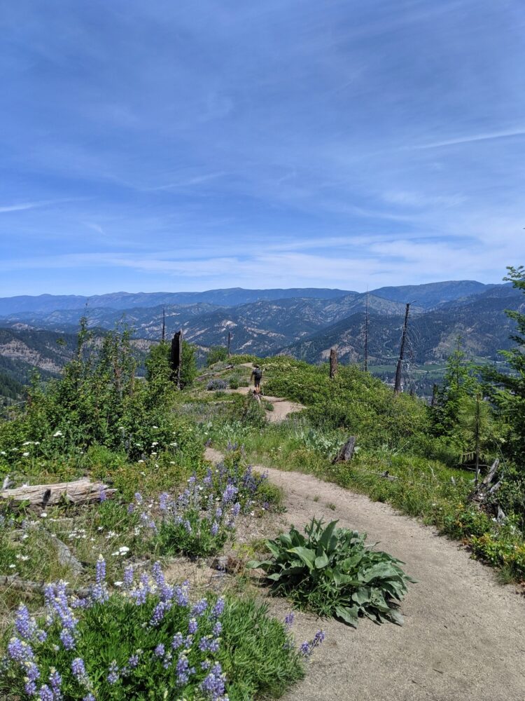
Towards the top, the path splits. The right fork leads to the end of the trail proper, a high bluff above Leavenworth. In late spring, violet lupine wildflowers provide a colourful foreground.
This three hour hike does max out the ‘fast’ qualification of this post, but a trip to Icicle Ridge is worth the extra time. Get onto the trail by 9.30am and you’ll be done in time for lunch. Or better still, take lunch with you and have it on the ridge!
Hike directions
The Icicle Ridge Trailhead is just over two miles drive south of Leavenworth, on Icicle Road. There is a sign for the trailhead on the main road, but it does come up quite quickly. Parking is limited in the turnaround loop, so I’d recommend carpooling if planning to hike in a group.


Leavenworth Waterfront Trails
Various routes, 1 mile / 1.6km – 3 miles / 3.2km (1 hour)
A trio of riverside parks lie just a few blocks from the downtown core of Leavenworth. Enchantment Park, Blackbird Island and Waterfront Park connect to create a network of trails along the banks of the Wenatchee River, winding in and out of the cottonwood and pine trees.
Alongside the rippling river, there are mountain views, historical interpretive signs, pocket beaches, bird watching, playgrounds and seating areas to enjoy. In autumn, the waterfront parks are an ideal place to spot salmon swimming upstream.
Blackbird Island is a particular highlight of this area, with three different trails to explore. It is accessed via short footbridges from Enchantment Park and Waterfront Park.
Due to the easy accessibility from downtown Leavenworth and the almost completely flat paths, almost anyone can explore this beautiful riverside area. It’s a great place to walk off lunch, dinner or a couple of scoops of gelato from Viadolce on Front Street.
Hike directions
Leavenworth’s waterfront parks are accessible via a few different locations, with one of the most convenient being from Main Street, just south of downtown. There are a couple of parking lots here, plus another large lot in Enchantment Park itself. Restroom buildings can be found in both Enchantment Park and Waterfront Park.


4 the Boyz Memorial Trail, Ski Hill
3.6 miles / 5.8 km (about 2 hours return)
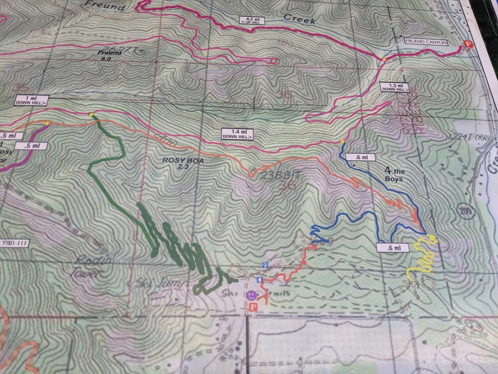
A spiderweb of multi-use trails can be found at Leavenworth’s ski area, the simply and aptly named ‘Ski Hill.’ There are quite a few different paths to choose from here.
Our pick is the 4 the Boyz Memorial Trail, named for Chris Rudolph, Johnny Brenan, Jim Jack and Danny Zimmermann who passed away in local avalanches.
Starting at the large parking lot at the base, this dirt trail slowly gains elavation as it curves around the hill. If short on time, there are excellent views of Leavenworth and the Enchantment mountains from only a mile or so in.
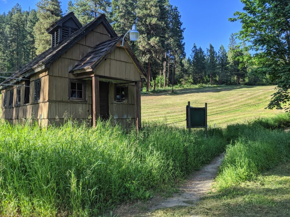
Besides the easy access and parking, another advantage of this trail is the option to grab a beer or a bite to eat at the historic Ski Hill Lodge on the way back down to the parking lot.
Due to the trails on Ski Hill being multi-use, hikers should be aware that mountain bikers may appear at anytime. Listen out for approaching bikers and prepare to get off the trail quickly when necessary.
Hike directions:
Follow Ski Hill Drive two miles north from Leavenworth. There is a very large parking lot at the end of the road, with posted trail maps and two vault toilets.


River Loop Trail, Icicle Gorge
4 miles, 6.5km (about 2 hours)
The furthest hike from Leavenworth on this list, the River Loop Trail is worth the drive for those looking for a straightforward, mostly flat hike with a decent payoff.
Surrounded by mountains, Icicle Creek rushes through the gorge with impressive power. Peaks of the Enchantments loom over the trees, hinting at the alpine beyond. If you don’t have the time or fitness to hike into the mountains proper, Icicle Gorge is a good way to get a taster of the area.
The River Loop Trail is easy to walk, with only a little elevation here and there. Well maintained bridges cross the river and creeks where necessary. Interpretive signage introduce some of the local flora and fauna along the way.
Besides the River Trail, there’s also a shorter ‘View Trail’ accessible from the same parking lot. I wouldn’t recommend it over the River Trail as we didn’t find that the views were justifiably better. It was also pretty overgrown on our June visit.
Hike directions
The Icicle Gorge Trailhead is located 15 miles along Icicle Road, south of Leavenworth. The last mile or so before the trailhead is unsealed (dirt), which is potholed and narrow in places. Drive slowly. The off-road parking lot has space for around twenty vehicles. There is a vault toilet.
*To park at this trailhead, you must have a valid National Forest Recreation Pass. The day pass is $5 per vehicle and can be purchased (cash only) at the trailhead itself.*


Hatchery Nature Trail
1 mile / 1.6km (30 minutes)
A hatchery wouldn’t usually be my first pick for a place to take a walk, but Leavenworth’s is surprisingly picturesque. The wide open valley offers a great vantage point of the Enchantments and other surrounding mountain ranges.
There are actually a few different trails on the property, though my top pick for a fast and fun hike is the Nature Trail. This short tarmac loop is almost entirely flat and meanders close to the river and back through pretty meadows. There is the opportunity to visit two bird hides, plus interpretive signage featuring native birds along the route.
While you’re in the area, I’d recommend having a look in the hatchery too. There’s a concise but informative exhibit on salmon and other local wildlife. It is also possible to take a peek at the growing juvenile salmon. The hatchery visitor centre is free to enter.
Hike directions
The Leavenworth National Fish Hatchery is situated 2.5 miles south of Leavenworth, on Icicle Road. The turnoff is wide signed. There is parking just outside the hatchery gates. Pick up a paper trail map at the information sign in front of the hatchery building.
This Leavenworth hike is also known as the Icicle Creek Nature Trail.


Old Tumwater Pipeline Trail
2.4 miles / 3.8km (1 hour)
The river name ‘Tumwater’ originates from Chinook Jargon (a pigdin trade language) with a meaning similar to ‘heartbeat waterfall.’ Indeed, the mighty Tumwater is as strong and consistent as a heartbeat, pounding through the canyon west of Leavenworth.
This out and back trail offers an easy riverside ramble with opportunities to spot bald eagles and watch rock climbers scale cliffs on the opposite bank. The hike begins with a crossing of the Tumwater on an old iron bridge before heading upstream.
The old route of a pipeline, the path is fairly wide all the way along. JR and I were able to walk side by side for much of the trail. There are a couple of rock outcrops to navigate around but these are very short.
On our spring visit, there was the one obstacle of a fairly shallow stream to cross about half way through. This shouldn’t cause a problem for most people and everyone we saw that day managed to keep their shoes dry.
The end of this Leavenworth trail is a little anticlimactic, but I think that is mainly because there is no sign to indicate the finale. The unmarked end is a rocky open area, beyond which the path narrows significantly and squeezes between giant boulders and the river below.
Hike directions
The Old Tumwater Pipeline Trailhead is 2 miles west of Leavenworth, on Highway 2. It is not signed, but look for the iron bridge and large parking lot next to the river. There is space in the parking lot for around twenty five cars, but turnaround space is limited. The parking lot has a vault toilet.


Hiking in Leavenworth: Essential info
- Besides the Icicle Gorge River Loop, all Leavenworth trails listed here are free to hike.
- As always, remember to Leave No Trace when hiking in Leavenworth. This includes packing out any trash you may bring and staying on designated paths. If you can pick up any trash you see, even better.
- No matter the distance to ‘civilisation,’ be alert for wildlife and keep your distance. A cougar and black bear (with cubs) were seen in Leavenworth’s waterfront parks during the week of our visit.
- Respect warning and closure signs. If a trail is closed, it is for a good reason. This could be deteriorating trail condition or recent wildlife presence.
- While all of these trails are fairly short, consider the 10 Essentials before heading out on your hike. At a minimum, bring water, snacks, extra clothing, a form of navigation and sun protection.
- Coming from British Columbia, we found every Leavenworth hike we tried to be exceptionally well built and maintained. The paths were generally free of tree roots and large rocks so you can spend more time looking up rather than down!

Thank you to the Leavenworth Chamber of Commerce who assisted with our visit to the area.
Check out these other hiking posts

One half of the Canadian/British couple behind Off Track Travel, Gemma is happiest when hiking on the trail or planning the next big travel adventure. JR and Gemma are currently based in the beautiful Okanagan Valley, British Columbia, Canada. Consider buying us a coffee if you have find any of our guides helpful!


Thanks for the information — it\’s extremely helpful. Well done!