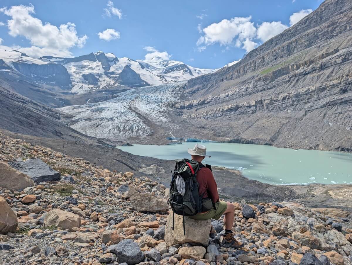
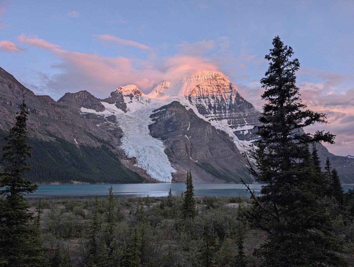
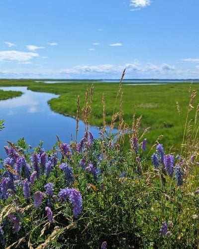
Snowbird Pass is the most popular day hike from Berg Lake and it’s easy to see why. You’ll be treated to views of enormous glaciers, gorgeously lush alpine meadows full of squeaking marmots, BC’s highest mountain and a milky turquoise lake dotted with icebergs.
This is a trail that impresses from beginning to end – it is as much about the journey as the destination. For that reason, you could turn around halfway through and still have an unforgettable experience.
For all these reasons, I rate Snowbird Pass as one of the best day hikes in British Columbia. There are not many other trails that offer such an incredible vantage point over a glacier.
After the Berg Lake Trail was flooded in 2021, Snowbird Pass was closed for years. Finally accessible again, we were so pleased to have the chance to check out the trail for ourselves.
It exceeded even my highest expectations! The experience was made even better by the company with us – Ashlyn (Lost Girl’s Guide to Finding the World) and her partner Aaron.
If Snowbird Pass is also on your hiking bucket list, this post shares everything you need to know (and more).
The breakdown looks like this:
Snowbird Pass Trail
Location: Mount Robson Provincial Park, British Columbia
Distance: 20km return from the Berg Lake Campground
Elevation gain: 870m elevation gain
Hike type: Out and back
Time: 6 to 10 hours
Difficulty: Challenging
Camping: Required to access trailhead
Fees: Only for camping
When to go: July to late September
Dogs: Not permitted
Backcountry necessities
- Always bring the 10 Essentials
- Know how to stay safe in the backcountry
- Remember to Leave No Trace to help keep the wilderness wild
- Understand how to avoid negative bear encounters
- Trying out backpacking for the first time? Read Backpacking 101
- Check out our packing guide with gear recommendations
- Sign up to our newsletter for a free backpacking checklist
Snowbird Pass, British Columbia
The Snowbird Pass hike is situated in Mount Robson Provincial Park, British Columbia, in the Canadian Rockies. This is the traditional territory of the Simpcw First Nation, the Lheidli T’enneh Nation and the Red Bluff Indian Band. The park boundary is less than one hour drive west of Jasper in Alberta.
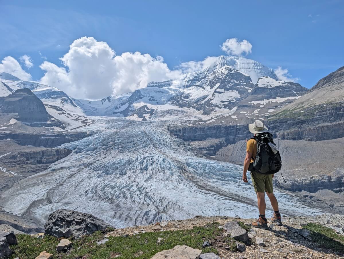
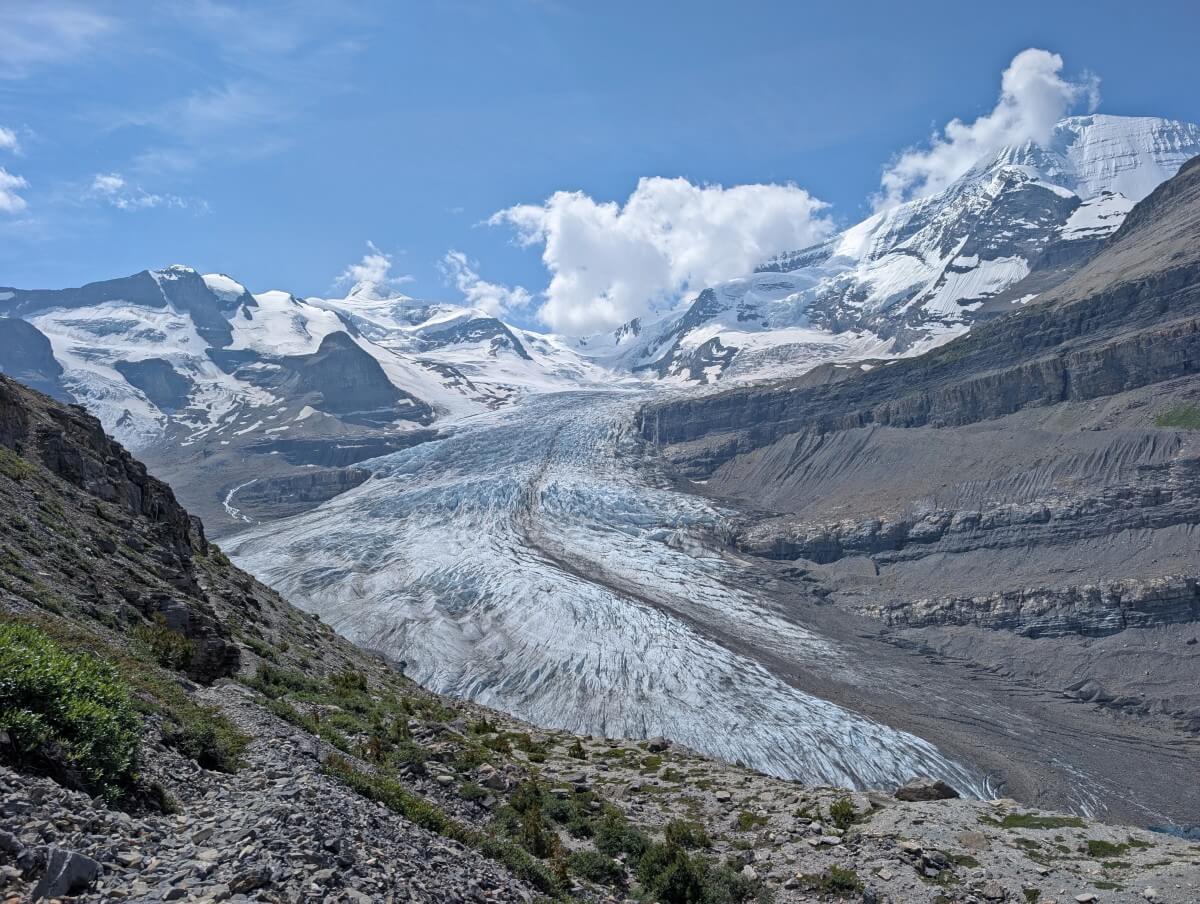
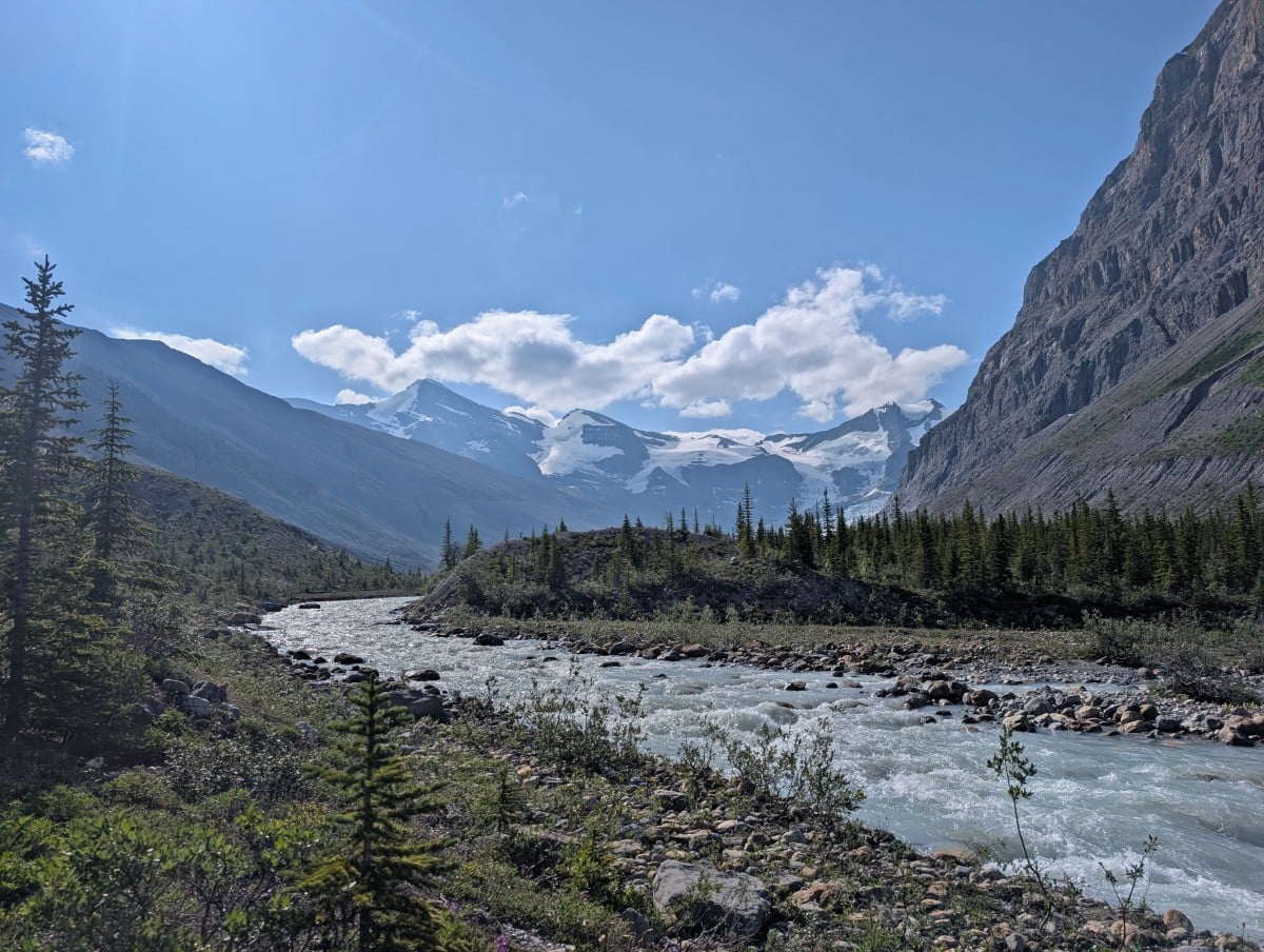
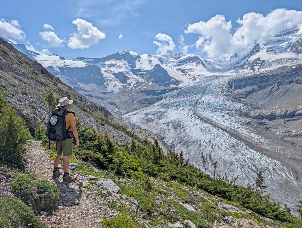
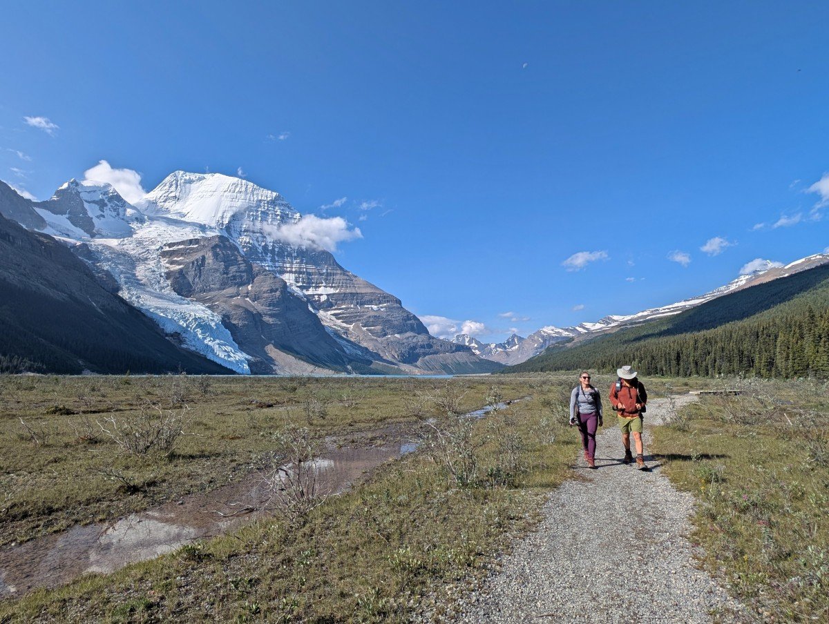
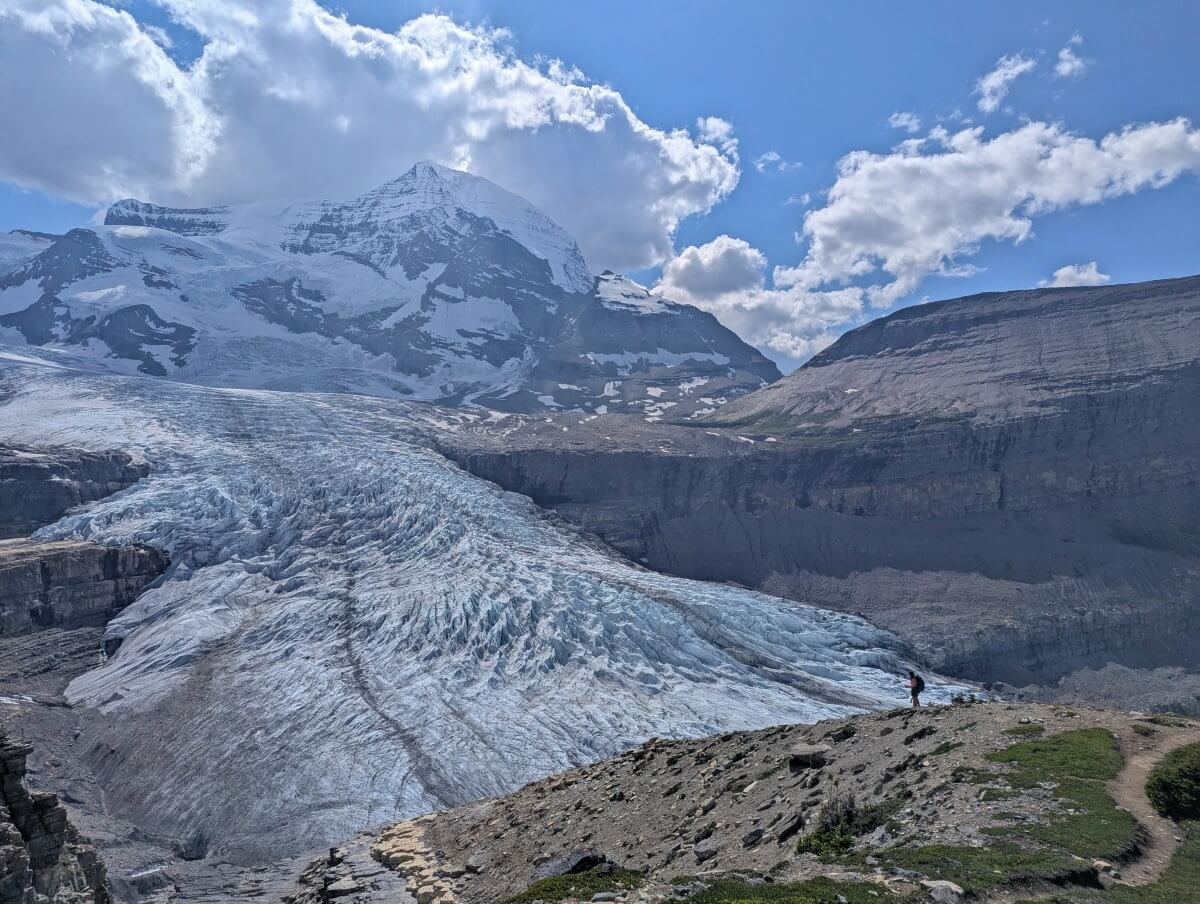
The trail starts in wide Robson Pass, where Berg Lake is located. From there, it follows the river to iceberg-strewn Robson Lake which sits below the spectacular Robson Glacier. The path then ascends up and across the rocky moraine (old glacial deposits), with incredible glacier views.
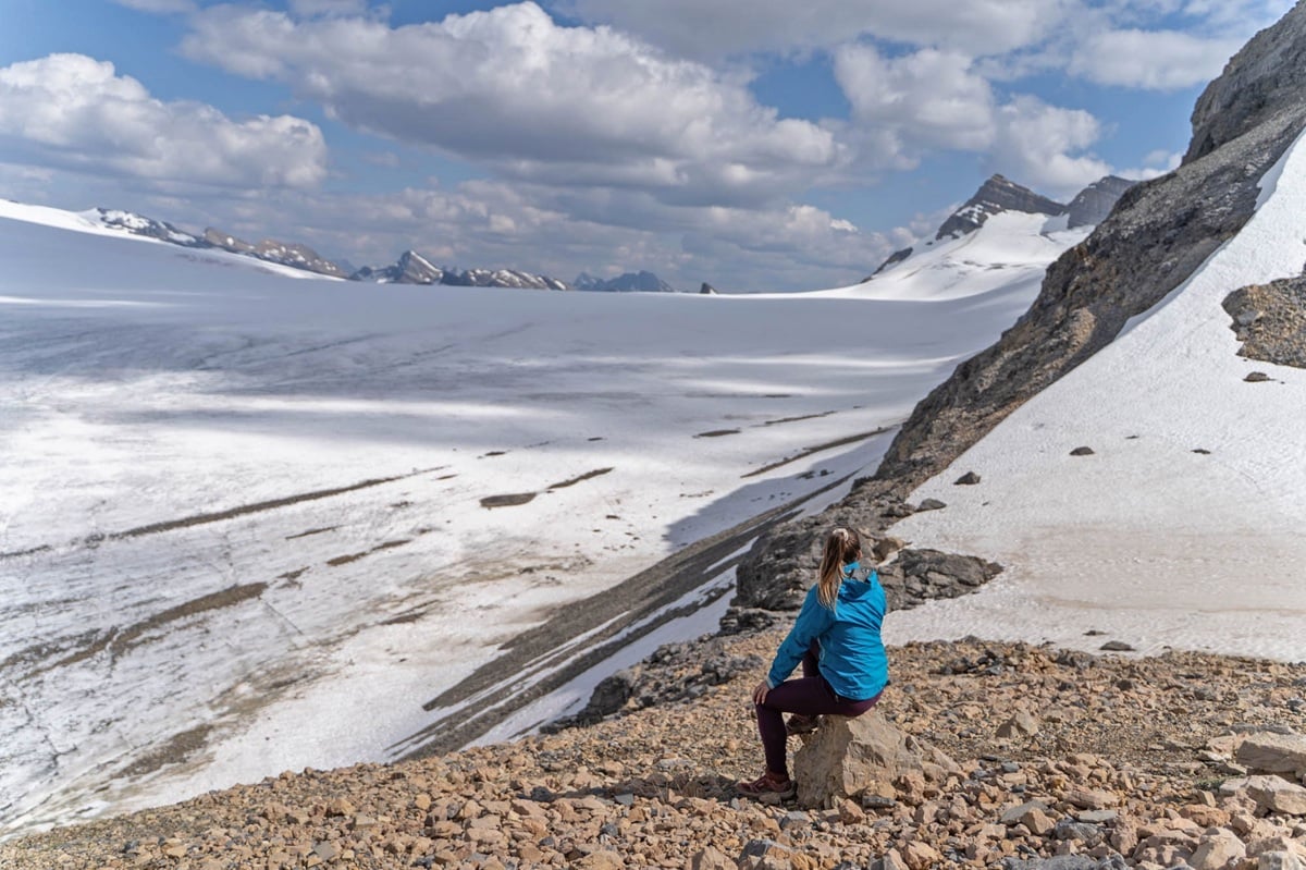
At the top of another climb is Snowbird Pass, a beautiful sub-alpine meadows area leading to a natural low gap between Titkana (2804 m) and Lynx (3192m) peaks. Sweeping views of the expansive Reef Icefield await at the top.
To reach the Snowbird Pass trailhead, you’ll first need to hike the 21km long Berg Lake Trail. So before reading the rest of this post, head to our Berg Lake Trail guide for more information about that.
Most hikers camp in the Berg Lake area for at least two nights and then dedicate one full day to Snowbird Pass. To do this, you’ll need to secure reservations for one of the nearby campgrounds (Berg Lake, Rearguard, Robson Pass or Adolphus Lake).
If possible, I’d suggest camping for three nights in the Berg Lake area. This offers more flexibility in case of bad weather and the chance to explore other day hikes. As I’ll explain in this post, Snowbird Pass isn’t the best trail to explore on a rainy or stormy day.
Timing your trip right is also crucial. Snowbird Pass is closed prior to 1st July to protect local wildlife, specifically caribou during their calving season. Before this time, the upper sections of the trail are usually still snow-covered, so access would be limited anyway.
We hiked Snowbird Pass on a sunny mid July day. The next day, it poured rain all day. But that was OK, since we’d planned three nights at Berg Lake to give us the choice of two days for hiking Snowbird.
Quick facts:
- Need to visit as part of a backpacking trip (no vehicle access to trailhead)
- Closed from 1st May to 1st July each year for caribou calving
- Usually snow free from mid July to late September
- 20km return from the Berg Lake Campground, with 870m elevation gain
- Completely free to hike, reservation required for camping
Snowbird Pass hike experience
The table below displays one-way distances from the official trailhead to different locations along the route. The full length of the trail depends on which campground you start at (more details in the campground section of this guide).
I’ve included these kilometre details in consideration for those who may not want to hike the full route.
If you’re low on energy or time, I’d suggest walking just beyond Robson Lake (around 3-4km return). This section of the trail is mostly flat and offers a good view of Robson Glacier as well as Mount Robson from a different angle. Allow 1 to 2 hours.
The Glacier viewpoint is another great destination. It’s worthwhile to walk another 30 minutes or so beyond it to experience a little of the meadows and try and spot some wildlife. The walk back to the viewpoint, framed by Robson Glacier, is fabulous. Allow 4.5 to 7 hours return.
| Snowbird Pass location | Distance from trailhead |
| Robson Lake | 1.7km |
| Start of steeper section | 2.3km |
| Start of traverse | 4km |
| Glacier viewpoint (start of meadows area) | 5.3km |
| Start of final climb to Reef Icefield | 7.5km |
| End of trail | 8.5km |
Trailhead to moraine traverse
The Snowbird Pass trailhead sits 400m beyond Rearguard Campground on the Berg Lake Trail, marked by a BC Parks signpost.
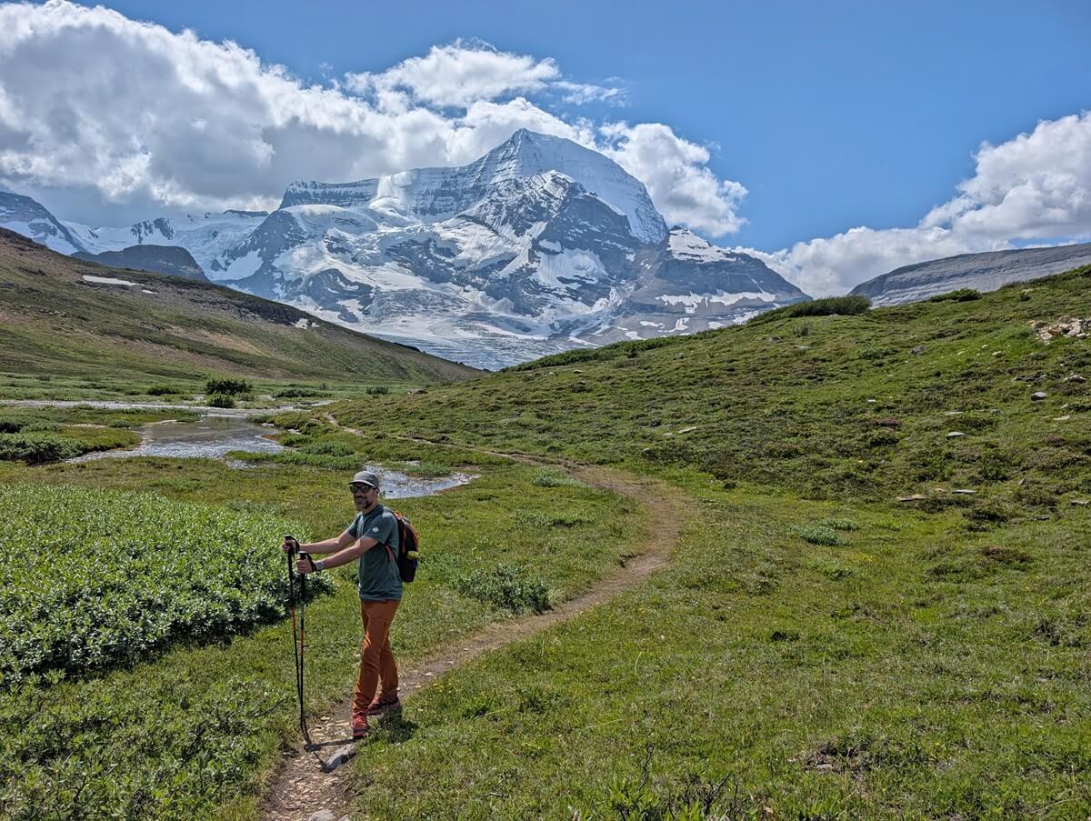
The first section of the trail is almost completely flat as it follows the edge of the Robson River. Look behind you to see Mount Robson.
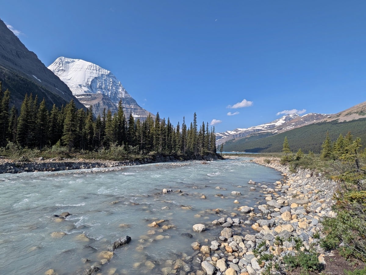
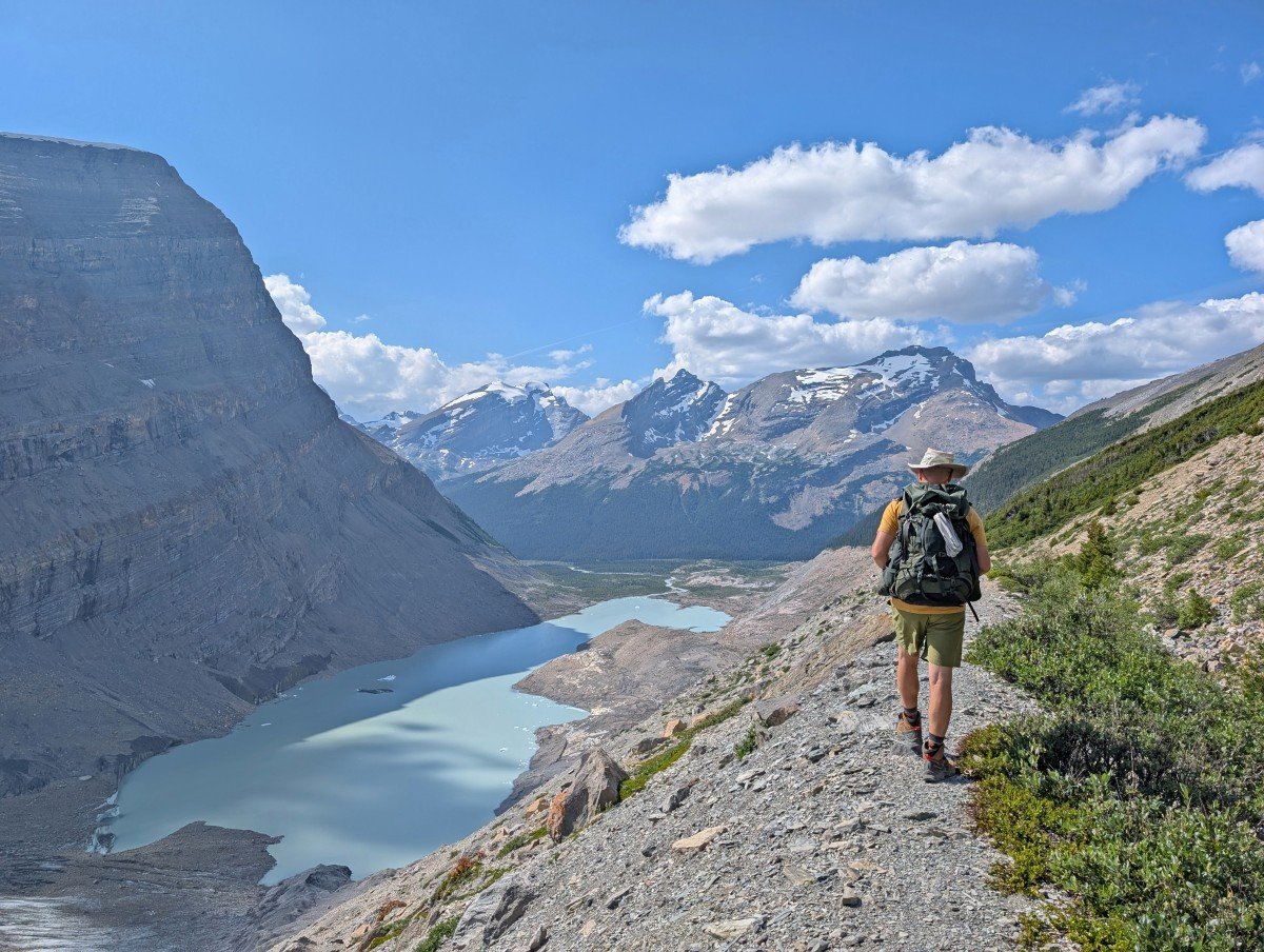
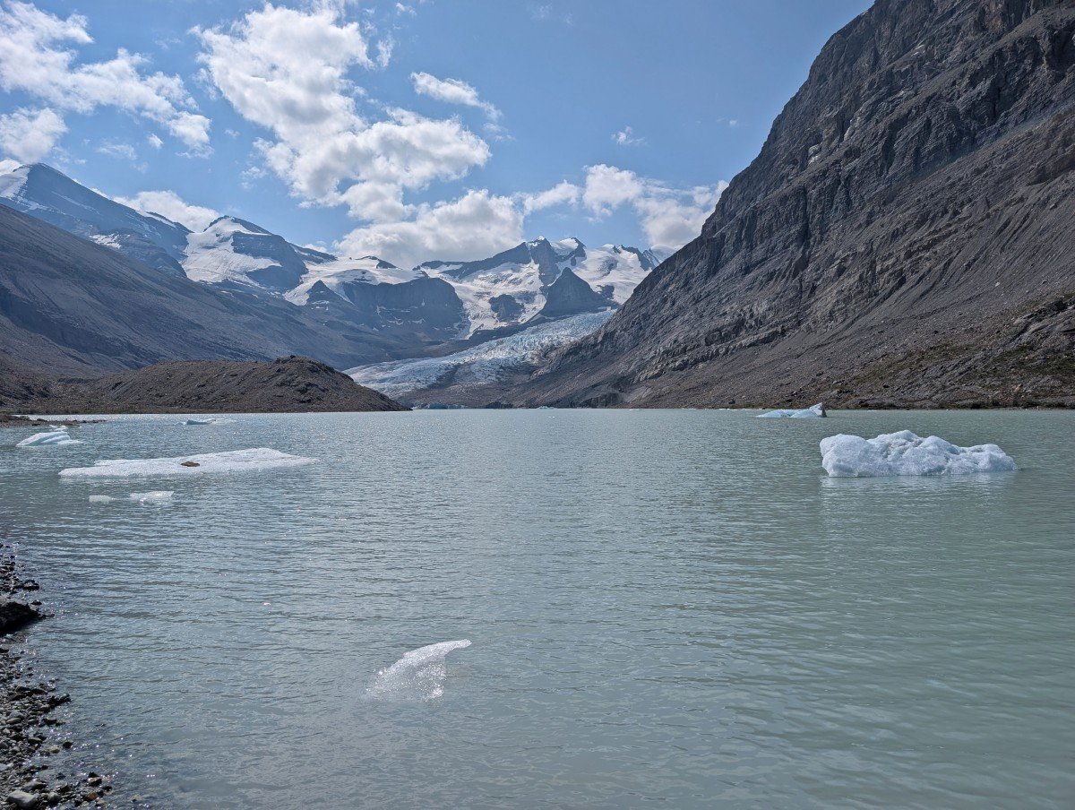
Views of the Robson Glacier and its surrounding snowy mountains start to appear after just 700m. Another kilometre further on and the trail skirts milky coloured Robson Lake, the surface of which is dotted with little icebergs.
There are lots of unofficial trails leading down to the lakeshore – take a dip if you dare! I can confirm that it is absolutely freezing! The rest of our group went in on the way while I waited until we got back.
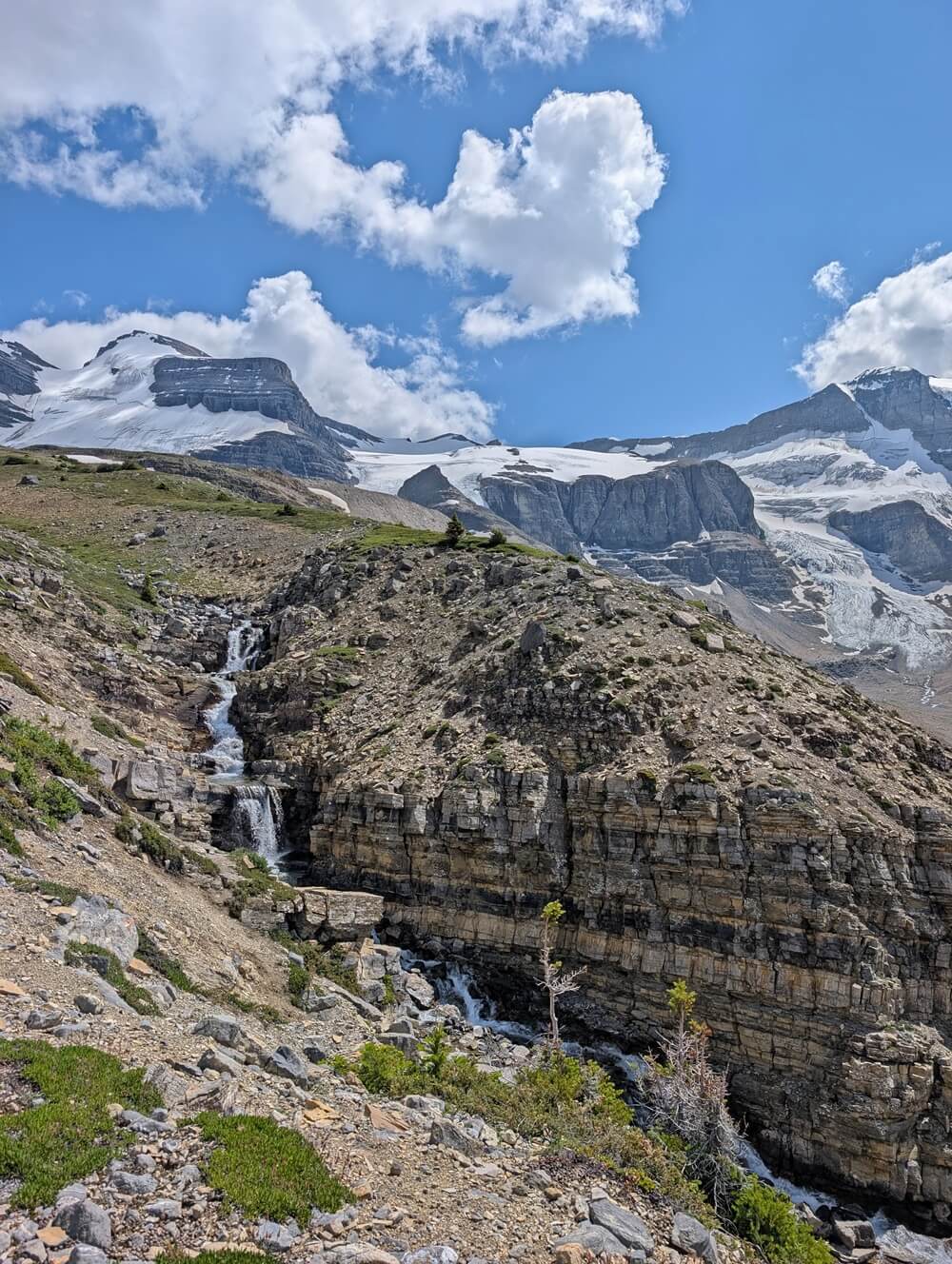
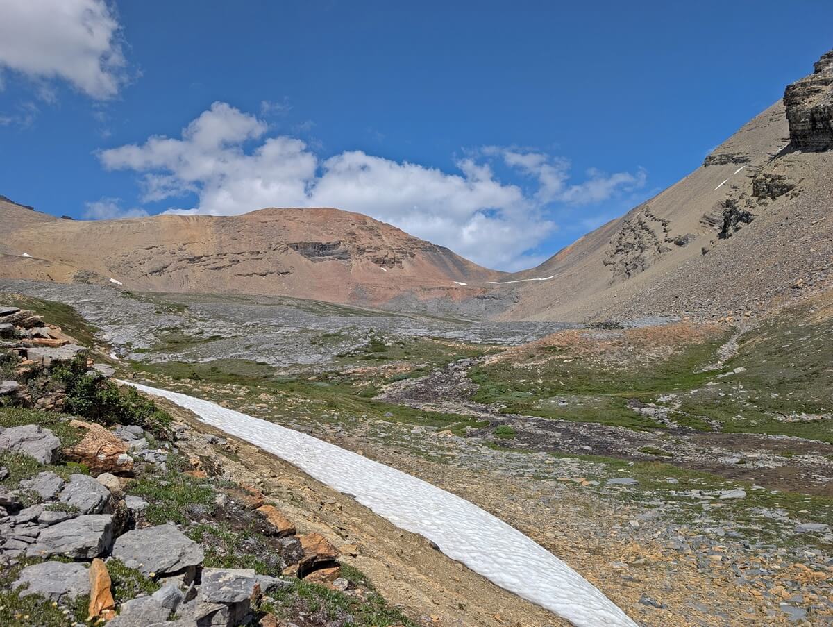
Beyond the lakeshore, the terrain becomes more rocky and the trail less established. There are some small ups and downs. A yellow warning sign marks the beginning of the first steep section (about 300m elevation gain in around 1.7km).
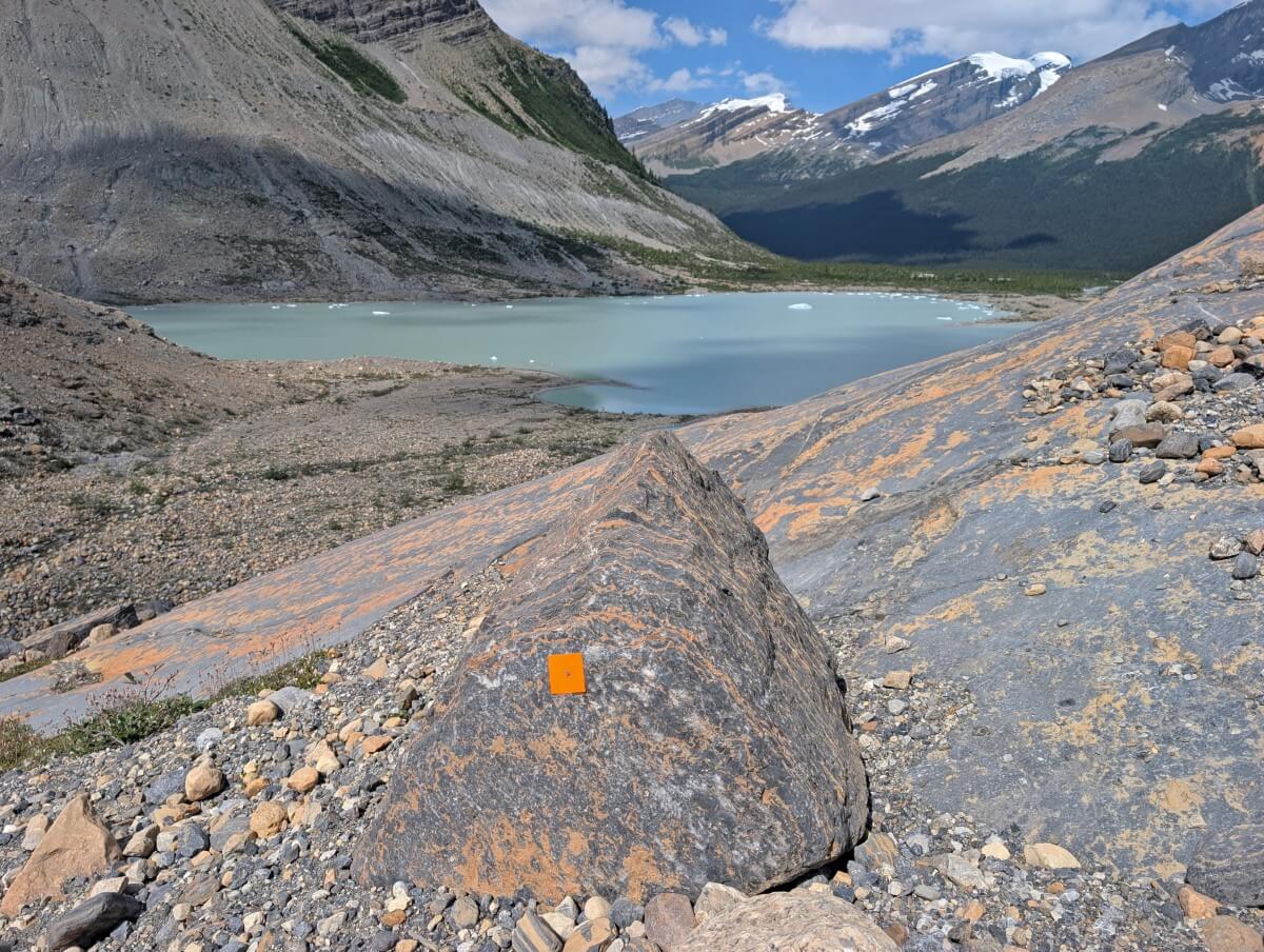
The trail can be hard to see at times as it switchbacks up the slope, with some areas featuring large boulders and others smaller loose rocks. Look for orange diamonds that mark the route.
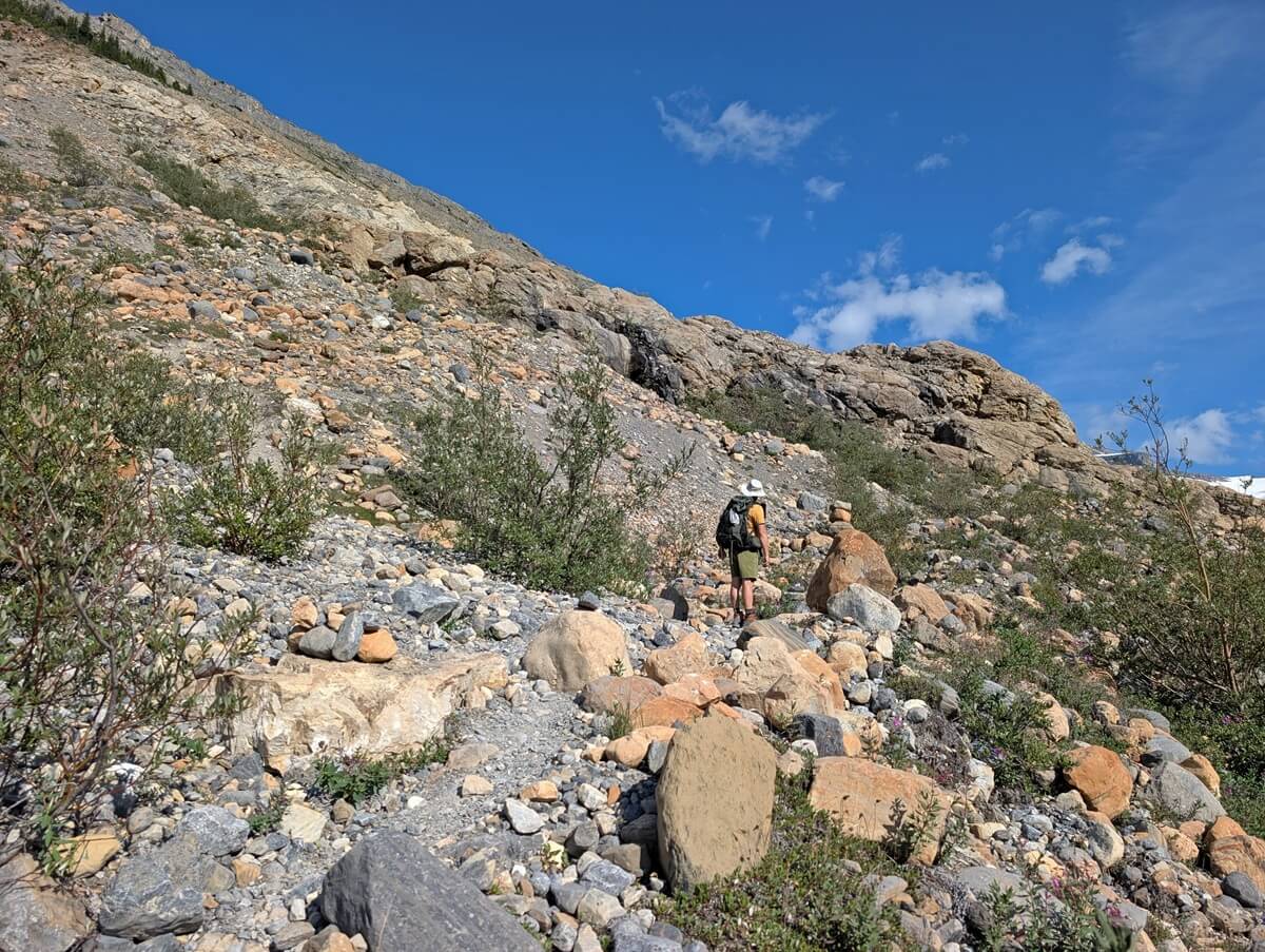
If you need a break from the uphill grind, just stop – the views of Robson Lake and the glacier get better with every step.
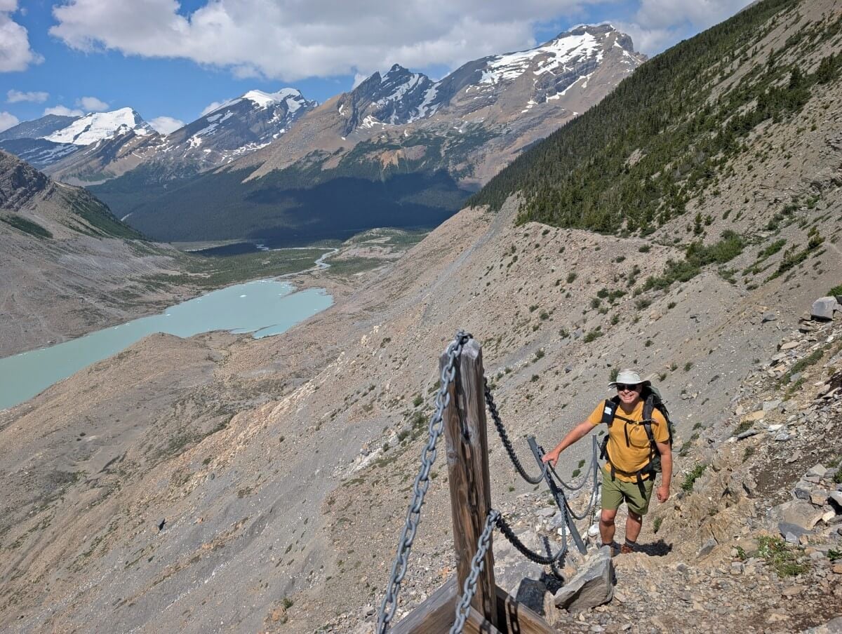
Around the 3km mark, the trail gets narrower. There is a drop-off to one side. Shortly after, there is a short chain fence section along an uphill section with a particularly steep drop-off. While it’s not necessary to use the chain for support, it provides an element of safety.
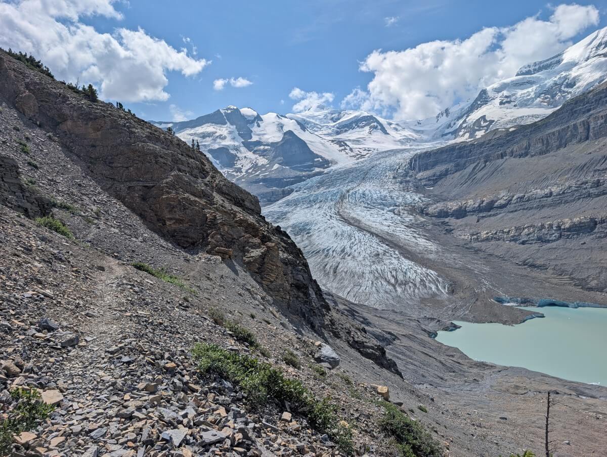
Moraine traverse to Robson Glacier viewpoint (meadows area)
After the chain section, the trail remains narrow but is more level as it emerges onto the top of the moraine (a ridge of glacier-deposited rock and debris).
The views are sweeping and the drop-off a bit less scary. There’s enough space to stop and take a short break if needed.
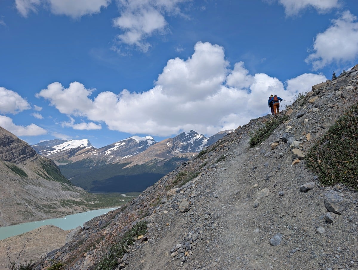
This wonderful section of trail continues for around a kilometre. Another steep section with narrow switchbacks awaits at the end of this stretch (about 80m elevation gain in 300m), providing access to Snowbird Pass’ amazing alpine meadows.
A viewpoint sits at the ‘entrance’ to the meadows, also a very popular lunch spot.
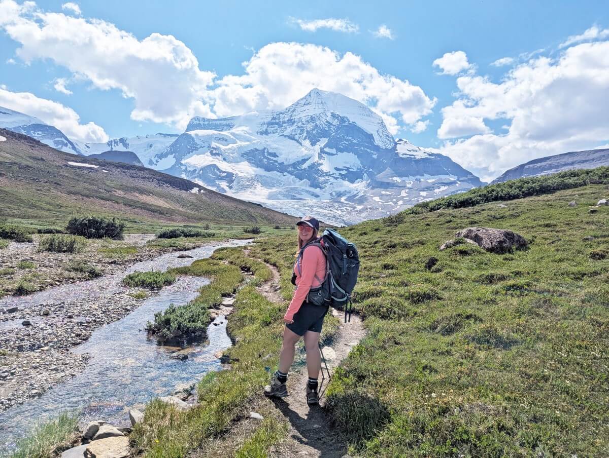
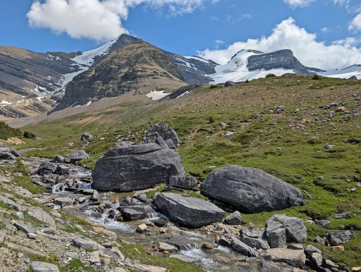
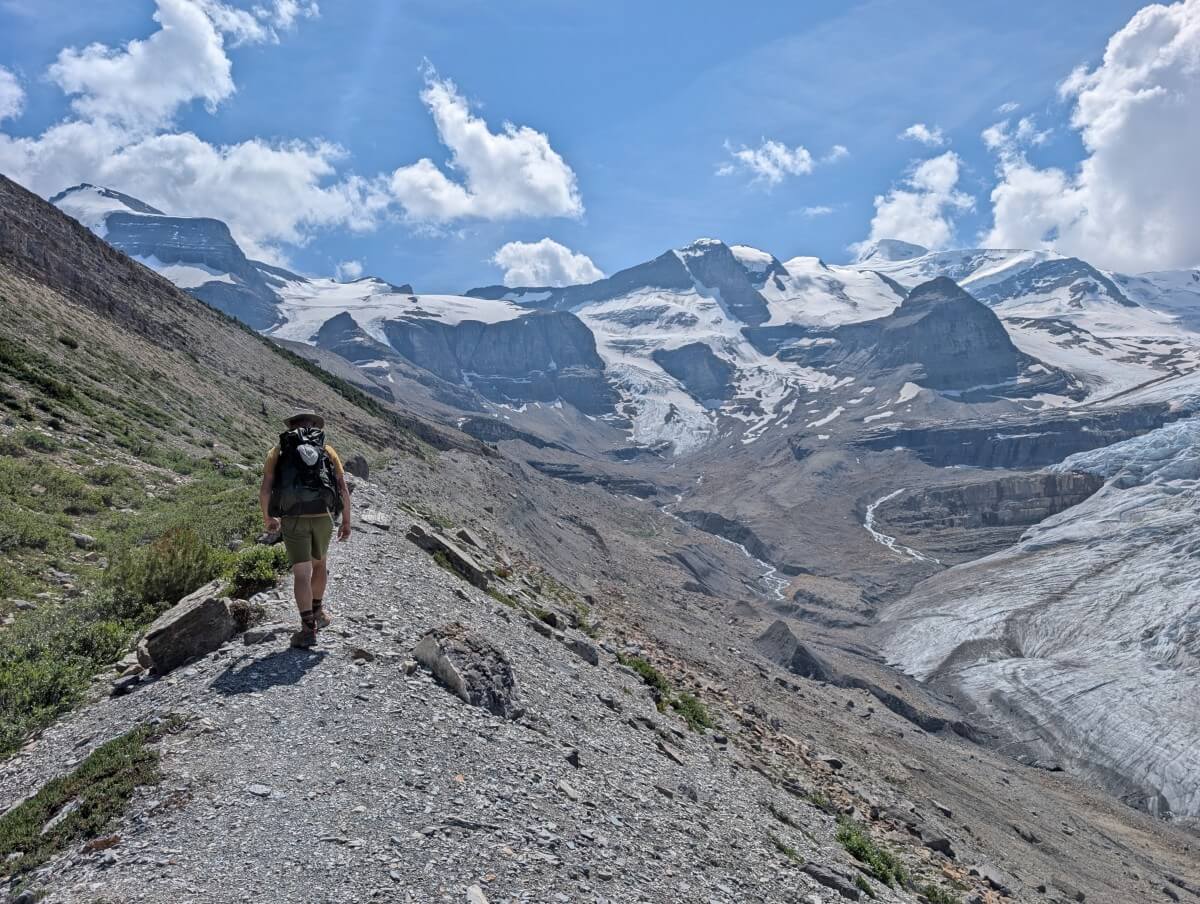
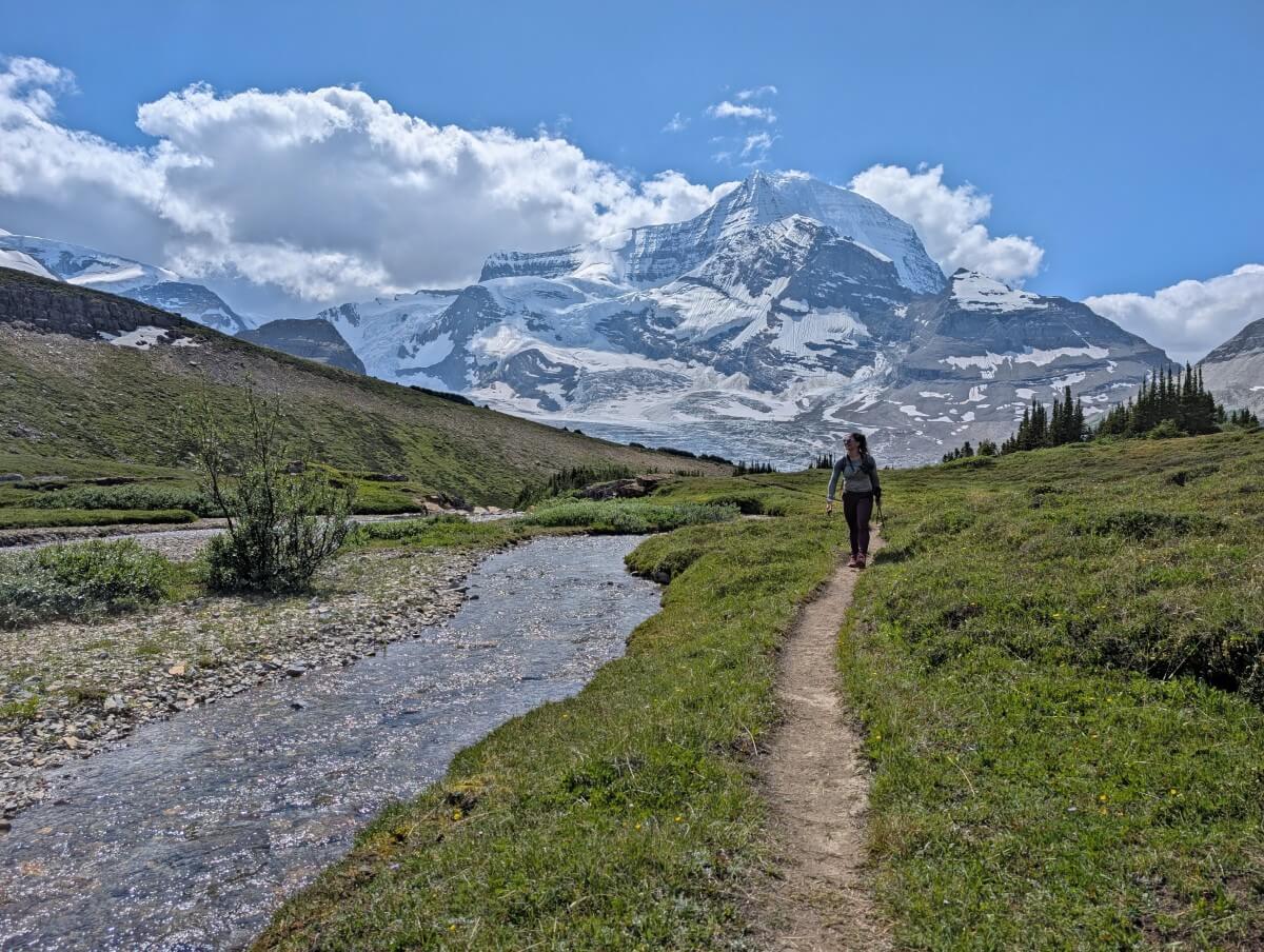
From here, the trail leads away from the spectacular view of Robson Glacier and into the main part of the meadows. The path parallels a fast moving stream with snowy mountains in every direction.
The first stretch of the meadows has a gentle incline, with more ups and downs as it continues. Look for marmots feasting on foliage and mountain goats on the surrounding cliffs.
Just over a kilometre from the main viewpoint, the path winds up a small ridge. At the top, you can finally see Snowbird Pass’ saddle between two mountains. The final approach features almost 300m elevation gain in 1.7km.
The end of the trail reveals a stunning view across the immense Reef Icefield. It stretches endlessly into the distance. Some hikers walk further along the ridge. The return journey is along the same route, with Robson Glacier as an incredible backdrop on the way back through the meadows.
Snowbird Pass hiking guide
Keep reading to discover everything you need to plan your Snowbird Pass hike, from camping details and navigational information to safety tips and essential items.
Location and trailhead
As mentioned, the Snowbird Pass hike is situated in Mount Robson Provincial Park. The trailhead is located almost halfway between the Rearguard and Robson Pass campgrounds on the Berg Lake Trail.
To get to the trailhead, you’ll need to hike the Berg Lake Trail and then camp overnight (unless you have the funds for a helicopter drop-off).
Snowbird Pass is a full day hike so you’ll need to camp the night after too. For that reason, a two or three night campground/hut reservation is ideal.
The Berg Lake Trail starts near Highway 16 in British Columbia. The closest community with services (food, hotels, gas) is Valemount, about 30 minutes drive south. Jasper, Alberta, is one hour to the east.
Fees and permits
Snowbird Pass is completely free to hike – no permit, day pass or reservation required. There are no parking fees either.
A valid backcountry camping permit is required to stay at any of the campgrounds close to the Snowbird Pass trailhead.
- Rearguard, Robson Pass, Berg Lake and Marmot are located in Mount Robson Provincial Park and are adminstered by BC Parks.
- Camping fees are $10/per person/per night. The reservation fee is $6/night for the first three nights (so up to $18 total) in one booking.
- A reservation guarantees a spot in the campground though all tent pads work on a first come, first serve system
- From 2026, non-BC residents will be charged an additional $20 per stay, per camping group, at provincial campgrounds.
- For more information on BC Parks campground reservations, head to our Berg Lake Trail guide. Reservations usually open in late autumn, the year prior (so December 2025 for summer 2026).
- Adolphus Lake is located in Jasper National Park and is operated by Parks Canada
- Camping fees are $15/per person/per night. The reservation fee is $11.50 per booking. Again, a reservation guarantees a spot in the campground though all tent pads work on a first come, first serve system
- If you stay at Adolphus, a Parks Pass is also required (like an admission fee). It is $12.25/person/day. This fee is waived in 2026 from 19th June to 7th September as part of the Canada Strong program
- Parks Canada reservations launch in January each year. The starting trailhead is ‘Mount Robson (out of park).’
If you don’t manage to secure a reservation for any of these campgrounds, keep an eye out for cancellations or let an automated service like CampNab do the work for you. It’s amazing how often people cancel, particularly when the forecast isn’t sunny.
Another option is the ACC Robson Pass Hut. Reservations open in late winter (2nd March for 2026) and the member fee is $50/per person/per night.
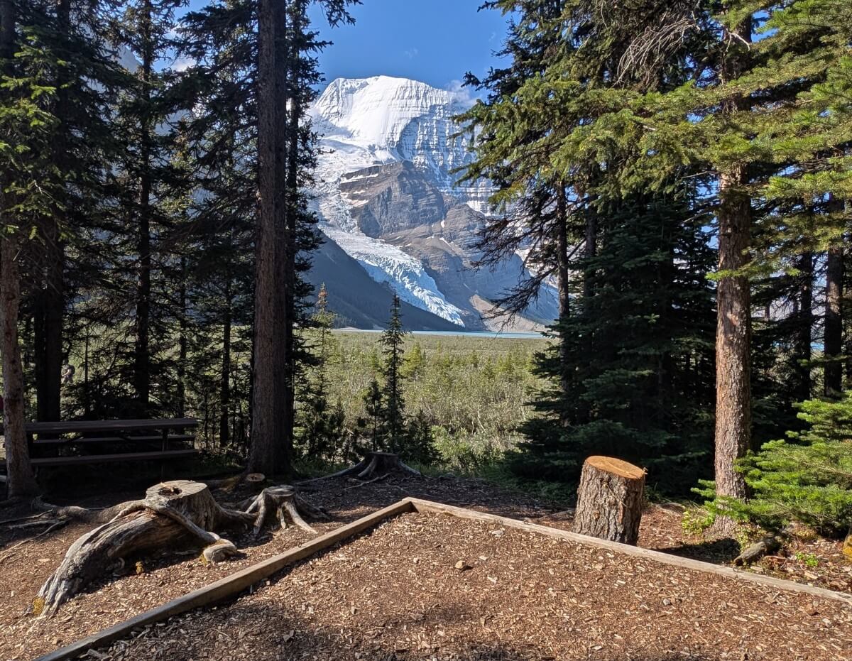
Campgrounds
There are five campgrounds (and a hut) near the Snowbird Pass trailhead:
- Rearguard (closest) – 400m away, 6 sites
- Robson Pass – 500m, 15 sites
- ACC Robson Pass hut – 900m, 12 person capacity
- Berg Lake – 1.3km, 26 sites
- Adolphus Lake (Jasper National Park) – about 2km, 5 sites
- Marmot – 3.3km, 7 sites
The terrain around Berg Lake is pretty flat so while some of these distances sound long, keep in mind that hiking the extra distance isn’t as bad as it may seem. Having said that, don’t underestimate how how tiring those last few kilometres will be on the way back to Marmot after a 20km+ day!
My preferred campgrounds for the Snowbird Pass hike are therefore Robson Pass (scenic, small) and Berg Lake (large, best facilities, access to the lake). Rearguard Campground also works well. Marmot is a little far for Snowbird but still works if there is no other option.
While we did visit Adolphus Lake, we didn’t explore the actual campground. It’s definitely a less popular option than the BC Parks campgrounds, but that is probably because not many people know about it. The trail from the lake to the trailhead is very flat.
Difficulty and navigation
Snowbird Pass is a popular trail while camping in the Berg Lake area. It is usually visited by around 30 to 60 people on sunny days in July and August, slightly more if a helicopter does a drop-off.
So while you’re likely to see some other hikers, there won’t be crowds of people.
The trail is therefore established and well used. In many places, however, it is pretty narrow and harder to find in rockier areas.
Be careful to pay attention during those sections – look out for the orange navigational markers that are attached to rocks (see photo below).
There are only a few signs along the route, including one at the trailhead on the Berg Lake Trail. We used Organic Maps to check our location and how much distance was left. I would recommend using a navigational app to help stay on track.
With the length, terrain and elevation gain in mind, Snowbird Pass is a difficult/challenging trail. This is particularly true if you are feeling tired after hiking to Berg Lake the day before.
There are plenty of steep switchbacks, loose rocks, narrow paths with drop-offs and a short chain section as well. Beyond the first few kilometres, most of the route is uphill.

The difficulty increases if the weather is wet, windy or stormy. This trail is very exposed to weather, with zero tree cover. The rocky areas demand some attention and would be slippery in the rain.
If you don’t like heights, I would take extra time to consider whether this trail is for you. I’m not super comfortable with sheer drop-offs and was fine on the way up. I didn’t look around much on the steeper sections on the way back.
Essential items and safety tips
- There is no phone signal anywhere in this area. We carried an Inreach satellite device for emergencies
- Weather can change quickly in the mountains. Check the predicted weather on Mountain Forecast but be prepared for all conditions. Bring a waterproof jacket, warm layers and sunscreen
- Bring the 10 Essentials with you. This is a long day hike in mountainous terrain. These items may help a small inconvenience from turning into a more urgent situation
- Hiking poles are helpful to have. There are some steep descents on this trail and poles can help reduce the impact on your knees. We used Black Diamond’s Carbon Zs, which are super light and also pack down easily
- Expect to see some wildlife. We spotted mountain goats and marmots. Give wildlife space and Leave No Trace (take all your trash with you)
- There is the opportunity to collect water in the meadows but use a purification device to ensure that it is safe to drink
- Don’t get summit fever. Snowbird Pass is a beautiful trail – you don’t need to get all the way to the end to enjoy the experience! The meadows area is a great turnaround point
For more recommended items, head to our Berg Lake Trail packing guide!
Other posts you may find helpful
Canadian Rockies Road Trip Loop: Detailed 9 to 12 Day Itineraries
The Best Things to Do And See in Wells Gray Provincial Park, BC
Ultimate 2 Week Western Canada Road Trip from Vancouver
The Best Things to Do in Yoho National Park, BC


One half of the Canadian/British couple behind Off Track Travel, Gemma is happiest when hiking on the trail or planning the next big travel adventure. JR and Gemma are currently based in the beautiful Okanagan Valley, British Columbia, Canada. Consider buying us a coffee if you have find any of our guides helpful!