
The Long Range Traverse is Gros Morne National Park’s premier backpacking experience, but it’s far from a typical hiking trail. In fact, it’s not a trail at all, but rather a rugged route across the beautiful yet unforgiving Long Range plateau.
There is no marked or maintained path, making navigation a key part of the experience. There are other challenges too, such as river crossings, blackflies, slippery terrain and steep ascents.
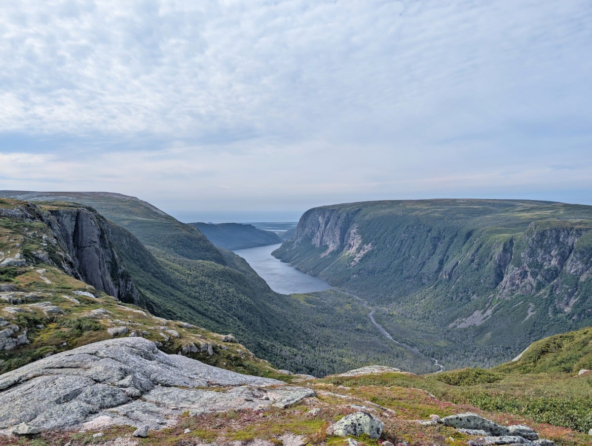
That said, for experienced backpackers who are comfortable navigating off-trail and dealing with unpredictable weather conditions, the Long Range Traverse offers a chance to explore one of the wildest parts of Gros Morne National Park.
The Long Range Traverse certainly tested us when we hiked it in mid September. All of the wrong turns, wet feet, mud and rain were worth it for the chance to experience the incredible solitude and raw beauty of this special place.
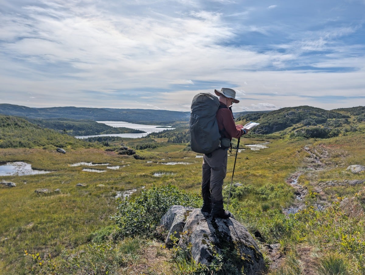
This super comprehensive guide will help you prepare to hike the Long Range Traverse, including information about what to expect on the route, campsites, suggested itineraries, recommended gear and more.
In partnership with Go Western Newfoundland and Parks Canada. There are some affiliate links ahead – if you make a purchase via one of these, we may receive a percentage of the sale.
Backcountry necessities
- Always bring the 10 Essentials
- Know how to stay safe in the backcountry
- Remember to Leave No Trace to help keep the wilderness wild
- Understand how to avoid negative bear encounters
- Check out our packing guide with gear recommendations
- Sign up to our newsletter for a free backpacking checklist
Introducing the Long Range Traverse
The Long Range Traverse (LRT) is located in Gros Morne National Park, Newfoundland, Canada.
This 36km long backpacking adventure starts on the edge of a freshwater (landlocked) fjord, climbs up onto the Long Range Mountains, crosses the remote Long Range plateau and then ends at the base of Gros Morne Mountain.
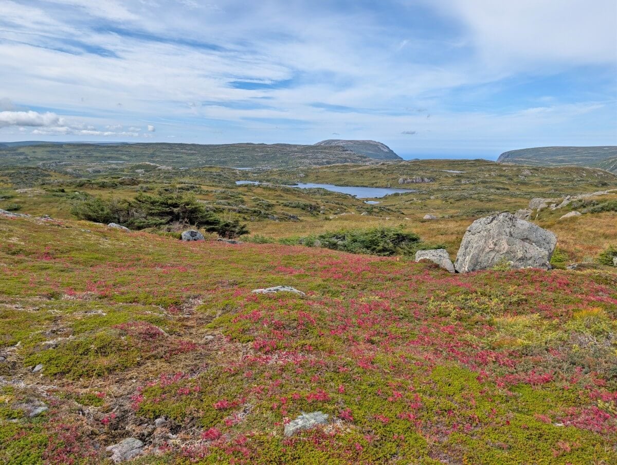
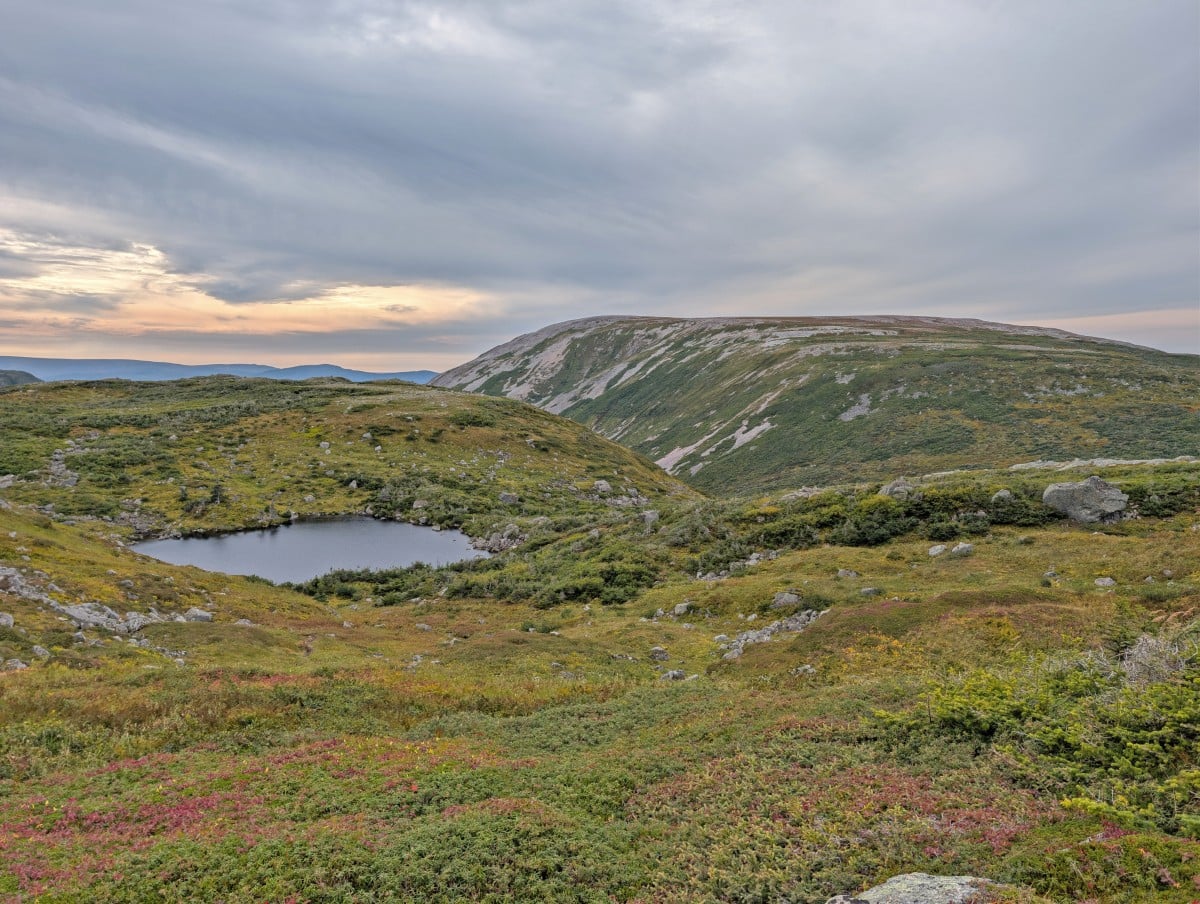
Along the way, the route passes through varied terrain of bog, barren barrens, rock slabs, tuckamore (stunted alpine trees), ponds and steep valleys.
This landscape was shaped by millions of years of tectonic plate shifting and glacial erosion, an aspect that makes Gros Morne National Park so geologically significant.
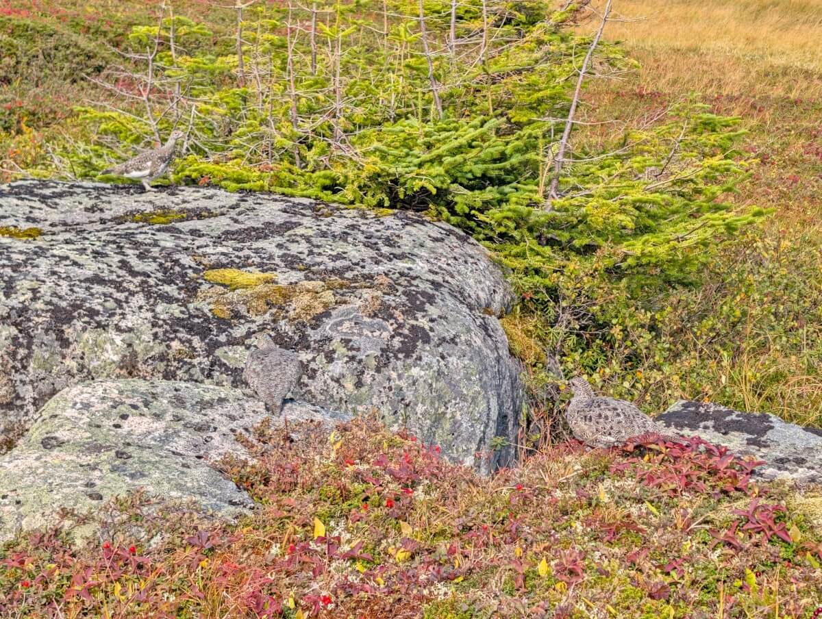
The route is also home to a variety of wildlife. Moose, caribou and rock ptarmigan can all be spotted on the Long Range plateau, though sightings are never guaranteed. We managed to see two out of three on our recent hike.
Quick facts
- 36km officially, but expect to hike closer to 45km
- Around 1,700m/1,800m elevation gain
- 3 to 5 day backpacking trip
- Rated difficult due to route, length, elevation gain, weather, terrain, river crossings
- Open from late June to late September
- Best time to go is late July to early September
- Campground reservations open in early February each year
- Dogs are not permitted
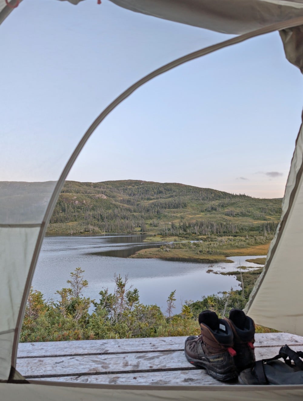
Our experience
We hiked the Long Range Traverse in mid September 2026. There were some incredible moments, along with a few challenges we hadn’t quite anticipated.
The scenery was glorious, the solitude incredible and the overall experience was unlike any other hike we’ve done. We saw only three other LRT hikers in 3.5 days.
Approaching our Long Range Traverse hike, we were most concerned about the navigation aspect. While we had some off-trail hiking experience, it’s not something we do all the time. The weather was another consideration, as September can be unpredictable.
As for the terrain, we figured it would be a mix of mountain and coastal hiking, both of which we had plenty of experience with. So we were less worried about that. In the end, the weather had the biggest impact on our Long Range Traverse experience, affecting both the terrain and navigation.
Click here to skip ahead to the hiking guide.
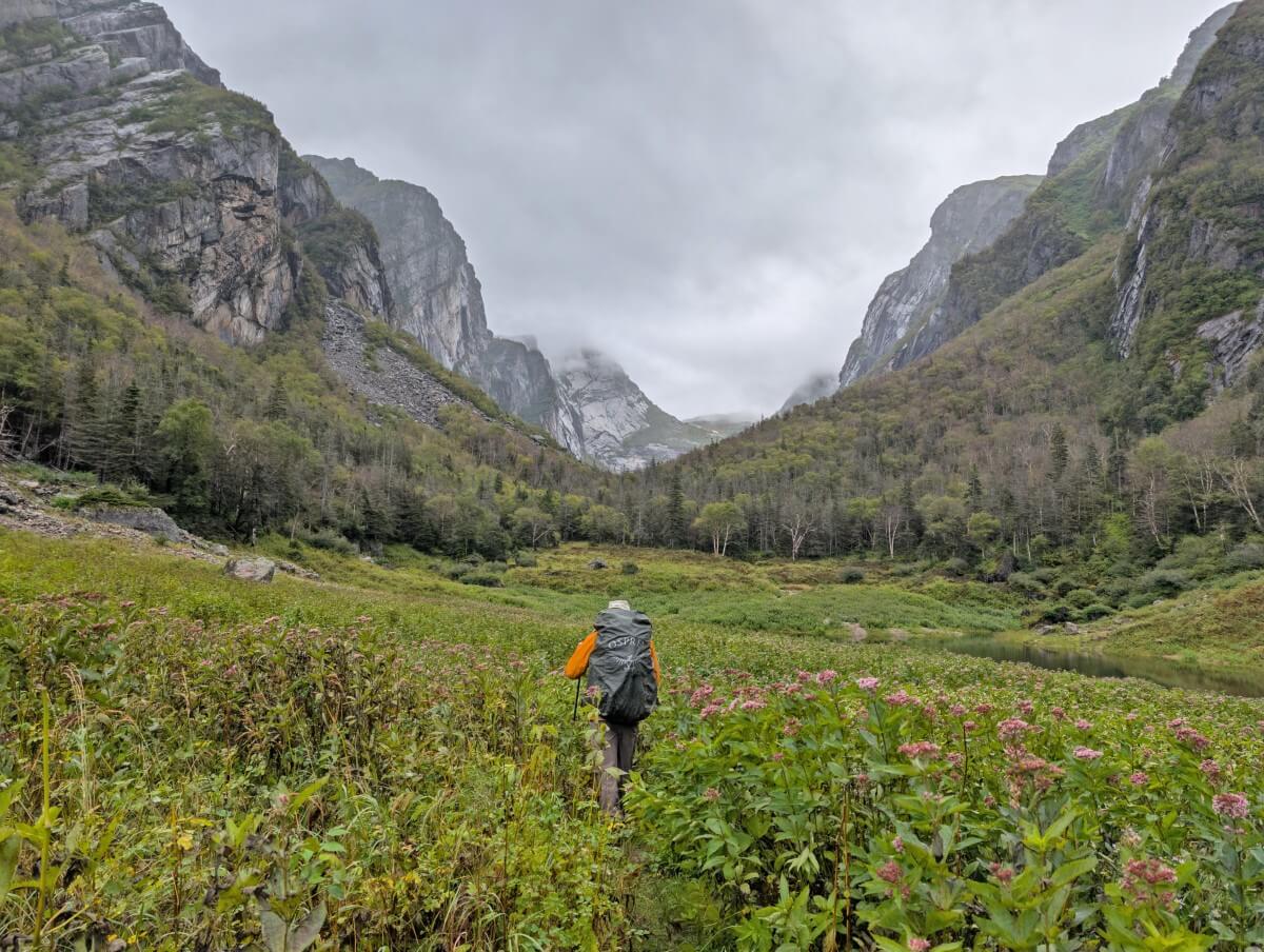
Western Brook Pond to the top of the gorge
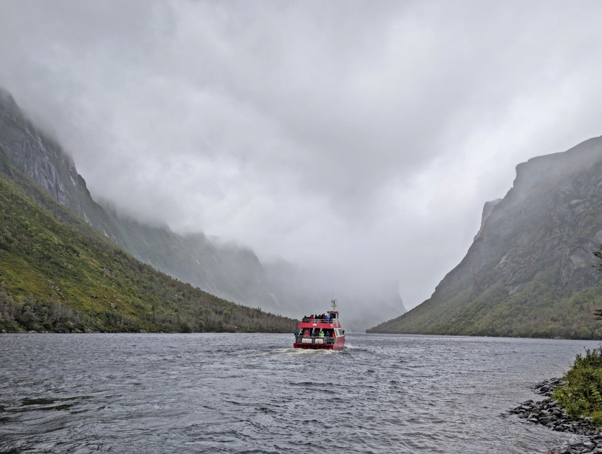
It rained heavily for over 12 hours before we arrived at Western Brook Pond. It was still raining and blowing a gale as we boarded the boat. We could see nothing. The steep granite walls of the freshwater fjord started to peek out of the clouds as our boat travelled towards the gorge but it wasn’t looking promising.
We were dropped off at the dock at the edge of the gorge, alone, while the rest of the boat tour guests waved goodbye, most of them exceptionally relieved they weren’t joining us.
The first section of the route was extraordinary – a wide meadow, lined by tall granite cliffs, some with waterfalls cascading for hundreds of metres. 1.5km in and we reached the brook that travels through the gorge.
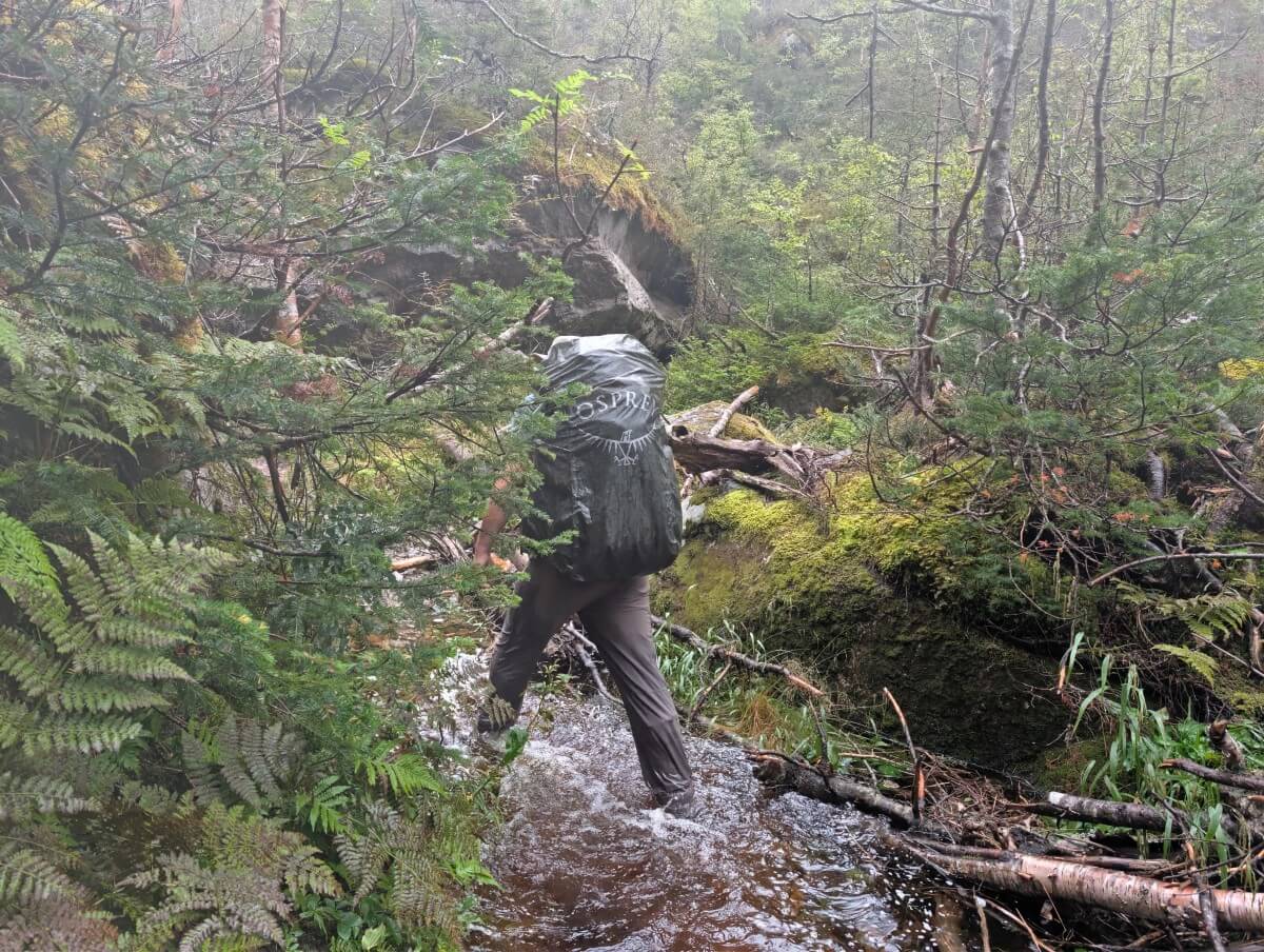
The water was running very high, almost to my knee. I know this because we had to walk through it almost a dozen times while trying to find the route. We saw very little evidence of past hikers, presumably due to all of the recent rain.
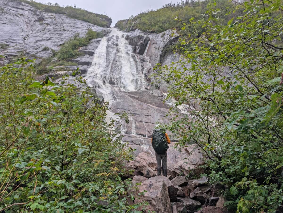
After eating snacks in a cave, we were relieved to soon reach the waterfall marking the start of the ascent to the top of the gorge. And what a climb it was: huge rocks, thick vegetation and water streaming down between it all.
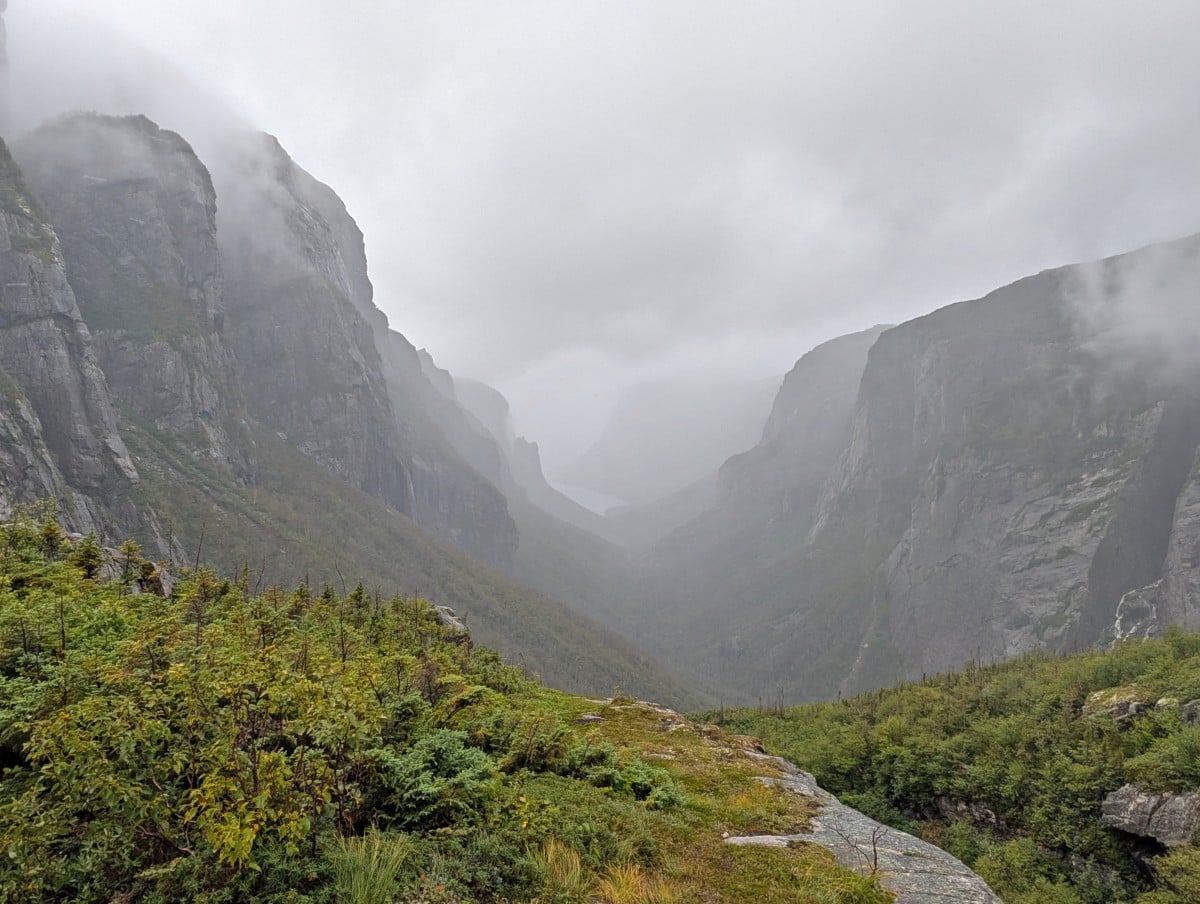
The rain became torrential again just as we reached the first rock slab, with no shelter anywhere in sight. We managed to take a few misty photos of the iconic gorge view, then had to figure out how to reach the larger rock slab via a couple more deep river crossings.
Top of the gorge to Marks Pond
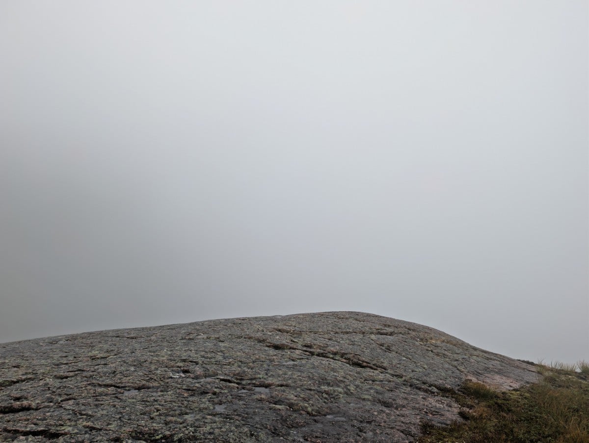
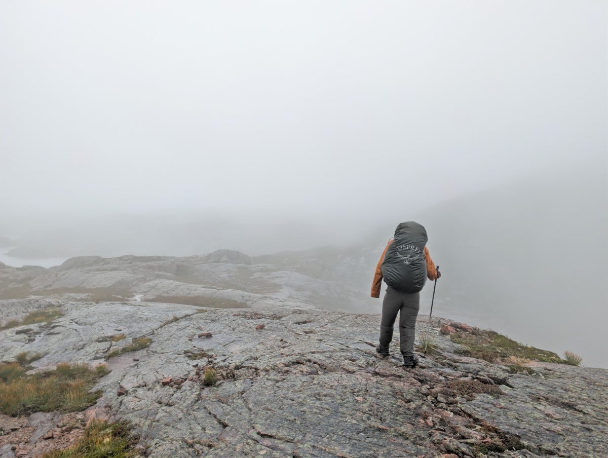
At the top of the gorge, we were met with nothing but fog. After tackling some of the hardest kilometres we’ve ever hiked, it felt pretty devastating to have no views to show for it. But our day wasn’t over – we still had to find our camping spot for the night.
With the fog, that proved a little difficult since we couldn’t see very far ahead. We took more than a few wrong turns before finally reaching the campsite, very cold and completely soaked through.
We woke up to find the rain and wind still going strong. And then it got worse – JR turned on our portable battery to charge his phone and found it completely empty.
So in addition to wet shoes, wet hiking pants and general dampness, we now had just 50% battery on one phone and 70% on the other. Less than ideal on a unmarked hiking route where we wanted to use our phones for navigation alongside the topographic map.
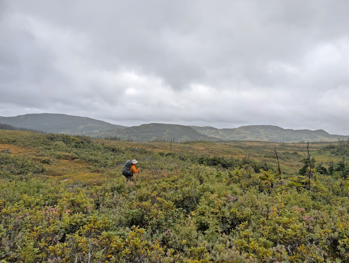
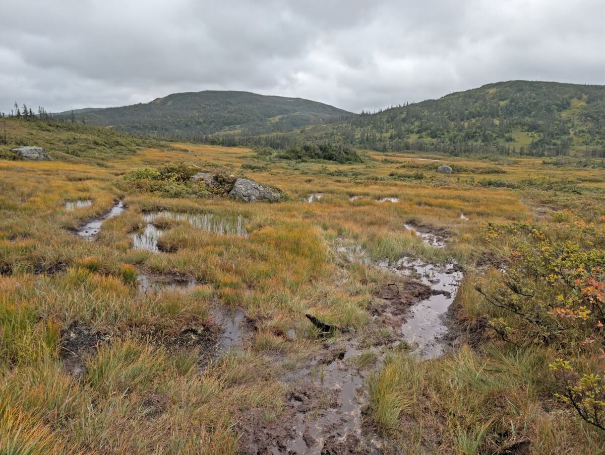
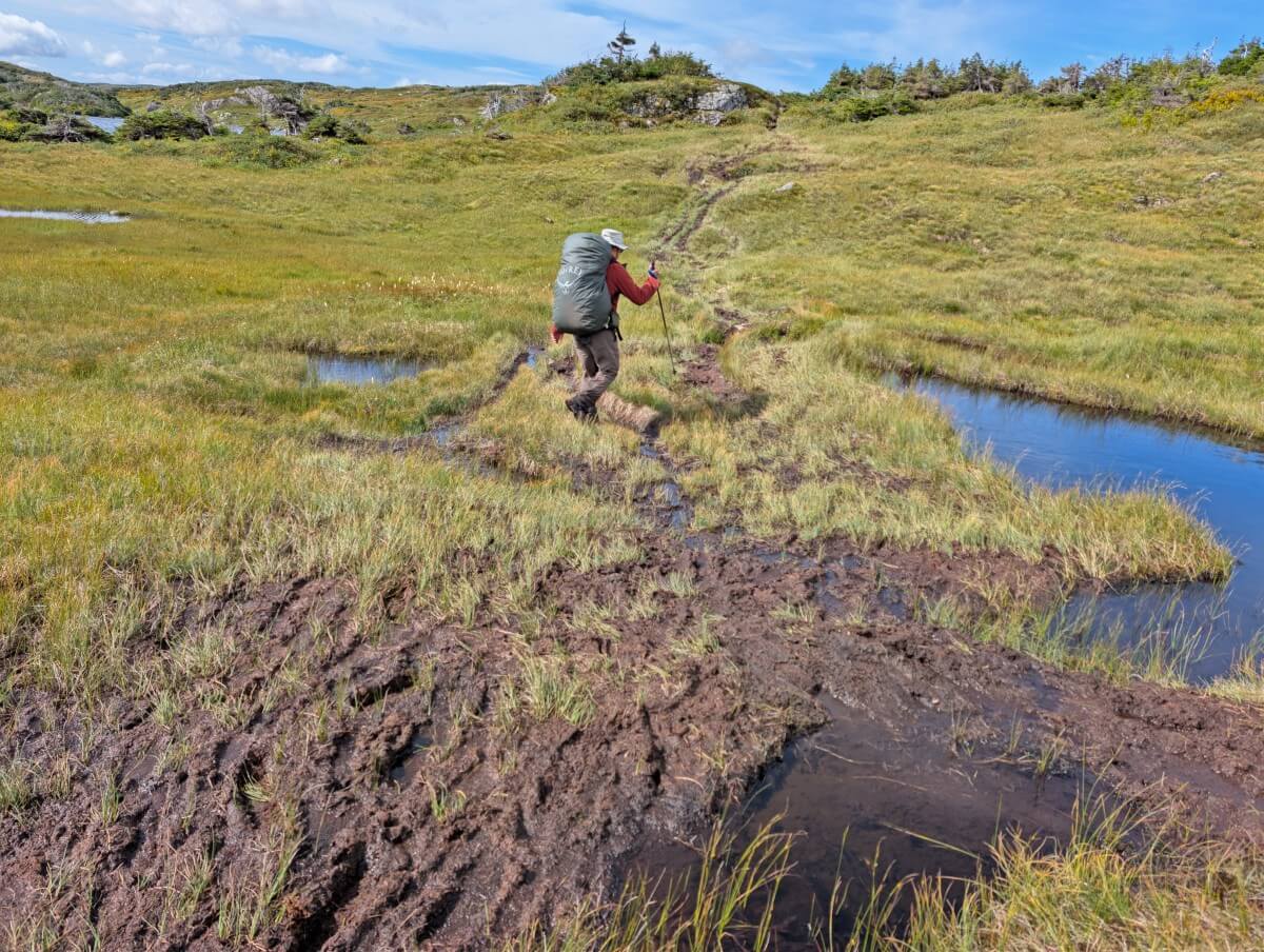
The route started with a mix of mud and dirt, gradually transitioning to grassy bog. We squelched our way through the terrain, using extra energy to lift our feet out of pools of water and mud with every step.
Some of the latter turned out to be surprisingly deep. On one occasion, I stepped into a hole and sank all the way to my hip. JR had to help pull me back out, luckily without losing my shoe in the process.
Marks Pond to Ten Mile Pond
The rain finally stopped before we reached Marks Pond. By the time we sat down for lunch, the sun had even come out. And that’s when everything changed.
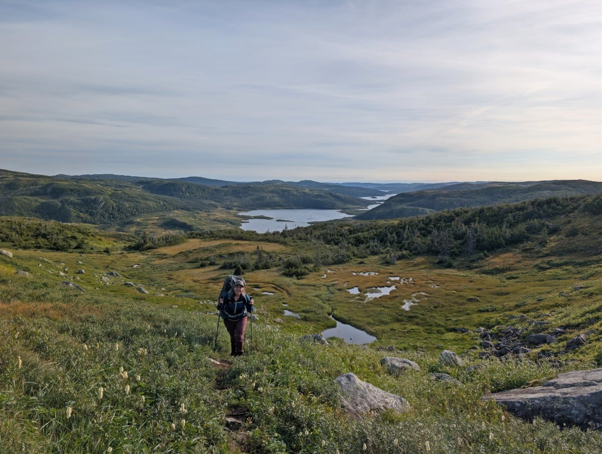
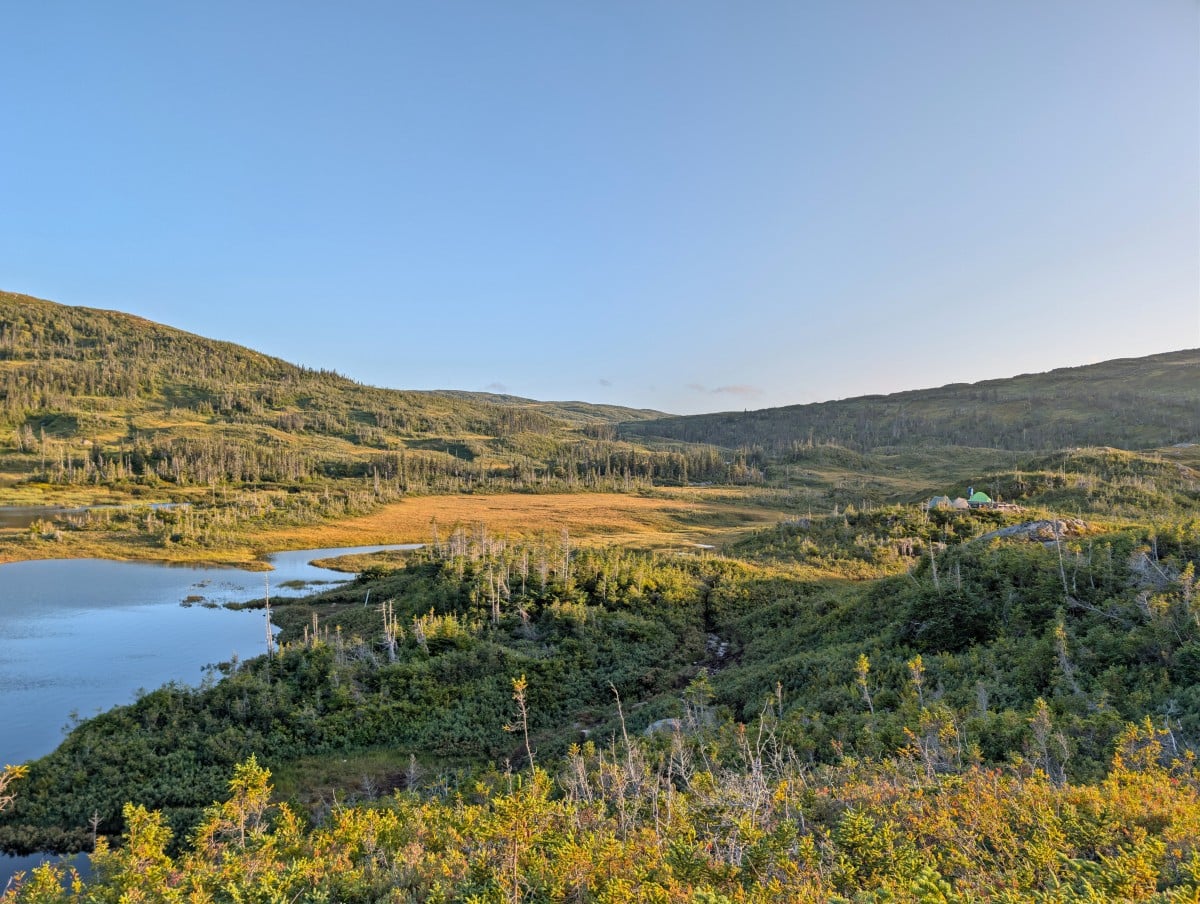
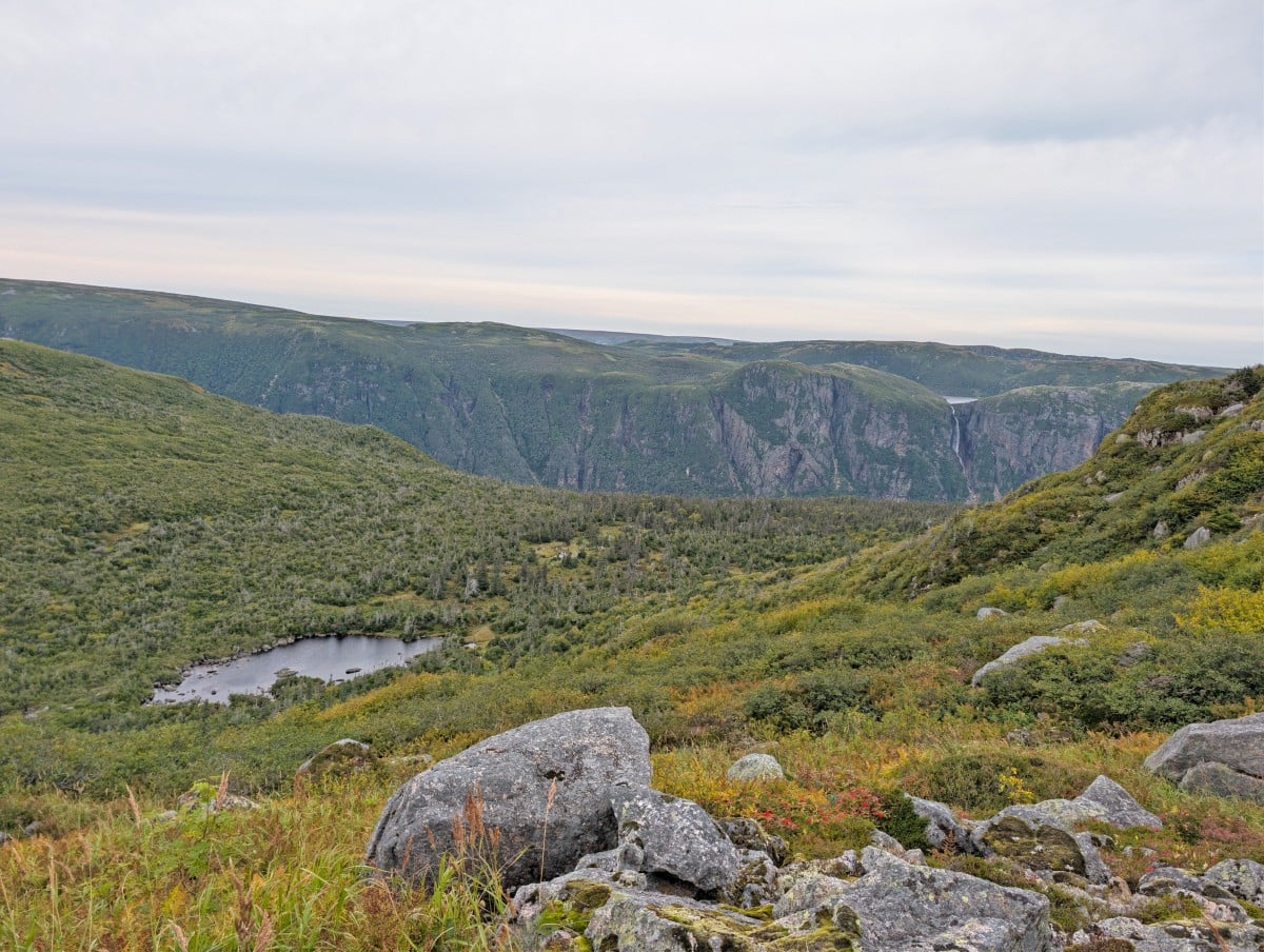
Yes, it was still muddy and incredibly wet, but the grass shone gold, the ponds sparkled in the sunlight, and we could finally see the landscape stretching out around us.
Our campsite that night, at Hardings Pond, was high above the water and we were able to dry most of our gear and clothing on the rock slabs. While it was a cold night with no clouds in the sky, getting to see a beautiful sunrise was pretty special.
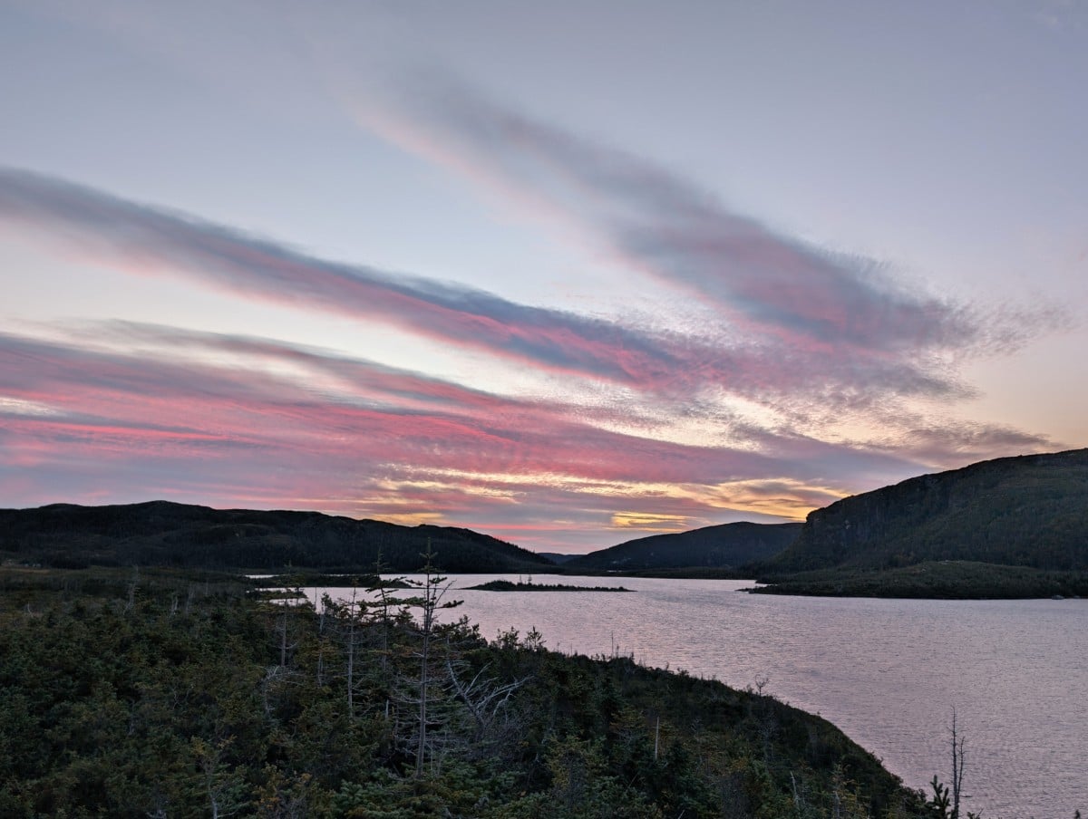
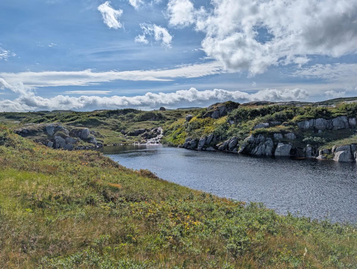
Day 3 continued to get even better. The route spent more time at higher elevations, on rocky ridges that offered amazing views, slightly drier terrain and red highlights from the blueberry bushes. We still had a couple of river crossings (including a deep one at Green Island Pond) and yet more mud.
Due to the battery situation and heavy rain and strong winds forecast for day 4, we decided to push ahead beyond Green Island Pond to Ferry Gulch. After our Western Brook Pond experience, it was also important for us to be able to see Ten Mile Pond, the other freshwater fjord on the route.
Ten Mile Pond to the end
And see it we did – and it was everything I hoped it to be. And just around the corner, JR spotted a bull moose in the distance. The steep descent into Ferry Gulch awaited, but we didn’t mind as we knew it was the last difficult part of the route. After that, we’d be on frontcountry trail.
The next morning, we woke up and headed up Gros Morne Mountain. While the promised rain hadn’t arrived, it was still incredibly windy so we made the call not the continue all the way to the summit.
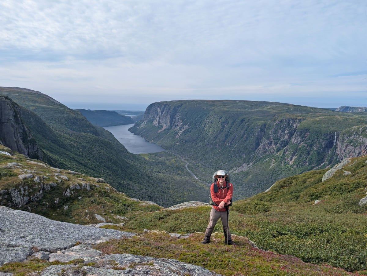
Still, the different perspective on Ten Mile Pond was well worth the relatively minimal effort. 200+ steps or not, I was glad not to have to walk through any more mud! Or so I thought.
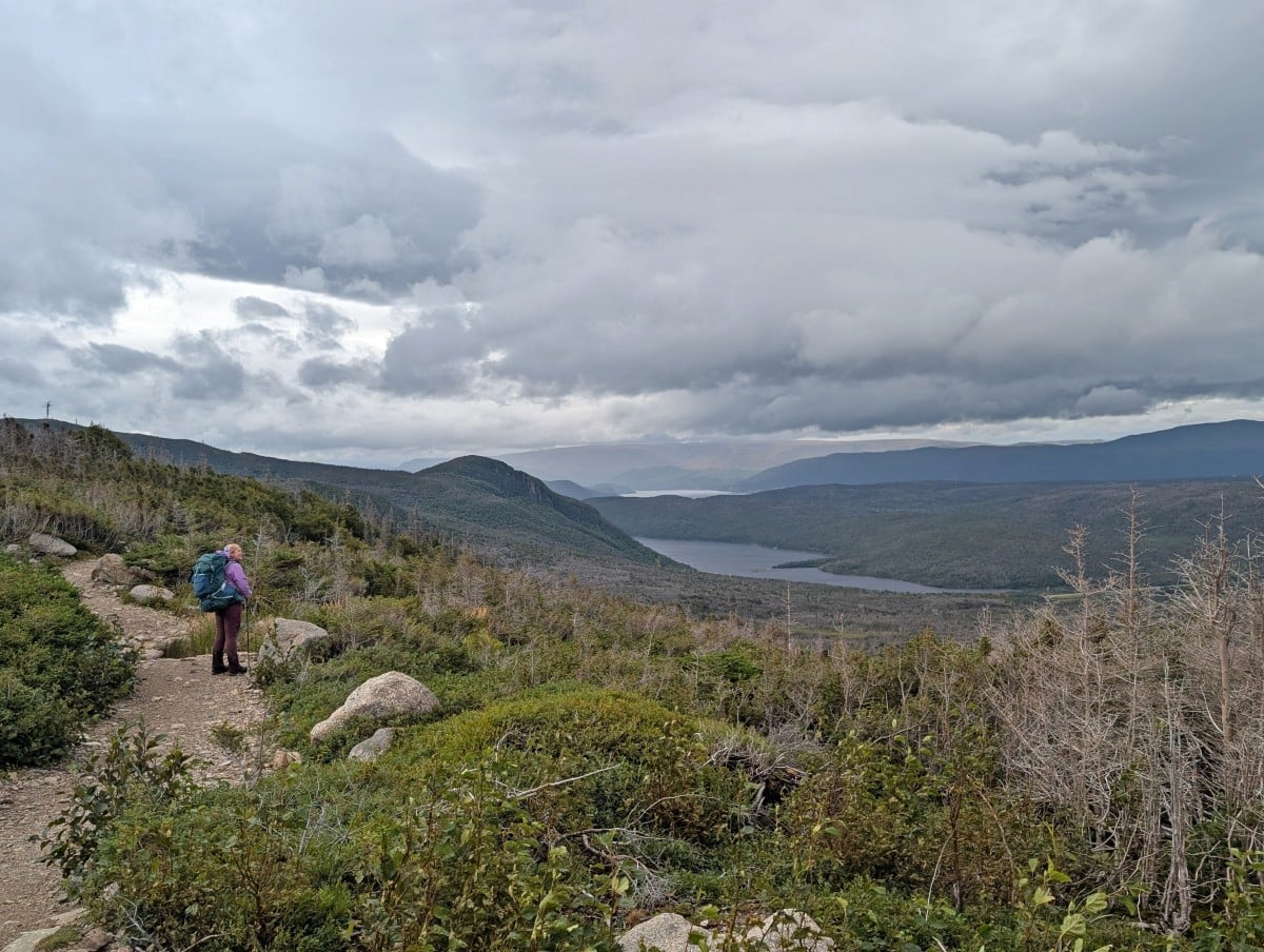
The first part of the trail to the parking lot was more challenging than I had anticipated, with large rocks, narrow sections and, yes, mud. The wind blew me over a couple of times as well.
The final 5km was the most wonderful, easy stretch of the entire route. While it did feel long, I was surprised to see beautiful views of Bonne Bay fjord, the ocean and even a few waterfalls. An outstanding end to a demanding hike! While we still had wet shoes, it was all worth it.
Long Range Traverse hiking guide
Inspired to hike the Long Range Traverse? In this section, you’ll discover everything you need to know to start planning a trip.
- Location and map
- Trailheads and transportation
- Orientation
- Reservations and fees
- Section breakdown
- Campsites
- Example itineraries
- Safety and wildlife
- Difficulty
- Recommended items
- Where to stay before and after
Location and map
The Long Range Traverse has two trailheads – Western Brook Pond (north, starting trailhead) and Gros Morne Mountain (south, finishing trailhead).
The Western Brook Pond trailhead is only accessible by a combination of foot and boat. Be sure to make a reservation for BonTours boat trip after securing a Long Range Traverse permit!
The map below shows the trailheads, campingsites and elevation profile (note that the total elevation gain/loss is about 600m less). The route includes the Gros Morne Mountain Trail, from Ferry Gulch to the highway adjacent parking lot.
Trailheads and transportation
Parks Canada requires all LRT hikers to travel the route from north to south. I would recommend parking your vehicle at the Gros Morne Mountain parking lot and then taking a taxi to the Western Brook Pond parking area. This requires a bit of organisation, especially as you have a boat to catch!
The Western Brook Pond trailhead (start) is only accessible by a combination of foot and boat. Here’s the typical way to start a hike on the LRT:
- Park in the Gros Morne Parking Lot
- Take pre-arranged taxi to Western Brook Pond parking lot (about 25 minutes drive)
- Then walk 3km (45 minutes) to the boat dock. Alternatively, take the golf cart ride for $10/person
- Finally, enjoy your pre-reserved boat trip to the east end of Western Brook Pond and then get dropped off on the LRT trailhead dock
We booked a taxi with Pittmans Taxi the evening before we left by calling 709-458-2486. The ride cost $60, payable either by credit card over the phone or in cash to the driver. Ivan, our driver, arrived right on time and has been operating this service for decades.
The Dock Side Café at the Bon Tours tour boat dock sells sandwiches, hot dogs, bagels, soup and pastries. This is convenient if you’ve had an early start.
Please note that if it is very windy, the boat tour may be cancelled. This almost happened on our departure day – the winds were around 40km/h.
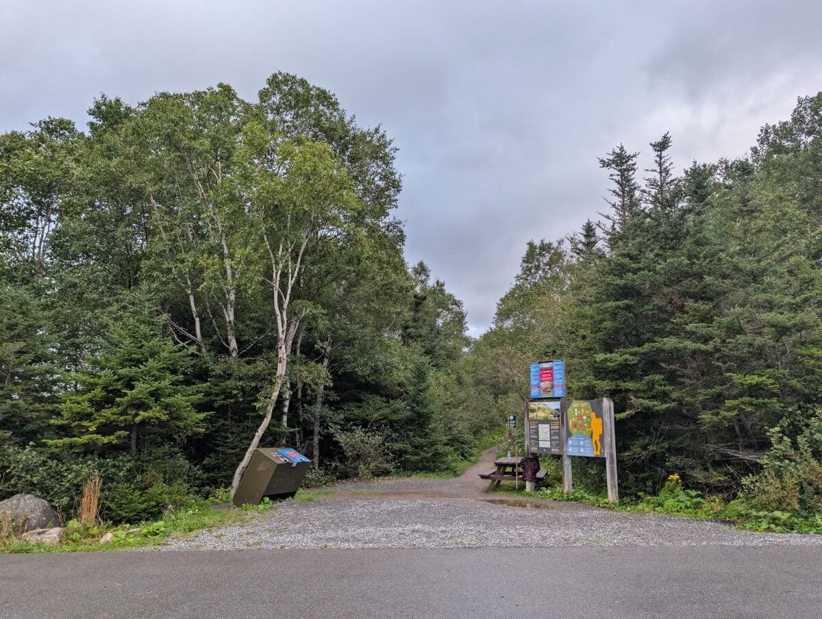
The Gros Morne Mountain trailhead (end) is used by day hikers as well as backpackers. It is located adjacent to Highway 430, only a few minutes drive south of Rocky Harbour. There are outhouses, trash bins and trail signage.
Orientation
IMPORTANT – All Long Range Travese hikers must attend an orientation at 2.30pm the day before their scheduled departure.
The orientation takes place at the Gros Morne National Park Visitor Centre near Rocky Harbour (click for Google Maps directions). The safety briefing includes a 20 minute long video and an overview of current route conditions. A navigation test was required at one time, but this has not been the case for years.
Emergency procedures are comprehensively covered, explaining when and how to call for help. If you don’t already have a satellite communication/locator device, staff will offer you one and instruction on how to use it.
Permits are issued after the orientation. Be prepared to confirm your chosen itinerary, including the campsites where you hope to stay. While you can deviate from your plan, as we did, having a rough itinerary helps staff know where you’re likely to be in case of emergency.
Long Range Traverse hikers must notify Parks Canada staff when they have completed their trip. If you don’t check in, staff will begin looking for you after 72 hours.
Reservations and fees
A Long Range Traverse permit is required to hike the route. Permits are limited, as Parks Canada only allows a maximum of three groups to start the LRT each day, with no more than four people per group (12 hikers total).
The Long Range Traverse permit cost is $124 per person, plus a $11.50 online reservation fee or $13.50 telephone reservation fee (fees correct as of 2026).
Hikers must also have a valid Gros Morne park pass – $12.25/day/adult. If you are planning to spend seven days or more in Canada’s national parks in a year, it is better value to buy an annual Discovery Pass.
The one-way BonTours boat tour ticket for Long Range hikers is $58/person. Book it via the BonTours website – look for ‘Long Range Traverse hiker’ after selecting the Western Brook Pond tour.
Reservation process
Hikers should make a reservation in advance to secure a permit for their preferred departure date. Last-minute permits may be available at the Rocky Harbour Visitor Centre, but these are subject to availability and cannot be guaranteed.
To make a reservation for a Long Range Traverse permit, you must use the Parks Canada Reservation System. It can be accessed online and also by phone (1-877-737-3783).
The reservation launch is typically in early February each year. The exact date is usually announced during the preceding December on this Parks Canada webpage.
To make a Long Range Traverse reservation:
- Click the ‘Backcountry’ tab then select ‘Long Range Mountains’
- Choose your arrival date and party size then click ‘search’
- A map will load below. If your preferred dates are available, the associated Long Range Traverse star will be green
- Click the star and then ‘Reserve’ (right hand side or above the map)
- If the star is red, switch to the Calendar view and choose from the available alternative dates
- If the campsites are still available, the next screen will display your reservation details, along with Parks Canada rules. Tick the two boxes and select ‘Confirm reservation details’
- At this point, your reservation is in the shopping cart and held. As long as you complete payment within 20 minutes, your reservation is secure
- Click ‘Proceed to Checkout’ to log into your Parks Canada account and pay for the reservation
For tips and more advice, head to our dedicated Parks Canada reservation guide.
Long Range Traverse section breakdown
Normally, in a guide like this, I’d provide a detailed breakdown of the route. However, since the Long Range Traverse is a route rather than a defined trail and is recommended for experienced backpackers only, so I’ll keep this section to an overview of what to expect.
For additional information, check out the comprehensive Parks Canada route description.
Please note that the below distances are approximate – we hiked around 8km more than the official 36km total.
| Waypoint # and | Approximate from Western Brook Pond trailhead (LR-1) |
| LR-2 Waterfall | 2.8km |
| LR-3 Rock slab | 3.2km |
| LR-4 Top of the gorge | 3.8km |
| LR-4a No Name campsite (new) | 5.3km |
| LR-5 Little Island Pond campsite | 6.8km |
| LR-6 Marks Pond campsite | 10.3km |
| LR-7 Notch | 12.1km |
| LR-8 Hardings Pond campsite | 14.8km |
| LR-9 Top of ridge | 16.5km |
| LR-10 Narrows between ponds | 18.3km |
| LR-11 Lower Green Island Pond campsite | 22km |
| LR-12 Upper Green Island Pond campsite | 22.3km |
| LR-13 Ten Mile Pond view (Bakeapple Pond) | 24.6km |
| LR-14b Steep Ferry Gulch descent | 27.2km |
| LR-15 Gros Morne Mountail Trail junction | 28km |
| LR-16 Ferry Gulch campsite | 28.3km |
| Gros Morne Mountain trailhead | 36km |
Northern trailhead (Western Brook Pond) to LR-4a (No Name Campsite)
The first challenge of the LRT is ascending the Western Brook Pond gorge, featuring just over 600m of elevation gain in 4km. Parks Canada suggests 3 to 5 hours to reach the top.
A well-worn path leads through the forest from the dock into a beautiful meadow, bordered by steep granite walls. The route then stays close to a brook that heads towards the back of the gorge. If water levels are high, it can be difficult to see where to go, so keep to the brook and be prepared to cross it several times.
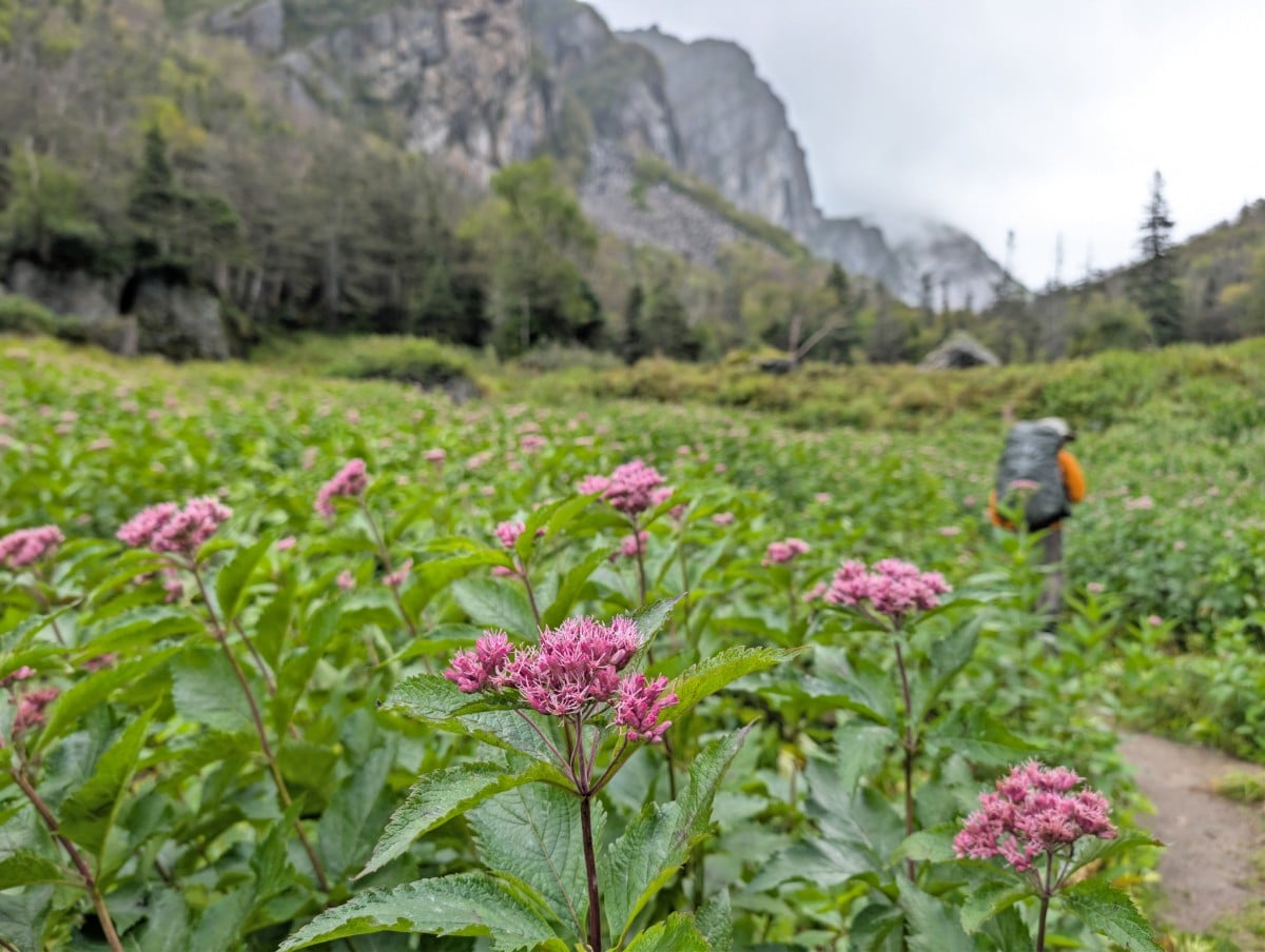
Eventually, you’ll reach a large waterfall (LR-2). Stay right, as the real ascent starts now on a steep, rocky route through the forest. Expect to use your hands to climb over some of the rocks.
The forest opens onto a rockslide. Follow the flagged path across it, as the rockslide is unsafe beyond this route. Back in the forest, there’s another steep climb over more rocks before reaching a small rock slab near the top of the waterfall. The famous view of the gorge is visible here (LR-3).
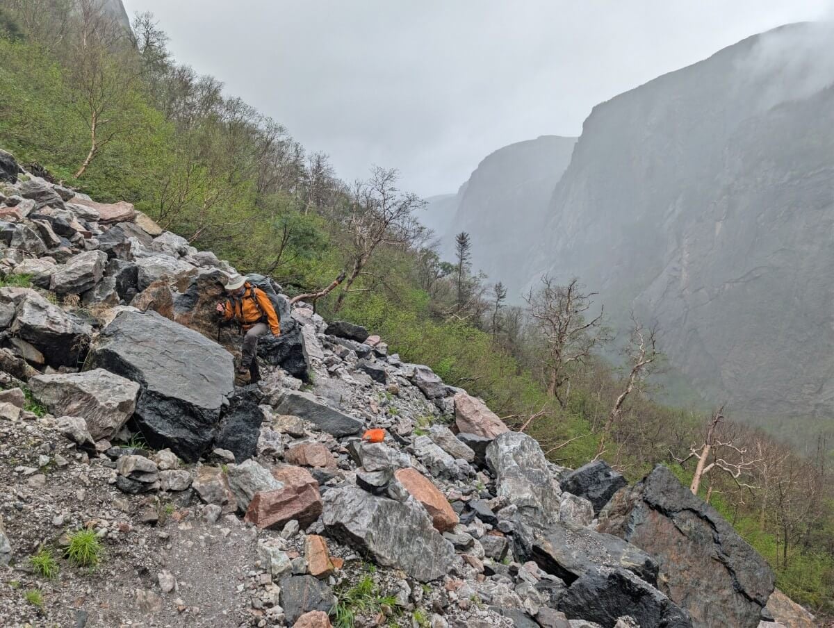
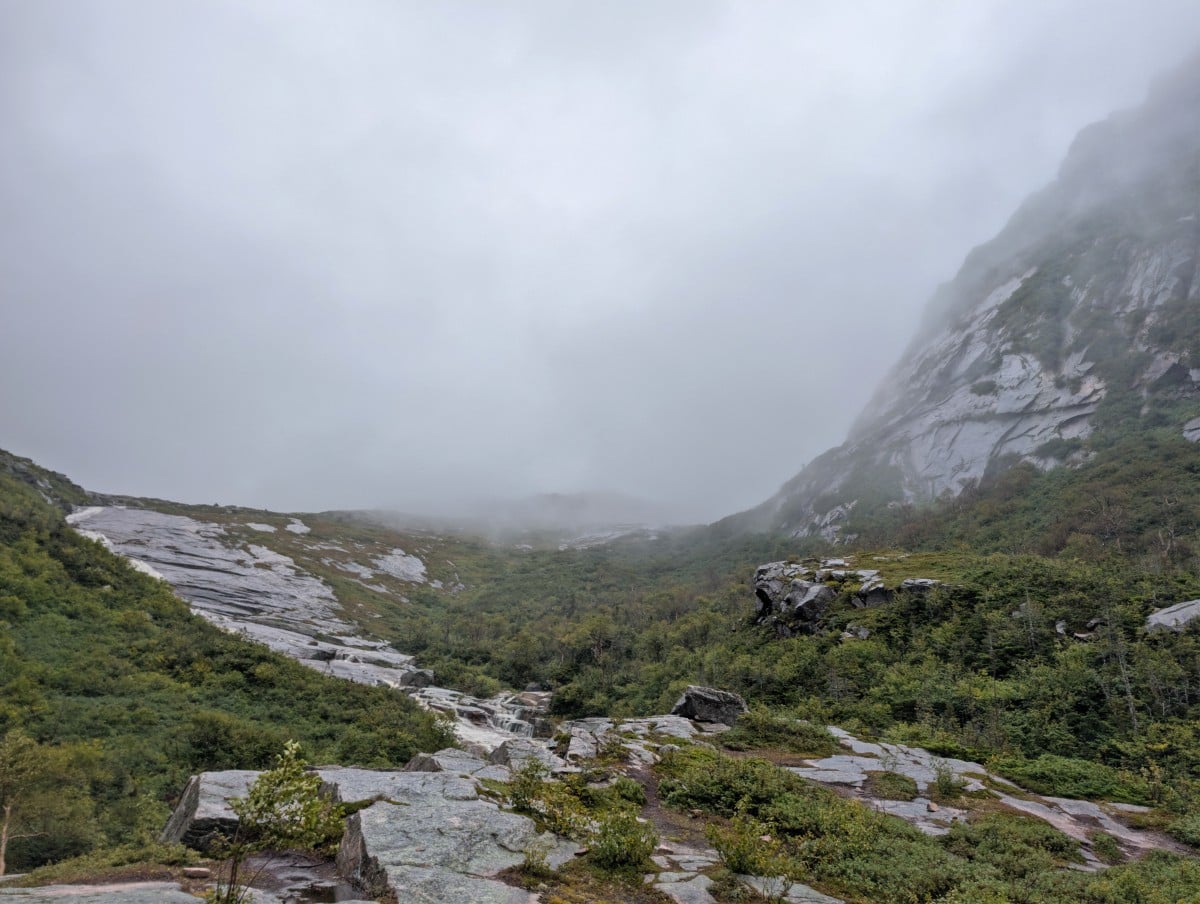
Continue toward the larger rock slab ahead, with water running down its left side. The aim is to reach the large rock slab. We found a route through the trees on the right of the small rock slab, crossed the water twice, then climbed onto the larger slab. We stayed centre as we climbed to the ridge (LR-4).
If the weather is favourable, there are incredible views from the ridge down the gorge. From here on, the route traverses the Long Range plateau, terrain filled with bog, rock slabs, small ponds, tuckamore and arctic alpine barrens. The first campsite, No Name (LR-4a) is just over 1km away.
LR-4a (No Name Campsite) to LR-8 (Hardings Pond)
With the gorge ascent behind you, it’s time to explore the plateau. Although the open terrain may seem easy to navigate at first (especially compared to the forested parts of the gorge), don’t get complacent.
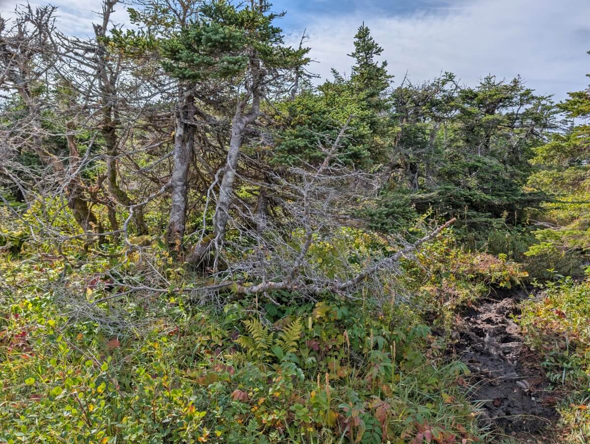
The first stretch to Hardings Pond stays low in the valleys. Expect lots of mud and bog. Check your GPS and/or map often to ensure you’re on the right path. If you find yourself pushing through a long stretch of tuckamore, you’ve probably strayed from the route.
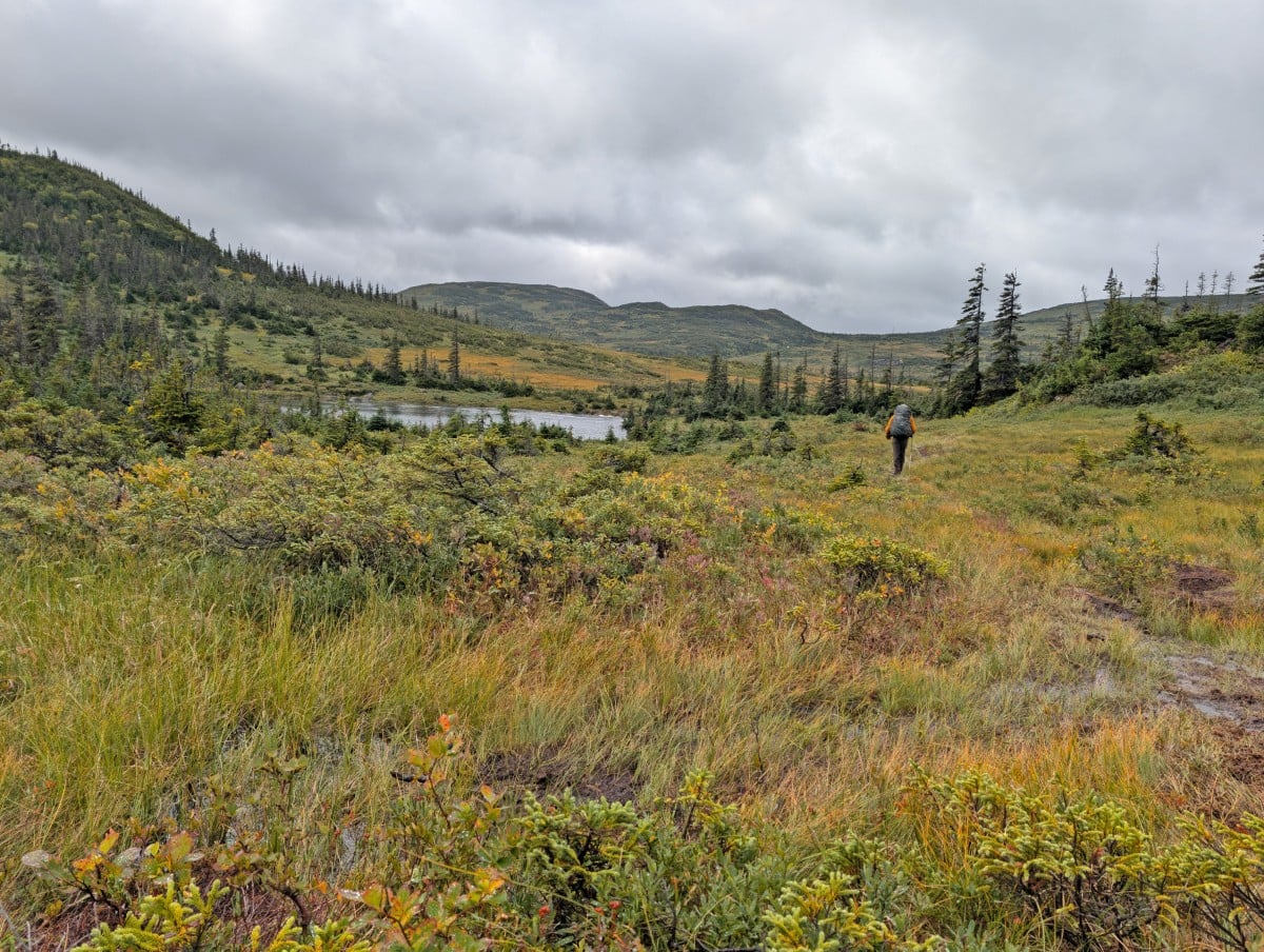
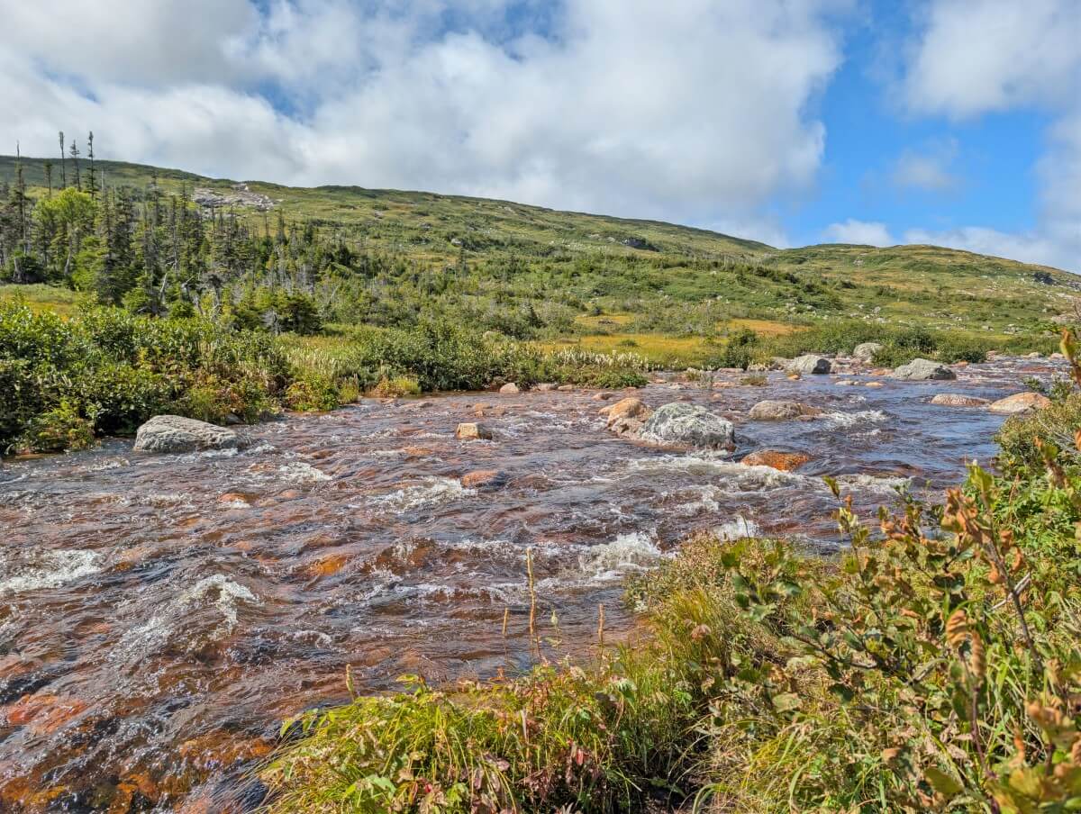
There are two routes approaching Marks Pond (LR-6) – the easterly one is shorter but does not go through the campsite. We chose to stay on the westerly route as it seemed the most used. There is a river crossing after Marks Pond. After heavy rain in mid September, it was almost to my knee.
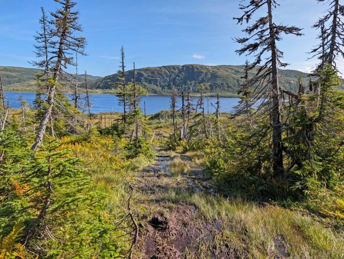
Around 1km from Marks Pond, the route ascends to a notch (LR-7) with lovely views of a series of ponds. The descent to Hardings Pond is steep in places and was very muddy during our hike. A Parks Canada rangers cabin can be spotted on the left – the campsite (LR-8) is almost 1km further.
LR-8 (Hardings Pond) to LR-11/12 (Green Island Pond)
The next section of the Long Range Traverse has considerably more elevation change than the previous stretch. For us, this meant much less mud. There are, however, less landmarks to spot so be sure to check your GPS often to stay on the route.
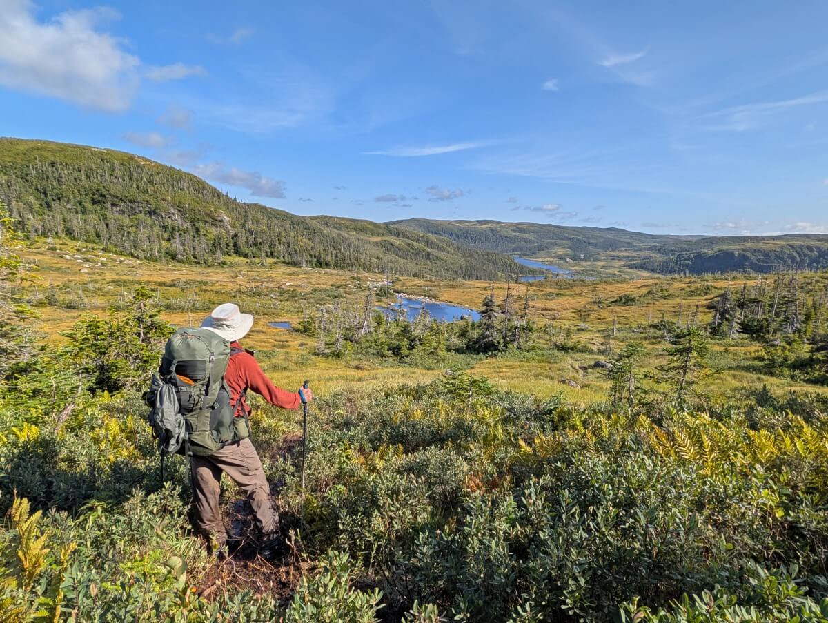
The route climbs to a ridge (LR-9) shortly after leaving Hardings Pond. This is a beautiful stretch, with panoramic views across the hills and ponds. There’s also less tuckamore, making it easier to get back on route if you stray. A somewhat steep descent leads to a narrows between two small ponds (LR-10).
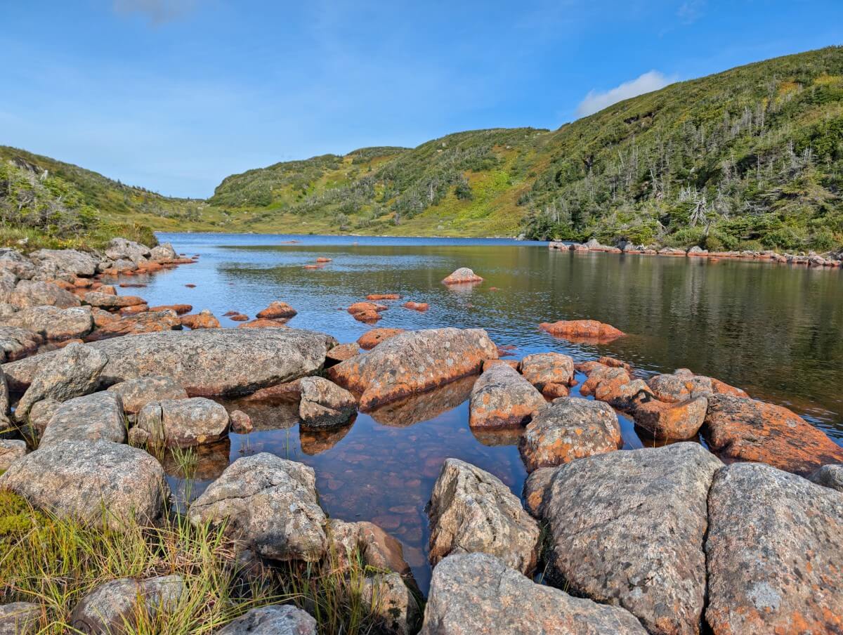
More views await on higher ground as well as some more bog. Skirting the edge of a large pond and then around the back side of the cliffs, the long downhill section to Lower Green Island Pond campsite (LR-11) begins. It seems to take forever as the route slowly dips into the valley.
Another river crossing is required to reach the Upper Green Island Pond campsite (LR-12). In mid September, the water pretty strong and around hip height for me at 5″2. The scenery around Upper Green Island Pond is glorious – ponds, rocky ridges and waterfalls.
LR-11/12 (Green Island Pond) to southern trailhead (Gros Morne Mountain)
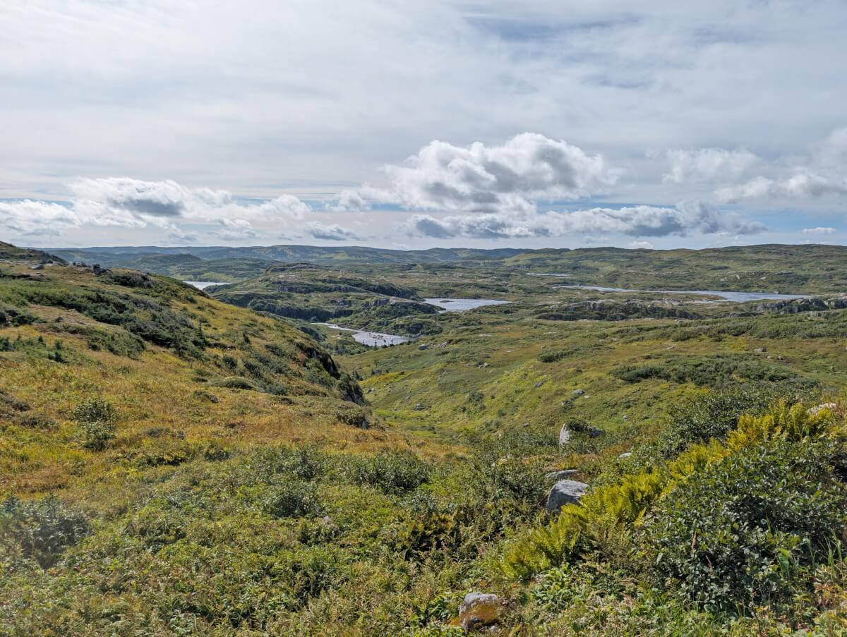
The final stretch of the Long Range Traverse stays high on rocky ridges for long stretches, punctuated by steep descents followed by climbs straight back up. For one of them, I had to use my hands to climb the rocks. Again, we found this section to be a lot less muddy overall than previous ones.
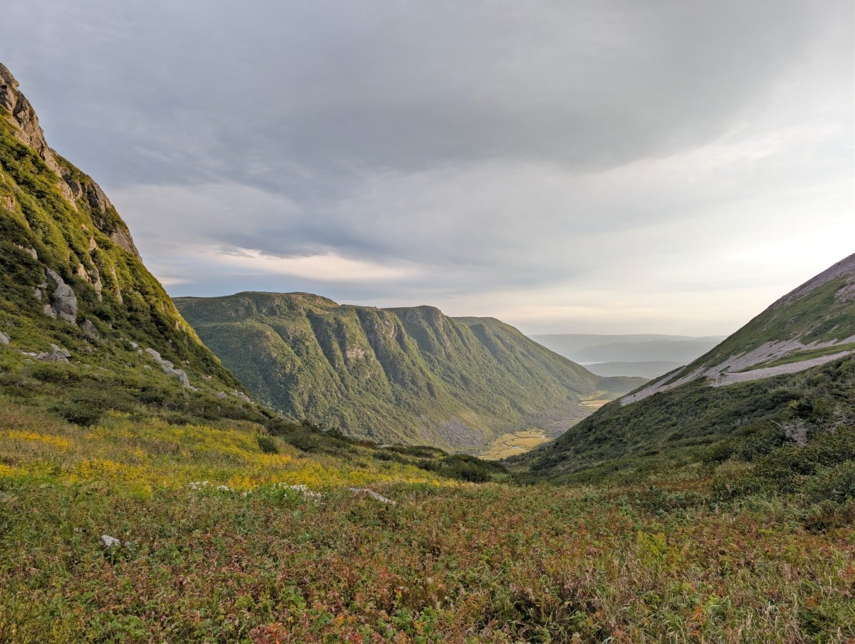
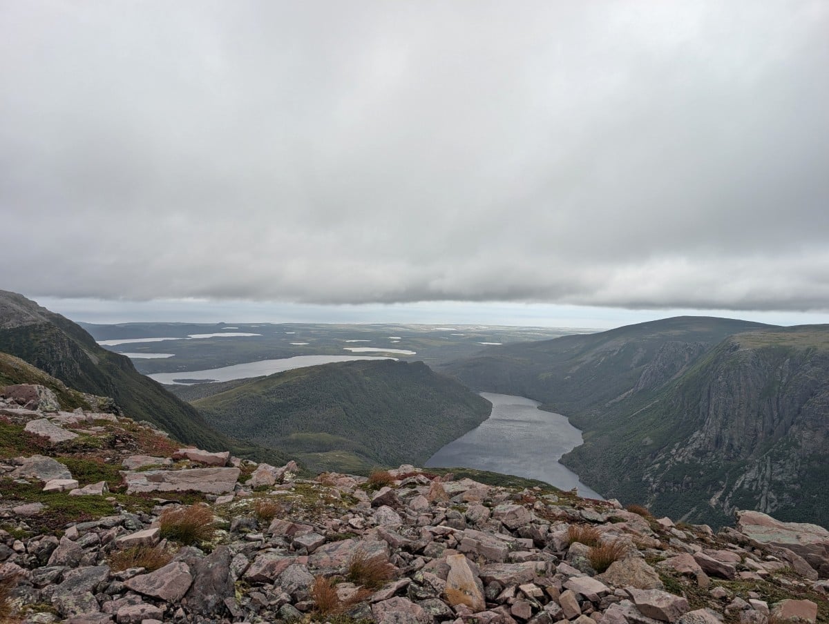
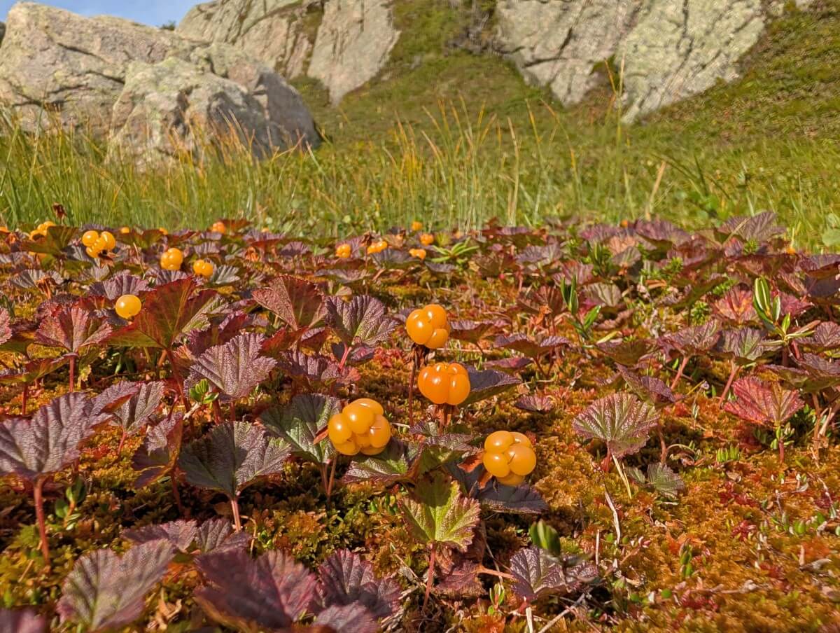
About 2.5km from Upper Green Island Pond is one of the most spectacular views on the entire route – Ten Mile Pond (LR-13). Be sure to stop and take in the scenery around this beautiful freshwater fjord which is backdropped by the pink hued 806m high Gros Morne Mountain.
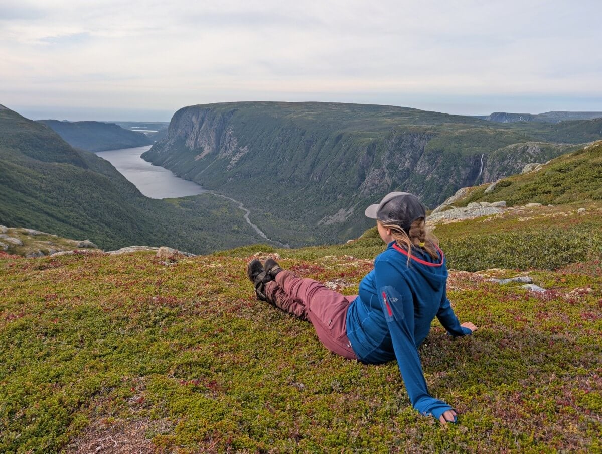
The route continues along the ridge, again with more small ups and downs. The upper rim of Ten Mile Pond and its impressive waterfall are visible along the way. Eventually, the descent into Ferry Gulch begins. Slow at first and then steeply (LR-14b), with large rocks and tree roots as obstacles.
The route stays rocky as it approaches the edge of a small pond. Once reaching the water, the route pops out next to the Gros Morne Mountain Trail, right by a set of stairs. And that’s it, the end of the Long Range Traverse!
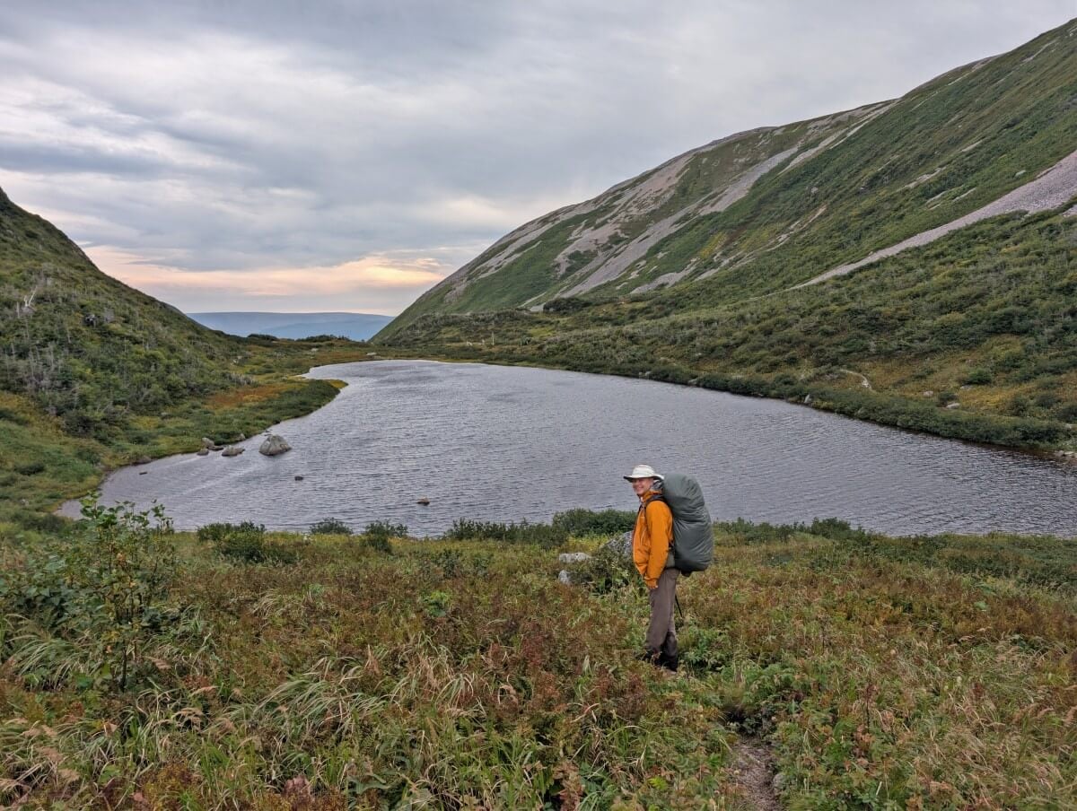
The Ferry Gulch campsite lies just ahead (LR-15), as well as 7.7km of frontcountry trail to the parking lot. But it’s not the easiest hiking experience.
The first 2.7km traverses the side of Gros Morne, with plenty of small ups and downs and a lot of rock obstacles. The final 5km is a wide, cleared trail, mostly downhill.
Planning to summit Gros Morne?
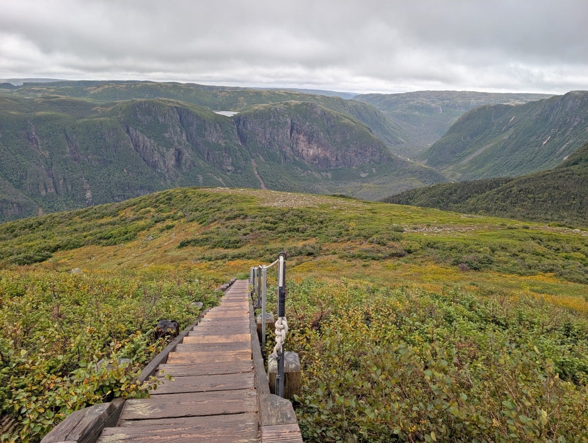
- Turn right before reaching Ferry Gulch campsite (5.6km return, 260m elevation). Allow 2 to 3 hours
- If you don’t have much energy/time, I’d suggest hiking the first 800m, to the long set of stairs.
- This takes around 20-25 minutes one-way with 130m elevation gain and there is a great view of Ten Mile Pond
- Hike back down the same way you came – don’t take the steeper route from the summit
- Take water for the trip as there are no water sources on the mountain
Long Range Traverse campsites
There are six campsites on the Long Range Traverse proper, with a seventh on the Gros Morne Mountain Trail (exit route). All have a water source nearby.
Most of the campsites have elevated wooden tent pads, which measure 12 foot by 12 foot. Snow can damage the tent pads and food caches. Outhouses come in the form of green throne toilets, with no ceiling. Privacy is limited but generally they are hidden or located in an out of the way spot.
Note – the approximate location mentioned below is from the Western Brook Pond trailhead.
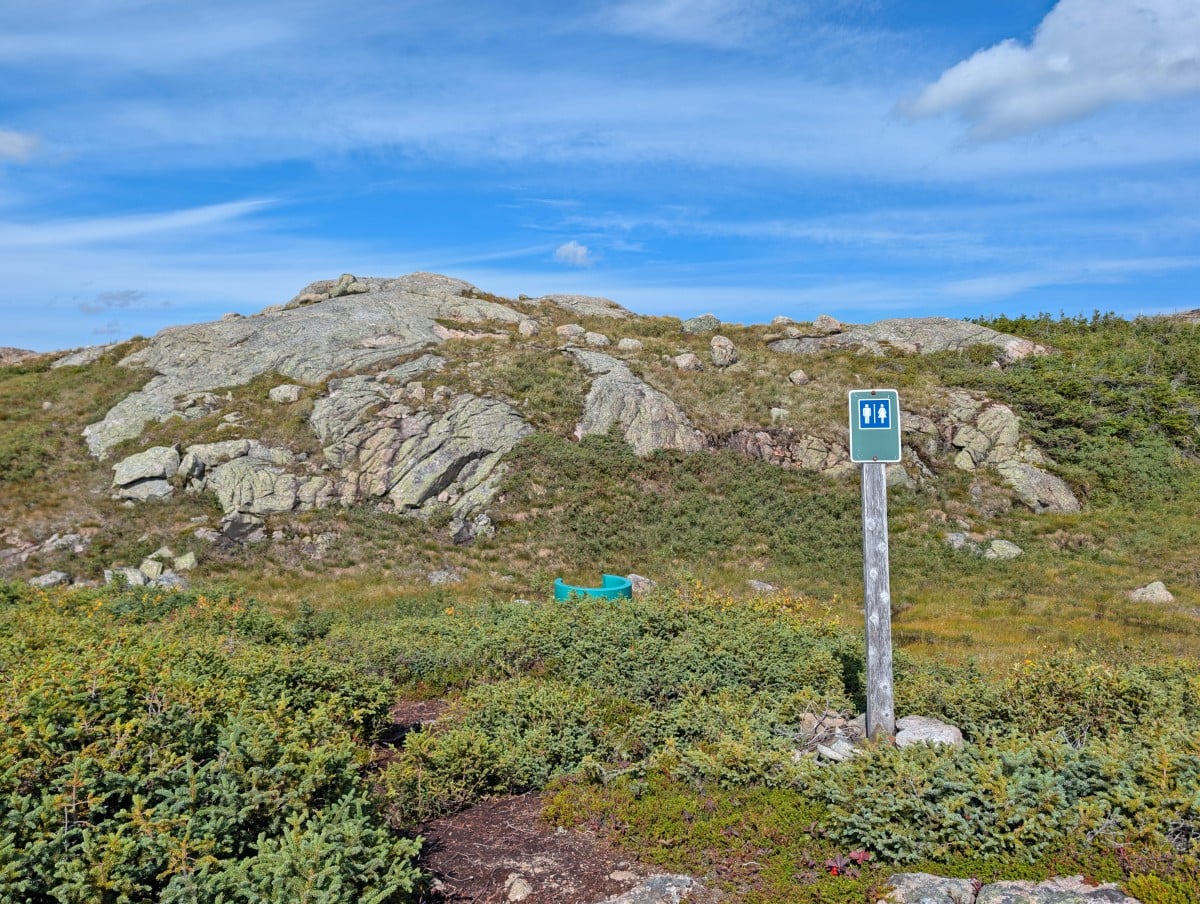
LR-4a, No Name Campsite
Approximate location from trailhead: 5.3km
Tent pads: 4 wooden tent pads
Other facilities: Green throne outhouse with privacy fence, new food cache, cooking platform
This new campsite was added for the 2026 season and is a great addition to the route. Located not far from the top of the gorge, No Name is convenient in bad weather or if you’d rather take your time and enjoy those incredible freshwater fjord views!
The tent pads are all lined up in a row, overlooking a beautiful pond. There is an additional wooden platform for cooking purposes, with upright beams (presumably for a tarp). The downside of this campsite is that it is pretty exposed, with little shelter to the wind.
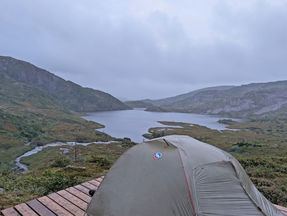
LR-5, Little Island Pond
Approximate location: 6.8km
Tent pads: 1 wooden tent pad
Other facilities: Green throne outhouse, food cache
Little Island Pond is a very small campsite by large lake. It’s a lot closer to the water than No Name. The campsite is backdropped by trees and a hill, which offers some shelter against the wind. Since we visited in wet weather, we didn’t spend a lot of time here.
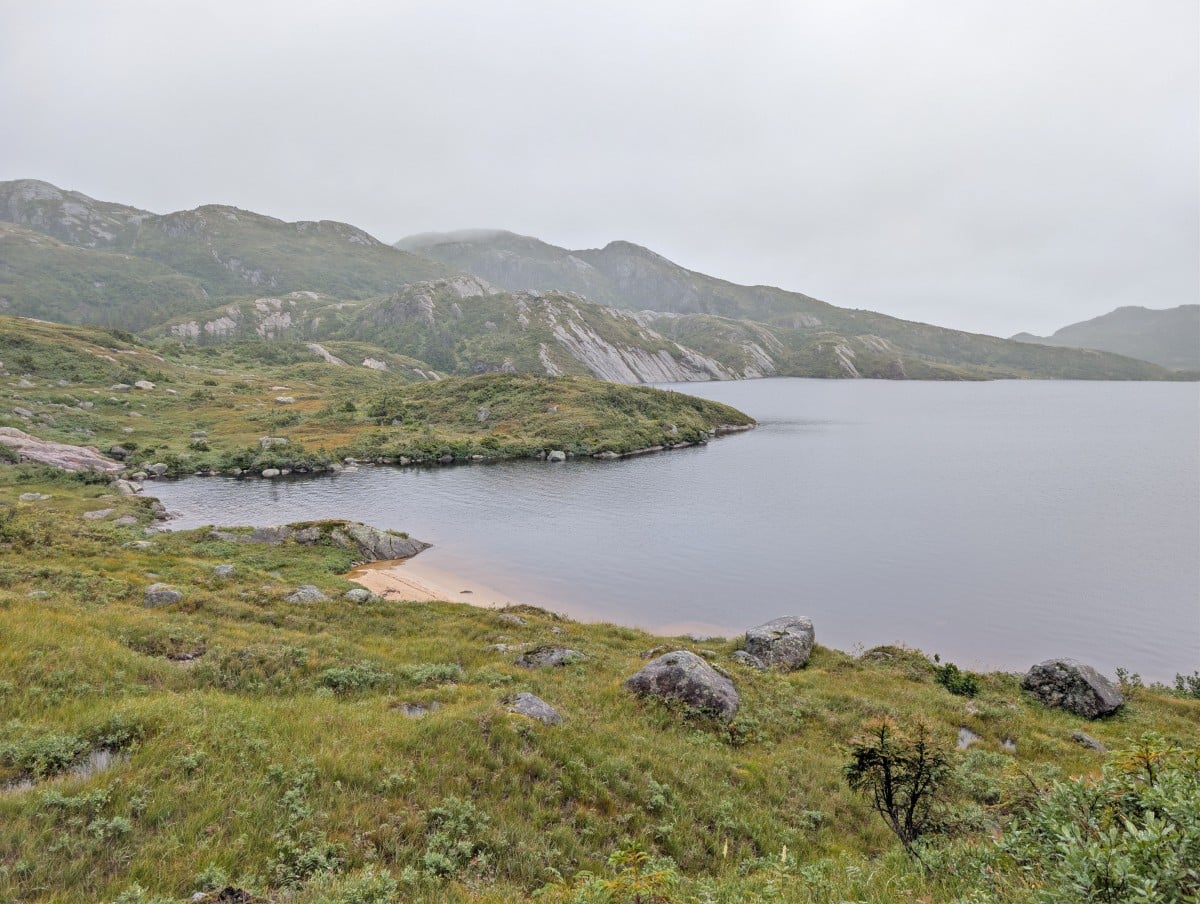
LR-6, Marks Pond
Approximate location: 10.3km
Tent pads: No tent pads, only cleared spaces
Other facilities: Green throne outhouse, food cache
Marks Pond is the only Long Range campsite without wooden tent pads. For that reason, it’s not a great choice in wet weather or after a lot of rain. Flooding is possible.
The area itself is pretty open, though there are some surrounding trees. We spotted three different flat areas that were clear enough for tents, one of which is very close to the water.
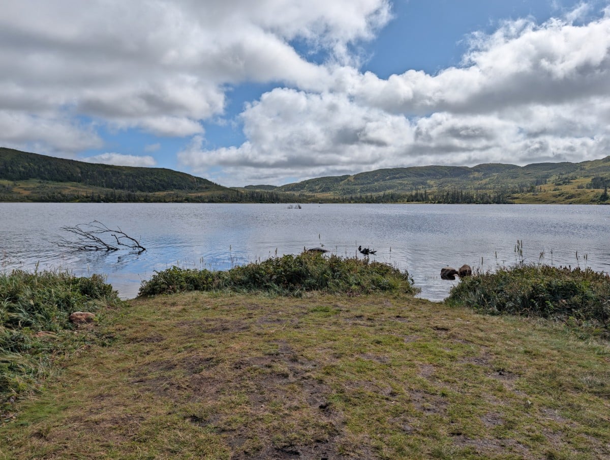
LR-8, Hardings Pond
Approximate location: 14.8km
Tent pads: 4 wooden tent pads (one broken) and 1 framed pad
Other facilities: Green throne outhouse, food cache
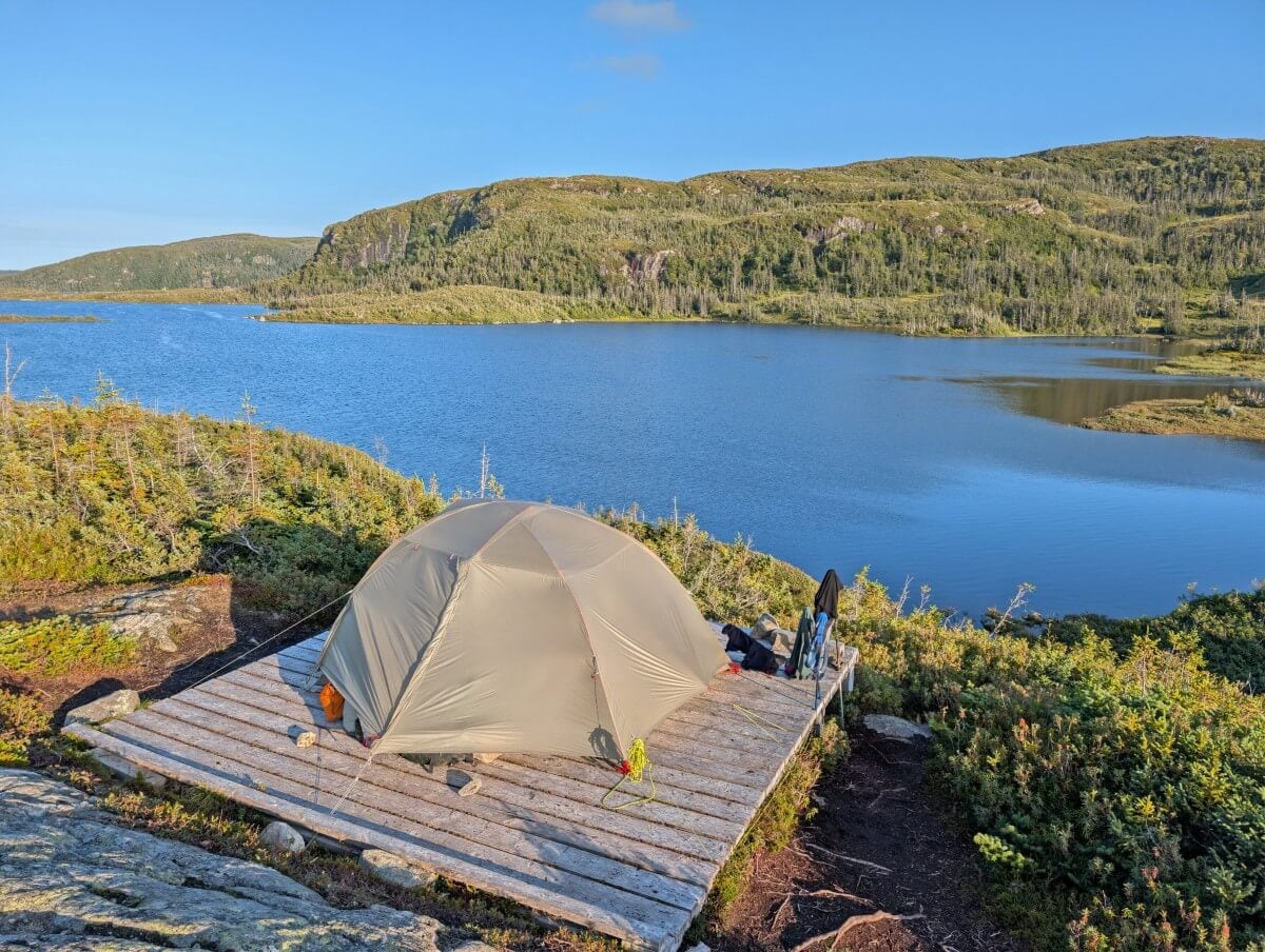
The largest campsite on the Long Range Traverse is Hardings Pond. The campsite is located at the southwest corner of the pond. Hardings is a popular destination on the LRT as it breaks up the journey between No Name and Green Island Pond very nicely.
We found two wooden tent pads near the water, one of which was broken. Two more wooden tent pads sit atop rocky outcrops, with stunning views of the pond. We also spotted a wood framed pad near the food cache. The green throne outhouse is hidden in foliage, between the two outcrops.
LR-11, Lower Green Island Pond
Approximate location: 22km
Tent pads: 3 wooden tent pads
Other facilities: Green throne outhouse, food cache
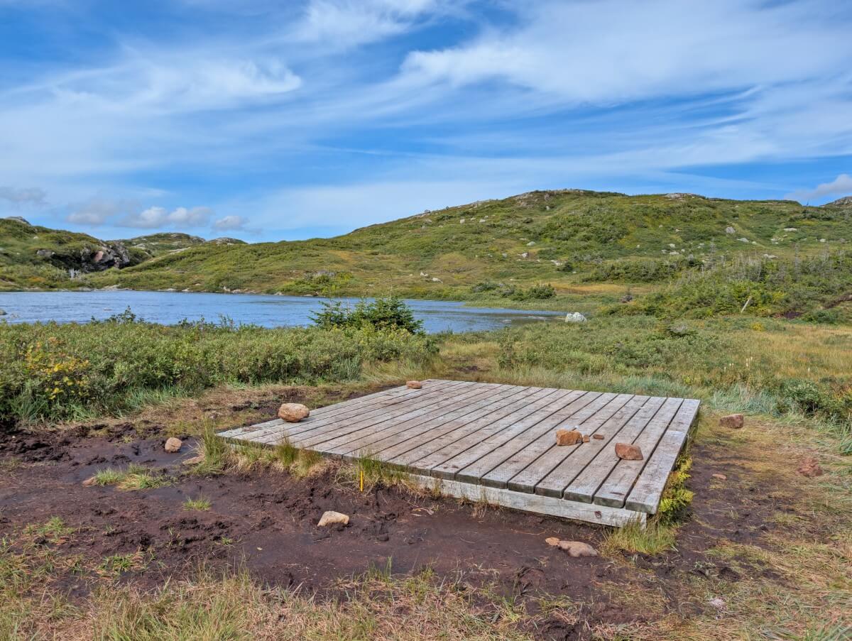
Lower Green Island Pond is one of the only campsites on the route that you can see long before reaching it! Three wooden tent pads are clustered together at the base of a bowl, right next to the river and pond.
This campsite is more sheltered from the wind than its close neighbour (Upper, see details below) but the blackflies can apparently be a pain. Of course, you’ll also have to start your day with a river crossing as well.
LR-12, Upper Green Island Pond
Approximate location: 22.3km
Tent pads: 3 wooden tent pads
Other facilities: Green throne outhouse, new food cache
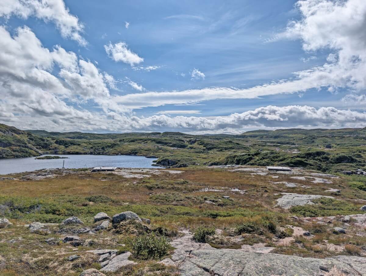
Upper Green Island Pond is my favourite campsite on the Long Range Traverse. The tent pads are nicely separated and each has a uniquely beautiful view of the pond. The site is very open, with lots of rock slab to hang out on. The disadvantage is there is little protection from the wind.
New for 2026, this campsite has a food cache and outhouse. Previously, hikers were directed back across the river to Lower Green Island Pond. The green throne sits tucked away in a gully, hidden to passing hikers.
LR-16, Ferry Gulch
Approximate location: 28.3km
Tent pads: 3 wooden tent pads
Other facilities: Green throne outhouse with privacy fence, food cache
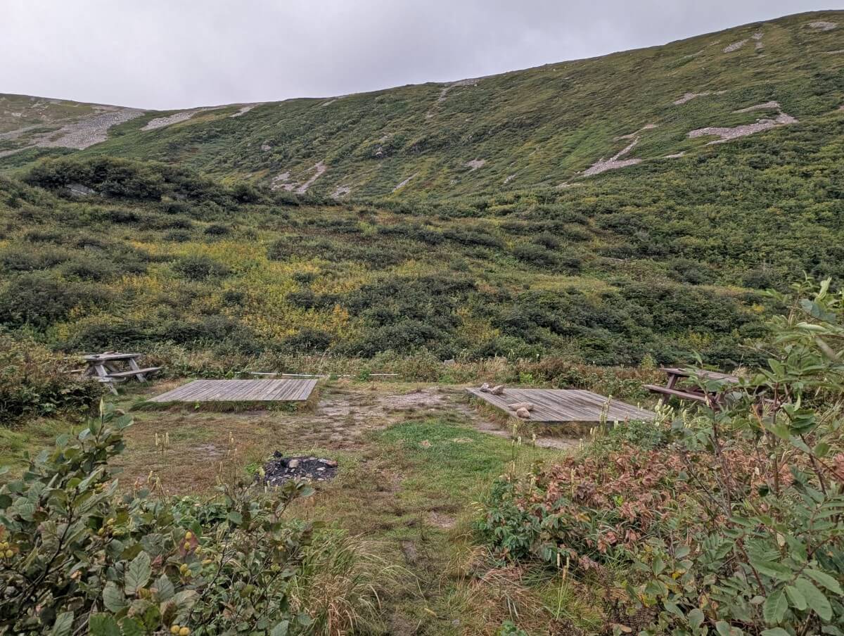
While Ferry Gulch is technically part of the Gros Morne Mountain Trail, it’s also an option for Long Range Traverse hikers. The campsite sits beside a small pond with views of Gros Morne. One tent pad is close to the outhouse and lakeshore, while two others are in a separate area with picnic tables.
Staying at this campsite is convenient for finishing early the next day or a side trip up to Gros Morne Mountain. The downside is that there is day hiking traffic and it is possible that the tent pads are already taken by non-LRT campers. We didn’t have this issue in mid September.
Long Range Traverse example itineraries
Most Long Range Traverse hikers spend 3 to 5 days on the route. Personally, I think four days is a good minimum to allow some flexibility for weather and, most importantly, time to enjoy the experience!
These itineraries are based on our favourite campsites – see the camping section for more details. No Name Campsite could be easily swapped out for Little Island Pond, for example.
Our 4 day itinerary
- Day 1 – Western Brook Pond trailhead to No Name Campsite, around 5.3km (we recorded 7.5km)
- Day 2 – No Name Campsite to Hardings Pond, around 9.5km (we recorded 11km)
- Day 3 – Hardings Pond to Ferry Gulch, around 13km (we recorded 16km)
- Day 4 – Ferry Gulch to Gros Morne Mountain trailhead, 7.7km
This wasn’t our intended plan but it worked out for the best with the conditions we had. On Day 1, we couldn’t (and didn’t) want to go any further with the rain and wind. It was also fairly late in the day when we arrived (5pm), since the ascent had taken so long due to flooding.
Day 3 was our best weather day so it made sense to make the most of it and push ahead to Ferry Gulch. It was a long day of hiking, but worth it to be able to finish early on day 4, before the wind and rain picked up again. This itinerary also enabled us to easily fit in a hike up Gros Morne Mountain.
Alternative 4 day itinerary
- Day 1 – Western Brook Pond trailhead to No Name Campsite, around 5.3km
- Day 2 – No Name Campsite to Hardings Pond, around 9.5km
- Day 3 – Hardings Pond to Lower/Upper Green Island Pond, around 7.2km/7.5km
- Day 4 – Lower/Upper Green Island Pond to Gros Morne Mountain trailhead, around 13.7km
Our original itinerary included an overnight stop at Lower or Upper Green Island Pond. We were planning to choose between these campsites depending on the weather at the time. While Ferry Gulch was a convenient place to stay, I would have preferred Upper Green Island Pond.
This itinerary divides the mileage and difficulty fairly evenly. The main downside is that you’ll need to summon some extra energy/speed for a side trip up Gros Morne Mountain on day 4, if desired.
3 day itinerary
- Day 1 – Western Brook Pond trailhead to Marks Pond, around 10.3km
- Day 2 – Marks Pond to Lower/Upper Green Island Pond, around 11.7km/12km
- Day 3 – Lower/Upper Green Island Pond to Gros Morne Mountain trailhead, around 13.7km
If you’re really determined to hike the LRT in three days, this is one way to do it. I would only suggest trying this itinerary in dry weather, however, as rushing the gorge ascent in rain would make this already challenging section potentially unsafe. Marks Pond may also be flooded.
I would also expect day two to be particularly tiring, as it a long day in terms of distance. Any navigation mistakes could add significant time and effort. As previously mentioned, I think a four day itinerary is the best way to go for some flexibility.
Safety tips and other essential information
Prepare to have no phone signal anywhere along the Long Range Traverse. Tell someone where you are going and when you plan to be off the route again. Parks Canada requests all LRT hikers to carry a satellite communciation/locator device.
The LRT does not have a marked trail. Hikers must be able to navigate the route using wilderness navigation skills in combination with a paper map, compass and GPS. Parks Canada provides a GPX file that you can upload to your favourite mapping app (ours is Organic Maps).
Weather can change quickly in this area. Cold temperatures are possible even in summer. Fog can make navigation difficult. Check the predicted weather but be prepared for all conditions, with plenty of layers.
Gros Morne National Park is home to moose, woodland caribou, black bear, foxes and arctic hare, plus many bird species. Bear encounters are rare but hikers should know what to do if they see one.
There are two mandatory river crossings, with more possible in wet weather. This Parks Canada river crossing guide for a different park provides information on safe crossing techniques (face upstream, unfasten backpack straps, use poles).
It can take 24 to 48 hours or longer for help to arrive on the LRT. Bring at least one day of extra food and multiple days of prescription medication.
Keep a clean camp and Leave No Trace while hiking. After eating, make sure you haven’t left any food or wrappers around. Use the food caches in the campsites for all cooking items and food when not in use.
Make noise while hiking. This alerts wildlife to your presence and gives them a chance to avoid you. As a general rule, animals don’t want to be close to humans. Give wildlife space if you do see some.
Long Range Traverse difficulty
The Long Range Traverse is a challenging route, with the difficulty varying depending on recent and current weather conditions. While the distances may not be long, don’t underestimate the technicality. This is not a hike you can complete without looking down and around a lot.
Navigation challenges
- The Long Range Traverse is a route rather than a trail. It is neither marked nor maintained by Parks Canada. Both animals and humans have created side routes that lead in different directions. In some places, it’s very easy to be led astray
- Hikers need to be experienced at backcountry navigation, including how to use a map/compass as well as GPX routing. Paying close attention to your surroundings is key.
- On our hike, there had been a lot of recent rain so mud made the main route more obvious in some stetches. Having said that, we still managed to get off route a number of times.
- The official distance (36km) is only a general guide – the real distance is a bit longer, especially if you go off route
Terrain
- The Long Range Traverse is surprisingly varied with open grassy/barren plateau, bog, mud, meadows, granite slab, tuckamore (stunted trees), steep rocky ascents/descents, river crossings and more.
- While the gorge ascent has the most total elevation gain (about 600m in 4km), the rest of the route has almost constant elevation change. Expect lots of ups and downs – there are not many truly flat stretches.
- The majority of the route is very exposed, with very little shelter from the weather (sun, rain, wind)
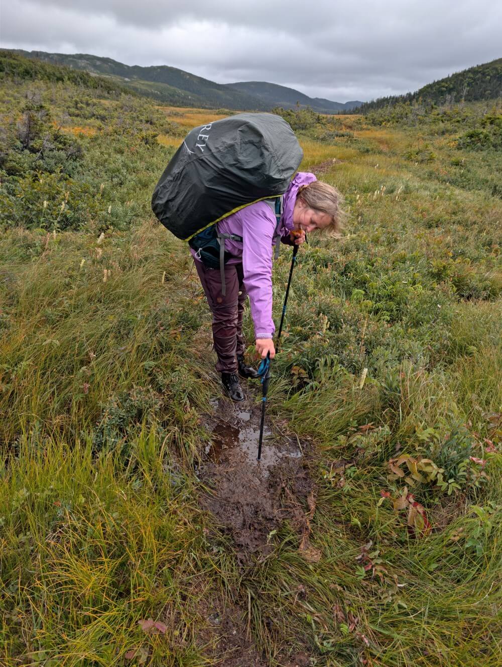
- The mud and water pools along the route can be surprisingly deep, and it’s often impossible to tell how deep they are until you step in. I found out the hard way (hip deep!)
Weather
- The weather conditions can change a lot and quickly in this area. And, as mentioned, there are not many places to hide
- In wet weather, the mud gets deeper, bogs become waterlogged, rivers rise, and many sections become more slippery. Hiking in these conditions requires extra time, effort and care.
- Please note that being wet and cold is not a valid reason for rescue, unless you are unable to safely continue or are at risk of hypothermia
- Fog can occur at any time and can make navigation difficult. Snow is also possible on some sections of the route during the early hiking season
Recommended items to bring
The lighter your backpack, the easier and likely more enjoyable your Long Range Traverse experience will be. That said, backpacking is all about balance, as you still need to carry everything necessary to stay self-sufficient and comfortable.
There are some items that I would specifically recommend to bring on the Long Range Traverse:
- Long Range Traverse permit – Don’t forget to attend the orientation to get your permit. Keep it handy when boarding the Western Brook Pond boat as you’ll need to show it to the staff
- Satellite device – We always bring a satellite Inreach for emergencies. If you don’t have one, Parks Canada will lend you a locator device
- Paper topographic map and compass – Hikers should carry (and know how to use) a paper map and compass as well as GPS navigation. The map can be purchased in the shop at the Rocky Harbour Visitor Centre
- Portable charger. Be sure to bring a power bank for your phone. This is especially important on the LRT, since you’ll be utilising GPS navigation on your phone
- Insect repellent and bug net/jacket – We had it easy in mid September (barely saw any!) but I’ve heard that the blackflies and mosquitoes can be ferocious earlier in the season
- Toilet paper. There is no toilet paper provided anywhere on the route. Bring your own supply, as well as hand sanitiser
- Hiking poles – Offering support for steep descents and ascents as well as river crossings, hiking poles also helpful for checking the depth of mud pools. We use the super light, compact and foldable Black Diamond Distance Z poles
- Camp shoes – Our shoes were wet for four days, making it a real treat to change into dry camp shoes at night. Next time, I’d bring something less sandal-like as the campsites were very muddy (I usually use lightweight Teva Hurricane Drift sandals)
- Gaiters – We found it really helpful to wear gaiters underneath our trousers on sunnier days. It kept water and mud out of our boots on the easier river crossings
Where to stay before and after the Long Range Traverse
Rocky Harbour is the primary accommodation hub for the Long Range Traverse, offering a range of B&Bs, small inns and cottages. The town is about 20 minutes drive from the Western Brook Pond parking area.
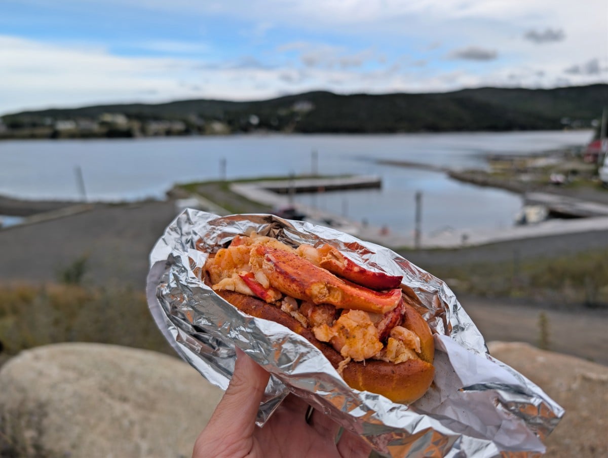
The night before starting the LRT, we stayed at Gros Morne BaseCamp in Norris Point, just south of Rocky Harbour. Our double queen suite had a private deck overlooking Neddie’s Harbour. It’s right next door to the JC King Lobster food truck, the best place for lobster rolls in Newfoundland!
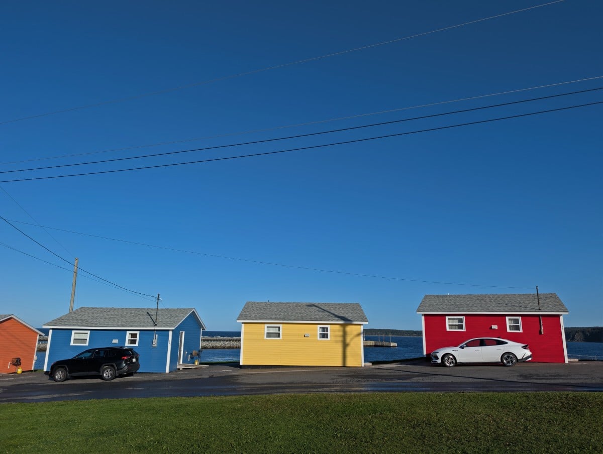
We were grateful to land at Gros Morne Cabins after our LRT hike, a colourful collection of small cottages right on the water in Rocky Harbour. I loved the homemade quilt adorning our queen size bed and the deep bathtub. The property has an on-site laundry, which was super convenient for us.
If camping, Parks Canada operates five frontcountry (vehicle accessible) campgrounds in Gros Morne National Park. There are more than 200 sites, with reservations launching in February each year.
Green Point Campground is the closest to the Western Brook Pond trailhead and offers a mix of serviced and unserviced sites adjacent to the ocean. The campground also has oTENTiks, perfect for hikers who want a break from sleeping on the ground!
Other posts you may find helpful
48 Hours in St John’s, Newfoundland: Best Things to Do
East Coast Trail Hiking and Camping Guide, Newfoundland
East Coast Canada Road Trip | 2 and 4 Week Itineraries
Quebec’s Whale Route: Highway 138 Road Trip Guide
27+ of the Best Beaches in Nova Scotia, Canada
Check out these recently published posts:

One half of the Canadian/British couple behind Off Track Travel, Gemma is happiest when hiking on the trail or planning the next big travel adventure. JR and Gemma are currently based in the beautiful Okanagan Valley, British Columbia, Canada. Consider buying us a coffee if you have find any of our guides helpful!