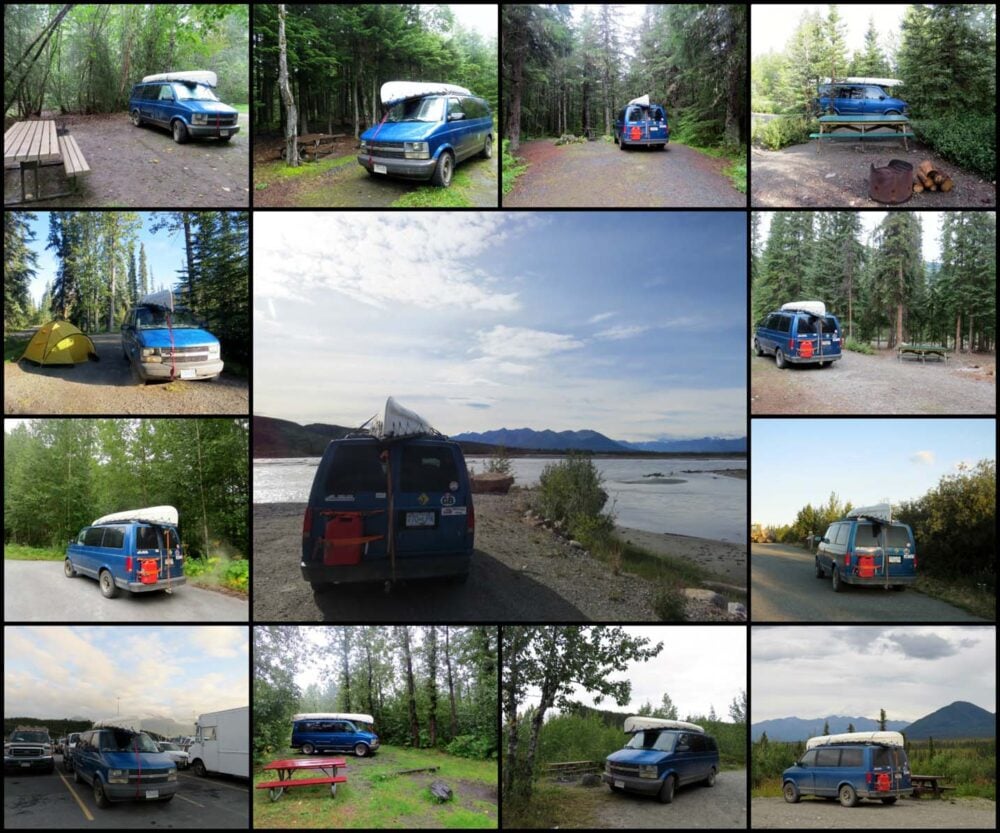
We left our home on Vancouver Island, Canada, on 13th April 2014 for an epic trip around Western Canada.
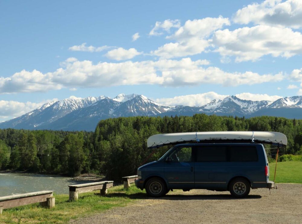
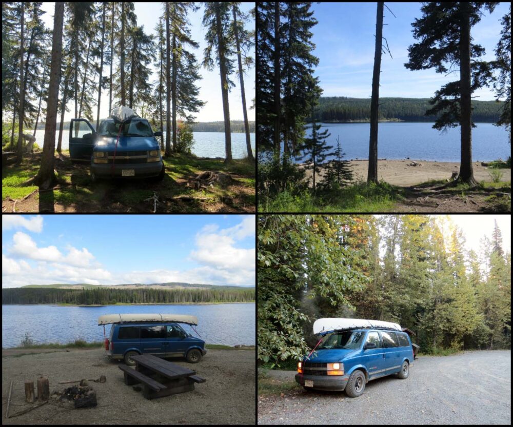
For five months we travelled in our converted Astro Van and explored British Columbia, Yukon, North West Territories and Alaska.

There was plenty of awesome paddling, hiking and off-the-beaten-track adventure, with the highlights being the Yukon River, Tombstone Territorial Park, Dawson City and Valdez (Alaska).
Regarding our budget, we had a pretty tight one for this trip. We had quit our jobs and had no source of income (I didn’t make any money blogging back then).
This five-month road trip cost $7000CAD, around $45/day. This included all of our living expenses, transportation (gas, insurance, maintenance) and attraction/activity costs but not the initial van investment or conversion.
The following post comprises our thoughts and experiences during the five-month trip, starting on Vancouver Island and concluding in Kelowna.
- Week 1 and 2: North Vancouver Island
- Week 3 and 4: South Vancouver Island
- Week 5, 6 and 7: Sunshine Coast
- Week 8 and 9: Driving to Yukon
- Week 10 and 11: The Dempster Highway
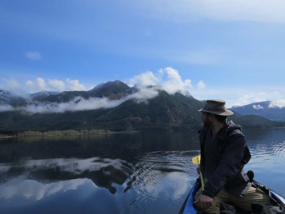
- Week 12 and 13: Paddling the Yukon River
- Week 14 and 15: Dawson City
- Week 16: Whitehorse, Carcross & Atlin
- Week 17 and 18: Alaska
- Week 19: Driving the Alaska Highway
- Week 20: Tumbler Ridge
- Week 21: The Okanagan Valley
Last updated October 2024

Week 1 and 2 – North Vancouver Island
What a feeling to be finally back on the road!
Two and a half years in the Comox Valley is the longest we have lived anywhere together, and while it was a great place to be waylaid, we are happiest exploring new places.
Not to mention that we now have at least five months off work, which does help too!
The first couple of weeks of our Western Canada road trip were based in North Vancouver Island – a region we had already seen some of and loved for the quiet, space and plentiful free camping.
You may wonder why we headed North first, over the much warmer southern half of the Island. Trust me, we did too after realising just how cold camping in April can be!

Cold and wet
Well, I’ll get to the why later, but camping in early Spring was most certainly different to what we were used to.
Campfires? No longer just for entertainment, we often had one going all day just for warmth. I don’t think either of us took off our thermals during these two weeks.
And the rain. Boy, do you notice the rain when you’re camping in it! We knew it would be cold and possibly very wet, but it’s hard to imagine while you’re planning inside a nice warm condo.

Finding space in the van
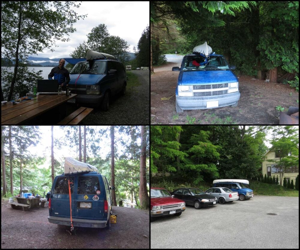
Aside from the weather, we’ve also had a problem with having way too much stuff in the van.
We hadn’t finished sorting our belongings by the time we left our home on Mount Washington, so the van was in a bit of a jumble.

A substantial part of this is food from our condo, including about 2kg of frozen edamame beans which I’d forgotten were still in the freezer, oops.
Needless to say, we had quite a few edamame bean-based meals over the first week or so! We’re finally getting there now though, maybe in another week or so things will be looking a lot better.

Sticking to the budget
Weather and organisation aside, life is good. We’re finally doing exactly what we’ve saved, waited and planned for. We’re outside, paddling, hiking, caving, exploring and living.
Best of all, we’re stuck to our budget of ten dollars a day. That’s the total for both of us, excluding gas for the van.
In fact, we would have been able to save money if grocery stores in the North of the Island weren’t so expensive! We took advantage of free camping at the many northern recreational sites almost every night.
We paid for a campsite near Telegraph Cove ten days in to experience proper showers (our solar shower can be lacking at this time of year).
Here are some of our highlights from the first two weeks on the road, around North Vancouver Island.

Cape Scott Provincial Park
Here’s one of the reasons we went North first – the $10 camping fees per person per night in Cape Scott Provincial Park starting May 1st.
Cape Scott is the north-western tip of Vancouver Island, and it’s a muddy 47km return hike to the Lighthouse at the end. We looked so happy at the start!
Considering it’s one of the wettest parts of the Island, we were very lucky to hike into the Park on such a beautiful day.
We still couldn’t escape the mud though! 3 days, 50km, one 6.6 magnitude earthquake and a whole lot of mud later, we made it!

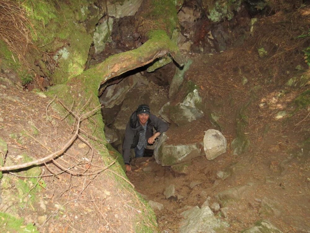
Caving on North Vancouver Island
We were continuously surprised by what could be found just off the main highways. Huson Caves was a real highlight (near Woss), with the Upana cave system near Gold River as well. Both are completely free!
Weeks 1 & 2 – Comox Valley to Cape Scott and back.
Kilometres driven: 1402
Kilometres hiked: 50.4 – Cape Scott Trail
Money spent: $160 (right on budget!)
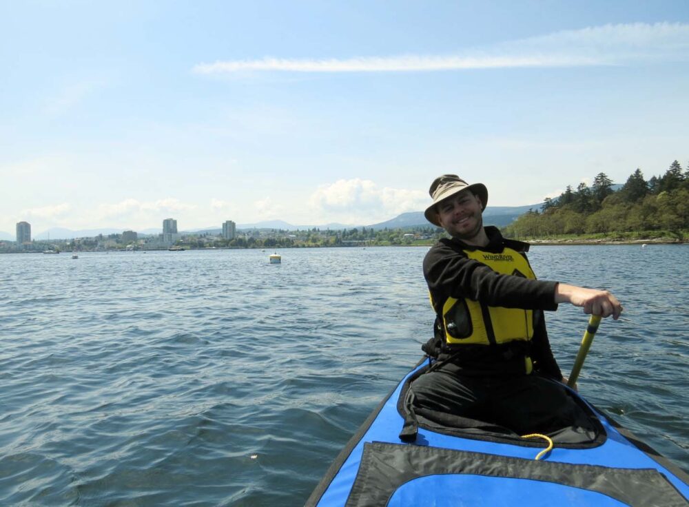
Lakes paddled: 3 – Atluck, Alice and Muchalat plus ocean canoeing on Johnstone Strait

Top level L-R: Little Bear Bay, Atluck Lake, Pinch Creek (Alice Lake).
Second level: Kathleen Lake, Nissen Bight (Cape Scott Park), Nels Bight (Cape Scott Park)
Third level: Alder Bay (paid camping near Telegraph Cove), Muchalat Lake, Miracle Beach.
Week 3 and 4 – South Vancouver Island
The first two weeks of our six-month road trip around Western Canada had been pretty wet and cold to stay the least.
Needless to say, we were pretty excited to have a four-night stay at a hotel in Tofino waiting for us by day 17.
A stay in Tofino
All the way back down from Port Hardy, we were patting ourselves on the back for having the forethought to pick up a really good hotel deal a few months before.
Being that we had already been to this area twice, the hotel stay would enable us to hide from the rain for a few days, catch up on the blog, watch lots of trashy television and get reacquainted with indoor plumbing.
Maybe we would head out to grab some food from Tacofino once in a while. However, as soon as we left North Vancouver Island, the sun came out.
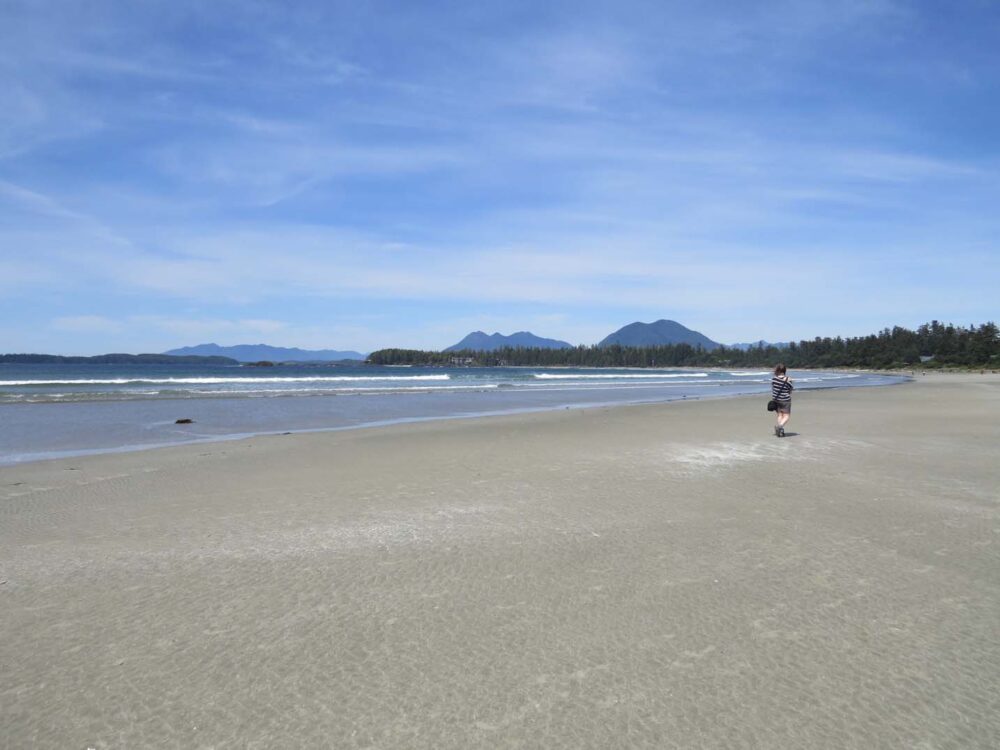
The sunniest stay on the West Coast
The sun didn’t just come out either, it truly shone, from 9am to 8pm almost every day of our visit. The locals were amazed at the 25 degree sunshine too; ‘it never gets like this, even in summer’ they said.
We mourned our lazy hotel stay for about half an hour and then headed out to frolic in the heat like everyone else.
Despite a few exceptions, the next few weeks were more of the same. And we have loved it. Even when it has rained, somehow it just wasn’t so bad.
While visiting Carmanah Walbran Provincial Park, one of the wettest places on the Island, we experienced rain so heavy that we could place a 500ml water bottle under our tarp and it would be filled within 5 minutes.
Two weeks of fun
These last few weeks have honestly been wonderful. OK, I know I talk about the weather a lot, but it really does make a difference when you live in a van.
Aside from the utterly fantastic sunshine that kept pouring out of the brilliant blue sky (fine, I’ll stop) we met up with lots of friends, both old and new, enjoyed plenty of showers, got out in the canoe a fair bit and ate very well.
The best of Southern Vancouver Island
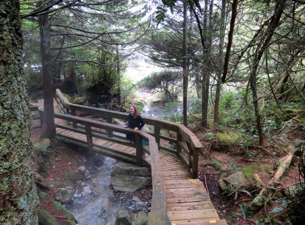
- We explored the best rainforest we have seen on the Island (Carmanah Walbran)
- Soaked in hot springs (Tofino)
- Returned to one of our favourite places and had an equally fantastic second visit (Salt Spring Island)
- Climbed small mountains (Mount Maxwell, Mount Finlayson)
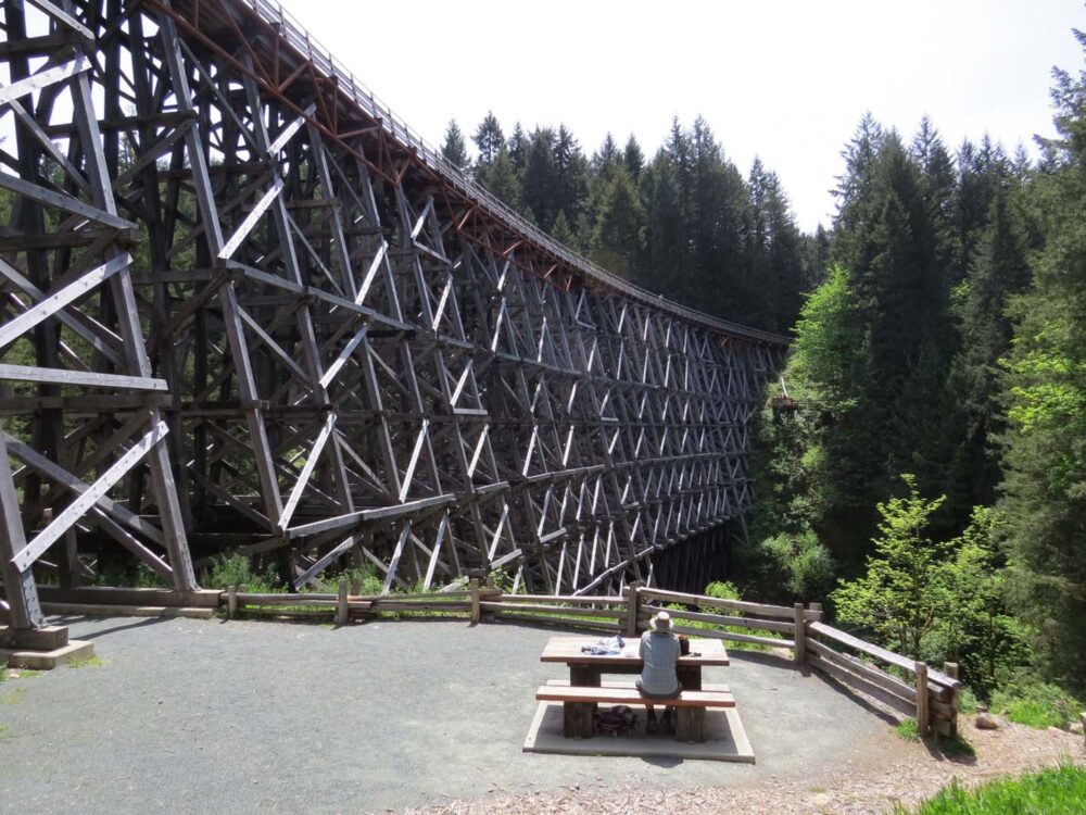
- Made new discoveries just off the main highway (Cowichan Bay, Kinsol railway trestle)
- Finally made it to some long-awaited destinations (Newcastle Island, Merridale Cidery, Englishman River Falls)
Warming up
The contrast between our time in the north of the Island and the south was a bit like night and day. It wasn’t only the weather and temperature, but also the landscape, people and places.
North Vancouver Island was just coming out of hibernation in mid-April, while in the south, early May means it’s almost Victoria Day long weekend (17th-19th) and therefore the start of the summer season.
A social few weeks
It may have been a bit busier (we had to camp with other people!) but the atmosphere was nice after so many days of quiet in the north. It’s been social too.
As well as meeting up with friends around the ‘big’ Island (one of these meetings included a return trip to the Comox Valley) and Salt Spring Island, we’ve been stopped a number of times by curious people.
This is usually regarding our canoe, our GB sticker on the back of the van or what we’re doing in general.
It’s been really refreshing to be able to talk about our trip, and our plans, get tips and advice, and sometimes even contacts for later on down the road. If we’ve met you recently, then this is a hello for you!
Finding free camping on Vancouver Island
What with the south of the Island being so much busier, there are far less free places to camp, even in May.
Our beloved free rec-sites that we were so used to around North Vancouver Island were nowhere to be found, but somehow we still didn’t pay anything for accommodation the whole time (thanks to our wonderful friends!)
Blowing the budget
Unfortunately, our ingenuity was not around while we were in Tofino; I think staying in a hotel went to our heads and the budget just flew out of the window within the first day.
Even in hindsight though, sometimes you just have to live a little.

Missing Della Falls
As much as we have enjoyed the last few weeks, a couple of things have not worked out for us.
We chose not to hike to Della Falls as planned, due to the snowpack coming so late this year. Watch this space though, it may happen someday! (edit – it did).
Weeks 3, 4 and 5 – South Vancouver Island – Comox Valley to Comox Valley via Tofino, Nanaimo, Carmanah Walbran, Salt Spring Island, Victoria, Shawnigan Lake
Kilometres driven: 1360 (2762 total so far)
Kilometres hiked: 26km (Newcastle Island, Carmanah Walbran rainforest, Mount Maxwell, Mount Finlayson, Kinsol Trestle)
Lakes paddled: 1 – Shawnigan Lake. 3 ocean canoes
Money spent: Too much! The first week was massively over budget due to treating ourselves in Tofino with the Hot Springs Cove tour and restaurant meals (around $500). Second week was better, totalling $100 ($30 over budget). Third week $120 ($50 over budget) And this was all with free accommodation! Oops.

Top level: Next to Taylor River (near Port Alberni), Miracle Beach, Rathtrevor Beach (Parksville)
Middle: Carmanah Walbran Provincial Park
Third level: North Shore logging road to Carmanah Walbran, Goldstream Provincial Park (near Victoria), Englishman River Falls Provincial Park (near Parksville)
Week 5, 6 and 7 – Sunshine Coast
Although we had plenty of exciting adventures lined up after our time on the Island was done, it was still hard to leave our home base of the last few years.
Despite thinking that we had explored most of it, we still managed to explore some new places within the last few days, squeezed in between saying goodbye to friends and trying to organise ourselves for the next stage of the trip.
We finally dragged ourselves onto the ferry to Powell River almost a week after we had arrived back in the Comox Valley.

The Powell Forest Canoe Circuit
And then it inevitably started to rain. Trying not to take it as an omen, we pushed on and started the Powell Forest Canoe Circuit the day after arriving on the ‘Sunshine’ Coast.
The 50km eight lake long circuit was beautiful in parts and rainy in others, though always so very quiet (we saw two people in five days).
Our second canoe circuit, this one was an improvement in quite a few ways from the first.
The portages were excellent (lots of canoe rests throughout the 8km total), the campsites well cared for, and most importantly, we were better prepared.
The huge Powell Lake did, however, catch us out on the last day; we had to battle a headwind and subsequent one-metre swell for the final 10km stretch home.
Dinner Rock Rec Site
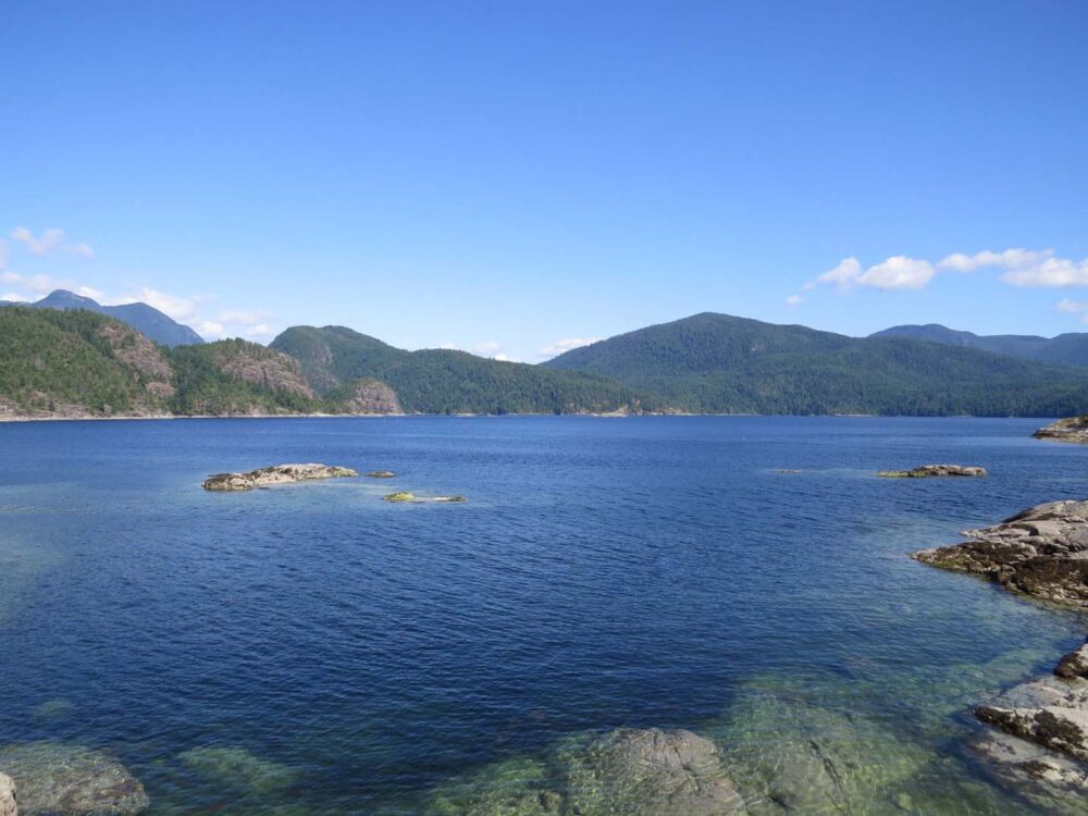
After finishing the circuit, we found our favourite free campsite so far.
Dinner Rock Rec Site, just south of Lund, is perched right above the ocean with views of nearby Savary and Cortes Islands and also Vancouver Island across the Strait.

Within ten minutes of arriving, we spotted both sea otters and whales just offshore and later enjoyed dinner in front of a blazing orange sunset.
We ended up staying three nights while preparing for our next adventure, and waiting for the weather to turn. We luckily didn’t have to wait long.

Desolation Sound
Now, I admit I was a little worried about Desolation Sound. We would be at least 20km out at sea with just our canoe, the furthest we would ever have been away on a paddling trip (logging roads were never too far away in the Powell Forest).
It turned out to be our best canoe trip yet. Desolation Sound wasn’t as quiet as the Powell Forest (or as remote as I’d thought, there’s a good cell phone signal all over!) but it made up for everything else. If you paddle, you MUST go here.

It was just stunning. We had perfect weather too, which always helps. JR definitely lucked out for his birthday, spending it paddling and snorkelling around such a beautiful place.
Ocean paddling is a lot more interesting for the most part than lake canoeing. We ate and drank like kings, as without any portages we could bring as many luxuries as we liked.
Unexpected free camping
The rest of the Sunshine Coast flew past after another stop at Dinner Rock as well as Townsite Brewery for a pretty early (11am) tasting. They were pretty generous with their samples, I must say!
After the first ferry to Earl’s Cove, we were back in prime Vancouverite weekend territory and almost had to pay for camping, but the host never returned to the campground that night.
Our current record of paying just once in two months still stands!
The rest of the Sunshine Coast
We hiked to see nearby Skookumchuck rapids, which were fast but not as wild as they would have been in high tide.
Jean Robert also explored Homesite Caves (a little too narrow for my liking) before we headed to the pretty seaside town of Gibsons Landing for our last night on the Sunshine Coast.
Finally, after almost two months of travelling, we made it to Vancouver, the long way round. From here, we would head north, all the way to the Arctic.
First, though, we took the opportunity to enjoy big city life and the continuing good weather while we could.
Weeks 6, 7 and 8 – The Sunshine Coast
Kilometres driven: 784 (3546 total so far)
Kilometres hiked: 20km – 8km round trip to Skookumchuck Rapids being most of it
Lakes paddled: 8 plus Desolation Sound ocean trip
Money spent: $350 over three weeks – slightly over budget, but we did have to pay $52 in transport costs for the Canoe Circuit (taxi then bus to return to starting place) and $25 marina parking for Desolation Sound….and it was JR’s birthday!
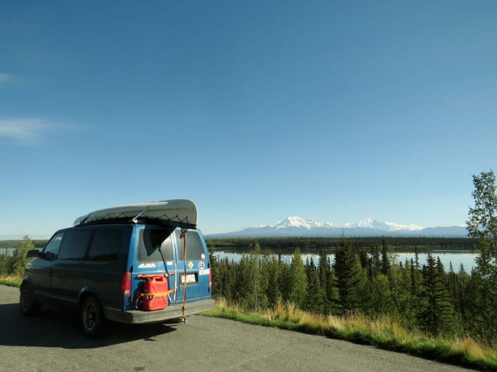
Week 8 and 9: Driving to Yukon
What a contrast we experienced over these couple of weeks of our road trip.
To be sure, we did travel a lot of kilometres, but to leave the big city bustle, head through several mountain ranges, an almost desert landscape, and then onto boreal forest, to finally arrive in the Yukon wilderness….it was pretty incredible.
Picking up speed
We drove the bulk of 3750km in just five days.
Looking back on the speed of our road trip so far, you may wonder why we were suddenly in such a hurry. The truth is we were around a week or so ‘behind schedule.’
The aim was to reach the Arctic Circle by 21st June – the summer solstice and also my 25th birthday.
To put you out of your misery, we did make it on time, via one great hike, some great fishing, a couple of glaciers, a winery, lots of too-blue-to-be-true lakes and a most excellent roadside bannock stall.

Living the big city life
Despite having visited Vancouver a handful of times already (and also not classing ourselves as city people at all), we still had a small list of must-do’s before we hit the road north.
We were lucky enough to stay with an old friend of JR’s, which meant free accommodation in the city and a chance to see some more new places not even on our Vancouver hit list.

It was to be our last time in a large city (some may say ‘proper civilisation’) for a while, so we took plenty of advantage of the opportunity. Many thanks are owed to both Ben and Emily for putting up with us for so long!
We ate and drank our way around Vancouver in between a few mountain hikes, bear watching and a trip to the Aquarium.
I don’t like busy places in general, but Vancouver is definitely one of the best cities out there. For us though, the road was calling and it was time to head north. Finally, the real road trip began!

The desert town of Lillooet
Onwards! Crossing several mountain ranges and passing more stunningly blue alpine lakes, we ended up in what felt like a desert. Well, almost.
We got out of the van in Lillooet to be hit by warm wind, much as we experienced in southern Europe.

The landscape is semi-arid, with rugged mountains and canyons almost enveloping the mighty Fraser River.
The area has very hot summers, sometimes reaching 40 Celsius in the shade. I found it hard to believe we were still in Canada. So I went with it.
When it feels like France, what do you do? Go to a winery. Luckily, the excellent and very local Fort Berens winery offered a fantastic tasting. (If you’re counting, we were up to three breweries and a winery within one week. And then nothing since…)
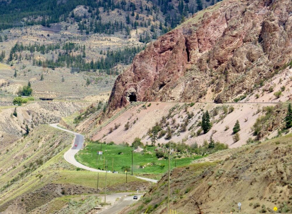
Driving through cowboy country in BC
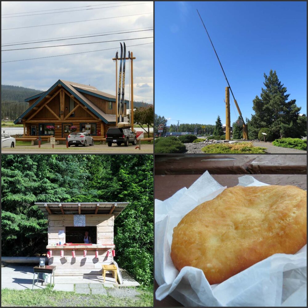
And this was when we started travelling quickly. From Lillooet, we drove north past many, many ranches (it’s cowboy country, don’t you know) to camp near Williams Lake for the night, not before spotting the world’s largest cross-country skis in 100 Mile House.
We didn’t spend too much time in this area as we will be back in late August/early September, primarily to paddle the Bowron Lakes Canoe Circuit.
Road to the north
The road west got more interesting around Smithers, where the hills turned into mountains yet the land still remained so very green and lush.
I could have happily stopped here for a while, but alas, we just had time for laundry and a short walk to a waterfall.
Consoling ourselves with bannock from a roadside stall near Hazelton (traditional First Nation fried bread), we turned north on the Stewart-Cassiar highway, the road that would take us all the way to the Yukon border.
We did consider going to Prince Rupert and the Haida Gwaii islands on the West Coast, but the ferry price was astronomical, even if we just went as passengers.
It’s the kind of thing that needs to be the central focus of a trip, rather than just an afterthought.
900km of driving
The Stewart Cassiar highway? Lots of bears, mountains, glaciers and lakes (the latter being particularly good for fishing as we discovered).
But that is stretched over almost 900km of driving, so not all of it is particularly exciting.
We did however see seven black bears the same day we made the detour towards Stewart on the Alaskan border to see Bear Glacier. They were all stuffing themselves with grass next to the road, not bothered by the (sometimes huge) RVs going past.
This was when we first started to spot the huge numbers of Alaskan-bound travellers…but more about that next time.
It was also about the time when we noticed how long the days were (11pm sunsets) and how much cooler it was.
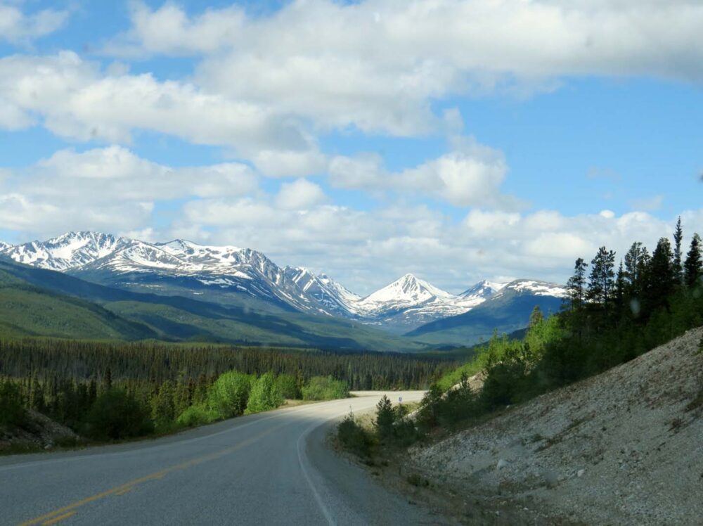
Arriving in Yukon
Finally, on the 17th June, we entered the Yukon Territory. I write, ‘finally,’ but I was actually a bit sad to leave BC and besides, it wasn’t the end of the driving.
We still had around 900km to go before the start of the Dempster Highway. And then from there, another 400km to reach the Arctic Circle.

It was going to be a long couple of days. Luckily then, it was light for around 19 hours a day and the scenery wasn’t half bad.
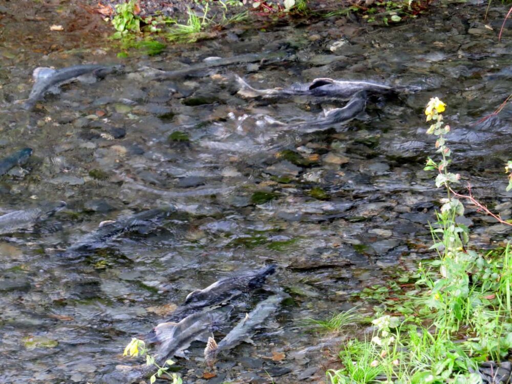
The wildlife kept coming too, with a coyote hanging out with us at a rest stop near the Yukon River’s Five Finger Rapids (which we will be canoeing soon!)

Amazing week….but lazy
An incredible week and a bit, though I did find it difficult to be so inactive. On the one hand, it made for a fairly cheap time, if you exclude all of the petrol/gas to do it.
It does make me wonder how people manage to do such extensive BC/Yukon/Alaska road trips in a month though…do they ever have the time to stop and see anything?!
The major thing I took away from the experience? Canada is big. Very big. How can we have driven almost 4000km and still be in the same country?!
Weeks 8 and 9: Vancouver, BC to the start of the Dempster Highway, Yukon
Kilometres driven: 3750 (7296 total so far)
Kilometres hiked: 18km Garibaldi Hike plus 10km around Vancouver (incl. Grouse Grind)
Lakes paddled: 1, Jigsaw Lake on the Stewart-Cassiar Highway
Money spent: $250, not including some (OK, most) activities in Vancouver paid for by my lovely parents and brother for my birthday. Thank you!

Squamish Riverside Rec Site, Cheak Canyon north of Squamish (very popular with climbers), Rogers Creek near Lillooet, Jigsaw Lake (home of great fishing!), A bear just for fun, Co-op Lake near , Five Fingers Rapids Rest Stop north of Carmacks, Rest stop near Dease Lake BC, Dugan Lake near Williams Lake
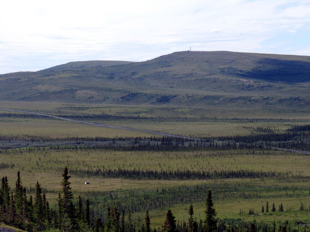
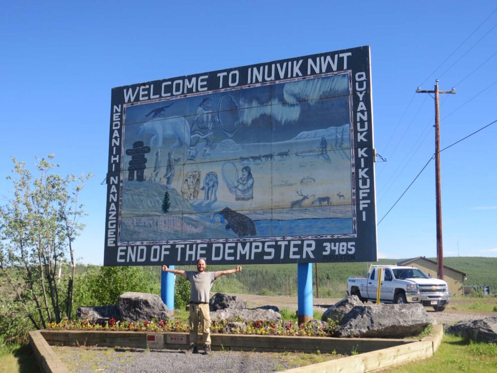
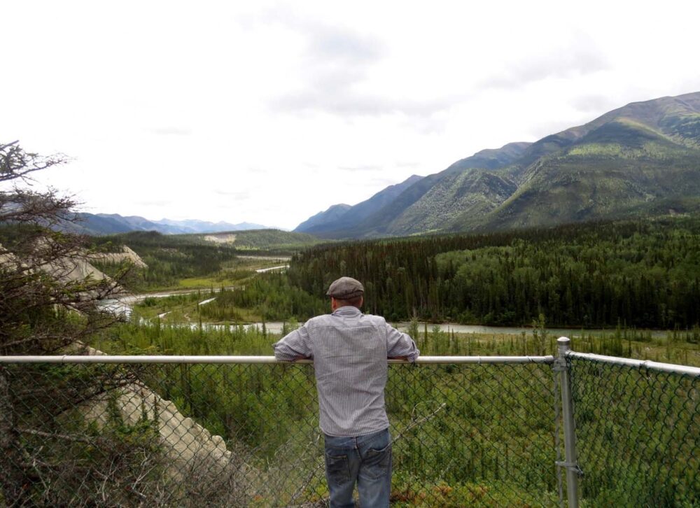
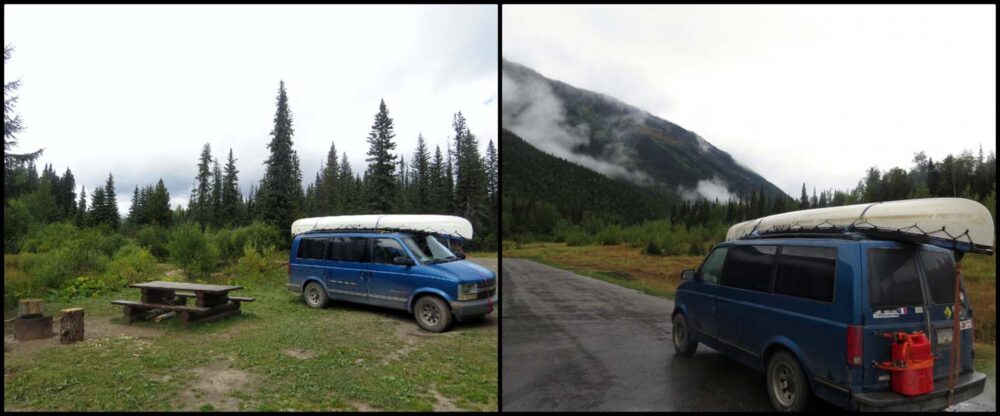
Week 10 and 11: The Dempster Highway
The Dempster Highway is legendary in Canada. It’s a 735km dirt road to Inuvik* in the Western Arctic, the furthest you can drive north in Canada.
The drive takes you over the Arctic Circle, to a land where the sun doesn’t set for weeks in midsummer, and then doesn’t rise at all in midwinter.
It was Jean Robert’s dream to drive it, and I think we did his dream justice, spending 11 days in total on the Dempster. We raced to the Arctic Circle in time for the summer solstice on 21
We raced to the Arctic Circle in time for the summer solstice on 21st June (also my 25th birthday) and then spent three days in Inuvik before heading back south. Strangely enough, it was actually the drive back I enjoyed the most.
(*2024 edit, now all the way to Tuktoyaktuk)
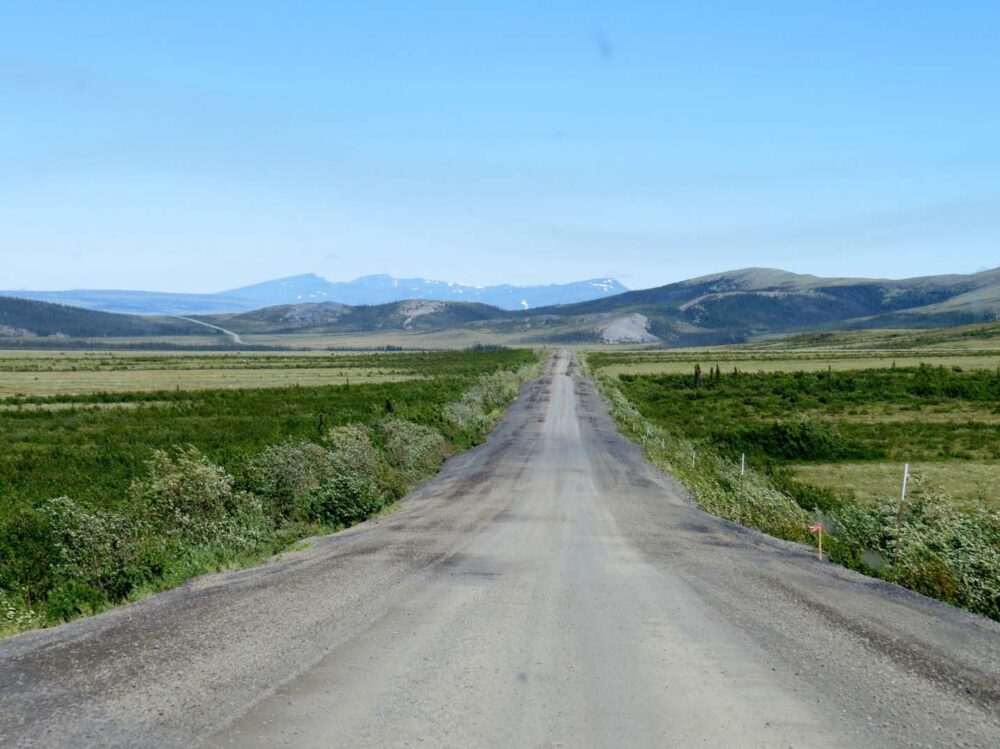
The Dempster Highway
Built in the late seventies, the Dempster Highway is feared as a tough road to travel. It follows the old dog sledding routes used by the North-West Mounted Police around the turn of the century (learned from the local First Nation communities) and is built on permafrost and tundra.
Drivers are advised to have two spare tires, an extra supply of gas and a well-maintained vehicle for the journey.
We’re no strangers to rough roads and remote locales. Our home of the last few years, Vancouver Island, is full of logging roads of varying conditions, so the well-maintained track of the Dempster was actually a nice surprise.
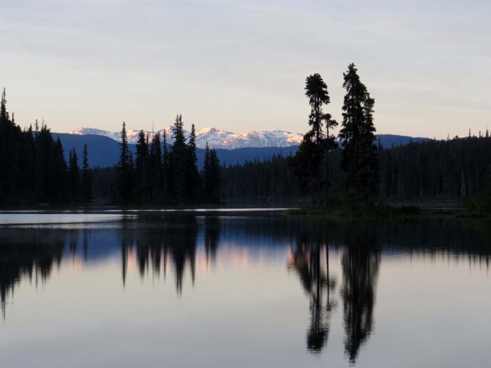
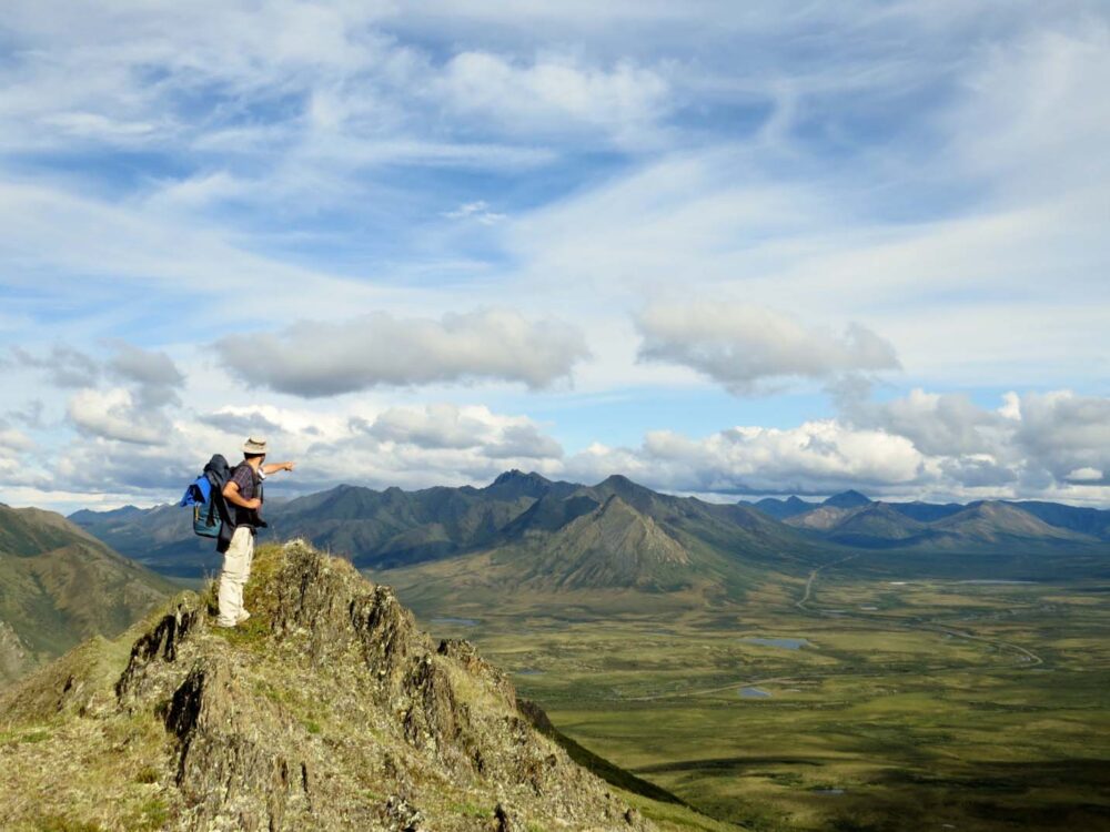
Tombstone Territorial Park, famous for rugged hills and jagged peaks, is only an hour or so in, and we were spotting white-capped mountains long before we got there.
We arrived at the Interpretive Centre to find Labrador tea brewing on the woodstove and bannock being cooked and served with local wild rhubarb jam. I can only guess they had heard I was coming.
We stopped driving at around 11pm, but not before spotting mountain goats and encountering a porcupine and grizzly bear. Well, not together, that would be a bit peculiar. The grizzly was very large and very fast. I was glad to be in the van.
More local wildlife made an appearance later when we did need to leave the van. A swarm of mosquitoes rudely invited themselves to dinner. We had been warned about this and had mosquito nets ready but jeez, I didn’t think they’d even dive in the food.
Jean Robert was even bothered, and he’s from New Brunswick. We retreated to the van and fell asleep under our makeshift bed net, to the anything-but-calming-hum of the bugs.
The mosquitoes were nowhere to be seen when we crossed the Arctic Circle the next day, probably due to the insanely high winds that made even walking difficult.
There aren’t really any trees in this area to act as a windbreak; there’s not really much of anything, besides rolling hills and the Dempster heading off into the distance. Whatever it is, it’s remarkedly beautiful, made even more so by the lack of people to share it with.
Wood stove pizza at the Arctic Circle
The clouds came in on the evening of the 20th, and didn’t leave until the 22nd. It was the first rainy day we’d had in weeks, quite a bit of bad luck for the summer solstice we had rushed to experience above the Arctic Circle.
No matter, we spent much of the day hiding from the mosquitoes (rain seems to perk them up), either in the van or the campground’s bug-proof shelter.
The latter did, however, have a most excellent wood stove, perfect for birthday/solstice pizza. What we didn’t realise was that we would soon be wishing for more days just like the 21st.
I’ve written more about the downsides of the Midnight Sun elsewhere, but I’ll leave you with this for now; 29 degrees, 24 hours a day, plus heat resistant bugs. It was a bit unexpected for the Western Arctic.

A few setbacks
Something else unexpected was the flat tire we received just north of Fort McPherson, one of the few settlements on the Dempster.
This was the same day the van started to rev up and down and intermittently stalling when driving below 50km/h. Losing a tire and the van making funny noises on the same day? Not good.
Losing a tire and the van making funny noises on the same day on the Dempster Highway, with mechanical services a long, long way away?
Really not good. To keep going or go back? Well, it was 50km less to keep going…. We did have a spare tire, but it was also a bit flat.
Problem solved with the help of some passing Albertans, we drove again (over 50km/h) until midnight, arriving in Inuvik early the next morning. It is one of the most interesting places I have ever been.
Friendly locals
The Mackenzie River runs alongside Inuvik, and we intended to start a 4-7 day paddle here to Tuktoyaktuk, the town further north next to the Arctic Ocean.
Needless to say, our plans changed when we discovered it would cost $1000 to ship ourselves and the canoe back to Inuvik afterwards, and we ended up enjoying this area for reasons we didn’t anticipate.
The locals are exceptionally friendly for one thing, not just in Inuvik, but along the whole Dempster Highway.
Turns out, they don’t particularly like the heat and bugs either, preferring the other seasons for the prolific hunting, fishing and sporting activities on offer (SO MANY skidoos! And dog harnesses in the supermarket!)
Driving south on the Dempster Highway
Leaving Inuvik, we were actually excited to get below the Arctic Circle again to have some form of night. A bit of a surprise after all that rushing to get so far north!
Driving south again, we took our time, enjoying the wilderness we had travelled this far to see.
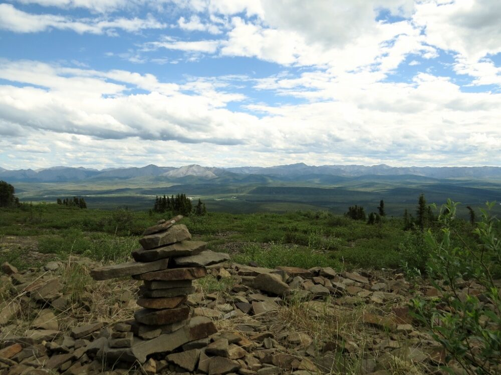
There were so many places to park off the road, and we hiked on the tundra and up the piles of slate to get a better view of the endless rolling hills mountains in the distance.
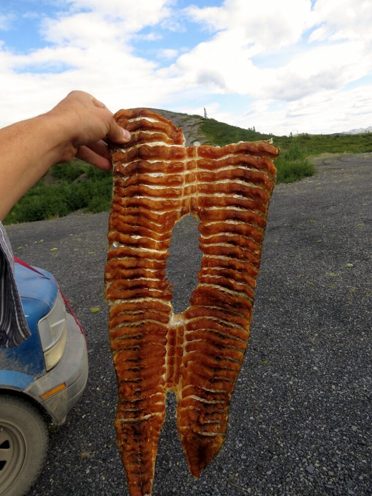
There were wildflowers too, as well as Labrador plants to make our own local tea with. Also local was Jean Robert’s smoked whitefish from a Gwich’in smokehouse camp by the river, and the bannock an Elder kindly offered us at the information centre when we told him we hadn’t been able to find any to buy.
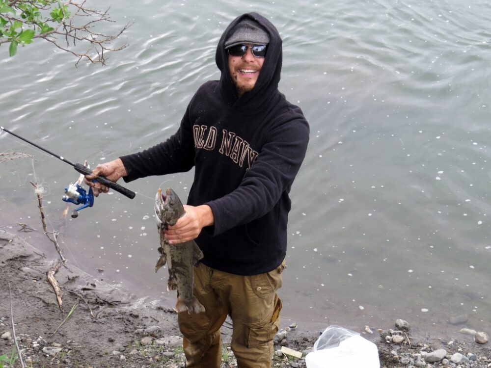
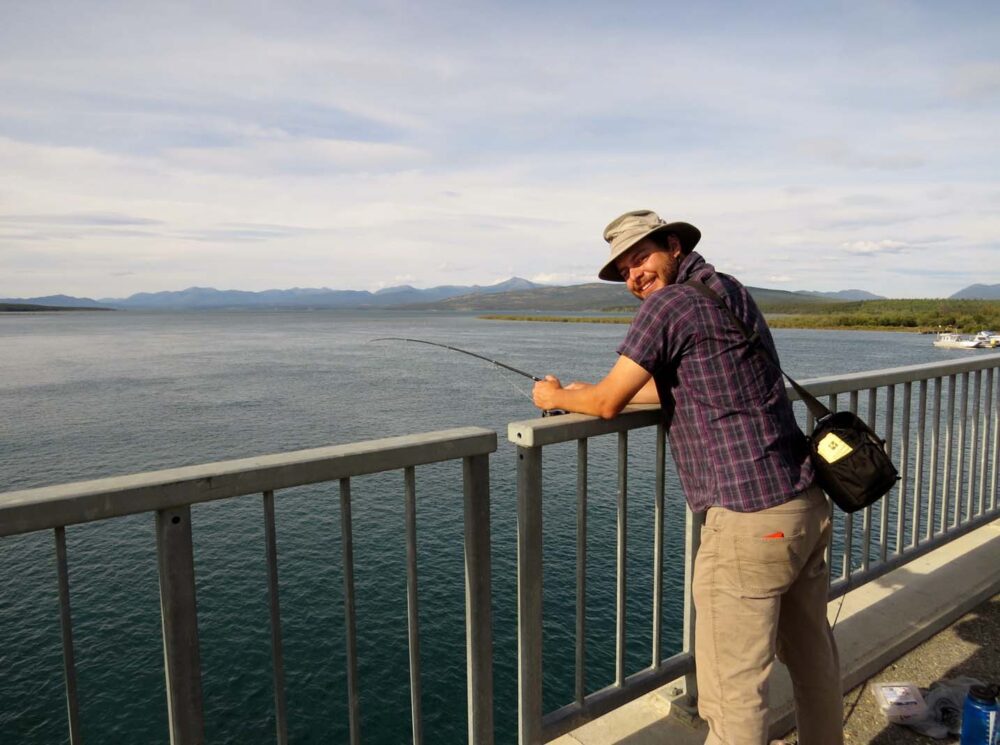
Fishing on the Dempster
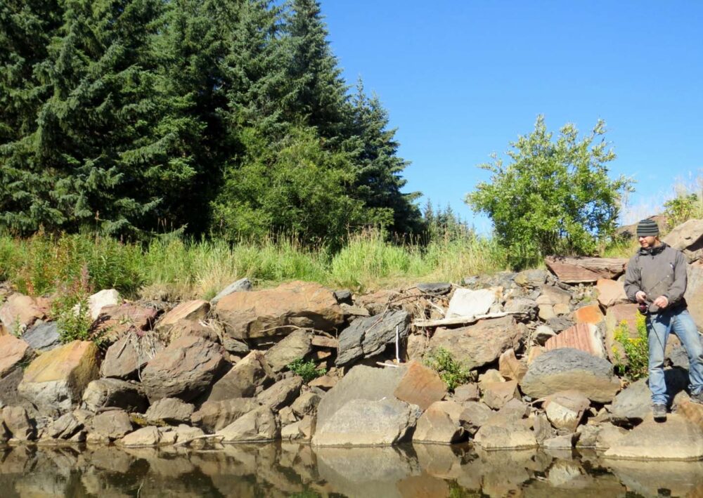
Jean Robert caught a big Dolly Varden on our last Dempster day. You may notice he looks pretty wet.
He jumped into the river after I accidentally pushed our spare tire out of the car (keeping it close for convenience) and it rolled off the nearby bluff, straight into the river.
He had to swim in neck-deep water to reach it. Looking back, it was quite hilarious. I did bring him dry clothes to change into, but he was determined to catch this big fish that he had spotted. Sure enough, he got it about ten minutes later.
You also may notice that JR looks dirty too. The fish jumped in the mud and splashed him. (Sorry fish).
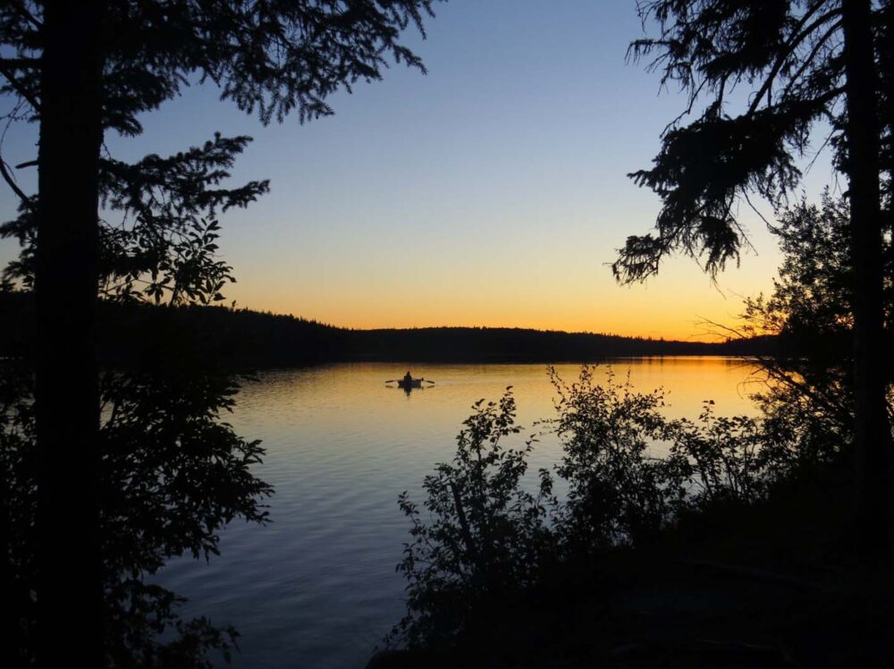
The last, and best, day
The best night on the road was the last. We parked overlooking an icy river and what looked like a volcano and cooked the grayling we had caught earlier on the Blackstone River. At 1am, everything burned red from the sun; finally, a sunset!
A beautiful end to an incredible ten days in the Arctic…..we ended up staying most of the next day too. We will be back again soon; Tombstone Territorial Park is still waiting (photo above).
Weeks 10 and 11: The Dempster Highway. 1520km return
$350 including food and paid camping in Inuvik plus one new tire at $200. Gas is VERY expensive in this area, being 1.89 in Inuvik
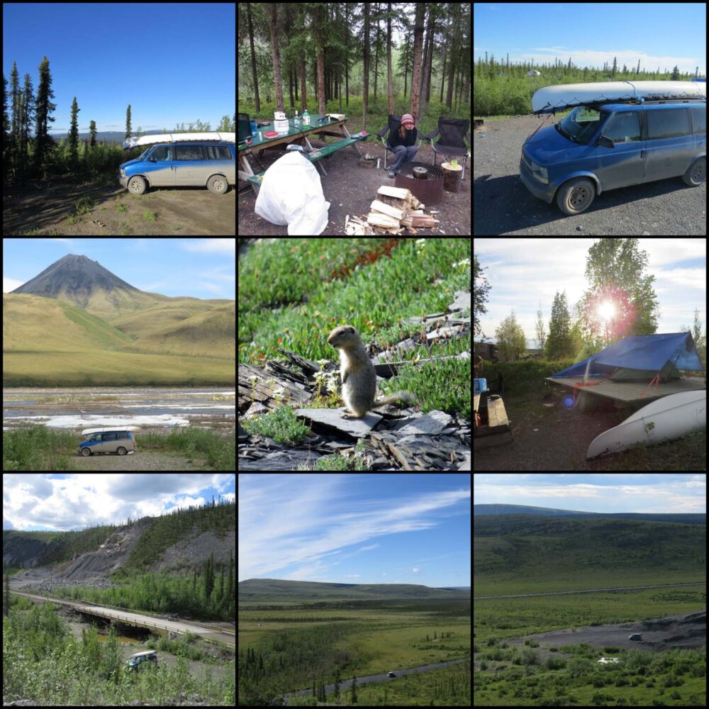
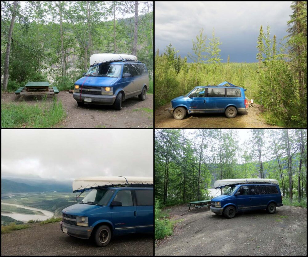
Just before Eagle Plains (halfway), Rock River Government campground (paid), NWT rest stop near Inuvik, Happy Valley Campground in Inuvik (paid), South of NWT border, south of Arctic Circle, Engineer Creek (very close to the Government campground), just outside of Tombstone Park boundary. And a ground squirrel called George in the middle, just because.
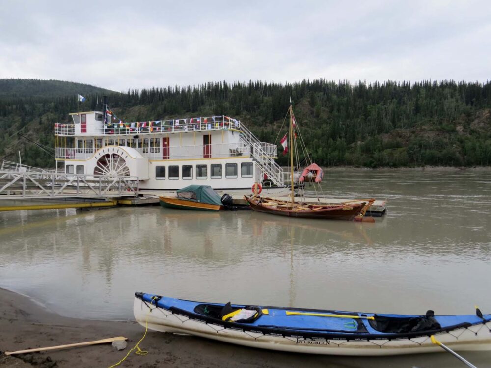
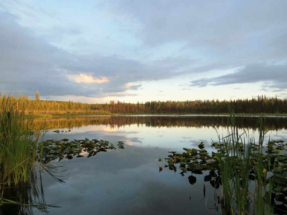
Week 12 and 13: Paddling the Yukon River
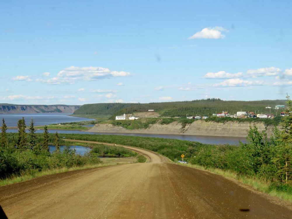
After spending 11 days on the dusty Dempster Highway to the Arctic Circle and back, I was looking forward to getting back to a bit of civilisation.
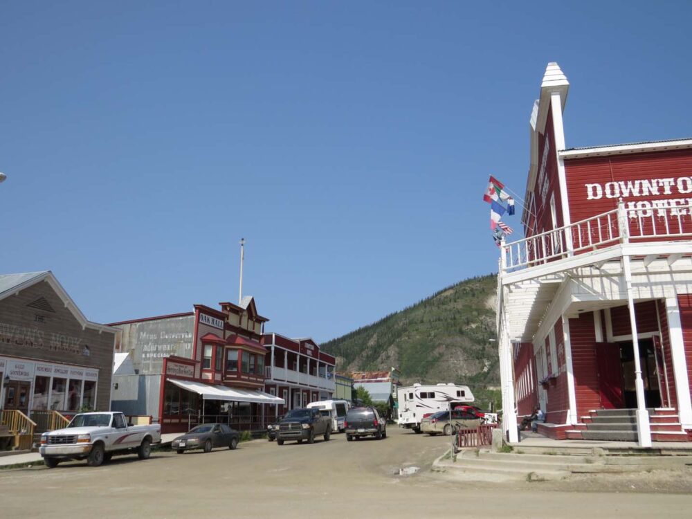
Dawson City wasn’t really what I had in mind at the time, but it ended up exceeding any expectations I could have ever had.
Playing a significant role in Canada’s gold rush history, Dawson City these days is a living museum and an outpost for travellers heading to or from Alaska.
For us, it was to be our base for a few days to prepare for our biggest canoe trip yet.
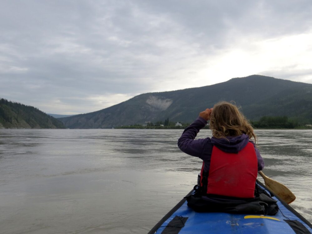
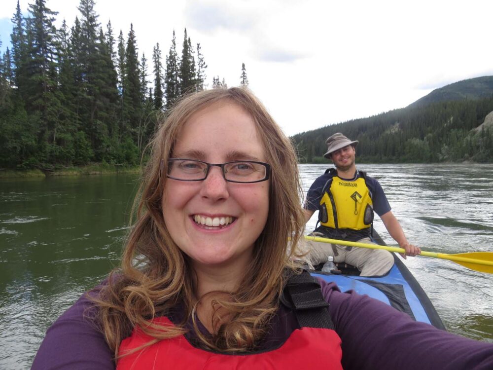
Paddling the Yukon River
Months before, when Jean Robert first suggested to me that we paddle the Yukon River from Whitehorse to Dawson City, I thought it was a great idea until I looked at the map and saw that it was a distance of 740km.
That didn’t sound so fun. Then he reminded me that it was a river, and rivers do tend to flow.
The Yukon isn’t exactly the slowest river either, travelling at an average of 10km/h. To the worst, he proposed, we could sit in the canoe for 7 or 8 hours a day and still make it in around 10 days without even paddling.
Now that didn’t sound very hard. I was in.

Preparing to paddle the Yukon River
At this point, you may be wondering why we would be heading into Dawson City to start a Whitehorse to Dawson City canoe trip.
Well, what with our rush to get to the Arctic Circle in time for the summer solstice, we didn’t have enough time to fit this trip in on the way up.

So instead, we had to take a shuttle bus from Dawson City back to Whitehorse (with the canoe and all of our gear) to start the trip.
I think it actually worked out a lot this way anyway since the van was waiting for us when we finished.

Canada Day in Dawson City
Arriving in Dawson City the day before Canada Day, we rolled into town with what felt like a million other RVs of all shapes and sizes as well as motorcyclists and the human-powered kind.
We took a day off from our trip preparations to celebrate my first Canada Day as a real, true Canadian Permanent Resident.
The morning parade was short and concise, but I think everyone was just in a rush to get to the free BBQ and cake.
Dancehall (or cancan) girls posed with local Mounties while the flag was raised and the National Anthem sung in English, French and the local native language.
Later, we watched the Yukon Gold Panning Championships by the river, introduced again with the National Anthem and cancan girls/Mounties combination.
We rounded it all up with the free Parks Canada ‘Greatest Klondiker’ show at the Palace Theatre.
We didn’t know it yet, but the whole day was a great representation of the spirit of Dawson City – the joining of gold mining culture with cultural diversity, bound together with northern tenacity and Canadian pride.

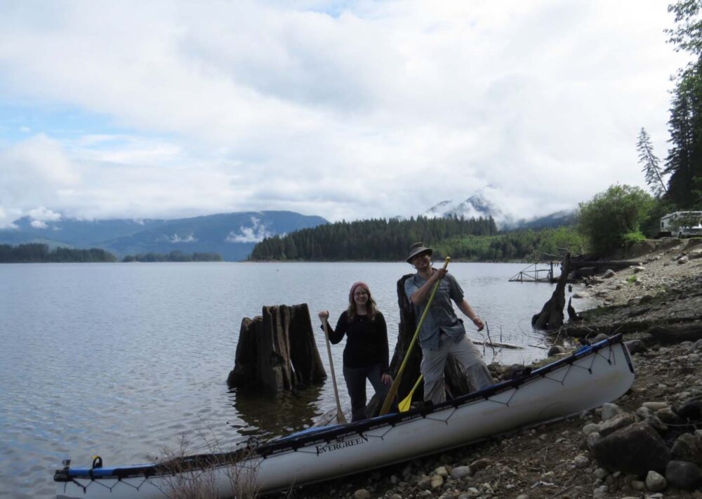
Paddling from Dawson City to Whitehorse
Don’t worry; we’ll get back to Dawson later. We actually ended up spending quite a bit of time there, so I’ll save it for another time.
Onto the Yukon, our first real river paddling experience. We’ve done a fair bit of lake and ocean canoeing, and a handful of connecting rivers as part of the Sayward Canoe Route last year, but nothing specifically on rivers.
In the North, there are big rivers everywhere you look, and if it’s not a river, it’s probably a really big lake that is actually part of a river.
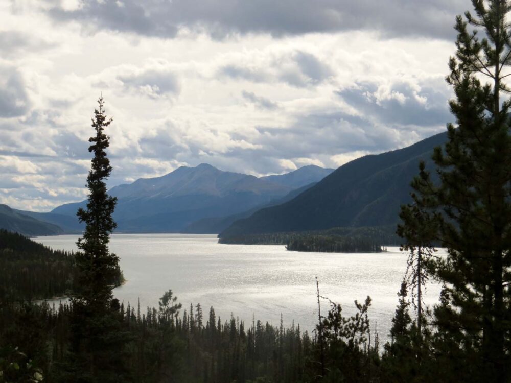
Lake Laberge, for example, is a 50km stretch of water not far on the Yukon River, just north of Whitehorse.
This lake and the Five Finger Rapids (roughly half way to Dawson City) were the only ‘dangers’ we were warned about before starting the trip. Aside from that, we were told to sit back, float and relax. And that we did, for the most part anyway.
Rain, rain, rain
The trip didn’t start well. It rained, a lot, and it was cold. 6 degrees in July cold. Half of my clothes were soaked, while I was wearing the other half all at once.
Starting a 730km trip cold and wet is not good. Our weather radio wasn’t helping matters, reporting ’60 per cent chance of rain’ every day for the next six days.
Arriving on Lake Laberge, it was still raining, and we had waves coming from behind us in two different directions. With a lake as big as that, you don’t mess around; we headed for land.
The next day, the water was flat as a pancake (unheard of apparently), and we went for it.
Paddling 45km down in eight hours we were exhausted that night, but extremely glad the next morning when gale-force winds came in and the lake was impassable by canoe.

Meeting other paddlers on the Yukon River
At times we felt like the only people on the river, not seeing any others for days (it helped that we tended to start and end late), but on other days we would see 4, 5 or 6 other groups of canoeists and boaters.
We met some great people (in particular, a group from Ontario who accompanied us on Five Finger Rapids day!), usually at campsites since it was hard to catch up or slow down for others.
A few days into our trip we learned that the Dawson City Music Festival would be starting around about the time we would be arriving at our destination. It felt like everyone else on the river was going except us.
Initially, I was a bit apprehensive as I knew tickets would be way out of our budget, and I don’t like crowds.
I gave into Jean Robert’s enthusiasm in the end and we paddled through the night (stopping at midnight and then getting up again at 5am totally counts as ‘through the night’ in my opinion) to get to Dawson in time to secure a campsite for the weekend. It turned out to be a very good decision.

Week 14 and 15: Dawson City
Since leaving Vancouver in June, we hadn’t stayed in one place very long.
Heck, for most of this road trip, we hadn’t stayed for more than a couple of nights in a row anywhere except for the Comox Valley and Vancouver while visiting friends.
By the time we finally left the tiny town of Dawson City (pop. 2000 in summer, 800ish in winter), we had been in the area for two weeks and JR had been offered a job.
I’m still not exactly sure how the former happened, but summer festivals and new friends definitely played a big part. That and the fact that Dawson City is a particularly special place.
For such a small town, it holds such iconic history within its small borders, and not just purely Canadian history either.

The Klondike Gold Rush
Dawson’s legacy began when George Carmacks, Tagish Charlie and Skookum Jim (and George’s wife Kate, but no one ever mentions her) discovered gold in Rabbit Creek, just outside what was then a tiny farming settlement.
The 1898 Klondike Gold Rush was on. Thousands of men and women from all around the world set out for the Yukon, traversing mountain passes and paddling mighty rivers (such as the Yukon, as we did!) in the hopes of eventually reaching Dawson.
Huge swathes of people didn’t make it, and most of those who did found that most of the land had already been claimed.
Dawson City in the 21st century
Nonetheless, Dawson grew to be the Yukon’s capital, with 40,000 people (the population of the Yukon is just under 34,000 today) living there at the height of the Gold Rush.
Residents were either miners or making a living from the miners via the various service industries that had sprung up (think food and entertainment, of all varieties).
Nowadays, tourism is the thing, although there is still plenty of mining going on around Dawson and along the Yukon River.
The Dawson City Music Festival
We arrived in Dawson (the second time) via the aforementioned river, one Thursday morning at 9am. Why so early?
We’d paddled late into the night and then got up at 5am to make sure we could secure a camping site for the Dawson City Music Festival.
By 6pm that day, all 98 campsites in the government campground had been taken, and we felt justified for rushing through the last part of our Yukon River paddle.
Although we didn’t have tickets ($130 for the weekend), we had been assured by many we’d met on the river that there would still be plenty for us to see. Thankfully, they were right.

A different atmosphere
With the festival in town, Dawson City felt different than our first visit around Canada Day. By the time we arrived after two weeks on the Yukon River, the atmosphere in the town had ramped up and it was busy.
Before, we had felt like the youngest people in town by around 30 years (RV and tour bus travellers do tend to be retired), but now?
The summer season and the music festival had brought some younger blood to the town.
We met up with friends met on the Yukon River and met new ones…some of whom we continued to see around and about town for the next few weeks. We weren’t the only ones who were having trouble leaving Dawson!
JR was eventually offered a bus driving job for next summer the morning we left – mainly for the reason that we were ‘still’ in town.

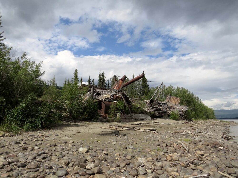
Things to do in Dawson City
With the music festival taking up so much of the weekend, by Monday we still had a long list of sights to see in and around Dawson City.
For me, this included visits to the Discovery Claim (to step in the footsteps of Carmacks et al), the sternwheeler graveyard on the banks of the Yukon River, the No. 4 Gold Mining Dredge, the 1920’s era steamer S.S. Keno and Jack London’s cabin. Oh, and see the views from the Midnight Dome hill above town (amazing!).
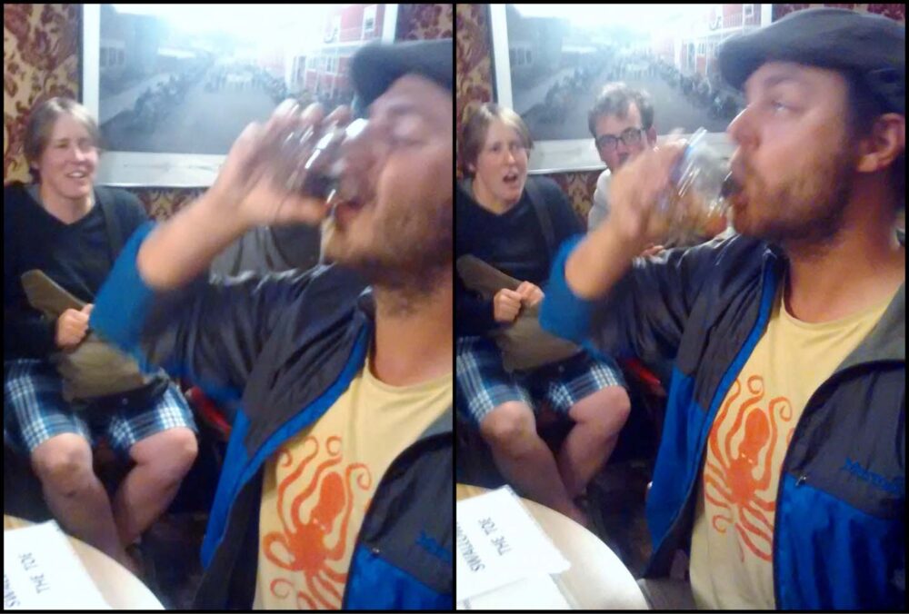
As well as the above, JR also wanted to down a drink with a petrified toe in it and pan for gold at Dawson’s free claim, No. 6.
I passed on the toe thing, choosing not to pay $10 to join the Sour Toe club, of which JR is the 55,604th member despite breaking the rules and putting the toe in his mouth. This is one of those occasions where the photos really do say it all…
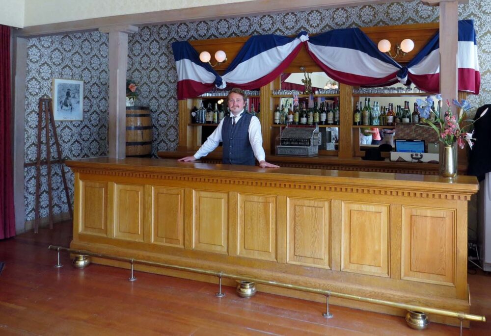
A living museum
Dawson City really is like a living museum; there are costumed Parks Canada interpreters all over the place, restored Gold Rush-era businesses alongside more modern convenience stores as well as other builders that have fallen into disrepair.
Diamond Tooth Gertie’s Gambling Hall claims to be the oldest casino in Canada and has dance hall girls performing three times a night.
We spent many a night there playing a bit of Blackjack, watching poker games, eating cheap pizza, waiting for happy hour and the final show at midnight.
Moosehide Gathering
By the time we had ticked off our list of Dawson City essential sights to see, it was time for another festival called Moosehide Gathering. This really was one of the most interesting events I have ever been to.
Moosehide is a bi-annual First Nation cultural event on traditional land just 3km up-river of Dawson City, featuring native and Northern music, arts, food and atmosphere.
We intended just to visit for one day but stayed for three.

Tombstone Territorial Park
After Moosehide, we left Dawson. But we didn’t go far, returning to the Dempster Highway to revisit Tombstone Territorial Park, a place we had left around a month before.
The weather was finally looking promising for a bit of hiking, and the snow was finally gone from the lower elevations. In Tombstone, you can hike and camp anywhere you like.
I’ve never been to any kind of protected area or park like this, so it was a more than little strange to just pick a mountain to climb and start hiking.
Four hours after leaving the van for our first overnight hike, we were on the top of Rake Mountain, with an incredible panorama surrounding us. An unbelievable payoff for such a short hike.
Our second overnight hike, to Grizzly Lake, was on a fairly challenging established trail and also had incredible views, although I think our trip up Rake Mountain a couple of days before overshadowed it a bit.
Weeks 12 and 13: Dawson City and Tombstone Territorial Park
551km driven (!!)
0km paddled
30km hiked (2 overnight trips in Tombstone)
$ spent? Around $300….we did, however, manage to camp free half the time
Over the Music Festival weekend and during part of Moosehide we stayed at the pretty nice Yukon Government campground across the river for $12/night. In Tombstone, we stopped one night in the park’s campground and one at Grizzly Lake, both $12/night.
For free camping, we parked at the top of the Midnight Dome a few times (bottom left photo), at the free claim site next to Bonanza Creek in the Goldfields, alongside Blackstone River in Tombstone and at various places around Dawson City itself.
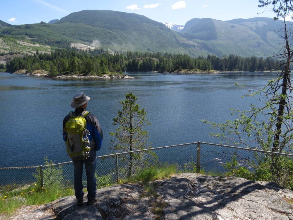
Week 16: Whitehorse, Carcross & Atlin
I was very excited at the start of this week, mainly for the prospect of returning to a bit of civilisation.
Don’t get me wrong, I love hiking and epic paddling trips but we had been in northern Yukon for six weeks and I was really looking forward to lots of summer food (blueberries! corn!) that was just too expensive or non-existent ‘up north.’
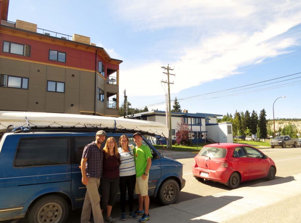
A surprise in Whitehorse
As well as the long-awaited food, we also arrived in Whitehorse to find the sunshine (yay!) and a wonderful surprise. Our friends Richard and Karina from Vancouver Island were passing through Whitehorse the same day as us!
It was really awesome to see some familiar faces after three and a half months on the road, especially 2,500km away from when we had last seen them! Our van looked like a giant compared to Richard and Karina’s little red car, see below.
The wrong way around?
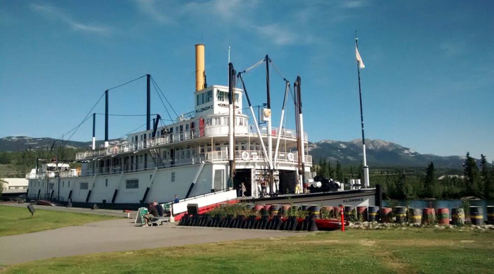
As well as reuniting with friends, we also revisited the Yukon River and reminisced about our Whitehorse departure almost a month before. If only the weather had been this good that day!
Seeing the Klondike sternwheeler at the edge of the river made me think that perhaps we should have stopped in Whitehorse before we started our two-week journey on the river; it feels like we did it all a bit backwards, learning more about the culture and history of the Yukon after we paddled it.
A similar thing with Yukon Brewing; by the time we got to visit the actual brewery, we had already been drinking the beer for weeks. Definitely, the other way round than how we usually do things!
Going home
Having already driven the Dawson City-Whitehorse road several times already (to get to the Dempster, to start our canoe trip) you may wonder why we didn’t drive into Alaska and complete the standard circuit that most people seem to do.
Simply put, it wouldn’t have been worth it since we actually had somewhere to be.
Jean Robert had made arrangements to visit his family in New Brunswick for a few weeks, coinciding with Acadian Day on August 15th.
At this point, he hadn’t been home for four years and with us not working or having any commitments, it seems like as good a time as any to go.
We didn’t ever consider me going with him, since it cost around $1000 for the flights (more than my flights in February to back to the UK!) and I knew if I went, we’d end up doing a lot of touristy things and it would cost a whole lot more than the initial flight cost.
Besides, it allowed him to speak nothing for French and have some quality family time for a whole two weeks!
With JR’s flight leaving from Whitehorse, we had a few days to kill…but it can be hard in the Yukon to find things to do without going ‘too far.’

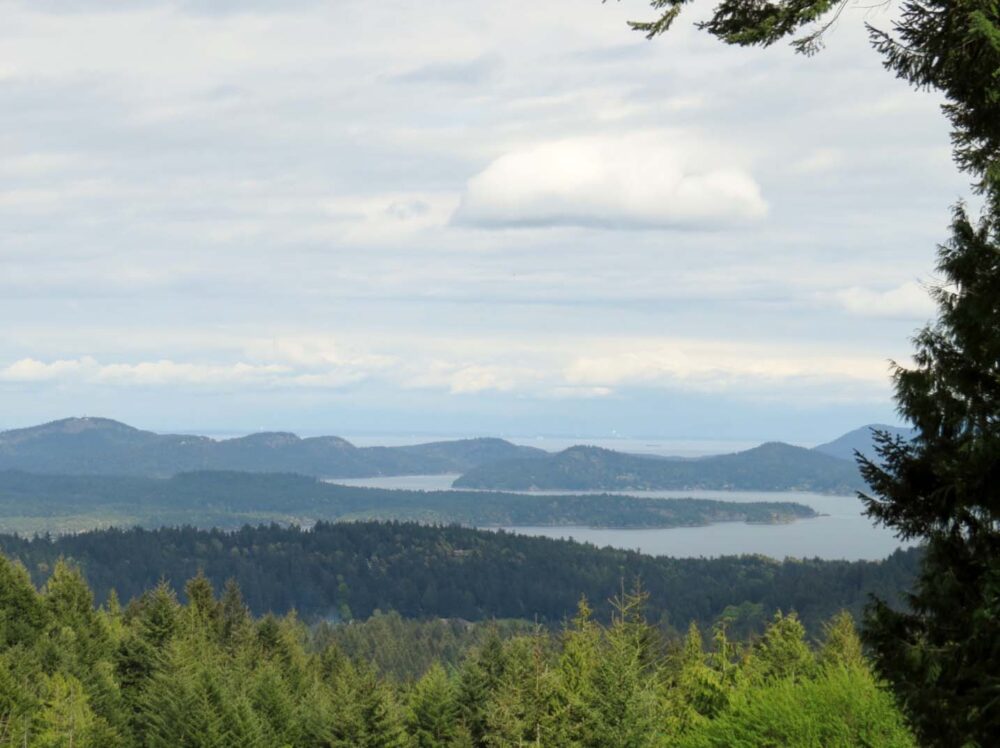
The Carcross Desert
Luckily then, we hadn’t been to Carcross yet, a small town just over an hour’s drive from Whitehorse.
On the way, there happens to be Emerald Lake, known for its beautiful green colouring (caused by deposits of clay and calcium carbonate) and the Carcross Desert. No, really.
The latter is one square mile of sand dunes, referred to as ‘the smallest desert in the world’ but really not since the climate is too humid to truly be one.
Regardless, we both thought it was pretty awesome (and a bit surreal). Absolutely not something you would expect to find in Canada, let alone the Yukon!

Cute Carcross
In Carcross itself there were more surprises, most notably being a really nice beach.
Sadly, it was much too windy (as in, hard-to-walk windy) to even contemplate sitting by the lake, but it did partly explain where all that sand at the Carcross Desert came from. Some local kite surfers were certainly enjoying it though.
Carcross is a cute place, with a newly developed boardwalk area with ridiculously good gelato and a little museum in Skookum Jim’s house (one of the co-founders of the gold discovery that started the Klondike Gold Rush).
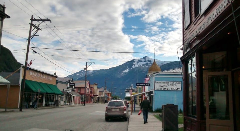
The White Pass railway takes passengers along the historic 1900 route to Skagway, Alaska, and back, via mountains, glaciers, ravines et al.
It was built to provide a better route over the mountains for would-be gold miners, who were spending months travelling and transporting their gear on foot over the Chilkoot Trail from southeast Alaska.
The bad news for the White Pass company was that the Klondike Gold Rush was more or less over by the time the railway opened.
Nowadays, people ride the White Pass for fun, or to return to Skagway after completing the Chilkoot Trail themselves.

A trip to British Columbia
With only a few days left in the Yukon for a while, JR just wanted to fish. The fish, however, did not want to be caught, despite trying at Tagish Lake, Snafu Lake and Hidden Lakes. It just wasn’t meant to be.
We did see some nice places though! The weather also held up and was remarkedly warm. After Jean Robert’s crack of dawn departure (5am!) I had some errands to do.
Just before we left Dawson City, I received my Permanent Residency card in the mail, and with my temporary British Columbia drivers licence running out very soon, I needed to apply for my ‘proper’ one. So I had to go to BC, which could have been a bit of an epic trip.
Luckily then, there’s a little geographical anomaly south of Whitehorse that makes the trip to BC a lot easier.
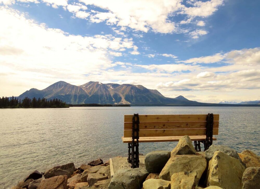
Atlin, BC
Atlin is a tiny town in the extreme north-eastern part of BC. The only way to reach it by road is via the province of Yukon, a highway that was only built in 1950!
Atlin’s population, like so many others in this area, exploded during the Gold Rush, with around 10,000 residents compared to 500 today.
It’s an attractive place, next to the very long and sometimes very blue Atlin Lake which is a gigantic 136km long. And I thought Lake Laberge, at 50km, was big!
There is no municipal government here, so the town’s residents govern themselves. I loved the spirit and tenacity of the locals, as well as the beauty of the surrounding mountains and glaciers.
The road to Alaska
New temporary drivers license in hand and the real one on the way, I could now continue onto my true destination: Alaska!
Of course, JR does want to go to Alaska one day, but as a dedicated trip, so he was fine with me taking a few weeks to see a little.
It is a big state after all. I was a little apprehensive about going on my own, but what else was I going to do for two weeks?
My first stop on my Alaska road trip was Skagway, an easily accessible town perched by the ocean in the ‘bit that should be Canada’ as my Dad says.
It’s only a few hours drive from Whitehorse to get to the border, and on the way, I saw some absolutely stunning scenery which made me more than a little excited about what was in store…

Week 16: Dawson City to Whitehorse, southern Yukon, Atlin and the road to Alaska
1337 kilometres driven
3km paddled (Snafu Lake, near BC/Yukon border)
0km hiked
$120 spent, with a fair portion on a couple of big grocery shops and ice-cream. Hurray!
Week 17 and 18: Alaska
As mentioned in my last post, JR flew home to New Brunswick to celebrate Acadian Day with his family for the first time in many years, while I continued the road trip into the US after a little detour to BC for my new driver’s license.
It was my first solo trip in five years, being that I met JR on my last solo trip…five years ago. I’m not going to lie, I was pretty nervous, though I’m not exactly sure why.
After all, I travelled on my own for nine months at 18, including a long road trip around New Zealand in an old beater which broke down every few days or so.
I had a little more confidence with our van, but still, somehow Alaska seemed a little scarier than NZ. It was probably the size of the place.
And the fact I had a canoe on top of the van, which I physically couldn’t move on my own. And, you know, bears.
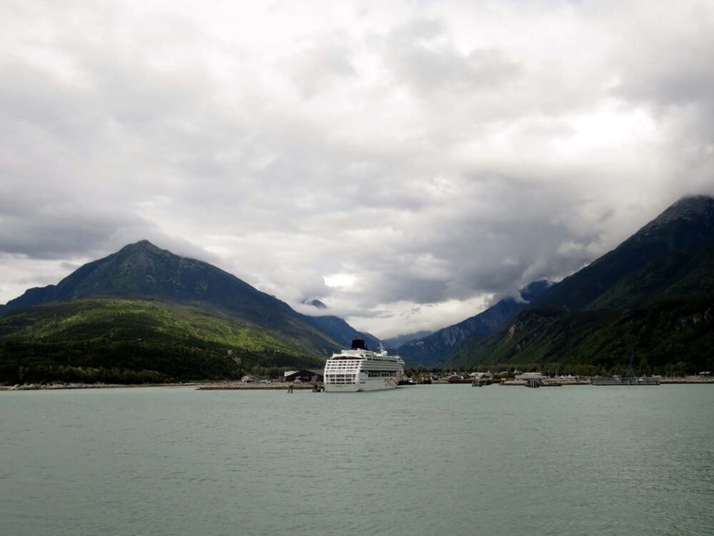
Skagway, Alaska
The first stop of my trip: Skagway. There’s a little strip of Alaska that is practically Canada and Skagway sits right at the top of it.
It wasn’t my kind of place – cruise ships, jewellery shops and tour groups. On my second day in Skagway, also the day I left, it started raining. It didn’t stop for the next four days.
By road, Skagway and Haines are over 550km apart, but by water, they are separated by a mere 22km.

Rainy Haines
Haines is a place I think I could have really liked. The photos I have seen of the town, with a multitude of mountains and glaciers framing it, are breathtaking.
Unfortunately for me, it was a steady 15 degrees Celsius every day, complemented by non-stop heavy rain and thick mist. I tried to outlast the rain, but it was impossible.
The weather forecast was seven more days of the same. It is difficult to enjoy a place so famed for its scenery when you simply can’t see any of it.
Locals told me that they were having the ‘worst summer in 27 years.’ Yukon too was having a bit of a damp summer, but this really was something else.
Haines does have some good points, however, even on rainy days. The two State Parks I stayed in were really nice, especially the Chilkoot Lake site, although I wasn’t lucky enough to watch grizzly bears catching salmon in the river nearby.

Back into Yukon
The cloud followed as I headed back up north and over the border again, along the road which I had been told is one of the most scenic in the Yukon and Alaska.
I really couldn’t tell you since I could only see maybe 50 metres in front of the van. I stopped halfway to Haines Junction in the hope that the weather would improve overnight.

Kluane National Park
On my first morning back in Yukon territory, I saw the sky for the first time in what felt like months. Go Canada!
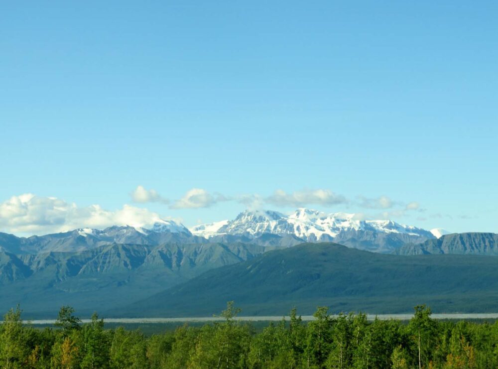
I was no longer that bothered about missing the first part of the Haines highway since the latter part was awesome enough by itself. The road follows the border of Kluane National Park, home of Canada’s highest mountains.
The Park also has North America’s highest concentration of grizzly bears. There are some great trails in this area, but I wasn’t really feeling confident enough to do anything longer than a couple of kilometres by myself, what with it being berry season (a bear’s favourite time of year) and all.
At Kathleen Lake, one of the prettiest lakes in the area, I almost got pushed into the water by seemingly gale-force winds that had sprung up out of nowhere.
A 1800km round trip
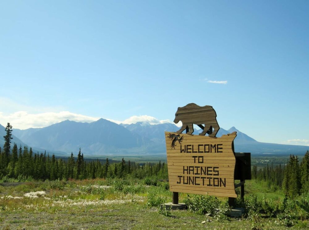
From Haines Junction (a picturesque ‘service town’ without a single grocery store) I wasn’t sure what to do.
If I wanted to continue into Alaska, it was a 300km drive just to get to the border. My experience of Alaska so far has not been too favourable, to say the least.
A kayak company, Pangaea Adventures, was interested in having me join a glacier tour in Valdez. A 1800km round trip. But what if I did if I went all the way there and just ended up experiencing rainy Haines 2.0?
Realising that I wasn’t sure what to do for the next six days if I didn’t go to Alaska, I went to Alaska. Probably not the best reason ever to go somewhere, but luckily, it worked out.
The Alaskan experience I was looking for
Simply put, I had an incredible six days. It completely exceeded my expectations. It was a heck of a lot of driving to do by myself, but I finally got the Alaskan experience I was looking for. Well, almost.
I may have seen glaciers, mountains, icebergs (!), volcanoes et al, but I hardly saw any wildlife. Alaska is a lot more populated than Yukon (735,000 vs. 34,000) so maybe that has something to do with it.
Alaska is home to a lot of big, impressive scenery, but I still think that the Yukon wins out for true wilderness.
The Yukon section of the Alaska Highway from Haines Junction to the border at Beaver Creek was my favourite drive in all of the north. I go back just to do this section again.
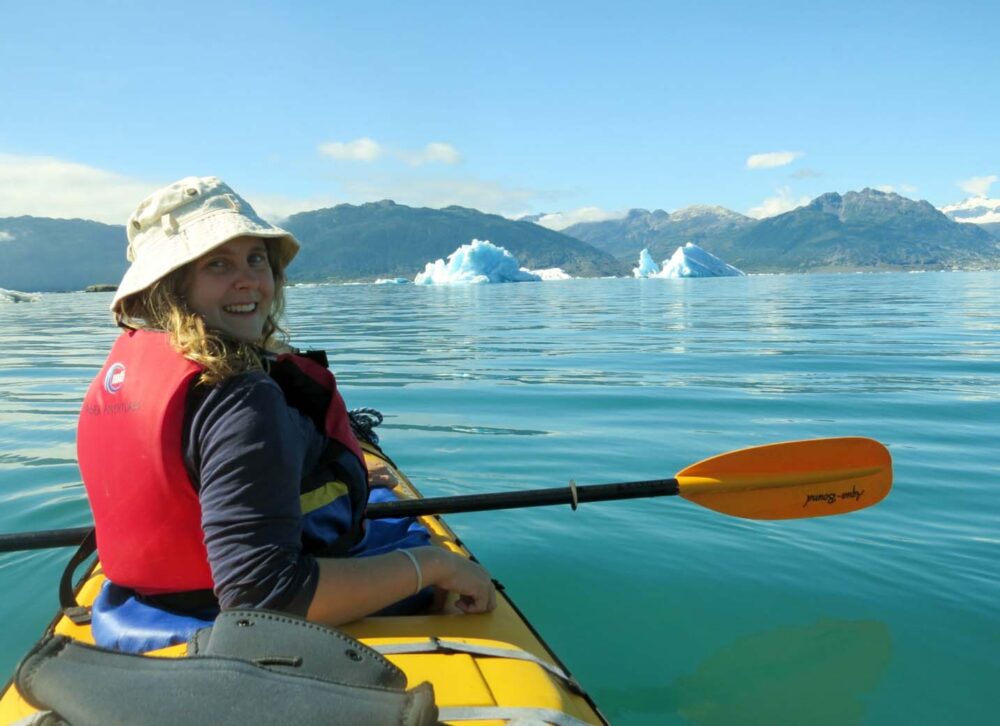
Valdez, Alaska
I really liked Valdez. The town is another product of the Gold Rush and has experienced a fair amount of hardships in its short history, being destroyed in the 1964 earthquake and then suffering from the Exxon-Valdez oil spill in 1989.
All that aside, Valdez sits in the most beautiful location imaginable. It still rained for half the time I was there, but I stuck it out and I was royally rewarded. I went kayaking with icebergs on the best day ever.
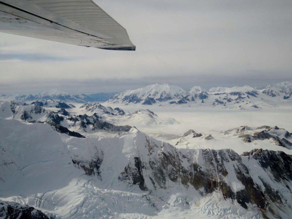
Flying over Klaune National Park
I drove back to the Yukon on a bit of a high (which was good, since I ended up driving 900km in 24 hours), only for things to get even better.
Back in Haines Junction, the town without grocery stores, I was lucky enough to have the opportunity to take a flight above Kluane National Park.
I saw Mount Logan, which at almost 6,000m is Canada’s highest mountain.
That same afternoon, I picked JR up at Whitehorse airport and promptly made him very jealous about not coming to Alaska with me. I just didn’t mention Haines and Skagway too much.
Weeks 17 and 18: Southeastern Yukon and Alaska (Haines, Skagway, Valdez)
3115 kilometres driven (on my own!)
2km paddled (Pine Lake, near Haines Junction)
10km hiked (Kluane National Park, Valdez, Haines)
$240 spent
Dyea State Park ($10), Chilkat State Park ($10), Chilkoot Lake State Park ($10 x 2), Million Dollar Falls ($12), Pine Lake ($12), Alaska Highway Rest Stop (free), Wrangell St. Elias National Park ‘Wayside’ (free), Squirrel Creek ($15), Valdez Glacier ($15 x 2), Valdez Marina (free), Valdez Road Rest Stop (free), Lake Creek ($12)….and again at Pine Lake but I forgot to take a photo ($12). The middle photo is the Alaska Highway between Haines Junction and the border
Week 19: Driving the Alaska Highway
After two weeks of an absurd amount of driving and a whole lot of Alaskan rain, I was very happy to bump into JR in Whitehorse!
The Klondike Sternwheeler, Whitehorse
We certainly know how to celebrate a reunion: explore a National Historic Site! Built in 1921, the Klondike sternwheeler sits in a dry dock next to the Yukon River.
These boats were a vital part of Yukon transportation from the Gold Rush era until the construction of roads in the 1950s.
The most impressive thing to me about sternwheelers is how they could carry a ridiculous amount of cargo (up to 225 tonnes) but could safely navigate in water depths as low as 1.21 metres.
Sternwheelers were, therefore, perfect for transporting people and goods up and down the Yukon River due to the variety of water depths, strange currents and the odd sandbar or two that comes out of nowhere (and we have first-hand experience).

To the Alaska Highway!
After a self-guided tour around the Klondike, we bid adieu to Whitehorse and did something that we hadn’t done in months: headed south.
This was it; the end of our Great Northern Adventure. Well, yes and no.
The truth is that JR and I still had thousands of kilometres to travel until we reached a point that wouldn’t be considered ‘north’ anymore but….still. Were we sad?
A little bit as it meant the main portion of our road trip was over, although on the other side of things, we were heading south, home of warmth and sunshine!
The summer in the Yukon had been pretty lukewarm, to say the least, so our new mission was to find a late summer hotspot to make up for it. So south we went.
A quieter drive
This week of the trip was the first time one of us was unwell.
JR had picked up some kind of flu bug on his journey over to New Brunswick and managed to bring it all the way back to the Yukon to continue the fun.
Consequently, he wasn’t up for any kind of strenuous activity, including our old favourites, hiking and paddling! Boo!
This portion of the trip is, therefore, a bit of a blur for me as I was driving more (JR typically drove 95% of the time on the trip) and we also didn’t do much actual exploring away from the van.
It was only when I was sorting through the photos for this post that I realised how beautiful this area really was. I can’t wait to go back and hike here!
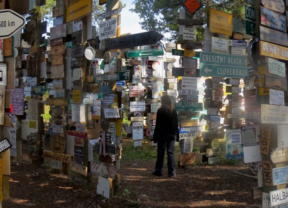
The Signpost Forest
On the way out of Whitehorse, we still had a couple of essential Yukon road trip experiences to tick off, the first being Watson Lake’s Signpost Forest.
The Signpost Forest is a collection of 72,000 signs (and counting…), started by the U.S. Army Corps who built the Alaska Highway in 1942 (more on the ‘Alcan’ another time).
While I knew the ‘72,000’ statistic, I still didn’t expect it to be so big. It really is a forest; it goes on and on and on….and when you think you’ve seen it all, there’s still more.
We found a couple of signs put up by visitors from New Brunswick and Southampton (UK), but the grand majority seemed to be from the US, Canada or Germany.
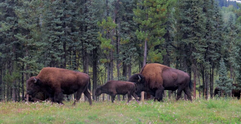
Bison on the Alaska Highway
The next major stop on the Alaska Highway was Liard Hotsprings.
On the way, we spent some time with my favourite Canadian roadside animal: bison. No, really, I love bison. All other animals – bears, caribou, moose etc. – usually run away so fast that you barely get a chance to see them.
Bison, on the other hand, do not care one inch about your presence and just carry on eating. And they are big animals.
We saw numerous herds (20+ bison!) before we reached Liard, stopping to watch families and individuals hanging out by the highway.
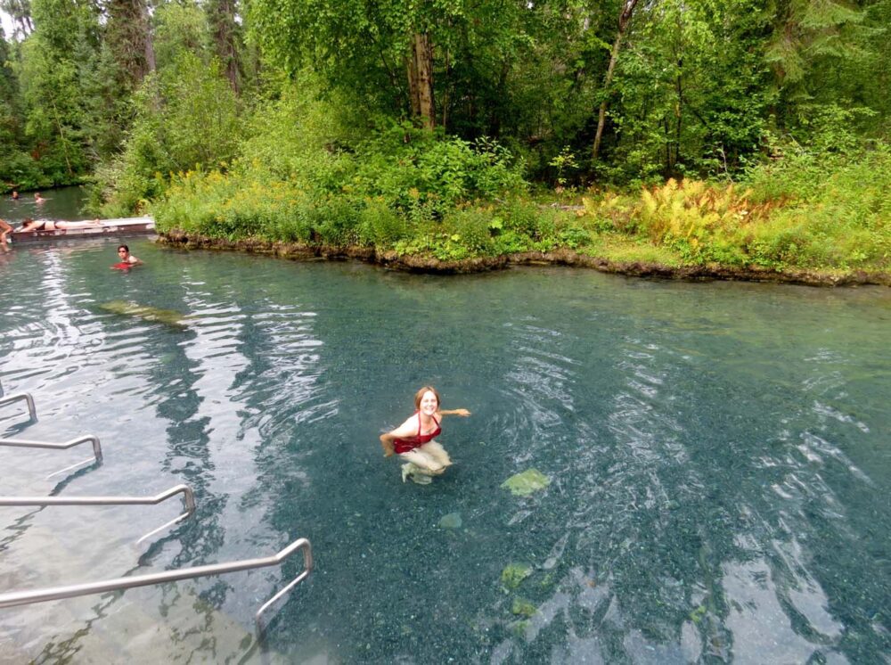
Liard Hotsprings
Even with all of this stopping, we were hardly ever overtaken. The Alaska Highway seemed so quiet, which wasn’t really a surprise to us since the peak season is usually June/July.
You can understand then, why were we shocked to reach Liard Hotsprings to find it packed with people….at 10 am.
The campground, with 53 spaces, was already completely full for the night, and the day use parking lot was getting packed already. I can’t imagine what it would be like during the busier season!
Luckily though, the ‘Alpha’ hot springs pool itself, accessible via a short boardwalk, still had lots of room for us.
The temperature ranges from 42 to 52 Celsius and it is the nicest hot springs I have ever been to, mainly due to the natural setting.
The Northern Rockies, BC
Onwards from Liard, the road headed into the Northern Rockies.
The Northern Rockies may not be as famous as the southern ones (Banff, Jasper, Lake Louise et al), but the area is certainly stunning in its own right. And it is incredibly quiet here. Especially in late August – after all, everyone is at Liard.
With JR not feeling well, we relied mostly on seeing the sights from the road, although we did take a little detour to the Salt Lick viewing point near Muncho Lake (see above for a photo of the lake, and then further above is the salt lick).
A salt lick (or mineral lick) is a natural mineral deposit where animals in nutrient-poor ecosystems can obtain essential nutrients – in this area, there is a high concentration of ungulates who use these.
Spotting ungulates
Ungulates (a wonderful word I learned while travelling through this area) include deer, caribou, moose and the interestingly named stone sheep, which are only found in northern BC.
While we weren’t lucky enough to see any of the latter, we did spot lots 0f caribou and moose, finally! Every time I see moose I am reminded how huge they are. And how much I don’t ever (ever) want to hit one on the road…

Land of industry
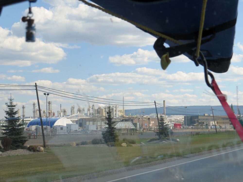
Away from the Rockies, the road becomes very flat. It’s almost like a different world, not only due to the flatness. This area is home to BC’s oil and gas industry.
While I thought I knew a fair bit about Canada’s oil production in the Alberta oil sands, I didn’t realise that this kind of industry existed in BC too. Perhaps I should have guessed from all of the names of the towns on the map – Fort Nelson, Fort St John.
In Canada, town names with the prefix ‘Fort’ or ‘Port’ always seem to imply an industrial background.
Driving around this area, our company on the highway was mostly large industrial trucks and work vehicles. I suddenly felt a little out of place. Camping areas dried up, with very few Recreation Sites and rest stops along the road.
The towns provide everything that the oil workers need (motels, rental car facilities, big-box stores such as Walmart and Marks’ Work Warehouse), but offer little in ambience and beauty.
While not a highlight of our trip, this area was an interesting insight into the ‘other’ side of BC.
The fastest man running around the world
It seemed somewhat ironic that in this oil-rich, industry-led area, we met Kevin Carr. Kevin is an ultra-marathon runner from Dartmoor, UK, who is running around the world.
Meeting him in late August, he was thirteen months into his trip. Kevin is raising money for Sane (the British mental health charity) and the British Red Cross.
He was so incredibly inspiring and the only thing he would accept from us was water.
Like us, Kevin was a little taken aback by all of the industry and heavy machinery on the roads. He is now running through Manitoba (in late autumn!!) on his way to Boston. Please consider donating to Kevin if you feel inspired by his journey!

The Kiskatinaw Bridge
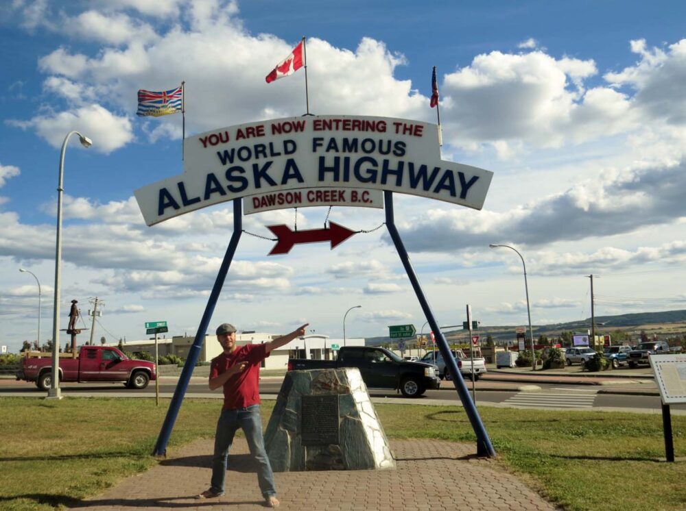
The Alaska Highway finishes (or rather, starts) in Dawson Creek, a town very close to the Alberta border. On the way, we passed through Taylor, my namesake town and the Kiskatinaw Bridge, the only timber bridge on the Alcan still in use.
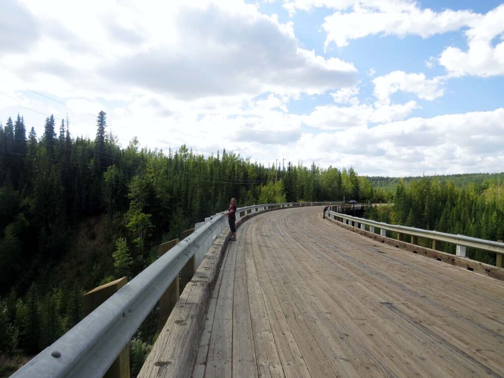
It curves nine degrees along its length, making it a little unusual. It was bypassed in the 1970’s, due to the maximum 25 tonne capacity, which was much too little for the industrial trucks.
Taking the prerequisite photos with the Alaska Highway Mile 0 signs in DC before we left, we continued south….
Week 19: Driving the Alaska Highway from Whitehorse to Dawson Creek
1,540 kilometres driven
0km paddled
3km hiked (it was pretty low key with JR being sick)
$140 spent
Duhu Recreation Site near Fort St John, Watson Lake Government Campground, Rest Stop near North Tetsa River in Stone Mountain Provincial Park, Rest Stop near Liard Rapids, Rest Stop near Jake’s Junction (Yukon).
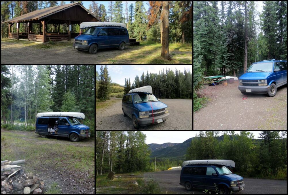
Week 20: Tumbler Ridge
This week was probably the most unexpected part of the whole trip. Despite having what I thought was a fairly good knowledge of BC, I had never heard of Tumbler Ridge and knew nothing about the surrounding area.
We ended up spending almost six full days here – the longest time in one place, with the exception of Dawson City (but you know, that’s just the way of Dawson).
There were three main reasons for this, the first being that the Labour Day long weekend was approaching and we knew we should probably bunk down somewhere until it was all over.
The second is less interesting; we were tired of driving so much in recent days and JR was still feeling the after-effects of his illness. The last reason, however, is the best; quite simply, there was so much awesome stuff to do around Tumbler Ridge!
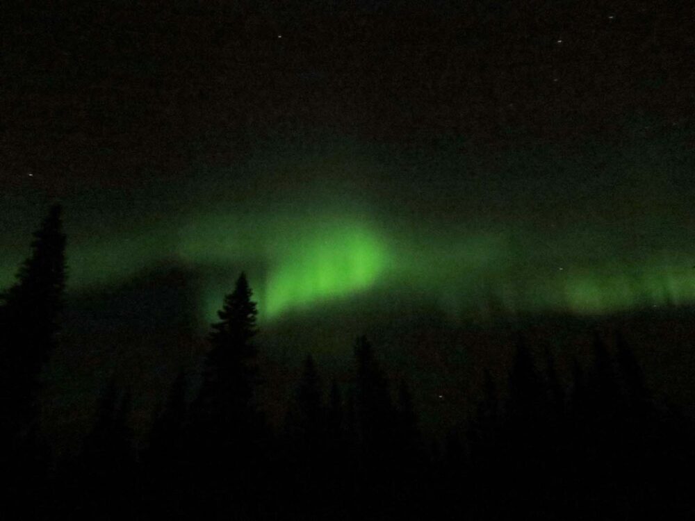
The Northern Lights
We hadn’t even been in Tumbler Ridge for very long before cool things started happening. Our first night camping next to Flatbed Creek, we saw the Northern Lights.
This was my first ever time to see them and it really was amazing. We were celebrating having reached our wonderfully empty (and free) campsite and at first, I thought the green lights were an after-effect of the cheap wine we were drinking.
JR, who has seen them plenty of times before in his home province of New Brunswick, confirmed that the illuminations dancing above us were indeed real.
The light show lasted around 10 minutes, but due to our excitement (not just me, JR said they were the best that he’d ever seen), we didn’t get our tripod out for a better photo.
So this is the best we could do to share the moment with you. We’ve had a lot of people assume that we would have seen the Northern Lights many times over this summer, what with being so far north most of the time.
While we were definitely north enough, our days (20 hours of light and more) were far too long to be able to have any chance to see the aurora borealis.
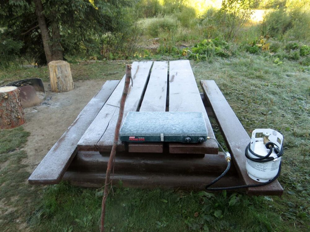
Frost in August
After the lights ended, we heard what sounded like wolves calling to one another a little distance away (as if they too were disappointed it was all over).
I was reassured by JR that they were probably coyotes….until we found some very large paw prints not far from our campsite a few days later.
The aurora was also followed by a hard frost the next morning. On the last day of August.
We made a pact to drive as fast as we could to the Okanagan as soon as the weekend was over. Until then, we planned to do a lot of fishing and explore around Tumbler Ridge.
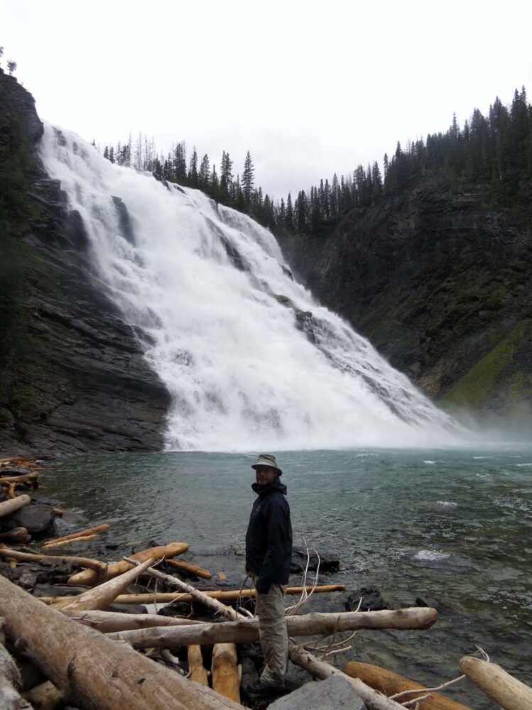
Kinuseo Falls
As it turns out, Tumbler Ridge is known as the ‘Waterfall Capital of the North.’
We chose to visit one of the largest, Kinuseo Falls, reached by one of the roughest industrial roads we have ever driven (130km return….but we did see a family of black bears and a wolf!)
Kinuseo Falls really is spectacular; dramatic, thundering and breathtaking all at once. We followed the steep muddy path down to the bottom of the falls to experience it all from another angle.
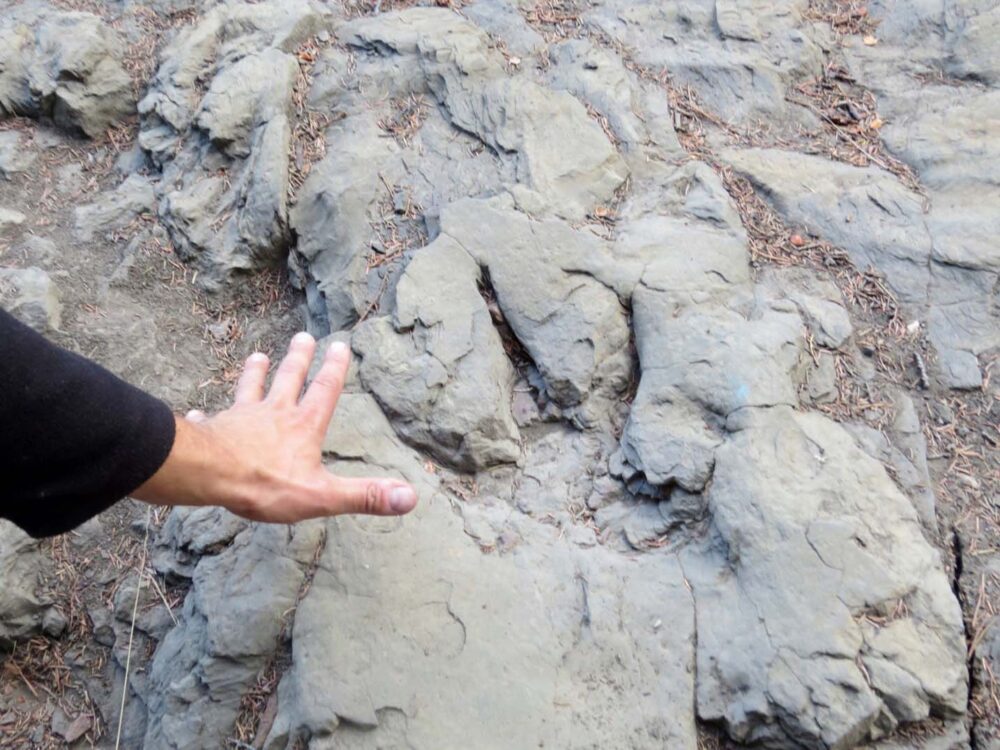
Dinosaur tracks
To top that, we combined another waterfall visit with a walk with dinosaurs. No, really.
Back in 2000, two young local boys discovered dinosaur tracks while on a rafting trip down Flatbed Creek (the same one we were camping next to).
Since there, hundreds more tracks and bones have been discovered in this area. I was amazed we could just visit some of the completely unprotected 75 million-year-old tracks next to the river. Very cool.
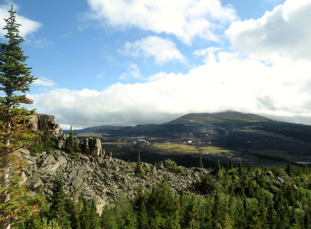
The Boulder Gardens
Last on the list was the Boulder Gardens. Some 30km south of Tumbler Ridge is a dry valley filled with rock boulders, towers and columns, all seemingly tumbling over one another.
It’s hard to really photograph this place well, with the trail leading past crevasses, over large rocks and right next to small caves.
JR did a bit of scrambling around to try and get a better perspective, which also came with clearer views of the nearby coal mine. A strange juxtaposition.
Heading towards the sun
Leaving Tumbler Ridge late on Labour Day, we set course for the Okanagan. As we regained phone signal, we discovered that the frost and low temperatures we had experienced in Tumbler Ridge were part of a wider cold snap which stretched all the way to Alberta.
Some parts of the Rockies (Jasper, Banff et al) were covered in snow.
If we hadn’t been sure whether to put off the Bowron Lakes (100km canoe circuit) and the Rockies for another year, we definitely were now. Our new destination: Kelowna. Only 1000km to go!
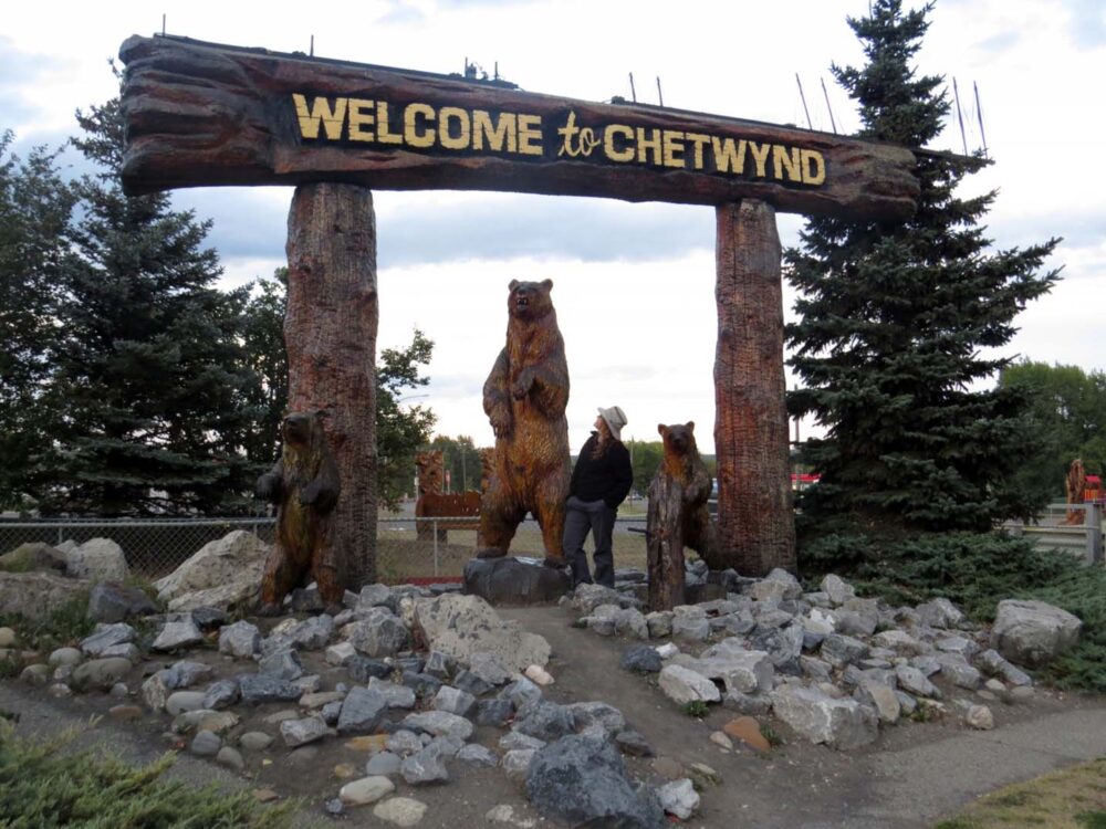
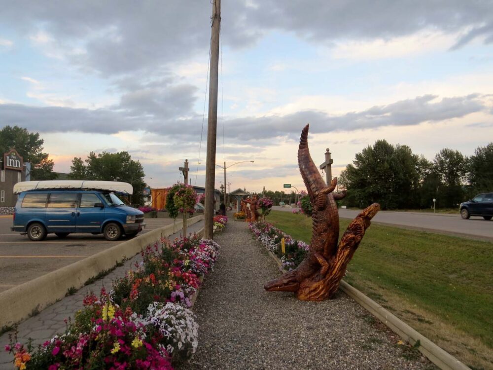
We started the next part of our journey with a quick visit to the ‘Chainsaw Sculpture Capital of the World’ (really!) – Chetwynd.
Week 20 ended with us trying to escape from a very scary-looking storm in Prince George, before stopping at Quesnel Walmart for the night.
If everything had gone as planned, at this point we would have turned towards Barkerville and spent the next 10 days or so paddling in the wilderness. Next year!
Week 20: Dawson Creek to Quesnel
1192 kilometres driven
0km paddle (sorry canoe)
10km hiked
Money spent -$70 (back on budget!)
Week 21: The Okanagan Valley
And here it is. The end of our huge road trip around Western Canada and Alaska. It’s a bit of a long one, but I really wanted to get this written and posted before the next year arrives!
Heading to the sun
As soon as we drove out of Quesnel, I knew we had made the right decision to head to the Okanagan rather than the Rockies or to the Bowron Lakes.
It was warm and sunny, and better still, there was corn. Being in the Yukon most of the summer, we had both really missed certain summer fruits and vegetables.
With a single corn on the cob in Dawson City costing $4, certain foods were just out of the budget. We celebrated by visiting a corn maze and then picked our own at another farm nearby.
12 cobs for $3, which we happily munched that night (best. corn. ever) by the picturesque Crystal Lake on BC’s ‘Fishing Highway’ (no. 24). No fish was caught by us though.

Van problems
Despite being so ecstatic with the corn situation, we couldn’t ignore that our van, Big Blue, was doing some strange things.
First, we smelled our brakes burning while driving on flat, straight roads. When actually braking, Blue would pull sharply to the left, making driving a little difficult at times.
The next biggest town on our way to Kelowna was Kamloops, but being a Thursday we couldn’t get an appointment with a mechanic until Monday.
Being that we were still able to drive, we pushed on to our final destination, Kelowna.
As well as sunshine, wineries and a big beautiful lake, our friends Jane and Seb (who we met on the Yukon River in July) were there too. Seb also happens to be a heavy-duty mechanic.
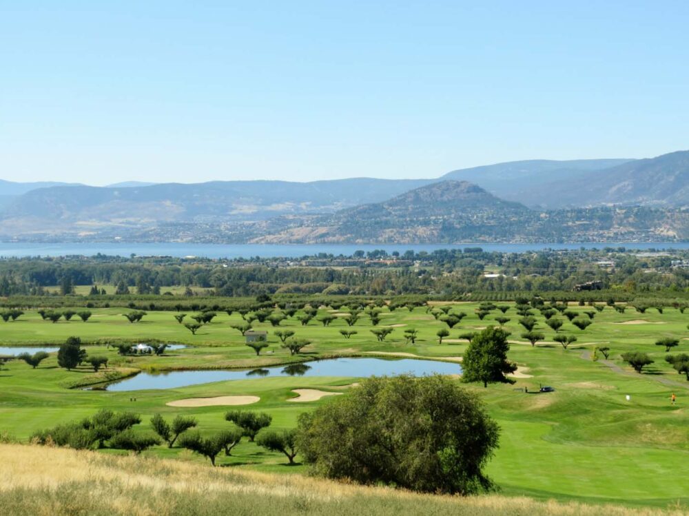
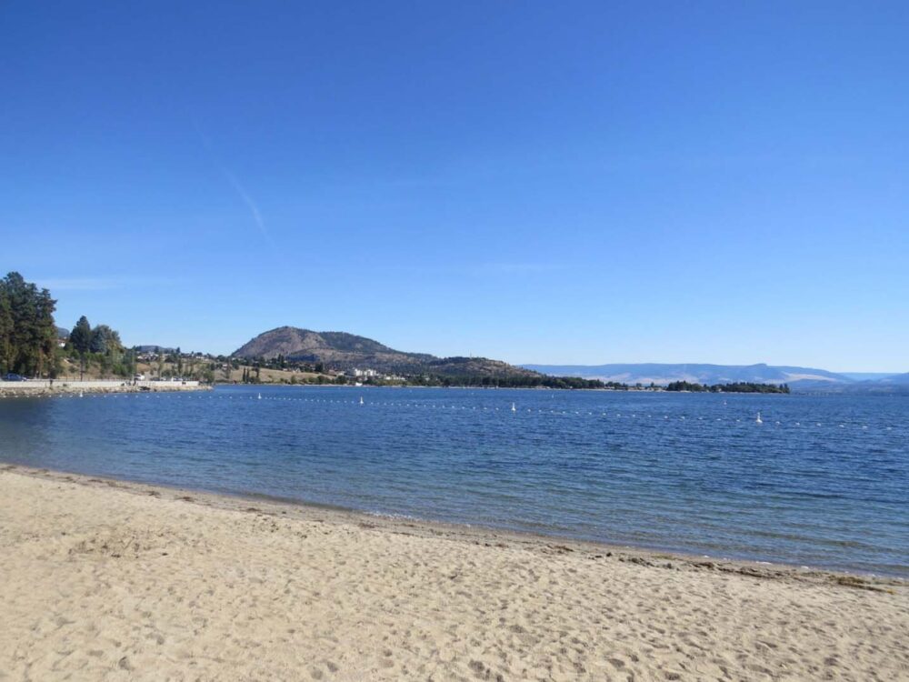
The driest part of BC
The problems with the van took some of the excitement away about arriving in the Okanagan Valley. But just look at it. Not the typical images most people associate with Canada, that’s for sure.
Dry and ridiculously sunny, the Okanagan regularly receives BC’s hottest summer temperatures (more in the 30s but sometimes up to 40c).
While it may have been September, we still were able to enjoy some of the warm temperatures we had been longing for all summer.
Kelowna itself was a little different than any town we had visited recently.
With golf courses, wineries, high-rise condos, speedboats and fancy restaurants, it felt a bit out of our league at first. Absolutely beautiful though, and in any case, we got into the spirit quickly.

Having recently decided to finish our trip early, we wanted to enjoy every day we had left.
Our friends Jane and Seb had just finished their own Canadian road trip and it was awesome to reflect on our travels with them. The van’s brakes were also fixed as a bonus!

Wine touring
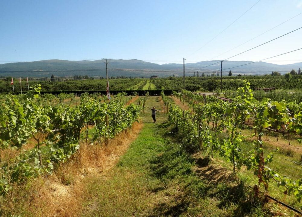
Kelowna is a haven for local food with seemingly endless orchards, farms, vineyards and cideries.
Mission Hill, perched on a hill above the shimmering Okanagan Lake, was the most stunning winery I’ve ever visited even though we couldn’t afford the $15 tasting fee!
Thinking that we could always buy Mission Hill’s wine in the shops one day we were feeling richer, so we focused on the local vineyards and downtown brewery. I could have happily spent days and days just touring all of them (and there really is a lot) but the lake was calling.
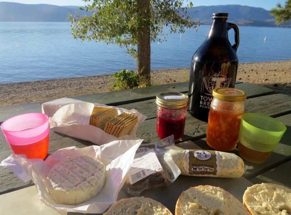
We spent days swimming, sunbathing and snorkelling at the lake, occasionally leaving to buy local fruit and cheese for picnics.
At one point I decided to settle down here, but the job opportunities didn’t end up matching the heaven that is Okanagan life!
Making the most of the outdoors
Our time in Kelowna wasn’t all about the warmth and hedonism in town; we also made sure to enjoy some natural sights too.
After all, we would be back to the daily grind and living within four (more solid) walls soon enough!
Camping above Kelowna in the hills was a lot cooler than in town but it was also free and reminded us why we travel the way we do.
We baked bread on the fire and fished on the lake under the full moon, all while reminiscing about the trip.
The highlight of the last two weeks? A horseback ride around Myra Canyon followed by a walk on the trestles. We left the Okanagan that evening to start the long drive back to Vancouver, from where we would figure out our next steps.
Our time in Kelowna had felt a bit like a bit of a holiday from a holiday. And like all holidays it had to come to an end sometime. The perfect end to an incredible five months on the road.
2024 update – After spending the winter in North Vancouver and Fort St John, we moved to Penticton in the Okanagan Valley in June 2015. We then left the city to travel full-time for 2.5 years…but returned to Penticton in 2020.

Week 20: Quesnel to Vancouver, via 10 days in the Okanagan
1660 kilometres driven
2 paddles, on James and Beaver Lakes
No hiking!
Money spent – $350. Being in the Okanagan (and at the end of our trip) we did a fair bit of wining and dining in the sun…out of budget, but worth it
Crystal Lake Rec Site, Beaver Lake Rec Site near Kelowna, Monument 83 trailhead in Manning Park (our last night) and James Lake near Kelowna.


One half of the Canadian/British couple behind Off Track Travel, Gemma is happiest when hiking on the trail or planning the next big travel adventure. JR and Gemma are currently based in the beautiful Okanagan Valley, British Columbia, Canada. Consider buying us a coffee if you have find any of our guides helpful!
Great post! I love seeing people exploring the far reaches of BC – although I can only imagine how cold it must be right now, especially at night. And an earthquake to top everything off? You guys must have some great stories to tell now. I especially love ” The Magic Cabin” – there aren’t many places in the world where campers can find a fully outfitted cabin offered for free to anyone who reaches it. 🙂
Hey Calli, the “Magic Cabin” is now one of our favourite places on the whole island. It’s definitely worth the effort to get there. The Earthquake really was quite something too, and to think we were originally going to finish the hike the day before! I’ll be writing more about the Cape Scott hike next week, it was a very eventful trip. Thanks for your comments!
This cabin should not be mentioned in here. It clearly states on the door to “Please keep this wonderful place off social media”and if you’ve been there yourself you should realize how special of a place it is and respect that request. And I’m sure that everyone who visits would like it to remain this way. When hidden gems like this are posted online it ruins the feeling of knowing you’re one of few that know about the place, they become overrun with tourists, and people ruin it. Please reconsider placing this cabin in your blog.
Hi Shayna,
I visited this cabin way back in 2014 and there was no such note (and social media was a bit of a different beast!) I absolutely take your point though and have removed my mention of it. I will also delete your comment in a few days, after i assume you will have seen this reply! I’m very aware of how important it is to ensure sustainability of vulnerable places (it’s one reason I don’t use Instagram). This post has received very little traffic over the years – it’s a relic of the days when our site was primarily for friends/family.