While many explore canals by boat, the adjacent towpath offers a unique adventure in its own right. The UK is threaded with a network of canals, linking landscapes and communities. Visiting my parents at Christmas provided an oppportunity to explore one very close to them – the Basingstoke Canal.
A 32 mile (51km) towpath runs along the navigable esection of this 200+ year old waterway, passing a 13th century castle, WWII fortifications, 28 locks and plenty of pubs.
We’ve explored quite a few long distance trails in the UK, from the Northumberland Coastal Path to the South Downs Way. Although the Basingstoke Canal Towpath isn’t the longest, most dramatically scenic or most challenging trail we’ve experienced, it still ranks among our favorites!
Easy to navigate, teeming with wildlife and rich in history, the Basingstoke Canal is also protected from the wind (and almost mud-free) in winter. The warmer months offer an added bonus: canal-side pub gardens dotted at regular intervals along the route.
Read on to discover everything you need to know about the Basingstoke Canal Towpath in Hampshire, with a trail overview, suggested short walks, recommended places to visit, and additional tips.
This post includes some affiliate links. If you click on this and make a purchase, we may receive a percentage of the sale.
Basingstoke Canal Towpath Walking Guide
Skip to any of the following sections of this Basingstoke Canal guide by clicking below:
Walking necessities
- Always bring the 10 Essentials
- Know how to stay safe
- Remember to Leave No Trace
- Recommended gear is listed on our Resources page
- Need a multi-day hiking packing list? Sign up to our newsletter for a free one!
Introducing the Basingstoke Canal Towpath
The Basingstoke Canal was built in the late 18th century to stimulate agricultural development, one of the first such canals of its kind in England. It was originally 37 miles long, running from the settlement of Basingstoke, Hampshire, to the River Thames via the River Wey in Surrey.
Interestingly, the plans were first drawn up in 1776 but then construction work had to be delayed for almost a decade due to budget issues relating to the American War of Independence.
The Canal was bought by Sir Frederick Seager Hunt in 1895. He set up a brickworks in Upper Nately, supplying bricks to many nearby businesses. Within a few years, bricks made up half of all traffic on the waterway.

Over the next few decades, trade along the Canal gradually ceased and the waterway fell into disrepair. During WWI, the Army took full control of the canal, which runs next to the Aldershot base.
In 1932, the 1.1 km (1,130 yards) Greywell Tunnel collapsed, completely halting any kind of boat use. Canal property at the western end was auctioned off.
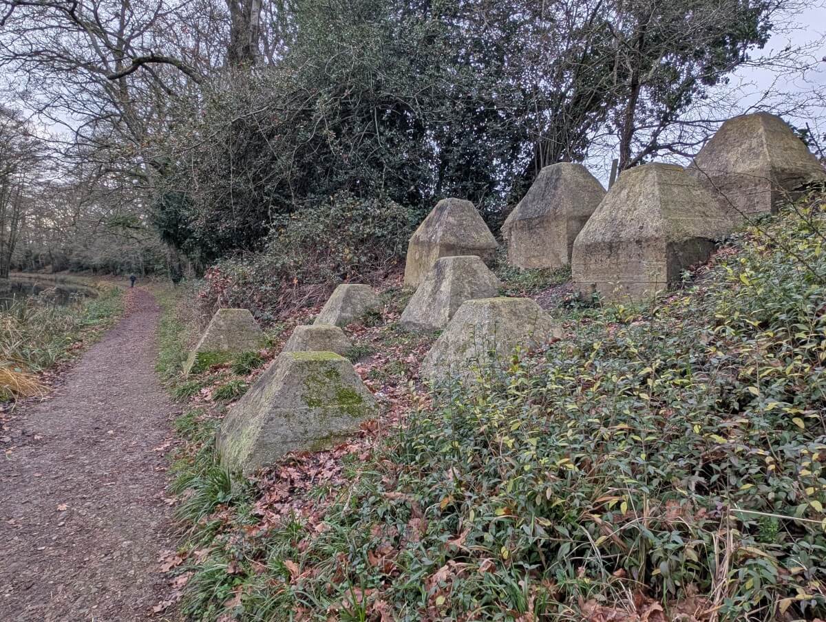
During WWII, the Canal was again utilised by the Army, this time as part of the General Headquarters Line (GHQ), an anti-invasion route to stop a potential Nazi advance on London. Some fortifications still remain along the Canal today.
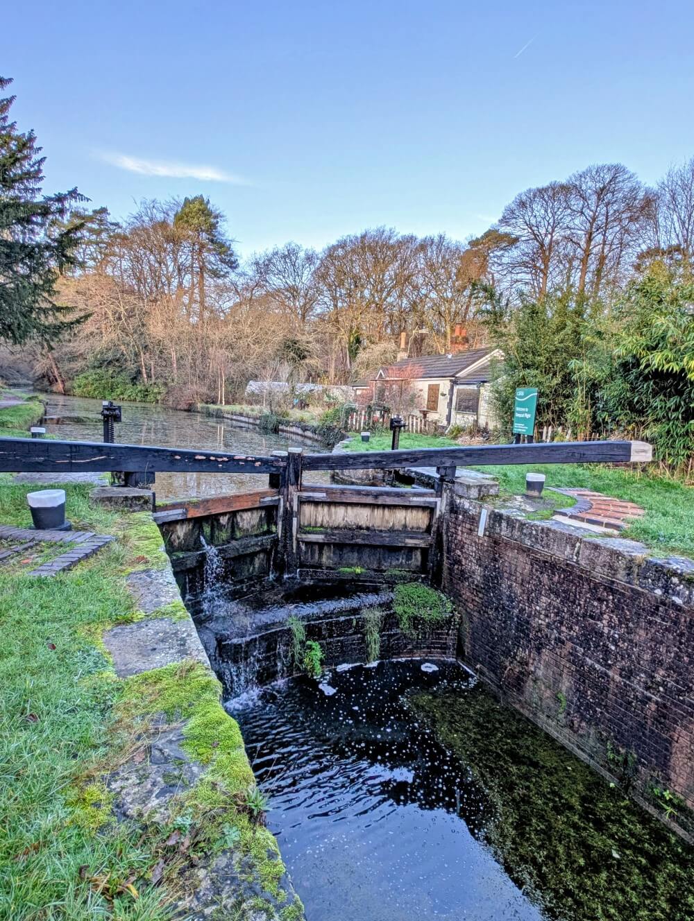
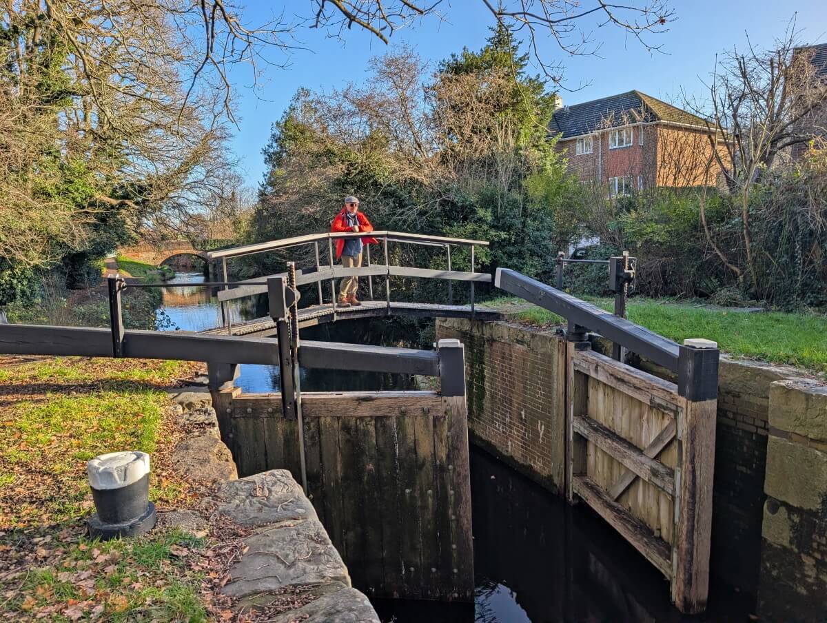
Restoration efforts by the Basingstoke Canal Society started in the 1970s. The project required a lot of work, including extensive dredging, refurbishment of 12 Grade II listed bridges and reconstruction of 29 locks along with 110 lock gates.
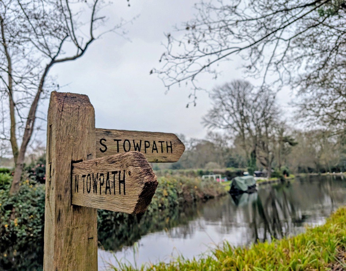
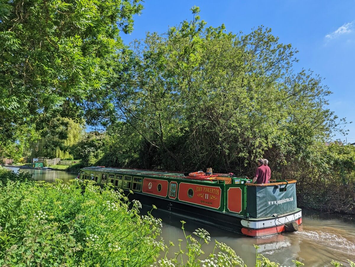
The Canal reopened for navigation in 1991. There is a walking path along the working section as well as portions of the disused western part. Historically, towpaths were used by horses or people to pull boats along the water before engines were used. It’s now utilised by cyclists, walkers and runners.
Quick facts
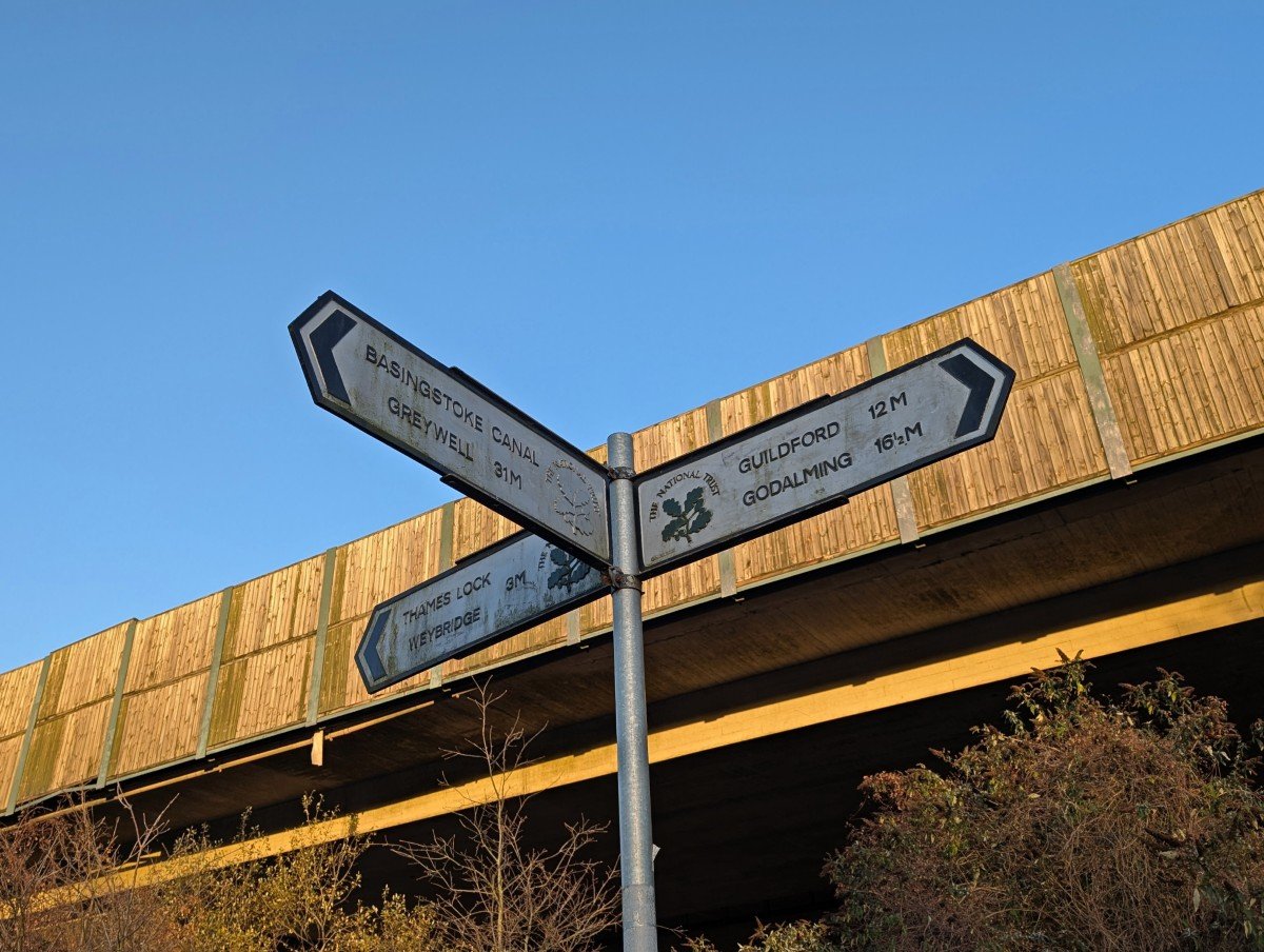
- The almost completely flat towpath runs 32 miles (51km) along the side of the operating Canal from Greywell near Upper Nately in Hampshire to Woodham Junction near Woking in Surrey
- Options range from multiple short day walks to a 2 to 4 day itinerary covering the full route on foot or by bike
- A particularly great walking destination in winter as very few sections of the towpath get muddy
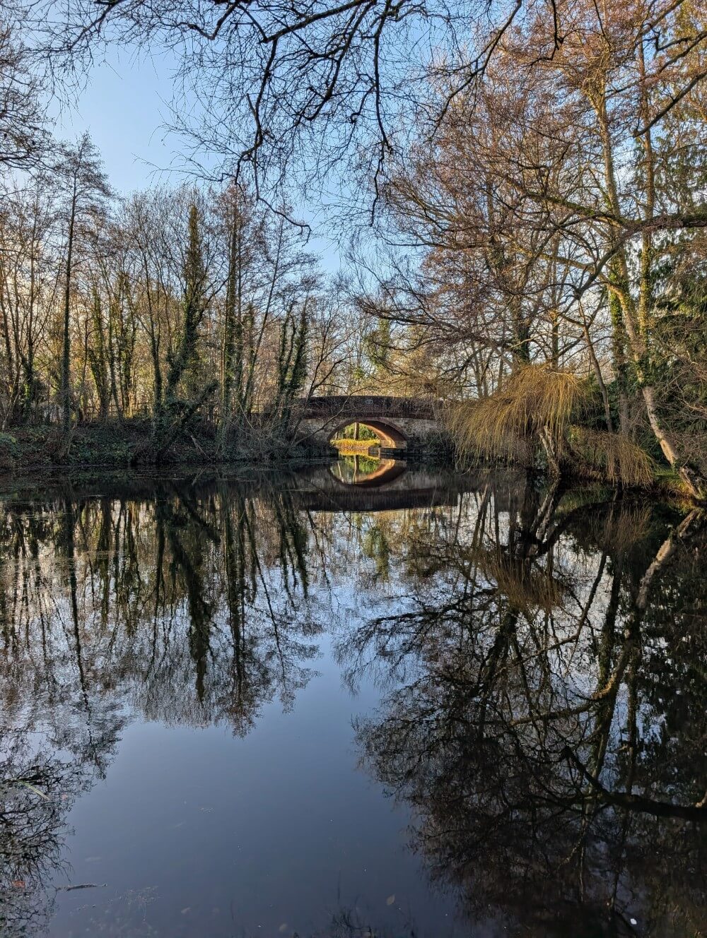
- There are 29 locks, 16 historical bridges and two aqueducts
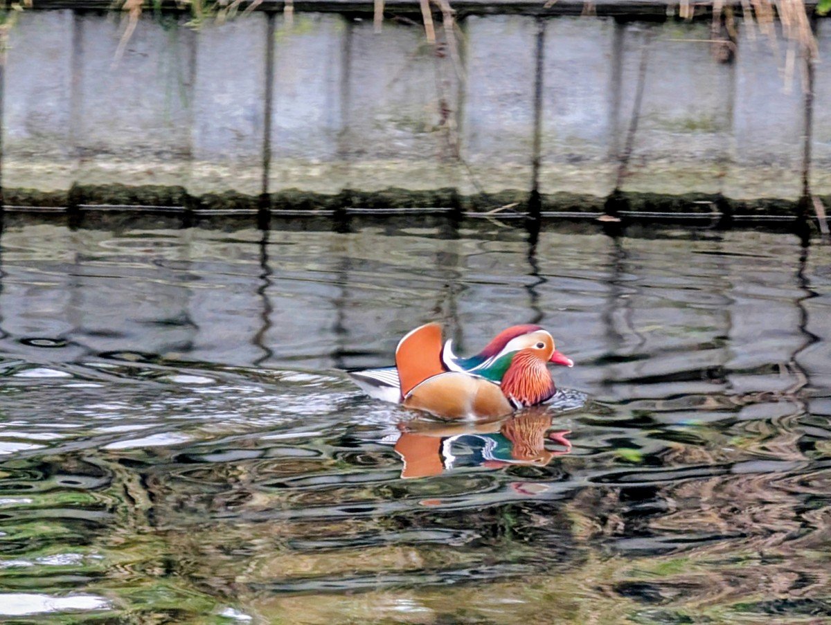
- The Canal is a notable wildlife habitat with unique ecological importance – 25 species of dragonflies, badger setts, five bat species and more
Where does the Basingstoke Canal start and finish?
The modern day Basingstoke Canal Towpath runs from Upper Nately near Basingstoke to Woodham Junction near Woking, below the M25. It is 32 miles or 51km long.
Technically, it is still possible to walk the old route all the way into the centre of Basingstoke (37 miles). We didn’t do that as we chose to focus on the section that is still operating.
To get a taste of the disused section, we extended our trip to start in Upper Nately and walked the short detour around the closed Greywell Tunnel.
Trail breakdown
This section offers a brief overview of each section of the Basingstoke Canal, based on our own experience walking it in December 2025.
The distances mentioned correspond to our own recordings. As mentioned, the operating length of the Basingstoke Canal is 51km (32 miles). We started along the disused section in Upper Nately, adding 2.6km (1.6 miles). We also detoured into Woking to see the H.G. Wells statues.
Most of the photos in this post are from this three day winter trip, although there are a few from a previous late spring walk as well.
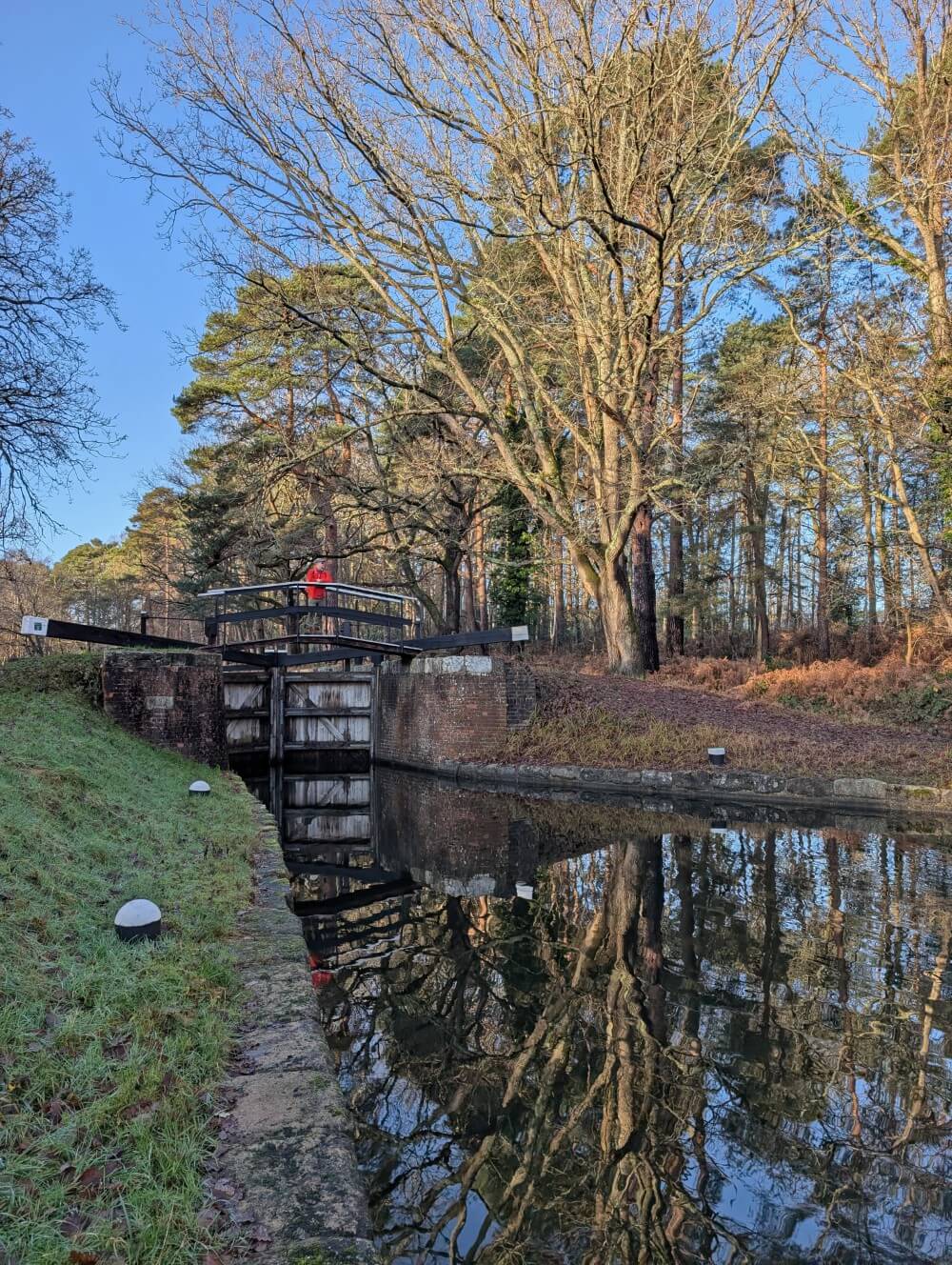
Upper Nately to Fleet – 11.1 miles/18km
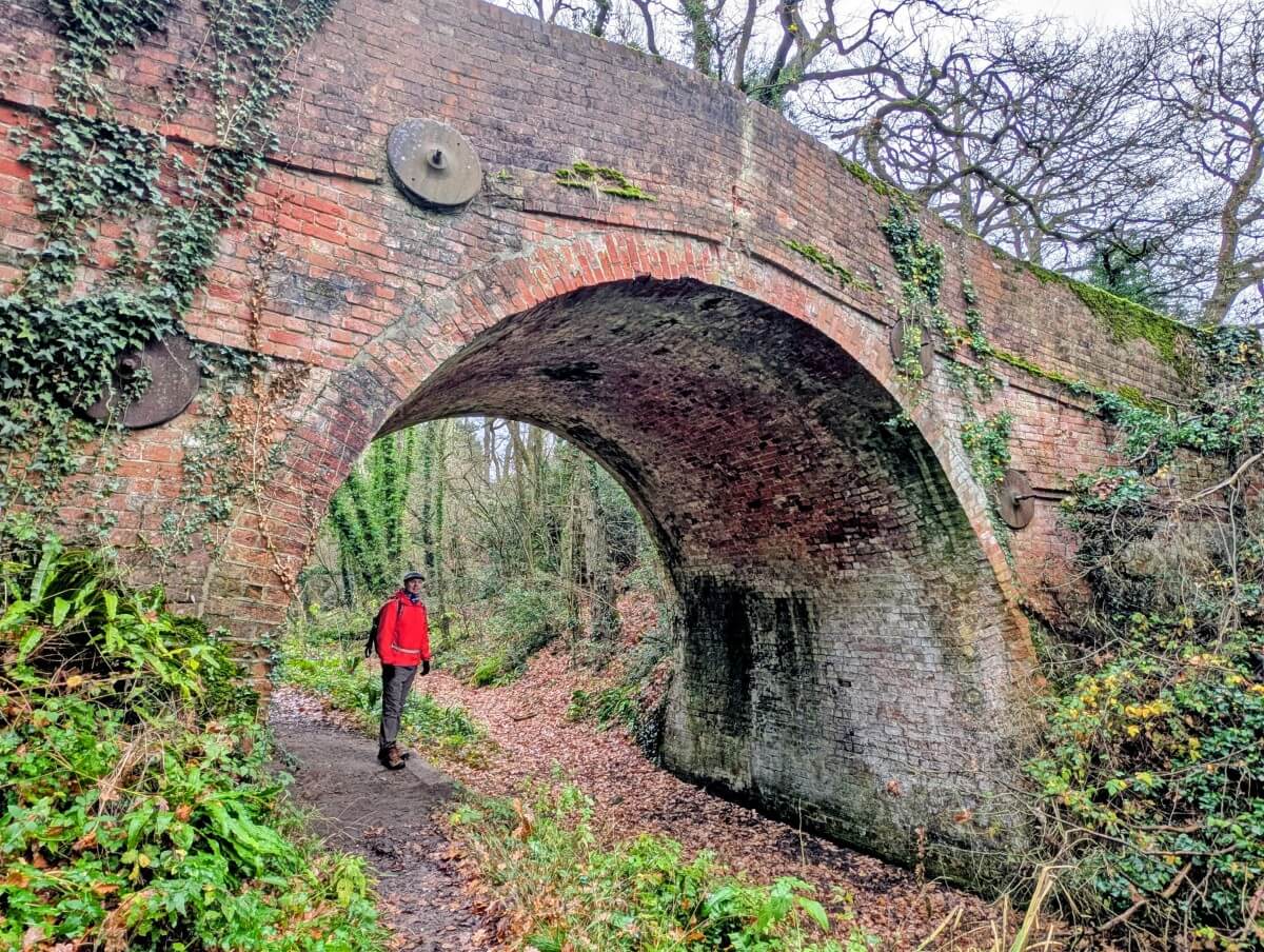
We started our Basingstoke Canal walk at Brick Kiln Bridge in Upper Nately. As previously mentioned, the western end of the Canal is disused.
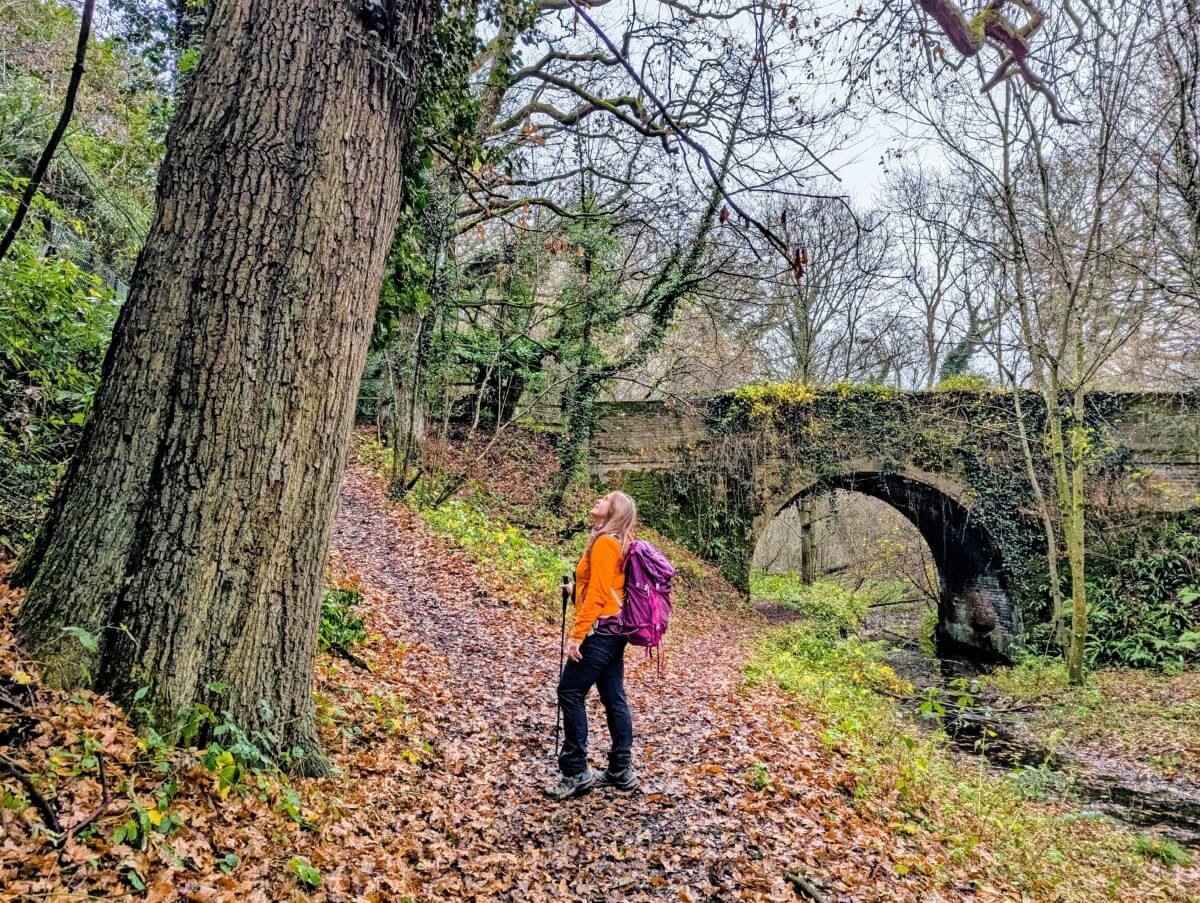
It’s still worth a visit: a damp, ivy-clad channel shaded by huge moss covered oak trees, with handsome 18th-century brick bridges spanning the way.
The collapsed Greywell Tunnel is fenced off and a little spooky. The detour across the fields next to Greywell Hill House provides some gorgeous views across the surrounding farms. From the village of Greywell, the journey truly starts.
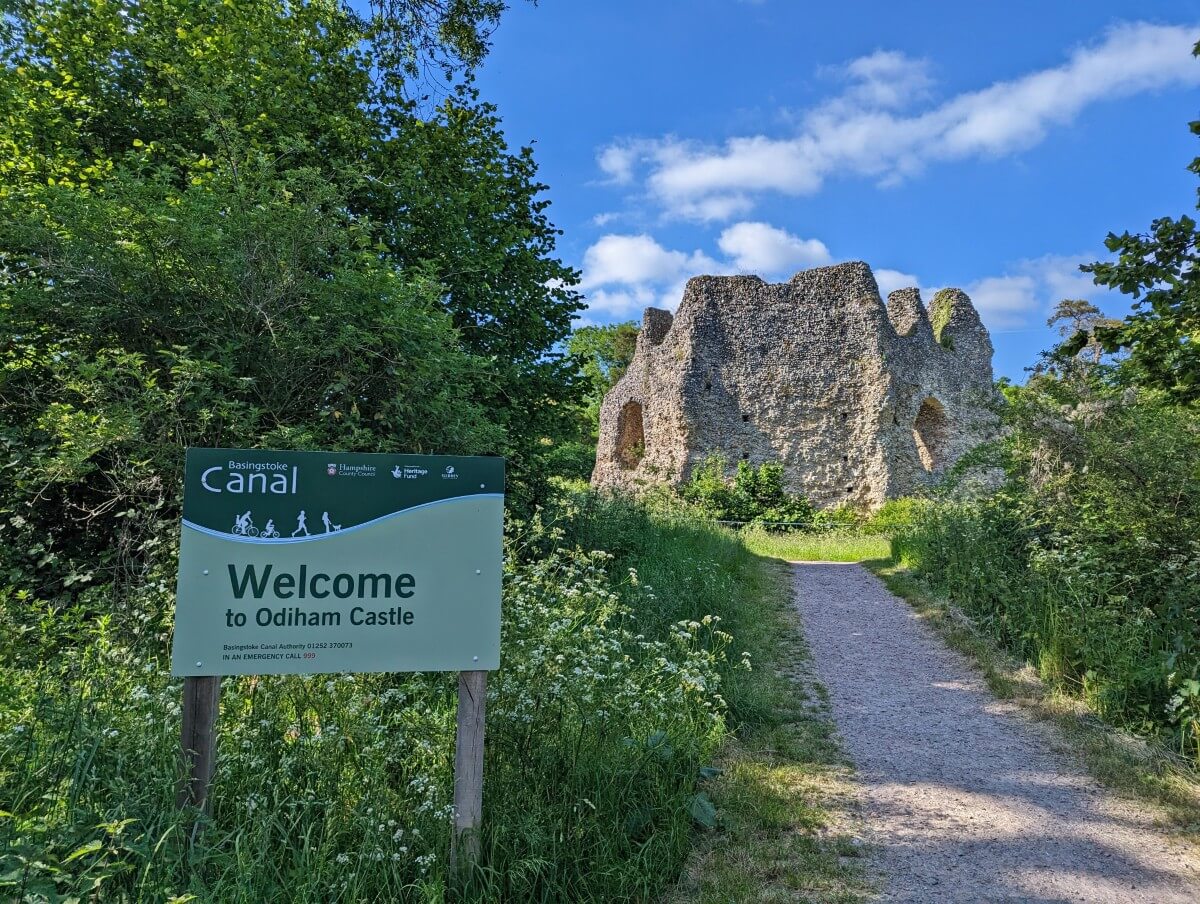
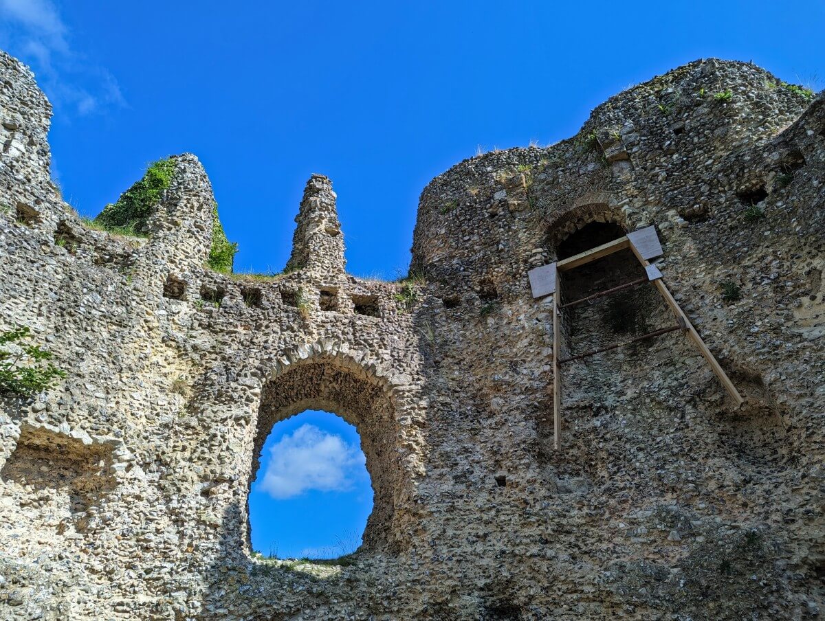
Less than 1km along the now water-filled Canal stands Odiham Castle, also known as King John’s Castle.
Built in the early 13th century as a stronghold, the site was most likely chosen as it is located halfway between Windsor and Winchester. Once captured for a short time by the French, this three storey stone keep was usually utilised as a hunting lodge.
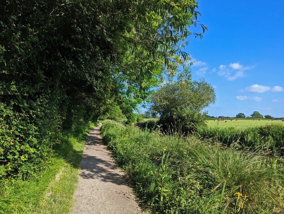
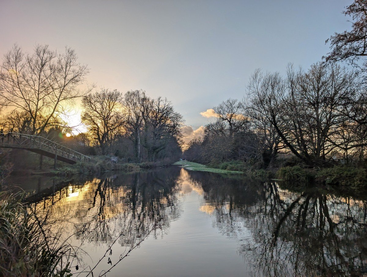
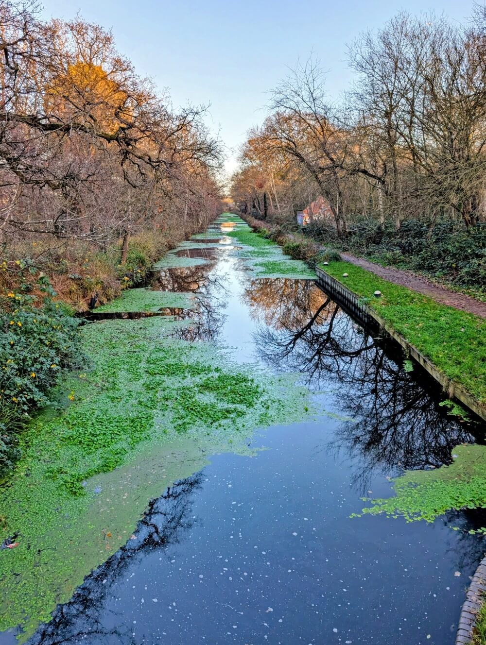
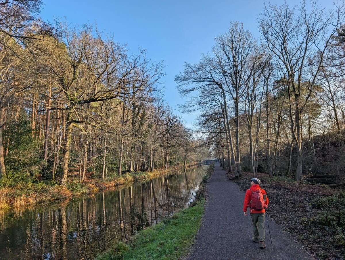
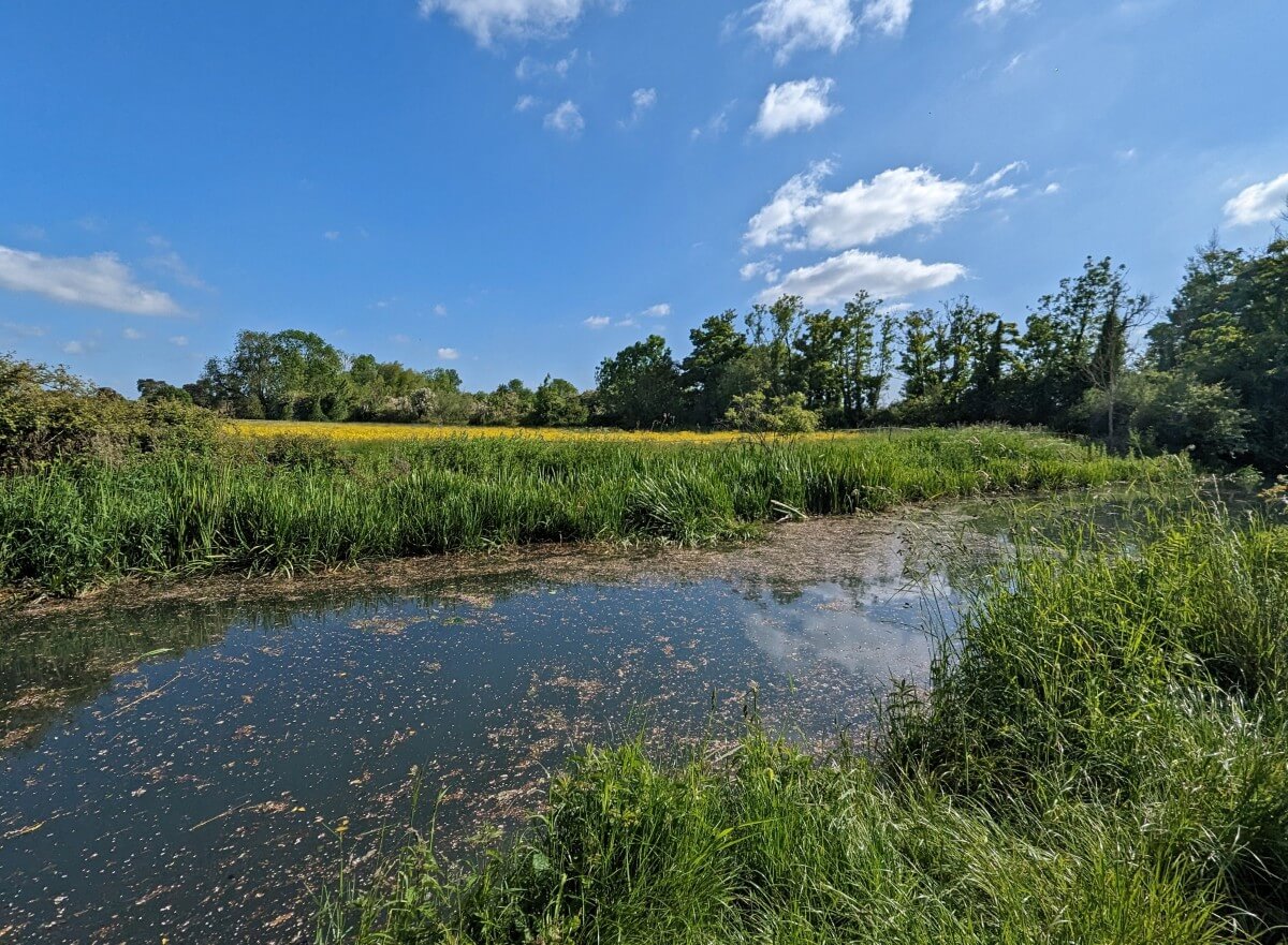
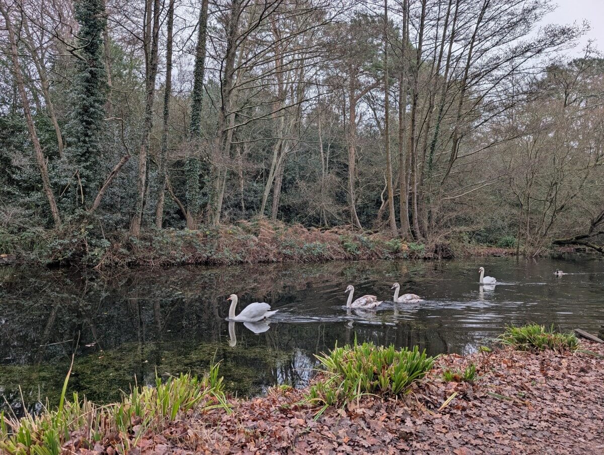
The windiest section of the Canal follows, with views of beautiful surrounding countryside, more historical brick bridges and a series of cosy country pubs. With its remarkably clear water and abundance of waterfowl, it’s clearly a thriving habitat.
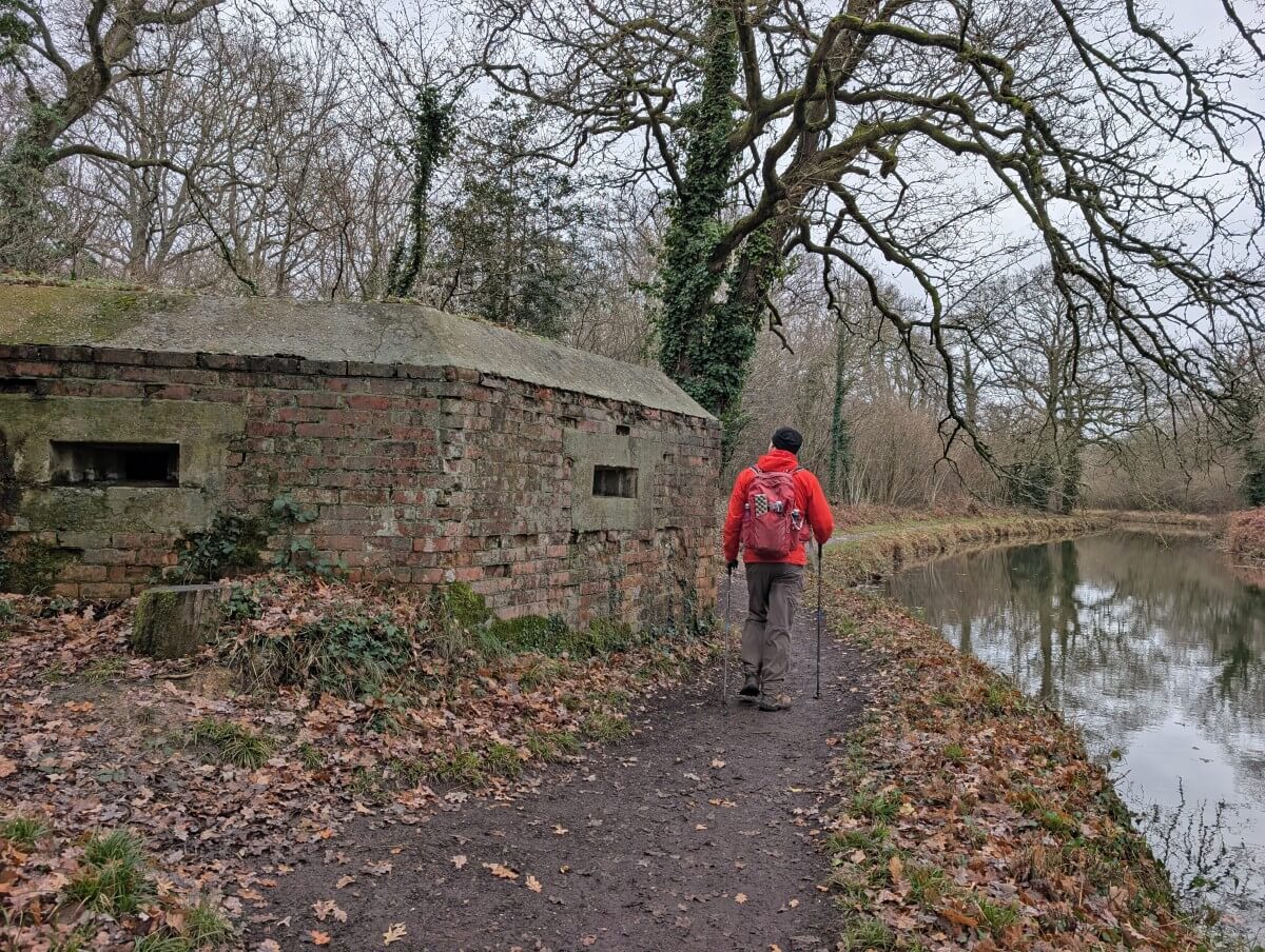
The route is punctuated with WWII fortifications, ranging from concrete anti tank cylinders and pyramid shaped “dragon’s teeth” to brick pillboxes. One of the latter is even accessible to explore.
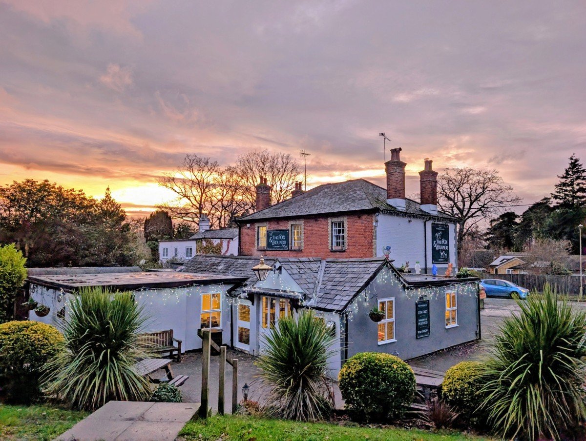
We ended our day at the excellent Fox & Hounds pub, just outside of Fleet. It has a large beer garden out the back, with some picnic tables perched right next to the towpath. The best way to end the day!
Fleet to Frimley Green -10.3 miles/16.6km
This central stretch offers a real mix of experiences. Heading out from Fleet, it feels remarkably rural, despite passing so close to Farnborough Airport. Further along, the route is flanked by the Aldershot army base on both sides. It still doesn’t feel too overlooked, however.
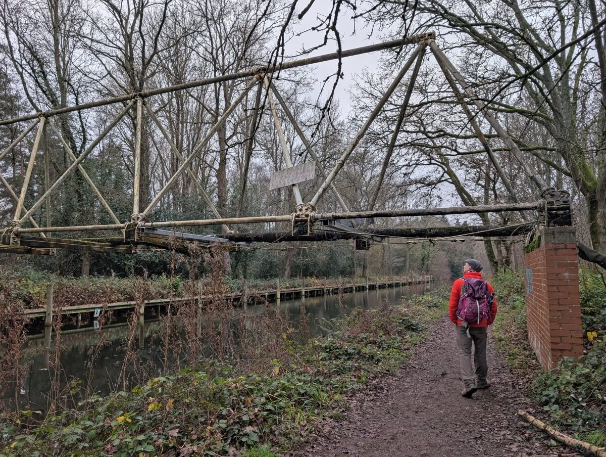
Before crossing under Farnborough Road, look out for the Inglis Pipe Bridge. It’s the only surviving WWI bridge of this type in England, a portable prefabricated steel structure.
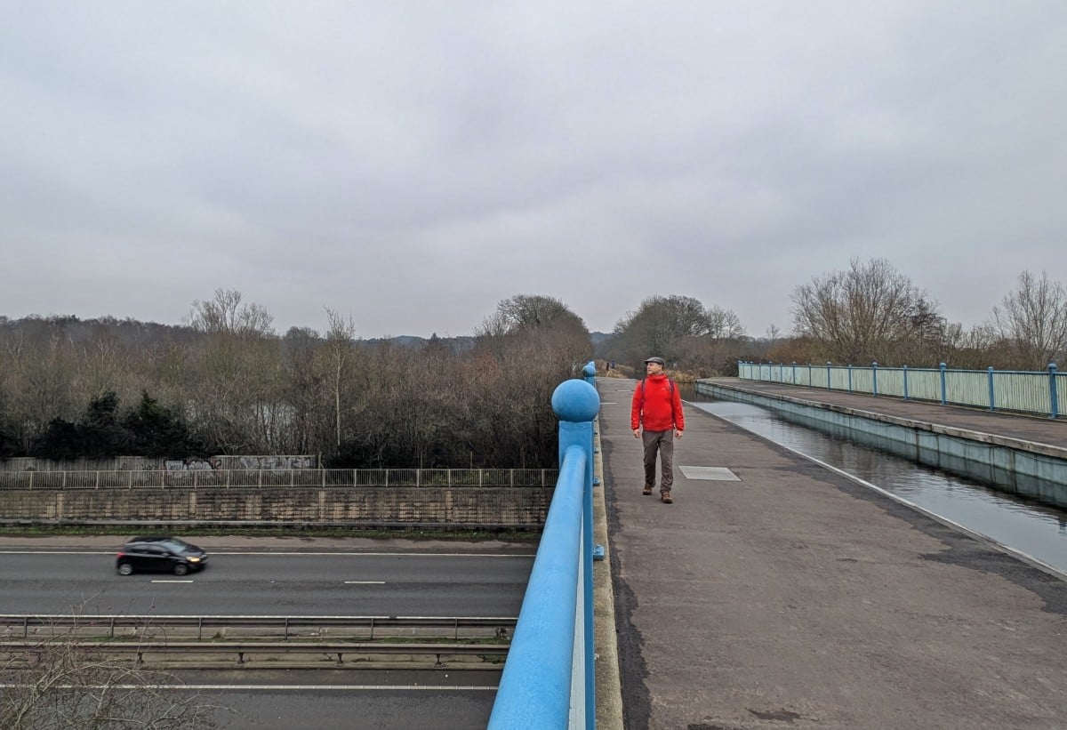
Another unique feature is the Ash Aqueduct, which transports the Basingstoke Canal over the A331. Originally, the plan was to build the road above the canal but it worked out to be more aesthetically pleasing to do the opposite! It’s quite something to stand next to a waterway over a busy road.
The community of Ash Vale is the ideal place to take a break and get a snack. The Christmas Bakery backs onto the Canal and has a tasty range of sweet and savoury treats. For something more substantial, head to the Swan pub a little further on. It has a great beer garden overlooking the water.
Look for the old sheds near where the railway line crosses over the Canal – boats used to be made here. The nearby Mytchett Lake is a favourite with fishermen as well as swans, coots and moorhens.
A swing bridge offers access to the Basingstoke Canal Centre. It was closed on our visit but there is a cafe, toilets and picnic area. From here, the village of Frimley Green is just a short walk away, with Frimley and its railway station also within reach.
Frimley Green to Woodham Junction near West Byfleet – 12 miles/19.5km
The final section of the Basingstoke Canal is all about locks. And rather surprisingly, aliens.
For us, the day began with an aqueduct – though we didn’t even realise it. The Frimley Aqueduct takes the Canal over the main Basingstoke to London railway line.
A little further on is the start of the Deepcut flight of locks. Here, 14 locks raise/lower the Canal about 30.5 metres (100 feet) in just 3.2km (2 miles). The path is wide, the views open and the houses very few – it’s one of my favourite sections. It is followed by the (shorter) Brookwood lock flight.
St Johns town centre occupies both sides of the Canal and is a good place to stop for food. There’s another flight of locks afterwards, followed by Langman’s Bridge, the last surviving canal bridge in its original form in Surrey.
From St Johns onwards, the Canal turns decidedly urban. Take advantage of the conveniences by picking up a hot drink at the Myrtle and May boat/coffee shop in Woking.
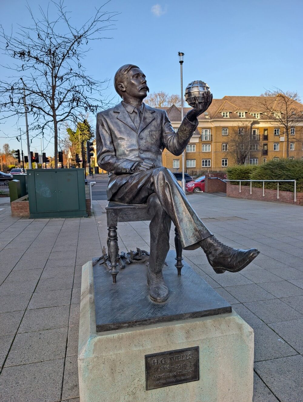
Did you know that the War of the Worlds was set in Woking? There’s a statue of H.G. Wells just steps away from the Canal and a Martian sculpture just a little further into the city centre. It’s worth the 500 metre detour!
After Woking, the Canal winds through some areas with industry on the right, parkland on the left. Housing eventually returns, as the finish draws near. Colourful narrow boat homes are parked on either side of the Woodham Lock Flight. The M25 looms above as the Basingstoke Canal pours into the River Wey.
Navigation and difficulty
The Basingstoke Canal has to be one of the easiest long distance paths to walk in the UK. For almost the entire route, the path follows the side of the canal. You’d struggle to lose your way.
The surface of the towpath varies between dirt, gravel and paved sections. Most of it is clear of tree roots and is almost completely flat throughout.
With that said, there are one major exception to this rule – the detour around the long closed Greywell Tunnel. This section is 1.4km long and is no signage (not that we could spot anyway). It’s clearly marked on our favourite trail app, Organic Maps.
Heading east, the path leads up and over the bridge above the Tunnel towards Greywell Hill House. There is a permissive path across to Greywell Hill Park which then leads down into the village of Greywell, right next to the Fox & Goose pub.
This detour route has a little elevation gain (about 30 metres) and is mostly grass and dirt path. The section above the tunnel can get pretty muddy in winter and after rain.
Elevation changes along the rest of the Canal are almost negligible, except around the Deepcut Locks, where the eastbound route slopes slightly downhill.
There are a few areas where there is a towpath on both sides on the Canal, such as around Brookwood.
As mentioned, the Basingstoke Canal is a great option for a winter walk, as it has minimal sections that become muddy or prone to flooding.
Where to stay on the Basingstoke Canal
Fleet, Frimley, Aldershot and Woking offer the most choice for accommodation close to (or even on) the Basingstoke Canal.
If I was following our itinerary again and needed to stop overnight along the way, I would probably do this:
- Fleet – Holiday Inn Express (very close to the Canal) or the Lismoyne Hotel
- Frimley area – Lakeside International Hotel or Deepcut Lodge Bed and Breakfast
For accommodation near the eastern end of the trail, I would suggest Woking (the Wheatsheaf) or West Byfleet (the Station pub).
To reduce the walking distance back to Woking from the end of the towpath, you could take a train from West Byfleet.
Where to eat and drink along the Basingstoke Canal
As the Basingstoke Canal passes through more built-up areas, food and drink options are fairly frequent.
While the western side of the path is more rural, you’ll still find places to stop for food and drink, largely in the form of pubs.
The following list was complied from our own observations. All of these places are less than five minutes walk from the towpath (no more than 0.2 miles or 500m):
- Fox & Goose, Greywell
- The Anchor Inn, North Warnborough
- The Waterwitch, Odiham
- The Barley Mow, Winchfield
- The Fox & Hounds, Fleet – we would highly recommended
- Oatsheaf, Fleet
- Sainsbury’s Local, Fleet (groceries)
- The Lake House, Aldershot (cafe)
- Christmas Bakery, Ash Vale – we would highly recommend
- Co-Op Food, Ash Vale (groceries)
- The Swan, Ash Vale
- Tesco Express, Ash Vale (groceries)
- Galeforce Café, Mytchett
- Harvester Kings Head, Frimley Green
- Esso, Brookwood (convenience shop and Greggs)
- Nags Head Inn, Brookwood
- The Rowbarge, St Johns
- Multiple shops and cafés in St Johns
- Myrtle and May, Woking (floating coffee shop)
- Multiple shops, cafés and pubs in Woking
- The Station, West Byfleet
Short walks on the Basingstoke Canal
Don’t have the time or energy to explore all of the Canal? Here are my favourite sections, perfect for a day or afternoon out.
Some of these suggestions can be combined for a longer walk. Public car parking is available at each starting location.
- Warnborough Lift Bridge*, North Warnborough to Eastrop Bridge, Upper Nately
- 3.6 miles return (5.8km) – or continue further
- Lift bridge, Odiham Castle, Greywell Tunnel, Fox & Goose pub, grounds of Greywell Hill House, Eastrop Bridge
- Colt Hill Car Park, Odiham, to the Greywell Tunnel eastern entrance
- 4.2 miles return (6.7km)
- Odiham Castle, lift bridge and two pubs (Waterwitch, Fox & Goose)
- Colt Hill Car Park to the Barley Mow Slipway, Winchfield
- 5.8 miles return (9.3km)
- Five historical bridges, two pubs (Waterwitch, Barley Mow)
- Barley Mow Slipway to Crookham Wharf, Crookham Village
- 5.6 miles return (9km)
- Two historical bridges, WWII fortifications, Barley Mow pub
- Crookham Wharf to Fox & Hounds pub, Fleet
- 2.8 miles return (2.5km)
- Swing bridge, pub
- Basingstoke Canal Visitor Centre, Mytchett to Ash Aqueduct, Aldershot
- 5.6 miles return (9km)
- Mychett Place Bridge, Mychett Lake, the Swan pub, Lakeside Nature Reserve, Ash Aqueduct
- Frimley Lodge Park, Frimley Green to to Pirbright Bridge, Brookwood
- 7.6 miles return (12km) – or turn around when you want!
- 14 of the Deepcut Lock system, wide path, pillbox by Pirbright Bridge
- St Johns Lye Car Park to Brookwood (west) or Woking (east)
- 4 miles return in either direction (6.4km)
- Series of locks, historical bridges, Rowbarge pub
- Woking to Byfleet (end of towpath)
- 7.7 miles return to Byfleet (12.4km) OR 6.2 miles return (10km) to West Byfleet
- Series of locks, narrow boat houses
*Car parking is available on Tunnel Lane
Suggested Basingstoke Canal itineraries
If you want to walk the full path over three days, I would suggest something similar to what we did:
- Upper Nately to Fleet – 11.1 miles/18km
- Fleet to Frimley – 10.3 miles/16.6km
- Frimley to Woodham Junction – 12 miles/19.5km
This divides up the trail into three manageable and almost completely even sections. Fleet, Frimley and Woking all have a choice of accommodation as well as public transportation connections (see below for more details).
Please note that the above distances are approximate and do not include extra mileage to reach bus stops/railway stations, food locations etc. We averaged around 20km total each day.
If you plan to have a late start, an alternative idea would be to stay in Odiham (off route) instead on Day 1 and somewhere closer to Aldershot on Day 2, and the Brookwood Heath area on Day 3.
For me, the more rural parts of the Canal are a real highlight, so this itinerary makes the most of that stretch.
Public transportation options
The eastern side of the Canal is quite urban and, consequently, the main towns are reasonably well served by public transport. Check out this Woking bus timetable page for more information on buses.
The path often crosses or parallels railway tracks. There are a few railway stations that are located very close to the route:
- Ashvale
- Brookwood
- Woking – major station, lots of connections
- West Byfleet
Fleet has a railway station, situated about just over a mile (almost 2 km) from the towpath. Another option is Frimley, which is around two miles from the canal. Frimley can also be accessed via bus, with routes including the 730/1 Flightline and the 48.
The western side of the Basingstoke Canal is a lot more rural. The Basingstoke #6 bus route passes through North Warnborough and Odiham.
The closest bus route to Upper Nately is the #13 or 731 – buses stop at the Hatch on the A30, about 1.8 miles away. Please note that the approach road is Upper Nately is narrow (no footpath).
The safer but more expensive option is to book an Uber. There is a small layby next to a post box just before Blackstock Lane, near the Brick Kiln Bridge. Alternatively, you can walk along the disused sections of the Canal all the way from Festival Place.
Essential items and final tips
- Plan to wear and bring a mix of clothing layers for longer walks. The weather can be pretty changeable in any season. If you don’t use the rain jacket, consider it good luck
- Bring an inflatable seat cushion in wet weather. There are many benches along the Canal. When it’s rainy, a dry, inflatable cushion is ideal to place on top of wet benches.
- Be sure not to forget a sun hat and sun cream. While there is some shade along the towpath, some areas (such as the Deepcut Locks) feel a lot more open and it would be easy to get burned on sunny days
- The Basingstoke Canal rarely gets muddy. We hiked in mid/late December and only found a couple of muddy areas, all of which were very short
- Flooding isn’t an issue. Locals we met along the trail, including one who has lived beside the towpath for more than 50 years, told us the canal rarely floods thanks to its efficient drainage system
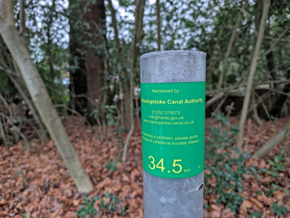
- There are green kilometre distance markers every 500 metres along the Canal, starting at the eastern end of the Greywell Tunnel and continuing to Woodham Junction
Other walking trails you may enjoy reading about
The Isle of Wight Coastal Path
Check out these recently published articles next


One half of the Canadian/British couple behind Off Track Travel, Gemma is happiest when hiking on the trail or planning the next big travel adventure. JR and Gemma are currently based in the beautiful Okanagan Valley, British Columbia, Canada. Consider buying us a coffee if you have find any of our guides helpful!