The South Downs Way is a 160km long distance trail from Winchester to Eastbourne (or vice versa) on the UK’s south-eastern coast.
The only national trail in the UK to be entirely situated within a national park, the South Downs Way (SDW) is also considered one of the most approachable.
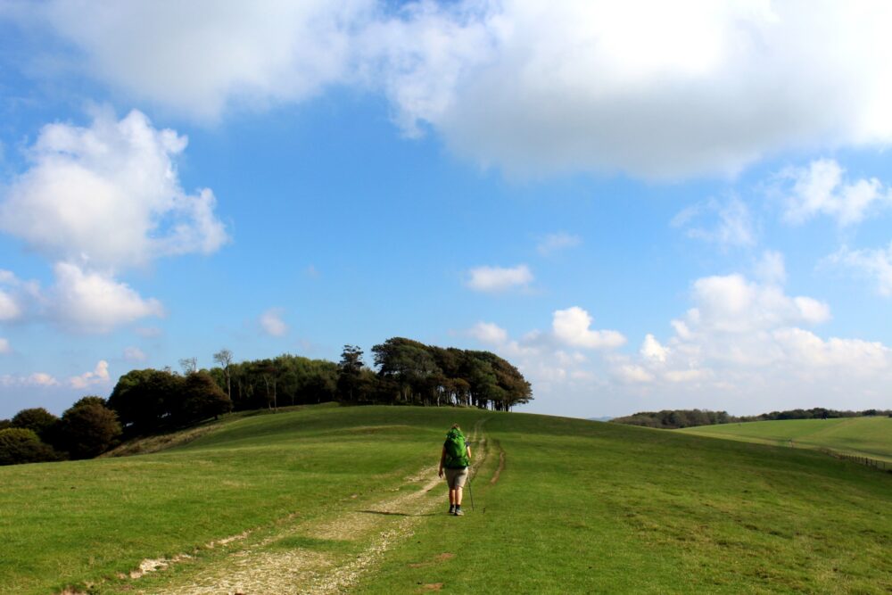
With much of the SDW following high chalk ridges, the trail offers boundless views of the English Channel, farmland, rolling grassy hills, tall cliffs, villages and even a couple of castles.

I spent 21 years living close to the path of the SDW. I was born in Brighton, raised near Winchester, visited my grandparents regularly in Seaford, went to university in Falmer and later worked in Lewes, Seaford and Newhaven.
For that reason, I chose the South Downs Way as my first thru-hike in 2016. I walked most of the trail solo.
I recently returned with JR to rewalk the trail, this time in the other (east-to-west) direction.

The main part of this post comprises a comprehensive hiking guide, featuring all the details you need to know to walk the South Downs Way yourself, including a full trail breakdown, accommodation list, the best places to see and eat, suggested itineraries, safety tips and more.
It is followed by an overview of our personal experience walking the South Downs Way.
This post includes some affiliate links. If you make a purchase via one of these links, I may receive a small percentage of the sale at no extra cost to you.

South Downs Way Walking Guide
Skip to any of the following sections of this SDW guide by clicking below:
Walking necessities
- Always bring the 10 Essentials
- Know how to stay safe
- Remember to Leave No Trace
- Recommended gear is listed on our Resources page
- Need a multi-day hiking packing list? Sign up to our newsletter for a free one!
Introducing the South Downs Way
The South Downs Way is a 160km walking path connecting the ancient cathedral city of Winchester with the seaside resort of Eastbourne.
The name of the trail refers to downland, specifically the open chalk hills that form a long ridge across Sussex and Hampshire.

The SDW’s protected footpaths and bridleways provide a ridge-top route along many of these hills, with shorter forested sections at lower elevations.
Offering a high vantage point above villages, fields, rivers and even the ocean, the path itself has a surprisingly remote feel.
History is easy to find here, with Roman ruins, Bronze Age fortifications, Medieval castles, 16th-century coaching inns and notable WWII sites on or close to the trail.

The South Downs Way is an ideal first-time long-distance walk (it was mine!) Located close to London, there are good transport links to both trailheads.
Here are some other quick facts:
- The SDW was officially launched in 1972 as the UK’s fifth national trail
- The path features around 4,150m total elevation gain and loss (13,615 feet), very similar to an ascent of Mount Kilimanjaro!
- More than 20,000 people finish the full trail annually, with approximately 20 million visits to individual sections
- The SDW is one of only two National Trails that can be completed by foot, horse or bike
- It is completely free to walk, cycle or horse ride the SDW. There are fees for some of the car parks
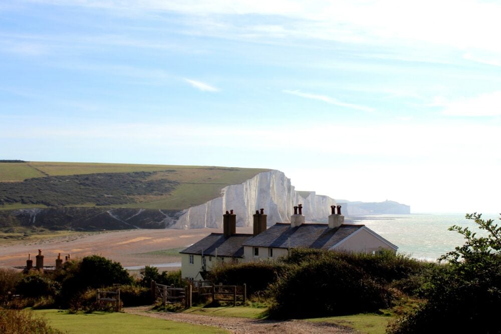
- The iconic Seven Sisters view (below) is just off the main SDW route. Consider planning your trip to include a detour to Seaford Head to see it
How long is the South Downs Way?
The South Downs Way, a fully signed and designated walking path, is 160km long.
The recommended time to walk the entire path is 8-10 days.

On an eight day SDW trip, most walkers traverse 16-25km (10-15 miles) daily with additional mileage to reach nightly accommodation. It is an achievable target for most reasonably fit people who are comfortable walking 6-8 hours at a time.
On my first eight day SDW hike (a mix of camping and B&Bs), I walked 114 miles/182km total. Our second eight day trip (B&Bs and hotels) featured a similar total distance.
If that sounds a little ambitious, plan for 9-11 days. The longer the duration of a trip, the easier it will be.

Where does the South Downs Way start and end?
The South Downs Way connects the Saxon capital of Winchester in Hampshire and the seaside town of Eastbourne in East Sussex.
- The western trailhead is located at the historic City Mill in Winchester’s city centre, not far from the King Alfred statue. The trail marker is nestled into the greenery in front of the gift shop
- The eastern trailhead is situated at the southern edge of Eastbourne, right at the base of the approach to Beachy Head. The trail marker is opposite the seasonal Kiosk cafe

Trail breakdown
Read on for a brief overview of the South Downs Way. If you’d like a more detailed description, I’d suggest purchasing the official trail guide or another South Downs Way walking book.
I have noted an approximate elevation gain for each day – anticipate a similar amount of loss.
Winchester to Exton, 19.5km (12 miles) with 350m elevation gain
Take some time before heading onto the trail to explore Winchester, particularly the spectacular 11th century Cathedral (admission fee).
The South Downs Way begins at the City Mill, near the King Alfred statue (the first true king of England).
The path follows the River Itchen before turning east through the city’s Highcliffe housing area. Make a short detour to check out the Wolvesey Castle ruins (free entry).

The M3 and A272 bridge crossing signifies the start of the SDW’s transition to the countryside.
There is an ascent up to Telegraph Hill and Cheesefoot Head, the latter a scenic amphitheatre where General Eisenhower addressed 100,000 Allied troops shortly before D-Day.
Holden Farm Cafe is a good spot for coffee or an early lunch, with the Milbury Pub a more formal option and scenic Beacon Hill a great alternative for those with a picnic. The descent into Exton offers fabulous views of the surrounding countryside.
Exton to Buriton area, 20.1km (12.5 miles) with 460m elevation gain
Leaving Exton, the SDW splits with separate cyclist and walker paths. The latter follows a river and is very narrow and muddy.
After the trail rejoins, the route passes a memorial stone for the 33 men killed when an RAF plane and glider crashed during a D-Day practice.

A steady climb travels up to Old Winchester Hill, the location of a Bronze Age settlement and Iron Age hillfort. The official SDW route goes around the elevated part of the hill but I would recommend going through it instead.
A long, sometimes muddy, switchback leads walkers down to Whitewool Farm, the location of Meon Springs Trout Fishery (plus cafe and glamping). It is a straightforward walk through the fields to the East Meon junction.

Turning south, the SDW becomes flinty and somewhat muddy before reaching the Sustainability Centre (camping, cafe).
Forest surrounds the path from here but beautiful views are still visible through the trees. Look for red kites flying the thermals.

The trail parallels a road on the approach to Butser Hill, the highest point of the SDW (271m). There is a cafe here. The descent to Queen Elizabeth Country Park passes through a Bronze/Iron Age field system.
Make a detour for toilets and food at the Visitor Centre (head for the main car park) and continue up through the forest. A relatively steep slope leads down to another parking area and the turn-off for Buriton.

Buriton to Cocking, 18km (11 miles) with 474m elevation gain
Leaving Buriton behind, the next section of the SDW features some of the longest stretches of road walking. The narrow tree-lined roads are surprisingly quiet and offer good visibility to spot approaching vehicles.
There are also a handful of road crossings, all of easily manageable. Heading into the National Trust’s Harting Down, the views start to open up.

A series of steep open hills provide a good introduction to classic South Downs Way terrain. Beacon Hill (242m) is an optional ascent, with the official trail route snaking around the peak rather than over.
Not far after this challenging section, the path passes Devil’s Jumps. These large rounded hills are Bronze Age burial mounds, carefully aligned to the setting of the summer solstice.
More forest follows, with the final 2km to the A286 mostly downhill and alongside sheep fields. If needed, watch for the turnoff to Cocking. The Cadence Clubhouse cafe sits just before the road crossing.

Cocking to Amberley, 19.3km (12 miles) with 390m elevation gain
As is customary for the SDW, the first part of this section climbs back up to the chalk ridge. It begins as a road and then transitions into a track, with trees bordering the south side.
The descent back down to the next road runs through a ploughed field, with lots of flint underfoot. There is another Cadence Clubhouse cafe by the A285 crossing.

The trail rises again on the other side of the road, with expansive views at the reward. Look for the detour to Stane Street (Roman Road) and Bignor Roman Villa (admission fee) if desired.
The SDW drops again on the other side of Bignor Hill as it heads towards the A29 crossing. The traffic can be quite fast here so be patient.
Another downward slope lies on the other side, leading to the River Arun. The pretty village of Amberley is not far away.

Amberley to Upper Beeding, 20.6km (12.8 miles) with 640m elevation gain
For me, this is the point where the South Downs Way really starts to come into its own. This is also the halfway mark of the trail!
This section begins with, yes, an ascent to the top of the chalk ridge. But this time, the SDW stays there for an extended time. While there are small ups and downs, this stretch is a gloriously easy stroll with views in every direction.

The four-lane A24 crossing is the largest on the trail but isn’t as bad as it initially seems. There is a place to stop in the middle while waiting for a break in traffic.
The path climbs back up to the chalk ridge immediately after the road, where more wonderful walking awaits. Try to spot Elizabethan-era Wiston House to the north, now used for government purposes.
The prehistoric hill fort of Chanctonbury Ring is a highlight of this section, and also a great picnic destination. A circle of beech trees was planted here by a landowner in the mid-18th century and then replanted after the Great Storm of 1987.

The trail then gently descends to the River Arun and the A283, with the English Channel as a backdrop. In spring, the fields bordering the trail shine with yellow rapeseed (canola) flowers.
It is possible to spot Brighton from here, with its 162m high observation tower rising above apartment blocks. An outdoor pig farm signals the finale of this section.
There are several different detour options to Steyning, Bramber and Upper Beeding. Bramber is host to a mostly ruined but still impressive castle (free).

Upper Beeding to Pyecombe, 11.3km (7 miles) with 415m elevation gain
A small kiosk, the South Downs Fodder Box, serves snacks and treats in a car park on the side of the A283. The trail immediately rises back onto the chalk ridge on the other side of the busy crossing.
The first half of this section is very much a repeat of the day before – easy walking on grass and flint with beautiful open views of the Sussex Weald to the north and the English Channel to the south.

In good weather, it is possible to see almost the rest of the South Downs Way, all the way to the top of the Seven Sisters cliffs above Cuckmere Haven.
Consider a stop at the YHA Truleigh Hill for snacks and/or water before continuing to Devil’s Dyke, an impressive 100m deep dry valley. An ice cream van often sits outside the pub in the main parking area.

The trail starts descending parallel to Devil’s Dyke, to Saddlescombe Farm. There is a cafe, toilets and a small farming exhibit here.
A short hill awaits on the other side of the farm, leading to the A23 bridge and a short paved walk into Pyecombe. The 12/13th century Church of the Transfiguration is worth a stop.

Pyecombe to A27 crossing, 13.5km (8.5 miles) with 260m elevation gain
The South Downs Way exits Pyecombe on Clayton Hill, across the fast-moving A273. Be sure to take your time crossing.
The trail parallels a golf course as it climbs towards the iconic 19th century black-and-white Jack and Jill windmills. The Jill windmill is usually open on Sunday afternoons from May to September (small admission fee).

Another pleasing section of the path follows, with undulating terrain to Ditchling Beacon (248m). Look for an ice cream van in the car park on weekends! The other side of Ditchling Beacon has similar satisfying terrain and panoramas.
A good picnic destination is Blackcap, a forested hilltop area just beyond a five-way junction where the SDW turns southwest (an additional 1km). Keep an eye out for naturally occurring dew ponds as well as orchids in spring.

The official South Downs Way route then descends through the fields to Housedean Farm and the A27 bridge crossing.
Walkers staying in Lewes can continue past Blackcap towards the Old Racecourse. Various trails drop down into the town centre from here. There is an alternative route through Kingston near Lewes as well.

A27 crossing to Alfriston, 22.1km (13.7 miles) with 510m elevation gain
This section of the SDW features two big climbs, with the first starting not long after the A27 bridge and railway tunnel.
The trail offers beautiful views of Lewes and the surrounding grassy chalk slopes, as well as several wind turbines and dew ponds. There is a signed detour to Lewes via Kingston near Lewes.

The SDW crosses the Greenwich Meridian (0°), the historical divider between Earth’s eastern and western hemispheres.
The descending path features a fairly gentle incline, with long sections on a concrete farmer’s track. There is an opportunity to detour into Rodmell and see Monk’s House (the former home of Virginia Woolf).

Arriving in the village of Southease, a must-stop is St Peter’s Church. The church’s round tower dates from the 11th century. There are benches and a water tap outside. Turn onto the River Ouse to backtrack to Rodmell or Lewes.
Not far from the church is the YHA South Downs, featuring a cafe and toilets. Be sure to take a good break since the second big hill is waiting on the other side of the A26 bridge!

Itford Hill can be approached in two ways – a short, steep climb or a longer, gentler path (the latter is the official SDW route).
Once at the top, it is a slow ascent to Firle Beacon (217m). The views are fantastic from here, with the towns of Lewes and Newhaven both visible. The trail finally drops into Alfriston, with a paved final approach.
Alfriston is undoubtedly one of England’s prettiest villages, with impressive 15th and 16th century buildings lining the narrow main street.
While Alfriston is certainly not a cheap overnight destination, I’d highly recommend taking the opportunity to stay here.

Alfriston to Eastbourne, 16.9km (10.5 miles) with 815 elevation gain
The final section of the South Downs Way brings walkers to the edge of the English Channel, atop the famous Seven Sisters and Beachy Head chalk cliffs.
Before leaving Alfriston, consider visiting the Alfriston Clergy House, the National Trust’s first protected property (fee required). The nearby 14th-century St Andrew’s Church is also worth a look.

The SDW departs the village along the Cuckmere River. After passing through the tiny village of Litlington, the trail rises into the surrounding fields and offers a view of the Litlington White Horse.
There is a brief foray into Friston Forest before a quick descent into Exceat, passing close to the Seven Sisters Visitor Centre before crossing the A259.

The SDW officially runs along a high ridge above the beautiful horseshoe bends of the Cuckmere River, but it is also possible to follow the riverbank.
Either way, a gentle climb is required to reach the top of the first cliff of the Seven Sisters. From here, it is a continuous up-down route along the high cliffs, with sometimes steep grassy/chalk terrain.

This is one of the most scenic (and busiest) sections of the entire South Downs Way – don’t rush it! Consider a stop at Birling Gap for ice cream or lunch, with another break around Beachy Head.
The South Downs Way officially ends at the bottom of the final steep descent from Beachy Head. It is a flat walk to Eastbourne city centre along the seafront promenade.
Please note that there is an alternative inland bridleway route via Jevington. It has significantly less elevation gain (375m total) and is suitable for horse riders and cyclists as well as walkers. The highlight is the Long Man of Wilmington chalk figure.

Which is the best direction to walk the South Downs Way?
Most walkers traverse the South Downs Way from west to east.
Having walked the South Downs Way in both directions, I would also recommend walking west to east. This is for a few different reasons:
- The prevailing winds blow from west to east so you will most likely have the wind at your back while walking in this direction
- The most spectacular section is between Cuckmere Haven and Eastbourne (Beachy Head and Seven Sisters cliffs). Travelling eastbound, it offers a climatic finish
- As well as being intensely scenic, the Cuckmere Haven to Eastbourne section is also the most difficult part of the SDW as it features the highest amount of elevation change. Some hikers may want to build up to this rather than do it on the first day
- The western side of the SDW is, in my opinion, less scenic overall. The last 30km or so features more wooded sections and fewer views. For this reason, I found finishing in Winchester a little anti-climatic
- The South Downs Way trailhead signage is better in Eastbourne, offering better opportunities for finishing photos! The Winchester trailhead sign is located at the City Mill – if it is closed (as it was for us), it is not possible to access the sign
- While both Winchester and Eastbourne have good transport links and a range of accommodation options, I’d choose to stay in Eastbourne over Winchester after finishing (views of the sea, cheaper)

Navigating the South Downs Way
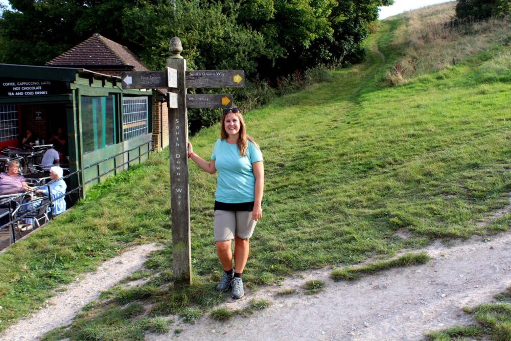
The SDW trail is very well maintained with excellent signage along the route.
There are only a few short road-walking sections, with the majority of the trail following dedicated footpaths and bridleways. Most sections are accessible by bikes and horses as well.
The acorn, England’s national trail symbol, can be spotted on many on many gates and fences on the trail.
Wooden directional signs can be found at almost every junction, with the acorn symbol always being prominent.
One in every ten of these junction signs displays the distance to and from the nearest major locations (I wish there were more!)
Maps and other resources
The signage is SO good on the South Downs Way that I only needed to look at a map a handful of times on both trips. On a 160km long route, that is outstandingly good!
The signage on adjacent paths was also excellent. We had no trouble finding the right path to go to Lewes or any of the rest of our overnight destinations.
Nonetheless, I would still recommend having a map. It is most helpful to have one when rejoining the route each morning. I prefer to have a physical map during initial planning as well.
For both SDW thru-hikes, I carried the Harvey South Downs Way National Trail map. It’s super durable and waterproof, with the latter being put to the test on our most recent walk.
For a quick glance at the entire route on my phone, I used GPX Viewer with a GPX route from the Saturday Walkers Club website.
My favourite offline map app, Organic Maps, features the South Downs Way and many adjacent routes. Keep in mind that the path is not often specifically labelled as the ‘South Downs Way’ but I found it easy enough to work out.

How difficult is the South Downs Way?
The SDW is a low difficulty long distance trail. There are plenty of hills but there is nothing technically difficult about walking up and down them.
Having said that, it may surprise some walkers how often it is required to ascend 80-100m to a hilltop, just to immediately descend again on the other side.
For that reason, the elevation gain is likely higher than you may initially expect. There are some lovely flat ridge sections but they are always bookmarked with hills.
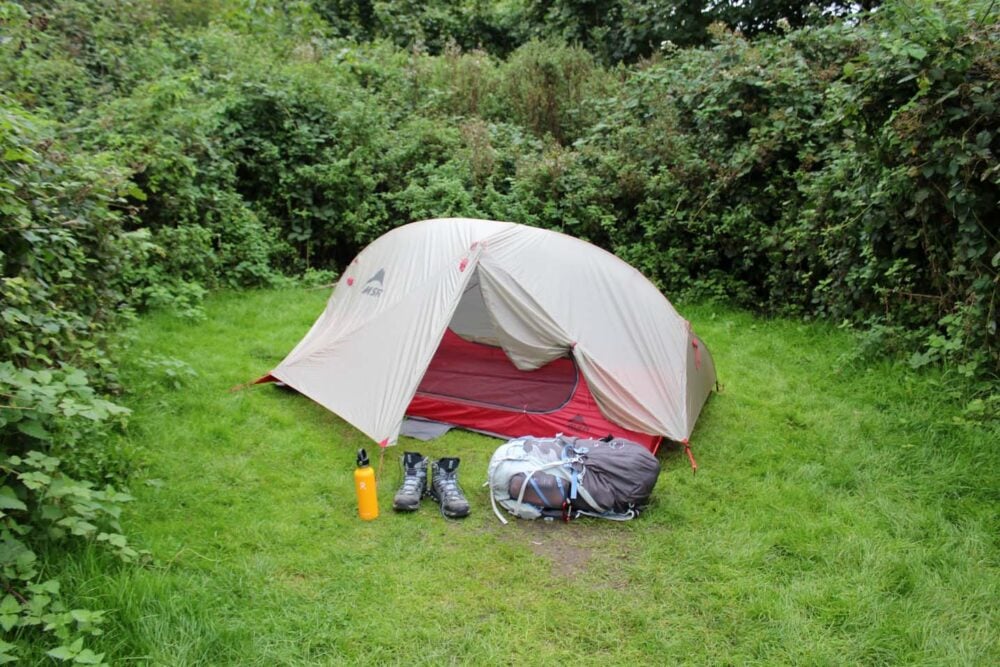
There are very few places to stay on the higher sections of the trail (besides a handful of campgrounds). For that reason, SDW hikers should be prepared to ascend back onto the trail every day. It’s a great way to warm up each morning!
The difficulty of the South Downs Way changes with the length of your planned walk.
A ten day thru-hike will be inherently easier than an eight day trip. Attempting to complete the SDW in five or six days will be more difficult.

South Downs Way trail condition
One important factor to note is the actual condition of the SDW trail; a substantial amount of the surface is made up of sharp rocks.
For that reason, I’d recommend a shoe with a thick sole (or substantial lugs). I received many blisters on my first SDW hike while wearing a lighter hiker.
The sections with grass or dirt are so much kinder on feet. Also notable alongside the sharp rocks are the sections with exposed chalk, which can be slippery in the morning and after rain.

Where to stay on the South Downs Way
A large range of accommodation is available on or close to the South Downs Way, including campgrounds (some with glamping options), B&Bs, guesthouses, pubs with rooms, holiday rentals and hotels.
Having said this, some areas of the SDW have limited accommodation. Most notably, the section between Pyecombe and Alfriston has very few options. Travelling to Lewes can be a good solution.

Accommodation costs along the SDW are generally quite high by British standards. This is due to the SDW travelling through mostly small villages in a relatively affluent area.
Expect to pay £80-130 per night for two people in a mid-range en-suite room (with or without breakfast). Some high-end places charge up to £180.
Glamping options are available for £50-100, shared hostel rooms are around £15-30 per person and campsites £10-20 per person.
When planning a trip, keep in mind:
- Some accommodation providers have a two night minimum stay (or two nights minimum on weekends). This often increases to three nights on bank holidays weekends.
- Demand for accommodation in the small villages surrounding the SDW can sometimes be quite close to supply on weekends, especially during the summer months. Book as early as you can.
- Saturday is a very popular day to start a walk or bike ride on the SDW. Eight days is a common duration for the full SDW walk, something that can invariably cause bottlenecks.
- Some B&B owners do not have websites and prefer bookings via phone. The list below includes some B&Bs without websites but recent Google reviews confirm that they are still operating
Winchester
Many options including:
Mercure Winchester Wessex Hotel
Cathedral Cottage B&B
Travelodge Winchester
Winchester Royal Hotel
Chilcomb
Beauworth
Holden Farm (camping and basic hut)
Exton
Warnford (off route)
Meonstoke (off route)

East Meon (both on/off route options)
Ye Olde George Inn (we highly recommend)
Pound Orchard Bed and Breakfast
The Longhouse B&B
Honeysuckle Cottage (two nights minimum)
Duncombe Farm (camping)
Meonside Camping
The Sustainability Centre (B&B, hostel, yurts, camping)
Upper Parsonage Farm (camping, glamping)
Clanfield (off route)
Buriton
The Nest Hotel & Restaurant
The Five Bells
Hurst (off route)
South Harting (off route)

Cocking (both on/off options)
The Blue Bell Pub
Moonlight Cottage B&B
Hyesett House B&B
Manor Farm Campsite and B&B (plus glamping options, which we’d highly recommend)
East Dean (off route)
Upwaltham
Bignor (off route)
Stane House B&B (we highly recommend)
The White Horse Inn
Bignor Roman Villa (camping, mid July to early September)

Slindon
Gumber Farm (camping, shared bunkhouse)
Houghton
South Downs Bunkhouse (hostel)
Arun Valley B&B
Amberley (off route)
Amberley Castle
Black Horse Pub
2 Farm Cottages (we highly recommend)
The Sportsman Inn
Woody Banks Cottage B&B
Washington (off route)
Washington Caravan and Camping Park
Holt House B&B
Swipes Farm (camping)
Steyning, Bramber and Upper Beeding (off route)
The Tollgate Hotel
The Castle Inn Hotel (we recommend)
The Rising Sun Pub
Hill View B&B
Springwells House

Truleigh Hill
YHA Truleigh Hill (hostel, glamping, camping)
Fulking
Foot of the Downs (glamping, two nights minimum)
Poynings
Saddlescombe
Saddlescombe Farm (camping)
Pyecombe (on and off route options)
Tallai House B&B
Duck Lodge B&B
Waydown Shepherd Huts (two nights minimum)
Chantry Farm (camping, glamping with two nights minimum)
Clayton area
The Jack & Jill Inn
Southdown Way Caravan & Camping Park

A27 crossing
Housedean Farm – (camping, glamping)
Kingston near Lewes (off route)
Swanborough Lakes Luxury Holiday Lodges (two nights minimum)
Lewes (off route)
Premier Inn
Monty’s B&B
The Dorset Pub
Aleberry B&B
The King’s Head Pub
Rodmell (off route)
Garden Studio B&B
Sunnyside Cottages B&B
The Loft (two nights minimum)
South Farm Rodmell (glamping)

Southease
YHA South Downs (hostel, camping, glamping)
Alfriston
Ye Olde Smugglers Inne (we highly recommend)
The George Inn
The Star
Wingrove House B&B
The Alfriston
Alfriston Camping Park
Alfriston Cabins
Exceat
Saltmarsh Hotel
Seven Sisters Camping Field

Seaford (off route)
The Wellington Pub and B&B
The White Lion Hotel
Polruan Seaford Head Guesthouse
Hill House B&B – very well located for Seaford Head detour
Birling Gap area
Eastbourne
Many options including:
The Pilot Inn – located very close to the trailhead
The Halcyon
The Lansdowne Hotel
da Vinci Hotel

Wild camping
Some walkers choose to wild camp on the South Downs Way.
Officially, wild camping (camping anywhere other than a designated campsite) is illegal in this area of England without the landowner’s permission.
To add to that, there are some specific local land restrictions to the SDW area, including some Sites of Special Scientific Interest (SSSI). No camping is allowed in SSSIs.
Anyone attempting to wild camp along the SDW should do plenty of research first and seek permission where possible.
Once on the trail, always plan to set up camp late, leave very early and be sure to leave no trace.
Suggested South Downs Way itineraries
There are so many ways to organise a South Downs Way walk.
When starting planning, I would first consider if you’d like to visit any of the more time-consuming attractions along the SDW, such as Bignor Roman Villa or the Alfriston Clergy House, and plan around that.
All distances are approximate.

Example 8 day itinerary – B&Bs and hotels
The most popular itinerary for an eight day South Downs Way thru-hike similar to this:
- Day 1 – Winchester trailhead to Exton, 20km/12.5 miles
- Day 2 – Exton to Buriton, 21km/13 miles
- Day 3 – Buriton to Cocking, 18km/11 miles
- Day 4 – Cocking to Amberley, 19km/12 miles
- Day 5 – Amberley to Bramber, 21km/13 miles
- Day 6 – Bramber to Housedean Farm (bus to Lewes/Brighton), 27km/16.5 miles
- Day 7 – Housedean Farm to Alfriston, 22.5km/14 miles
- Day 8 – Alfriston to Eastbourne trailhead, 17km/10.5 miles (+2km to rail station)
This itinerary breaks the distance into reasonably even days. The most difficult and longest day will certainly be day 6, which also finishes with a bus trip into Lewes or Brighton unless staying at Housedean Farm.
The other problem with this itinerary is the lack of accommodation options in Buriton. An alternative would be Clanfield, just south of Queen Elizabeth Country Park.
If venturing into Lewes doesn’t appeal, consider our suggested 9 day itinerary instead.
Walkers who aren’t strict about staying on the official South Downs Way path have more overnight options.
One idea would be to walk directly to Lewes from Blackcap (instead of turning south to Housedean Farm) and stay there overnight. The next day, walk along the River Ouse to Southease and continue to Alfriston.
Example 9 day camping itinerary
- Day 1 – Winchester to Holden Farm, 10km/6.2 miles
- Day 2 – Holden Farm to the Sustainability Centre, 20km/12.4 miles
- Day 3 – Sustainability Centre to Manor Farm Campsite, 25km/15.5 miles
- Day 4 – Manor Farm to Bignor Roman Villa, 14km/8.7 miles
- Day 5 – Bignor Roman Villa to Swipes Farm – 18km/11.1 miles
- Day 6 – Swipes Farm to Truleigh Hill YHA – 15.5km/9.7 miles*
- Day 7 – Truleigh Hill YHA to Housedean Farm, 22km/13.6 miles
- Day 8 – Housedean Farm to Alfriston, 22.5km/14 miles
- Day 9 – Alfriston to Eastbourne trailhead, 17km/10.5 miles (+2km to rail station)
*or Saddlescombe Farm, 21km/13 miles
9 day itinerary – B&Bs and hotels
An example of a longer itinerary would be:
- Day 1 – Winchester trailhead to Exton, 20km/12.5 miles
- Day 2 – Exton to Buriton, 21km/13 miles
- Day 3 – Buriton to Cocking, 18km/11 miles
- Day 4 – Cocking to Amberley, 19km/12 miles
- Day 5 – Amberley to Bramber, 21km/13 miles
- Day 6 – Bramber to Pyecombe, 22km/14 miles
- Day 7 – Pyecombe to Rodmell*, 23km/14.2 miles
- Day 8 – Rodmell to Alfriston, 16km/10 miles
- Day 9 – Alfriston to Eastbourne trailhead, 17km/10.5 miles
*Or Southease, 24km/14.9 miles
As before, there is still one particularly long day. There just aren’t many accommodation options between Pyecombe and Southease, without detouring into Lewes. As it is, Rodmell is off the main trail route.

10 day itinerary
- Day 1 – Winchester trailhead to Exton, 20km/12.5 miles
- Day 2 – Exton to Clanfield (Hampshire Hog), 19km/11 miles
- Day 3 – Clanfield to Cocking, 21km/13 miles
- Day 4 – Cocking to Bignor, 14km/8.7 miles
- Day 5 – Bignor to Amberley, 11km/7 miles
- Day 6 – Amberley to Upper Beeding/Bramber, 19km/12 miles
- Day 7 – Upper Beeding/Bramber to Pyecombe, 13km/8 miles
- Day 8 – Pyecombe to Rodmell, 23km/8.7 miles
- Day 9 – Rodmell to Alfriston, 16km/10 miles
- Day 10 – Alfriston to Eastbourne trailhead, 17km/10.5 miles
This itinerary has a somewhat tiring start but then mellows out along the most scenic sections of the South Downs Way.
The shorter days offer time to explore some of the paid attractions along the South Downs way, such as the Bignor Roman Villa, Monk’s House in Rodmell and the Alfriston Clergy House.
This 10 day South Downs Way itinerary could easily be made into an 11 day trip, with the journey from Pyecombe to Rodmell being split in half.
I would suggest taking a bus to Lewes to stay there overnight, making time to see the castle and the Anne of Cleves House.

Where to eat and drink on the South Downs Way
The following cafes, pubs and kiosks are located on or very close (100m or less) to the South Downs Way.
Check opening times first, especially on weekdays and in spring/autumn.
- The Bishop on the Bridge, Winchester
- Holden Farm Cafe, Beauworth
- The Milbury Pub, Beauworth
- The Shoe Inn, Exton
- Zed and Bolly’s Cafe at Meon Springs Lodge
- The Beech Cafe at the Sustainability Centre, near East Meon
- Butser Roundhouse Café, Butser Hill National Nature Reserve
- Beechwood Kitchen, Queen Elizabeth Country Park
- Cadence Clubhouse, Cocking (by A286)
- Richline Farm Shop (supplies only), Cocking
- Cadence Clubhouse, Upwaltham (by A285)
- George & Dragon, Houghton
- The South Downs Fodder Box, A283 crossing near Upper Beeding
- YHA Truleigh Hill Cafe
- The Devil’s Dyke Pub
- The Wildflower Cafe, Saddlescombe
- The Plough, Pyecombe (slightly off trail)
- Courtyard Cafe at the YHA South Downs, Southease
- The George Inn, Alfriston
- Ye Olde Smugglers Inne, Alfriston
- Six Bells, Alfriston
- The Singing Kettle, Alfriston
- Litlington Tea Gardens
- Cadence Clubhouse, Litlington
- The Plough & Harrow, Litlington
- Saltmarsh Farmhouse & Cafe, Exceat
- Birling Gap Tea Room
- Cadence Clubhouse, Beachy Head
- The Beachy Head Pub
- The Kiosk, Eastbourne trailhead
We found ice cream vans at Devil’s Dyke, Ditchling Beacon, Birling Gap and Beachy Head.
Walkers who are willing to detour further off the main path will find even more dining opportunities, such as the Blue Bell Inn in Cocking, the Hampshire Hog in Clanfield (near Queen Elizabeth Country Park) and Amberley Tea Room in Amberley.
Though there are quite a few food options along the SDW, the trail passes very few convenience shops (only in Alfriston). The Alfriston Village Store has a great delicatessen offering made-to-order sandwiches.
Meonstoke Post Office & Village Stores is 1km off trail from Exton.

What to see on the South Downs Way
As well as the many scenic viewpoints and beacons (hilltops), the South Downs Way features the following places of interest.
Winchester City Mill
Winchester Cathedral – off trail (fee required)
Wolvesey Castle (Old Bishop’s Palace) ruins, Winchester
St Peter’s & St Paul’s Church, Exton
Old Winchester Hill – Iron Age hill fort with Bronze Age barrows
Uppark House and Garden – off trail (fee required)
Devil’s Jumps, near Harting Down – Bronze Age burial mounds
Stane Street near Bignor – Roman road, off trail
Bignor Roman Villa – off trail (fee required)
Amberley Museum – off trail (fee required)
Chanctonbury Ring, near Washington – Prehistoric hillfort
Bramber Castle – off trail
St. Mary’s House & Gardens, Bramber – off trail (fee required)
Jack and Jill Windmills, near Pyecombe (fee required to enter)
Lewes Castle and Museum – off trail (fee required)
Anne of Cleves House Museum, Lewes – off trail (fee required)
St Peter’s Church, Southease – 11th century tower)
Monk’s House, Rodmell – Virginia Woolf’s house, off trail (fee required)
Alfriston Clergy House (fee required)
Litlington White Horse, visible from coastal trail to Eastbourne only
Long Man of Wilmington, visible from inland trail to Eastbourne only
Birling Gap and the Seven Sisters chalk cliffs
Beachy Head (Britain’s highest chalk cliff)
Eastbourne promenade and pier
Consider planning your trip around the attractions that interest you the most. For example, we stayed in Lewes overnight to visit the castle and in Bignor to see the Roman Villa.

Public transportation on the South Downs Way
There are good public transportation links to the SDW’s western and eastern trailheads, with Winchester and Eastbourne both hosting a well-serviced railway station and numerous bus services.
The eastern side of the South Downs Way has an excellent public transportation network, with train and bus access possible at more than half a dozen places along the route.
The transportation network in this area is so comprehensive that it is possible to walk the eastern side of the South Downs Way via public transport, using Brighton as a base.
For example:
- Day 1 – Train or bus 12 from Brighton to Eastbourne, walk to eastern SDW trailhead (2.5km/1.6 miles), walk to Exceat (12km/7.5 miles), bus 12 back to Brighton
- Day 2 – Bus 12 from Brighton to Exceat, walk to Southease (17km/10 miles), train back to Brighton
- Day 3 – Train from Brighton to Southease, walk to Ditchling Beacon (19km/12 miles), bus 79 back to Brighton (weekends only)
- Day 4 – Bus 79 from Brighton to Ditchling Beacon (weekends only), walk to A283 near Upper Beeding (16km/10 miles), bus 2 back to Brighton
- Day 5 – Bus 2 from Brighton to A283, walk to Amberley (21km/13 miles), train back to Brighton
Alternatively (if the weekend timing is problematic):
- Day 1 – Train or bus 12 from Brighton to Eastbourne, walk to eastern SDW trailhead (2.5km/1.6 miles), walk to Exceat (12km/7.5 miles), bus 12 back to Brighton
- Day 2 – Bus 12 from Brighton to Exceat, walk to Southease (17km/10 miles), train back to Brighton
- Day 3 – Train from Brighton to Southease, walk to Pyecombe (24km/15 miles), bus 270/273 back to Brighton
- Day 4: Bus 270/273 from Brighton to Pyecombe, walk to A283 near Upper Beeding (21km/13 miles), bus 2 back to Brighton
- Day 5 – Bus 2 from Brighton to A283, walk to Amberley (21km/13 miles), train back to Brighton
These examples are only two possible itineraries; there are many more.

Lewes would also make a convenient base. Here’s an example itinerary:
- Day 1 – Bus 125 from Lewes to Alfriston, walk to Eastbourne railway station (20km/12 miles), train back to Lewes
- Day 2 – Bus 125 from Lewes to Alfriston, walk to Southease (17km/10 miles), take train back to Lewes OR walk additional 7km/5 miles along Ouse River
- Day 3 – Train from Lewes to Southease, walk back to Lewes via Blackcap (21km/13 miles)
Eastbourne is another decent choice for a base, with this potential itinerary:
- Day 1 – Walk to eastern SDW trailhead (2.5km/1.6 miles), walk to Exceat (12km/7.5 miles), bus 12 back to Eastbourne
- Day 2 – Bus 12 from Eastbourne to Exceat, walk to Southease (17km/10 miles) OR Lewes via Ouse River (24km/15 miles), train back to Eastbourne
- Day 3 – Train from Eastbourne to Southease OR Lewes, walk to Pyecombe (24km/15 miles OR 15km/9.5 miles), bus/train combination back to Eastbourne

Guided hikes on the South Downs Way
It is possible to book self-guided walking tours along the South Downs Way.
Most tours will include pre-booked accommodation, luggage transfers, detailed daily itineraries and some food (typically just breakfast). This is a good option for anyone who doesn’t have the time or interest to organise the details of a walking trip.

Baggage transportation options
An alternative is to use a luggage transfer service only. This is a great way to reduce the weight you are carrying. South Downs Way Baggage Transfers and Luggage Transfers offer this service.
We considered luggage delivery service when planning our recent trip but it didn’t work out for several reasons.
For the South Downs Way Baggage Transfers, walkers must be travelling west to east (we were not) and we stayed at some places where pick-up was unavailable anyway.
In the end, we started and finished the eastern half of the SDW in Brighton, where JR’s family were able to store items at the hotel (the Old Ship).

South Downs Way safety tips
As destinations go, this area of England is considered relatively safe. There is low crime activity in general.
The South Downs Way is well-travelled by walkers and cyclists. We would usually see another group of people at least every hour on weekdays, and every 20-30 minutes on weekends. I felt comfortable walking the SDW as a solo woman.
There are some other safety considerations while walking the South Downs Way, however.
‘Civilisation’ is never too far away but keep in mind that the phone signal is weak in some areas. Always tell someone where you’re going and when you plan to be back.

The vertical chalk cliffs of Beachy Head and the Seven Sisters are constantly eroding. Stay far away from the edge to avoid walking on unstable terrain.
The South Downs Way is a popular walking destination for dog owners, with off-leash dogs being a very common sight along the trail. I am nervous around off-leash dogs but I found that the majority (99%) stayed far away from us so it wasn’t a problem.
It is necessary to walk along some roads on the SDW. The majority of these follow very quiet roadways (or there is a pavement), so it is not much of an issue. The longest road walking sections were between Winchester and Exton.

There are around a dozen road crossings, with the busiest being the A24 near Washington, the A283 near Steyning, the A273 near Pyecombe and the A259 in Exceat. Take your time!
Sheep and cattle graze the fields on and around the South Downs Way. Give animals space and an escape route. Be especially careful around any calves and lambs. If you have a dog, keep them leashed in fields with animals.
The SDW is very exposed in many areas with very little shade. Wear sun protection and appropriate clothing. Consider starting early (before 8am) during hot weather periods.
Although the SDW is one of the better national trails to walk during wet weather/winter as the chalk drains reasonably well, it can still get muddy and slippery in places.

What is the weather like on the South Downs Way?
Southern England has a temperate climate. Winters are cold and wet, while summers are warm and humid. Small amounts of snow occasionally falls in winter but usually disappears quickly.
British weather is inherently unpredictable, however, with all manner of conditions (rain, cloud, fog, hail, sunshine and more) possible on the same day at any time of year!
Indeed, our recent April/May 2024 walk on the South Downs Way features cold temps, high winds, showers, torrential rain, hail and warm sunshine. Temperatures ranged from 8°C to 25°C!
My late September SDW walk was very different. It was 15°C to 20°C all week long and I didn’t use my rain jacket once.

Technically, the South Downs Way can be walked all year round. For most people, though, the best time would be April to October, when the weather is warmer and drier and the daylight hours are longer.
Local restaurants and attractions will have more favourable opening hours during this time as well. Some smaller accommodation providers may close temporarily in winter.
The warmest and driest weather is usually experienced in June, July and August.
Essential items
- Bringing a mix of clothing layers, including a rain jacket, is a must! As mentioned, the weather in Southern England can change a lot, especially during spring and autumn. If you don’t use the rain jacket, consider it good luck
- Plan to be completely self-reliant. Besides Winchester and Eastbourne, Alfriston is the only town of any size that the SDW travels directly through. The villages surrounding the trail are very small, often boasting a convenience store only
- Carry a good First Aid Kit with a decent supply of plasters and blister care items. These Nexcare Blister Bandages are great but are difficult to find while hiking
- Hiking poles can be very helpful for the steeper hills as well as possible muddy/slippery sections. My preferred pair of poles is Black Diamond’s Distance Carbon Z – incredibly light, foldable and durable. We used them for better stability on muddy sections and during torrential rain
- Be sure not to forget a sun hat and sun cream while hiking the SDW. There is very little shade while on the ridge and it is easy to get burned. This is true even when the sky is cloudy
- Keep your phone and extra clothes safe from the rain in a dry bag. Consider a rain cover for extra protection against the wet weather during spring and autumn

Water sources and toilets
There are more than 20 places to get water along the South Downs Way.
Holden Farm (near Winchester) and the Southease YHA are additional water stops not listed on the PDF.
Water filling is also available at any of the Cadence Clubhouses. It is also worth checking churches for taps when in dire need.
The Eastbourne side of the trail has far more water taps and facilities (including toilets), especially on and around the Seven Sisters section.
If you plan to gather any other water along the route, I’d suggest bringing a water filter.
We found public toilets at the following locations:
- Abbey Gardens, Winchester
- Butser Roundhouse
- Visitor Centre, Queen Elizabeth Country Park
- Saddlescombe Farm
- St Anne’s Terrace, Lewes
- Seven Sisters Visitor Centre, Exceat
- Birling Gap
- Beachy Head
- Helen Garden near the Eastbourne trailhead
- Eastbourne Bandstand
For more options, make purchases at cafes and pubs along the route.

Walking the South Downs Way: Our experience
As mentioned, I have walked the South Downs Way twice, once in each direction.
Solo west to east thru-hike, September 2016
I first walked the South Downs Way in late September one year, mostly solo. It was a mix of success and disappointment as I had to take a break on day two after developing injuries.
Carrying solo camping gear for the first time, my backpack was much heavier than I was used to and didn’t have enough support.
I had also chosen the wrong hiking shoes (not enough cushion for the South Downs Way’s sharp flint surface) and had been way too ambitious regarding the distance I could cover.
My original South Downs Way itinerary looked like this:
- Day 1: Winchester to East Meon, 20 miles (Camping at Sustainability Centre)
- Day 2: East Meon to Cocking, 20 miles (Camping at Malthouse B&B, now closed)
- Day 3: Cocking to Amberley, 12 miles (Two Farm Cottages B&B)
- Day 4: Amberley to Bramber, 12 miles (The Castle Inn)
- Day 5: Bramber to Kingston-near-Lewes – 20 miles (Camping at Spring Barn Farm, now closed)
- Day 6: Kingston-near-Lewes to Seaford, 18 miles (At friend’s house)
- Day 7: Seaford to Eastbourne, 12 miles
After taking a break on day 2 at Harting Down, I started day 3 at Littleton Farm near Upwaltham. I then returned to hike from Littleton Farm back to Harting Down to finish the full trail distance over 8 days.
As per the original plan, my mother joined me for 2 nights of the trip (Amberley and Bramber). It was certainly a memorable adventure.
I felt such a sense of achievement once I had finally finished, even with the initial problems.
East to west thru-hike, April/May 2024
A triumphant return to the South Downs Way!
The opportunity to hike the SDW again came about when JR asked me to plan a 3-5 day walking trip for his father and partner.
I decided that we need a 60-70km long trail with history (preferably at least one castle), great views, easy access from London and not-too-difficult terrain.

The eastern half of the South Downs Way took pole position when we decided to combine the hike with a trip to France.
The plan was for the four of us to travel to Brighton, bus to Eastbourne and then hike to Bramber together (70km total) before catching a ferry from Newhaven to Dieppe. JR and I would then return after France to finish the final 90km of the trail.
Our itinerary looked like this:
- Day 1: Eastbourne to Alfriston, 20km/12.5 miles (Ye Olde Smugglers Inne)
- Day 2: Alfriston to Lewes, 17.9km/11.1 miles (Premier Inn)
- Day 3: Lewes to Pyecombe, 16km/10 miles (Jack and Jill Inn)
- Day 4: Pyecombe to Bramber, 16km/10 miles (Brighton)
- Day 5 (one week later): A283 to Bignor, 28km/17.3 miles (Stane House B&B)
- Day 6: Bignor to Cocking, 14km/8.7 miles (Manor Farm)
- Day 7: Cocking to East Meon, 30km/18.6 miles (Ye Olde George Inn)
- Day 8: East Meon to Winchester, 29km/18 miles

It worked out great! Eastbourne to Alfriston was certainly a challenge on the first day, especially with the extra few miles to/from bus stops and the trailhead.
Detouring to Lewes was a good decision, with a fun morning spent at Lewes Castle (a definite hit for our international visitors).
Day 7 and 8 were both long and tiring but we were pleased to finish when we did.
The weather was so mixed, with our penultimate day featuring consistent torrential rain. We finished in Winchester having enjoyed a day of glorious sunshine.


One half of the Canadian/British couple behind Off Track Travel, Gemma is happiest when hiking on the trail or planning the next big travel adventure. JR and Gemma are currently based in the beautiful Okanagan Valley, British Columbia, Canada. Consider buying us a coffee if you have find any of our guides helpful!