When thinking about hiking in Canada, I would bet that most people would probably mention British Columbia or Alberta first (I was guilty of that as well).
In the last few years, however, we have discovered that the province of Québec is supremely underrated as a hiking destination.
The Gaspé Peninsula, in particular, offers so many incredible hiking opportunities, with rolling mountains, rugged coastline and dense pine forests to explore.
While I love a long hike, I also enjoy fitting short day hikes into a travel itinerary.

Not only is hiking a good way to stretch the legs after hours in the car, but it also offers a chance to connect with nature and explore beyond the beaten path.
This post will showcase short hiking trails (7km or less), ideal for time pressed visitors to the Gaspé Peninsula.
Here’s what to expect:
- Parc national de la Gaspésie
- Parc National du Bic
- Forillon National Park
- Percé GeoPark
- Parc national du Lac‑Témiscouata
The Gaspé Peninsula is located on the traditional territory of the Mi’gmaq
This post includes some affiliate links. If you make a purchase through one of these links, we may receive a small percentage at no extra cost to you. We were hosted on the Gaspé Peninsula by Quebec Maritime.

Gaspé Peninsula Hiking Trails
From short 2-3km strolls to multi-day backpacking trips, there’s a little something for all levels of hikers on the Gaspésie.
For the most dedicated, the Gaspé Peninsula also hosts over 800km of the International Appalachian Trail, a designated grand randonnée.
Before setting out on the trail, consider the following advice.
- Always bring the 10 Essentials to make sure small inconveniences don’t turn into emergency situations
- Tell someone where you are going and when you plan to come back (especially as the phone signal is not consistent in the Gaspésie area)
- Know how to stay safe while hiking
- Remember to Leave No Trace to keep the wilderness wild
- Understand how to avoid negative wildlife encounters (including bears)
National parks vs. provincial parks
The Gaspé Peninsula hosts one national park and five provincial parks.
Forillon National Park is administered by Parks Canada. Visitors must have a valid park pass to explore the trails.
In 2026, summer admission fees are $10.00 per adult, $8.75 for seniors. Children and youth are free.
Visiting many national parks and historic sites in Canada? Consider purchasing a Discovery Pass, which includes free entry for one year.
In Quebec, provincial parks are referred to as ‘parcs nationaux’ (national parks). This can be a bit confusing for people visiting from outside Quebec!
Quebec’s provincial parks are administered by Sépaq.
The following provincial parks are located on the Gaspé Peninsula:
- Parc National de la Gaspésie
- Parc National du Bic
- Parc national du Lac‑Témiscouata
- Parc national de Miguasha
- Parc national de l’Île-Bonaventure-et-du-Rocher‑Percé
This post features hikes in the first three parks. The daily access fee in 2026 for all of these parks is $10.10/adult.
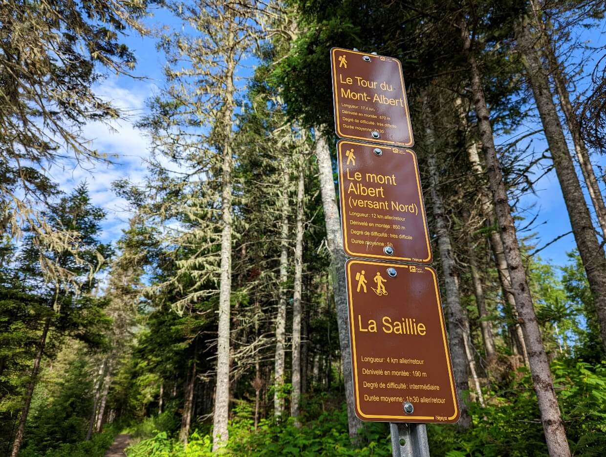
Signage on Gaspé Peninsula hiking trails
Anglophone hikers be aware, the majority of trail signage in Québec is in French only.
You may find these words helpful while hiking in Québec:
randonnée – hiking
sentier – trail
chute – waterfall
belvédère – observation tower or platform
chemin – path
Forillon is a National Park and as such, signage is in both English and French languages. Signage in the provincial parks is in French only.
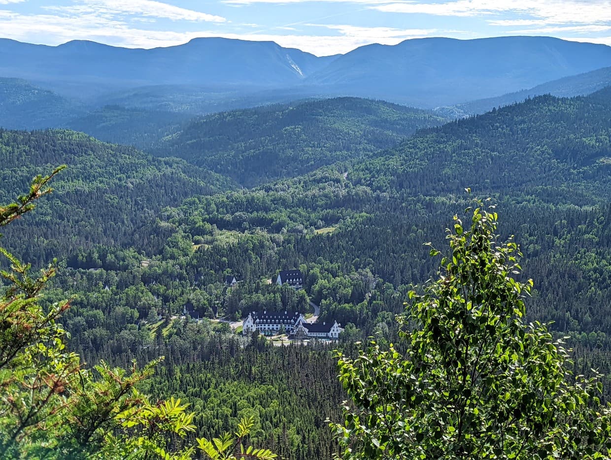
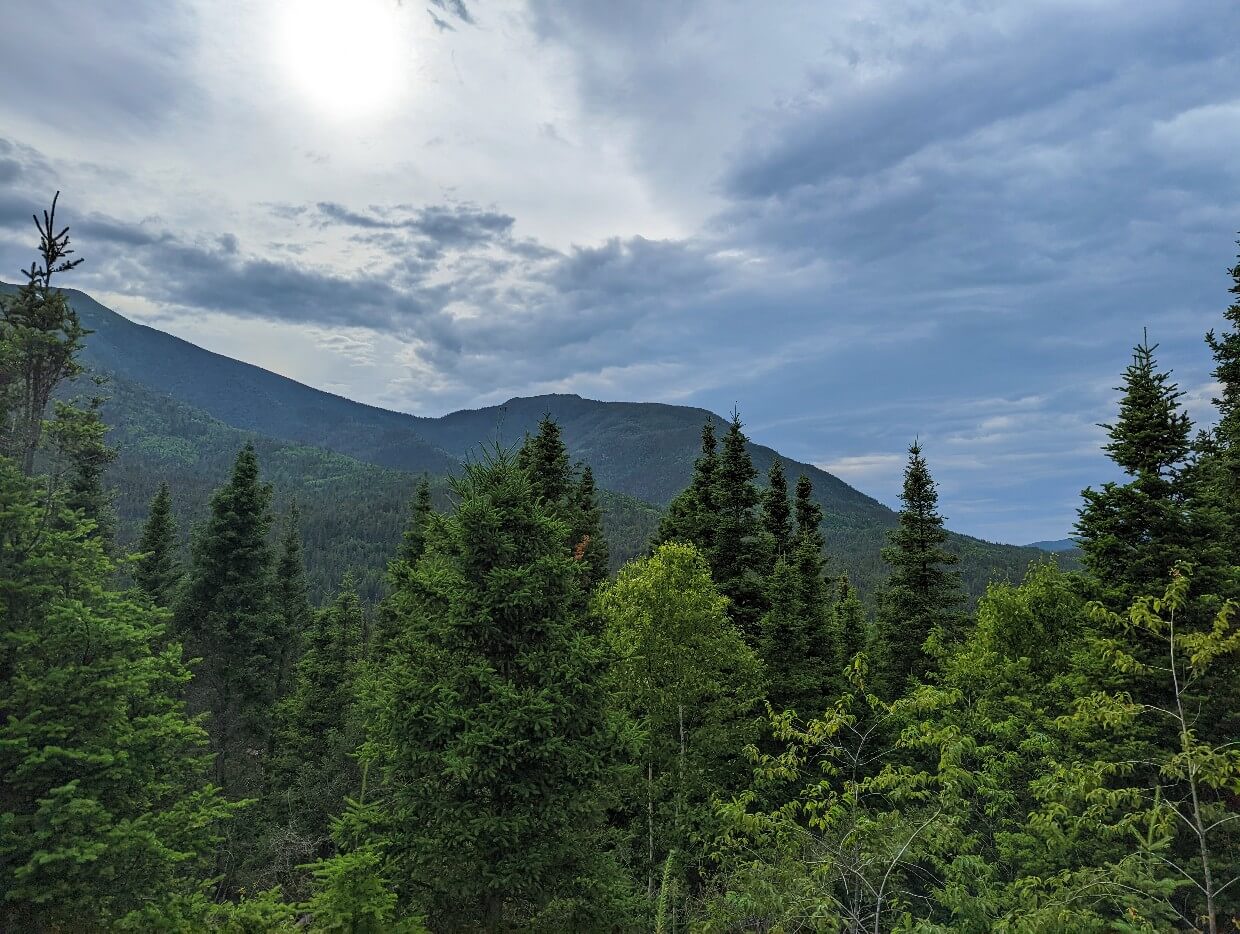
Parc national de la Gaspésie
Just a short drive inland, the lush, mountainous terrain of Gaspésie National Park feels like a world away from the Peninsula’s fishing villages. The park protects the Chic Chocs range, the northern extension of the Appalachians.
Gaspésie National Park‘s hiking season is usually mid-May to mid-October. These hikes can be enjoyed throughout that period.
Visiting in summer with more time? I’d highly recommend the trails to the summits of Mont Albert and Mont Jacques Cartier. The latter is the highest mountain in southern Québec and is home to the endangered Gaspésie Caribou.
Where to stay: The Gîte du Mont-Albert is a beautiful four star hotel right in the middle of the Parc de la Gaspésie. Alternatively, Sainte-Anne-des-Monts is only 30 minutes away. The stylish Hôtel & cie is the ideal base.
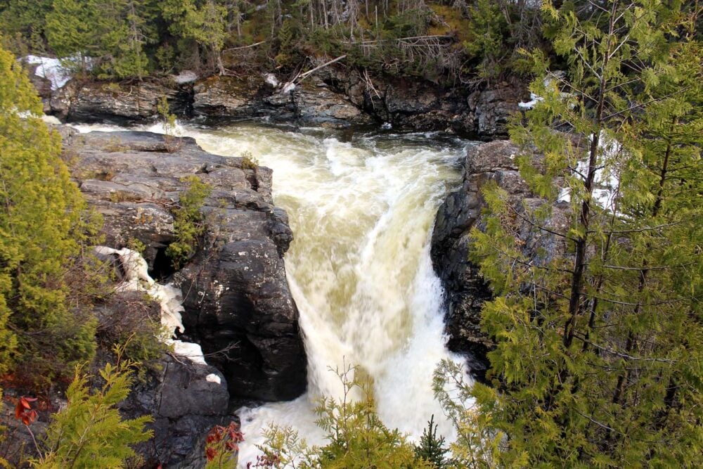
La Chute-Sainte-Anne
This hiking trail is both easiest and shortest in the park (1.7km from the Discovery Center), but it has a surprisingly good payoff for relatively little effort. The path is almost completely flat as it follows the river towards the Chute-Sainte-Anne.
A viewing platform offers an unobscured view of the powerful waterfall plunging into the canyon.
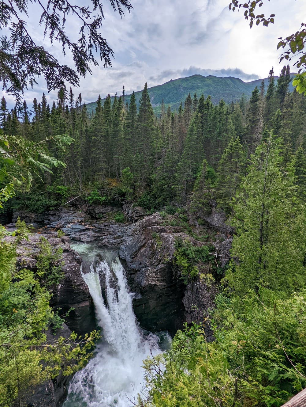
We’ve visited this waterfall in both May and July, with late spring being the optimal period of the two. The flow was simply roaring at this time; it was an impressive sight!
This trail can be combined with the Belvédère de la Lucarne (below) to form a loop route, starting and finishing at the Discovery Center.
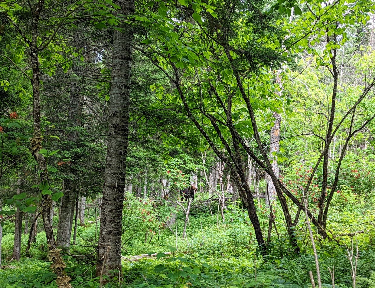
Belvédère de la Lucarne
Translated as ‘skylight viewpoint,’ this quick 700m trail (with 80m elevation gain) leads from the Discovery Center to an elevated platform looking up to the surrounding mountains.
The surrounding trees are quite tall so the views are not completely clear. But it still offers a good vantage point to get an idea of the surrounding park.
On its own, this trail is not worth going out of the way for. But when combined with the Chute-Sainte-Anne, it forms a pleasant hiking loop.
The section between the platform and the Discovery Center is heavily forested and we were fortunate enough to see a moose with a couple of calves here.
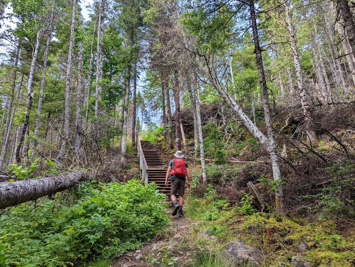
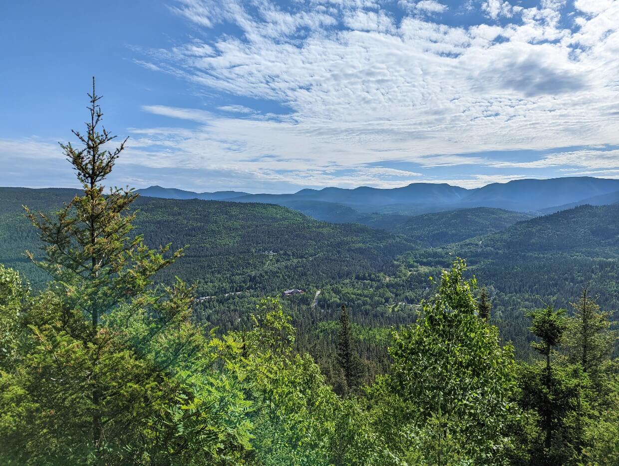
La Saillie
Uphill most of the way, this intermediate trail (4.2km return with 190m elevation gain) is a short and sweet journey to an elevated platform with beautiful views of the valley.
If you only have 2-3 hours in the park, I’d recommend hiking to this viewpoint first and then looping back to the Discovery Center via the Chute-Sainte-Anne and Belvédère de la Lucarne (above trails).
While steep at times, the hiking path is wide and travels through a shaded forest, accompanied for a time by a stream.
This trail is part of the route to the summit of Mont Albert. Sometimes cited as one of the best hikes in the whole of Québec, the Mont Albert trail leads to a huge summit plateau with panoramic views of surrounding mountains and lush valleys.

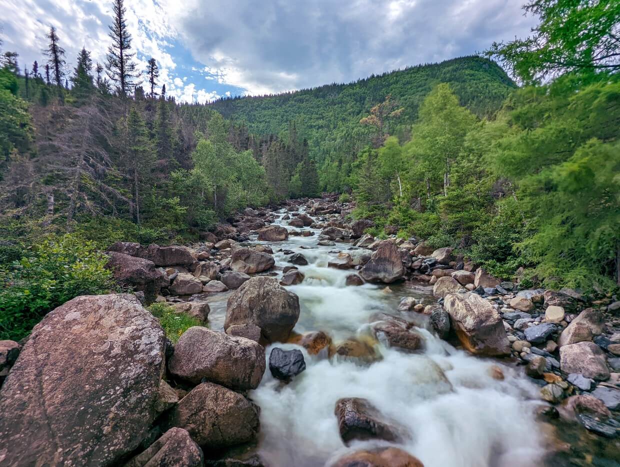
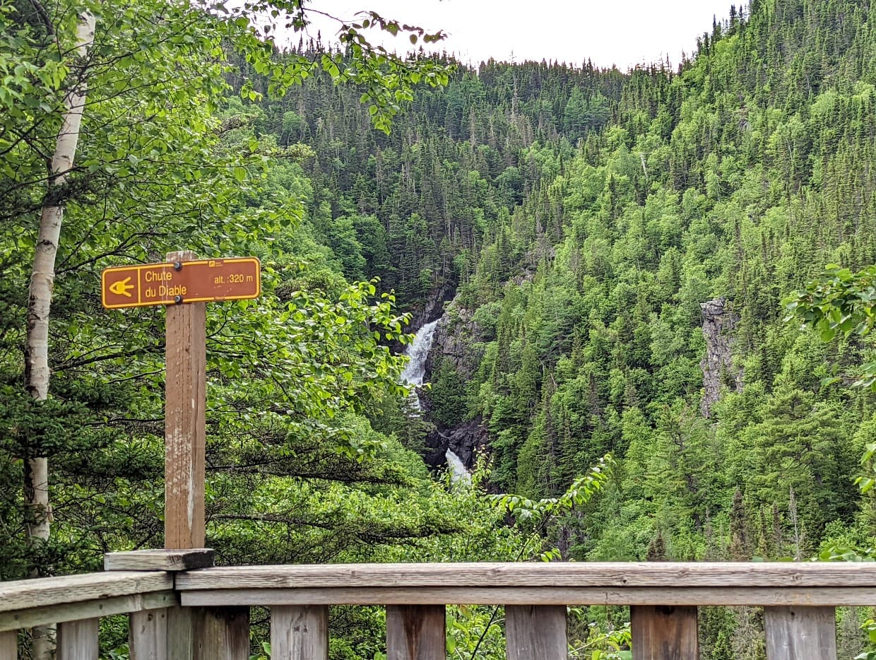
Diable (Devil) Falls
Looking for a longer hike but don’t have time to hike to the top of Mont Albert? This 7km return trail takes around 3 hours to hike and finishes at a viewing platform overlooking the cascading Diable Falls.
The intermediate level path gains only 120m throughout the journey, as it travels through the forest and passes the Chute-Sainte-Anne waterfall. It also crosses the pretty Ruisseau du Diable.
Much as the Saillie Trail is on the way to Mont Albert, Diable Falls is too. Mont Albert can be hiked as a loop or out and back route.
We hiked to Mont Albert in a counterclockwise direction, visiting Saillie on the way up and Diable Falls on the way down.
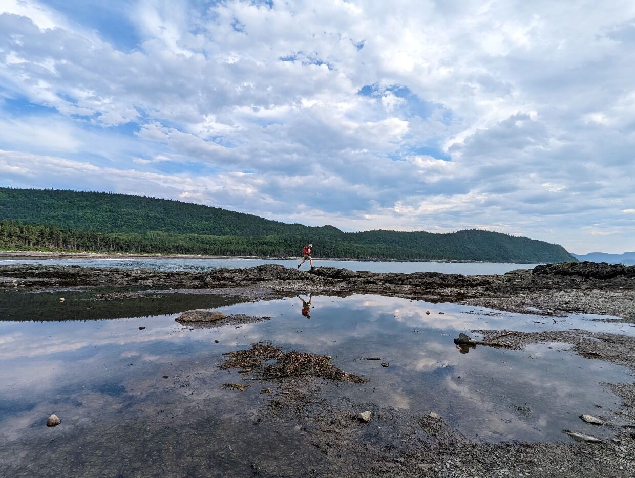
Parc National du Bic
It’s all about the coast at Parc National du Bic, with golden sand beaches, rugged coves, scattered islands, salt marshes and more. The park is well known for wildlife watching too, with a local population of 200+ playful seals.
The trail network features more than 25km of hiking paths, ranging in difficulty from easy to very difficult. The Rioux Farm trailhead offers the best concentration.
For me, Parc du Bic is like a smaller, less remote version of Forillon National Park. If you don’t have the time to get to the end of the Gaspé Peninsula, this park offers a good taster.
Where to stay: The recently renovated Motel du Bic, as the name implies, is only minutes away from a park entrance

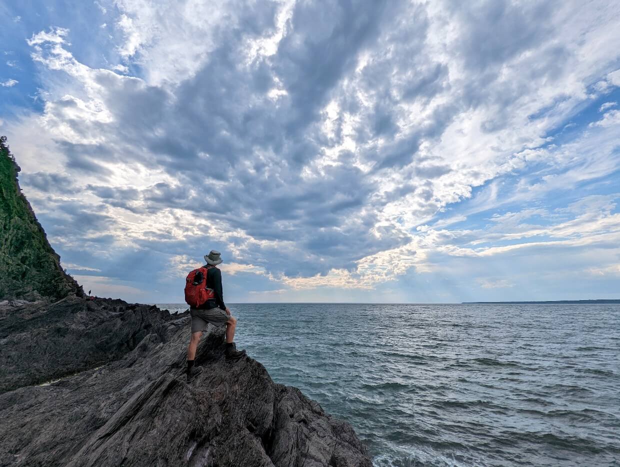
Cap-à-l’Orignal
La Tour Cap-à-l’Orignal is an iconic Parc du Bic hiking trail and also one of the best short hikes on the Gaspé Peninsula.
The 6km loop path parallels a series of sandy beaches before completely disappearing at the foot of a rock face.
Hikers need to climb up, over and down the rugged coastline to reach the Cap (Cape) itself. It’s an adventurous experience like no other on the Gaspésie and we loved it!
This trail is definitely not for the faint hearted – some sections are situated high above the crashing waves and use of both hands is needed at times. The rock itself has the look of shattered glass and is almost as sharp!
Timing is also incredibly important – it is recommended to start the trail two hours before low tide.
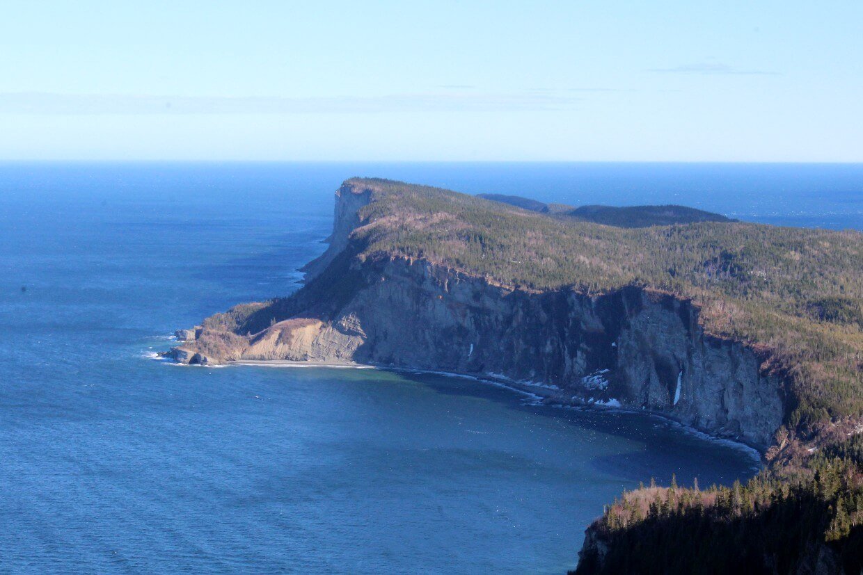
Forillon National Park
Located at the tip of the Gaspé Peninsula, Forillon National Park has a real end-of-the-world feel about it. The ocean has dramatically shaped the landscape here, creating steep cliffs, wide coves and pebbly beaches.
Majestic mountains loom behind, though most visitors stay on the coast. The park was quite busy with construction during our May visit but the following hikes proved superb.
Where to stay: Each room at the Motel du Haut Phare features an ocean view, perfect for relaxing after an day exploring Forillon

Cap-Gaspé
Part of the much longer Les Graves trail, this 8km return trail starts at the end of the Boulevard de Grande Greve.
Almost entirely flat, the hike to the Cap-Gaspé Lighthouse is both easy and incredibly scenic. It is also the start (or end) of the International Appalachian Trail.
Watch for wildlife on both land (we saw bears, porcupines and a lynx!) and sea as the trail winds around the coastline before finishing on the top of an 85m cliff. A narrow path continues on for another 350m to Land’s End (must do!)

Mont-Saint-Alban
The hike to the Mont Saint Alban observation tower has two trailheads. The route from Petit-Gaspé is gentler and shorter, at 3.6km return (alternatively, 7.2km for a loop).
Fairly steep at first, the effort is definitely worth it to see the panoramic views of Forillon’s rugged coastline from above.
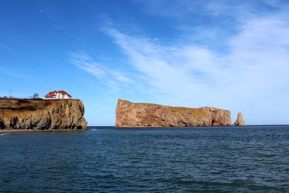
Percé GeoParc
The town of Percé is best known for the huge striking rock formation jutting out from the bay. The arch within the rock is one of the world’s largest. Percé Rock is a stunning sight, no matter the angle you see it from.
But there is more to Percé than this one rock. Recently designated a UNESCO Global Geopark, the Percé Rock is just the most obvious example of the rich geological heritage in this area.
To learn more, take a trip to the Géoparc de Percé, a relatively new community-driven project that celebrates everything rock related.
To this end, they have developed a number of local trails to surrounding geosites. I’d recommend checking out the excellent interactive Tektonik exhibit before picking up a trail map.
Where to stay: The Riotel Percé is situated oceanside, with spectacular views of the Rock directly from some rooms
Sentier des Belvédère
Accessible from the back of the Géoparc campground or the end of Rue de l’Église, this trail gains elevation quickly on a gravel road.
After turning onto the trail proper, it’s not too long before the lookout tower and fabulous panoramas of the bay and Percé Rock comes into view.
Continue on another 300m to reach the suspended glass platform (extra charge). For a longer hike, follow the T4 trail to the trou sans fond (bottomless hole) further up Petit Mont Sainte Anne.

Chemin de la Grotto
Follow the above instructions but ignore the turn for the Sentier des Belvédère. Another 800m along the gravel road will lead to the Grotto, a beautiful cascading waterfall.
Many layers of rock have eroded, forming an impressive gorge. The site has apparently been a religious pilgrimage site for many years.

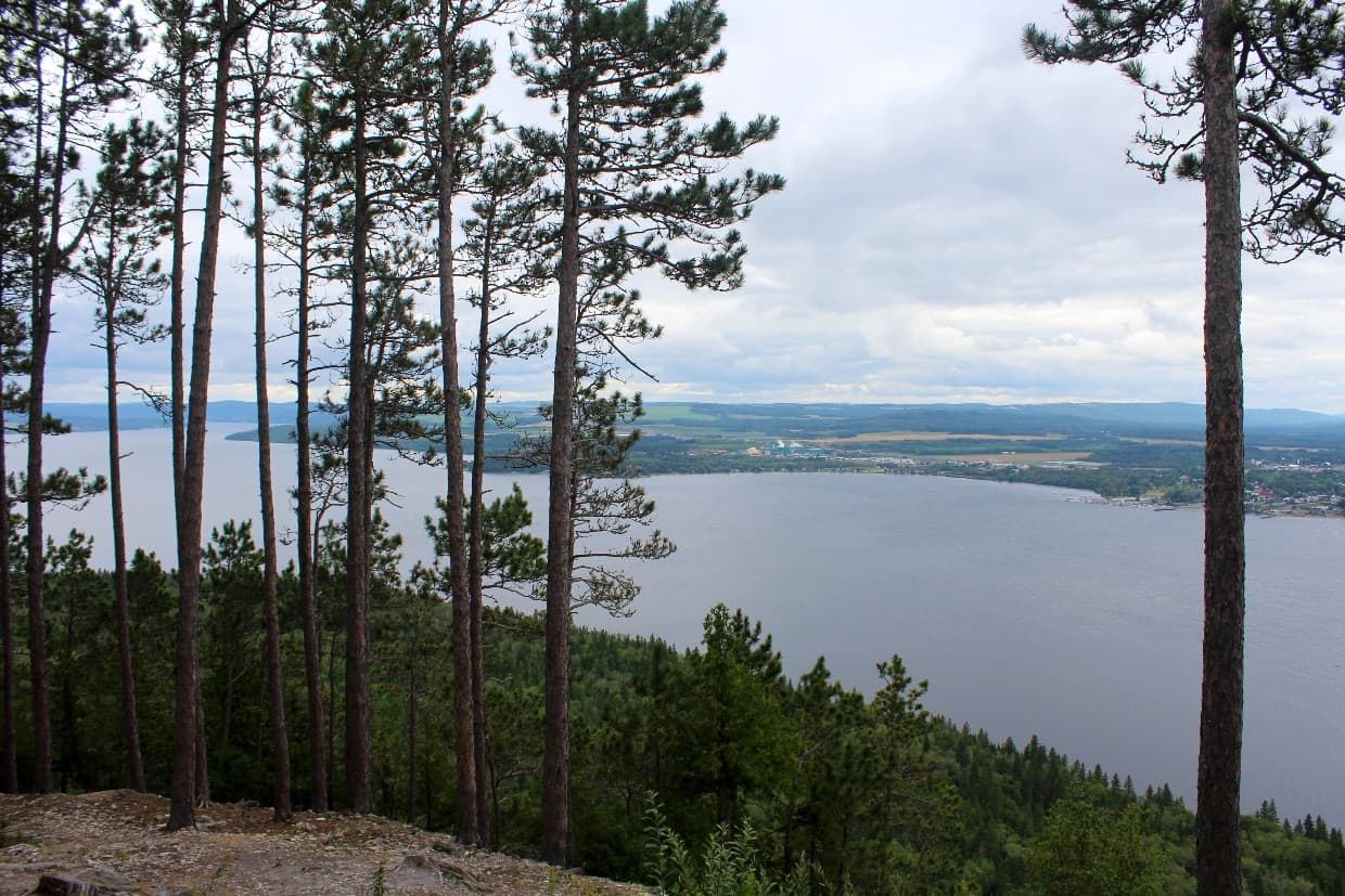
Parc national du Lac‑Témiscouata
Perched on the edge of the largest lake in the region (39km long!), this parc national is a favourite of hikers and paddlers alike.
Humans have been utilising the land and water here for thousands of years, with more than 60 archaeological sites found within the boundaries of the park.
Though Parc national du Lac‑Témiscouata can easily be spotted from Highway 132, keep in mind that you need to drive to the ‘back’ of the park to reach the entrance.
Where to stay: Accommodation is thin on the ground near this park, but Motel Royal is a highly rated pick. It’s 40 minutes drive from the park entrance

Montagne-du-Fourneau
For us, the most rewarding trail in Parc national du Lac‑Témiscouata was definitely Montagne-du-Fourneau.
The 5.8km return trail steadily climbs through a pinewood forest to a beautiful viewpoint above the lake. The total elevation gain is around 185m. There are some striking rock cliffs to be found along the way.
The trailhead is located at the Anse-à-William Discovery and Visitors Centre. It’s possible to extend this hike with a walk along the lakefront.
Check out these other Quebec posts next
Ultimate Two Week Coastal Quebec Road Trip Itinerary
Magdalen Islands Travel Guide: The Best Things to Do, See & Eat
Four Fun Ways to Go Whale Watching in Tadoussac, Quebec
3 of the Best Places to Camp on the Gaspé Peninsula

One half of the Canadian/British couple behind Off Track Travel, Gemma is happiest when hiking on the trail or planning the next big travel adventure. JR and Gemma are currently based in the beautiful Okanagan Valley, British Columbia, Canada. Consider buying us a coffee if you have find any of our guides helpful!
Epic views, waterfalls, wildlife, and lighthouses – I’d love each of these hikes! I had no idea Quebec was such diverse in landscape and full of so many great hiking trails!
When we make it out to Quebec (one day…), I want to hike ALL of these!! The French brings back memories of French classes (seems like a lifetime ago…).
Awesome! Quebec is a province with so much to offer and you can brush up on your French too!
Thanks for the great info. I am planning a trip to Gaspe and was deciding which trails are suitable for my senior mom and young kids. Now I know and I am narrowing down my waaaay too long list 🙂 I just hope we have nice weather when we get there 🙂
I’m so glad this was helpful! Have a wonderful trip with your family 🙂
Hi there! I’ll be in Gaspé in May and I was wondering if you could tell me if the roads will be open in the national park for hiking to Summit Mount Alban in May. Thanks!
Hi John,
According to Parks Canada’s latest update, the secondary roads in Forillon are currently closed. The hiking trails, however, are currently open and the main route through the park (132) is open. It’s difficult to say what the status will be next month.