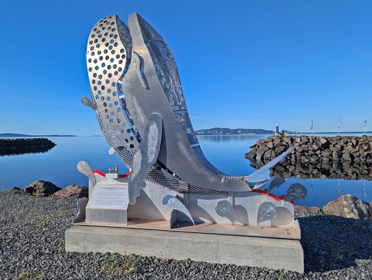
Bienvenue to Quebec’s Whale Route, a 850km journey along the north shore of the St. Lawrence River. Named for the 13 whale species that inhabit these waters, this route offers a high chance of seeing them up close, breaching or spouting just offshore.
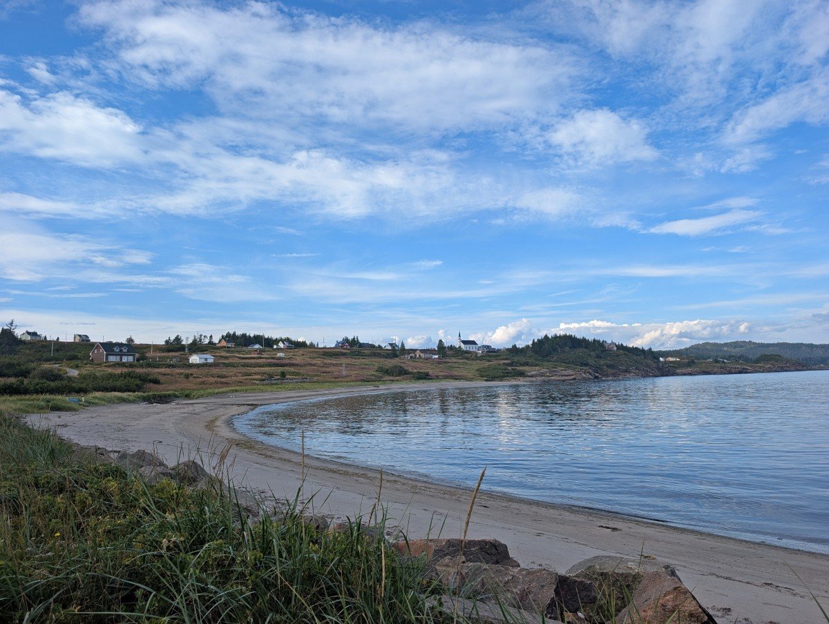
But that’s not the only reason to explore Highway 138. This scenic coastal route is packed with beautiful sandy beaches, cute colourful houses, breathtaking ocean views, fresh seafood and plenty of salty sea air.
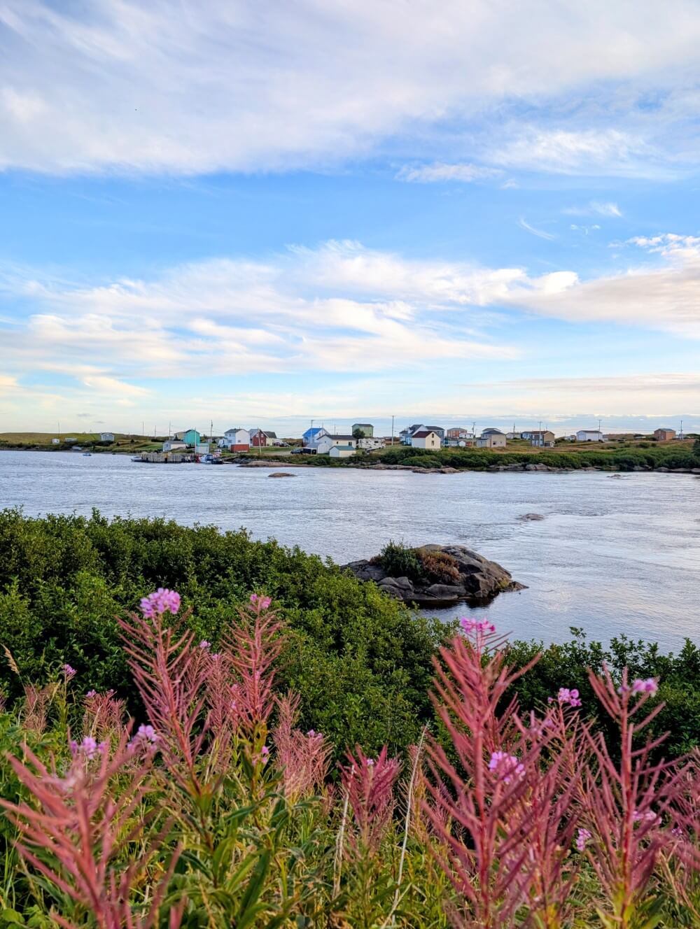
Add in spectacular waterfalls, a national park with incredible rock formations, waterfront hiking trails, ocean sunsets, plentiful fossils, quiet roads and voilà – an adventure you’ll never forget! And on that note; it also offers a great chance to practice French.
We have been fortunate to explore sections of the Whale Route multiple times in the last few years, usually on the way to or from JR’s hometown in New Brunswick.
Most recently, we were invited by Quebec Maritime to explore the most eastern part of the Whale Route, from Sept-Îles to Kegaska.
It wasn’t long before we fell in love with the area, with the ocean views, local cuisine, interesting landscapes and the slower pace of travel.
Explore Quebec’s incredible Whale Route from Tadoussac to Kegaska with this comprehensive guide featuring all of the best things to do, places to stop and viewpoints you cannot miss, all based on our first hand experiences.
We’ve also included a suggested itinerary and some trip planning essentials to help prepare for your own road trip along the Whale Route.
This post is in partnership with Quebec Maritime. There are affiliate links below – if you make a purchase, we may receive a percentage of the sale.
Introducing Quebec’s Whale Route / Highway 138
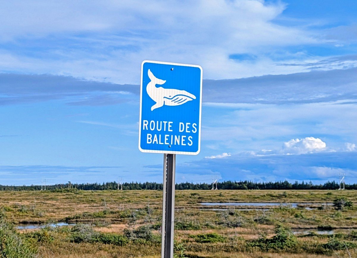
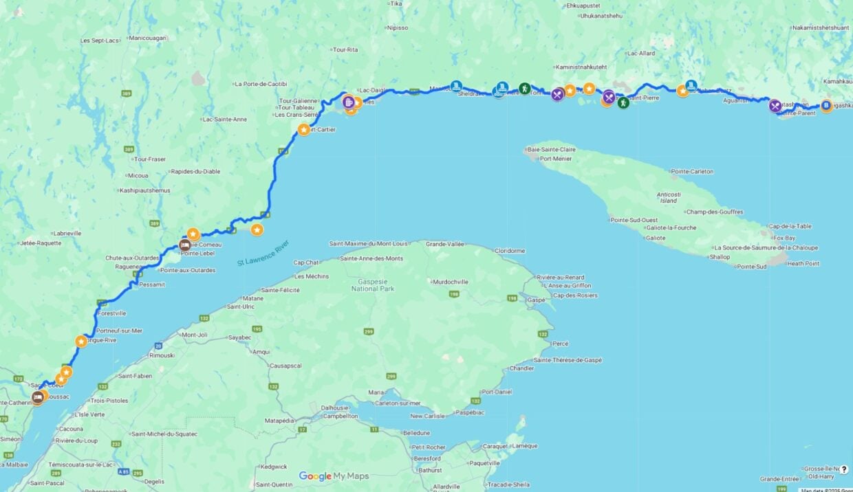
Also known as Highway 138, the Whale Route (or Route des Baleines) closely follows the northern coastline of the St Lawrence River in the Côte Nord region of Quebec.
The route stretches 850km from Tadoussac to Kegaska, a distance most visitors will travel twice over 7-10 days (two chances to see everything along the way!) For reference, Tadoussac is about three hours drive north from Quebec City.
Beyond Kegaska, the coast is accessible by boat only. A supply ship, the Bella Desgagnés, connects many communities along the Whale Route and continues to Blanc-Sablon, on the border of Newfoundland and Labrador.
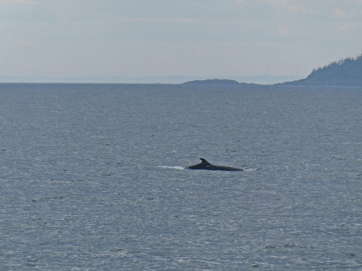
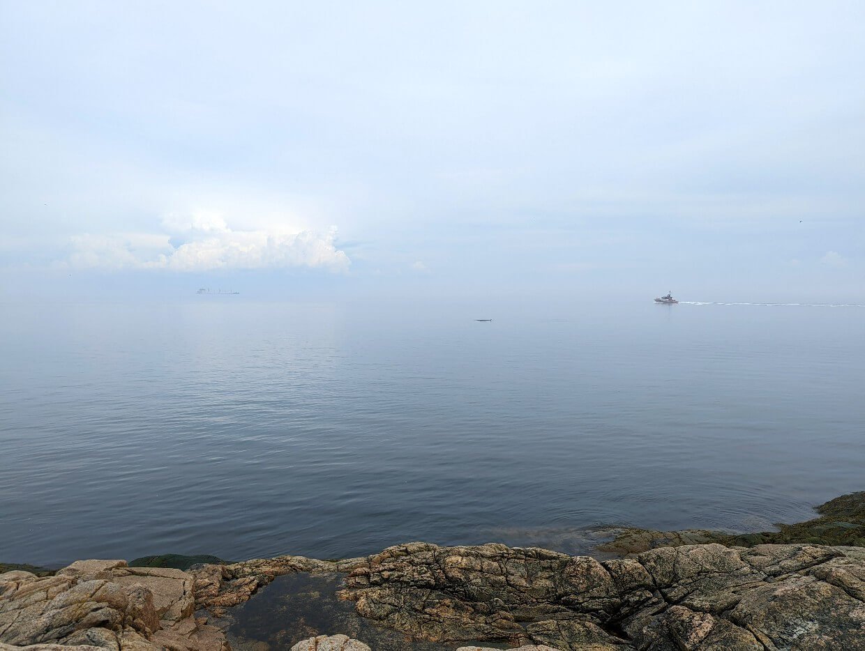
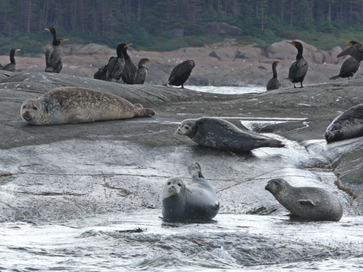
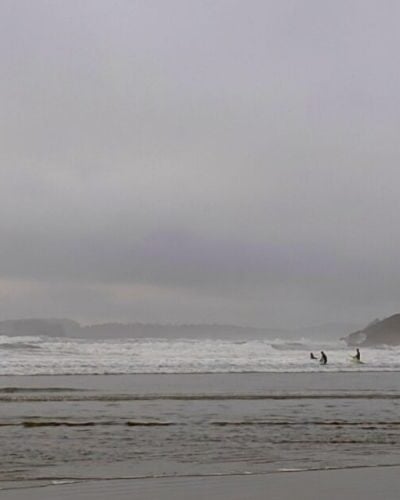
As mentioned, the highway gets it name from the plentiful whale population in the St. Lawrence. They are so plentiful that it is possible to see them from shore (and, indeed, we have many times).
For a better chance and a closer look, there are many opportunities to get out on the water via guided boat tours or kayak trips.
The landscape surrounding the highway is shaped by ancient bedrock (the billion year old Canadian Shield) and more recent glacial activity.
At one time, this area was submerged under a shallow tropical sea. Limestone sediments accumulated on the sea floor, preserving marine organisms as fossils.
Later (about 20,000 years ago), the pressure of thick glaciers and their eventual melt sculpted the landscape, carving rivers, creating waterfalls and cliffs, and leaving behind the iconic limestone monoliths that rise along the coastline in Mingan National Park.
Highlights of the Whale Route
Local communities on the Whale Route
The Innu (‘human being’ or ‘person’) have lived in the Côte-Nord region since time immemorial, traditionally following a seasonal cycle of hunting, fishing, and gathering. From the 18th century, fur trapping became an important part of trade with Europeans via posts along the St. Lawrence.
Today, there are five Innu communities on the Whale Route – Essipit, Pessamit, Uashat, Ekuanitshit and Nutashkuan. Innu-aimun is an Algonquian language with two main dialect areas (east and west).
The other settlements along Highway 138 have mixed demographics, with Québécois and Acadian residents forming the majority, and small pockets of English-speaking families, often descendants of settlers from Anticosti Island, Newfoundland or the Maritimes.
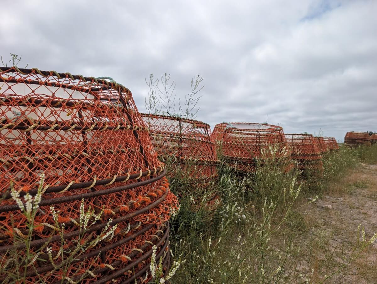
Fishing was the mainstay of the local economy for many years, with cod, lobster, crab and scallop sustaining families for generations. It’s more small scale now, with forestry, mining, hydroelectricity and tourism playing a larger role.

The best things to do on Quebec’s Whale Route
Ready to discover the best of Highway 138?
Here are 30+ of the best things to do while driving Quebec’s Whale Route, from lighthouses, historic sites and characterful towns to waterfalls, hiking trails and scenic viewpoints.
Use the map below to help plan your Whale Route adventure!
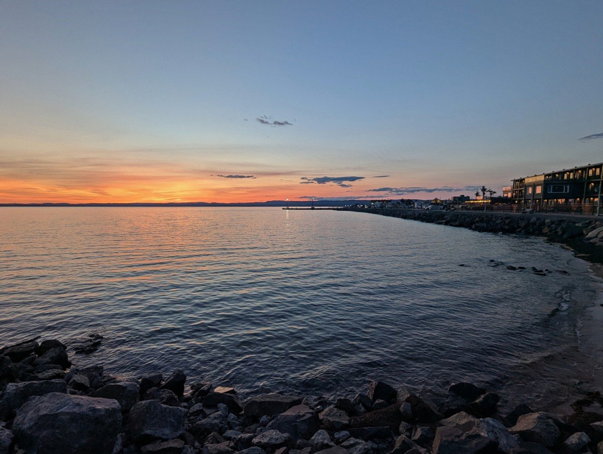
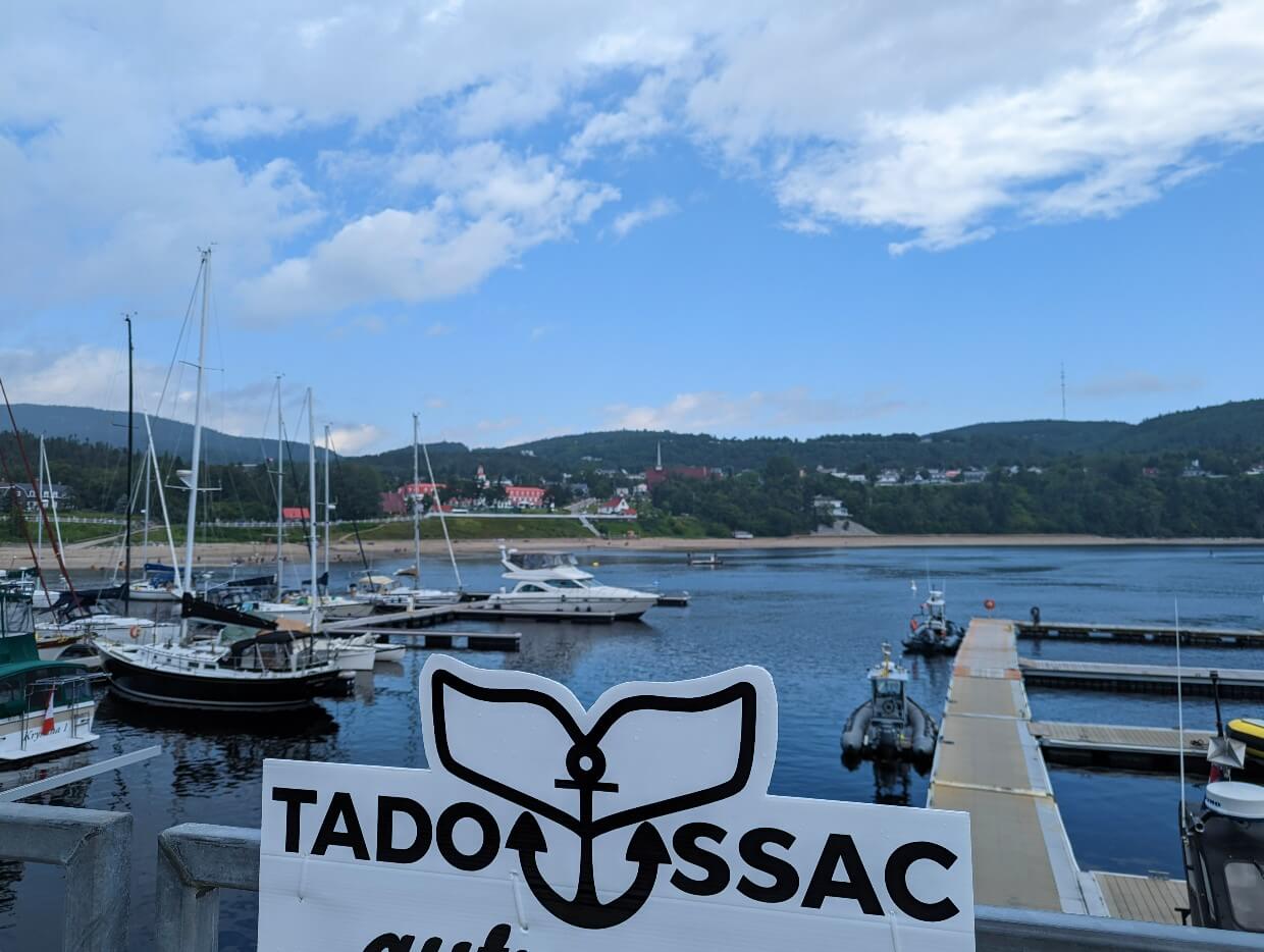
Tadoussac
The tiny town of Tadoussac is one of the best places to go whale watching in the entire world. As many as thirteen different whale species (including belugas, minke, humpbacks and even the legendary blue whale) gather to feed at the confluence of the freshwater Saguenay River and salty St Lawrence River.
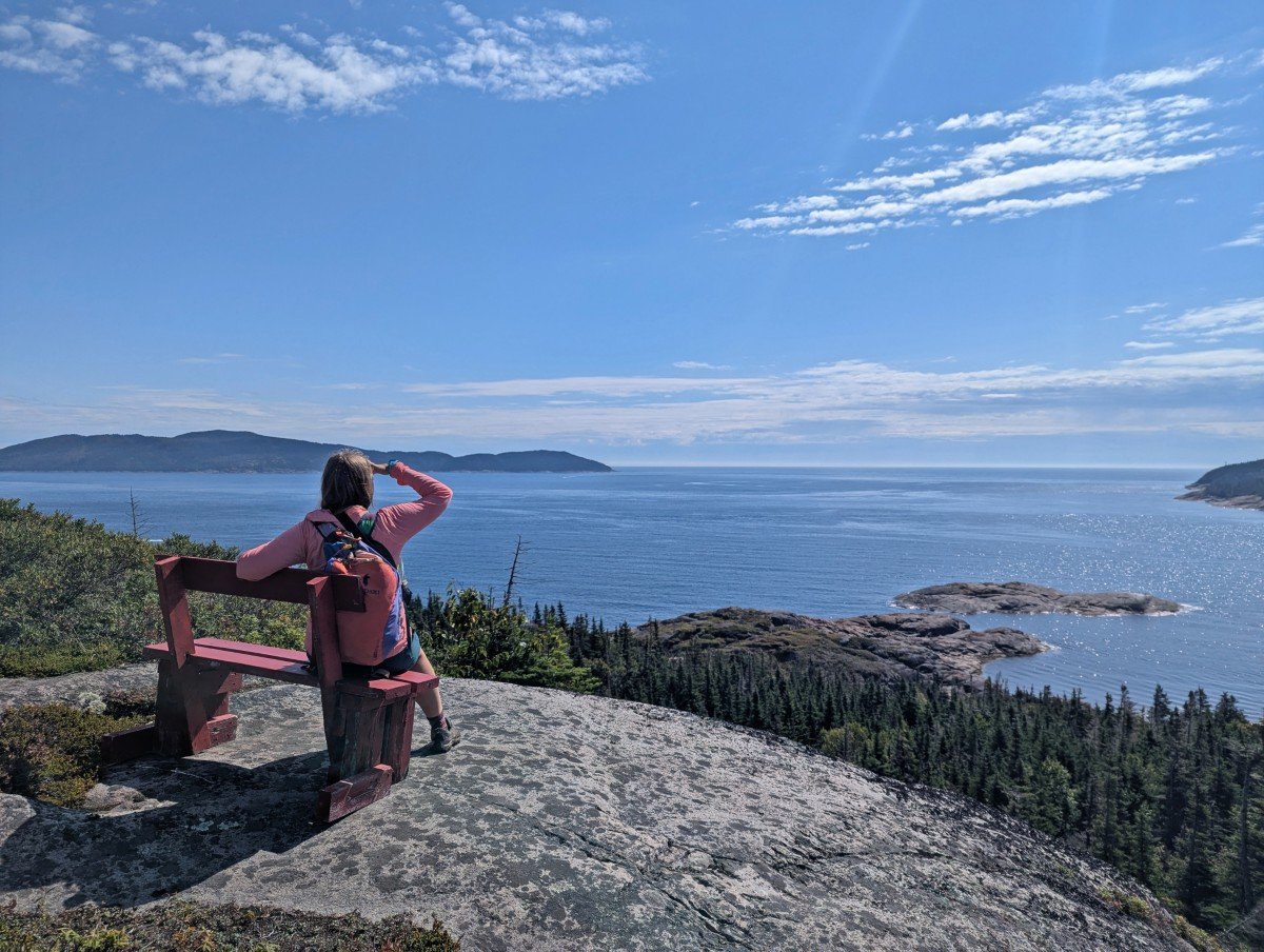
Whale watching in the Saguenay–St. Lawrence Marine Park is possible by boat, Zodiac (we recommend this one), kayak and even from land. We’ve seen whales at five different places around Tadoussac –
- Sentier de la Pointe-de-l’Islet viewpoint – Boardwalk and platforms near Tadoussac’s marina, free
- Pointe Noire Interpretation and Observation Centre – Exhibits and elevated viewpoints near ferry terminal, Parks Canada admission fee
- Tadoussac ferry ride across the mouth of the Saguenay River – Free
- Cap-de-Bon-Désir Interpretation and Observation Centre – Lighthouse and platform, Parks Canada admission fee
- Marine Mammal Interpretation Centre (CIMM) – Exhibits and rocky viewpoint near marina, admission fee for exhibits
The best non-whale related activity in Tadoussac? The sand dunes! 5km north of town is an area with 30m high sand dunes, sitting right in front of the ocean. Created by glaciers thousands of years ago, these dunes really are a sight to behold.
Where to stay
On our most recent trip to Tadoussac, we stayed at Hotel Le Beluga. Choose between motel rooms and spacious balcony queen rooms. The local bakery is across the street and it’s only 10 minutes walk to the waterfront and marina.
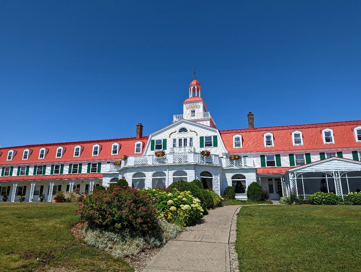
The Hotel Tadoussac is the town’s most iconic property, a beautiful red and white building with ocean views. It’s conveniently close to the marina and Sentier de la Pointe-de-l’Islet viewpoint.
Centre de découverte du milieu marin, Les Escoumins
The whale theme continues as Highway 138 heads east. One of my favourite (and reliably good) land whale watching spots is 25 minutes drive from Tadoussac – the Marine Environment Discovery Centre.
This Parks Canada operated facility offers interpretive exhibits (in both English and French), an amphitheater, diving centre, elevated viewpoints of the ocean as well as multiple scenic boardwalks. One of the latter is wheelchair accessible. Bilingual interpreters are on hand to help spot whales.
The fee to visit the Marine Environment Discovery Centre is $10.00/adult. Youth and children are free. If you have a Parks Canada Discovery Pass, entry is free.
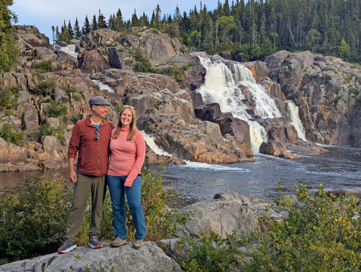
Parc de la Chûte de Sault-Au-Mouton
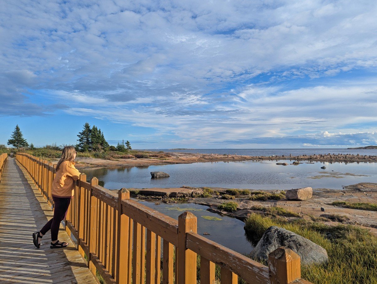
A suspension bridge with a view of a waterfall on one side and the ocean on the other? Yes please! And it’s free too!
Parc de la Chûte de Sault-Au-Mouton is one of my favourite places along the entire Whale Route. The combination of the reddish/brown rocks, the falls and the ocean is so beautiful.
The scenic bridge isn’t the only reason to stop at this park – there’s a boardwalk leading to the edge of the waterfall itself. The area between the waterfall and the ocean is also a popular place to dip and swim on hot days.
Baie-Comeau
The small city of Baie-Comeau is a logical place to stop before heading further on the Whale Route. It’s 200km from Tadoussac, about 2 hours 20 minutes without any stops. Buy the supplies you need, fill up on gas or relax and stay overnight.
One of the most exciting things to do in Baie-Comeau is to take a tour with Attitude Nordique. We were originally meant to join their Via Ferrata and kayaking tour before our trip had to be cut short.
Via Ferrata (meaning ‘iron road’) basically refers to protected climbing route with ladders, rungs and steel cable. Attitude Nordique also have a zip line so be sure to check them out if you’re looking for a little excitement during your Whale Route road trip!
Where to stay
We’ve never stayed overnight in Baie-Comeau but I’ve heard good things about Hôtel Le Manoir. It’s an impressive 4 star French chateau inspired hotel, right on the river and very close to downtown.
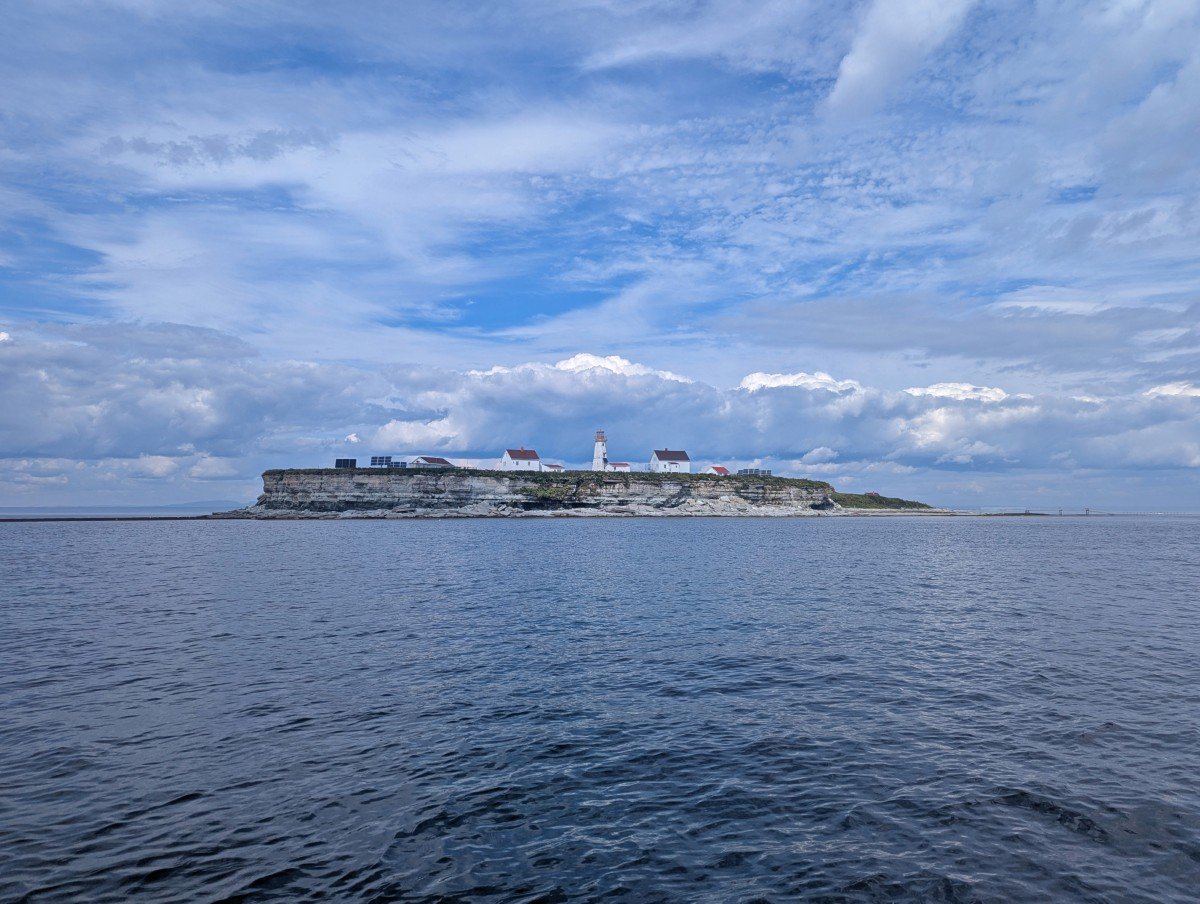
Le Phare de Pointe-des-Monts
Le Phare de Pointe-des-Monts is a very pretty red and white striped 30m high lighthouse. It was built in 1830 and now contains a museum with seven floors of exhibits sharing the stories of shipwrecks and lighthouse keepers.
It is usually possible to go all the way up to the lightroom as well but unfortunately the entire museum was closed for the 2025 season. Hopefully it will reopen next year.
A couple of other great places to stop between Baie-Comeau and Sept-Îles are Belvédère Baie St-Pancrace and Parc de la Taïga. Both involve short walks to beautiful viewpoints, with the latter also featuring a large waterfall.
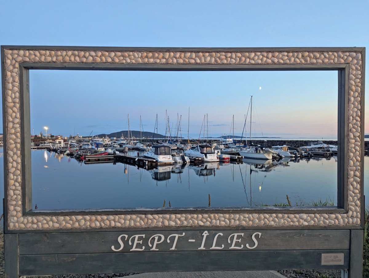
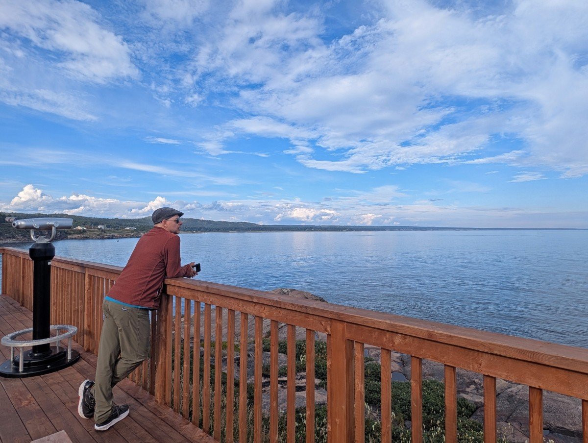
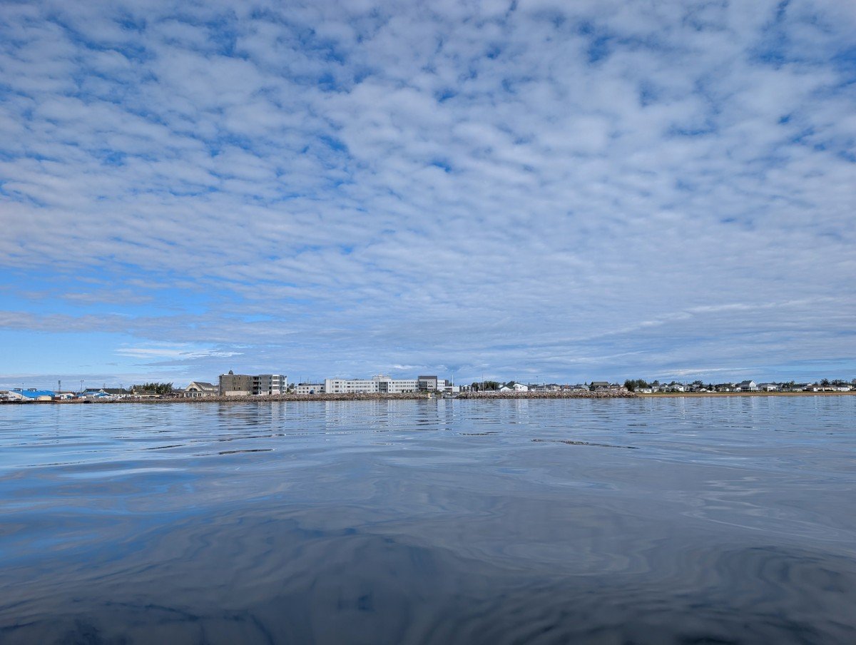
Sept-Îles
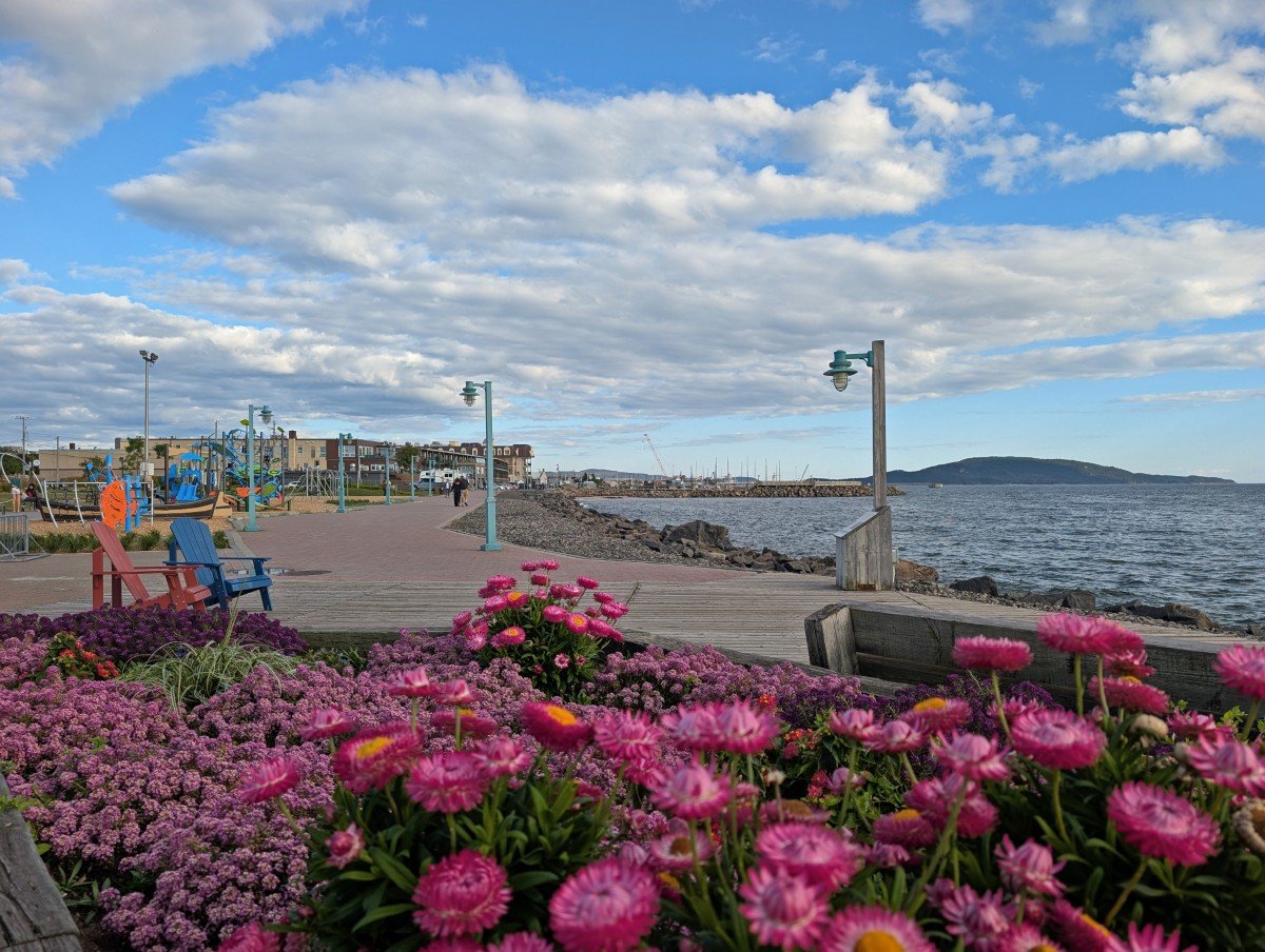
Sept Îles is the largest community along this section of the Whale Route and it well worth an overnight stop, with a gorgeous waterfront promenade, ocean views and a 9km long (!) sandy beach a very short drive from town.
True to this small city’s name, there are seven islands just offshore. We spent most of the day on one of the largest, la Grande Basque. Via Zodiac shuttle with Les Croisières Sept-Îles, it took us just minutes to get there (and we saw a minke whale and seals on the way back!)
La Grande Basque has 12km of trails, six beaches, and four coastal campgrounds. We hiked the 8.5km ‘large loop’ to a waterfall in a cave and beautiful Pointe de Sud, returning on a higher route. It’s classic coastal hiking – steep in places but well maintained with stairs, bridges, and ropes.
Other interesting places to go in Sept Îles include:
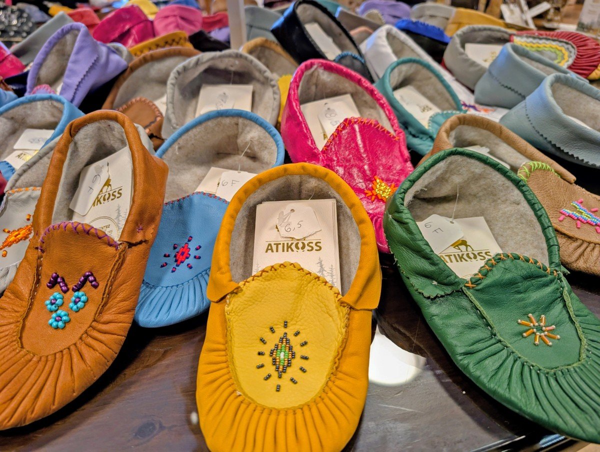
- Atikuss Maskisin Économusée, an Innu community workshop and boutique with handcrafted products made using traditional methods
- The Vieux-Poste (Old Post), a historical reconstruction of the area’s 18th century fur trading post with exhibits featuring stories of both Indigenous and non-Indigenous residents and their trading relationship
- Musée Le Shaputuan, dedicated to sharing Innu culture, including seasonal cycles of activities and traditions
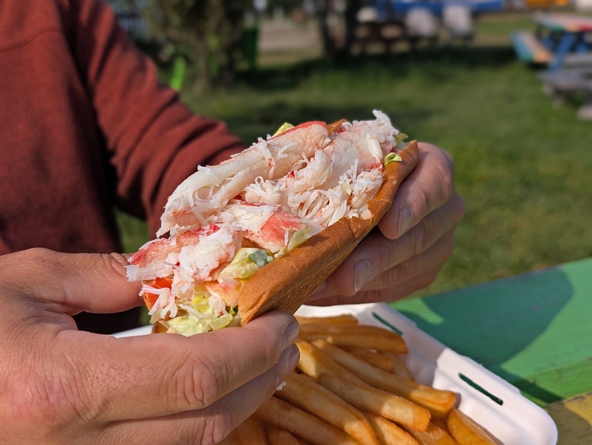
- Casse-Croûte du Pêcheur, a very popular seafood takeout, with Restaurant le P’tit Snack another great option – be sure to try the local favourite, la guédille au crabe (crab roll)
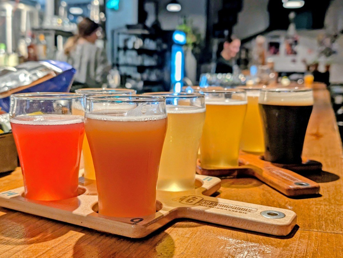
- La Compagnie Microbrasserie, the perfect spot for dinner or drinks. As many as 15 different homemade craft beers are usually on tap, with the local delicacy bourgots (whelks) as a bar snack
Where to stay
We loved the waterfront location of the Hôtel Sept-Îles – most of the rooms have sunset views and a balcony or patio area. I’d recommend asking for a high floor if possible.
The hotel is walking distance from Restaurant le P’tit Snack, La Compagnie Microbrasserie and Les Croisières Sept-Îles (for whale watching tours and shuttles to the islands).
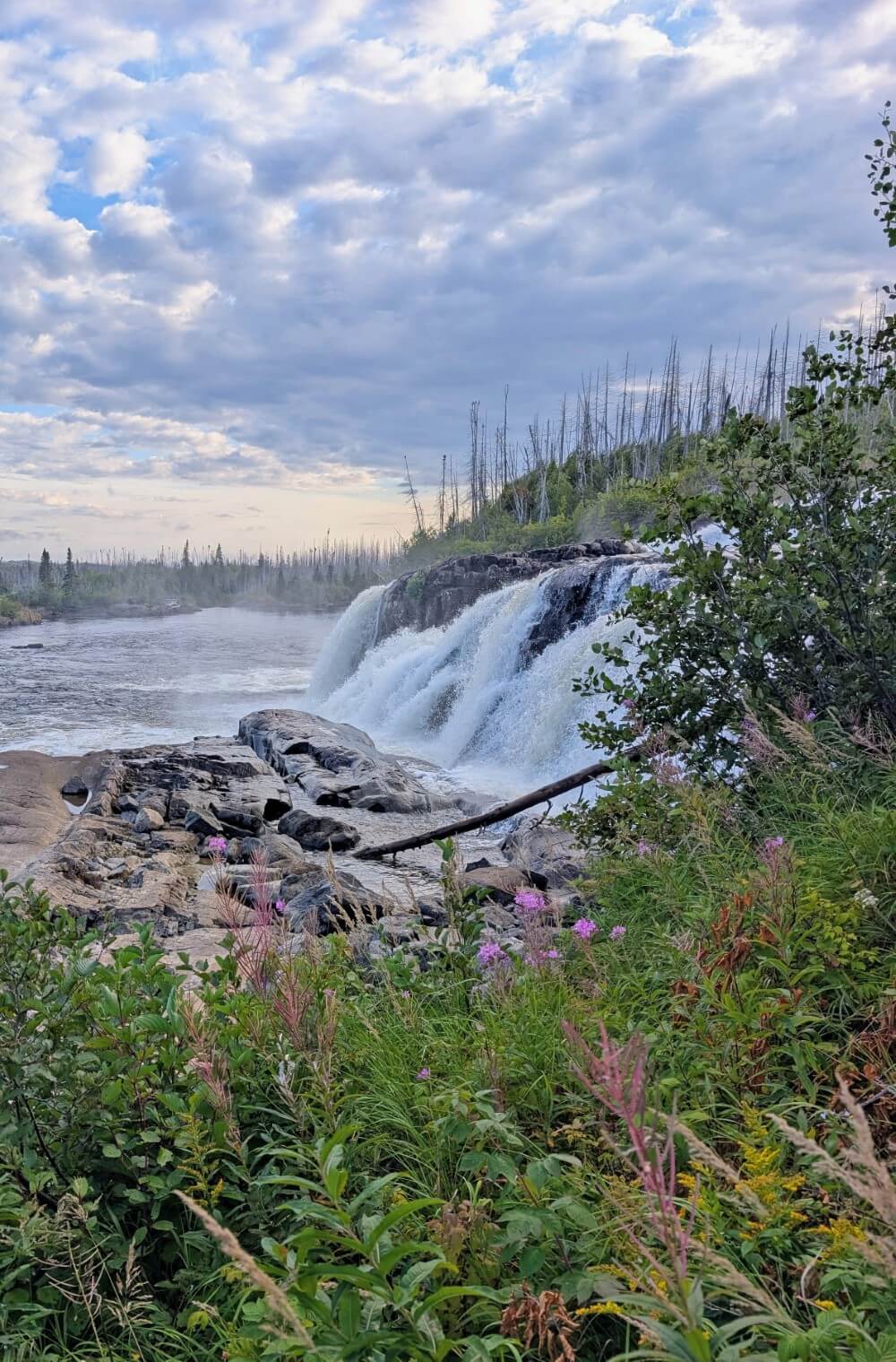
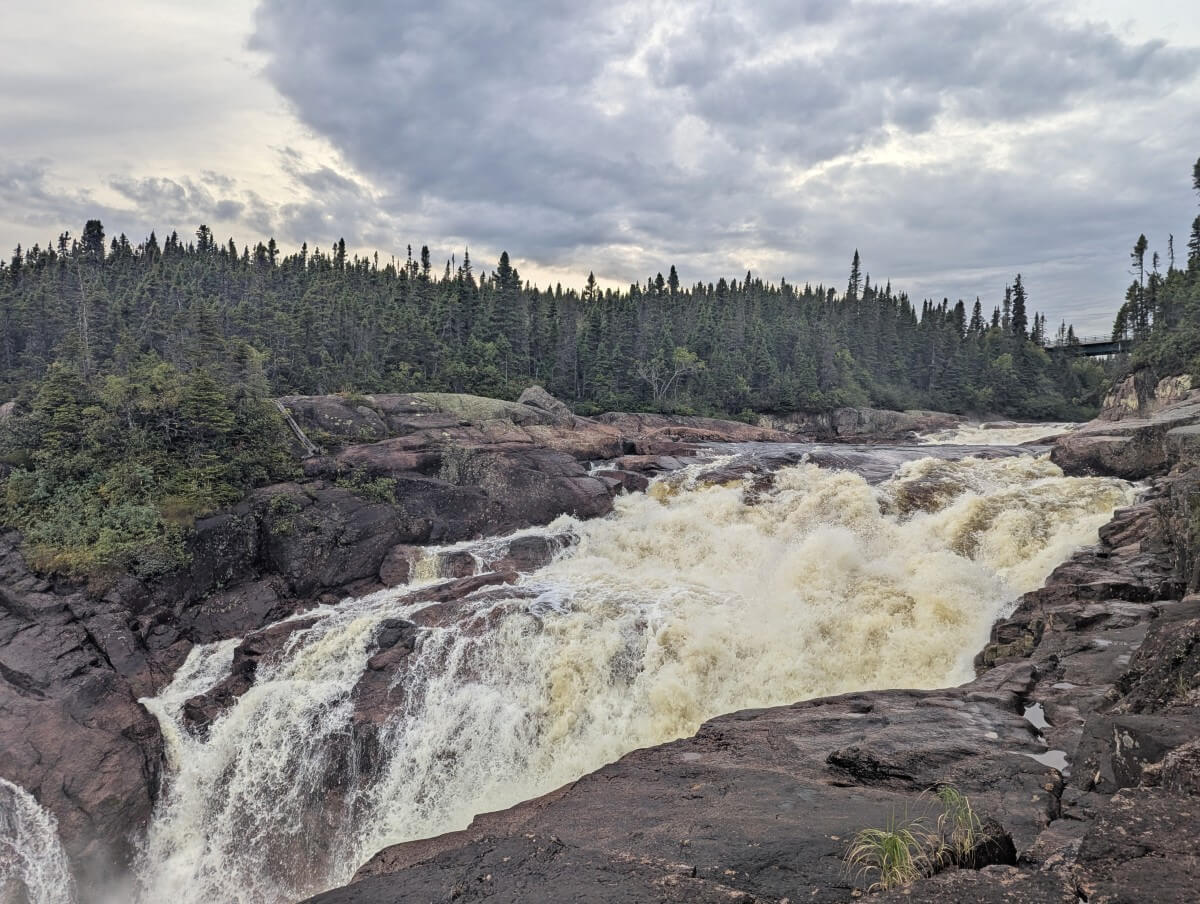
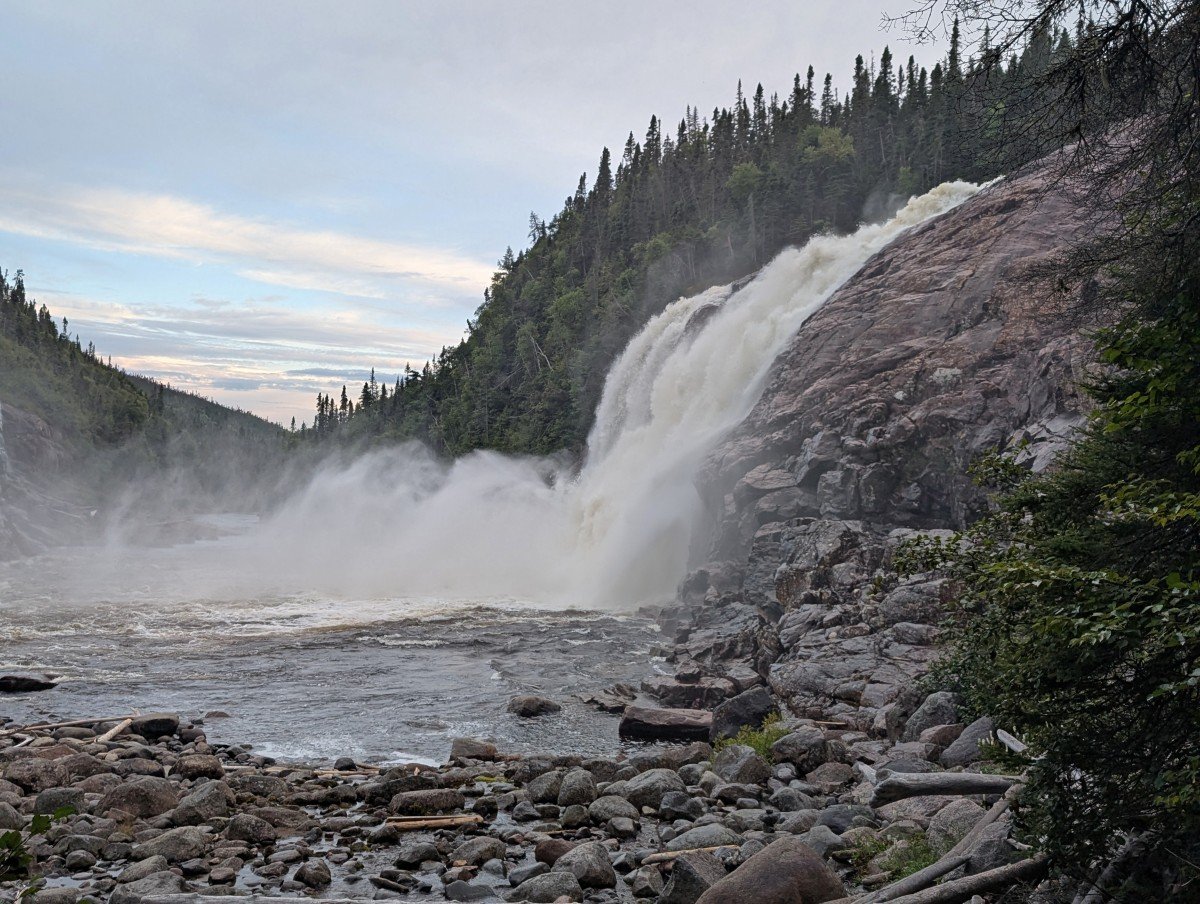
Chute Manitou
Chute Manitou is probably the most well known waterfall along the Whale Route and for good reason. It is actually a series of cascades with multiple viewpoints, some of which are only a few minutes walk from the highway.
For the best views, head to the small parking lot on the eastern side of the Rivière Manitou (the one without the tourist infomation centre). Cross the highway carefully and then follow the well maintained trail 200m to the first viewing area (about 5 minutes or less).
A few sets of steps lead down to the next two viewpoints. The final, most impressive lookout is almost 1km return with over 100 stairs each way. La Grosse Chute is over 25m high and was flowing very hard during our late August visit. It’s absolutely stunning!
Rivière-au-Tonnerre
The community of Rivière-au-Tonnerre (Thunder River) has not one, but two waterfalls to visit. It also has an unusual looking church and a free waterfront RV campground.
The blue wooden l’église Saint-Hippolyte, just over 100 years old, is one of Canada’s few Norman-style churches, with a tall bell tower, arches, and a long nave. Though we couldn’t see the interior during our visit, it’s still impressive from the outside.
La Chute du Petit Sault is just a minute from the highway. A short trail leads to a platform above the waterfall. The angle makes the falls hard to see, but the ocean views are great.
The real star of Rivière-au-Tonnerre is Chute Grand Sault, with several cascades that are absolutely spectacular. It’s 8km from Highway 138 via the unpaved Rue de la Fôret. Signs mark the way. When in doubt, stay right.
From the parking area, it’s a 300m hike downhill to the riverside lookout. The wide, obstacle-free path was built and maintained by hard working local volunteers.
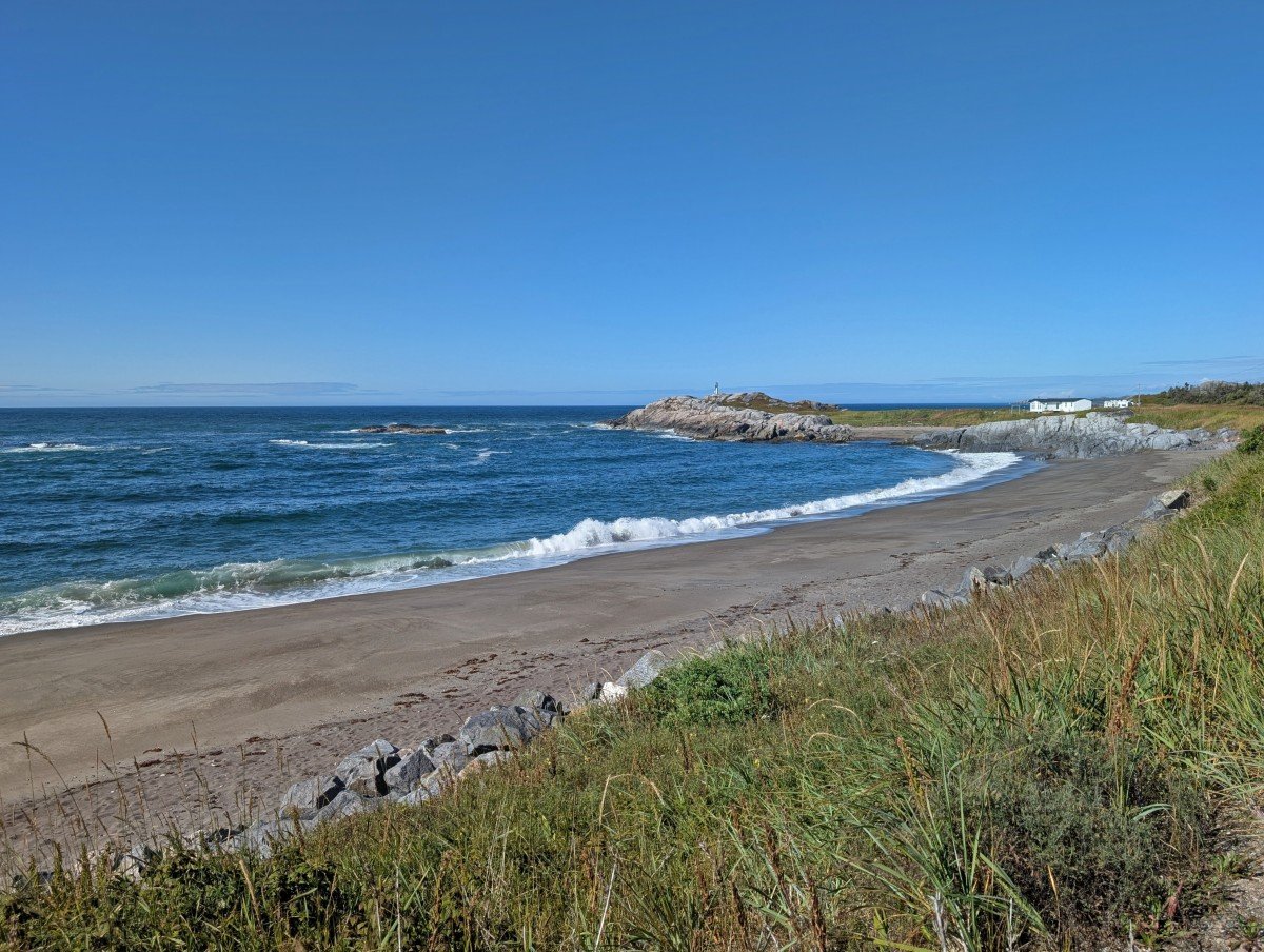
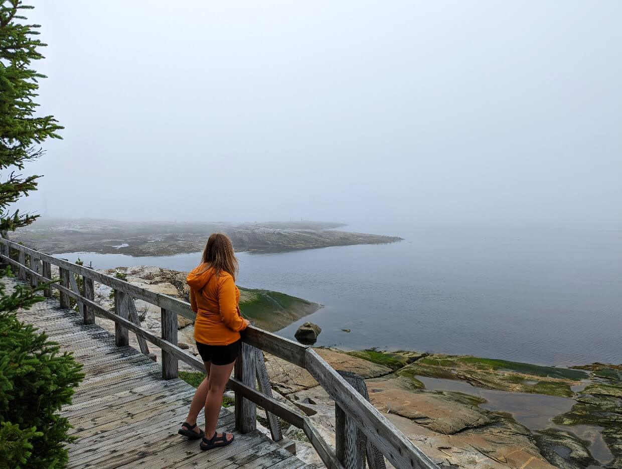
Belvédère de Magpie and the Anse à Zoël
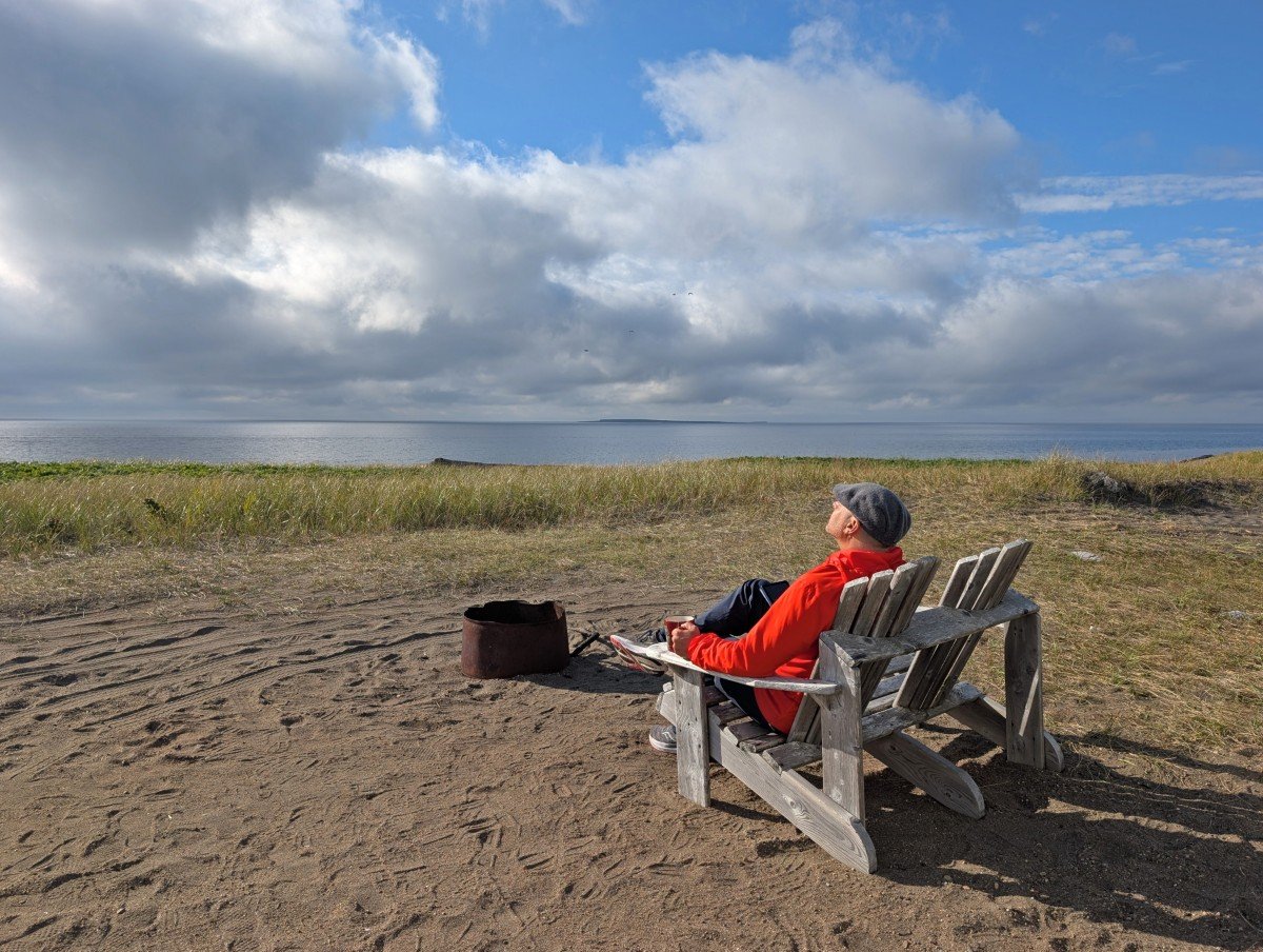
Magpie is the perfect example why it is so valuable to venture beyond the highway. While there isn’t a lot to see from the road, a beautiful sandy beach and viewpoint is waiting just below this cute community.
Belvédère de Magpie is a platform perched on a rocky headland just above the beach. It is accessible via a set of stairs. It’s the perfect place to take in the ocean views, look for whales and enjoy a break from the road!
A short 1.5km loop trail starts from the belvédère. The Anse à Zoël features more ocean viewpoints and a forested section. Please note that it is not well marked – this trail guide has a map. Allow around an hour.
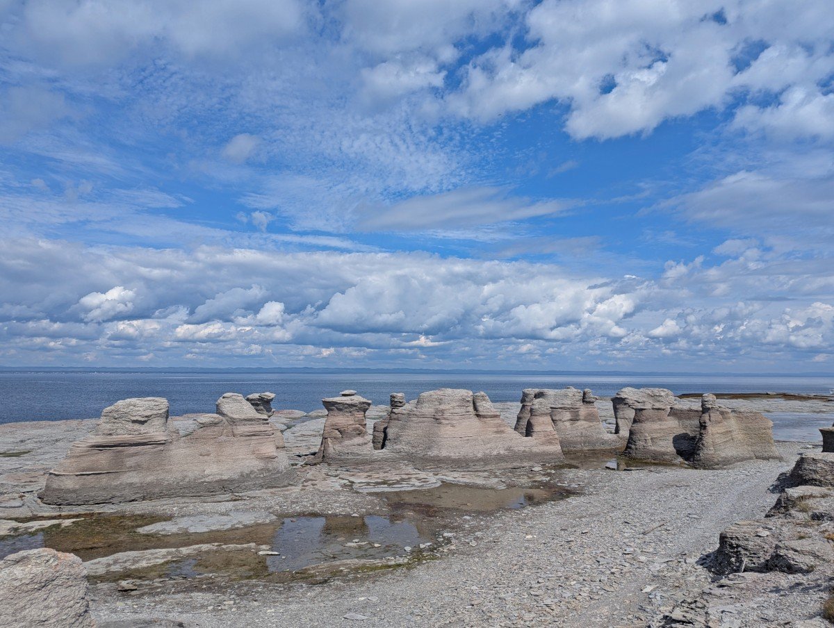
Mingan Archipelago National Park Reserve
Mingan Archipelago National Park Reserve is one of the Whale Route’s true highlights. My expectations were high, and I’m happy to say the park delivered.
Consisting of 20 main islands and about a thousand smaller islands and islets, Mingan is best known for its amazing limestone monoliths (rock pillars), which were shaped by glacier activity and erosion.
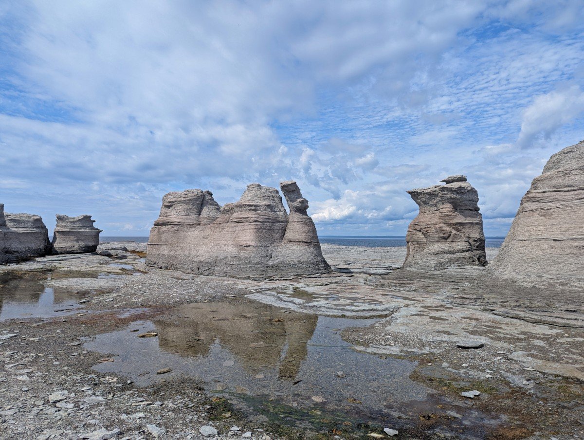
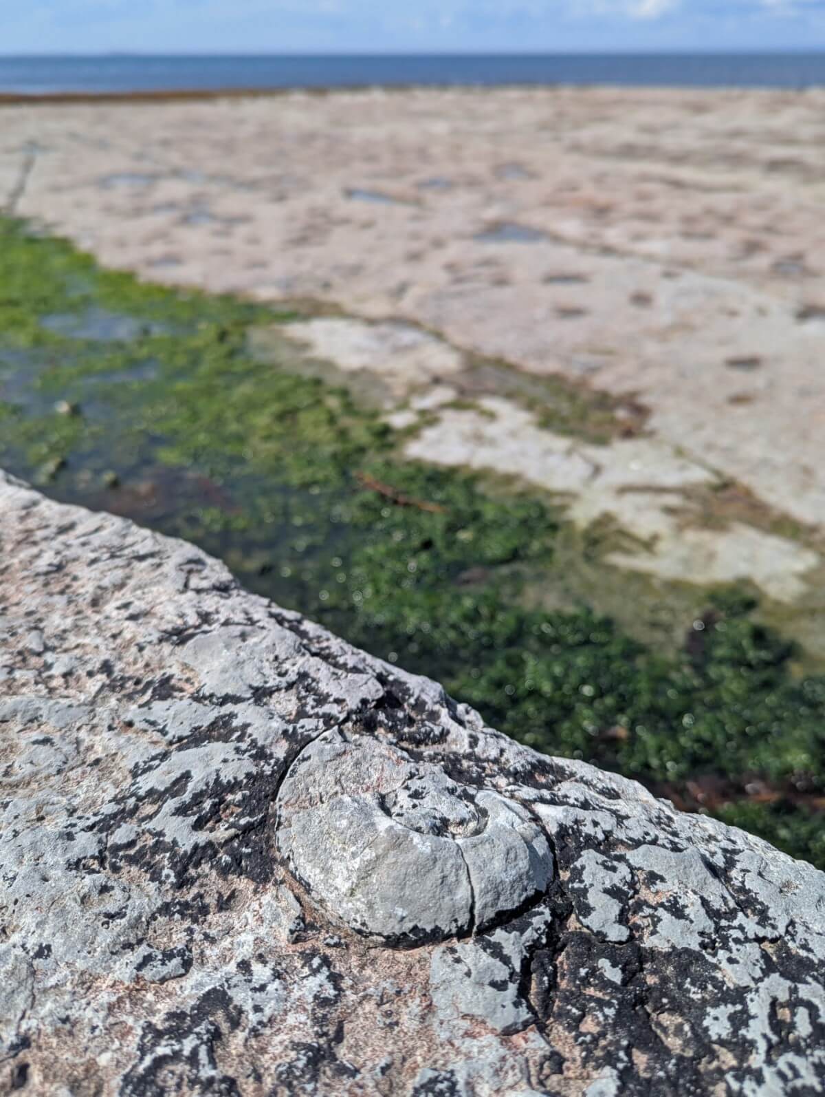
Beyond the monoliths, Mingan hosts colonies of endangered shorebirds (and puffins!), 80km+ of hiking trails, historic lighthouses, and unusual Arctic-alpine plants. The islands are fossil rich too – we found so many cephalopods (including ammonites)!
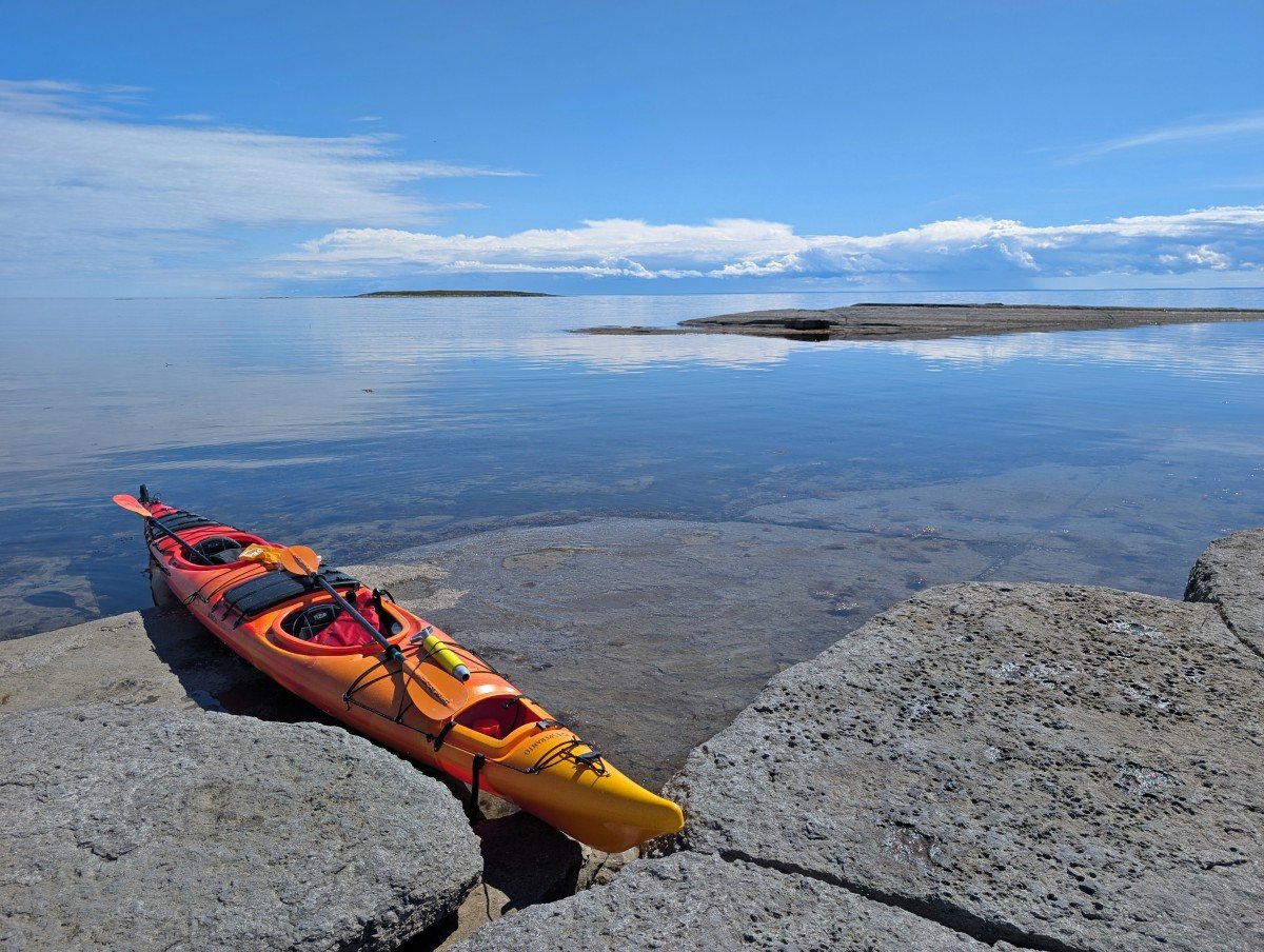
Mingan is accessible by water only – choose between locally operated boat tours or kayak tours. We did both (a Pure Discovery boat tour with Famille Loiselle Excursions and a kayak trip with Noryak), each experience worthwhile to see the islands from a different perspective.
It’s also possible to stay overnight on the islands, in a lighthouse station, campgrounds, oTENTiks and teardrop shaped Ôasis accommodations.
For everything you need to know to plan an outstanding trip to the Mingan Archipelago, head to our dedicated guide.
Longue-Pointe-de-Mingan
This small community is the first location with boat trips to the Mingan Archipelago. It has a beautiful waterfront boardwalk and Parks Canada Interpretation Centre. The latter is well worth a visit to understand what makes Mingan so special.
In the same building is the Mingan Island Cetacean Study Interpretation Centre. The MICS is a non-profit organisation studying cetaceans in the Gulf of St Lawrence. It is possible to join their scientists on research expeditions.
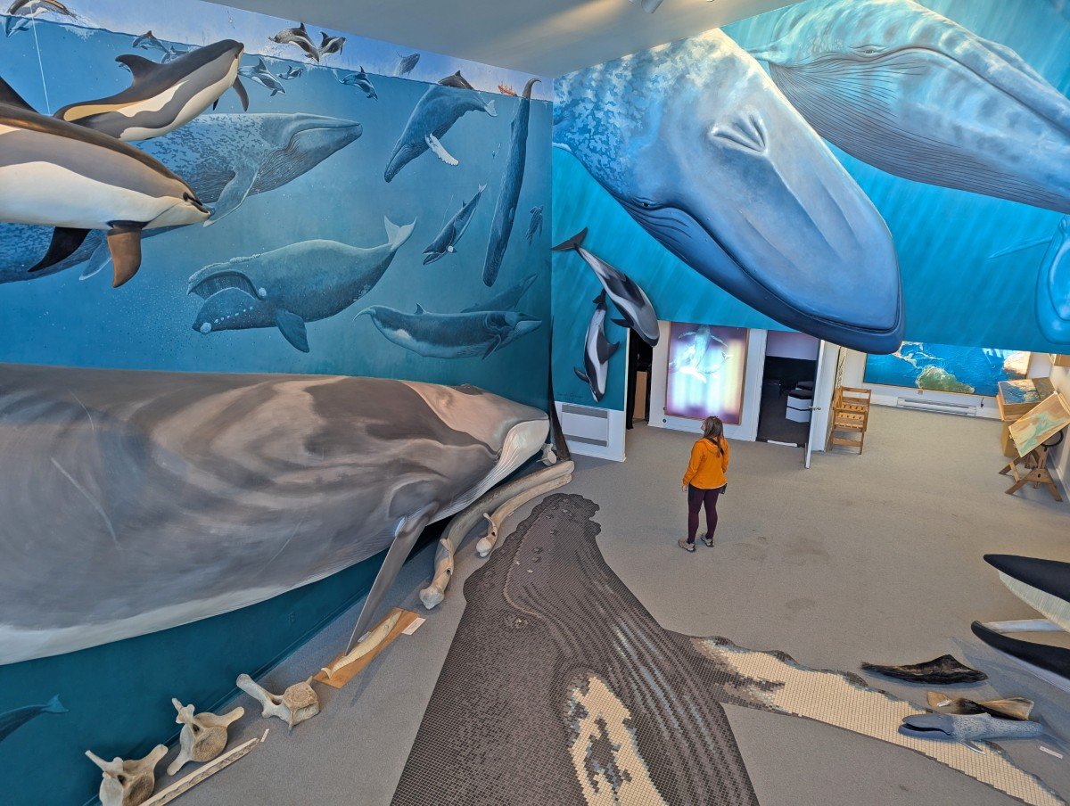
The Centre has shares information on their work, accompanied with to scale whale models and ocean inspired artwork. There is an admission fee.
Cantine Nat is where it’s at for food in Longue-Pointe-de-Mingan! This casse-croûte serves up all the classics, plus the best guédille au crabe (crab roll). Afterwards, pick up an ice cream topped with local chicoutais berries at Bar laitier chez Marina. It’s right next door.
Ekuanitshit/Mingan
Just a little further east of Longue-Point is Ekuanitshit (‘things run aground’), or Mingan in French, an Innu First Nation reserve. The Innu here used to hunt seal on the Mingan Archipelago.
The Maison De La Culture Innue is an immersive cultural centre with exhibits showcasing the Innu language and way of life.
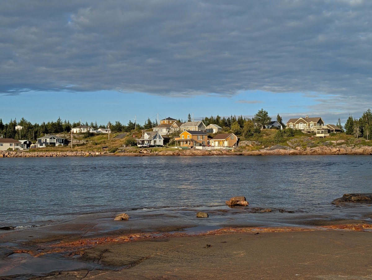
Havre-Saint-Pierre
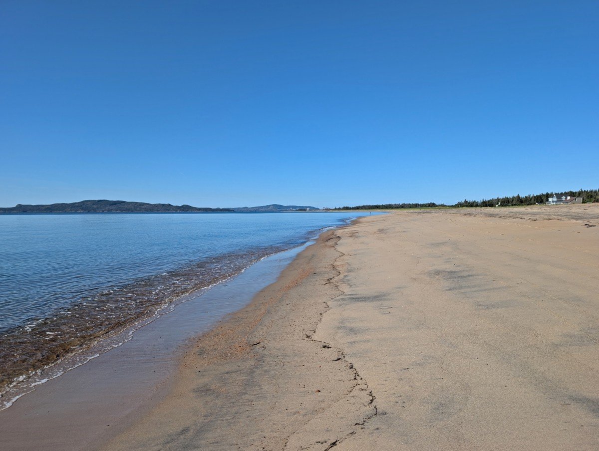
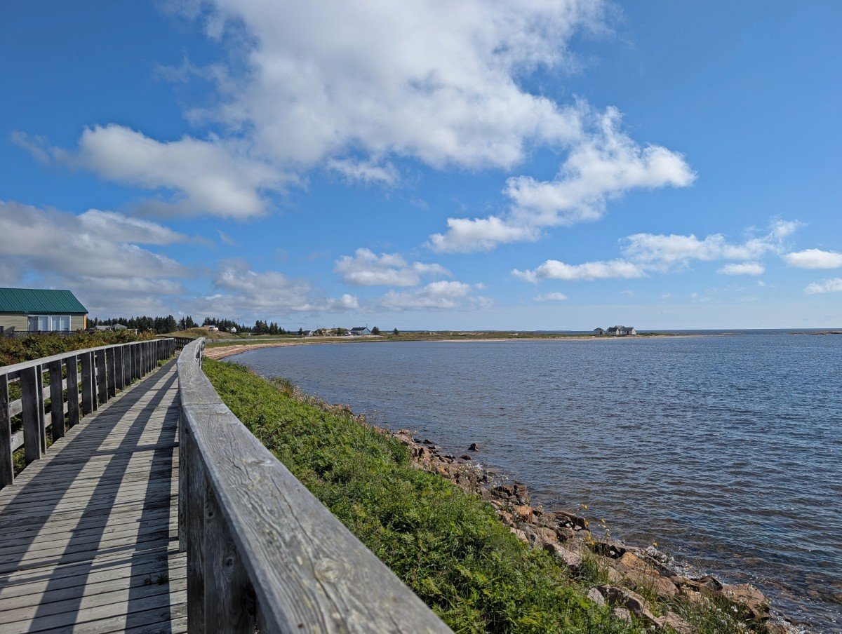
Situated on a point jutting into the St. Lawrence, Havre-Saint-Pierre is the main base for exploring Mingan Archipelago National Park Reserve. It’s also a charming town in its own right, with a long sandy beach, promenade, and the largest selection of shops, restaurants, and accommodations in the area.
We were surprised to learn Havre-Saint-Pierre is a proud Acadian community (like the one JR grew up in), settled by families from the Îles-de-la-Madeleine in the mid-19th century. The tricolour flag is easy to spot on homes and road signs.
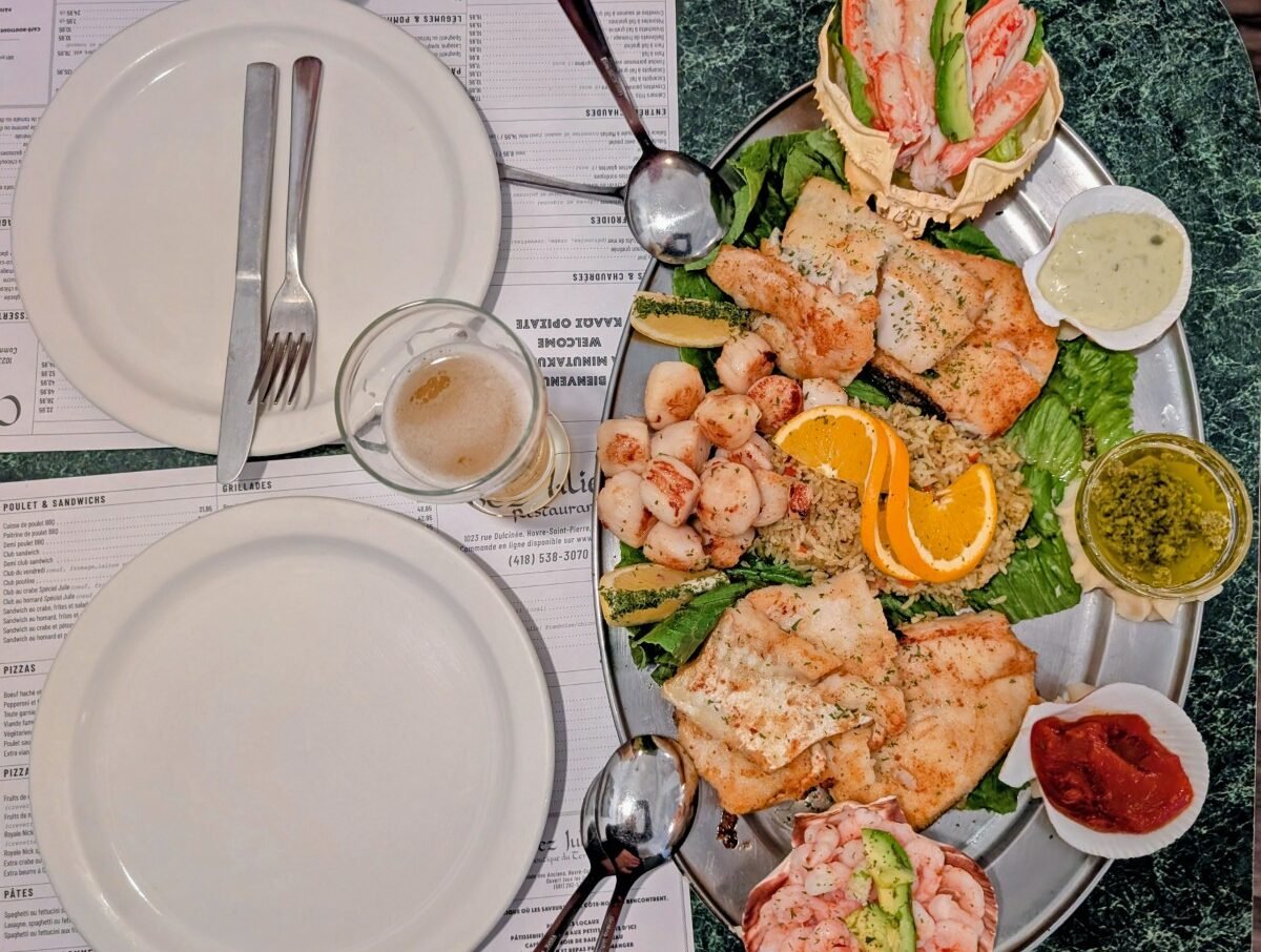
For food, Restaurant Chez Julie is the top choice – well worth it if you love seafood (we highly recommend the two-person platter!) A cheaper option with a view is La Promenade, while Puyjalon Brasserie et Distillerie should be your go-to for drinks.
Where to stay
I’d recommend spending at least a night or two in the Havre-Saint-Pierre/Longue-Pointe-de-Mingan region, primarily to visit Mingan. Camping on the national park islands is also a great option if you have camping equipment.
We stayed at Hôtel du Havre, a large property at the edge of town. The decor is a bit dated but the rooms have everything you need for a night or two. It’s very close to Restaurant Chez Julie.
The Famille Loiselle (yes, who also run boat excursions to Mingan!) operate a campground in Longue-Pointe-de-Mingan. They have waterfront camp spots, some with services, as well as fully equipped trailer rentals and ready-to-camp cabins.
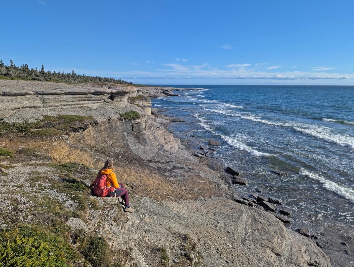
Cap Ferré Trail
Ready for a hike? The relatively short Cap Ferré Trail is a must-do before leaving Havre-Sainte-Pierre. It offers gorgeous coastal views, limestone monoliths (similar to those on the Mingan Archipelago), and a waterfall.
To reach the trailhead, exit Highway 138 at Chemin de l’Anse de la Grande Pointe (km 1232) and follow the unpaved road past a quarry. After 3km, go straight at the first junction and right at the next. The signed trailhead is 5km from the highway.
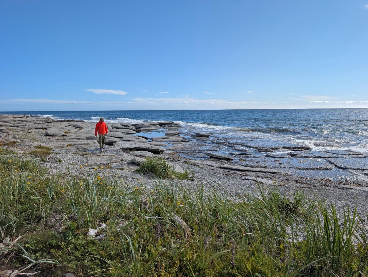
The path follows an ATV track to the coast, where you’ll find pebbles, smooth rocks, and waves.
Watch for fossils in the rocks (we spotted plenty) and mushroom-shaped limestone monoliths. Interpretive signs explain more, though only in French.
Further on, the trail climbs as cliffs rise above the shore. The finale is a waterfall plunging into the ocean from red cliffs topped with monoliths. Amazing! Keep an eye out for whales too. The full hike is 3 km return. Allow at least an hour, more if fossil hunting.
Baie-Johan-Beetz
Baie-Johan-Beetz is quite the unusual sounding municipality. Named after a Belgian-born naturalist who lived here, it is home to around 100 people.
Located at the mouth of the Piashti River, the colourful houses perch on reddish-brown rocks above the ocean. The community is surrounded by taiga, also known as boreal forest. A wildfire prompted an evacuation in 2013, but thankfully stayed 1.5km from the boundary.
On the west side of the river is Parc de Baie-Johan-Beetz, a beautiful spot to take a moment and enjoy the views. There are some interpretive signs explaining the history of the area and a covered picnic area.
Sentier des chutes Quetachou
Only five minutes east of Baie-Johan-Beetz lies the Quetachou River, home to several spectacular waterfalls. A 4km return trail winds along the river through the boreal forest, offering views of each fall.
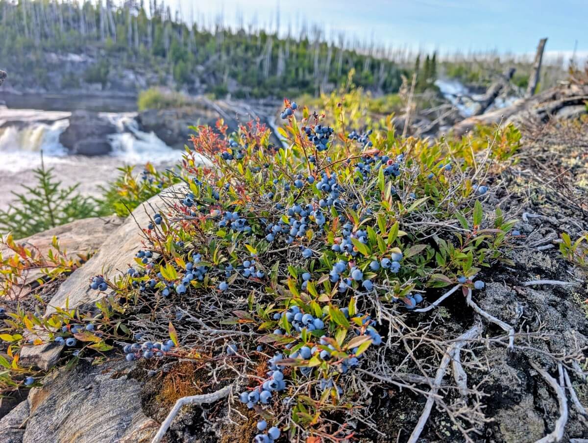
Park in the small lot on the north side of Highway 138 and then cross carefully to reach the signed trailhead. The path is narrow and rooty with some small ups and downs. It’s wet and muddy in some areas. In late August, wild blueberries line the trail.
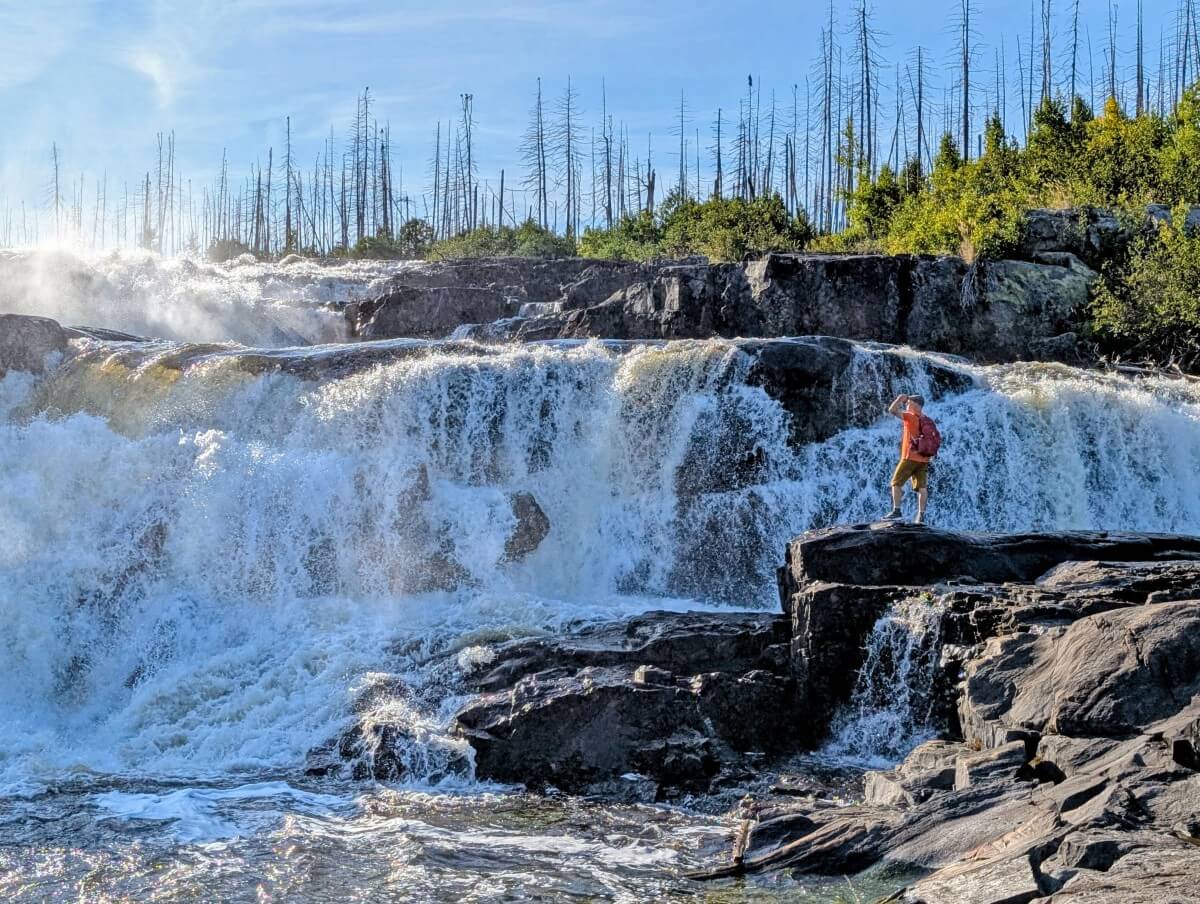
A wildfire swept through here in 2013 so it has a bit of a stark appearance. Local artwork was added a few years later to bring the trail back to life. Keep your eyes peeled – I won’t ruin the surprise!
The first and largest cascade is located just beyond the 1km mark, down some beautifully made stairs. Watch your steps on the rocks when trying to find the best vantage point.
The trail continues another kilometre along the river to a final viewpoint featuring several more cascades. This section is more difficult, with some steep (but very short) uphills, one with a rope.
Natashquan and les Galets
Natashquan is my favourite of the Whale Route’s smaller communities. Once one of the most active fishing centres in the Côte-Nord region, it still has a buzz of activity and charm.
The picture perfect sandy beach is an incredible 7km long. Access it from the parking area next to Café Bistro l’Échouerie, also our top pick for food along Highway 138. Creative dishes, lots of fresh seafood, fair prices. There’s a sunny ocean view patio too.
A short walk from the café is les Galets, a Quebec Heritage Site. Twelve small red and white wooden storage sheds sit atop a rocky outcrop, once used by fishermen in the late 19th and first half of the 20th century. Backdropped by the ocean, the site captures both the beauty and history of the area.
Another way to access les Galets is to stroll the waterfront boardwalk from the tourist information centre. It’s about 1.2km return.
For Francophones, Natashquan is famous for being the home of poet Gilles Vigneault. His childhood house is open for visits, as well as the school he once attended (both have admission fees).
Where to stay
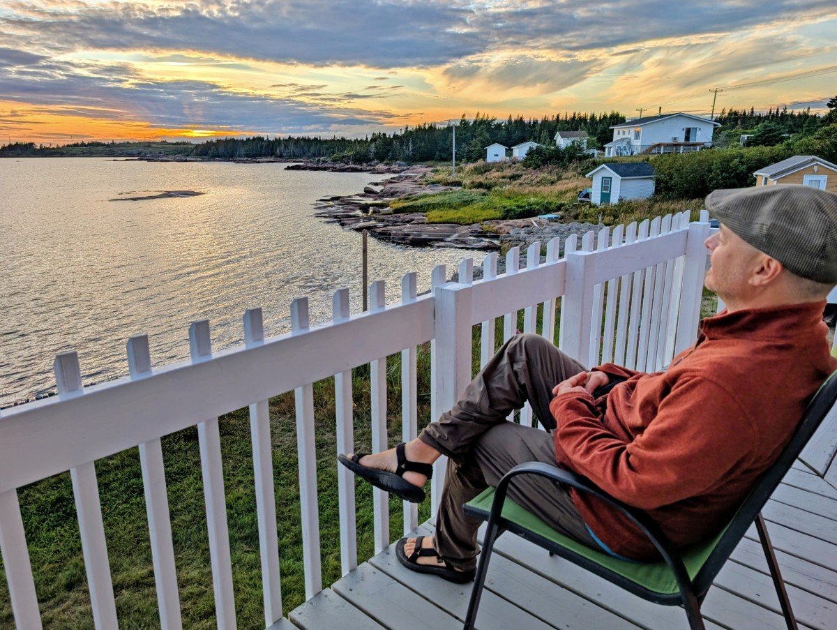
We stayed at the wonderful Auberge Le Port d’Attache in Natashquan, a striking red and white property right on the water.
Operated by the affable Magella for more than 30 years, most of the rooms have ocean views and either a patio or balcony (perfect for sunset). The lower priced rooms have washroom facilities. Breakfast is included.
Kegaska
The community of Kegaska marks the end of Highway 138 and the Whale Route! Only boats provide onward travel up the coast. Kegaska has a population of about 120, many of whom are descendants of English-speaking families that relocated from Anticosti Island a little over a century ago.
The famous ‘138 FIN’ sign used to sit right in front of the ocean but it was unfortunately stolen in August 2025, only a few days before our visit! Several unofficial ‘end of the road’ signs have been added since.
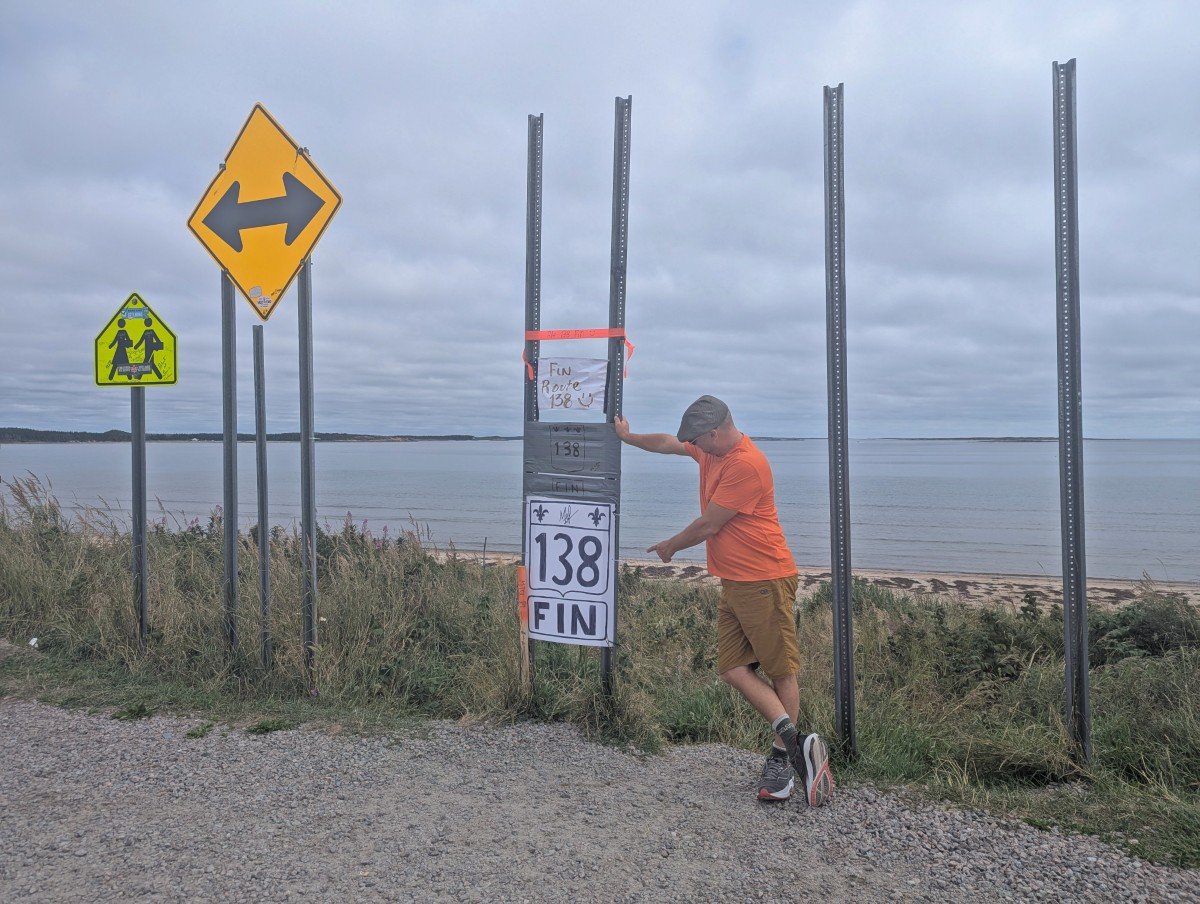
Behind the sign (whatever is displayed at the time of your visit!) is a gorgeous golden beach. It’s the ideal place to have a picnic or just relax.
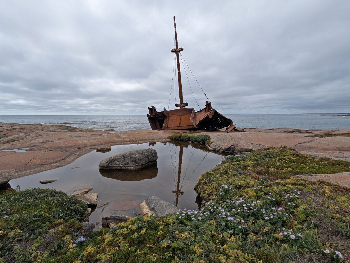
The other must do in the area is the short walk to the Brion shipwreck. This was a cargo ship from the Magdalen Islands that crashed on the rocks south of Kegaska in 1976. Worth a visit for the ocean views too! Watch for the signage on Chemin Jacques Cartier.
Highway 138 trip planning essentials
Inspired to take a drive on the Whale Route? Before you start planning, you may find the following tips helpful.
When to go
The main tourism season for the Whale Route is late June to late August. It is possible to travel the Whale Route before and after this peak period, but keep in mind that some restaurants, tours and attractions will be closed. The weather is also the warmest during this time.
Even in late August, we found a few popular spots had already closed for the season, such as the Casse-Croute du Pêcheur in Sept-Îles. On the other hand, we loved how quiet everything was at this time of year. We were completely alone at all of the waterfalls viewpoints, for example.
To see puffins in the Mingan Archipelago, plan a trip for late June or July. We didn’t see any in late August.
Keep in mind that the last two weeks of July are the Quebec construction holiday (Vacances de la construction). This is the most popular time for the Québécois to travel – hotels will be busier, tours will sell out quicker and there will be more tourists.
Other important dates to consider is Saint-Jean-Baptiste Day (24th June) and Labour Day (Fête du Travail, the first Monday in September). Most shops and restaurants are closed. Plan accordingly!
Highway 138 road trip itinerary
Not sure where to start? Here’s an example road trip itinerary for Quebec’s fabulous Whale Route, based on our own experiences.
Day 1: Arrive in Tadoussac
Day 2: Tadoussac
Day 3: Tadoussac to Baie-Comeau
Day 4: Baie-Comeau to Sept-Îles
Day 5: Sept-Îles to Havre-Saint-Pierre
Day 6: Havre-Saint-Pierre
Day 7: Havre-Saint-Pierre OR Natashquan (day trip to Kegaska)
Day 8: Natashquan/Havre-Saint-Pierre to Sept-Îles
Day 9: Sept-Îles
Day 10: Sept-Îles to Tadoussac
If you’ve only got a week in the region, head straight to Sept-Îles from Tadoussac (combining days 3 and 4) and shorten your stays in both Havre-Saint-Pierre and Sept-Îles by one night each.
Need to rent a vehicle to drive the Whale Route? Here’s an idea for you – fly into Sept-Îles with PAL Airlines, hire a vehicle there and then spend 4-5 days exploring the eastern section (to Kegaska and back) and then 4-5 days exploring the western section (to Tadoussac and back).
This split itinerary also works great if you just want to explore one stretch of the Whale Route. If you have to choose, I’d vote for Sept-Îles to Kegaska for the Mingan Archipelago, waterfalls, solitude and scenic communities.
PAL Airlines offers year round daily flights to Sept-Îles from Quebec City and Montreal, convenient for connecting with other destinations. Discounted fares are available for travelling within the province, subsidised by the Government of Quebec.
Essential items to bring
- Warm clothing, even in summer. It can be significantly cooler on the St Lawrence coast and even more so if you take a boat trip out onto the ocean. Bring a warm hat, gloves, a scarf/Buff and a warm jacket.
- Bug repellent. We didn’t have any issues with mosquitoes and blackflies in late August but I believe they can be an issue earlier in the summer. Be sure to bring repellent and other items (like a head net) as needed!
- Cash. It’s useful to have some cash while travelling in the Côte-Nord. While the vast majority of places will take card, a few of the smaller local businesses only take cash (or would prefer it)
- Parks Canada Discovery Pass. Already have a Parks Canada annual pass? Be sure to bring it with you to receive free admission into several Parks Canada locations around Tadoussac
- Binoculars. To help get a better look at all the amazing wildlife along the Whale Route!
- Some French. While a lot of people working in local tourism speak English, it is polite to know at least the basics. Hello (bonjour), thank you (merci) and please (s’il vous plait) will be welcomed!
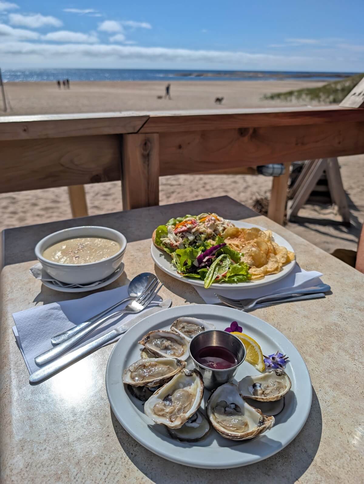
Local food to try
Local food is front and center on Quebec’s Whale Route. I’d recommend trying as many local products as you can while visiting! As you may guess, seafood is king but there are other options too.
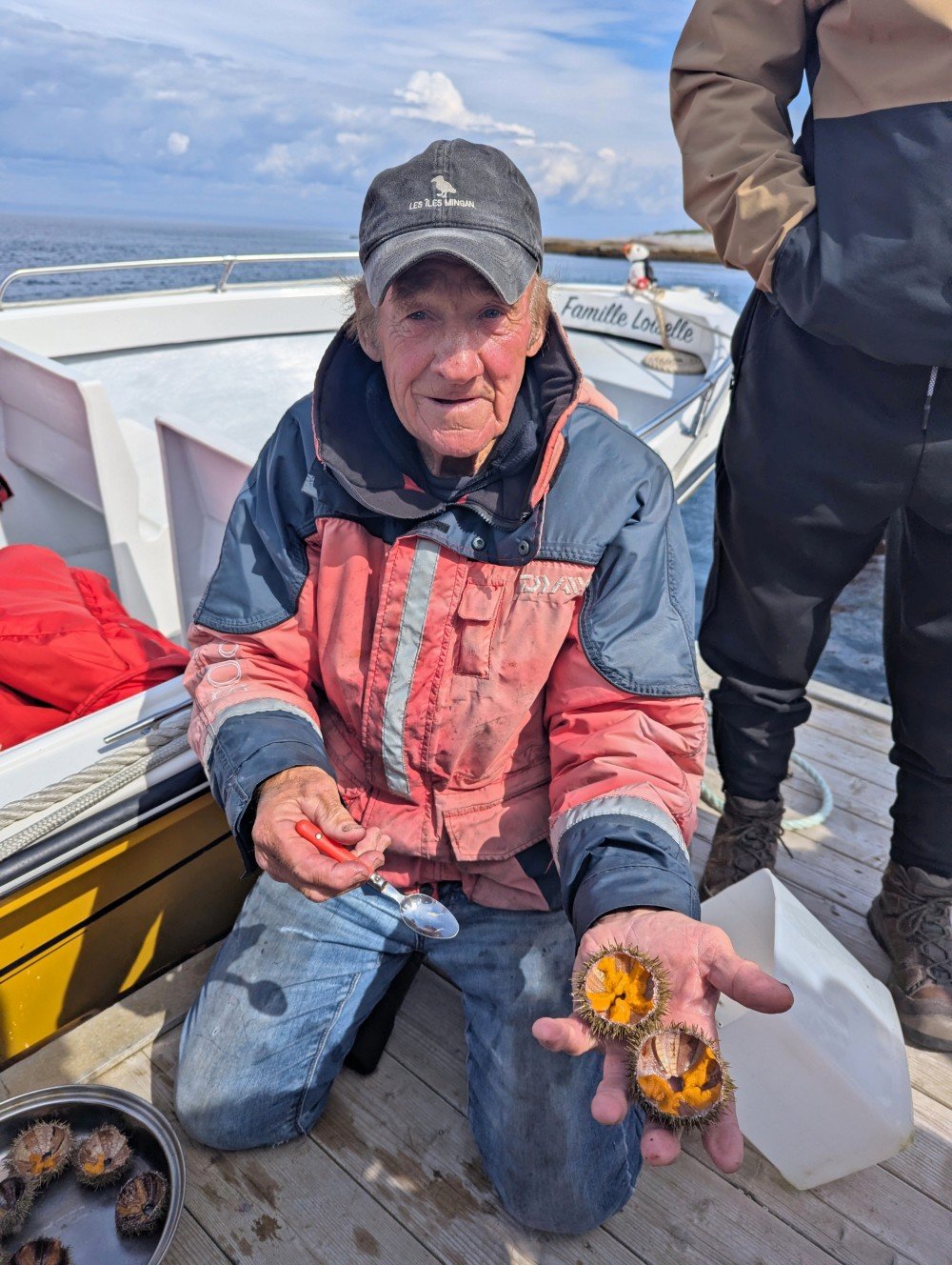
Cod (morue) fishing was the major industry for many years, with crab (crabe) and prawns (cravette) a bigger focus now. Local specialities include whelks (bourgots) and sea urchins (oursin).
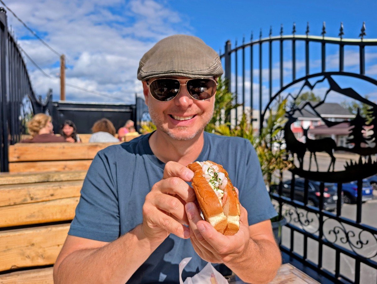
Our favourite way to eat seafood in Côte-Nord (and Quebec Maritime more generally!) is at a casse crôute, basically a super local fast food takeout. Bonus if it has a view! For restaurants, we loved Café l’Échouerie in Natashquan. Be sure to stop there if you love creative seafood dishes.
We ate sea urchins right from the ocean on our Noryak kayak trip and our Famille Loiselle boat trip. The locals catch them with mops!
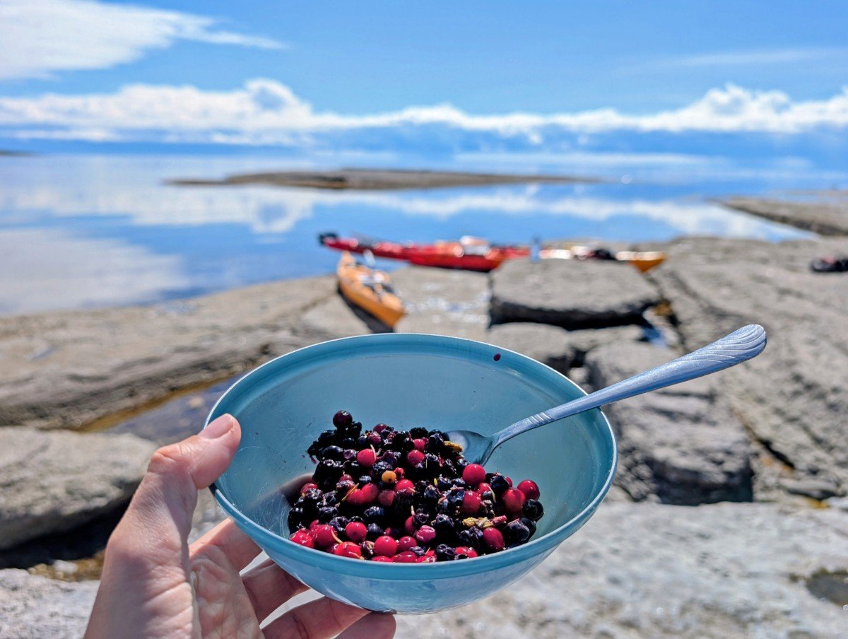
Wild blueberries (bleuets) were everywhere during our trip – we saw SO many groups of people out picking them by the side of the highway and trails. Lingonberries (l’airelle rouge) are also in season in late summer, as well as haskap berries (baies de camerise).
The most special berry found on the Whale Route is the orange coloured cloudberry (chicoutais). The plants grow one fruit only so its a very small harvest. We found all of these berries served on ice cream or within other local desserts. Délicieux!
For local, fresh produce, head to Le Grenier Boréal in Longue-Pointe-de-Mingan. It’s a co-op farm with a selection of pre-picked vegetables and fruit as well as pick your own. It works on an honour system (bring cash if you can).
Final tips
- Sept-Îles, Havre-Saint-Pierre or Baie-Comeau have the largest choice of grocery stores. Smaller communities do have well stocked convenience stores (they even sell local craft beer) but produce and brands are more limited
- Don’t wait too long to fill up on gas. While there are plenty of gas stations located along the Whale Route, not all of them are open that late and if one is closed, it may be a fair distance until another
- The Whale Route is almost completely paved. There are two exceptions – the final few kilometres approaching Kegaska and any sections under active construction
- Some of the casse crôutes close at 6/7pm so be sure to arrive early, especially if there are few other options in town
- Forgot something from home? The convenience stores and hardware stores in the smaller communities have a great mix of items
- Phone signal is limited between Sept-Îles and Longue-Pointe-de-Mingan. It’s a two hour drive so not a super long stretch but something to be aware of
- Relax! This area of Quebec has a very laid back vibe. It’s not the kind of place to rush around. Or rather, if you do, you may be missing the point!
You may find these other Quebec posts helpful
Ultimate Two Week Coastal Quebec Road Trip Itinerary
Discover the Mingan Archipelago, Québec: National Park Travel Guide
Best Things to Do in Témiscamingue: Opémican National Park & Beyond
10 Fast and Fun Gaspé Peninsula Hiking Trails, Québec
Magdalen Islands Travel Guide: The Best Things to Do, See & Eat
Four Fun Ways to Go Whale Watching in Tadoussac, Quebec
The Best Places to Camp on the Gaspé Peninsula
Check out these recently published posts:


One half of the Canadian/British couple behind Off Track Travel, Gemma is happiest when hiking on the trail or planning the next big travel adventure. JR and Gemma are currently based in the beautiful Okanagan Valley, British Columbia, Canada. Consider buying us a coffee if you have find any of our guides helpful!