After two weeks of an absurd amount of driving and a whole lot of Alaskan rain, I was very happy to bump into this person in Whitehorse:
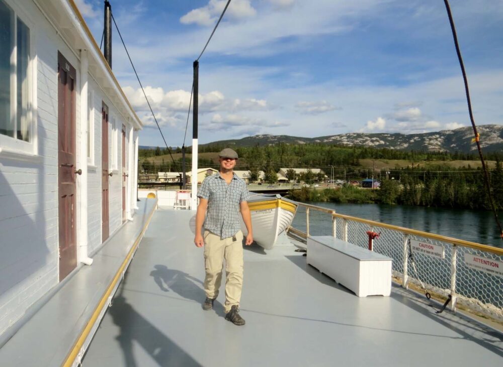

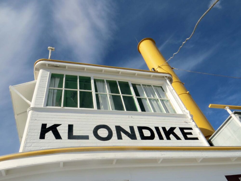
The Klondike Sternwheeler, Whitehorse
We certainly know how to celebrate a reunion: explore a National Historic Site! Built in 1921, the Klondike sternwheeler sits in a dry dock next to the Yukon River.
These boats were a vital part of Yukon transportation from the Gold Rush era until the construction of roads in the 1950s. The most impressive thing to me about sternwheelers is how they could carry a ridiculous amount of cargo (up to 225 tonnes) but could safely navigate in water depths as low as 1.21 metres.
That is really nothing. Sternwheelers were, therefore, perfect for transporting people and goods up and down the Yukon River due to the variety of water depths, strange currents and the odd sandbar or two that comes out of nowhere….I absolutely love that I can say this from first-hand experience.
To the Alaska Highway!
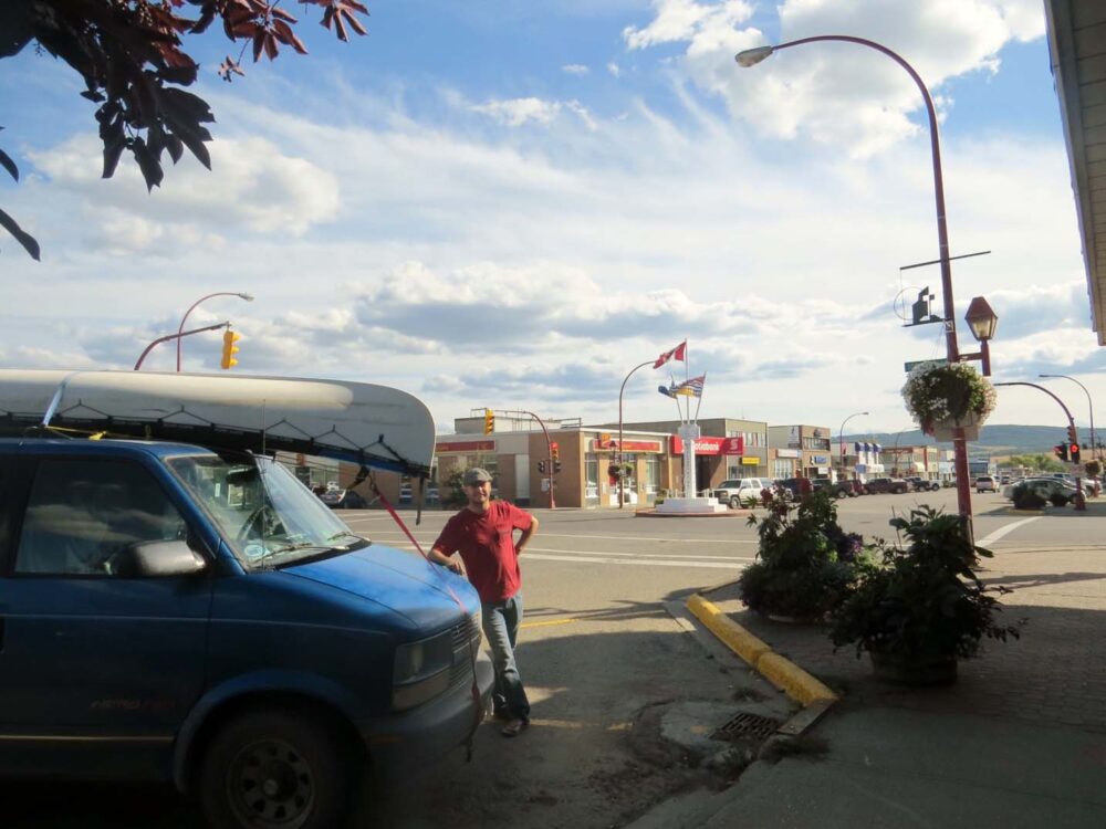
After a self-guided tour around the Klondike, we bid adieu to Whitehorse and did something that we hadn’t done in months: headed south. This was it; the end of our Great Northern Adventure. Well, yes and no.
The truth is that JR and I still had thousands of kilometres to travel until we reached a point that wouldn’t be considered ‘north’ anymore but….still. Were we sad?
A little bit as it meant the main portion of our road trip was over, although on the other side of things we were heading south, home of warmth and sunshine! The summer in the Yukon had been pretty lukewarm, to say the least, so our new mission was to find a late summer hotspot to make up for it. So south we went.


A quieter drive
This week of the trip was the first time one of us was unwell. JR had picked up some kind of flu bug on his journey over to New Brunswick and managed to bring it all the way back to the Yukon to continue the fun. Consequently, he wasn’t up for any kind of strenuous activity, including our old favourites, hiking and paddling! Boo!
This portion of the trip is, therefore, bit of blur for me as I was driving more (JR typically drove 95% of the time on the trip) and we also didn’t do much actual exploring away from the van.
It was only really when I was sorting through the photos for this post when I realised how beautiful this area really was. I can’t wait to go back and hike here!
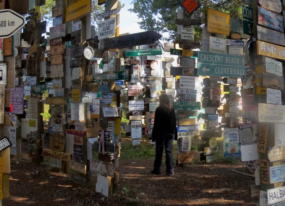
The Signpost Forest
On the way out of Whitehorse, we still had a couple of essential Yukon road trip experiences to tick off, the first being Watson Lake’s Signpost Forest. The Signpost Forest is a collection of 72,000 signs (and counting…), started by the U.S. Army Corps who built the Alaska Highway in 1942 (more on the ‘Alcan’ another time).
While I knew the ‘72,000’ statistic, I still didn’t expect it to be so big. It really is a forest; it goes on and on and on….and when you think you’ve seen it all, there’s still more.
We found a couple of signs put up by visitors from New Brunswick and Southampton (UK), but the grand majority seemed to be from the US, Canada or Germany.


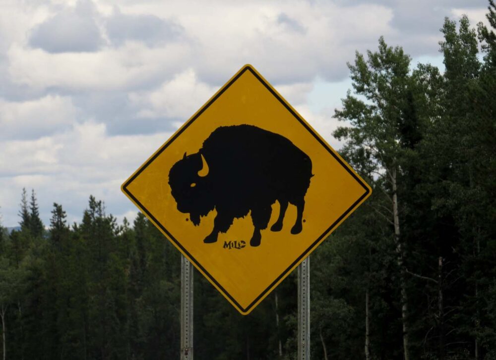

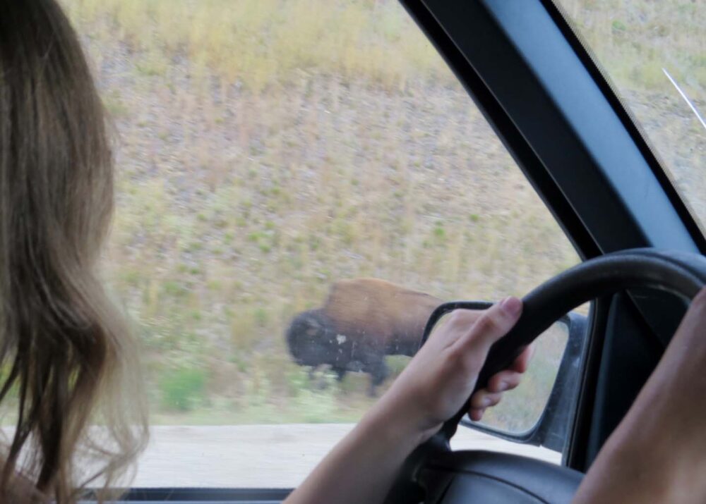

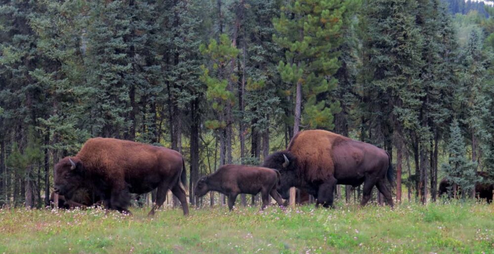


Bison on the Alaska Highway
The next major stop on the Alaska Highway was Liard Hotsprings. On the way, we spent some time with my favourite Canadian roadside animal: bison. No, really, I love bison. All other animals – bears, caribou, moose etc. – usually run away so fast that you barely get a chance to see them.
Bison, on the other hand, do not care one inch about your presence and just carry on eating. And they are big animals. We saw numerous herds (20+ bison!) before we reached Liard, stopping to watch families and individuals hanging out by the highway.
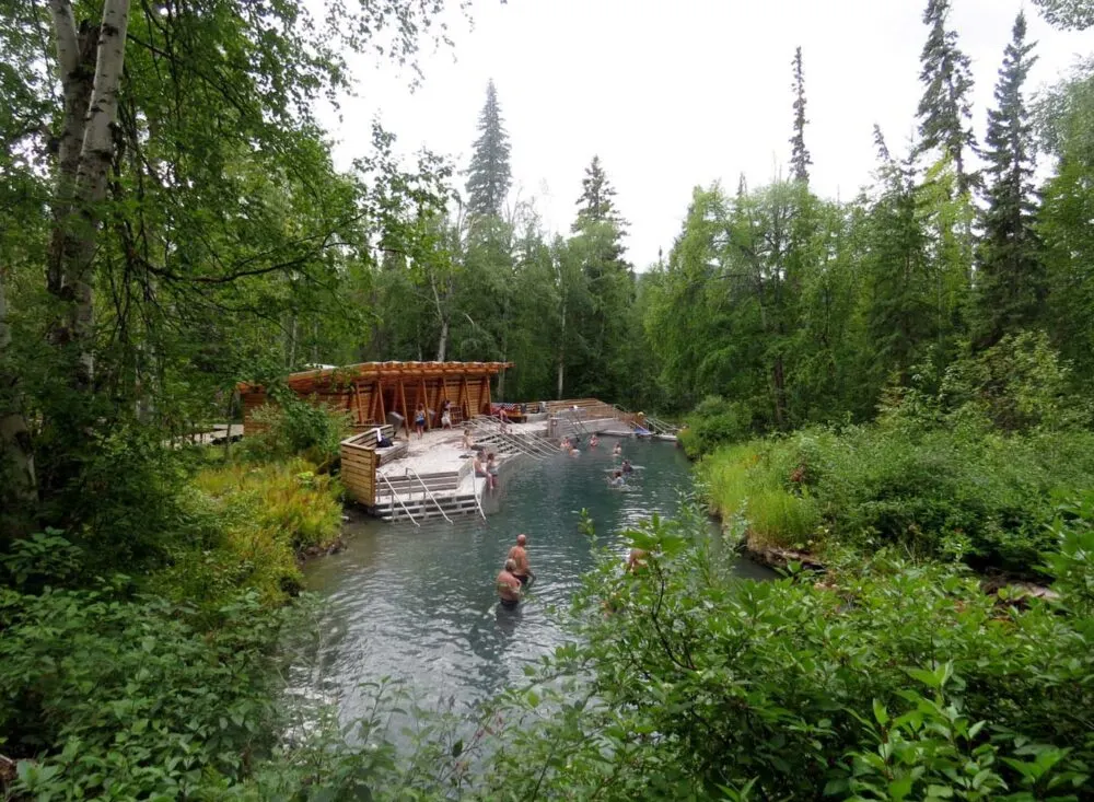
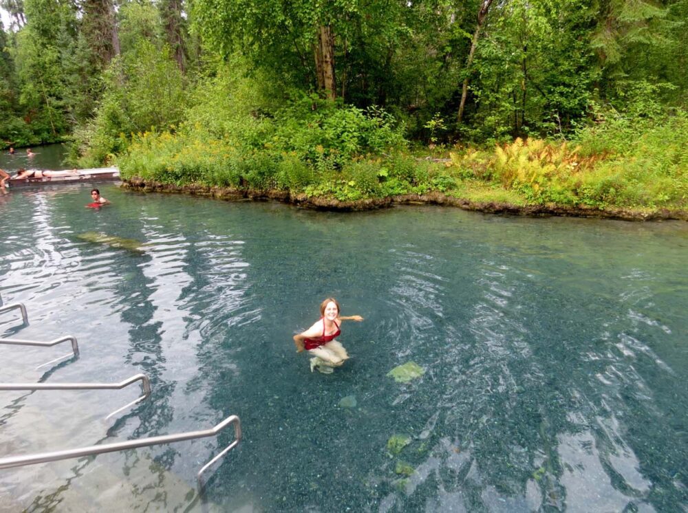
Liard Hotsprings
Even with all of this stopping, we were hardly ever overtaken. The Alaska Highway seemed so quiet, which wasn’t really a surprise to us since the peak season is usually June/July. You can understand then, why were we shocked to reach Liard Hotsprings to find it packed with people….at 10 am.
The campground, with 53 spaces, was already completely full for the night, and the day use parking lot was getting packed already. I can’t imagine what it would be like during the busier season!
Luckily though, the ‘Alpha’ hot springs pool itself, accessible via a short boardwalk, still had lots of room for us. The temperature ranges from 42 to 52 celsius and it is the nicest hot springs I have ever been to, mainly due to the natural setting.


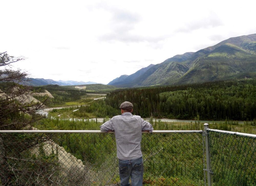


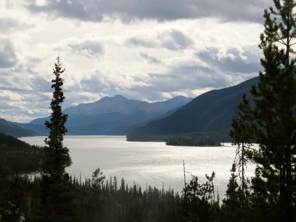
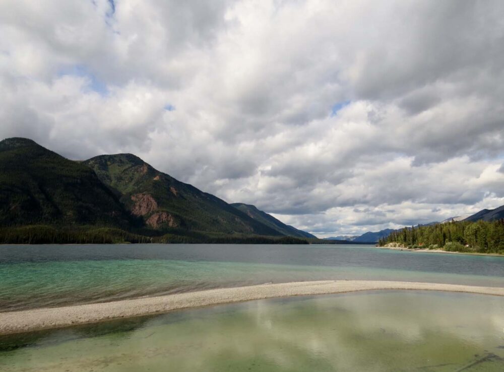
The Northern Rockies, BC
Onwards from Liard, the road headed into the Northern Rockies. The Northern Rockies may not be as famous as the southern ones (Banff, Jasper, Lake Louise et al), but the area is certainly stunning in its own right. And it is incredibly quiet here. Especially in late August – after all, everyone is at Liard.
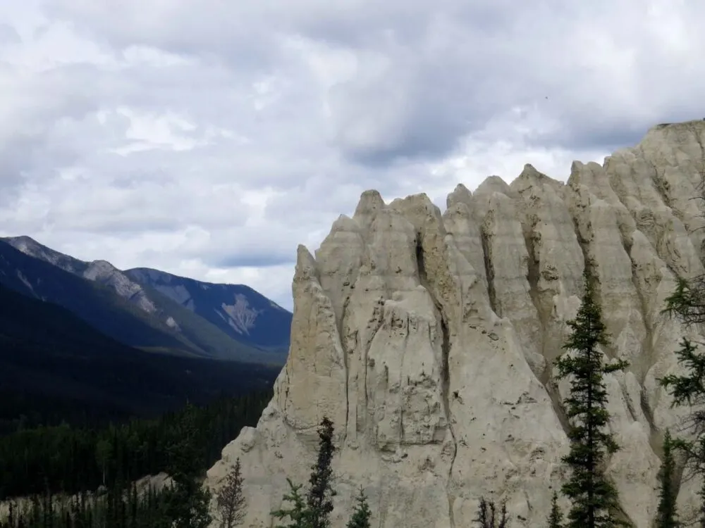
With JR not feeling well, we relied mostly on seeing the sights from the road, although we did take a little detour to the Salt Lick viewing point near Muncho Lake (see above for a photo of the lake, and then further above is the salt lick).
A salt lick (or mineral lick) is a natural mineral deposit where animals in nutrient-poor ecosystems can obtain essential nutrients – in this area, there is a high concentration of ungulates who use these.
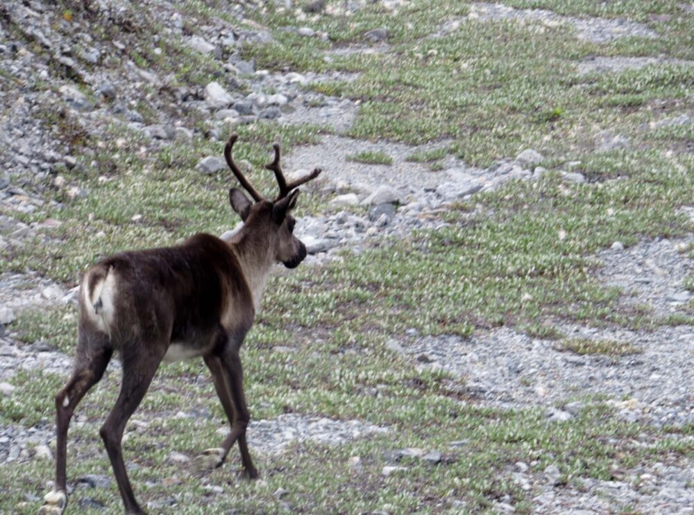
Spotting ungulates
Ungulates (a wonderful word I learned while travelling through this area) include deer, caribou, moose and the interestingly named stone sheep, which are only found in northern BC.
While we weren’t lucky enough to see any of the latter, we did spot lots 0f caribou and moose, finally! Every time I see moose I am reminded how huge they are. And how much I don’t ever (ever) want to hit one on the road…


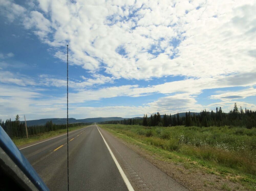

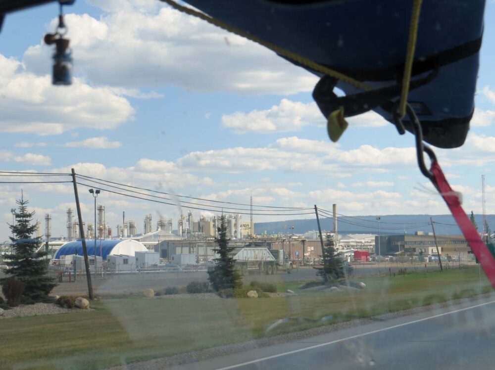
Land of industry
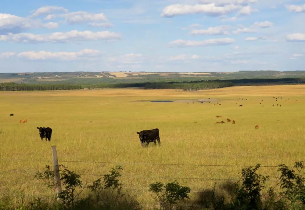
Away from the Rockies, the road becomes very flat. It’s almost like a different world, not only due to the flatness. This area is home to BC’s oil and gas industry.
While I thought I knew a fair bit about Canada’s oil production in the Alberta oil sands, I didn’t realise that this kind of industry existed in BC too. Perhaps I should have guessed from all of the names of the towns on the map – Fort Nelson, Fort St John.
In Canada, town names with the prefix ‘Fort’ or ‘Port’ always seem to imply an industrial background.
Driving around this area, our company on the highway was mostly large industrial trucks and work vehicles. I suddenly felt a little out of place. Camping areas dried up, with very few Recreation Sites and rest stops along the road.
The towns provide everything that the oil workers need (motels, rental car facilities, big-box stores such as Walmart and Marks’ Work Warehouse), but offer little in ambience and beauty.
While not a highlight on our trip, this area was an interesting insight into the ‘other’ side of BC. While I would love to say that I am against the oil fields for environmental reasons, this is very hard to justify when I drive a gas-guzzling vehicle.


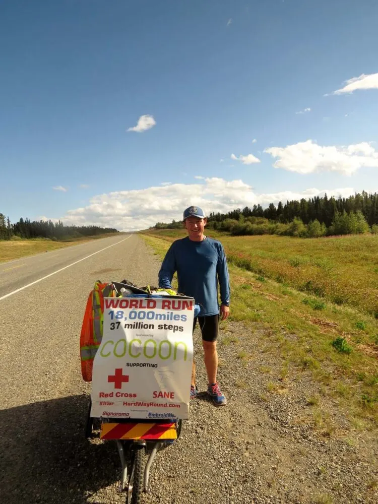
The fastest man running around the world
It seemed somewhat ironic that in this oil-rich, industry led area, we met Kevin Carr. Kevin is an ultra-marathon runner from Dartmoor, UK, who is running around the world. Meeting him in late August, he was thirteen months into his trip. Kevin is raising money for Sane (the British mental health charity) and the British Red Cross.
He was so incredibly inspiring and the only thing he would accept from us was water. Like us, Kevin was a little taken aback by all of the industry and heavy machinery on the roads. He is now running through Manitoba (in late autumn!!) on his way to Boston. Please consider donating to Kevin if you feel inspired by his journey!
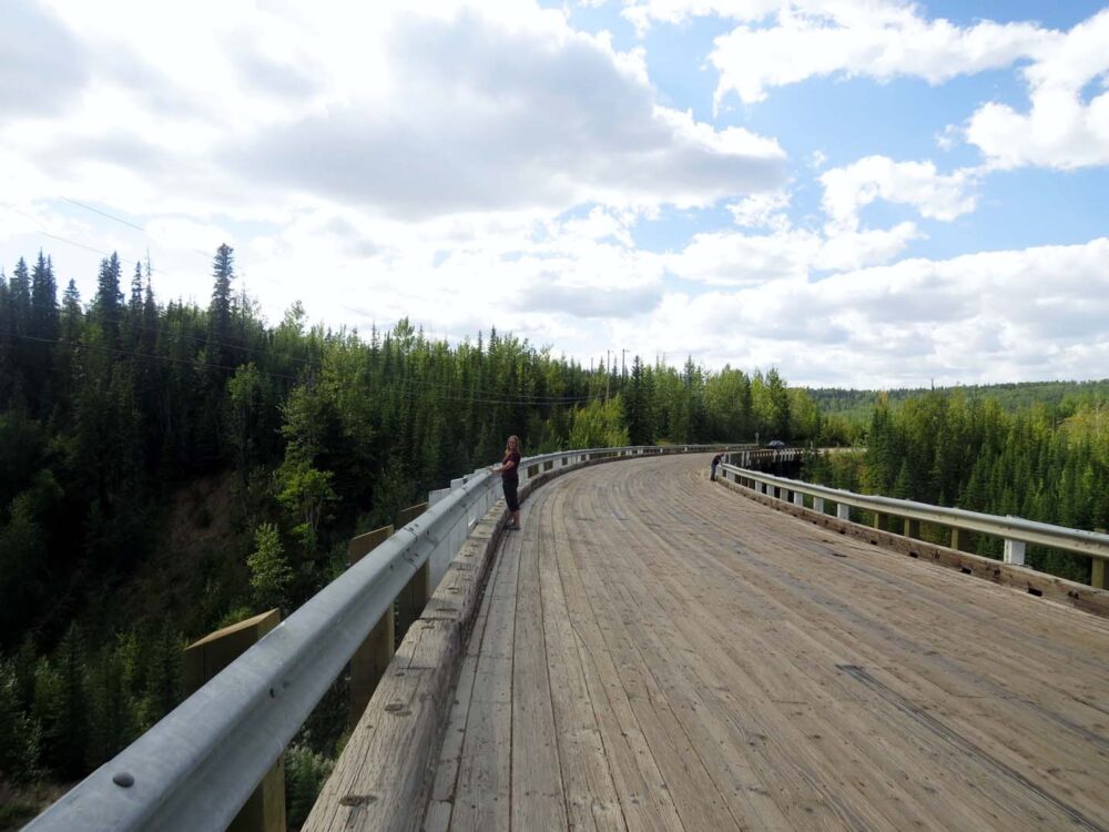
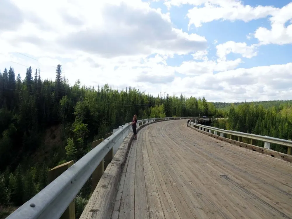
The Kiskatinaw Bridge
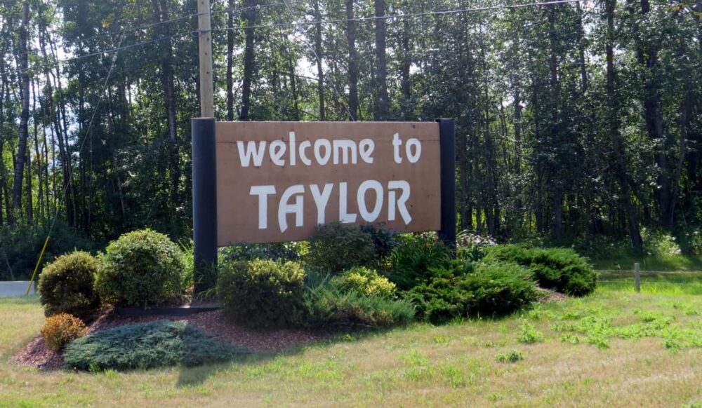
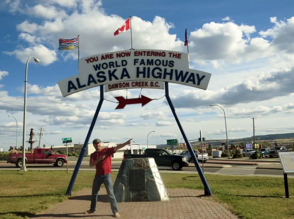
The Alaska Highway finishes (or rather, starts) in Dawson Creek, a town very close to the Alberta border. On the way, we passed through Taylor, my namesake town and the Kiskatinaw bridge, the only timber bridge on the Alcan still in use.
It curves nine degrees along its length, making it a little unusual. It was bypassed in the 1970’s, due to the maximum 25 tonne capacity, which was much too little for the industrial trucks. Taking the prerequisite photos with the Alaska Highway Mile 0 signs in DC before we left, we continued south….


Week 19: Driving the Alaska Highway from Whitehorse to Dawson Creek
1,540 kilometres driven
0km paddled
3km hiked (it was pretty low key with JR being sick)
$140 spent
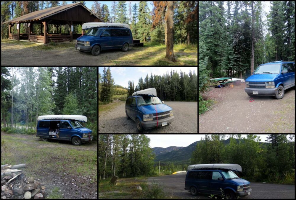

From top left clockwise: Duhu Recreation Site near Fort St John, Watson Lake Government Campground, Rest Stop near North Tetsa River in Stone Mountain Provincial Park, Rest Stop near Liard Rapids, Rest Stop near Jake’s Junction (Yukon).
Adventure in your inbox
Subscribe to our monthly email newsletter and receive a round-up of our latest outdoor adventures plus other exciting beyond the beaten path destinations
We never share your information with third parties and will protect it in accordance with our Privacy Policy
Check out these recently published posts:


One half of the Canadian/British couple behind Off Track Travel, Gemma is happiest when hiking on the trail or planning the next big travel adventure. JR and Gemma are currently based in the beautiful Okanagan Valley, British Columbia, Canada
Adapting to winter life in Northern BC | Off Track Travel
Saturday 6th of December 2014
[…] in north-eastern BC, Canada. It is located at Mile 43 of the Alaska Highway, which we drove the ‘wrong way round’ this summer. Thanks to Wikipedia, I have just learned that being founded in 1794, FSJ is the […]
Krista
Saturday 1st of November 2014
Gemma what's Kevin's wheeled thingy? Was he pulling that behind him as he ran or something...?
Gemma
Wednesday 19th of November 2014
Hey Krista, it was basically a children's buggy (or pram as we'd say in the UK) that he pushed in front of him and stored all his gear on. It was surprisingly light!
Murray Lundberg
Friday 31st of October 2014
Interesting perspective on the "Fort" prefix, Gemma - it actually denotes a fur-trading history. I have to try VERY hard to find good things to say about the Peace district now because of the industrial focus - 20 years ago that was lovely country to drive through. Sorry that you had such poor weather in the Yukon and Alaska - you do have a lot of hiking to do in the North, and I know just the person to show you and JR the great spots :) And Liard Hot Springs - well, you have to experience it in mid-winter!
Gemma
Monday 24th of November 2014
Yes, that would be my uneducated take on the whole 'Fort' thing - I guess it shows that we did not really stop and explore much, including visitor centres/museums! As it ended up, we're now living in the area, so I'm sure I'll learn more now. Definitely with you on the industrial angle, though it really does look better (on the surface) in winter, as I'm finding out now. We sure to be back up north at some point, for reasons you'll see in a post coming soon!