What a contrast we experienced over these couple of weeks of our road trip. To be sure, we did travel a lot of kilometres, but to leave big city bustle, head through several mountain ranges, an almost desert landscape, and then onto boreal forest, to finally arrive in the Yukon wilderness….it was pretty incredible.
Picking up speed
We drove the bulk of 3750km in just five days. Looking back on the speed of our road trip so far, you may wonder why we were suddenly in such a hurry. The truth is we were around a week or so ‘behind schedule.’
The aim was to reach the Arctic Circle by 21st June – the summer solstice and also my 25th birthday. To put you out of your misery, we did make it on time, via one great hike, some great fishing, a couple of glaciers, a winery, lots of too-blue-to-be-true lakes and a most excellent roadside bannock stall.
Living the big city life
Despite having visited Vancouver a handful of times already (and also not classing ourselves as city people at all), we still had a small list of must do’s before we hit the road north.
We were lucky enough to stay with an old friend of JR’s, which meant free accommodation in the city and a chance to see some more new places not even on our Vancouver hit list.
It was to be our last time in a large city (some may say ‘proper civilisation’) for a while, so we took plenty advantage of the opportunity. Much thanks is owed to both Ben and Emily for putting up with us for so long!
We ate and drank our way around Vancouver in between a few mountain hikes, bear watching and a trip to the Aquarium. I don’t like busy places in general, but Vancouver is definitely one of the best cities out there. For us though, the road was calling and it was time to head north. Finally, the real road trip began!


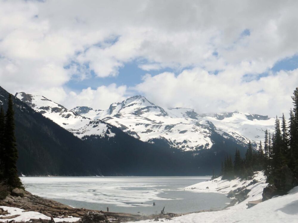
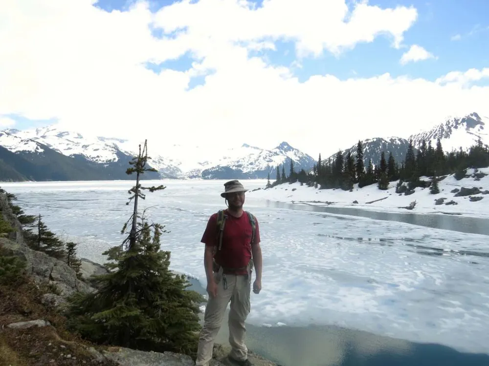
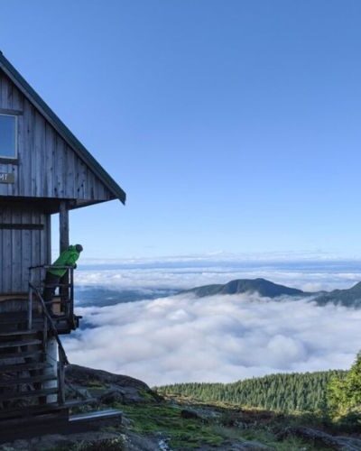
Garibaldi Provincial Park
Well. Kind of. We stopped and camped just over an hour away from Vancouver the first night. Not much of an escape. But there was good reason for it, I promise. I’d heard of a fantastic hike between Squamish and Whistler in Garibaldi Provincial Park.
Said to be the best one day hike you can do in BC, it’s an 18km round trip to Garibaldi Lake, with 940m elevation gain. Most of that height is gained in the first 6km, which actually works out a lot better than it sounds since the last 6km is therefore straight downhill!
While we enjoyed the hike, it’s hard to admit that we were slightly disappointed when we reached the lake. Somehow we had forgotten that if there was snow over the last 2km or so, it would probably mean the lake would be frozen too. Oops.
This meant we didn’t really get to see the beautiful turquoise water that Garibaldi Lake is known for. It was still a beautiful sight, but with the lake being frozen we were just as impressed by the view of mountains on the way up (around the 6.5km mark).
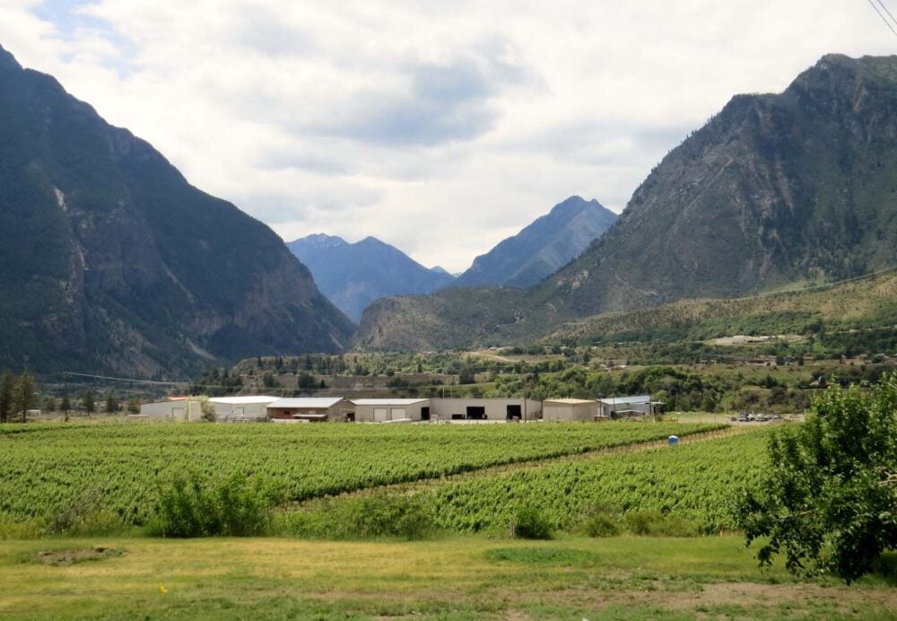
The desert town of Lillooet
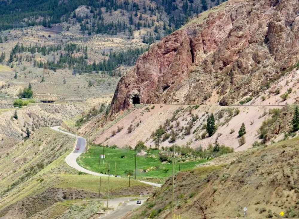
Onwards! Crossing several mountain ranges and passing more stunningly blue alpine lakes, we ended up in what felt like a desert. Well, almost. We got out of the van in Lillooet to be hit by warm wind, much as we experienced in southern Europe.
The landscape is semi-arid, with rugged mountains and canyons almost enveloping the mighty Fraser River. The area has very hot summers, sometimes reaching 40 Celsius in the shade. I found it hard to believe we were still in Canada. So I went with it.
When it feels like France, what do you do? Go to a winery. Luckily, the excellent and very local Fort Berens winery offered a fantastic tasting. (If you’re counting, we were up to three breweries and a winery within one week. And then nothing since…)


Driving through cowboy country in BC
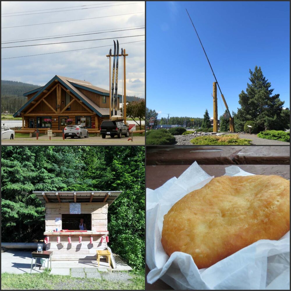
And this was when we started travelling quickly. From Lillooet we drove north past many, many ranches (it’s cowboy country, don’t you know) to camp near Williams Lake for the night, not before spotting the world’s largest cross country skis in 100 Mile House.
We didn’t spend too much time in this area as we will be back in late August/early September, primarily to paddle the Bowron Lakes Canoe Circuit.
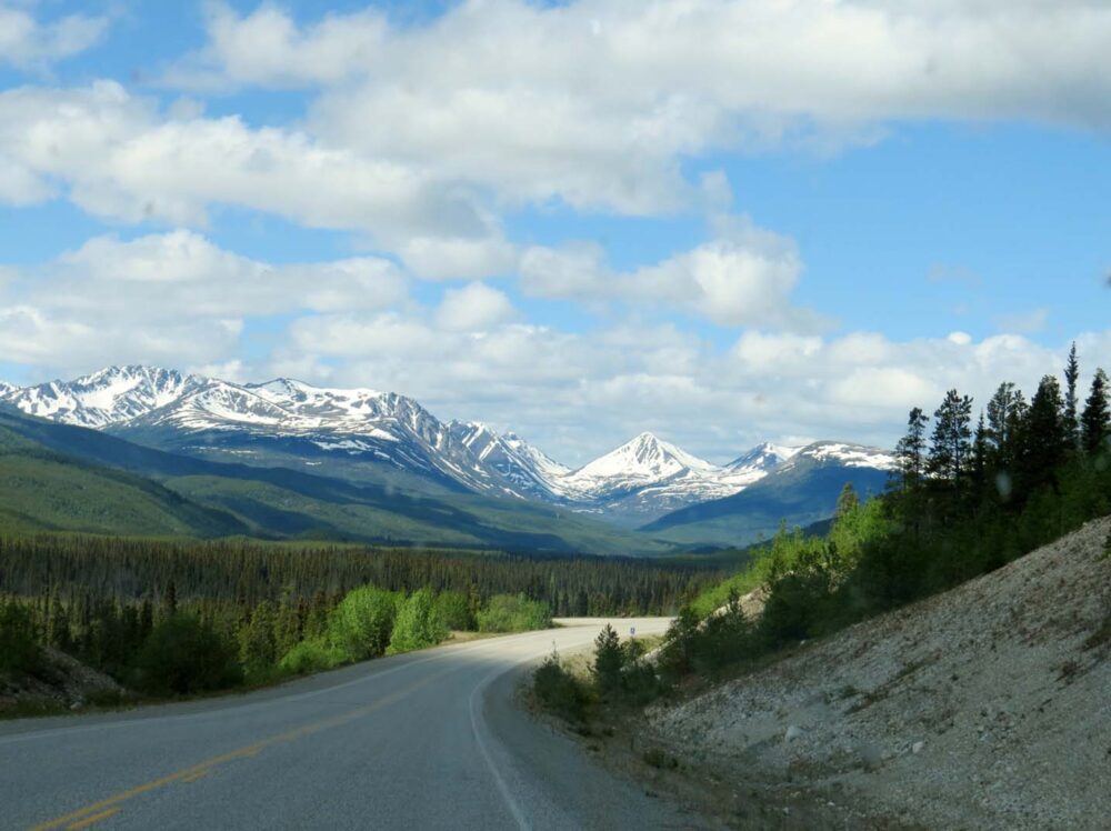
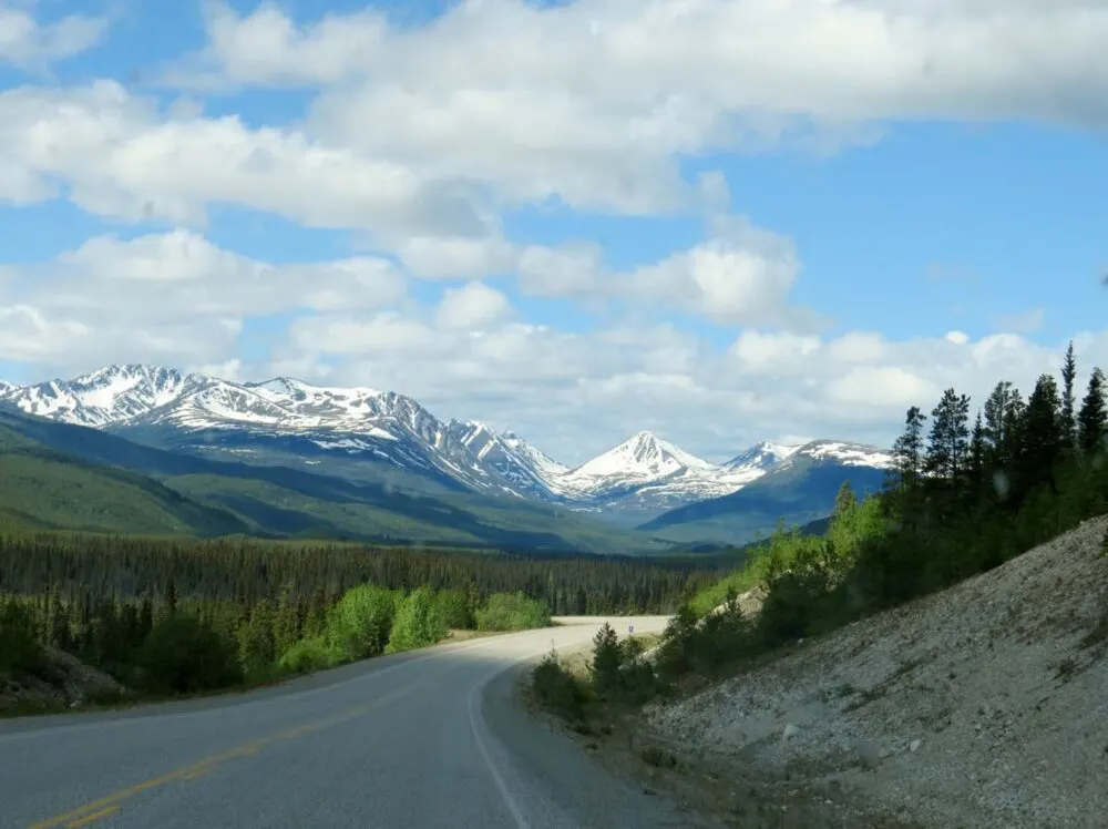
Road to the north
The road west got more interesting around Smithers, where the hills turned into mountains yet the land still remained so very green and lush. I could have happily stopped here for a while, but alas, we just had time for laundry and a short walk to a waterfall.
Consoling ourselves with bannock from a road side stall near Hazelton (traditional First Nation fried bread), we turned north on the Stewart-Cassiar highway, the road that would take us all the way to the Yukon border.
We did consider going to Prince Rupert and the Haida Gwaii islands on the West Coast, but the ferry price was astronomical, even if we just went as passengers. It’s the kind of thing that needs to be the central focus of a trip, rather than just an afterthought.


900km of driving
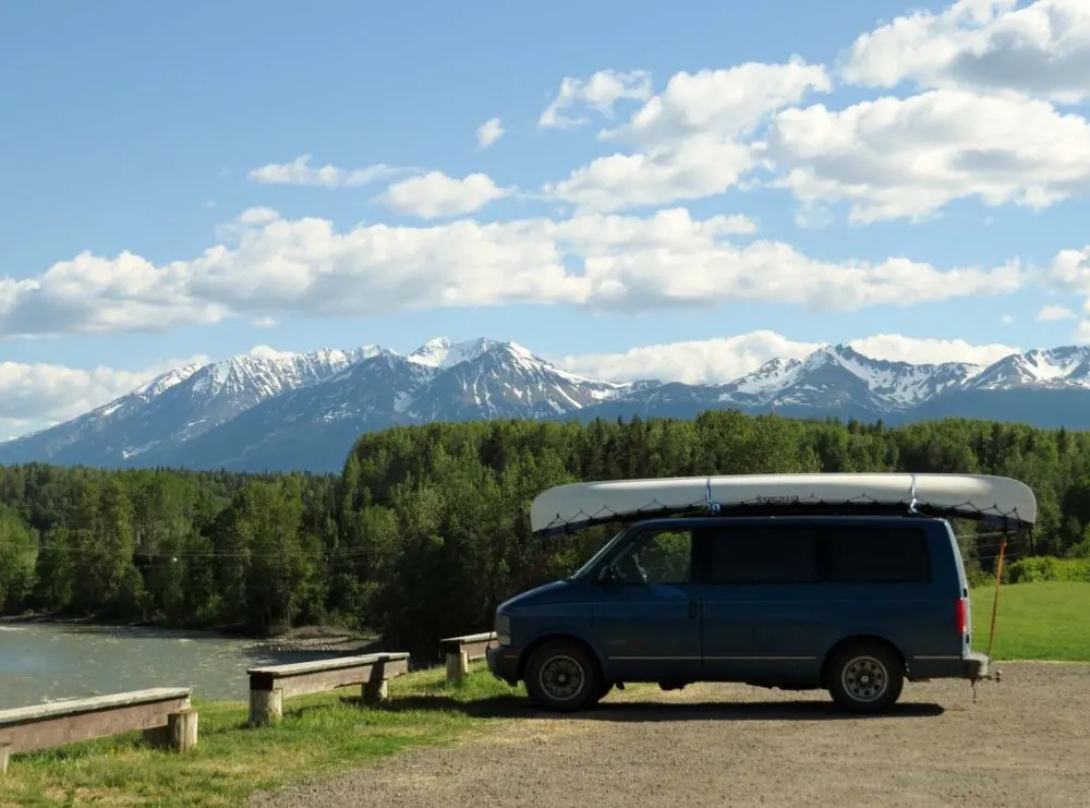
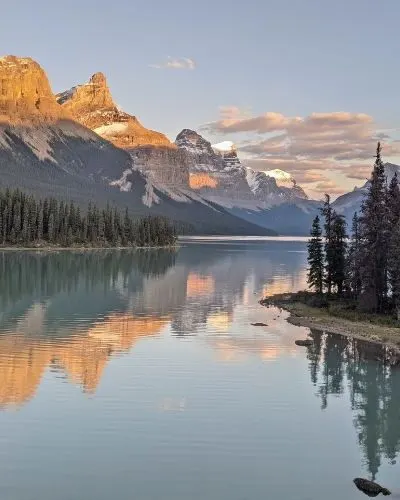
The Stewart Cassiar highway? Lots of bears, mountains, glaciers and lakes (the latter being particularly good for fishing as we discovered). But that is stretched over almost 900km of driving, so not all of it is particularly exciting.
We did however see seven black bears the same day we made the detour towards Stewart on the Alaskan border to see Bear Glacier. They were all stuffing themselves with grass next to the road, not bothered by the (sometimes huge) RVs going past.
This was when we first started to spot the huge numbers of Alaskan-bound travellers…but more about that next time. It was also about the time when we noticed how long the days were (11pm sunsets) and how much cooler it was.
Arriving in Yukon
Finally, on the 17th June, we entered the Yukon Territory. I write, ‘finally,’ but I was actually a bit sad to leave BC and besides, it wasn’t the end of the driving. We still had around 900km to go before the start of the Dempster Highway. And then from there, another 400km to reach the Arctic Circle.
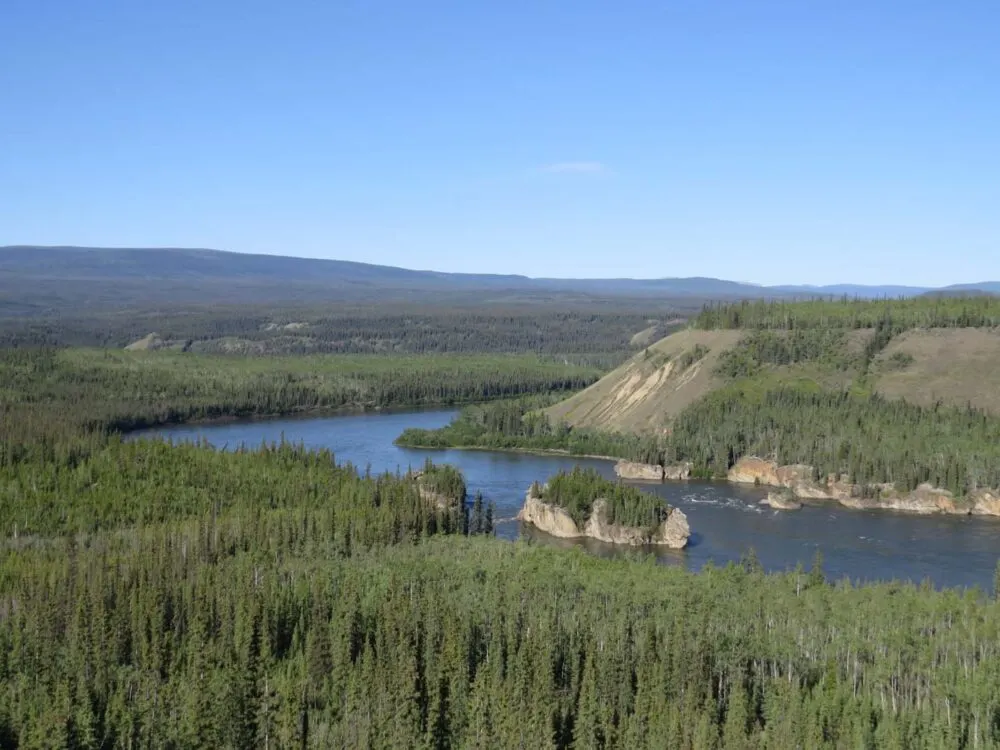
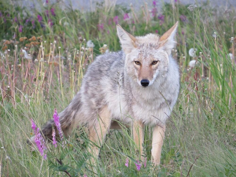
It was going to be a long couple of days. Luckily then, it was light for around 19 hours a day and the scenery wasn’t half bad. The wildlife kept coming too, with a coyote hanging out with us at a rest stop near the Yukon River’s Five Finger Rapids (which we will be canoeing soon!)
Amazing week….but lazy
An incredible week and a bit, though I did find it difficult to be so inactive. On the one hand, it made for a fairly cheap time, if you exclude all of the petrol/gas to do it.
It does make me wonder how people manage to do such extensive BC/Yukon/Alaska road trips in a month though…do they ever have the time to stop and see anything?!
The major thing I took away from the experience? Canada is big. Very big. How can we have driven almost 4000km and still be in the same country?!


Weeks 8.5 and 9: Vancouver, BC to the start of the Dempster Highway, Yukon
Kilometres driven: 3750 (7296 total so far)
Kilometres hiked: 18km Garibaldi Hike plus 10km around Vancouver (incl. Grouse Grind)
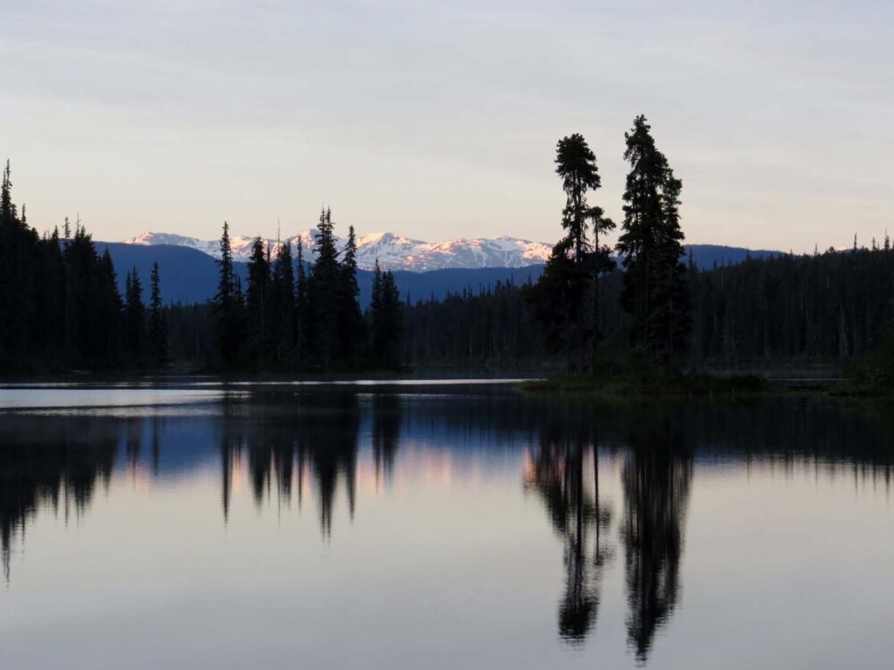
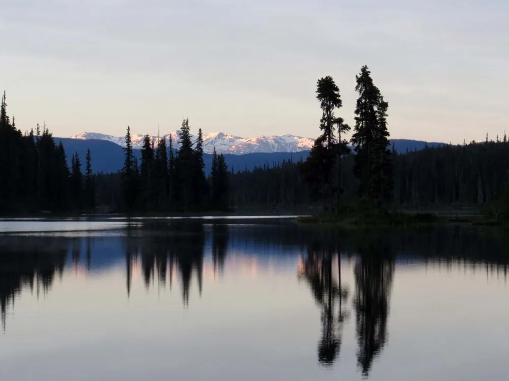
Lakes paddled: 1, Jigsaw Lake on the Stewart-Cassiar Highway
Money spent: $250, not including some (OK, most) activities in Vancouver paid for by my lovely parents and brother for my birthday. Thank you!


Nine completely free campsites from Vancouver to Yukon…clockwise from Left to Right.
Squamish Riverside Rec Site, Cheak Canyon north of Squamish (very popular with climbers), Rogers Creek near Lillooet, Jigsaw Lake (home of great fishing!), A bear just for fun, Co-op Lake near , Five Fingers Rapids Rest Stop north of Carmacks, Rest stop near Dease Lake BC, Dugan Lake near Williams Lake
Adventure in your inbox
Subscribe to our monthly email newsletter and receive a round-up of our latest outdoor adventures plus other exciting beyond the beaten path destinations
We never share your information with third parties and will protect it in accordance with our Privacy Policy
Check out these recently published posts:


One half of the Canadian/British couple behind Off Track Travel, Gemma is happiest when hiking on the trail or planning the next big travel adventure. JR and Gemma are currently based in the beautiful Okanagan Valley, British Columbia, Canada
Nic
Sunday 6th of July 2014
Looks like a great trip so far!
Glad you experienced the Grind - know you know how tough it is!
Linda
Thursday 3rd of July 2014
Wonderful, the walk to the lake looks amazing. Love to you both Lin PS Jess has broken her arm in 2 places